A Civil War Plan of the City and Environs of London - Walter Harrison - 1775
Cartographer - Walter Harrison
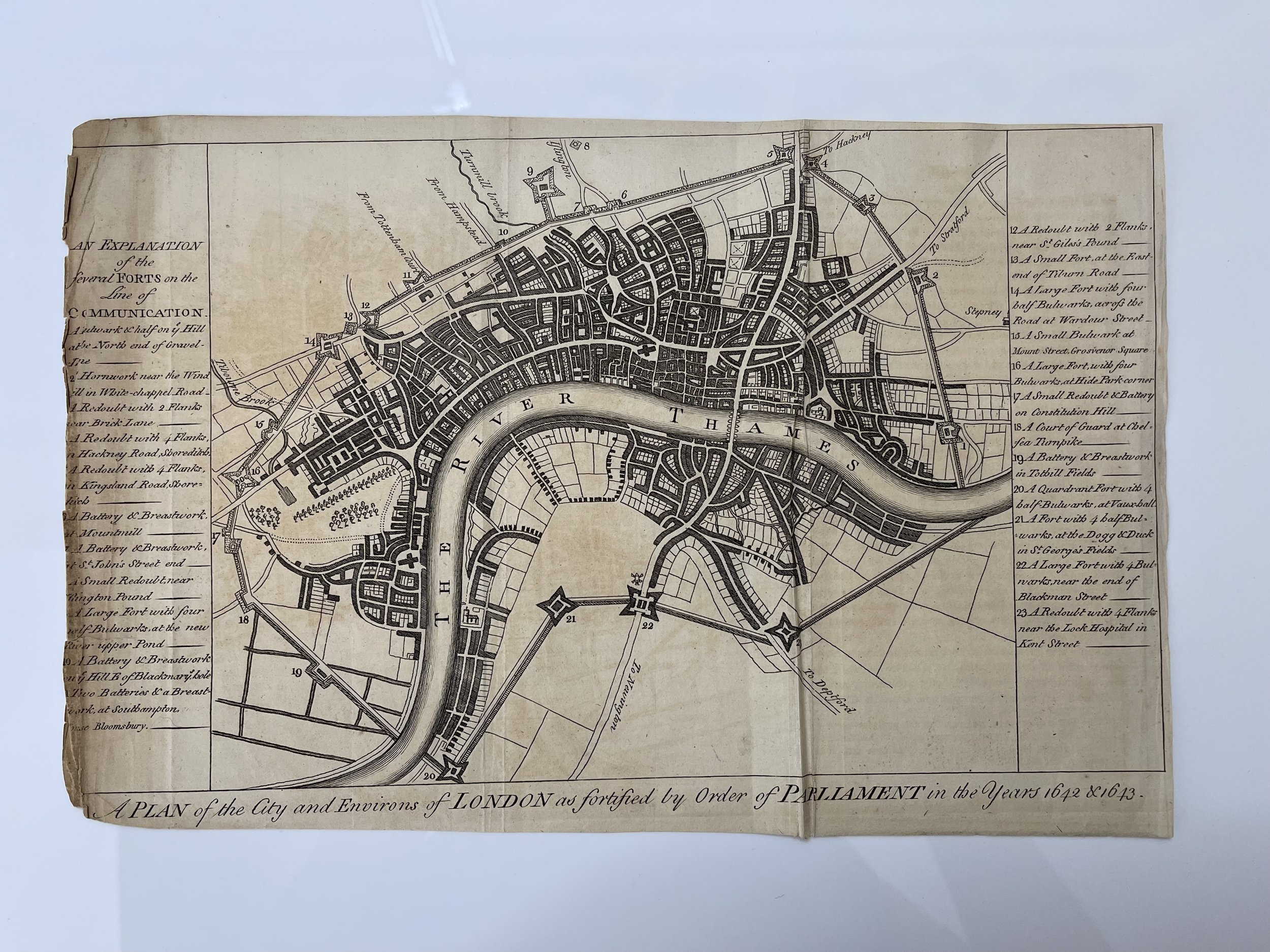
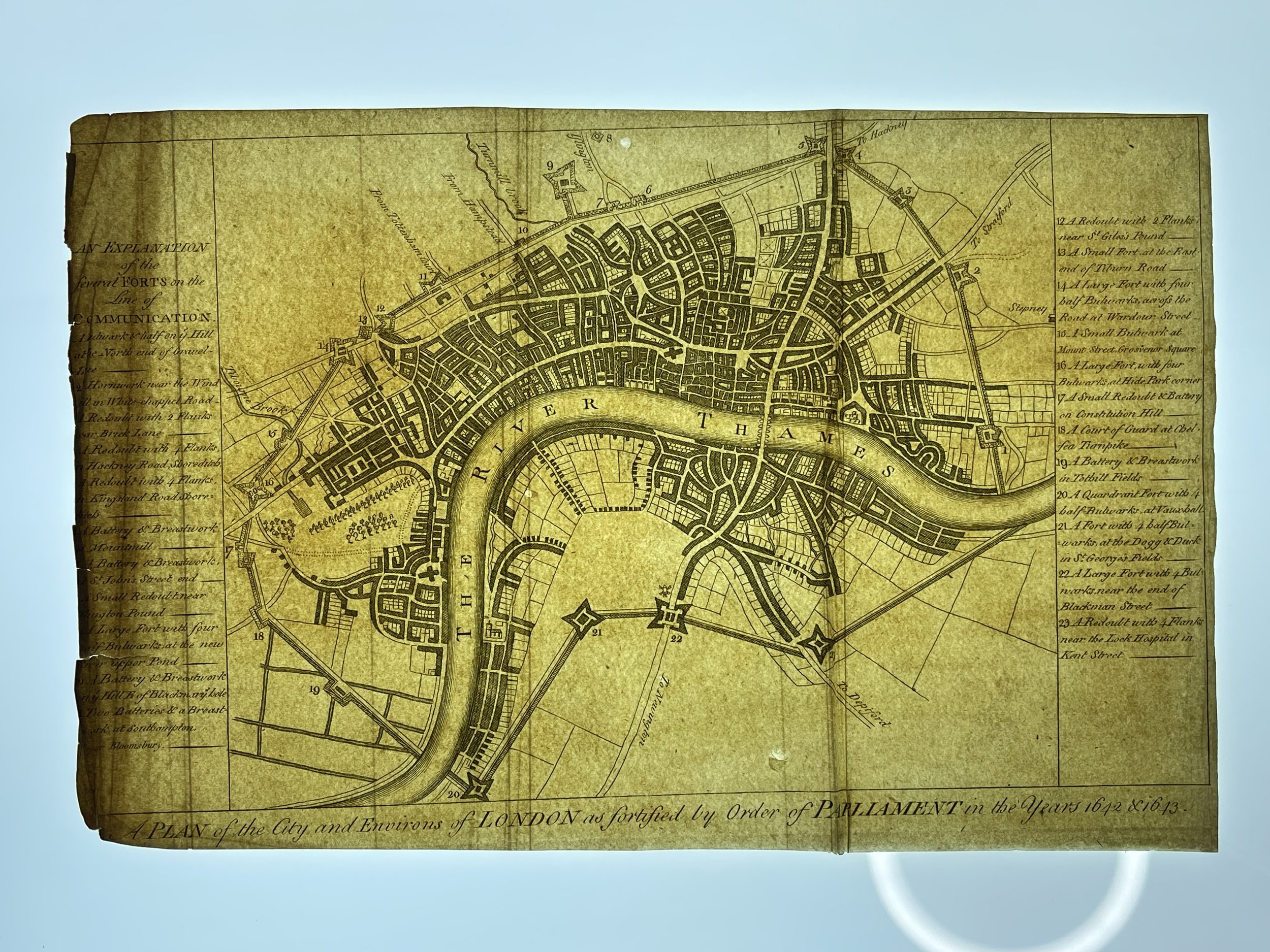
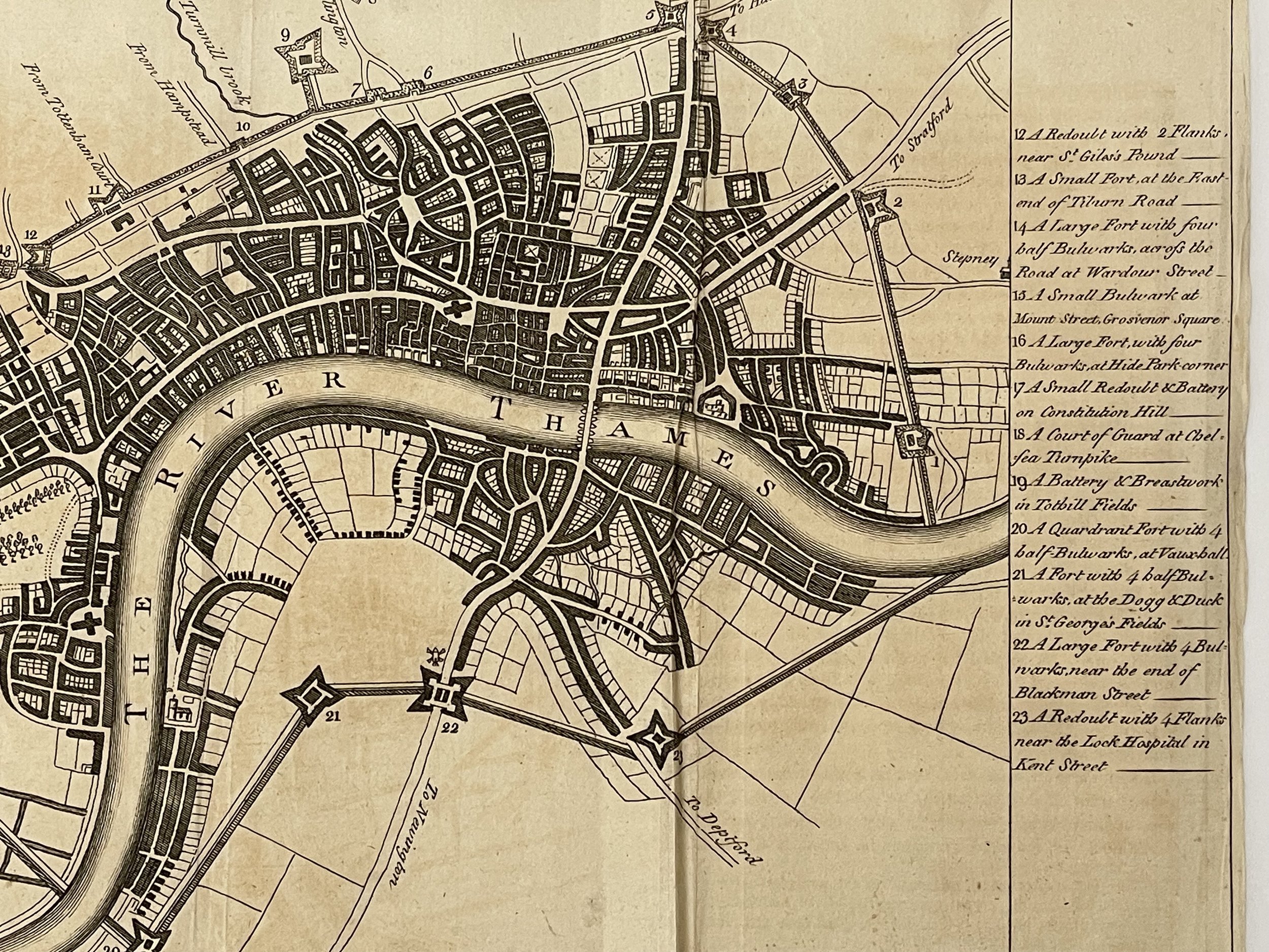
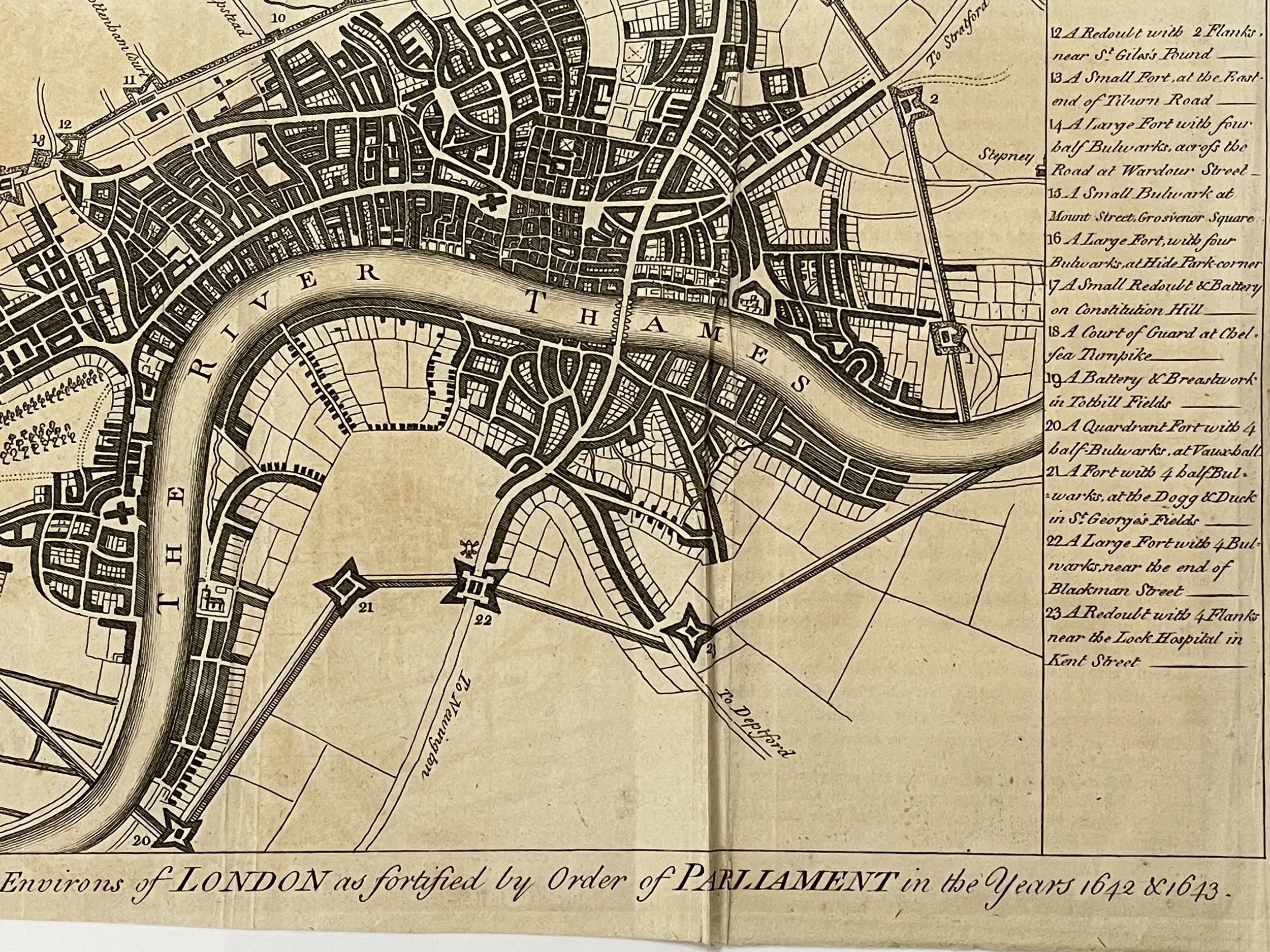
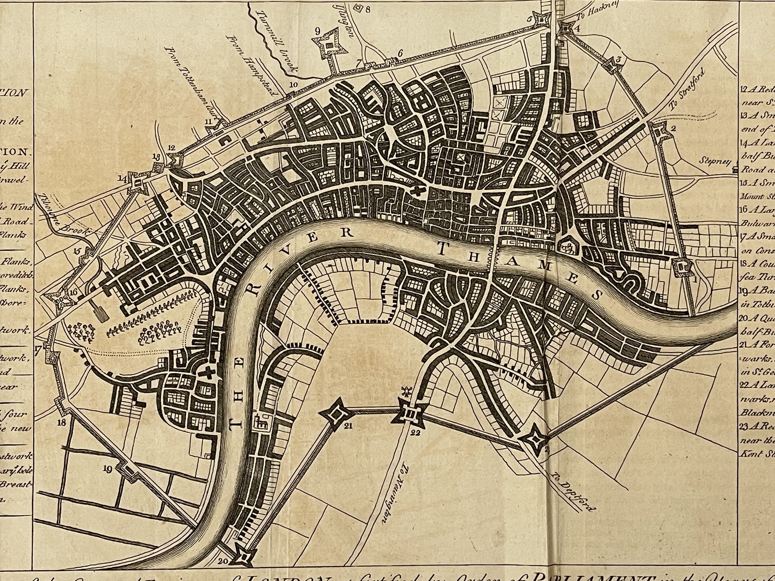
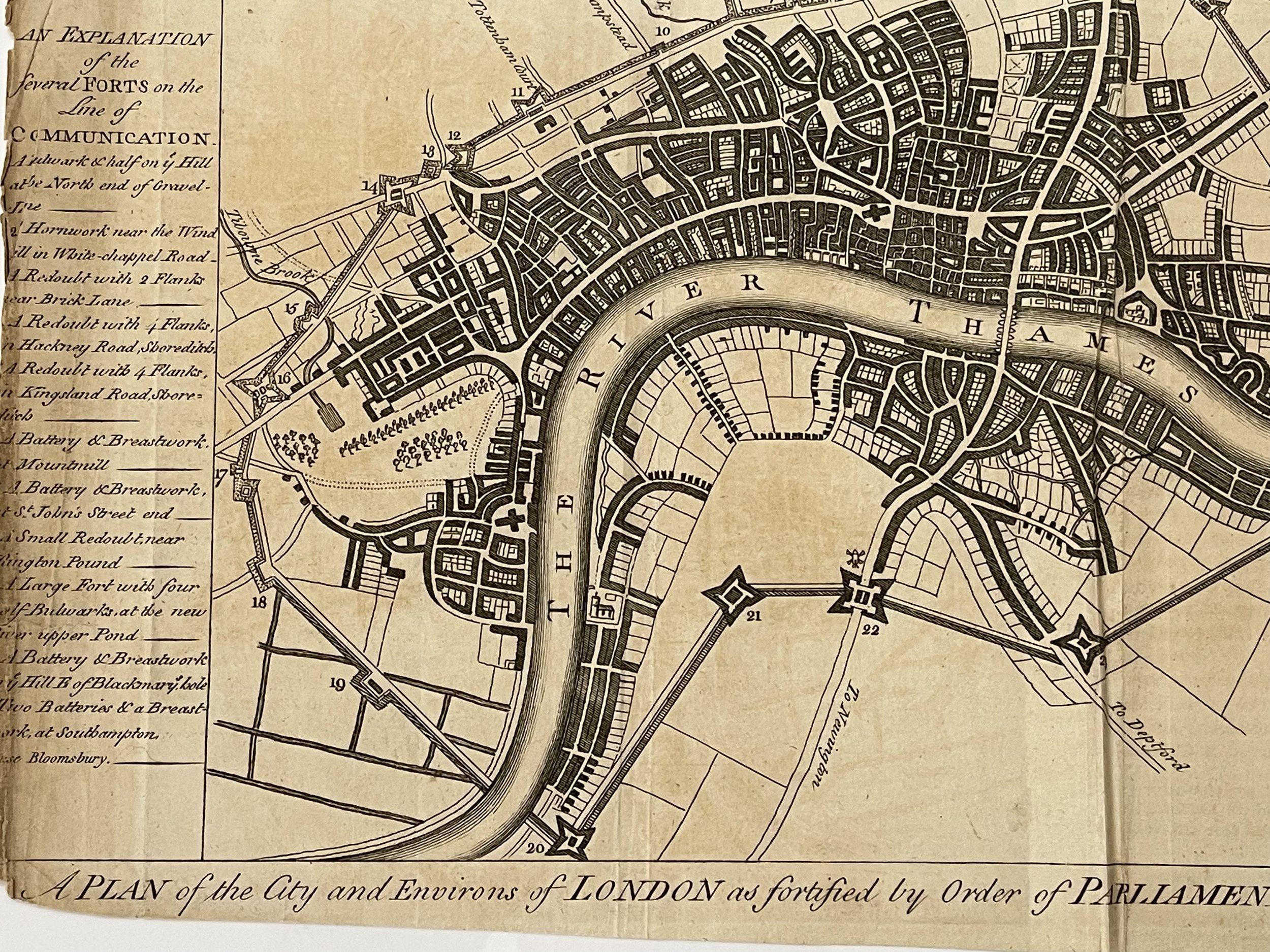
London. Charming plan of London showing and describing the city's fortifications during the English Civil War. Published for Harrison's History of London. 1775. Approx engraved area: 8" x 12.5" (200mm x 310mm)
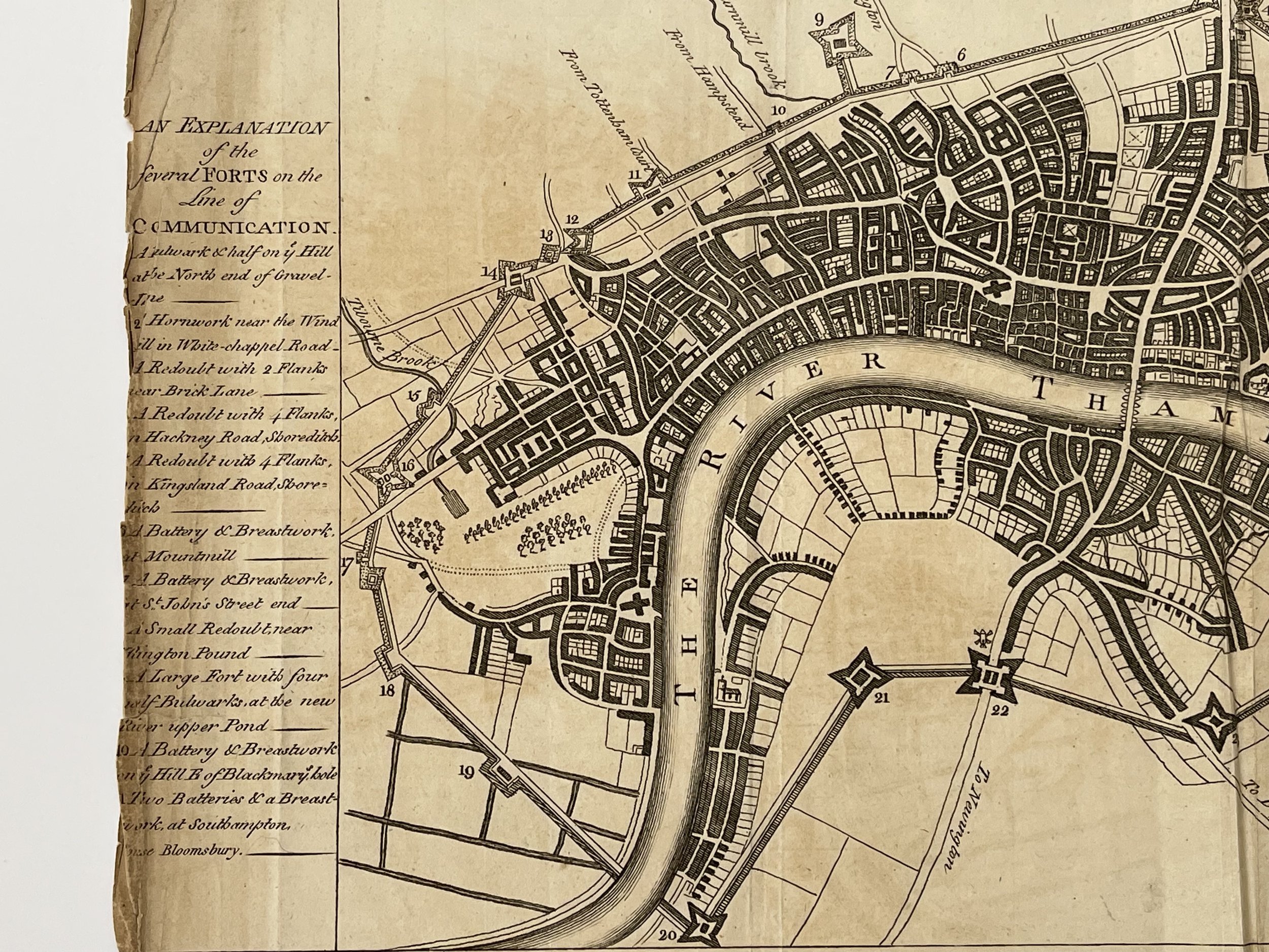
A Plan of the City and Environs of London as fortified by Order of Parliament in the Years 1642 & 1643. An explanation and map of the fortifications of London during the English Civil War. An earth rampart surrounded the city, with 23 forts or outworks. This is a retrospective map executed in 1728 and published in 1775.
The map shows, and a numbered key describes the fortifications put in place (and perhaps made of wood) to defend London from the Royalist forces in the Civil War. With no such attack forthcoming, they were demolished in 1647. Recent excavations in the grounds of Buckingham Place, through which the walls appear to go, failed to reveal any trace.
A New and Universal History, Description and Survey of the Cities of London and Westminster, the Borough of Southwark, and their Adjacent Parts, by Walter Harrison is a 1775 book illustrated with 102 monochrome plates, describing the appearance of London at that time. It was published by John Cooke in 70 parts. These were issued weekly, each with one or two of the plates. The illustrations were prints made using engraved copper plates.
COOKE, JOHN (1731–1810), bookseller, was born in 1731, and began life as assistant to Alexander Hogg, one of the earliest publishers of the cheap ‘Paternoster Row numbers,’ or standard popular works issued in weekly parts.
Cooke started for himself and made a large fortune in the same way of business.
These editions were published in sixpenny whity-brown-covered weekly parts, well edited and printed. They were divided into three sections—select novels, sacred classics, and select poets. A shilling ‘superior edition’ was also issued.
Cooke died at York Place, Kingsland Road, on 25 March 1810, aged 79. His son Charles succeeded to the business at the Shakespeare’s Head, Paternoster Row, but only survived him six years, dying 16 April 1816, aged 56. The son was a liveryman of the Stationers' Company.
Map has some staining from sunlight probably, but the engraving and panelled script is clear, bright and is in very good condition otherwise. Pricing and grading commensurate.
Cartographer - Walter Harrison
London. Charming plan of London showing and describing the city's fortifications during the English Civil War. Published for Harrison's History of London. 1775. Approx engraved area: 8" x 12.5" (200mm x 310mm)
A Plan of the City and Environs of London as fortified by Order of Parliament in the Years 1642 & 1643. An explanation and map of the fortifications of London during the English Civil War. An earth rampart surrounded the city, with 23 forts or outworks. This is a retrospective map executed in 1728 and published in 1775.
The map shows, and a numbered key describes the fortifications put in place (and perhaps made of wood) to defend London from the Royalist forces in the Civil War. With no such attack forthcoming, they were demolished in 1647. Recent excavations in the grounds of Buckingham Place, through which the walls appear to go, failed to reveal any trace.
A New and Universal History, Description and Survey of the Cities of London and Westminster, the Borough of Southwark, and their Adjacent Parts, by Walter Harrison is a 1775 book illustrated with 102 monochrome plates, describing the appearance of London at that time. It was published by John Cooke in 70 parts. These were issued weekly, each with one or two of the plates. The illustrations were prints made using engraved copper plates.
COOKE, JOHN (1731–1810), bookseller, was born in 1731, and began life as assistant to Alexander Hogg, one of the earliest publishers of the cheap ‘Paternoster Row numbers,’ or standard popular works issued in weekly parts.
Cooke started for himself and made a large fortune in the same way of business.
These editions were published in sixpenny whity-brown-covered weekly parts, well edited and printed. They were divided into three sections—select novels, sacred classics, and select poets. A shilling ‘superior edition’ was also issued.
Cooke died at York Place, Kingsland Road, on 25 March 1810, aged 79. His son Charles succeeded to the business at the Shakespeare’s Head, Paternoster Row, but only survived him six years, dying 16 April 1816, aged 56. The son was a liveryman of the Stationers' Company.
Map has some staining from sunlight probably, but the engraving and panelled script is clear, bright and is in very good condition otherwise. Pricing and grading commensurate.
Code : A1053
Cartographer : Cartographer / Engraver / Publisher: Walter Harrison
Date : Publication Place / Date - 1775
Size : Sheet size: 8 x 12.5 Inches
Availability : Available
Type - Genuine - Antique
Grading A-
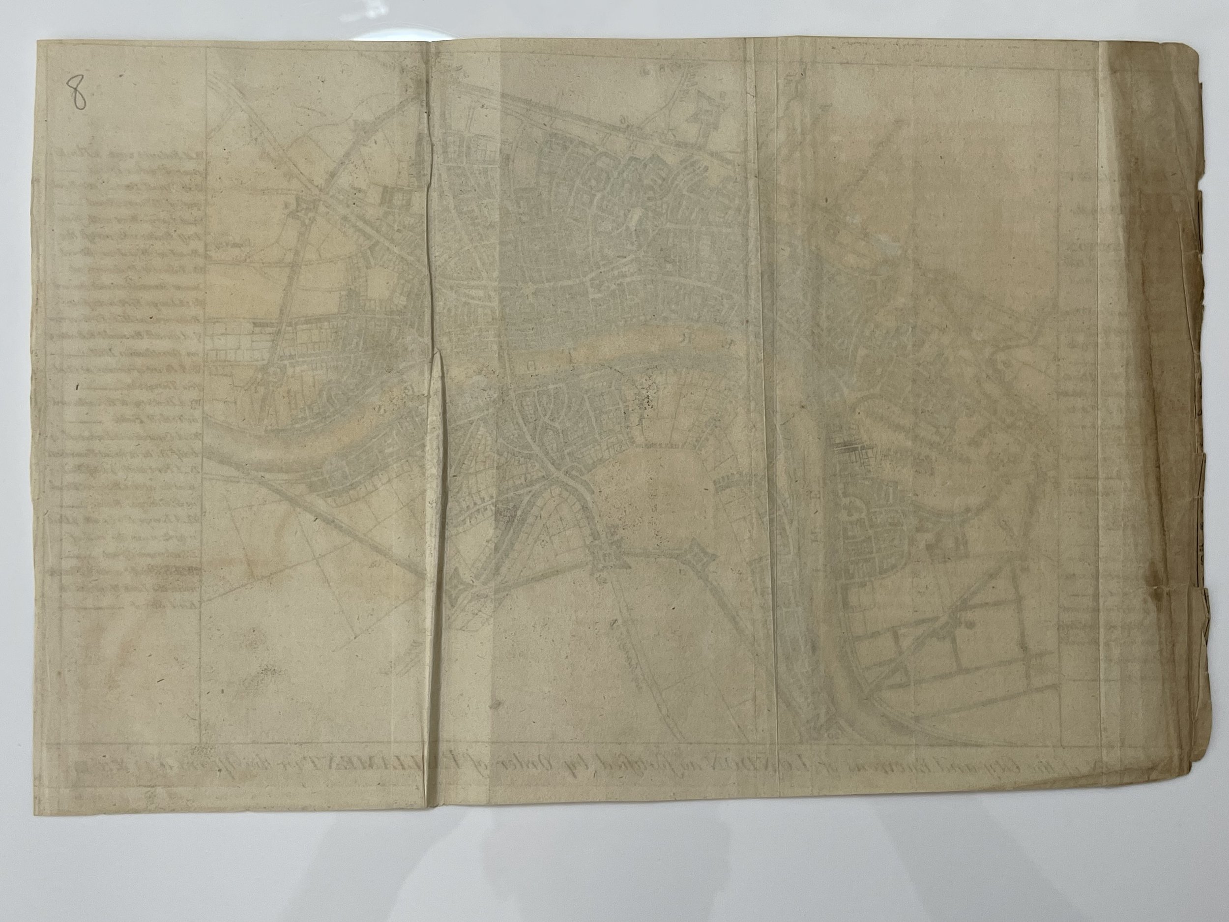
Where Applicable - Folds as issued. Light box photo shows the folio leaf centre margin hinge ‘glue’, this is not visible otherwise.
Tracked postage, in casement. Please contact me for postal quotation outside of the UK.