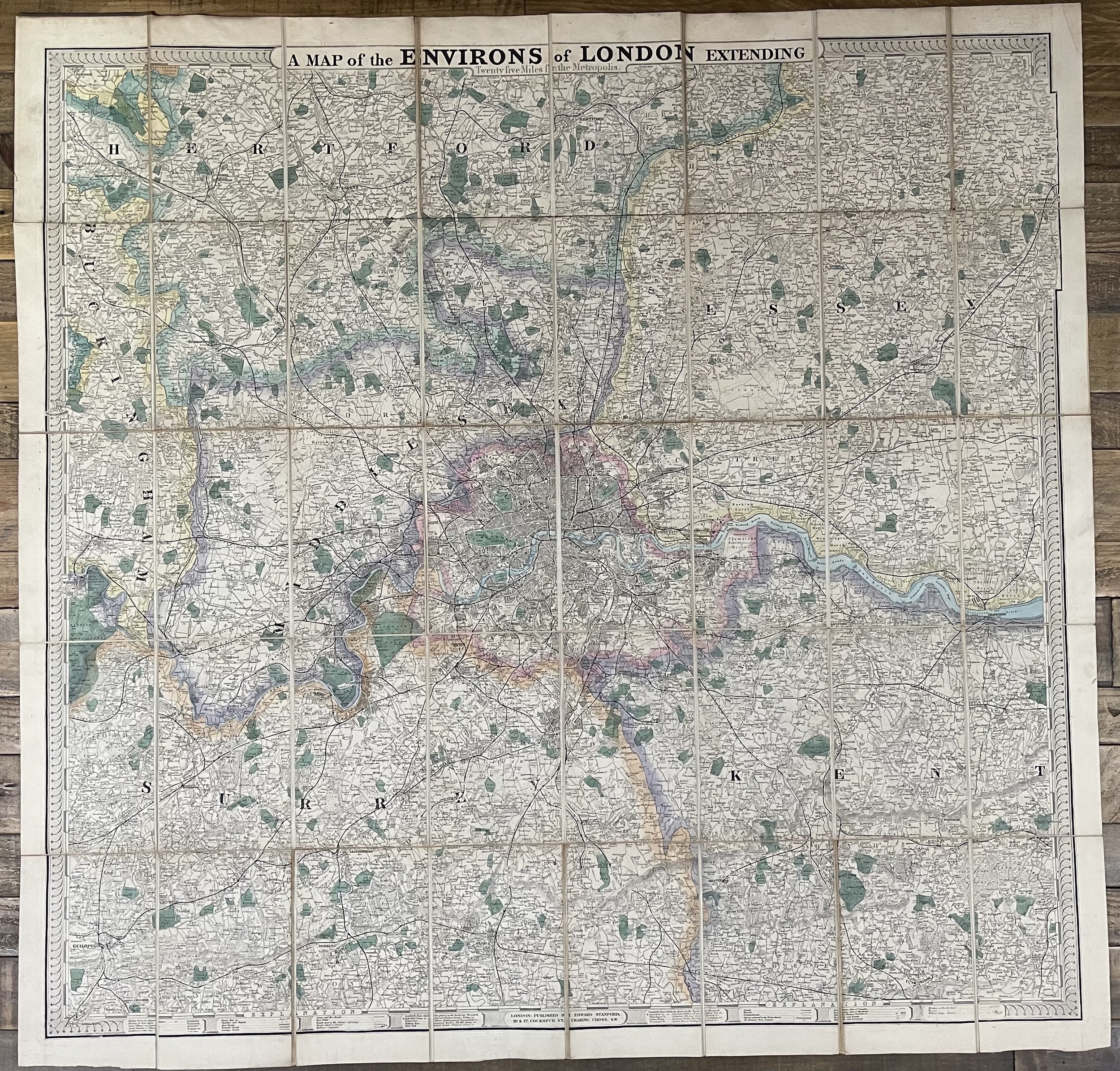
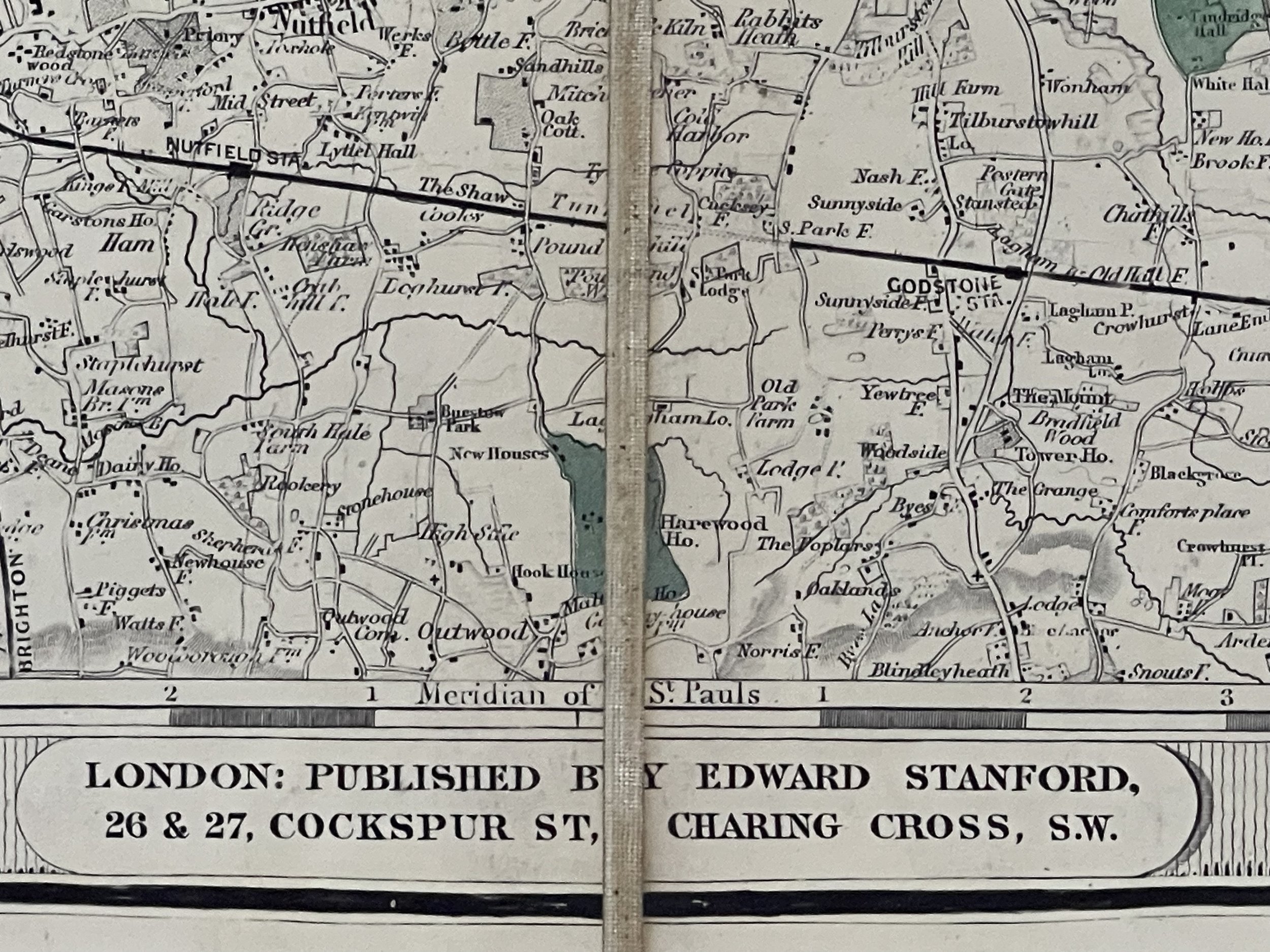
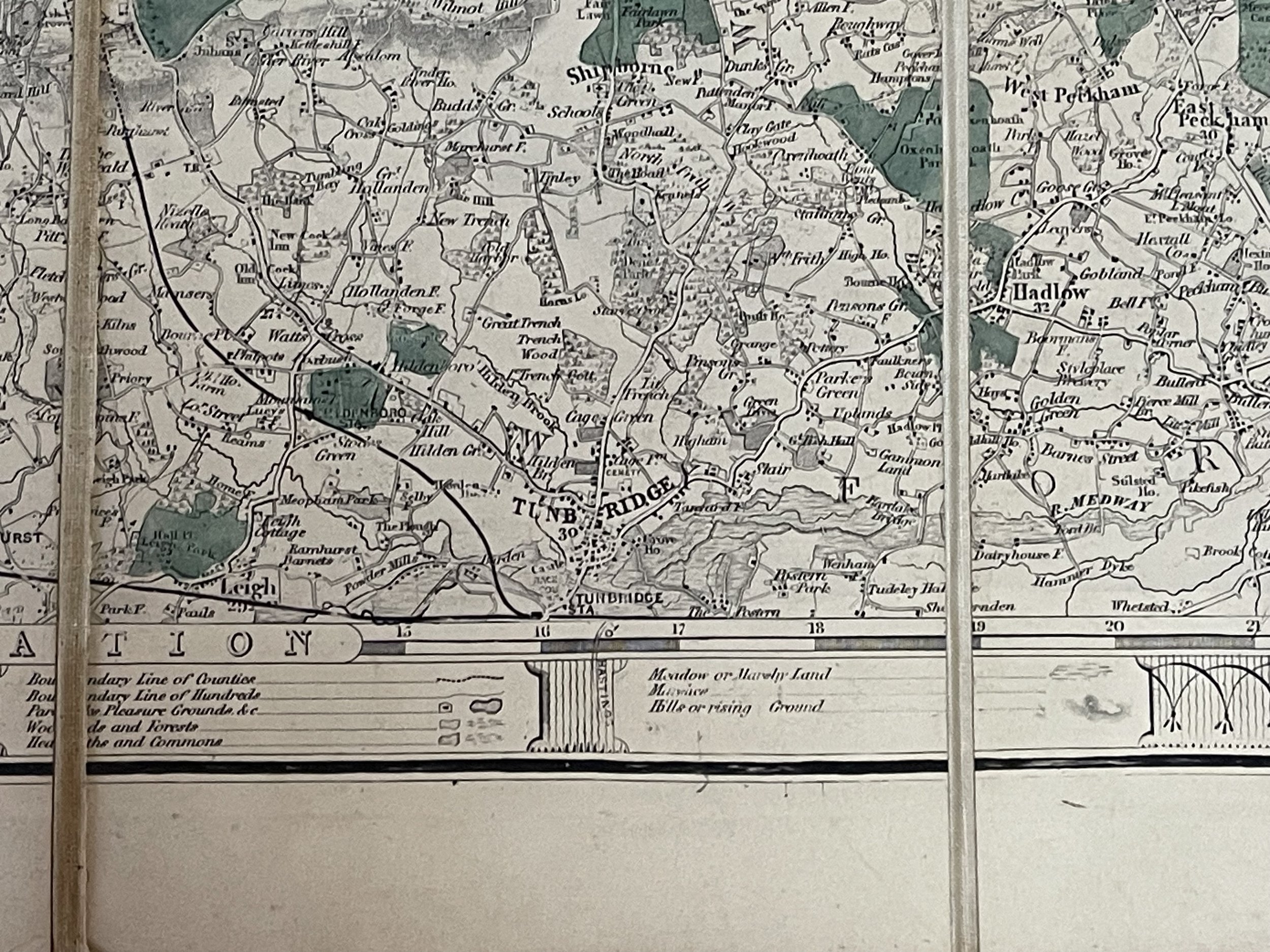
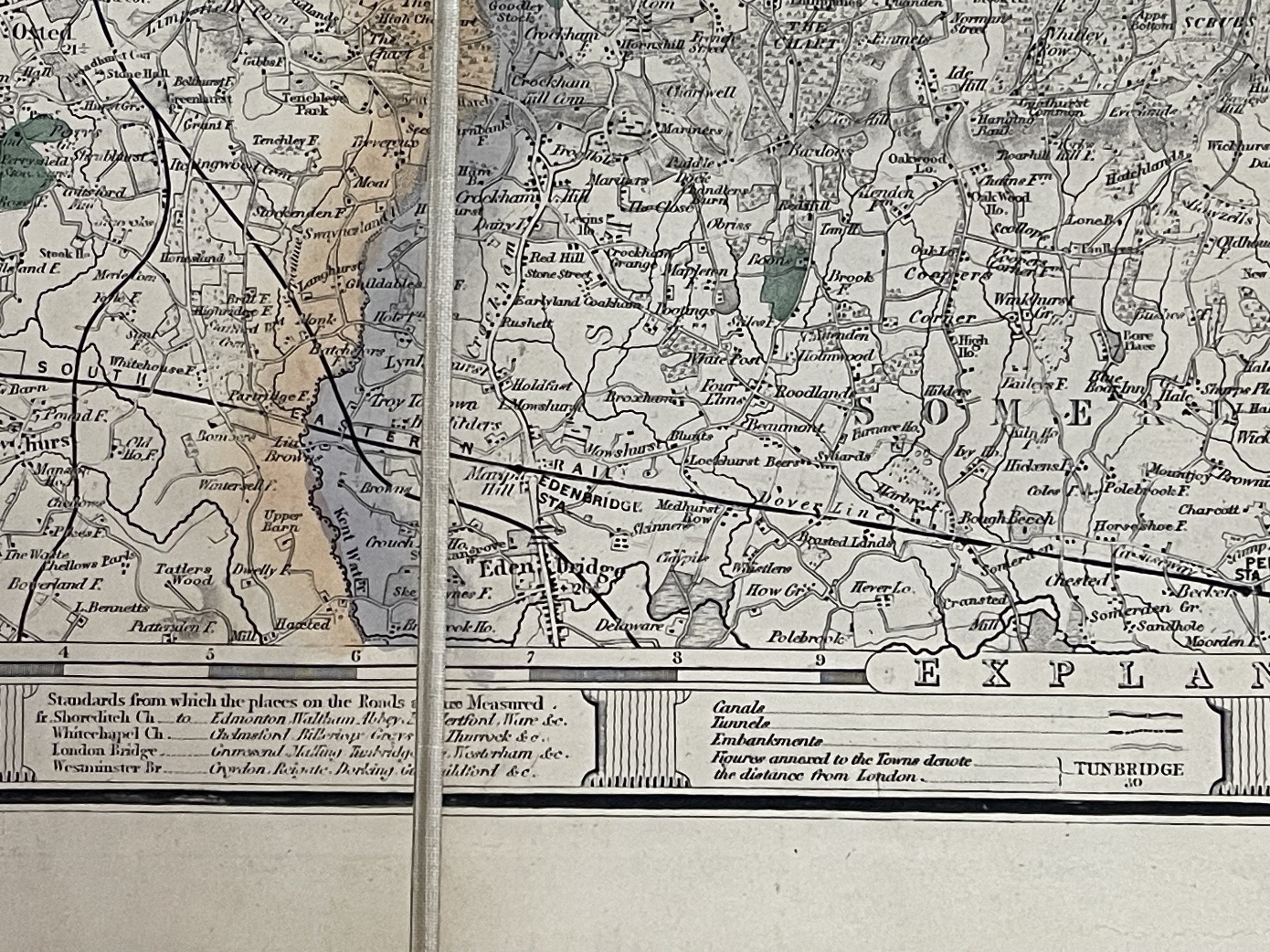
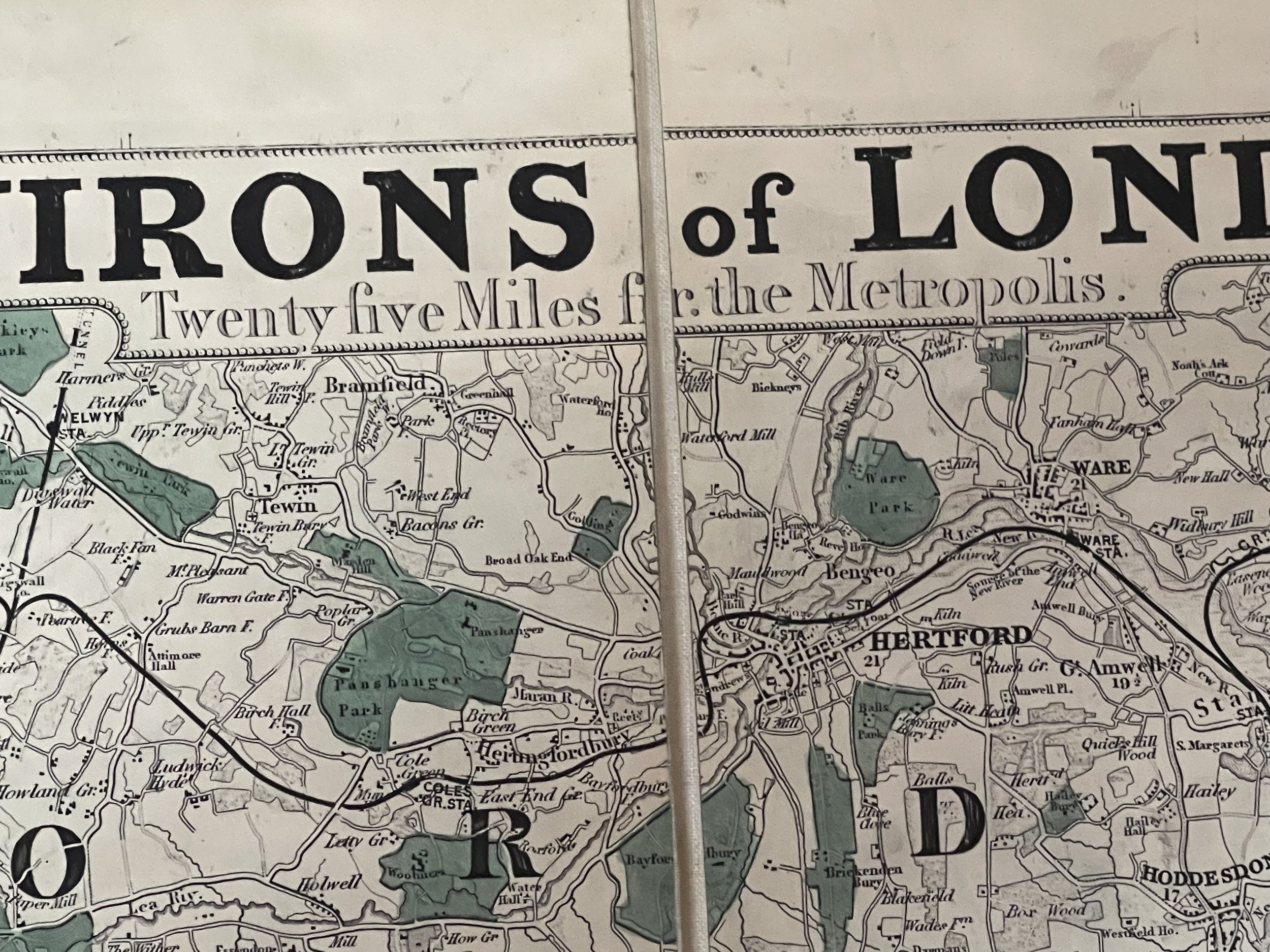
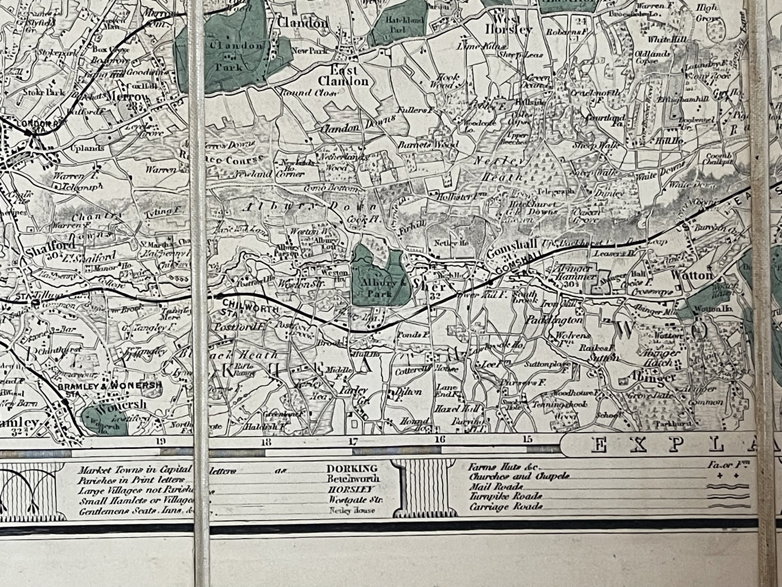
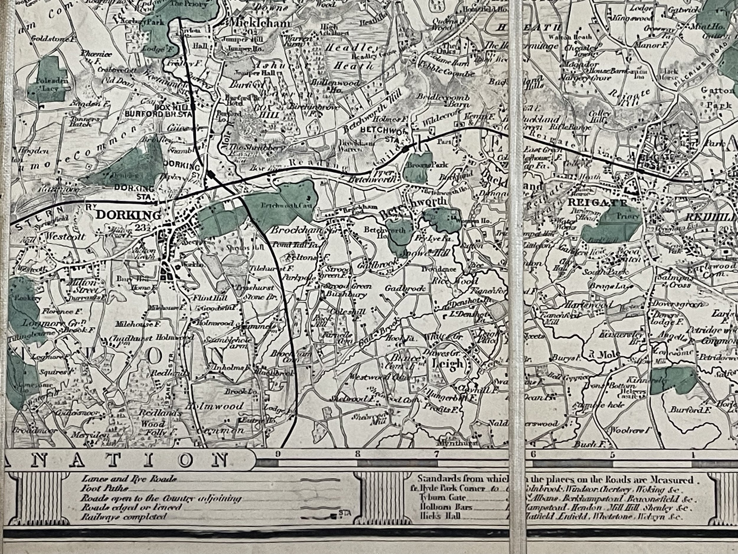
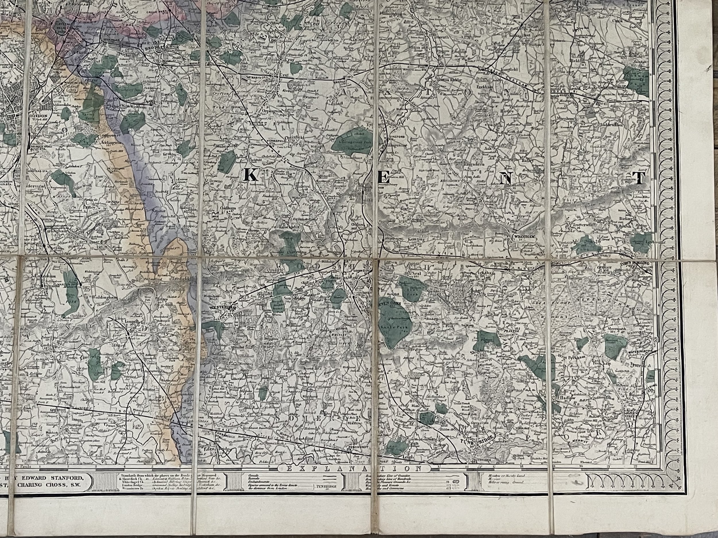
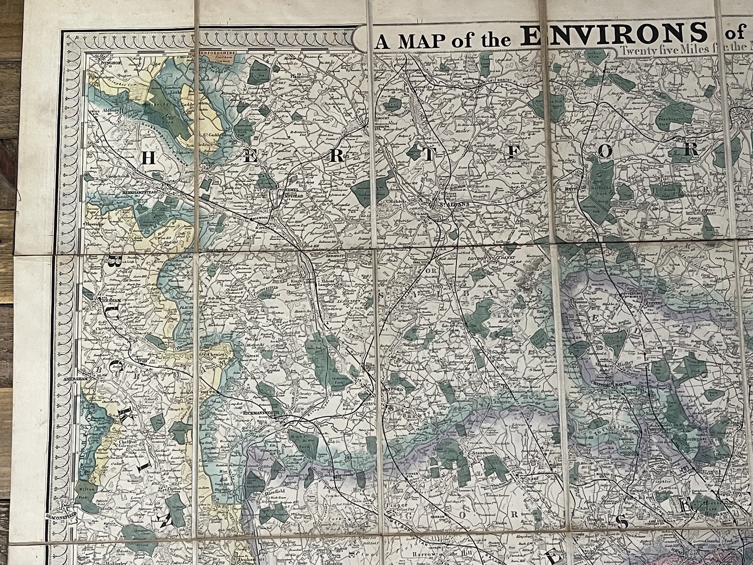


A Map of the Environs of London Extending - Edward Stanford - 1880
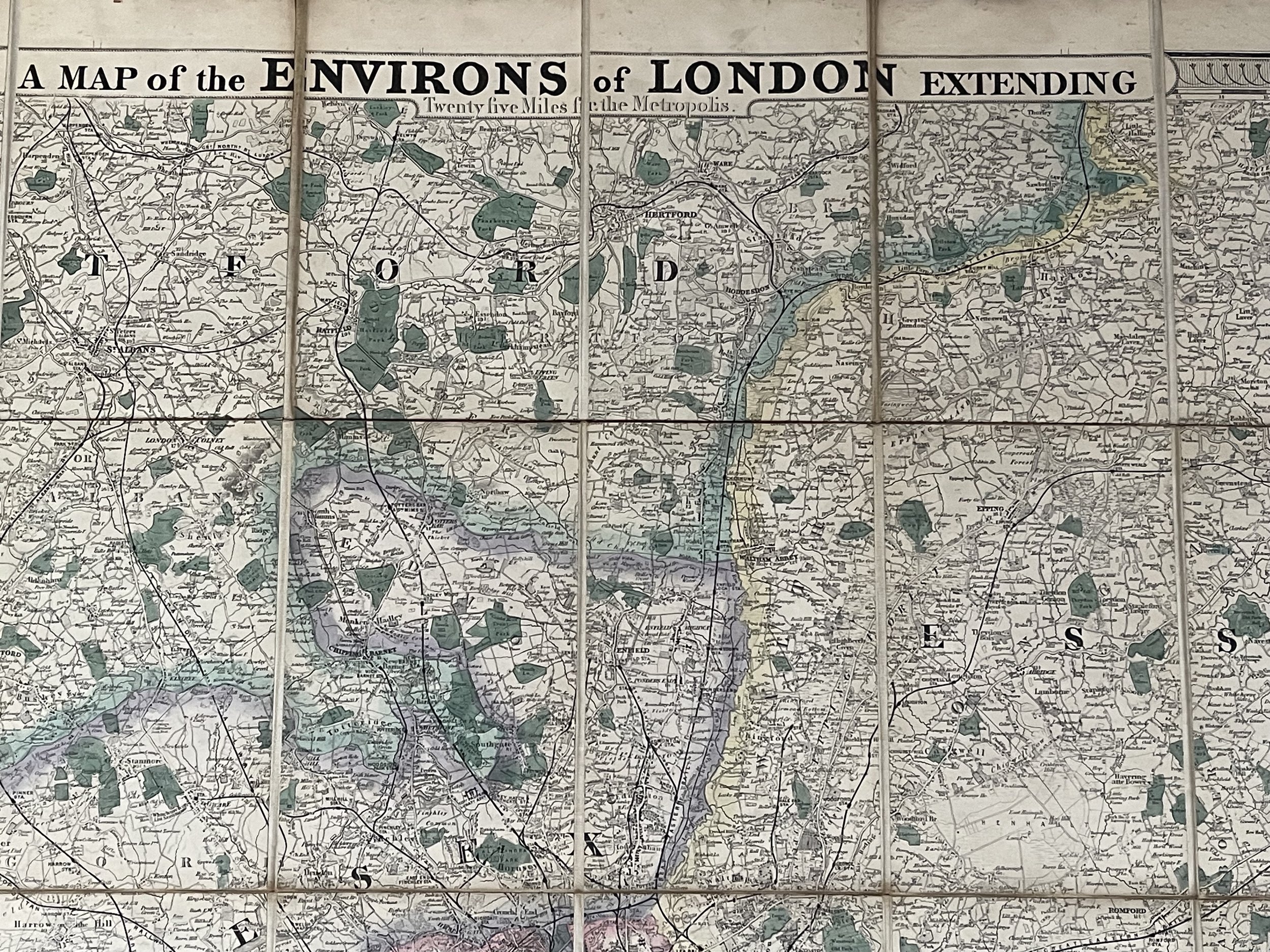
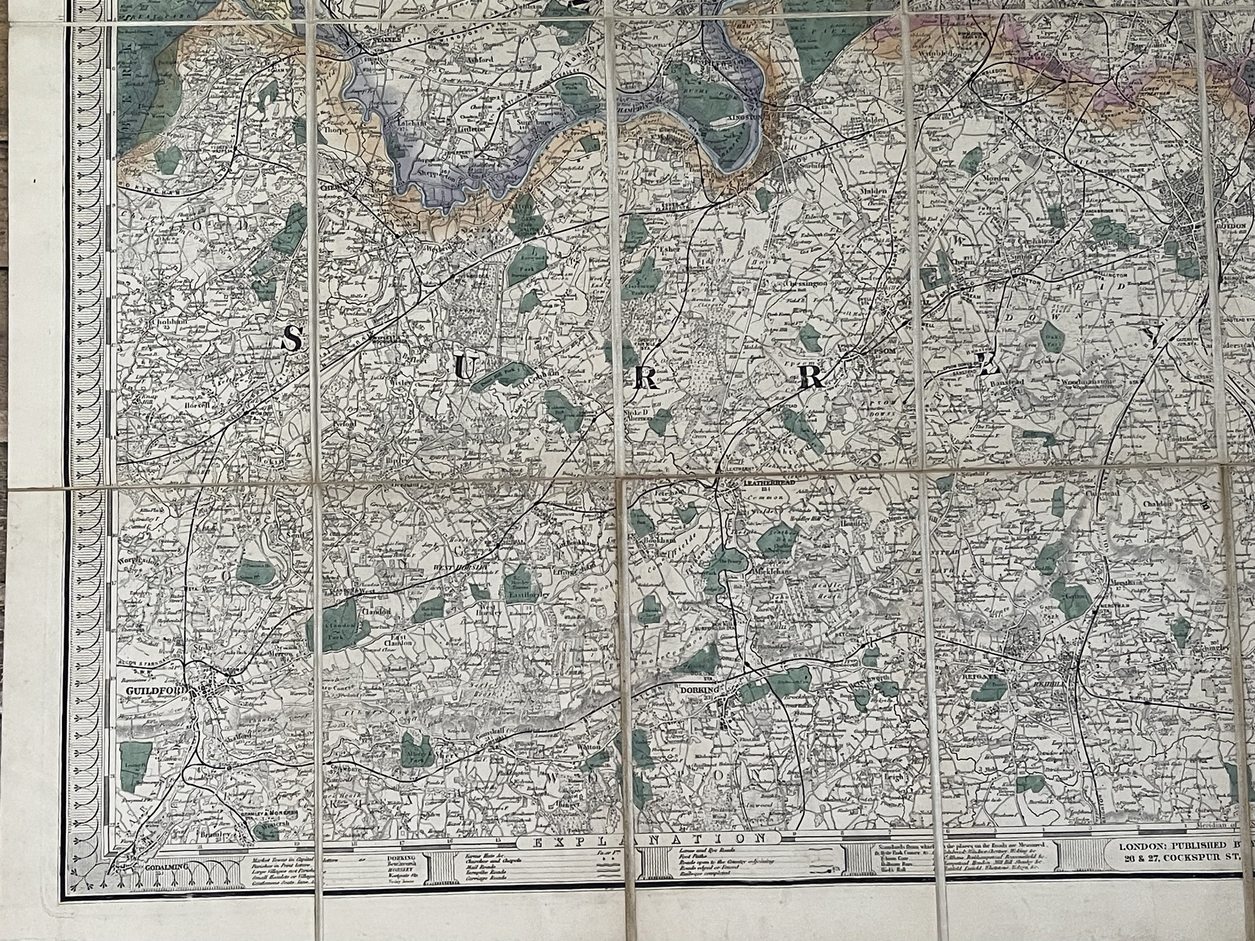
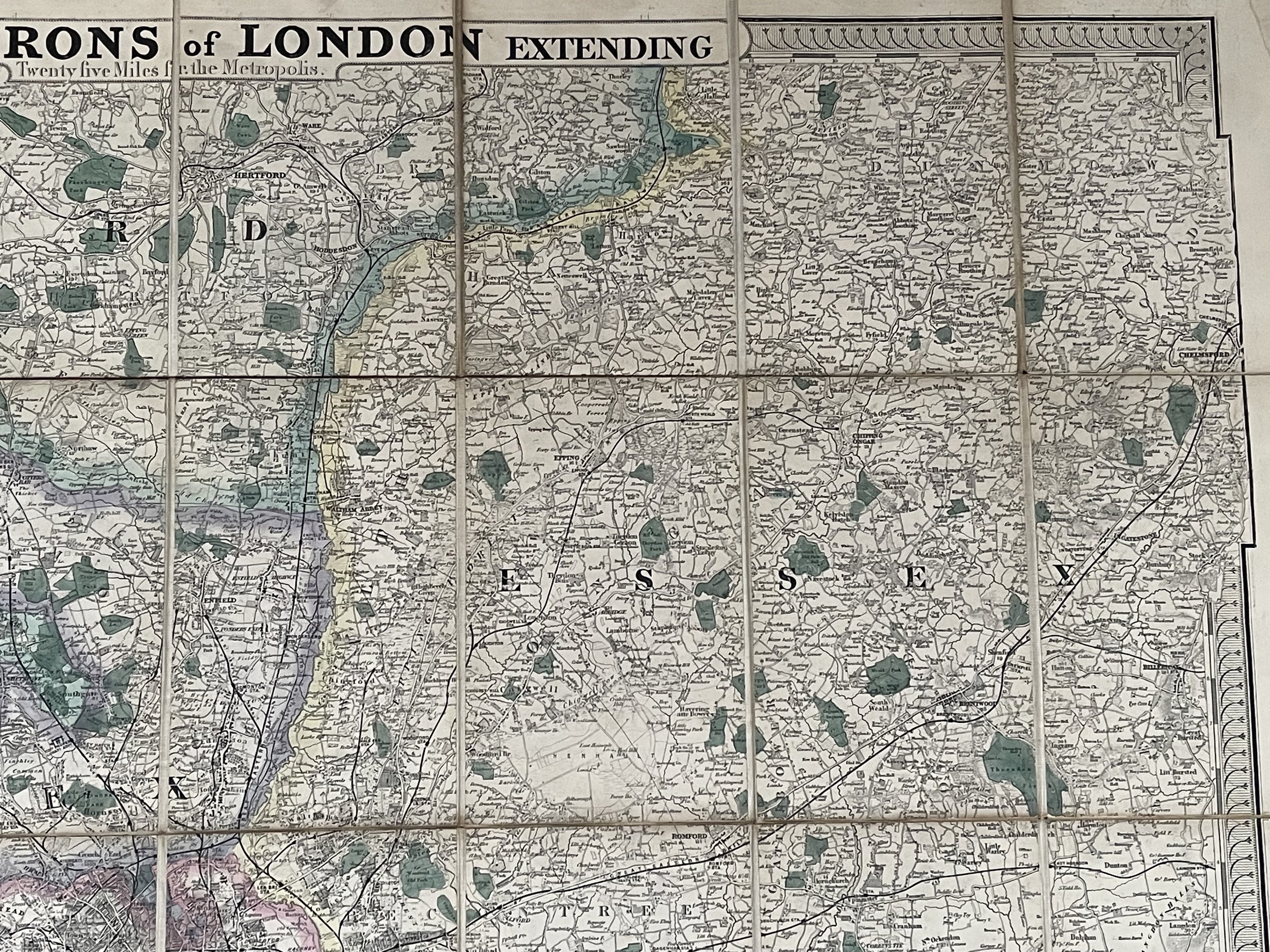
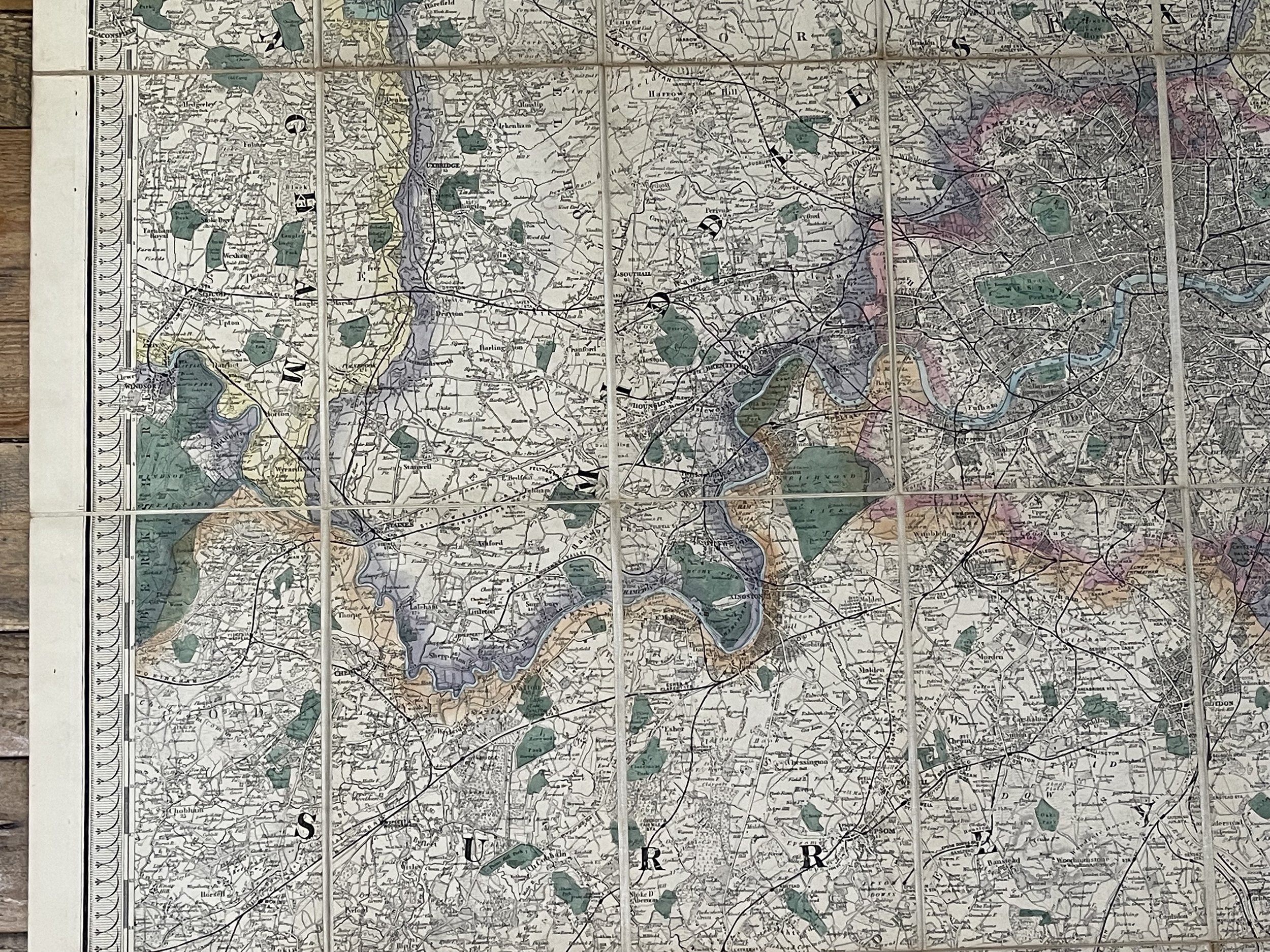
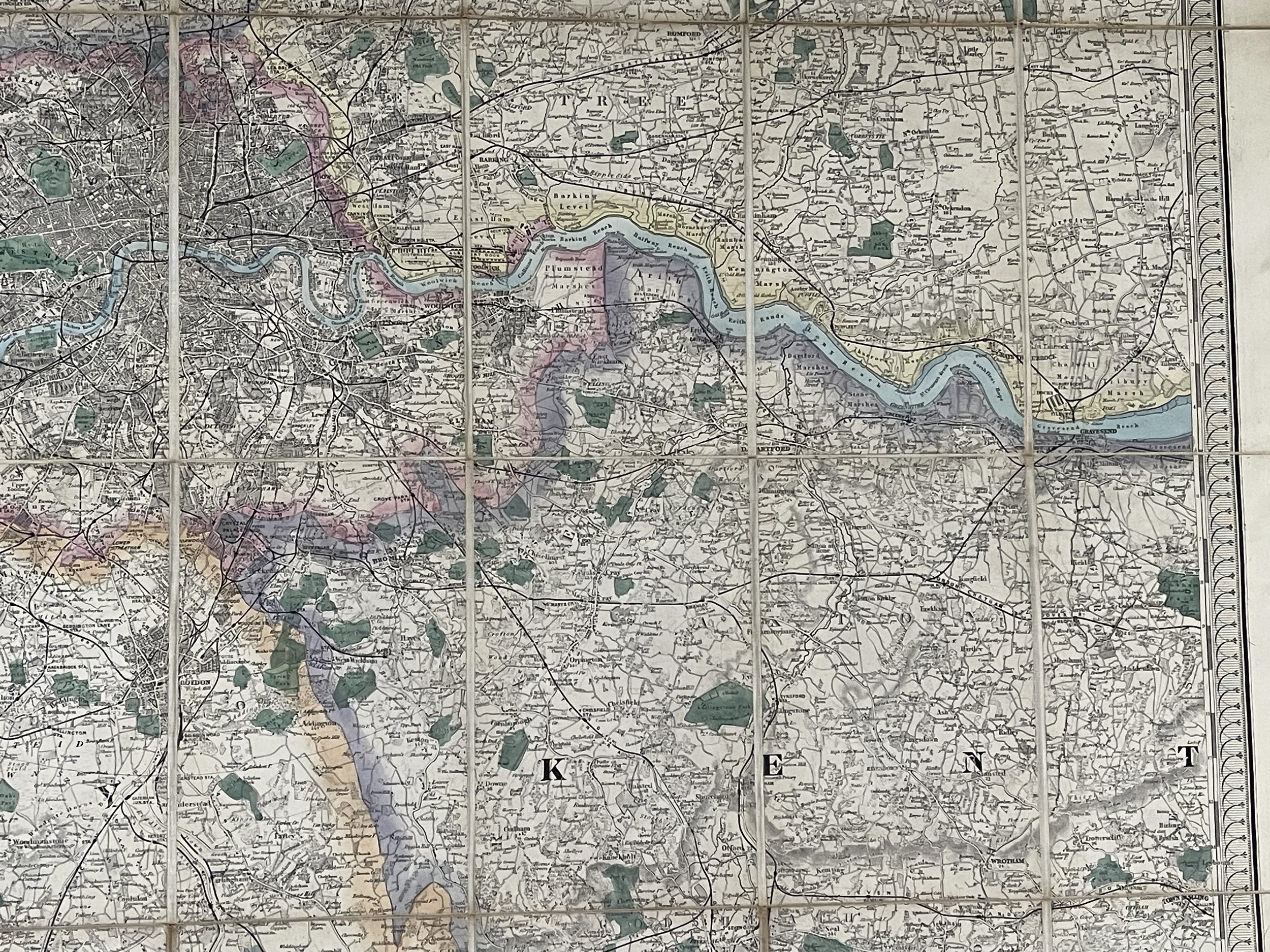
A Map of the Environs of London Extending. Stanford. Folding map. Twenty-five miles from the metropolis.
Hand coloured map in original state. Paper backed onto linen. Undated Circa 1880.
97.2 x 94.5 cm. Missing its front cover board but otherwise in good condition for its age.
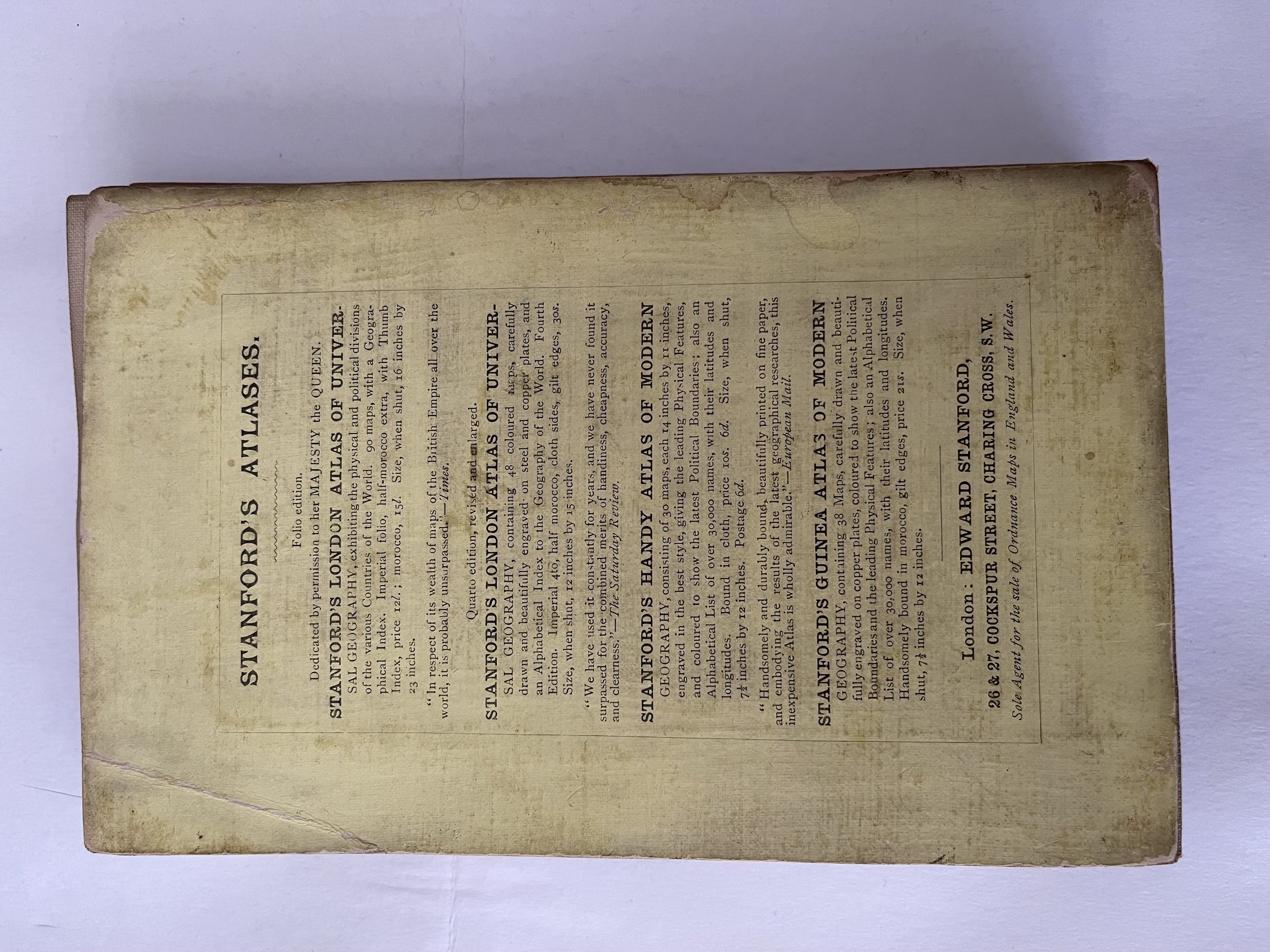
Edward Stanford (27 May 1827 – 3 November 1904) was the founder of Stanfords, now a pair of map and book shops based in London and Bristol, UK.
Born in 1827, and educated at the City of London School, Edward Stanford developed his interest in maps after being employed by Mr Trelawney Saunders at his map and stationery shop. He became a partner to Saunders in 1852 at the age of 25. In 1853, the company was dissolved, and Stanford took over the remains of the business with the intent of turning it into a map specialist. With British colonial expansion pushing the demand for maps worldwide, and being the sole specialist of maps in London, the move was both obvious and lucrative.
The name Stanfords became prominent in 1862 when his project to make the most accurate map of London possible was published. Stanford's Library Map of London is still on sale today, over 150 years later.
Company ownership remained in the family until 1947, when it was absorbed into George Philip & Son. However, in 2001 Stanfords separated from George Philip & Son and the name Stanfords is displayed on both stores and on many lines of maps and books produced by the company.
A Map of the Environs of London Extending. Stanford. Folding map. Twenty-five miles from the metropolis.
Hand coloured map in original state. Paper backed onto linen. Undated Circa 1880.
97.2 x 94.5 cm. Missing its front cover board but otherwise in good condition for its age.
Edward Stanford (27 May 1827 – 3 November 1904) was the founder of Stanfords, now a pair of map and book shops based in London and Bristol, UK.
Born in 1827, and educated at the City of London School, Edward Stanford developed his interest in maps after being employed by Mr Trelawney Saunders at his map and stationery shop. He became a partner to Saunders in 1852 at the age of 25. In 1853, the company was dissolved, and Stanford took over the remains of the business with the intent of turning it into a map specialist. With British colonial expansion pushing the demand for maps worldwide, and being the sole specialist of maps in London, the move was both obvious and lucrative.
The name Stanfords became prominent in 1862 when his project to make the most accurate map of London possible was published. Stanford's Library Map of London is still on sale today, over 150 years later.
Company ownership remained in the family until 1947, when it was absorbed into George Philip & Son. However, in 2001 Stanfords separated from George Philip & Son and the name Stanfords is displayed on both stores and on many lines of maps and books produced by the company.
Code : A1022
Cartographer : Cartographer / Engraver / Publisher: Edward Stanford
Date : Publication Place / Date - 1880
Size : Sheet size: Image Size: 97.2 x 94.5 cm
Availability : Available
Type - Genuine - Antique
Grading A
Where Applicable - Folds as issued. Light box photo shows the folio leaf centre margin hinge ‘glue’, this is not visible otherwise.
Tracked postage, in casement. Please contact me for postal quotation outside of the UK.