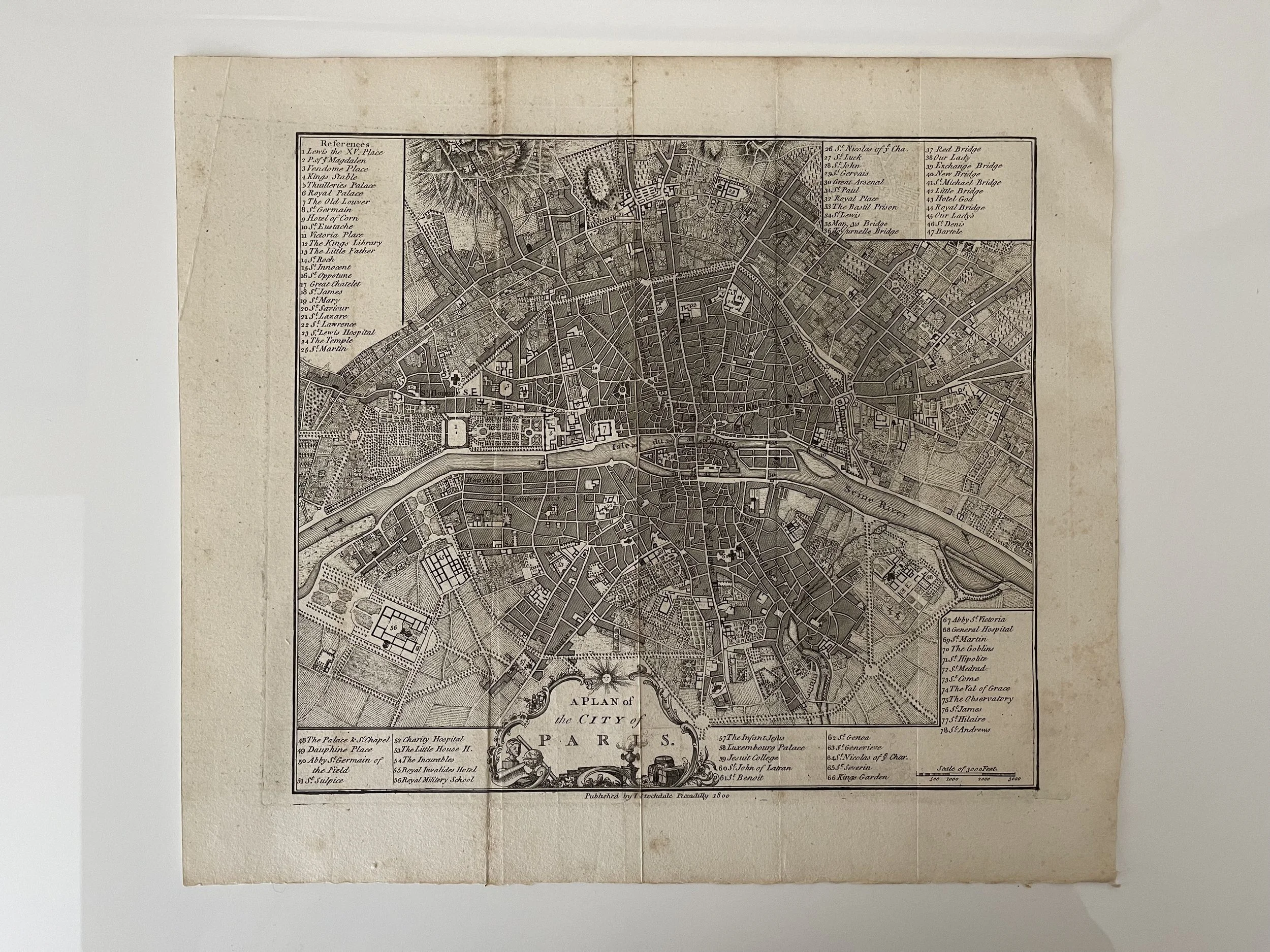
A Plan of the City of Paris - John Andrews / John Stockdale - 1800
'A Plan of the City of Paris' - John Andrews / John Stockdale - 1800
Size: The printed area measures approximately 257mm x 235mm with margins beyond, blank verso.
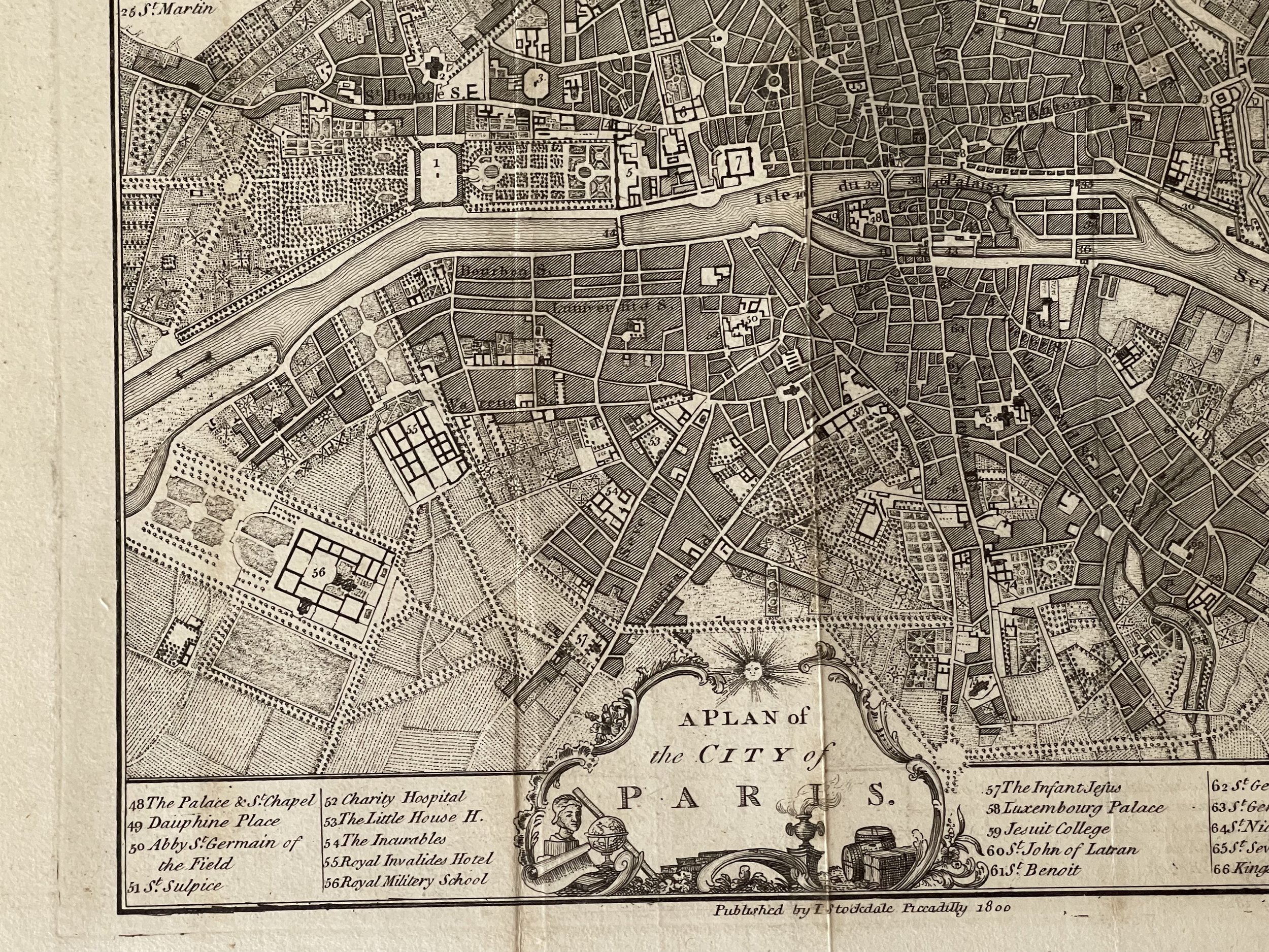
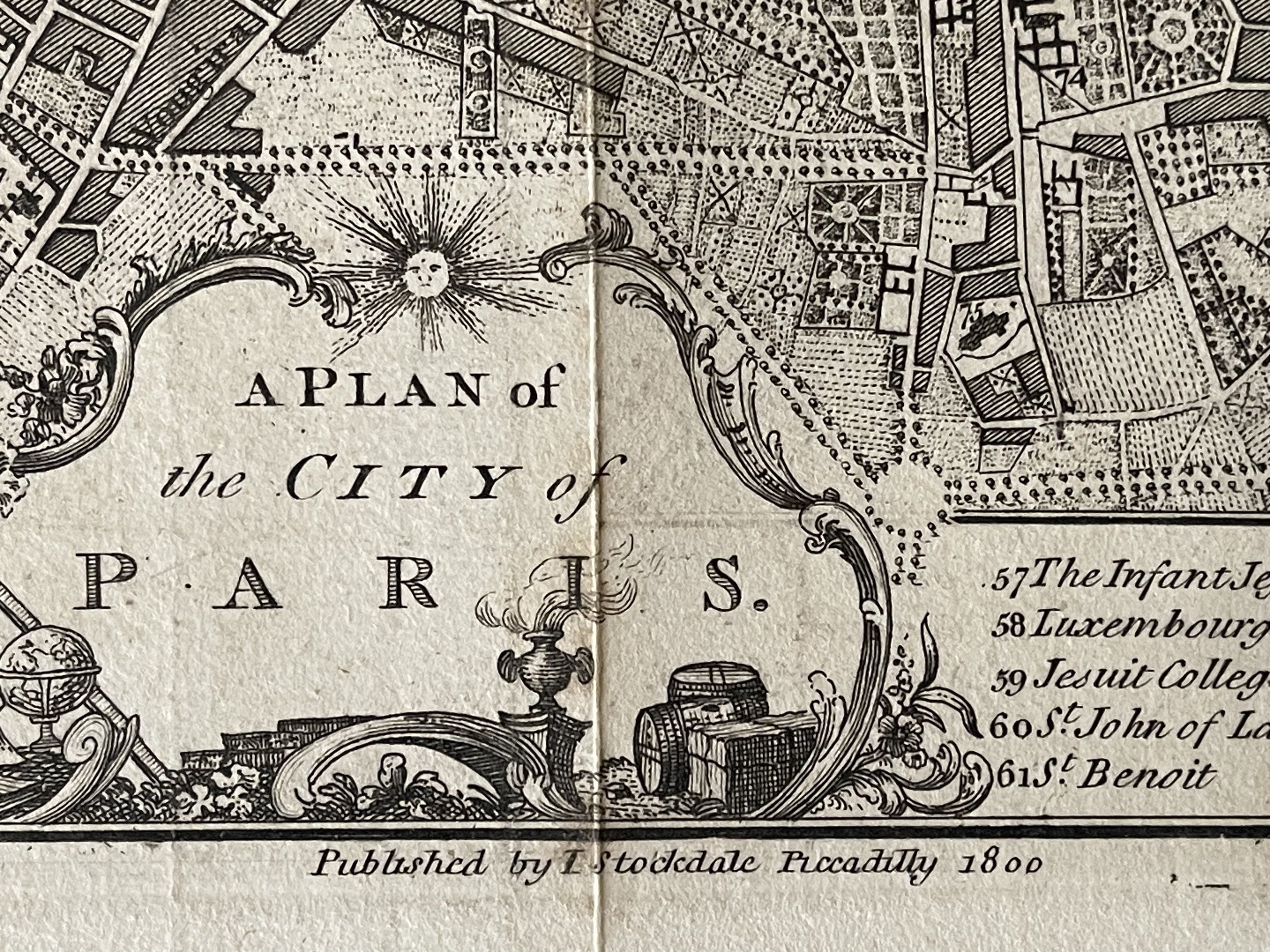
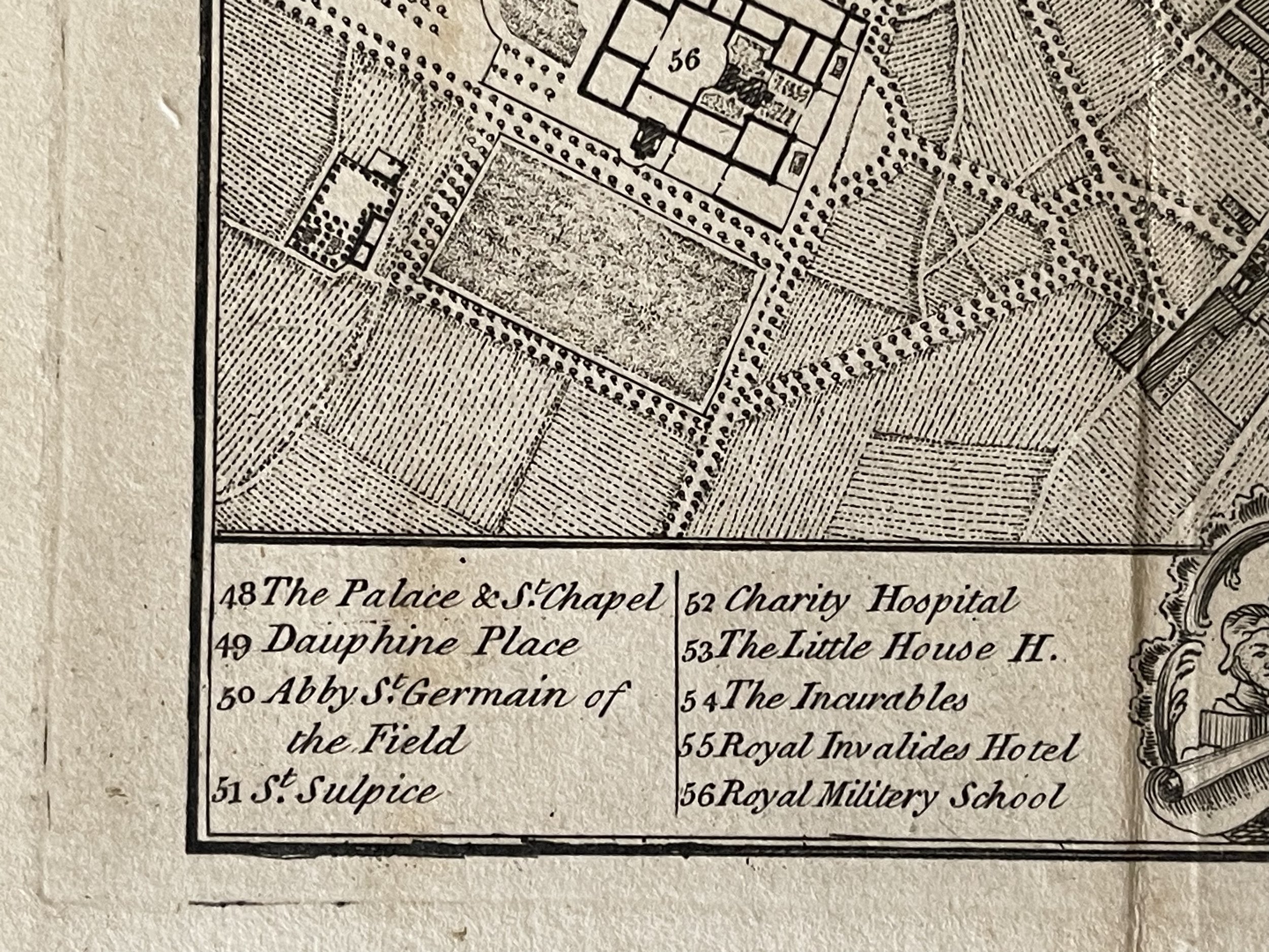
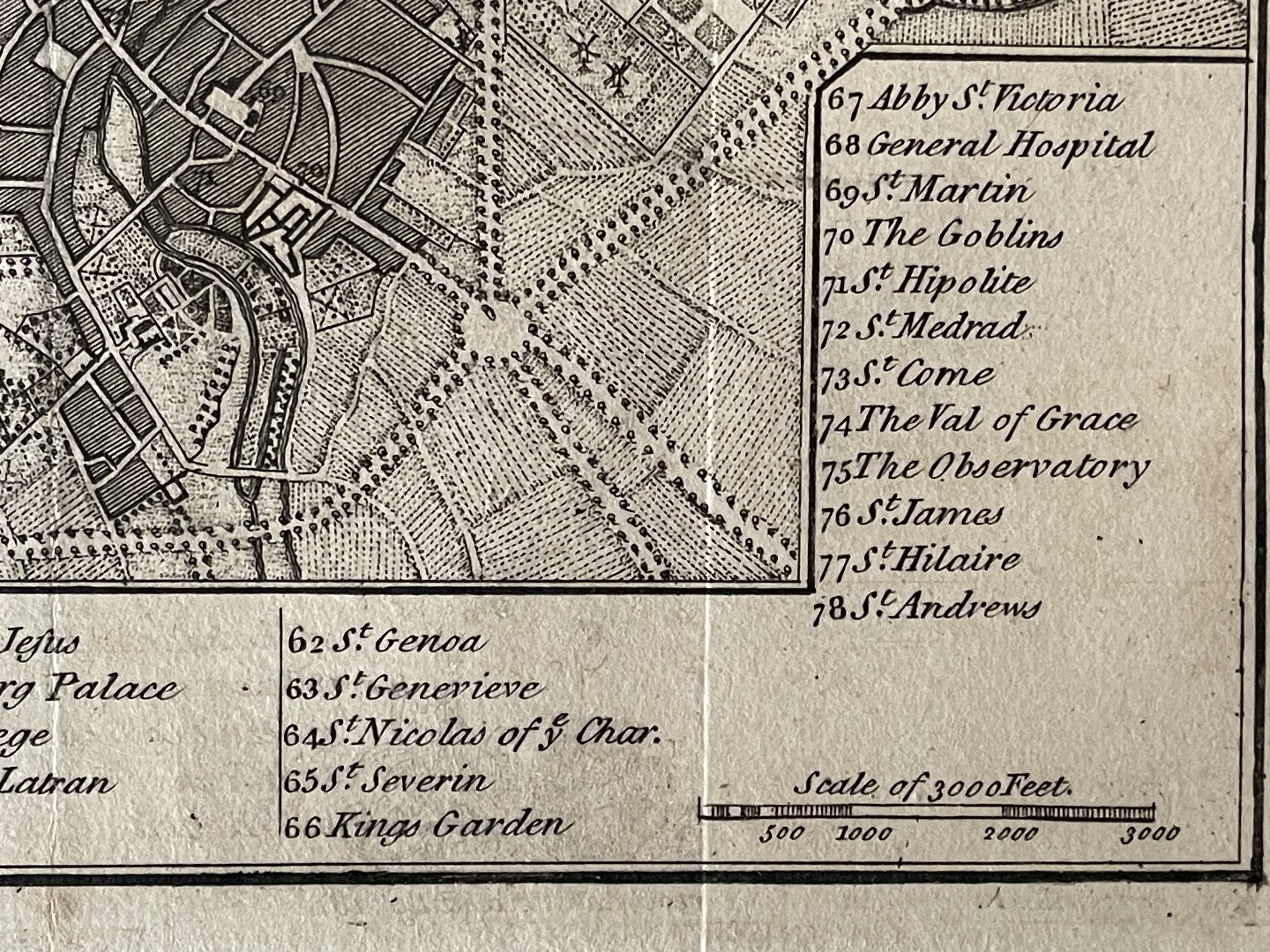
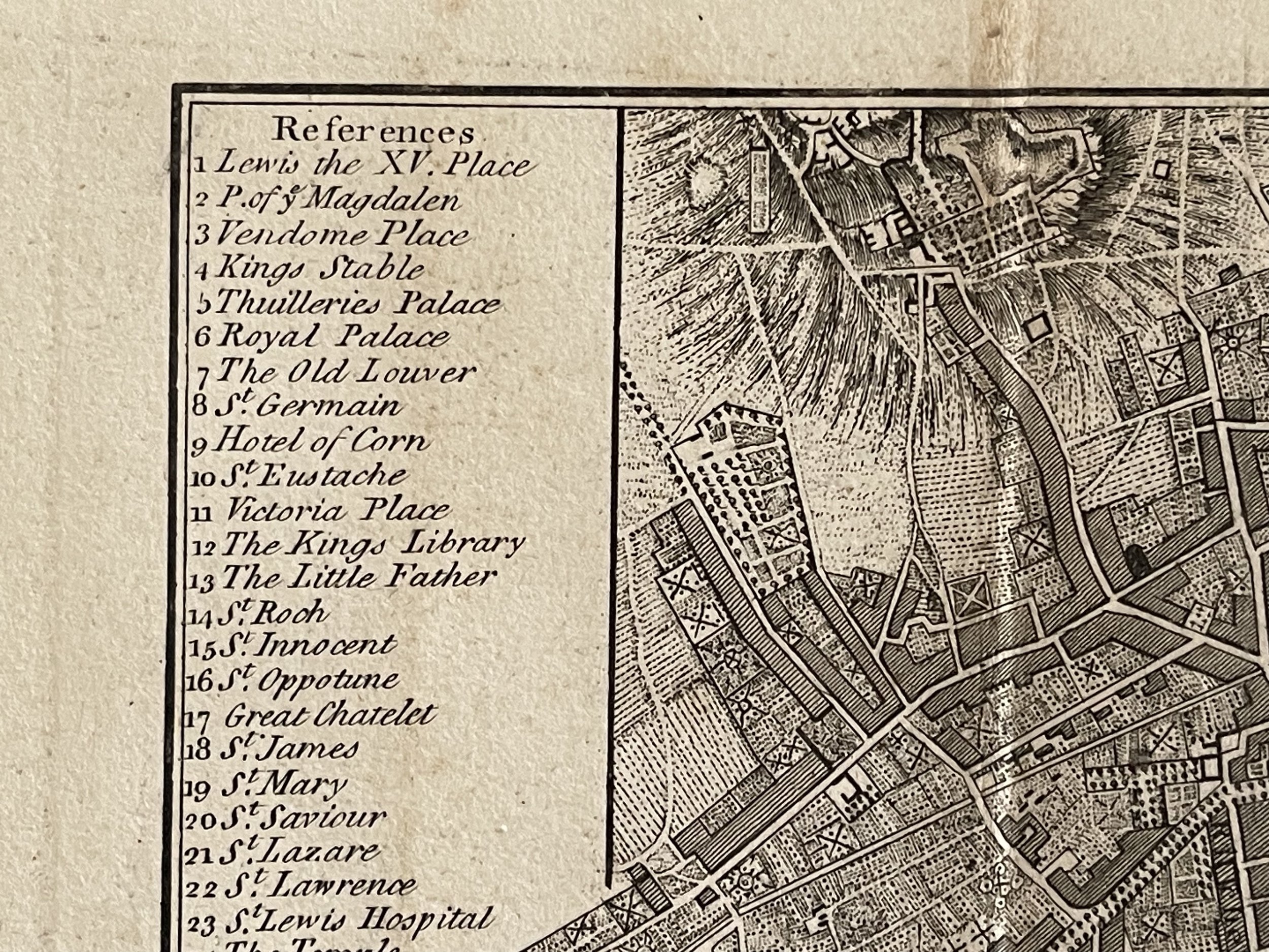
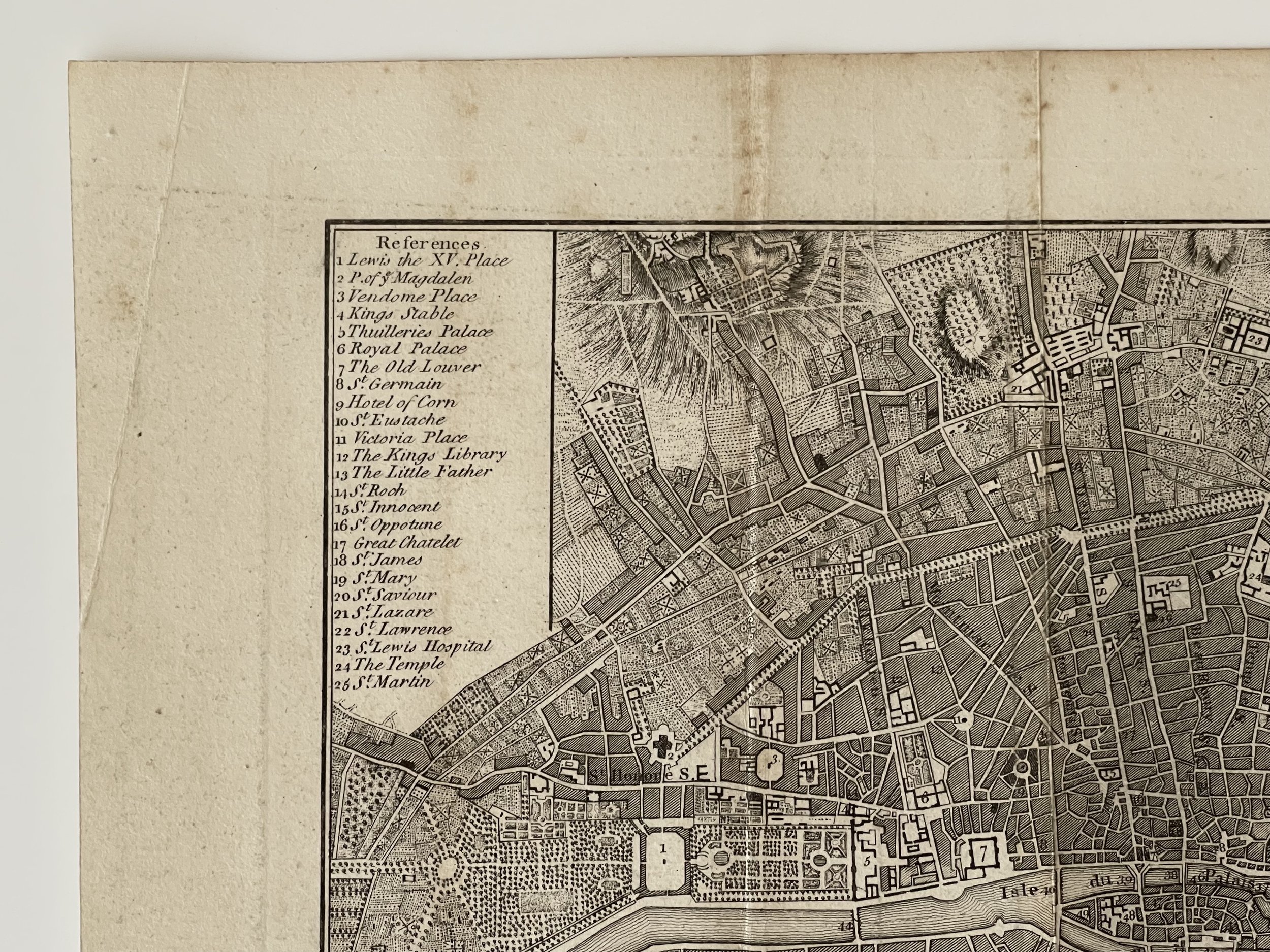
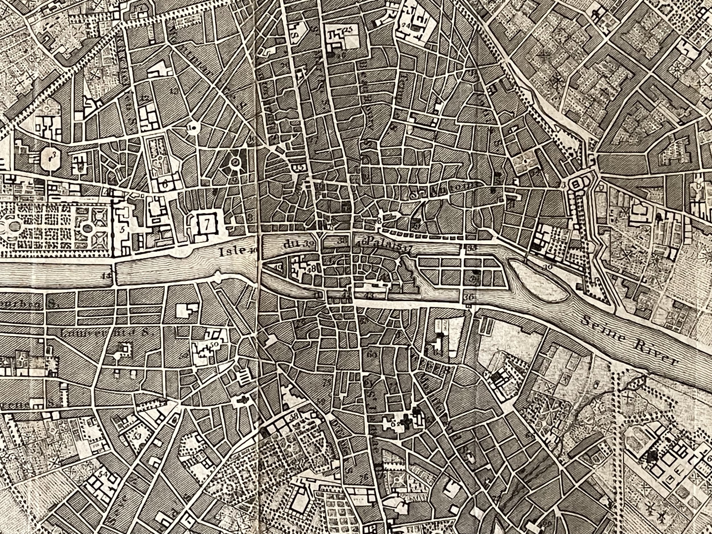
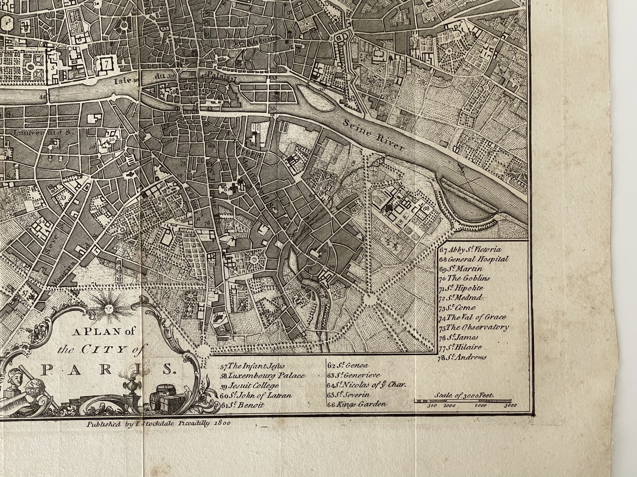
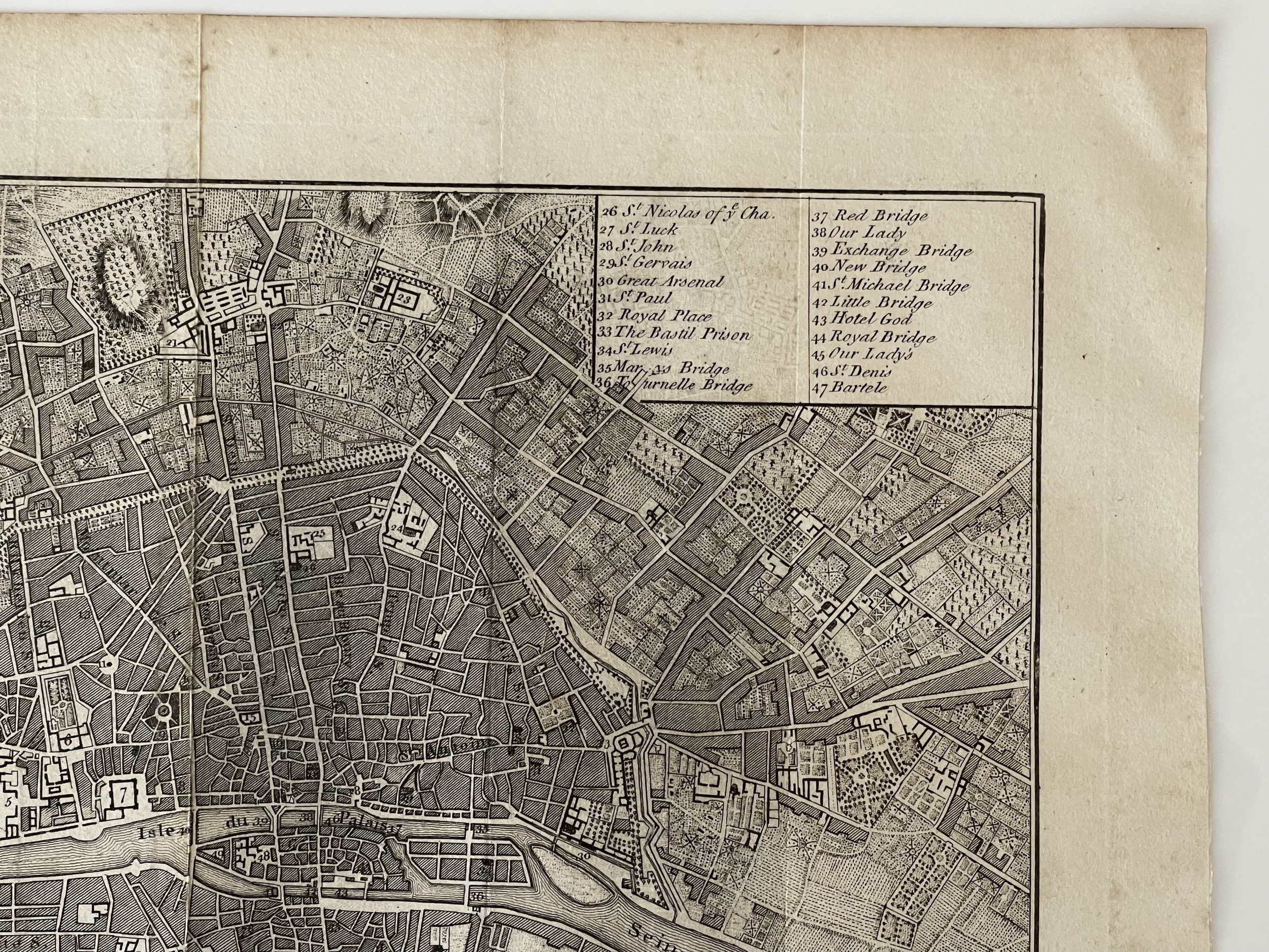
Description: A beautiful engraving copper-engraved detailed plan of the city of Paris which includes 78-point key identifying important buildings and structures. The plan was first published in 'Plans of the Principal Cities in the World' in 1776 with this example being published in 1800.
Cartographer / engraver: Originally drawn by John Andrews, published by John Stockdale.
Provenance: Likely published in 'Plans of the Principal Cities in the World', John Stockdale, 1800
Condition: Very good condition. Light age toning and occasional age spots. Several old vertical folds. Please study all the photographs carefully to fully appreciate the condition.
'A Plan of the City of Paris' - John Andrews / John Stockdale - 1800
Size: The printed area measures approximately 257mm x 235mm with margins beyond, blank verso.
Description: A beautiful engraving copper-engraved detailed plan of the city of Paris which includes 78-point key identifying important buildings and structures. The plan was first published in 'Plans of the Principal Cities in the World' in 1776 with this example being published in 1800.
Cartographer / engraver: Originally drawn by John Andrews, published by John Stockdale.
Provenance: Likely published in 'Plans of the Principal Cities in the World', John Stockdale, 1800
Condition: Very good condition. Light age toning and occasional age spots. Several old vertical folds. Please study all the photographs carefully to fully appreciate the condition.
Code : A344
Cartographer : Cartographer / Engraver / Publisher: John Andrews / John Stockdale
Date : Publication Place / Date - 1800
Size : Sheet size: Image Size: 32 x 29 Inches
Availability : Available
Type - Genuine - Antique
Grading A-
Where Applicable - Folds as issued. Light box photo shows the folio leaf centre margin hinge ‘glue’, this is not visible otherwise.
Tracked postage, in casement. Please contact me for postal quotation outside of the UK.