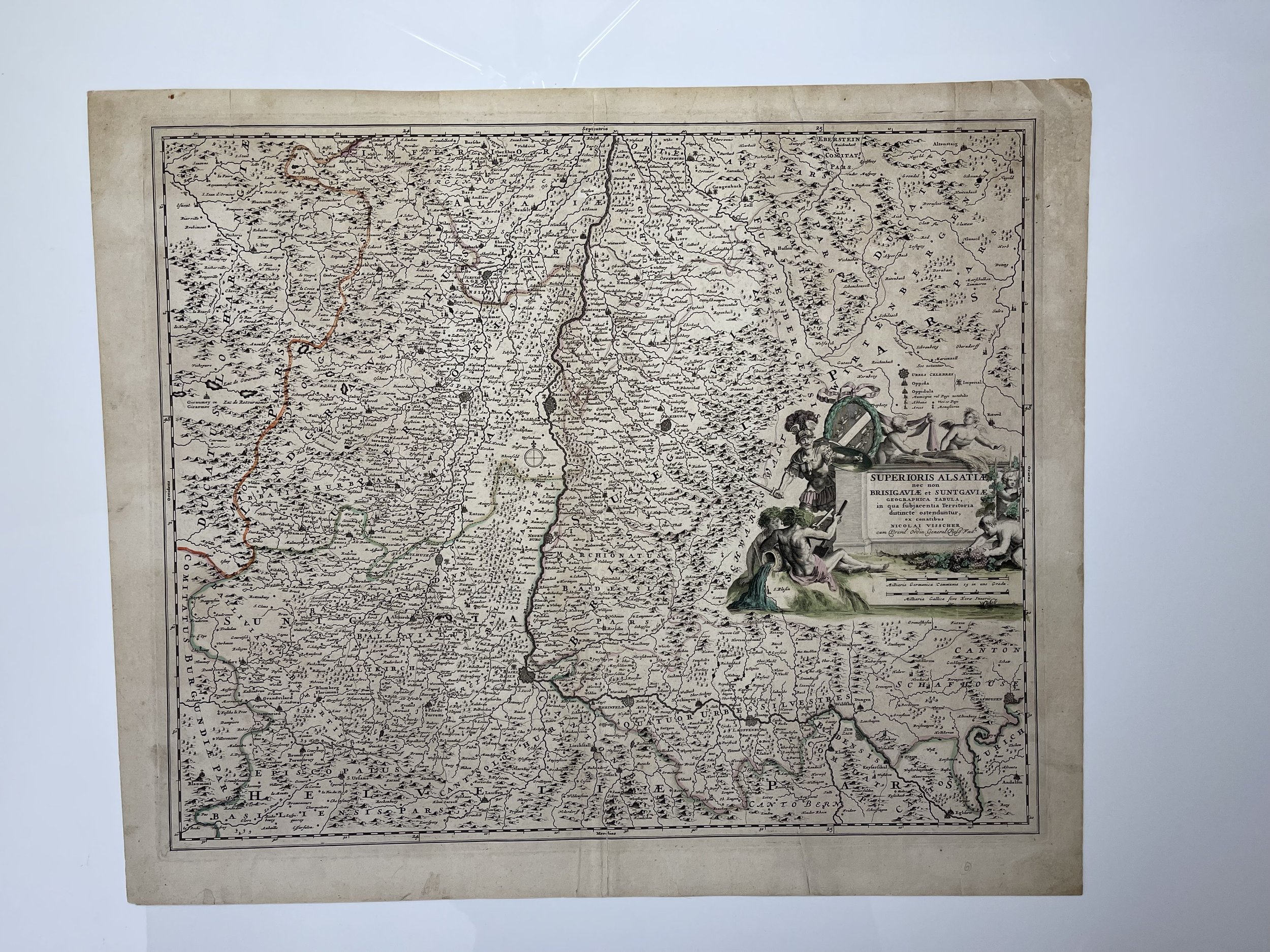
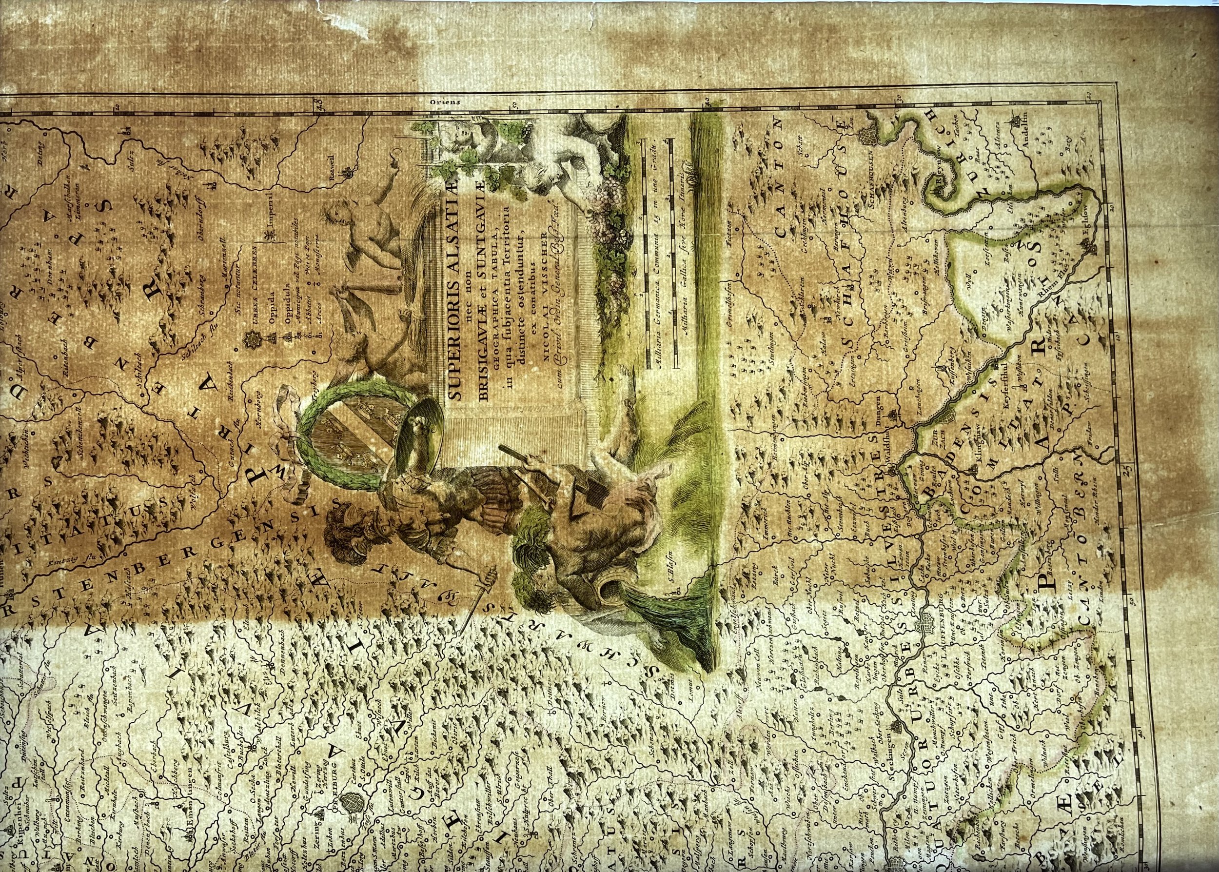
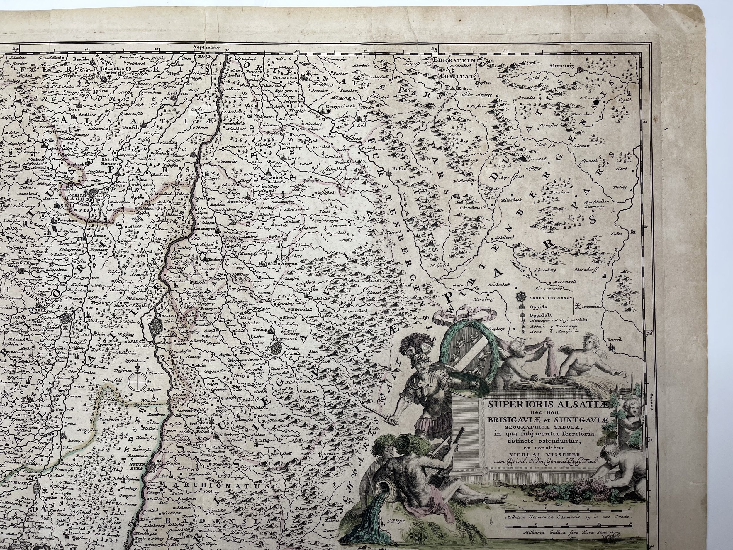
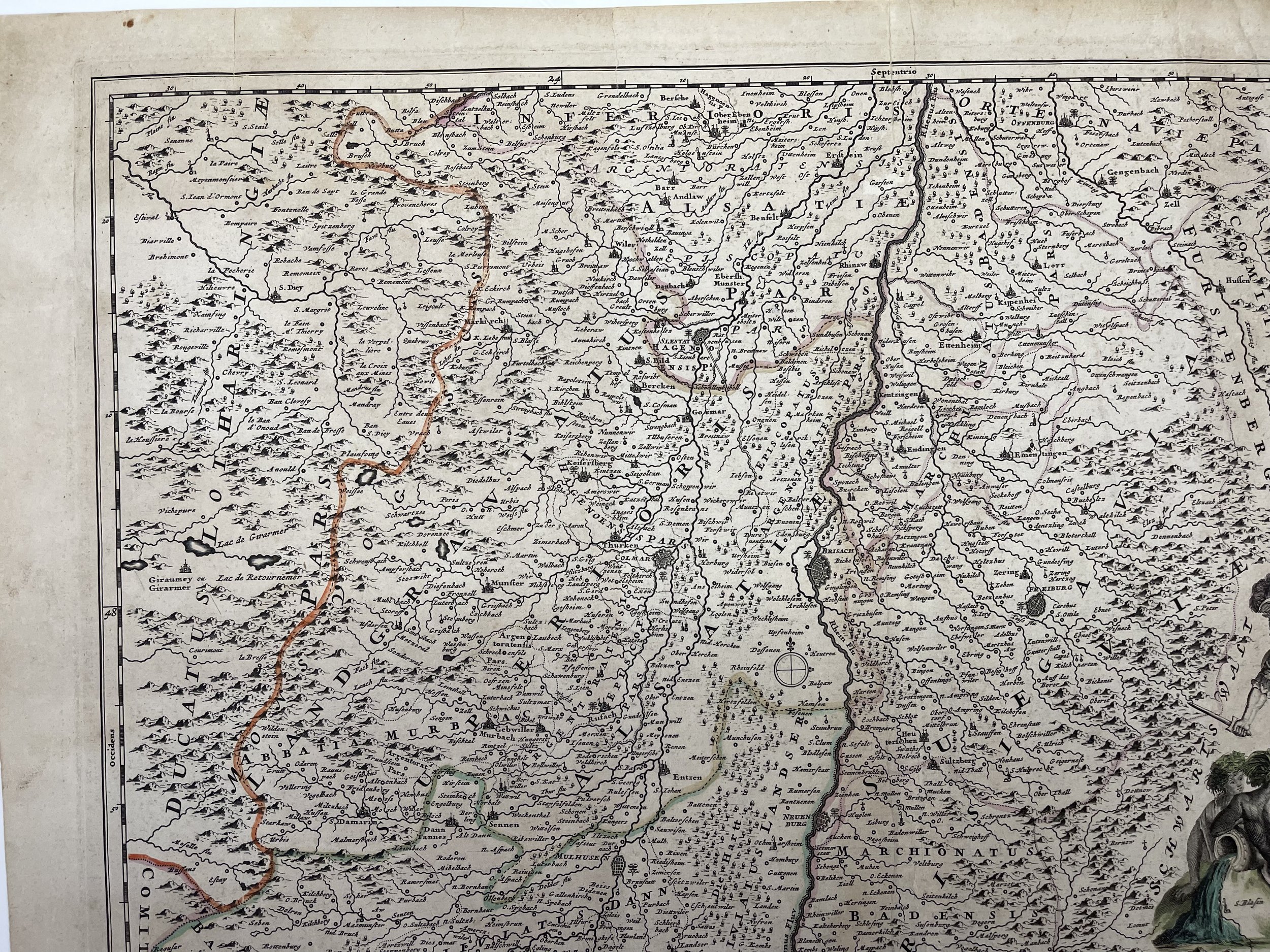
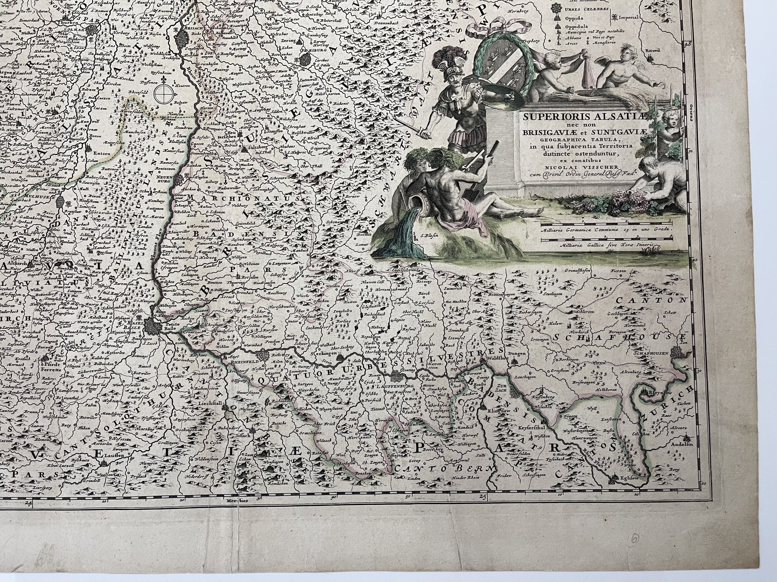
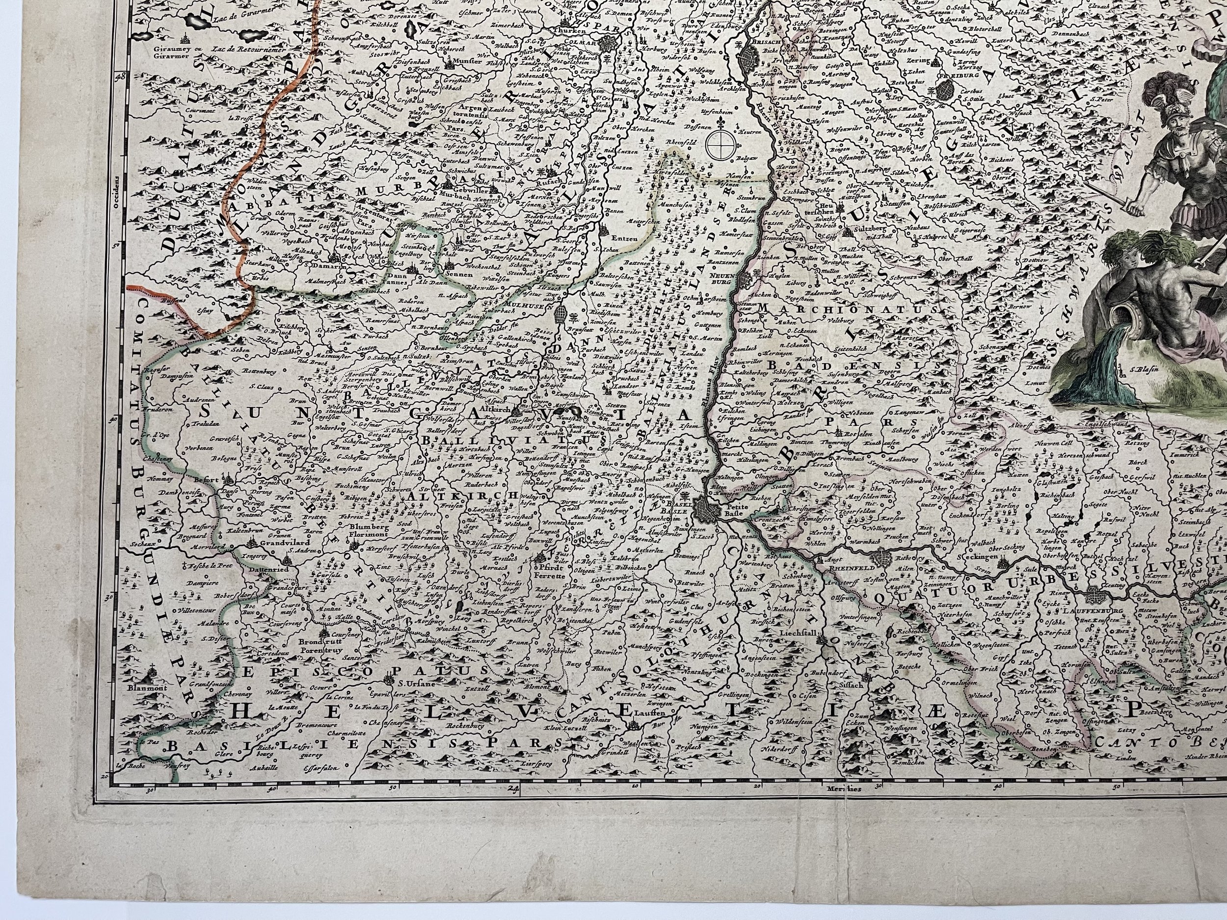
Alsace Germany - Superioris Alsatiae - Nicolaes Visscher - Amsterdam - C 1649
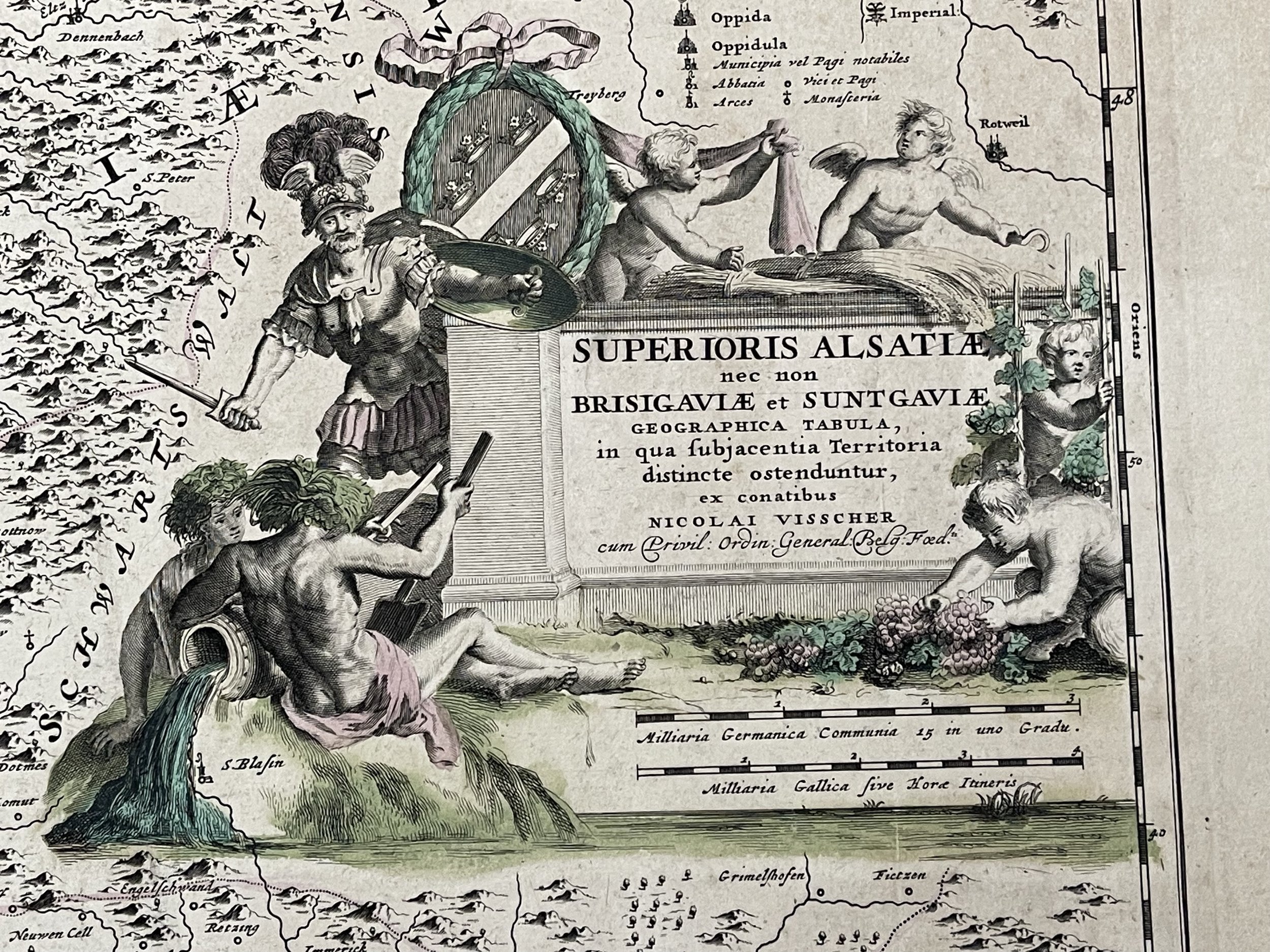
Superioris Alsatiae nec non Brisigaviae et Suntgaviae geographica tabula in qua subjacentia territoria distincte ostenduntur
Alsace Germany - Nicolai Visscher
Beautiful hand coloured in outline engraved map of upper Alsace region. Shows administrative boundaries, towns, fortifications, forests, waterways, canals and landmarks. Includes decorative title cartouche, compass rose and legend. Pictorial relief. C 1652-1702.
Nicolaes Visscher I (25 January 1618, Amsterdam – buried 11 September 1679, Amsterdam) was a Dutch engraver, cartographer and publisher. He was the son of Claes Janszoon Visscher. His son, Nicolaes Visscher II (1649–1702), also worked with him and continued the family tradition of mapmaking after his death. Visscher died in Amsterdam in 1679 and was buried in the Nieuwezijds Kapel on 11 September of that year, though a death year of 1709 is maintained by some sources.
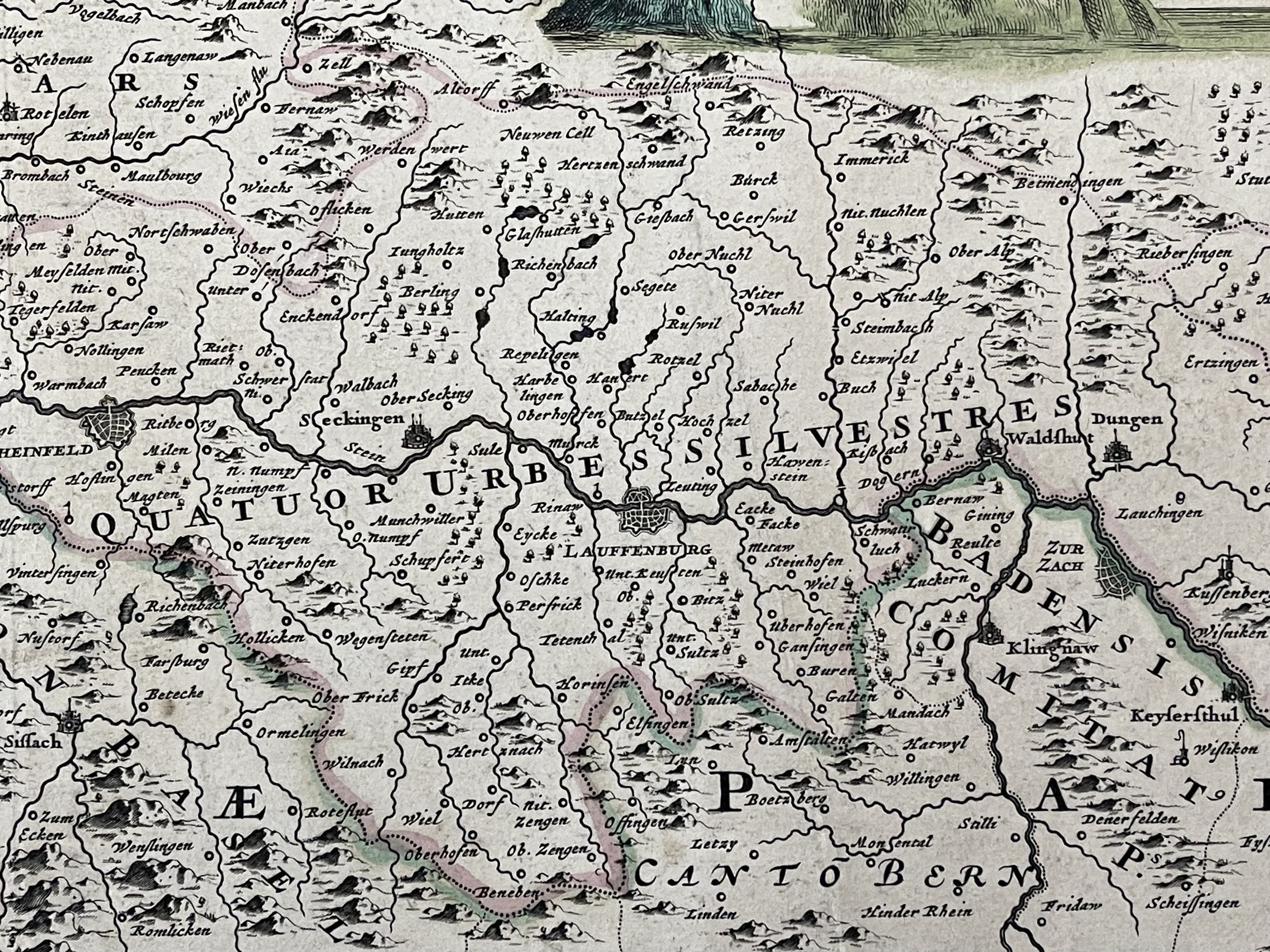
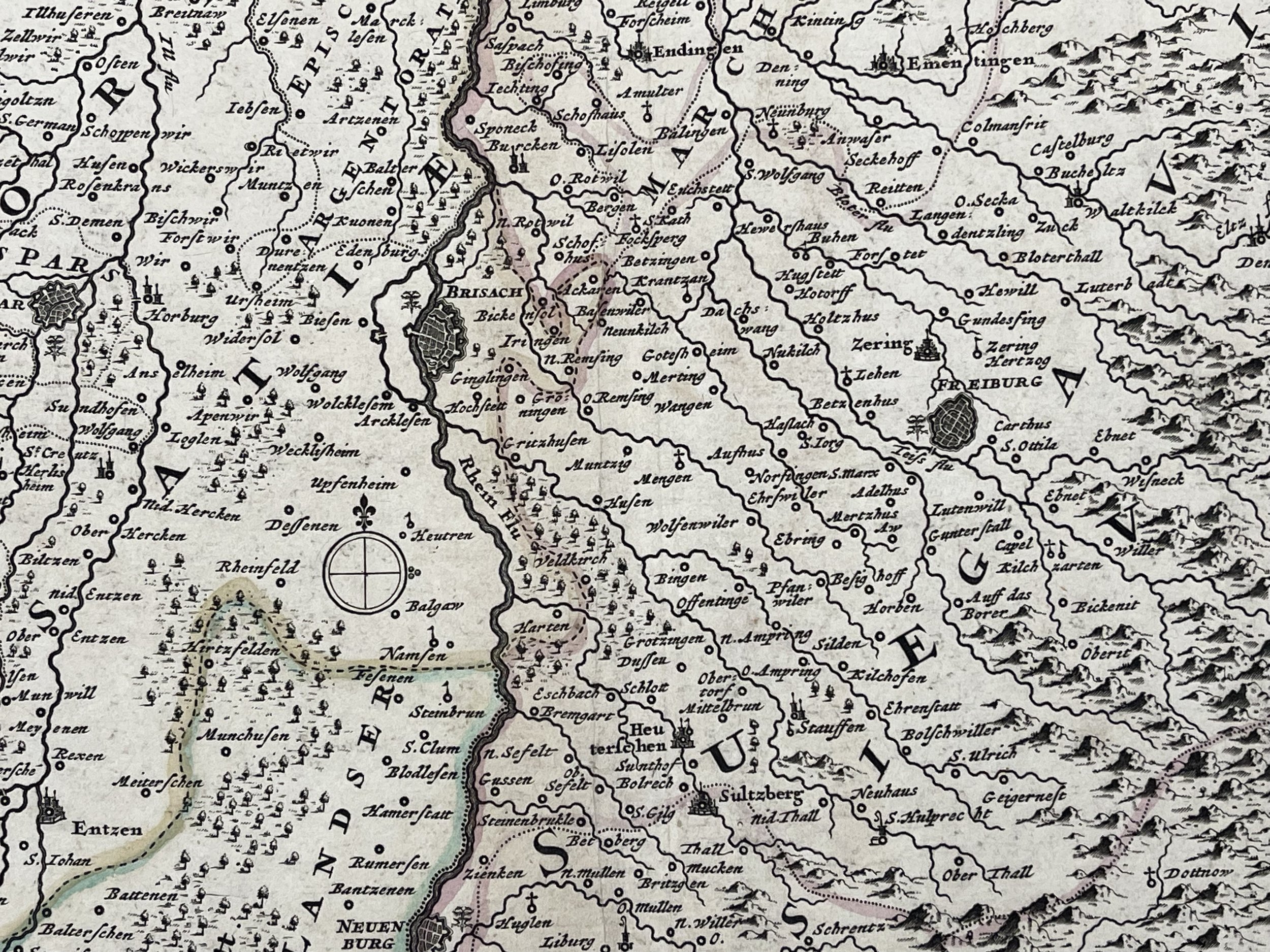
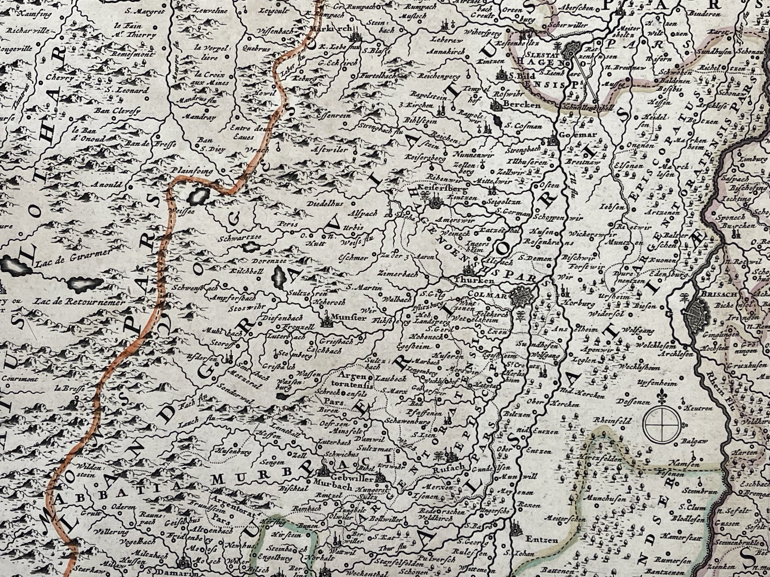
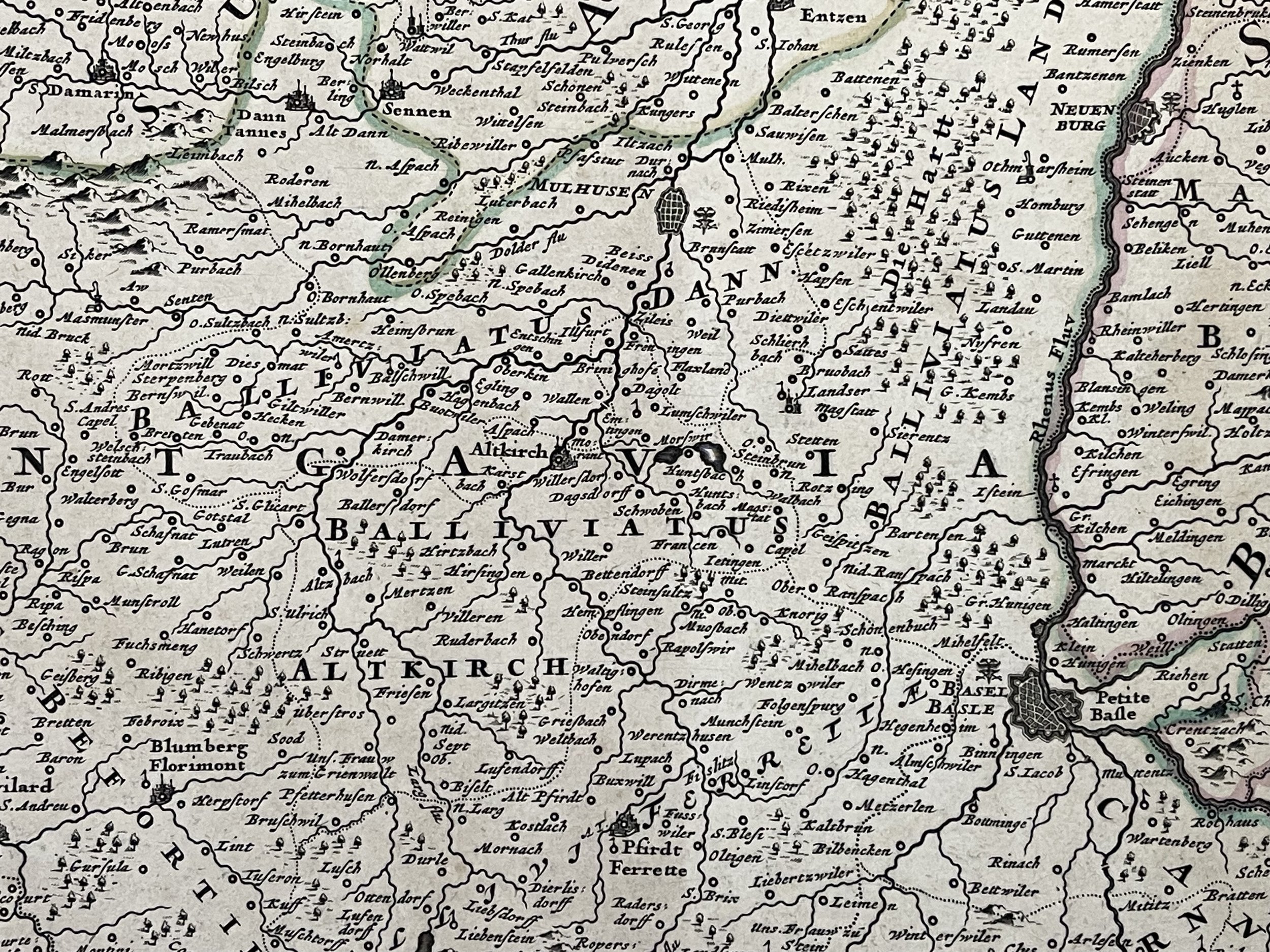
The map includes the fortified cities of Colmar, Freiburg, Breisach, Basle and Schaffhausen. Alsace is an area and a former region in the east of France. The capital is Strasbourg. It is subdivided in the departments Haut-Rhin and Bas-Rhin. The region became part of Alsace-Champagne-Ardenne-Lorraine when the area was re-divided in January 2016. The lefthand side is decorated with a fine (fully coloured) figural cartouche featuring a soldier, river gods, putti and a vineyard. The cartouche clearly pays homage to Roman Alsace (c. 60 BC), when the Romans had invaded and established Alsace as the centre of viticulture. To protect this highly valued industry, the Romans built fortifications and military camps that evolved into various communities which have been inhabited continuously to the present day. While part of the Roman Empire, Alsace was part of Germania Superior. The Atlas Minor is a fine and comprehensive composite atlas, and one of a series of large atlases compiled and sold by the Visscher family of art dealers and cartographers in the 17th century. Founded by Nicholas Visscher, this work is known for the high quality of engraving, exceptionally fine ornament, and accurate geographical information. No two of the Visscher atlases seem to have been identical in content, and most contain, like this one, a selection of maps by the Visschers themselves as well as other cartographers. In this case most of the maps are published by Visscher. In addition to the striking world map by Allard with its black background and numerous projections and found in the "Atlas Major" from about 1705, there are maps of the continents, regional maps of Europe, ten maps of Asia, and seven maps related to America.
Excellent condition. Lightbox reveals some foxing / staining, but this cannot be seen in normal light. Pricing and grading commensurate.
Superioris Alsatiae nec non Brisigaviae et Suntgaviae geographica tabula in qua subjacentia territoria distincte ostenduntur
Alsace Germany - Nicolai Visscher
Beautiful hand coloured in outline engraved map of upper Alsace region. Shows administrative boundaries, towns, fortifications, forests, waterways, canals and landmarks. Includes decorative title cartouche, compass rose and legend. Pictorial relief. C 1652-1702.
Nicolaes Visscher I (25 January 1618, Amsterdam – buried 11 September 1679, Amsterdam) was a Dutch engraver, cartographer and publisher. He was the son of Claes Janszoon Visscher. His son, Nicolaes Visscher II (1649–1702), also worked with him and continued the family tradition of mapmaking after his death. Visscher died in Amsterdam in 1679 and was buried in the Nieuwezijds Kapel on 11 September of that year, though a death year of 1709 is maintained by some sources.
The map includes the fortified cities of Colmar, Freiburg, Breisach, Basle and Schaffhausen. Alsace is an area and a former region in the east of France. The capital is Strasbourg. It is subdivided in the departments Haut-Rhin and Bas-Rhin. The region became part of Alsace-Champagne-Ardenne-Lorraine when the area was re-divided in January 2016. The lefthand side is decorated with a fine (fully coloured) figural cartouche featuring a soldier, river gods, putti and a vineyard. The cartouche clearly pays homage to Roman Alsace (c. 60 BC), when the Romans had invaded and established Alsace as the centre of viticulture. To protect this highly valued industry, the Romans built fortifications and military camps that evolved into various communities which have been inhabited continuously to the present day. While part of the Roman Empire, Alsace was part of Germania Superior. The Atlas Minor is a fine and comprehensive composite atlas, and one of a series of large atlases compiled and sold by the Visscher family of art dealers and cartographers in the 17th century. Founded by Nicholas Visscher, this work is known for the high quality of engraving, exceptionally fine ornament, and accurate geographical information. No two of the Visscher atlases seem to have been identical in content, and most contain, like this one, a selection of maps by the Visschers themselves as well as other cartographers. In this case most of the maps are published by Visscher. In addition to the striking world map by Allard with its black background and numerous projections and found in the "Atlas Major" from about 1705, there are maps of the continents, regional maps of Europe, ten maps of Asia, and seven maps related to America.
Excellent condition. Lightbox reveals some foxing / staining, but this cannot be seen in normal light. Pricing and grading commensurate.
Code : A61
Cartographer : Cartographer / Engraver / Publisher: Nicolaes Visscher
Date : Publication Place / Date - Circa 1649
Size : Sheet size: Image Size: 62 x 53 cm
Availability : Available
Type - Genuine - Antique
Grading A-
Where Applicable - Folds as issued. Light box photo shows the folio leaf centre margin hinge ‘glue’, this is not visible otherwise.
Tracked postage, in casement. Please contact me for postal quotation outside of the UK.