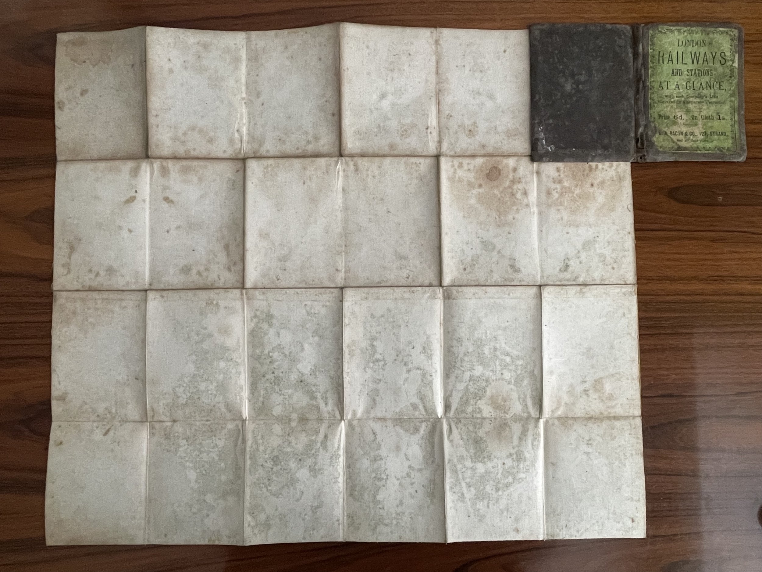
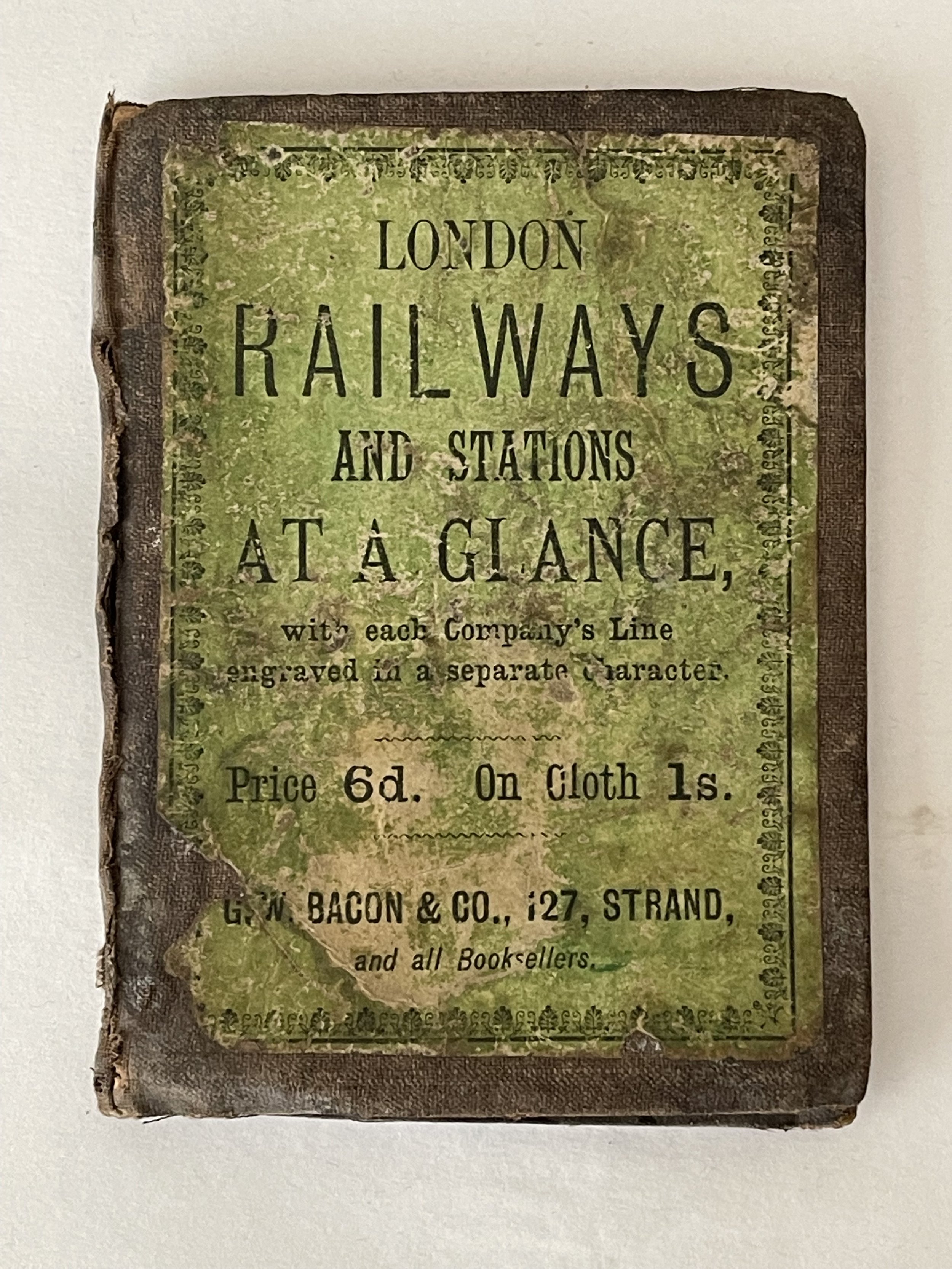
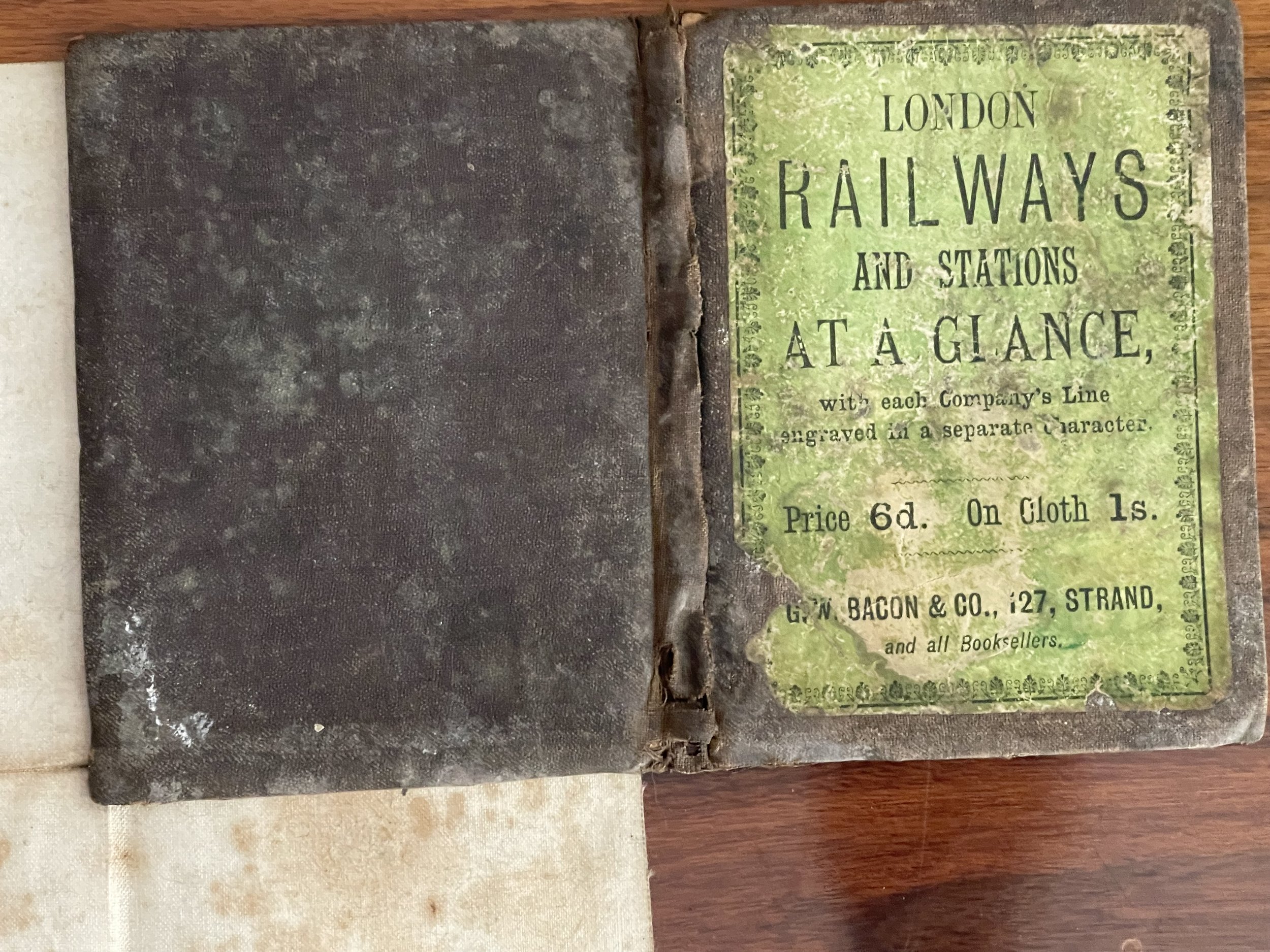
Bacon's London Railways & Stations at a Glance - George Washington Bacon - 1876
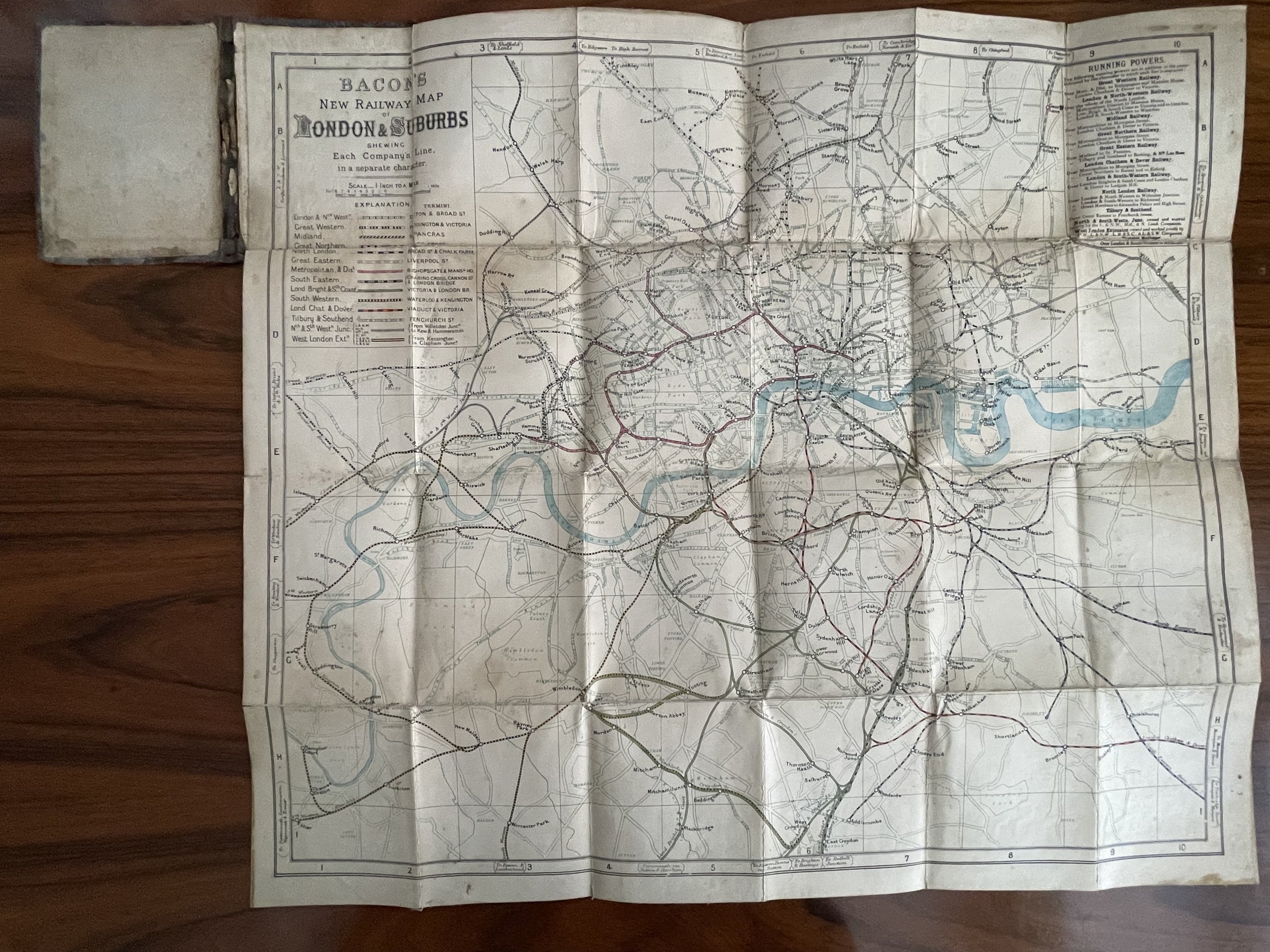
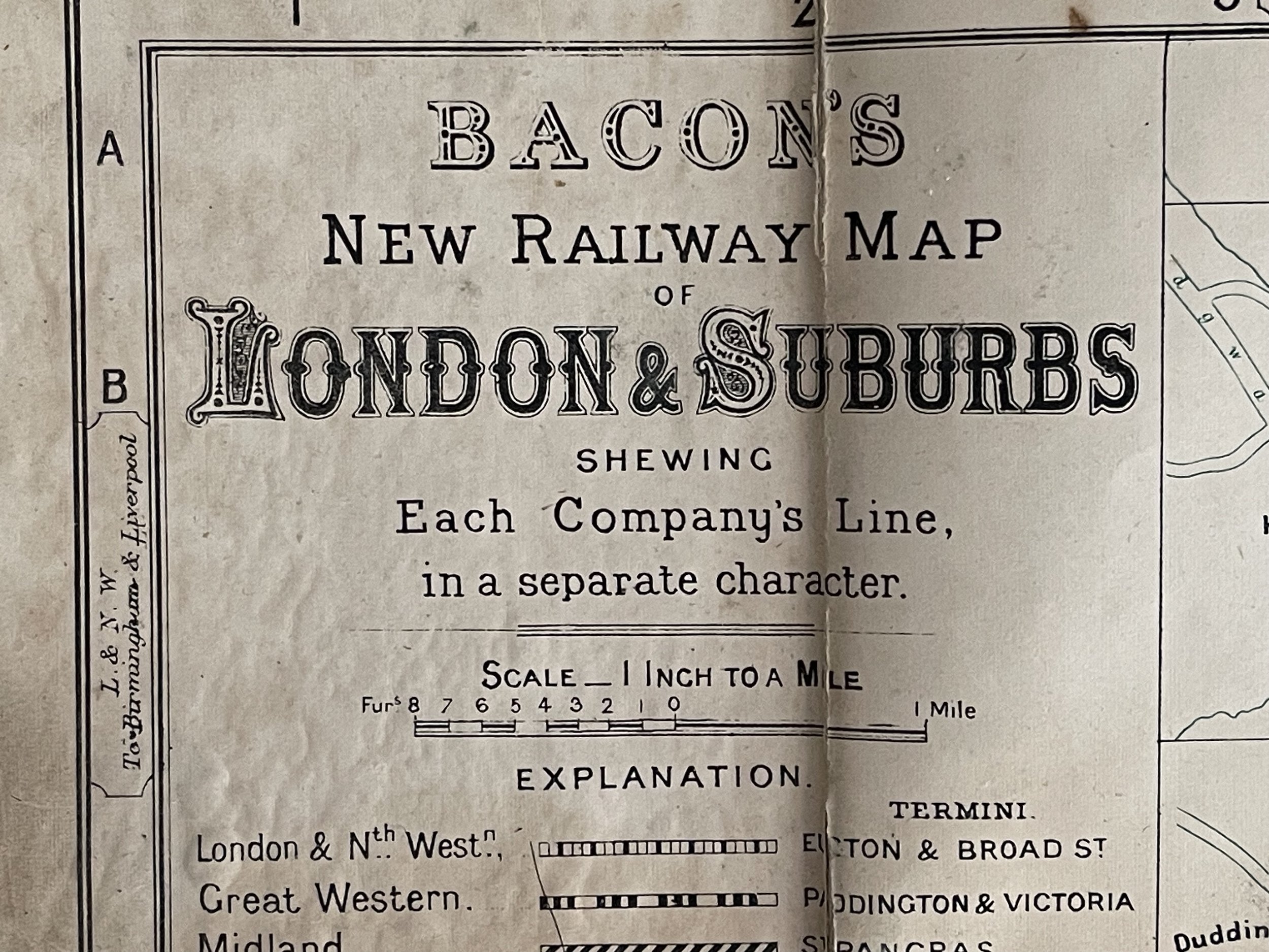
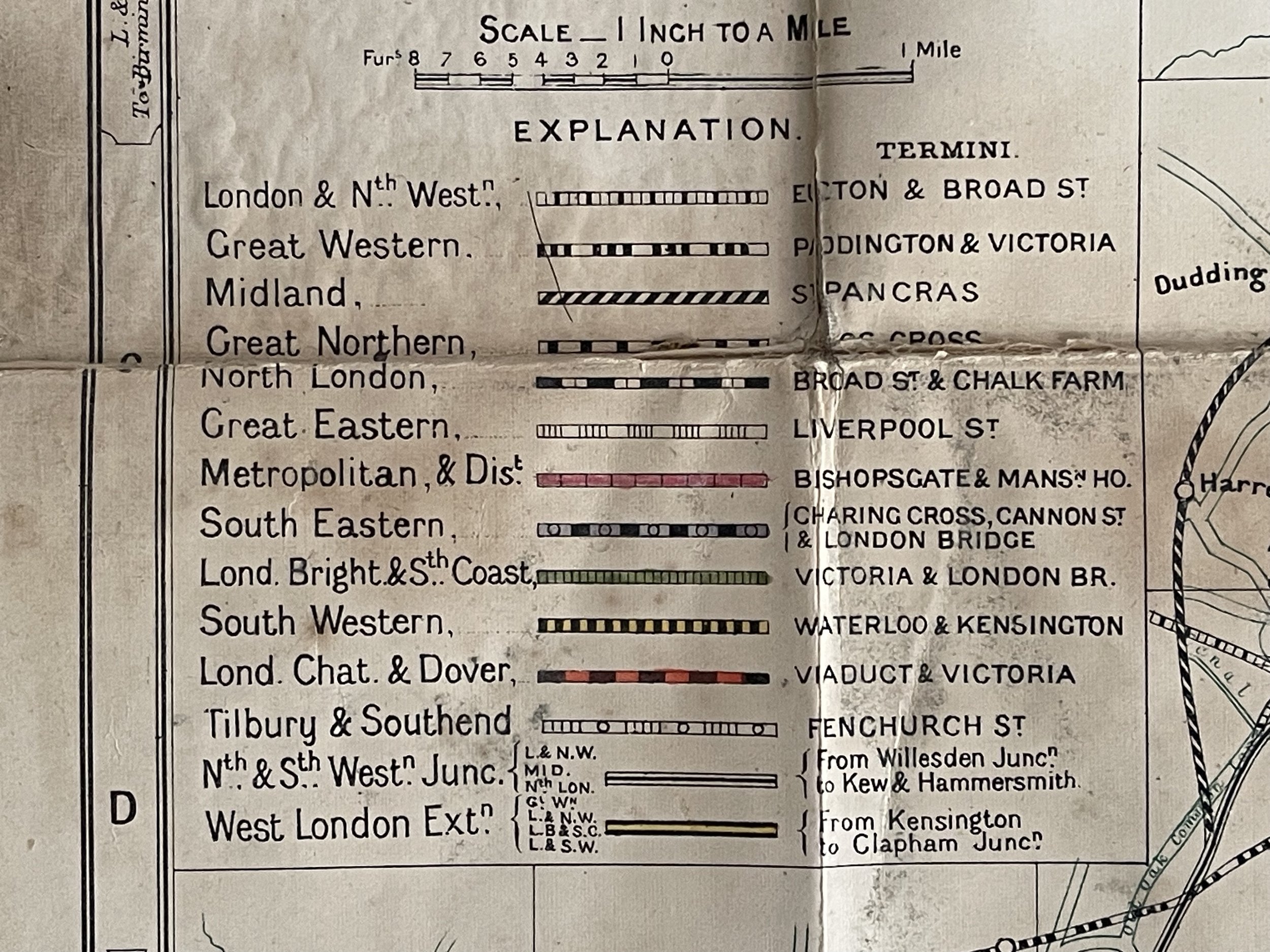
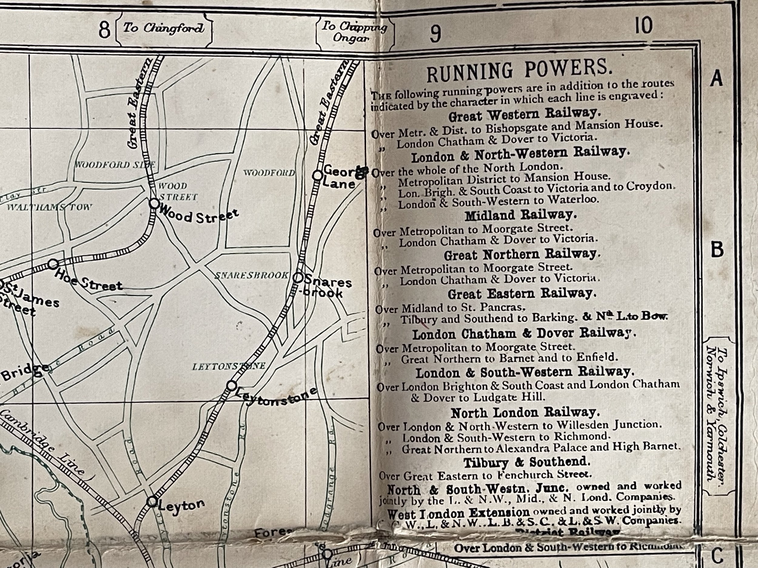
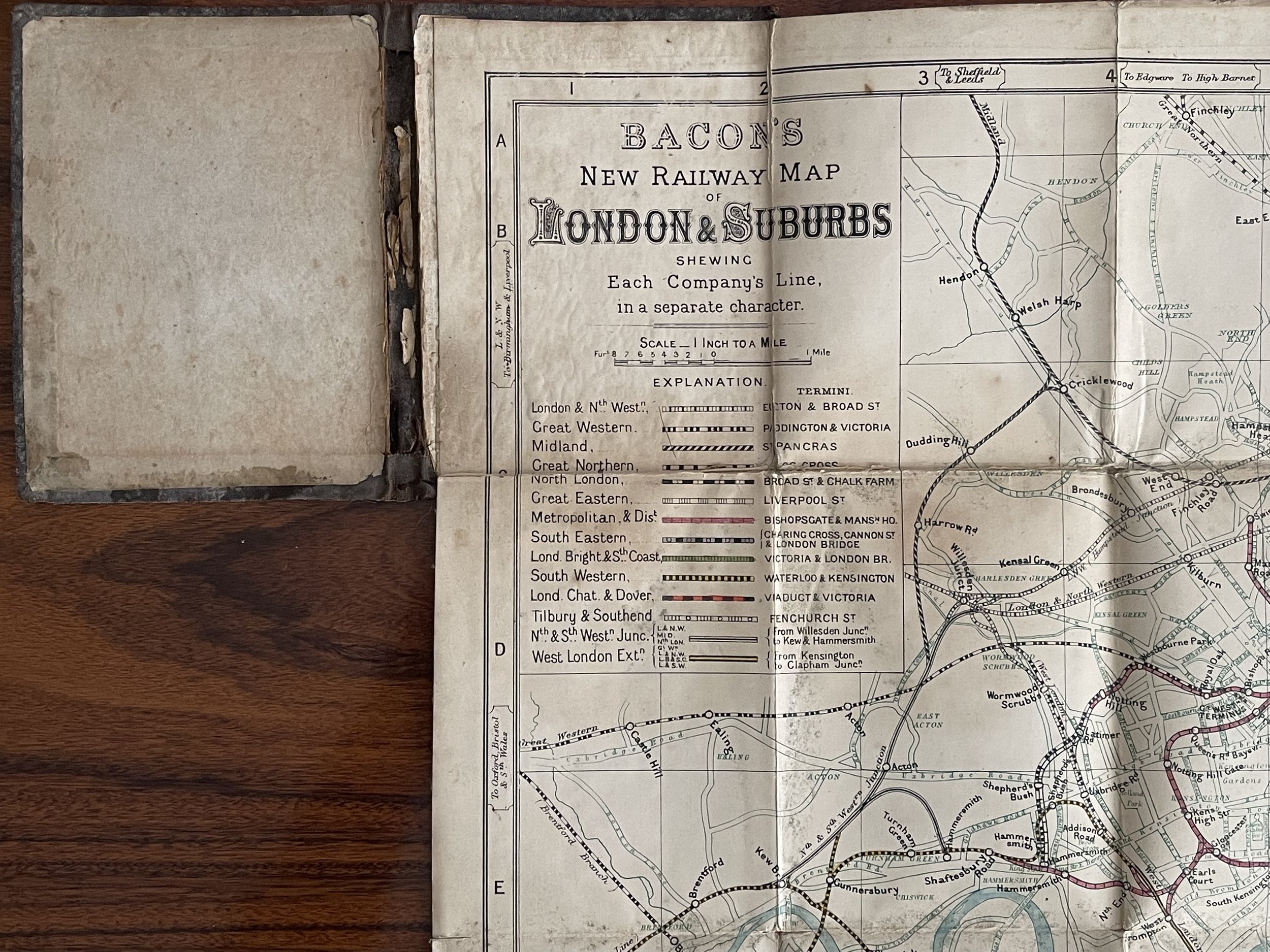
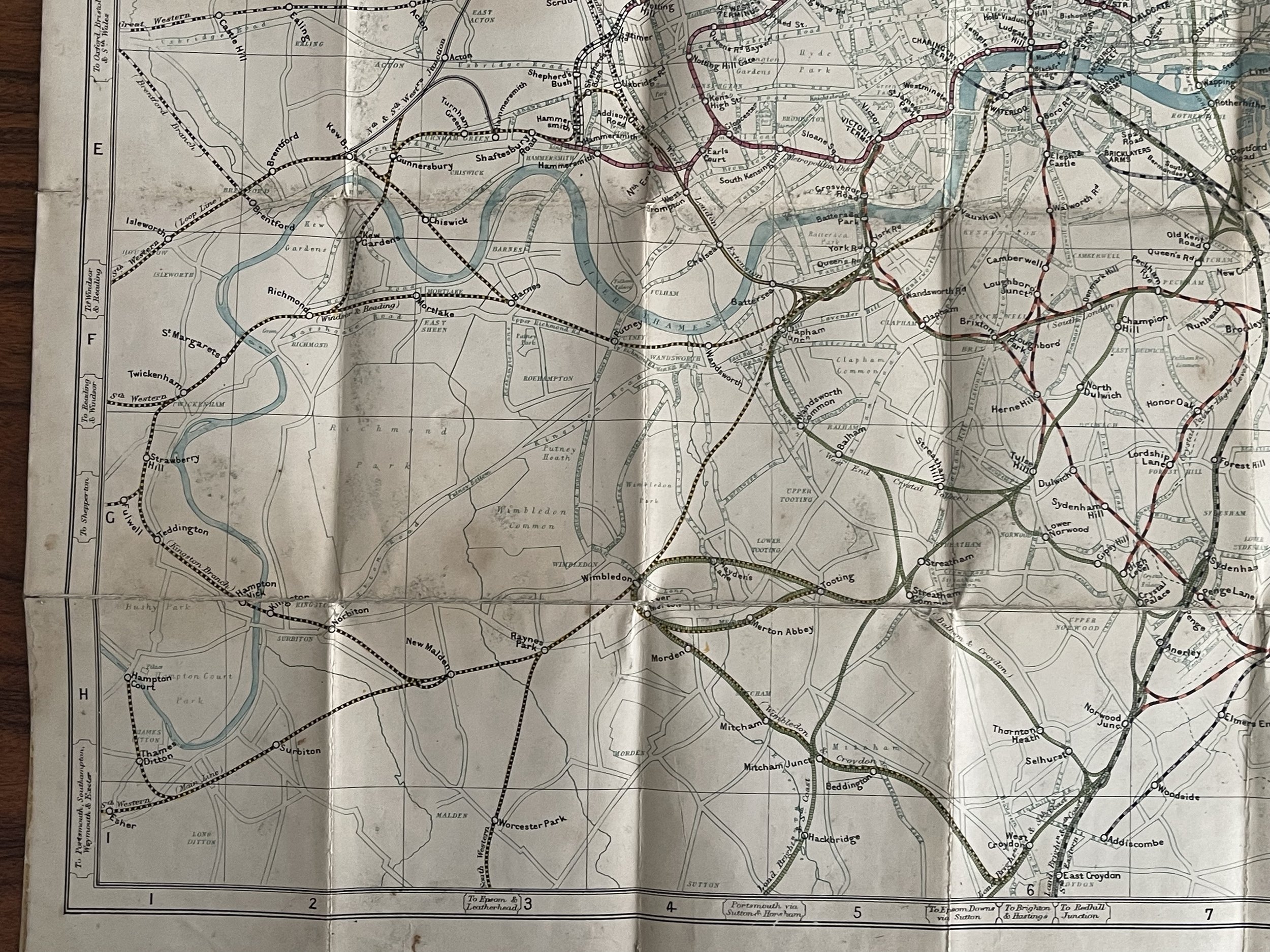
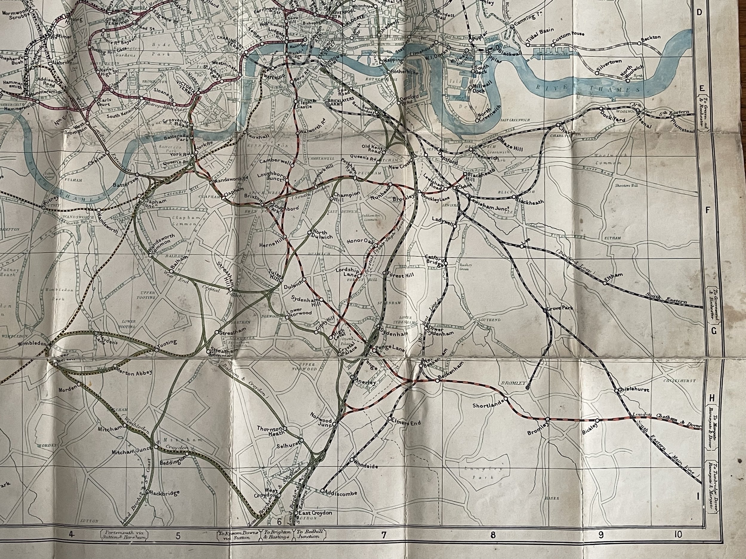
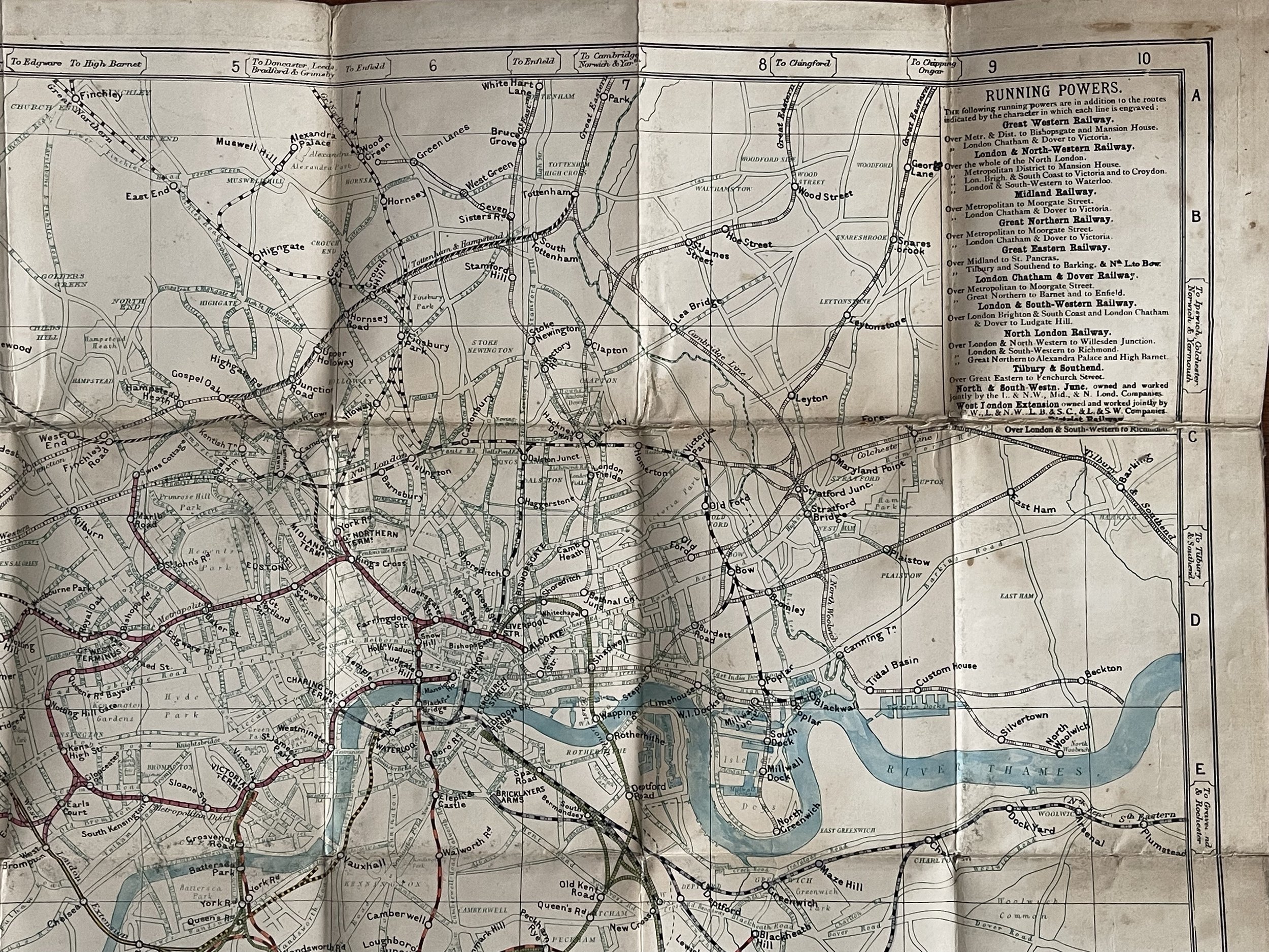
New Railway Map of London and Suburbs map G W Bacon - 1876 approx
George Washington Bacon (1830–1922) was an American mapmaker and publisher who developed a successful business producing maps of London. In 1861, Bacon founded a series of businesses. He became bankrupt in 1867, after failing to keep on top of managing these businesses. In 1870, Bacon started his business, G.W. Bacon & Co., on 127 Strand, London. He based his atlases on the plates used by Edward Weller for his Weekly Dispatch Atlas. In 1893, he bought the map business of James Wyld. During this time period, G.W Bacon created illustrations of British colonial wars, with their most famous publication being Bacon's South Africa War Prints in 1901, covering the Second Boer War.
Around 1900, G.W. Bacon was purchased by the Scottish publishing house of W.& A.K. Johnston and incorporated into their own. Maps using the Bacon brand were being produced as late as 1956. About 1967 their name was changed to Johnston & Bacon.
The significance of this map shouldn’t be underestimated. It shows an early construction of the (London Underground) Metropolitan and District Railway and other lines in the mid 1800s. The map can be dated by researching how far the Underground network has been constructed. Ive dated the map to before 1882 as the Metropolitan & District line hadnt been extended to the Tower of London as of yet. It had also not been extended to Willesden Green so the map had to have been made before 1879. Algate extension was in place so after 1876. Hammersmith to Ravenscourt Park not yet constructed so the map is before 1877.
Considering it was a pocket map of the period, its amazing it still survives. Ive not seen another of this era on the open market.
Pricing and grading commensurate.
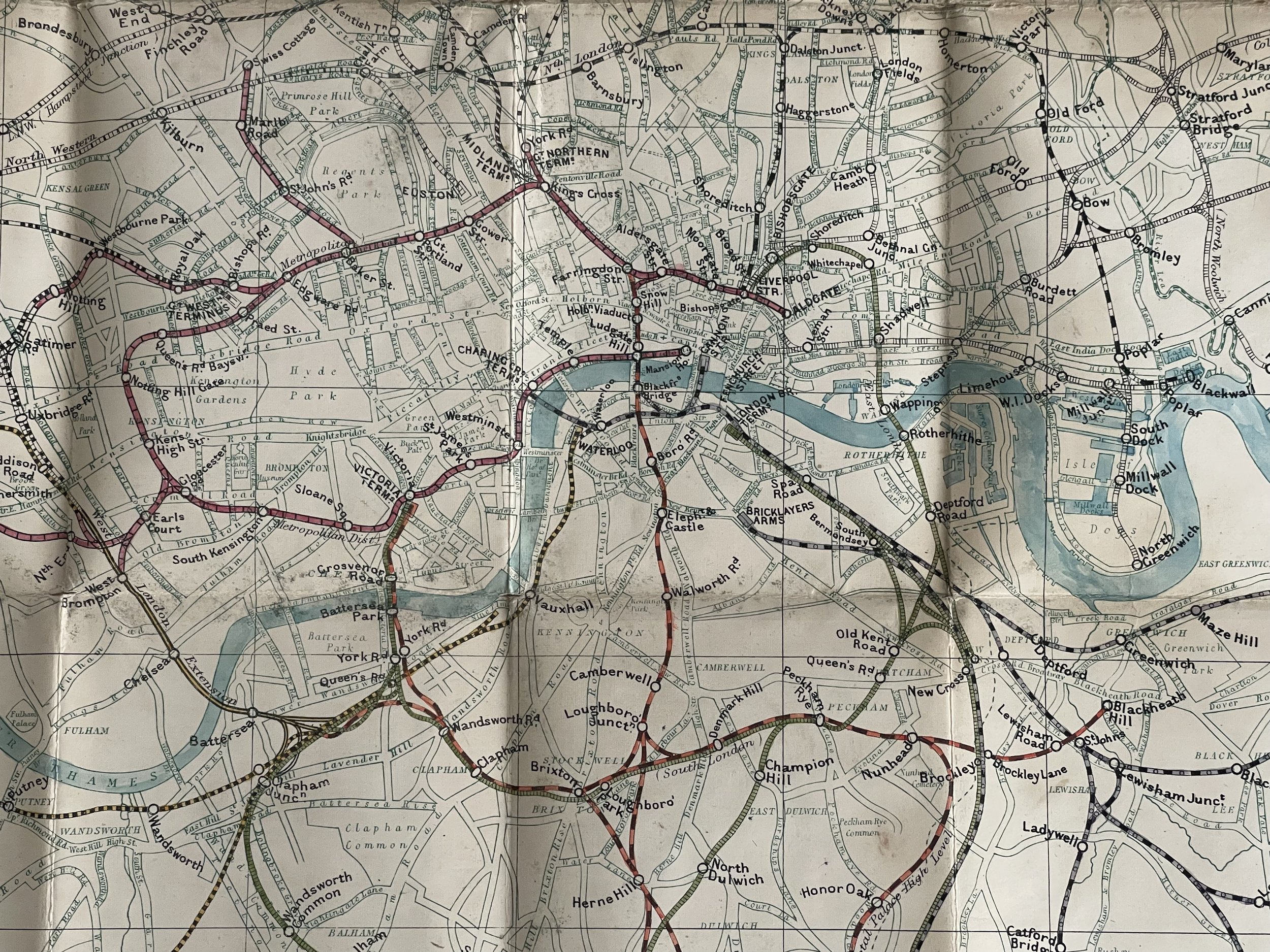
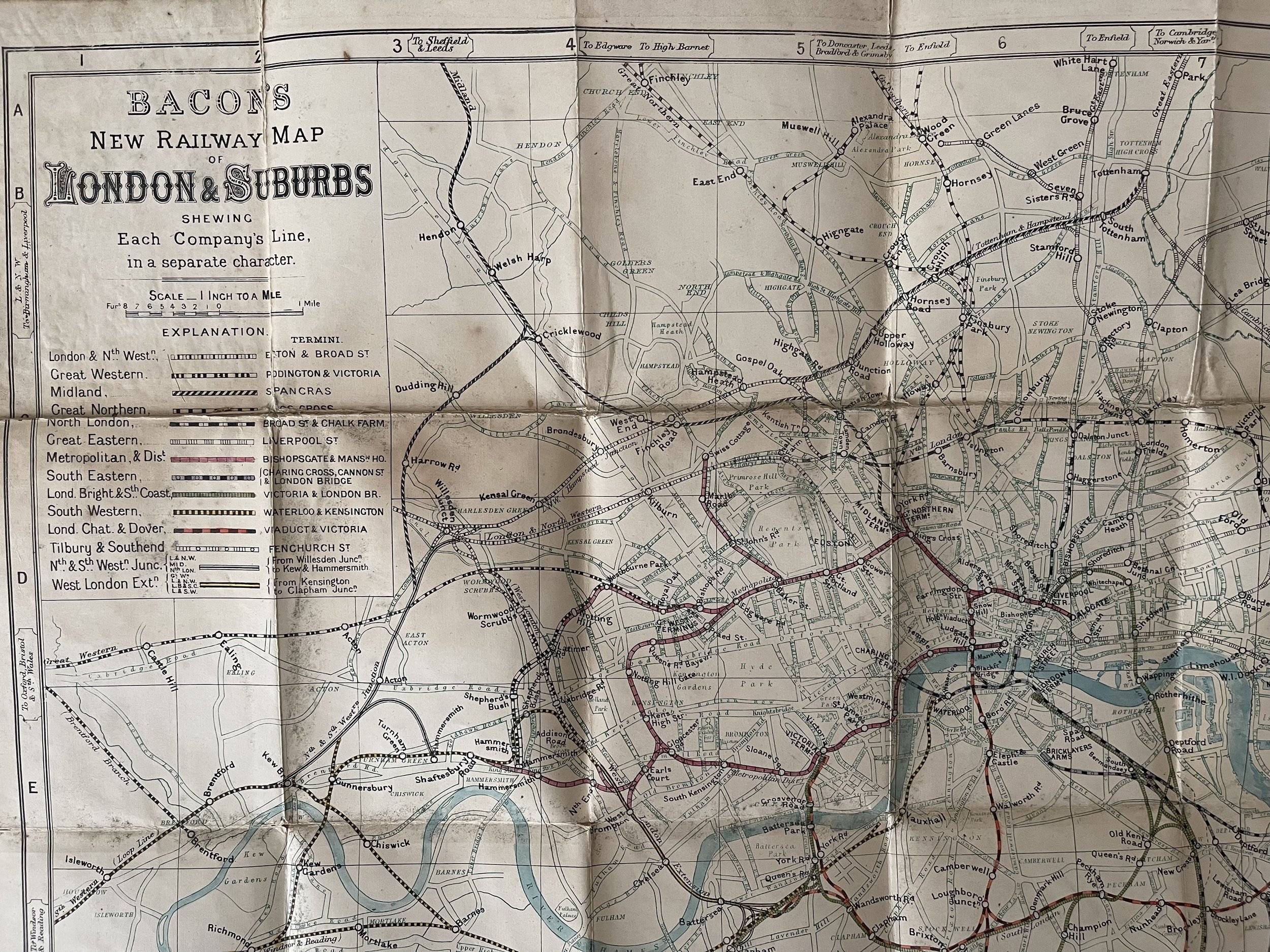
Code : A969
Cartographer : Cartographer / Engraver / Publisher: G W Bacon
Date : Publication Place / Date - 1876
Size : Sheet size: Image Size: 46 X 52 cm
Availability : Available
Type - Genuine - Antique
Grading A-
Where Applicable - Folds as issued. Light box photo shows the folio leaf centre margin hinge ‘glue’, this is not visible otherwise.
Tracked postage, in casement. Please contact me for postal quotation outside of the UK.