
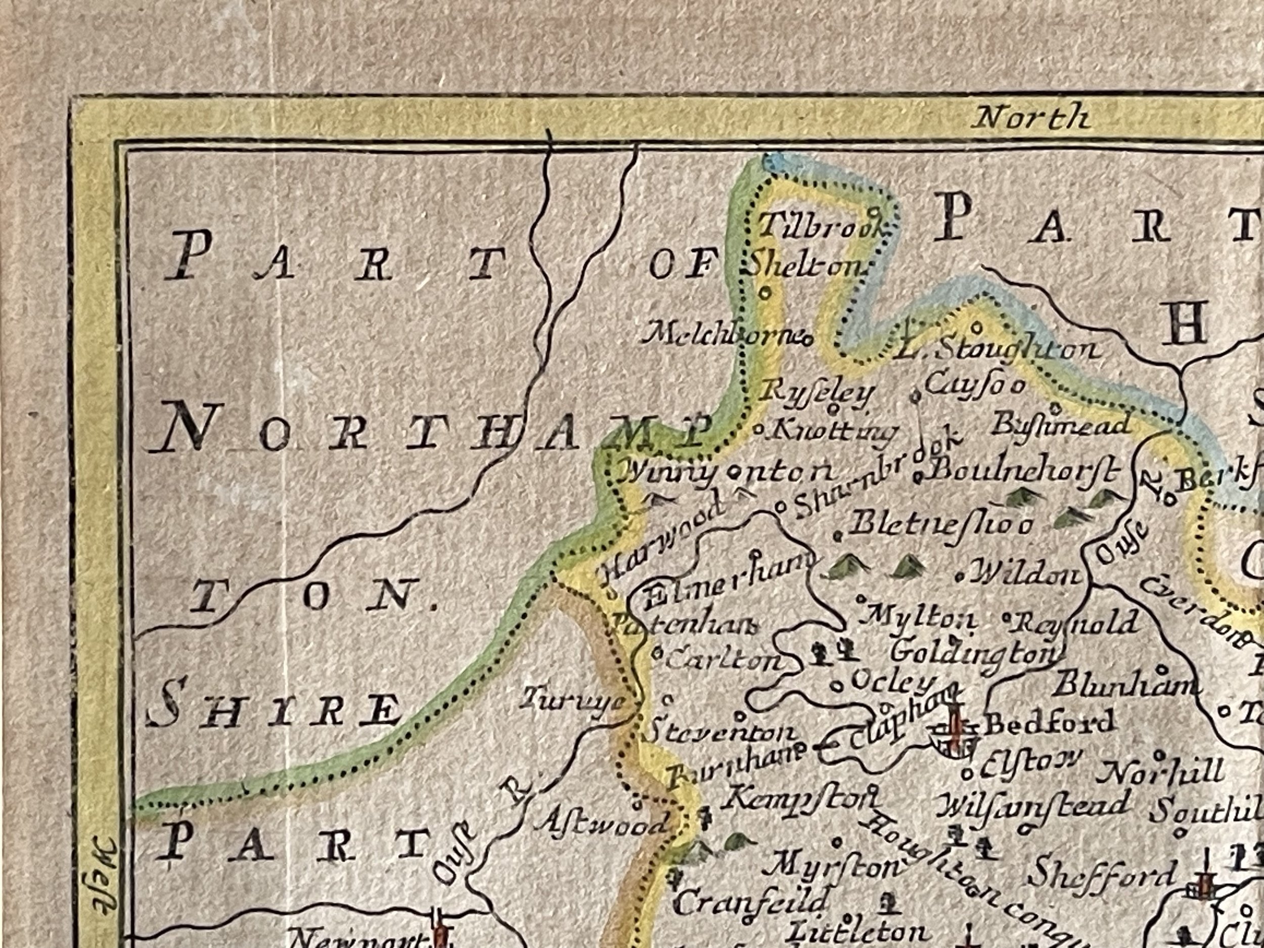
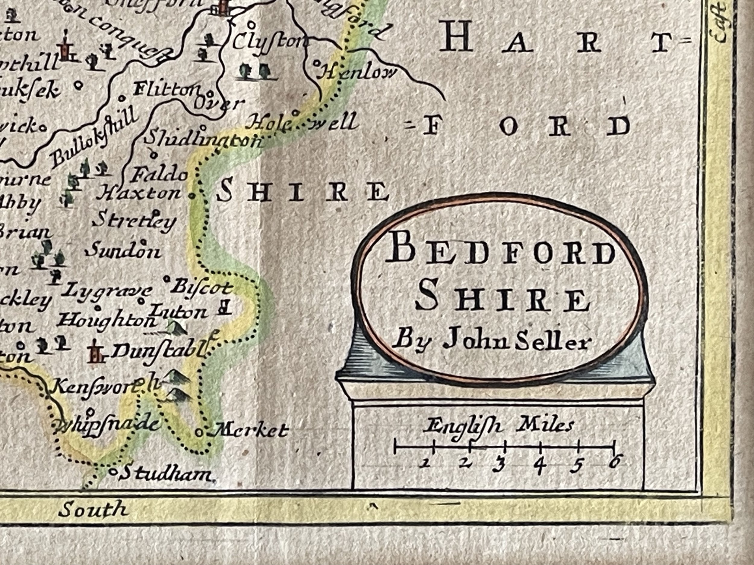
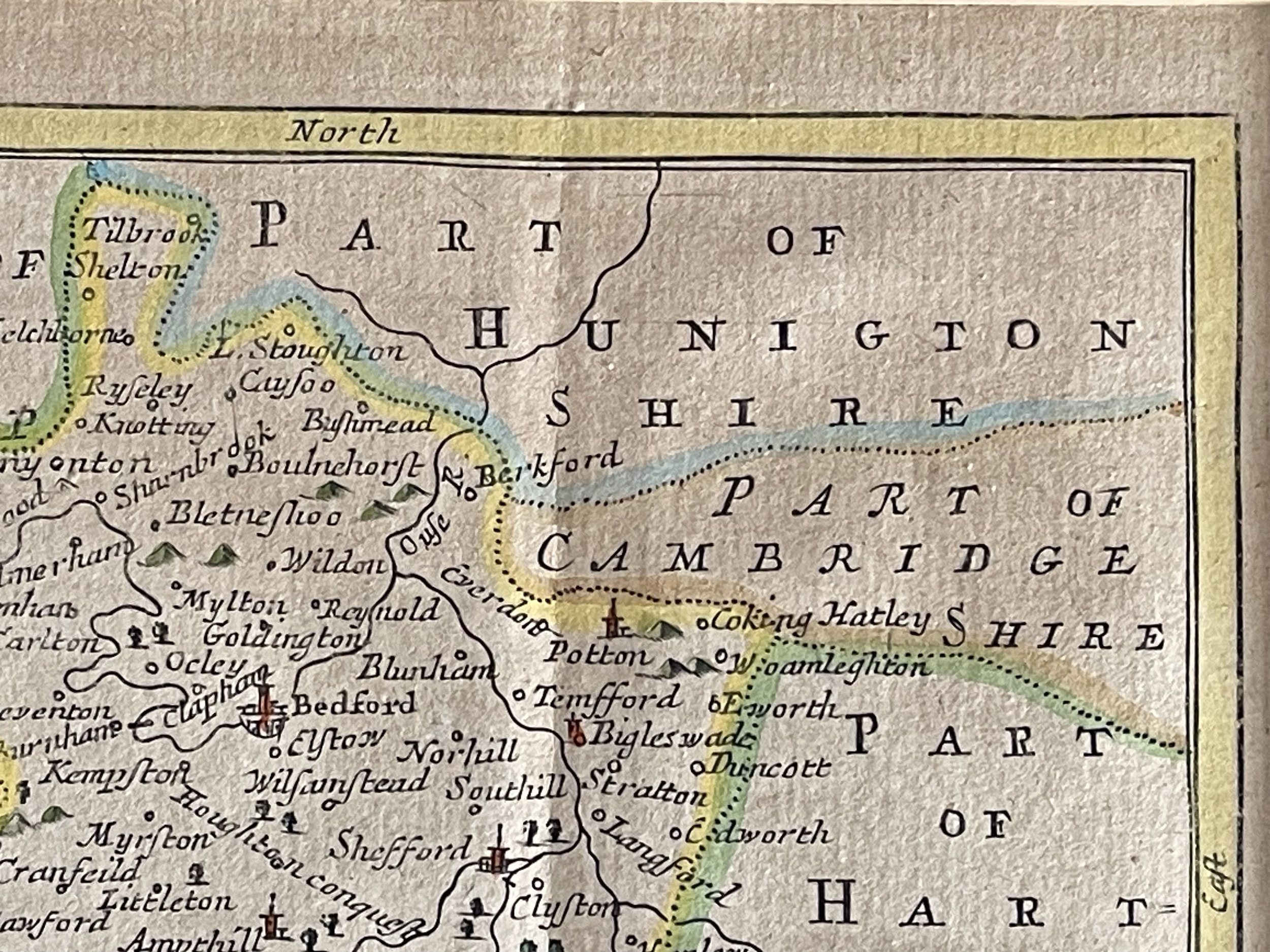
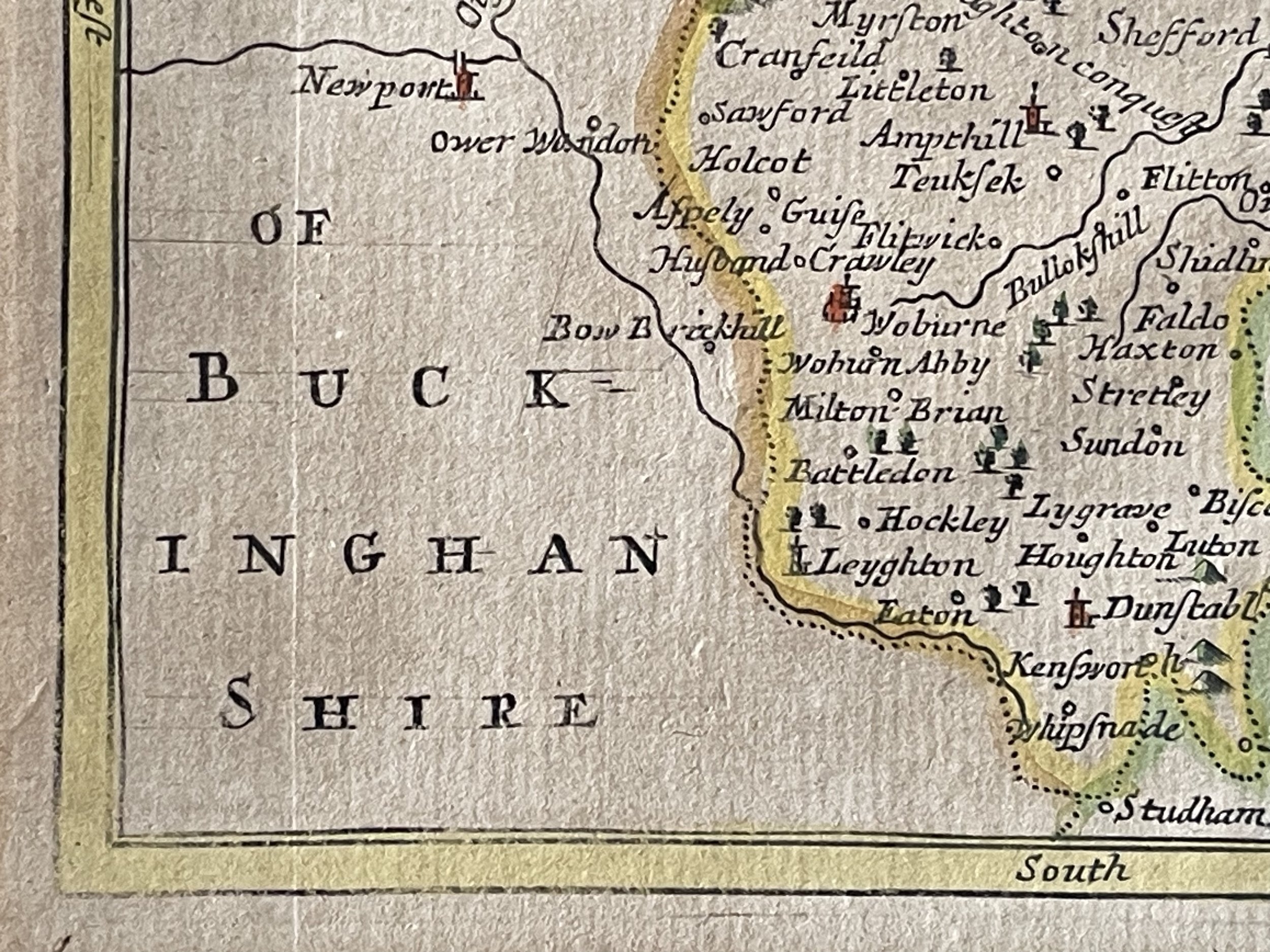
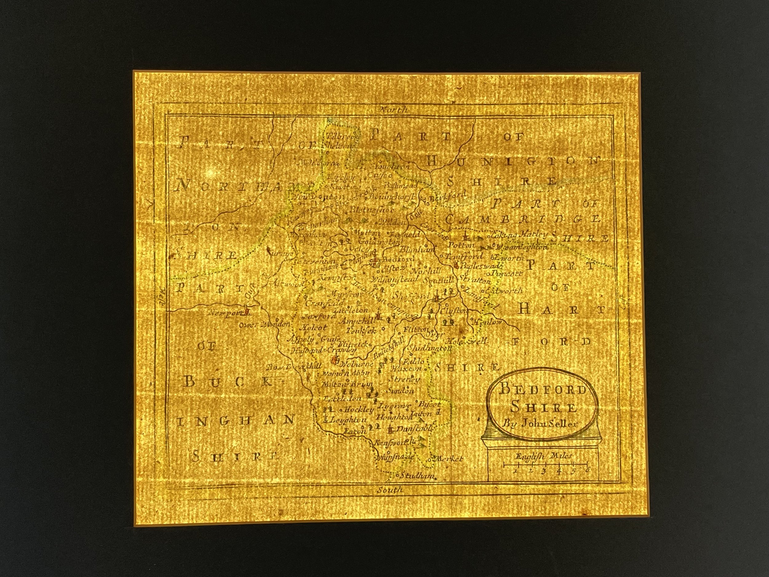
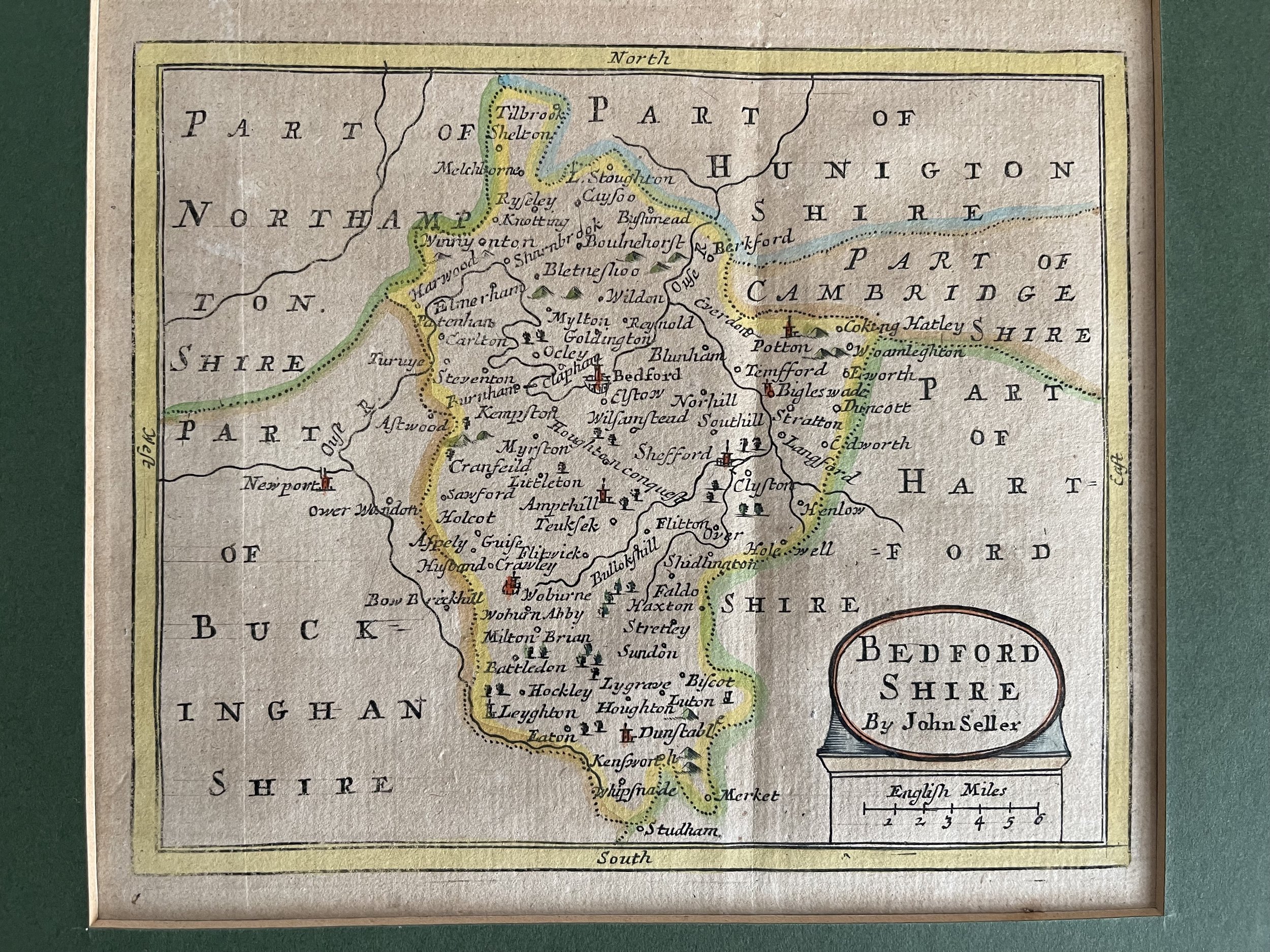
Bedfordshire, England - John Seller - 1695
An attractive and rare late 17th century map of Bedfordshire which appeared in John Seller's Anglia Contracta (London: J. Seller, 1694/1695).
John Seller 1639-1701 - (fl. 1660-1697) was a noted English map maker and publisher of the time, particularly for his sea charts; interestingly, financial difficulties had seen him produce the Anglia Contracta to help revive his fortunes. The maps themselves were reworked and reissued nearly a century later for Francis Grose's Antiquities of England & Wales. John Seller (London, 1639 - 1701) had an active life. He was the Royal Hydrographer and mathematical instrument maker to King Charles II and James II. John Seller was also a major British publisher of maps, charts and geographical and nautical publications. Such fine series of maps as, "Atlas Minimus" (1679), "New System of Geography" (1685), "Atlas Terrestris" (1680-1685), and "The English Pilot" were developed by his hand.
The Map is accompanied with a Green Mount for framing.
Code : A434
Cartographer : Cartographer / Engraver / Publisher: John Seller
Date : Publication Place / Date - 1695
Size : Sheet size: Image Size: 19 X 18 cm
Availability : Available
Type - Genuine - Antique
Grading A
Where Applicable - Folds as issued. Light box photo shows the folio leaf centre margin hinge ‘glue’, this is not visible otherwise.
Tracked postage, in casement. Please contact me for postal quotation outside of the UK.