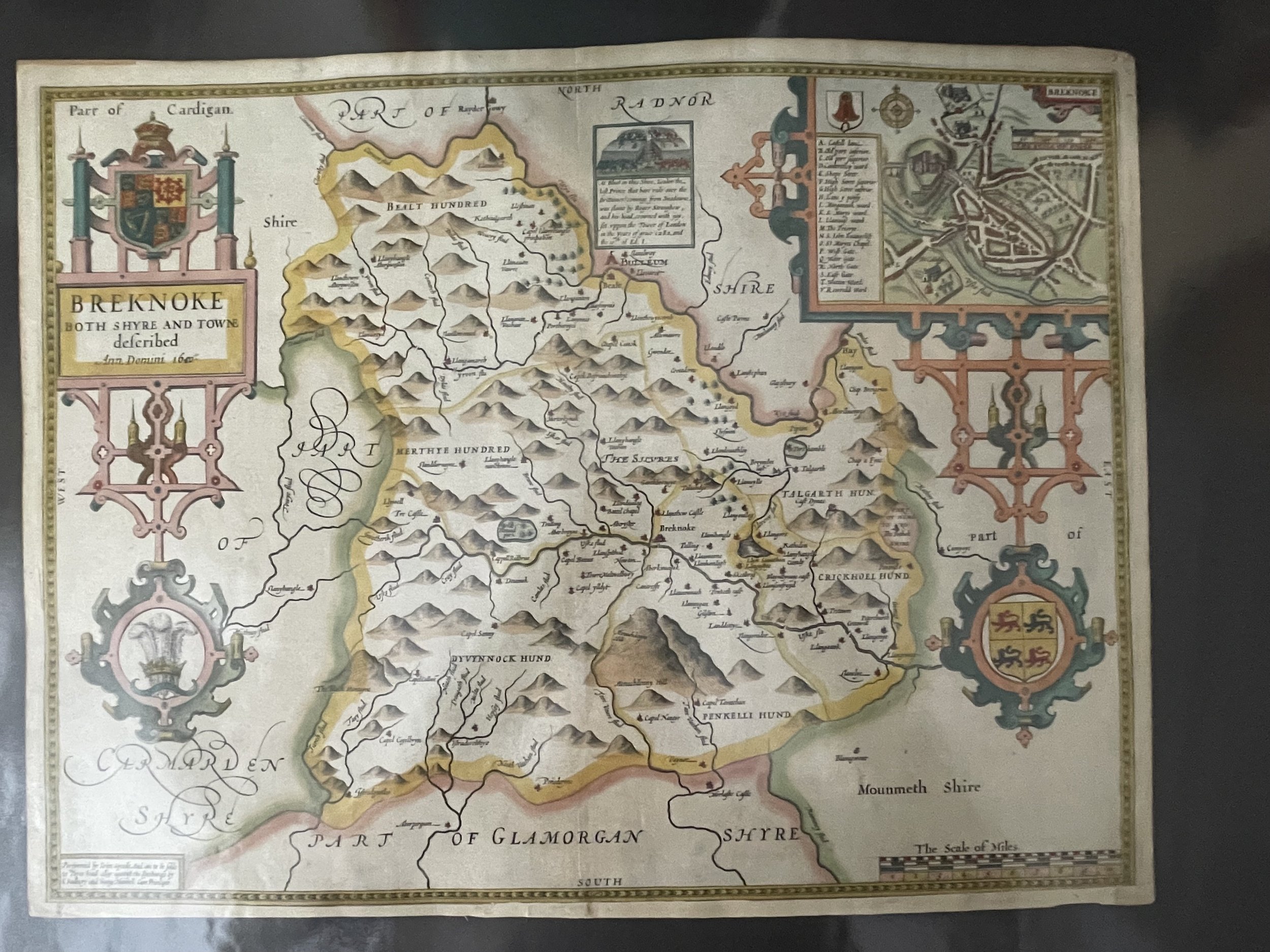
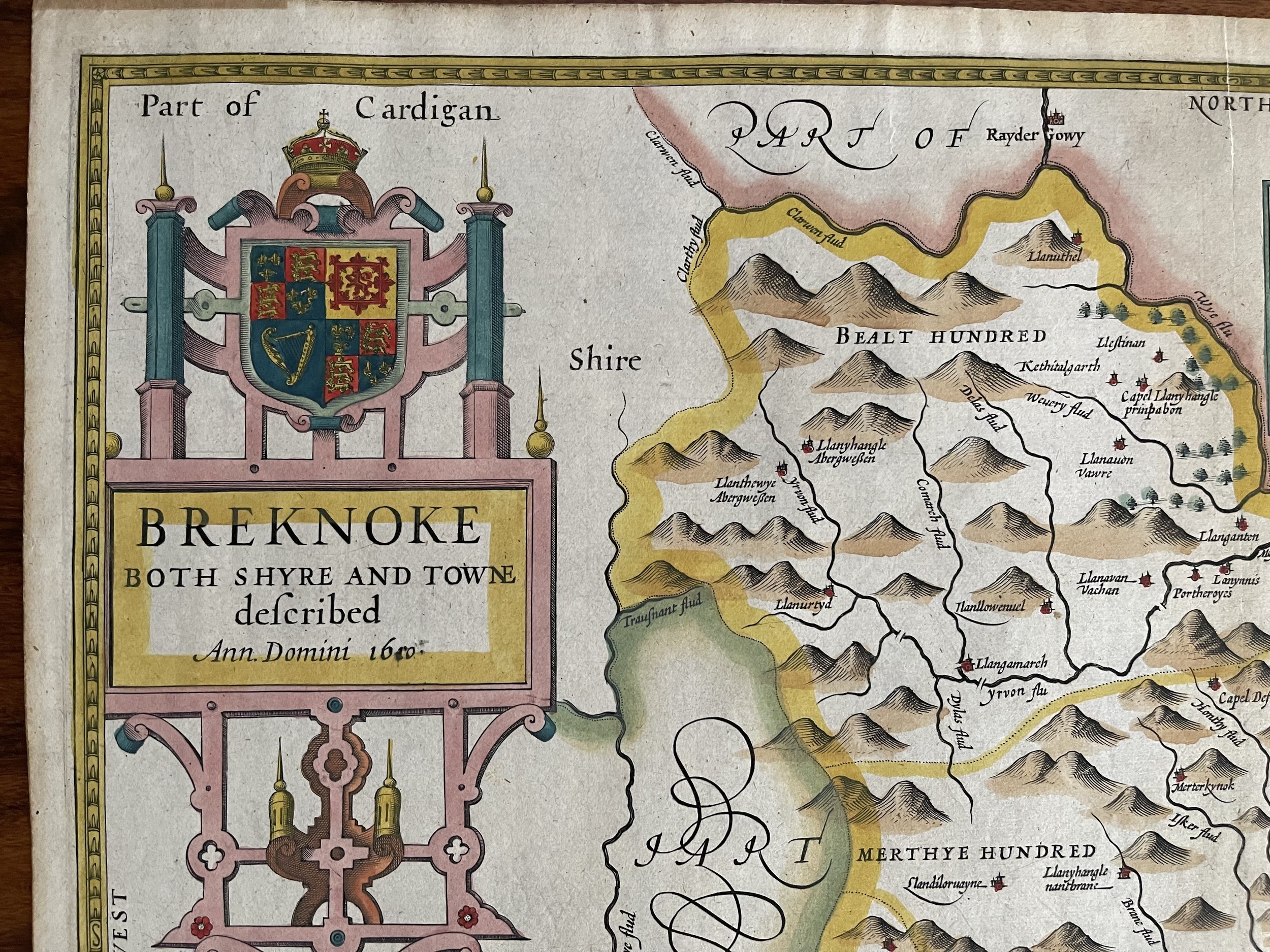
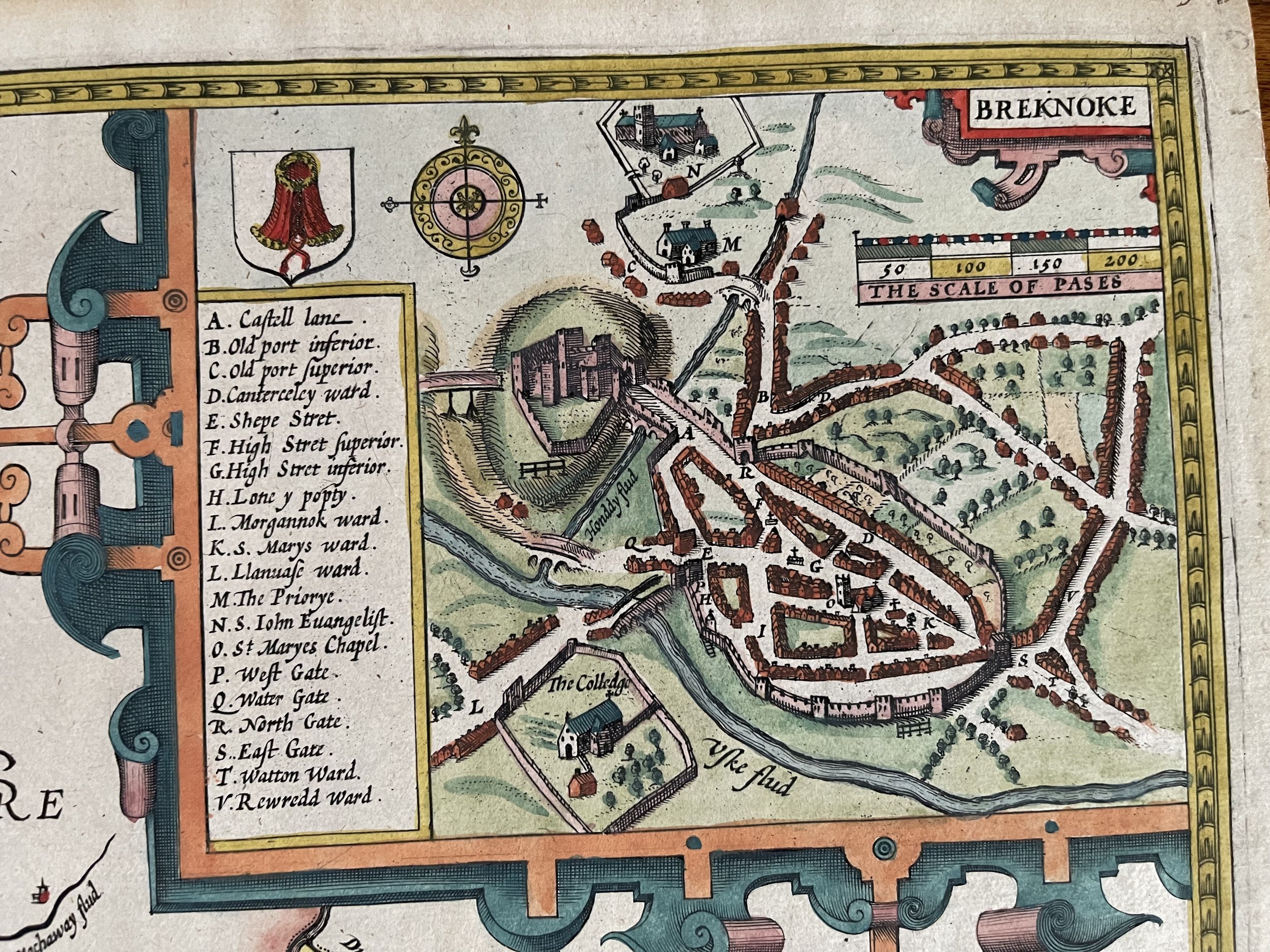
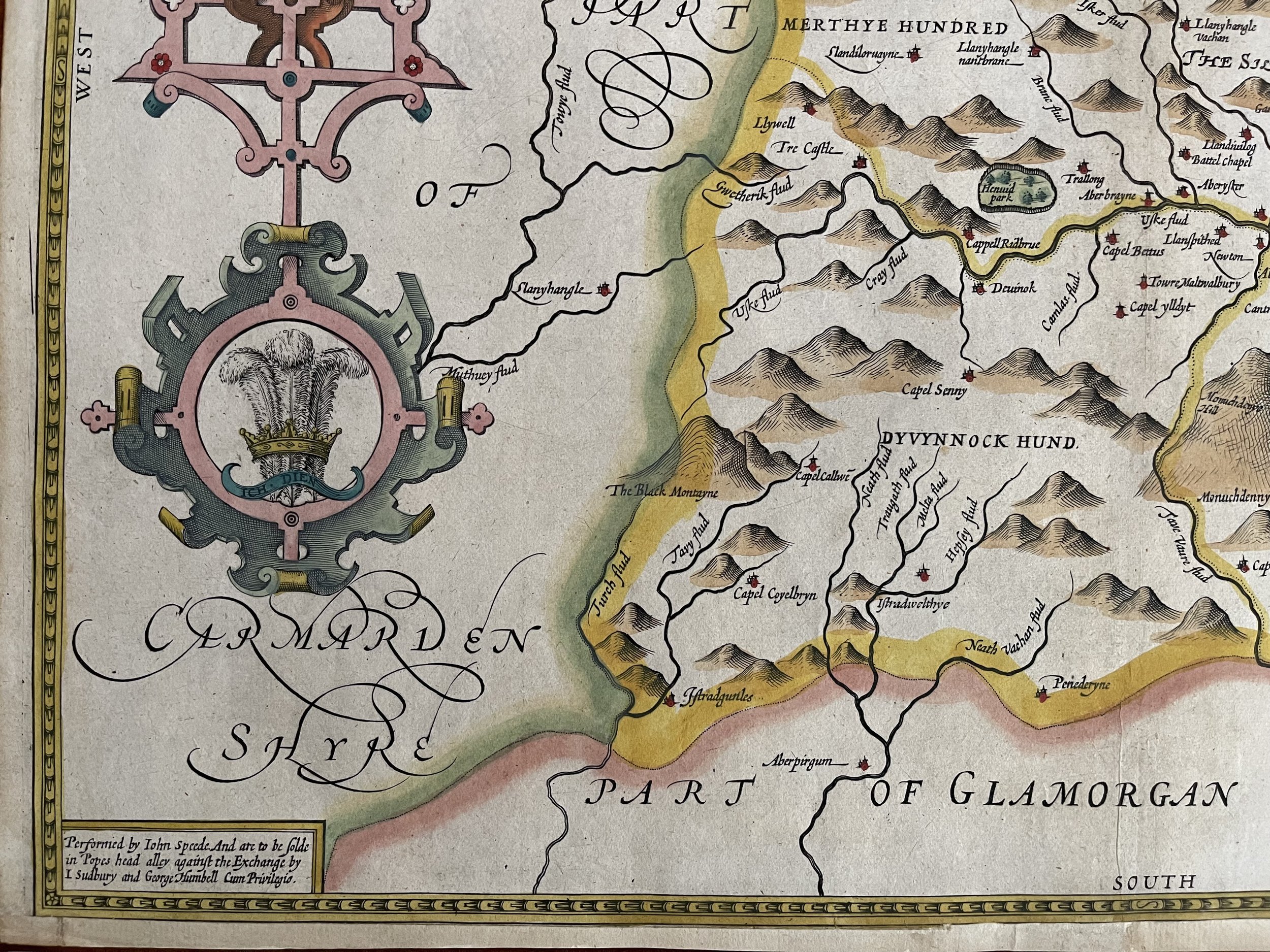
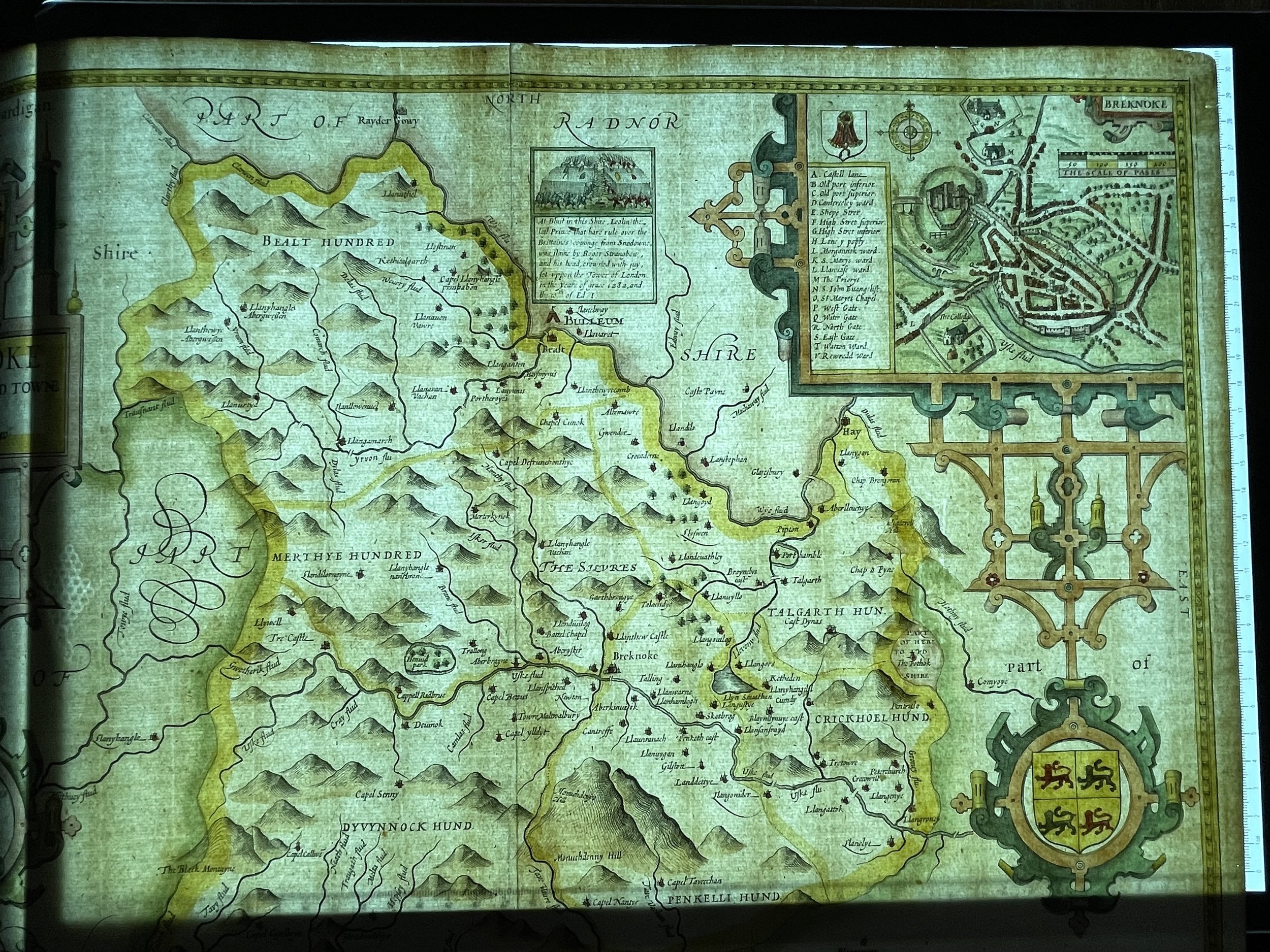
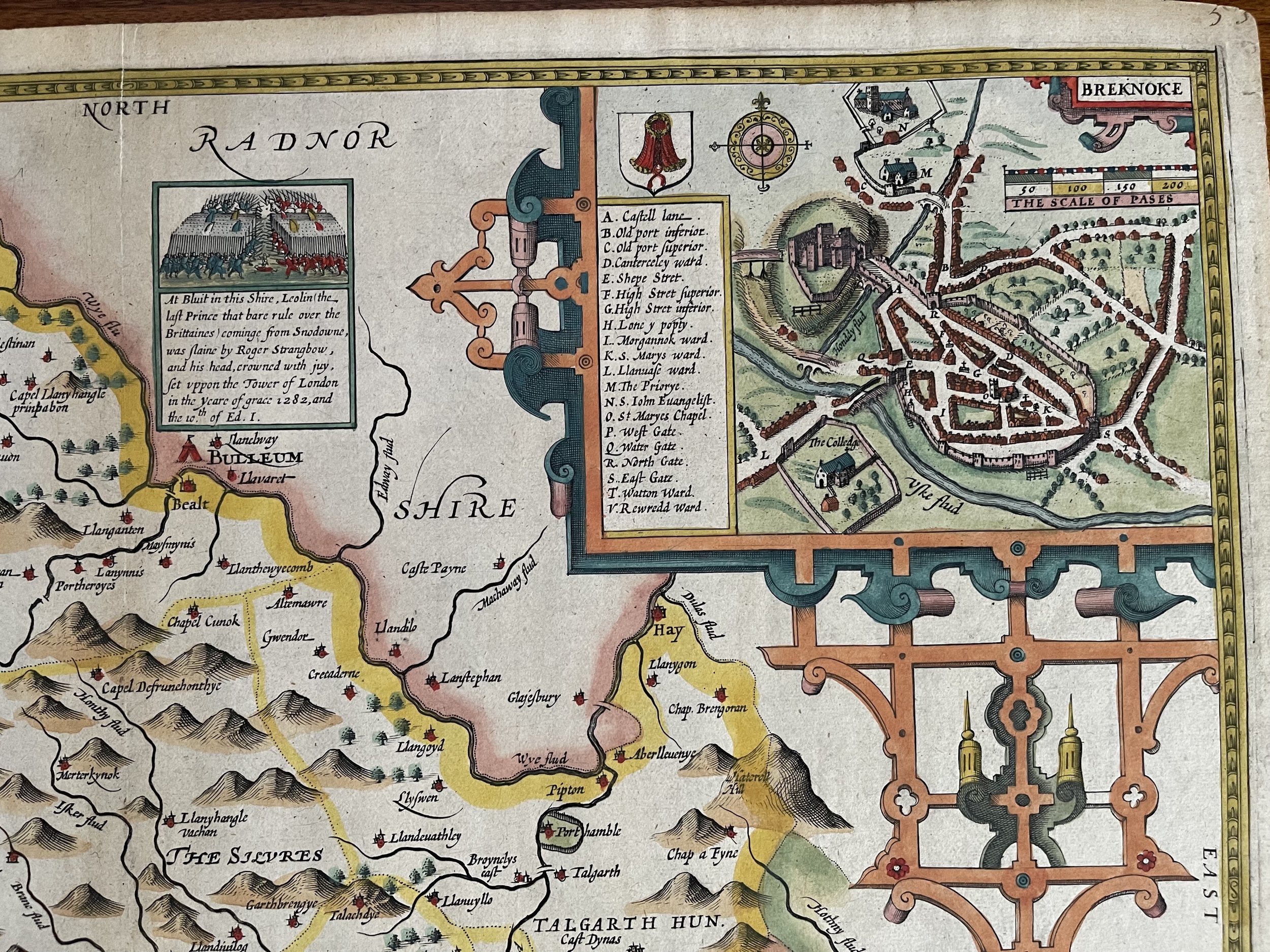
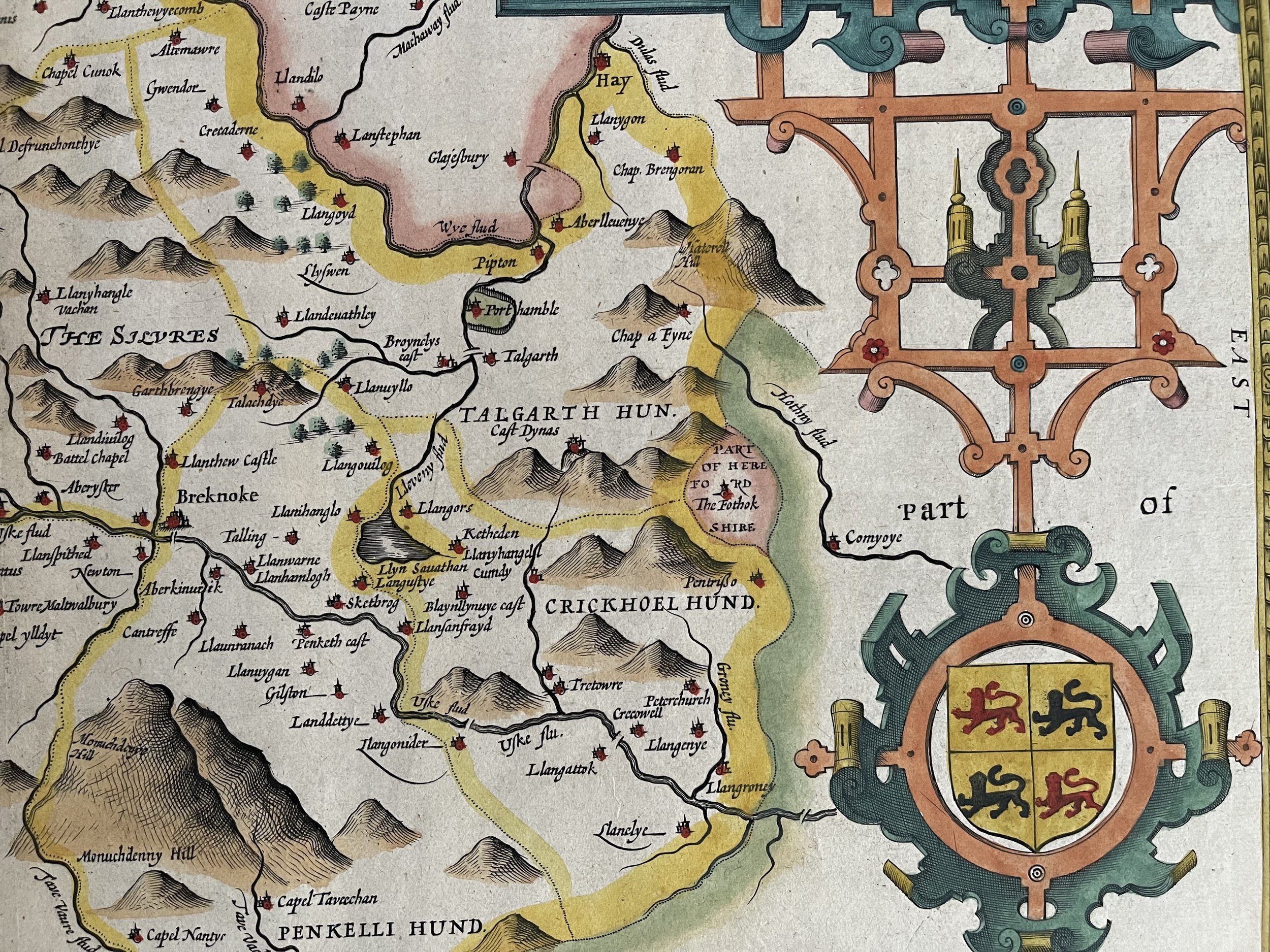
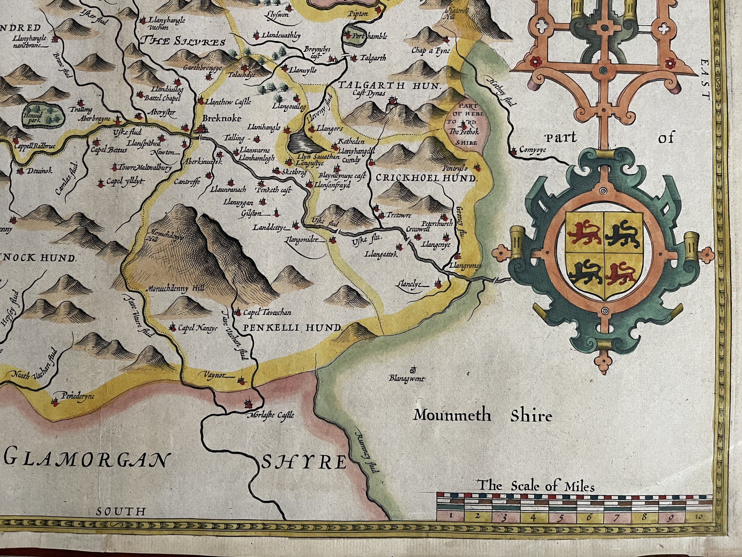

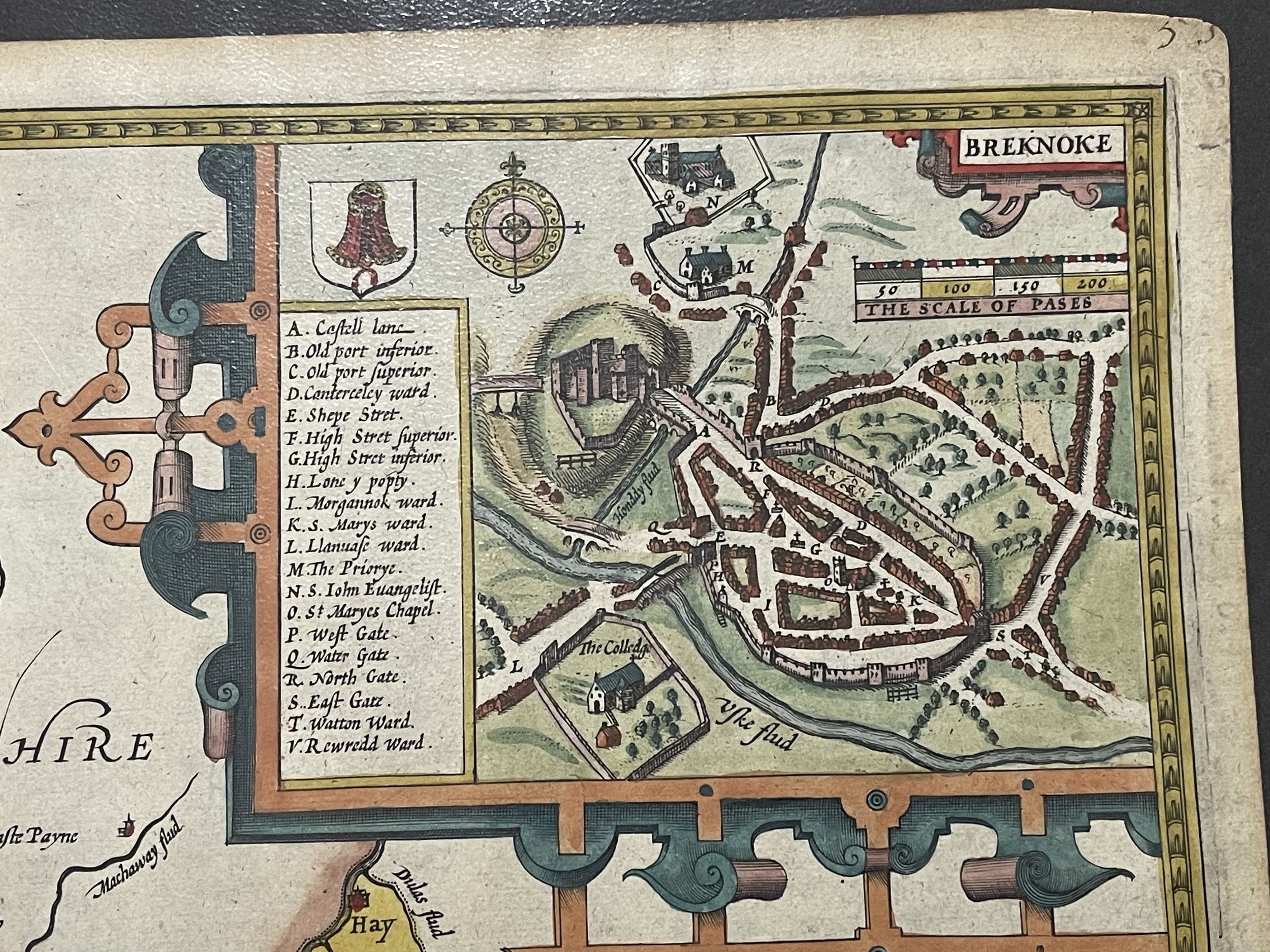
Breknockshire Wales - Breknoke both shyre and towne described. - John Speed - 1627-31
A beautifully coloured map of the historic county of Brecknockshire, with an inset map of the city of Brecon.
Brecknockshire, part of modern day Powys and the location of the Brecon Beacons National Park. Inset map of the town of Brecon.
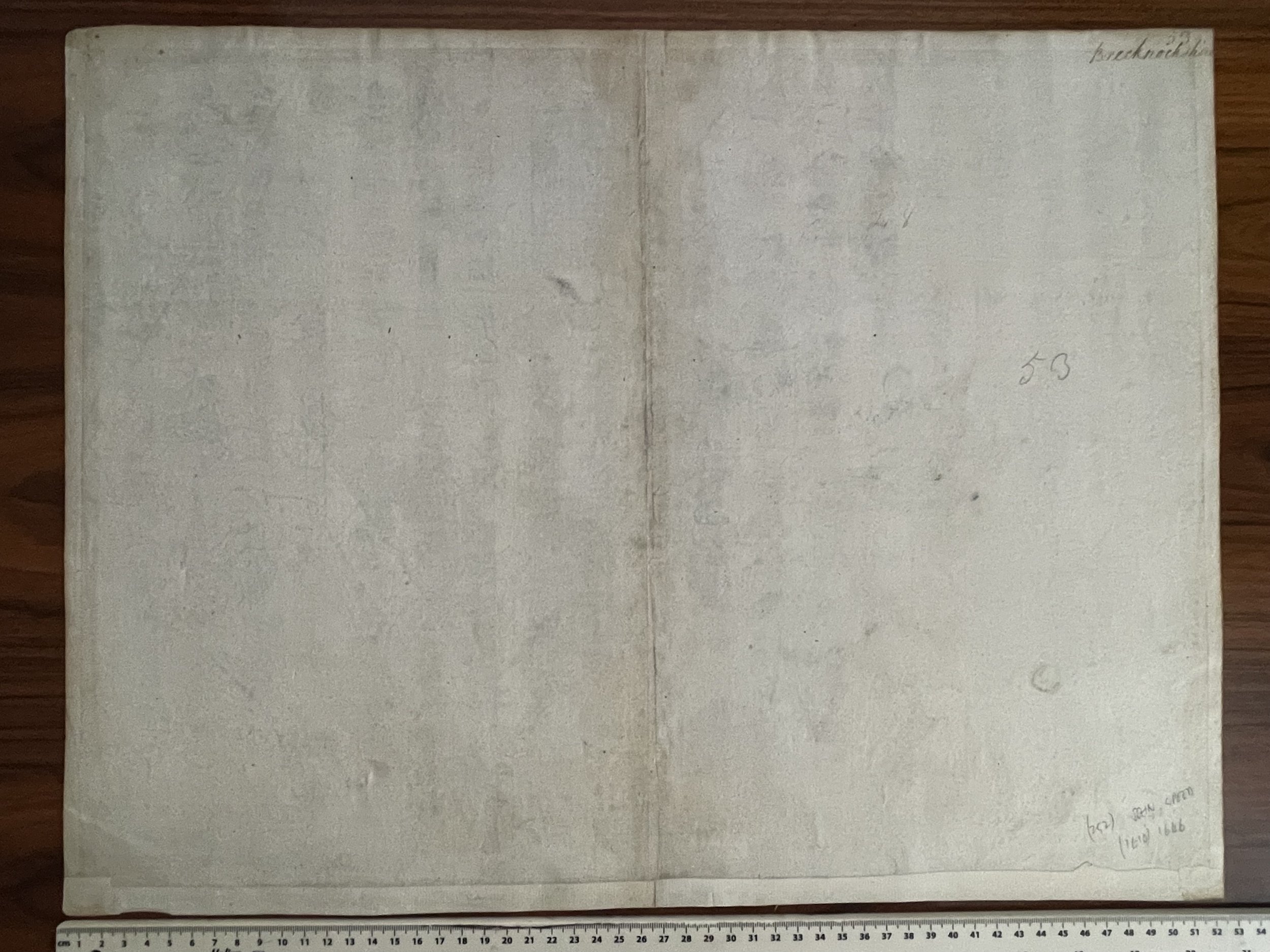
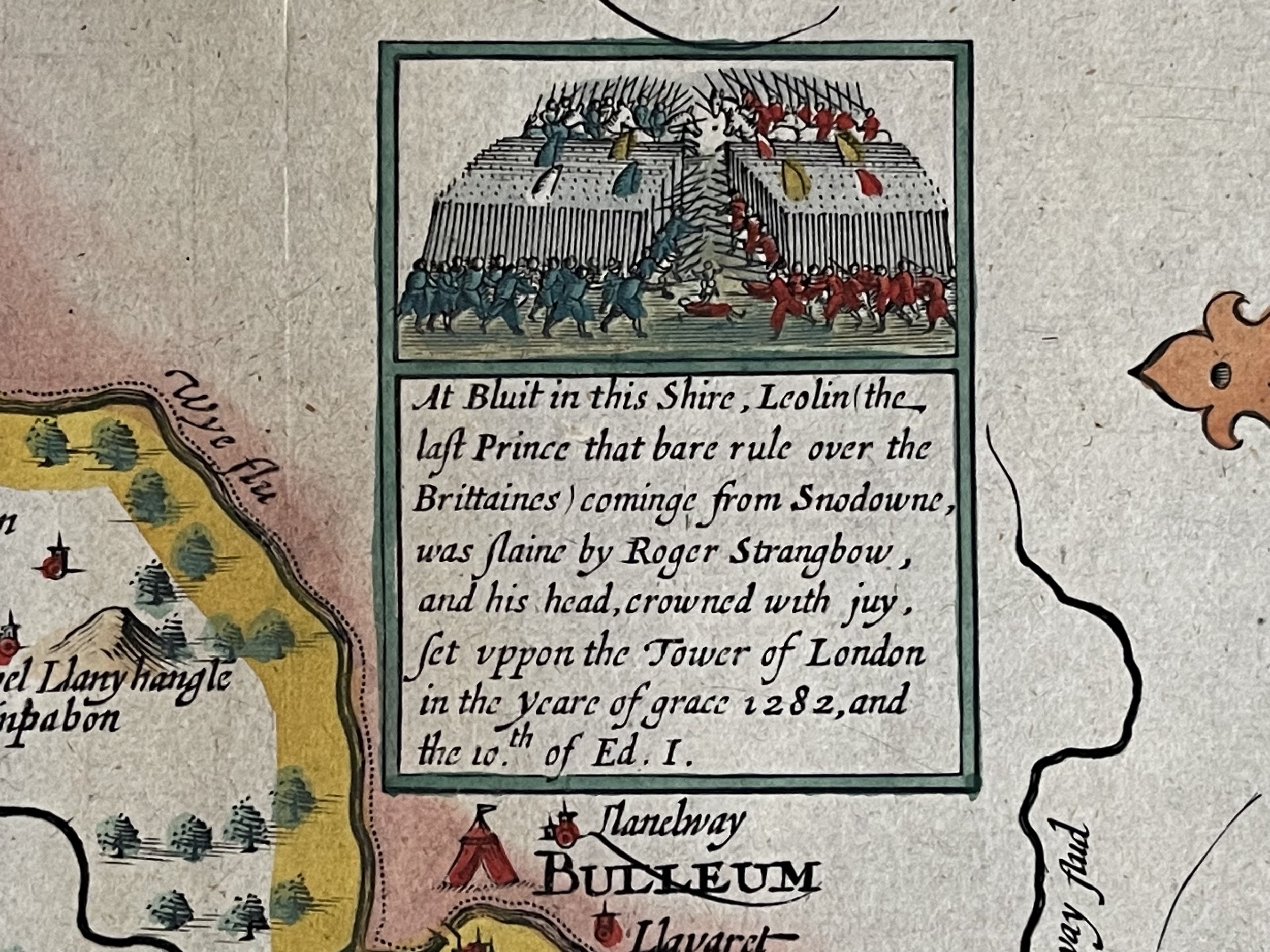
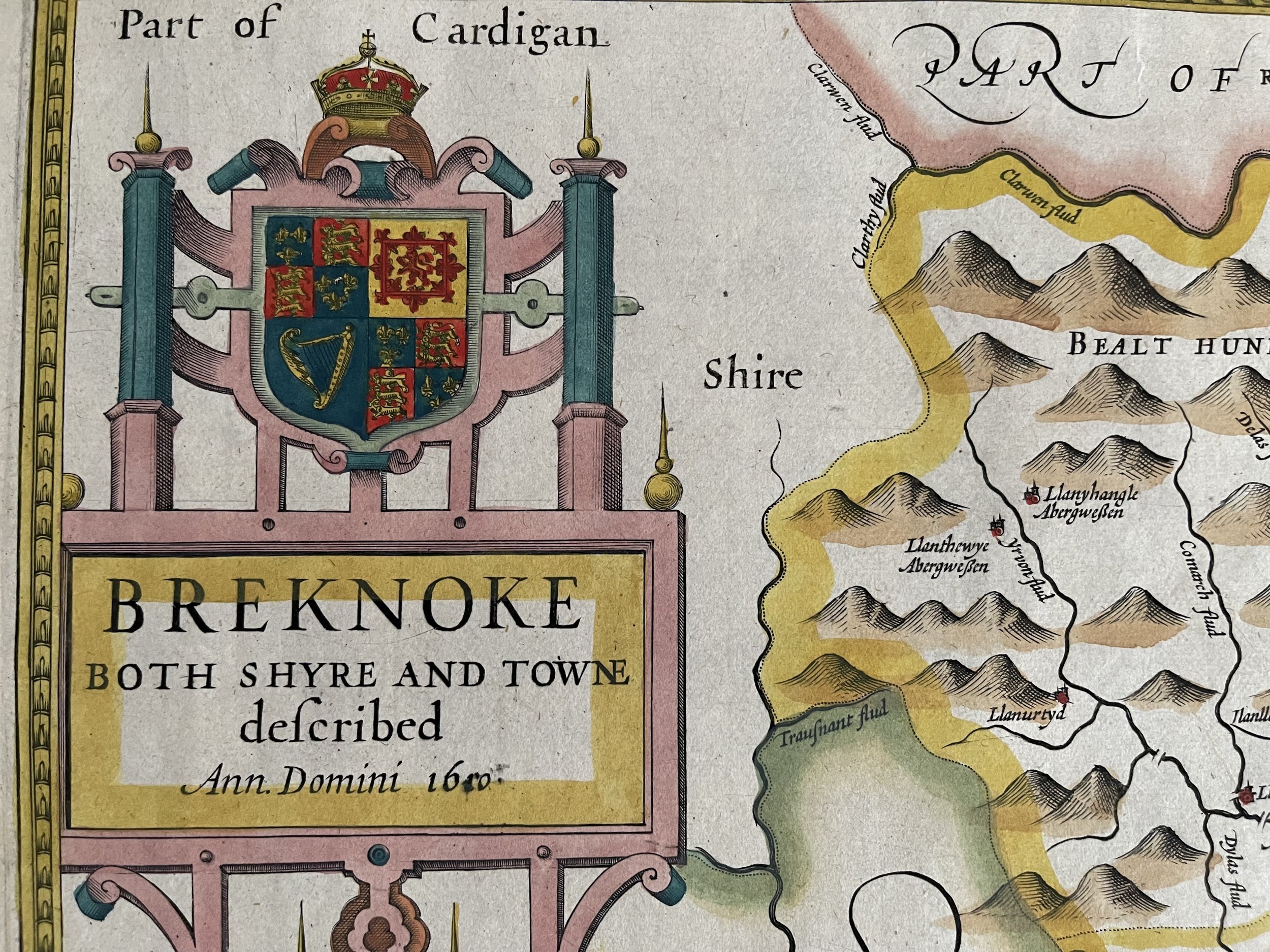
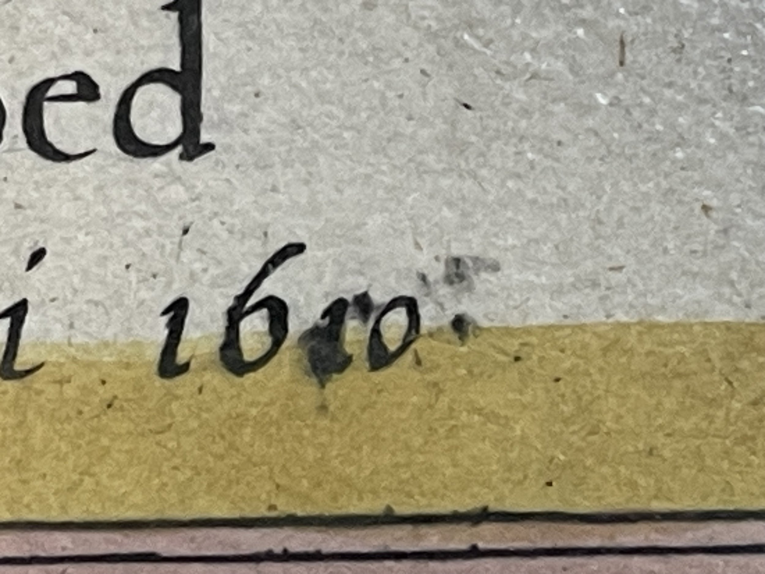
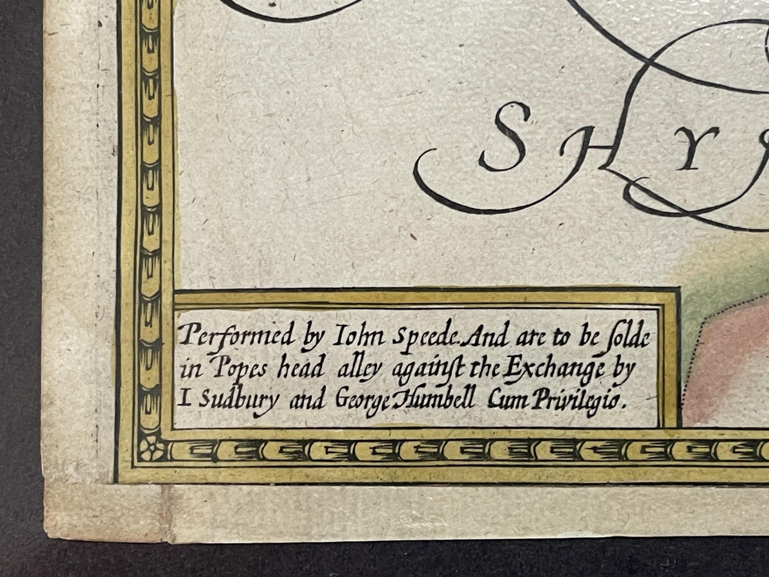
This map described and dated as the 1610 edition although one of the digits is slightly smudged during the printed process. Some later edition depicted the correct date of construction, others didn't. I have however dated the map to 1627-31 from Thomas Chubb's The Printed Maps of Great Britain and Ireland 1579-1870 (1966 edition). Page 35 Para 3 XXV - confirms that the the map is performed by John Speed (Speede), and was sold (Publisher) by J Sudbury (Mentioned on map only) and George Humble at White Horse in Popes-head Alley. The bottom left of the map itself shows this information (SeePhoto). The scale on the map is also correct at a scale of 10 miles = 4.5 Inches. The coat of Royal Arms shows Brecknoke (Top left) and there is also a cartouche of the Prince of Wales feathers (bottom left). Top right shows a folio plate number 53. The verso is plain with some pencil marks from previous owners that are common place. The border is double lined as apposed to single lined.
This same map is shown on page 222 of The Counties of Britain by Nigel Nicholson, complete with date smudge.
John Speed (1552-1629) was the outstanding cartographer of his age. His 'Theatre of Great Britain' was the first atlas of the British Isles: Speed prepared the maps himself about two years before they were published.
His maps and books dominated the seventeenth-century English market. The present map is taken from the 1627 English edition published by George Humble (Humbell on map).
John Speed (1551 or 1552 – 28 July 1629) was an English cartographer, chronologer and historian of Cheshire origins. The son of a citizen and Merchant Taylor in London, he rose from his family occupation to accept the task of drawing together and revising the histories, topographies and maps of the Kingdoms of Great Britain as an exposition of the union of their monarchies in the person of King James I and VI. He accomplished this with remarkable success, with the support and assistance of the leading antiquarian scholars of his generation. He drew upon and improved the shire maps of Christopher Saxton, John Norden and others, being the first to incorporate the hundred-boundaries into them, and he was the surveyor and originator of many of the town or city plans inset within them. His work helped to define early modern concepts of British national identity. His Biblical genealogies were also formally associated with the first edition of the King James Bible. He is among the most famous of English mapmakers.
A beautifully coloured map of the historic county of Brecknockshire, with an inset map of the city of Brecon.
Brecknockshire, part of modern day Powys and the location of the Brecon Beacons National Park. Inset map of the town of Brecon.
This map described and dated as the 1610 edition although one of the digits is slightly smudged during the printed process. Some later edition depicted the correct date of construction, others didn't. I have however dated the map to 1627-31 from Thomas Chubb's The Printed Maps of Great Britain and Ireland 1579-1870 (1966 edition). Page 35 Para 3 XXV - confirms that the the map is performed by John Speed (Speede), and was sold (Publisher) by J Sudbury (Mentioned on map only) and George Humble at White Horse in Popes-head Alley. The bottom left of the map itself shows this information (SeePhoto). The scale on the map is also correct at a scale of 10 miles = 4.5 Inches. The coat of Royal Arms shows Brecknoke (Top left) and there is also a cartouche of the Prince of Wales feathers (bottom left). Top right shows a folio plate number 53. The verso is plain with some pencil marks from previous owners that are common place. The border is double lined as apposed to single lined.
This same map is shown on page 222 of The Counties of Britain by Nigel Nicholson, complete with date smudge.
John Speed (1552-1629) was the outstanding cartographer of his age. His 'Theatre of Great Britain' was the first atlas of the British Isles: Speed prepared the maps himself about two years before they were published.
His maps and books dominated the seventeenth-century English market. The present map is taken from the 1627 English edition published by George Humble (Humbell on map).
John Speed (1551 or 1552 – 28 July 1629) was an English cartographer, chronologer and historian of Cheshire origins. The son of a citizen and Merchant Taylor in London, he rose from his family occupation to accept the task of drawing together and revising the histories, topographies and maps of the Kingdoms of Great Britain as an exposition of the union of their monarchies in the person of King James I and VI. He accomplished this with remarkable success, with the support and assistance of the leading antiquarian scholars of his generation. He drew upon and improved the shire maps of Christopher Saxton, John Norden and others, being the first to incorporate the hundred-boundaries into them, and he was the surveyor and originator of many of the town or city plans inset within them. His work helped to define early modern concepts of British national identity. His Biblical genealogies were also formally associated with the first edition of the King James Bible. He is among the most famous of English mapmakers.
Code : A44
Cartographer : Cartographer / Engraver / Publisher: John Speed / J Sudbury & G Humbell
Date : Publication Place / Date - C1627-31
Size : Sheet size: Image Size: 53 x 40.5 cm
Availability : Available
Type - Genuine - Antique
Grading A
Where Applicable - Folds as issued. Light box photo shows the folio leaf centre margin hinge ‘glue’, this is not visible otherwise.
Tracked postage, in casement. Please contact me for postal quotation outside of the UK.