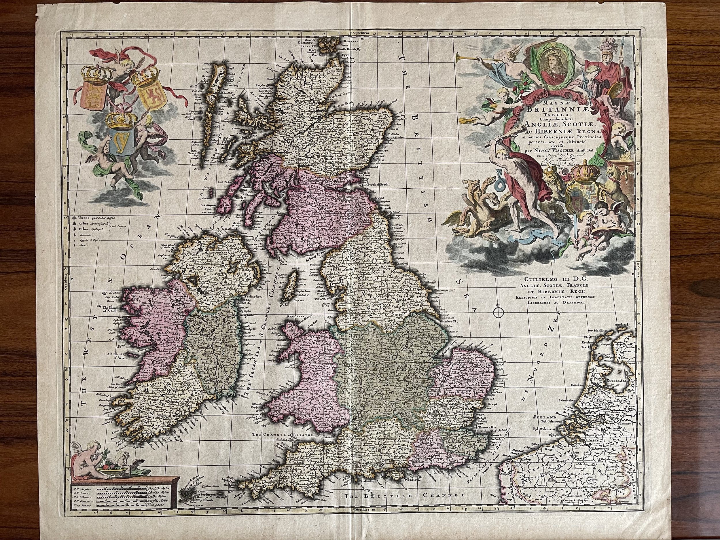
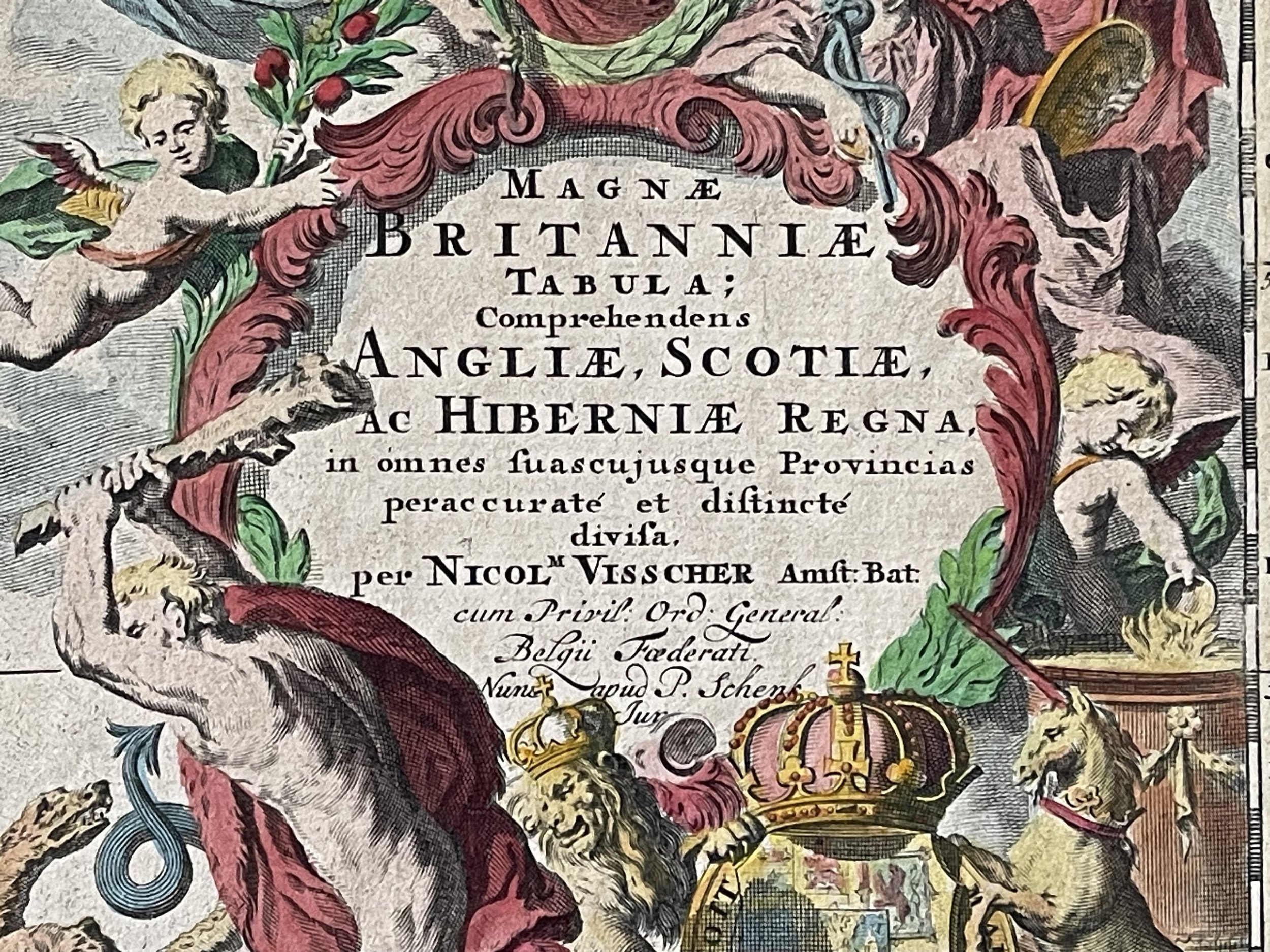
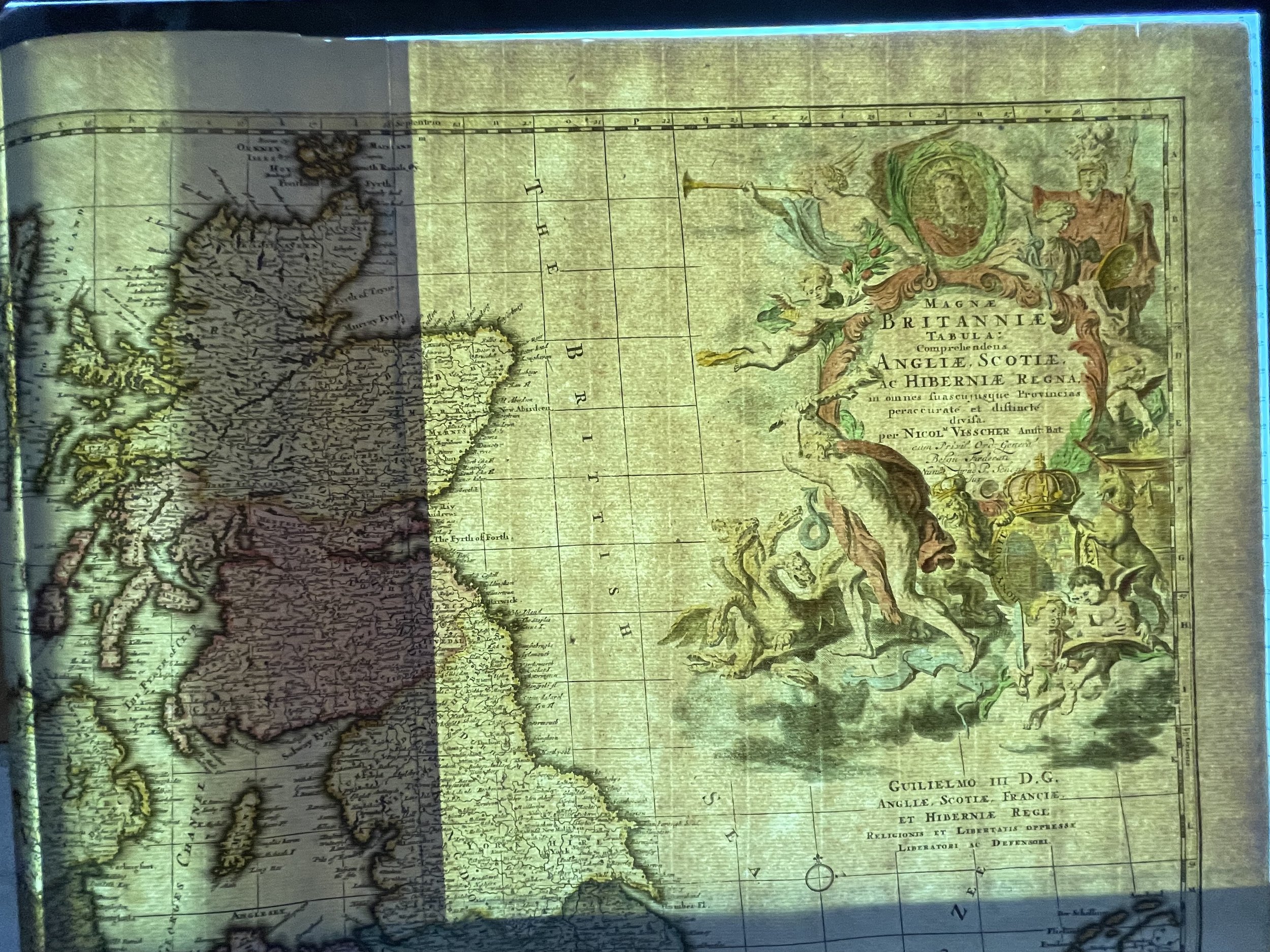
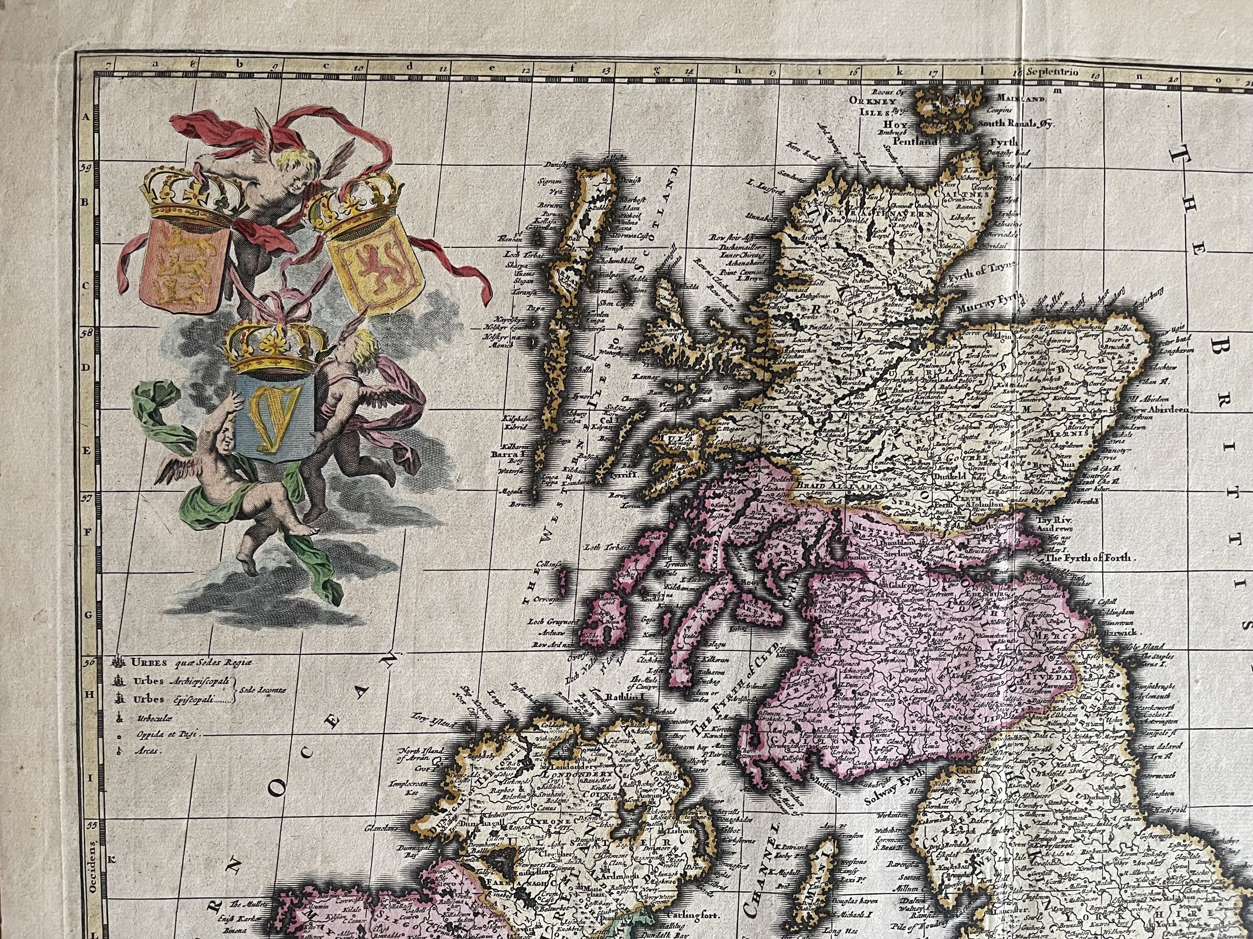
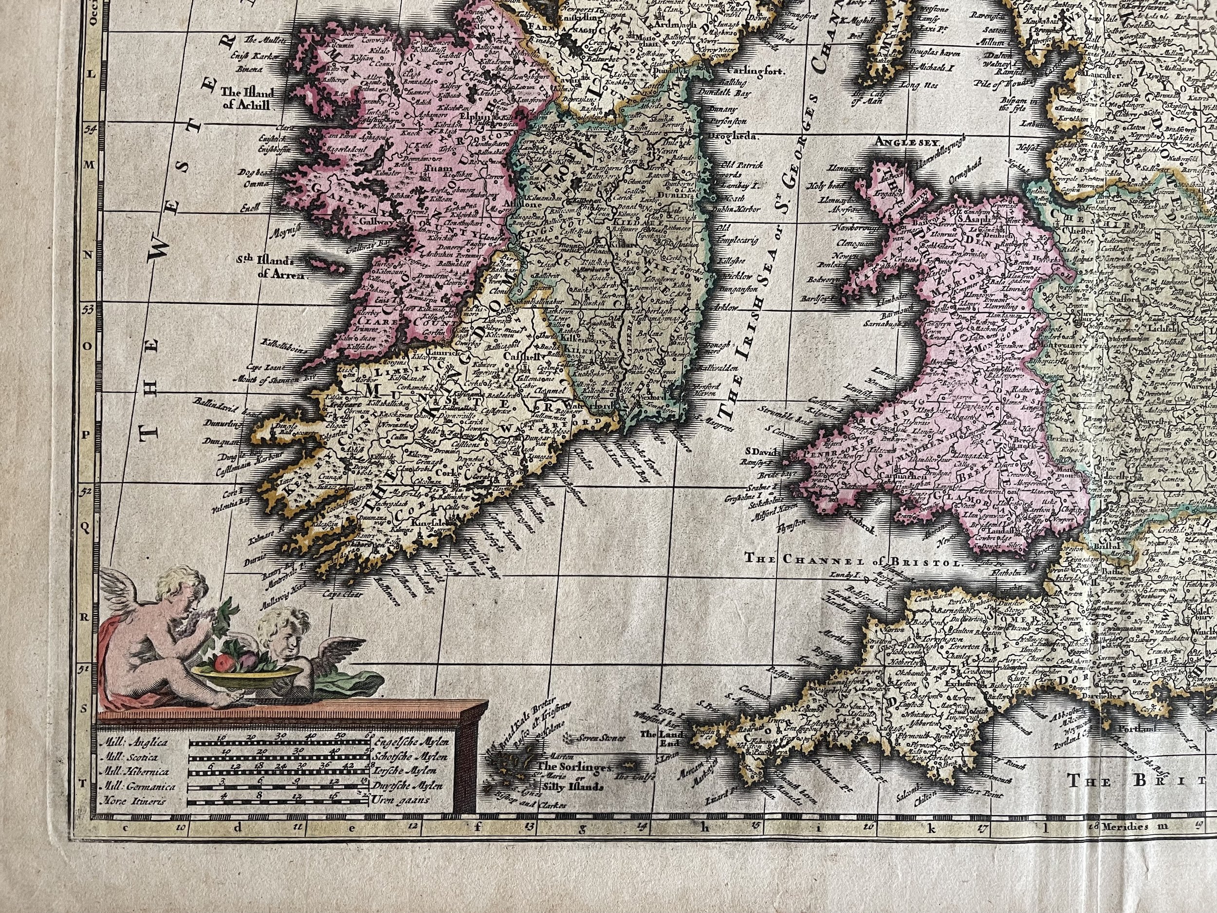
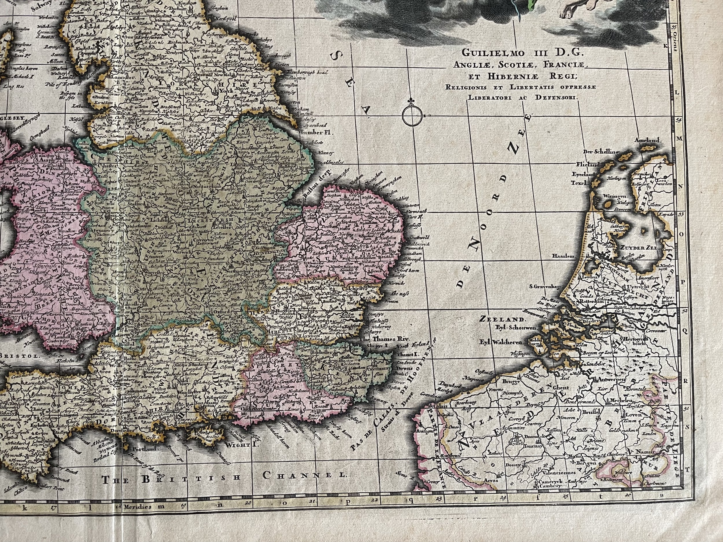
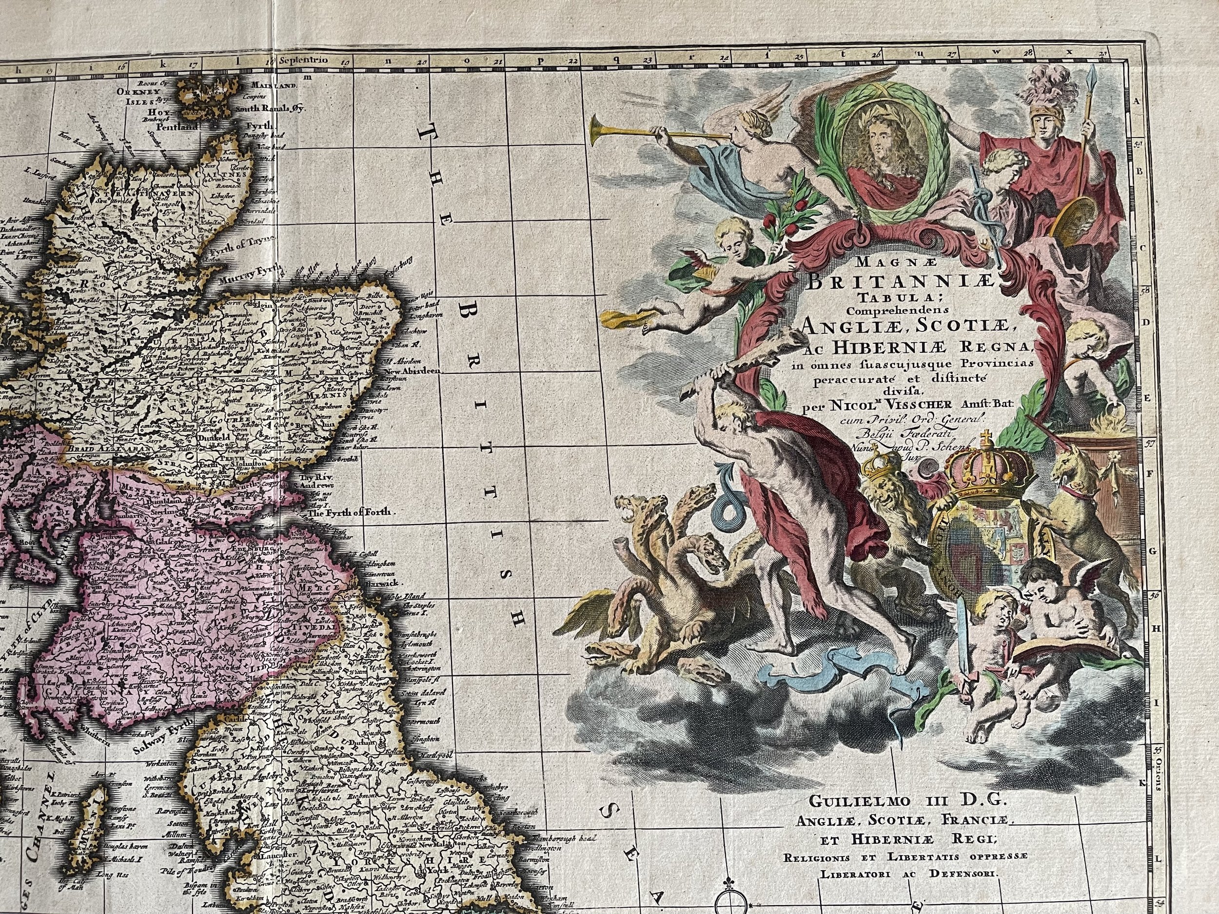
British Isles - Magnae Britanniae Tabula...Angliae, Scotiae, Ac Hiberniae Regna...- Nicolaes Visscher, Peter Schenk - 1660
This large rare hand coloured original antique map of Great Britain & Ireland was published by Nicolaes Visscher in 1690This is a very beautiful map with rich deep colour and heavy engraving on clean and stable paper. It is also an important map, dedicated to William III of Orange (King Billy) who ruled GB & Ireland between 1689 & 1702, a time of great change both in Europe and the New World.
Cartographer : Claes Jansz Visscher (The Elder)
Claes Jansz Visscher was a prominent Dutch engraver, cartographer, and publisher of the Golden Age of Dutch cartography and printmaking. He was born in Amsterdam in 1587 into a family of engravers and publishers. He learned his craft under his father, Jan Claesz Visscher, and went on to establish his own successful publishing business in Amsterdam. Visscher is particularly well-known for his contributions to the field of cartography. He produced a number of maps of the Netherlands and other European countries that were characterized by their accuracy and attention to detail. His maps were highly regarded during his time and are still considered some of the finest examples of Dutch cartography. Visscher was also a skilled engraver, and he produced a large number of prints, including portraits, landscapes, and religious scenes. He was particularly known for his use of intricate, detailed engraving techniques that allowed him to capture the subtle nuances of light and shadow. Throughout his career, Visscher was commissioned by many leading patrons and collectors, including the Prince of Orange and the Dutch East India Company. His work was highly valued for its technical skill, attention to detail, and beauty, and it continues to be admired by art lovers and collectors today.
Nicolaes Visscher I (25 January 1618, Amsterdam – buried 11 September 1679, Amsterdam) was a Dutch engraver, cartographer and publisher. He was the son of Claes Janszoon Visscher. His son, Nicolaes Visscher II (1649–1702), also worked with him and continued the family tradition of mapmaking after his death. Visscher died in Amsterdam in 1679 and was buried in the Nieuwezijds Kapel on 11 September of that year, though a death year of 1709 is maintained by some sources.
Visscher's legacy as a leading figure in Dutch cartography and printmaking can still be seen today. His maps and prints are highly collectible and sought after by art lovers and collectors around the world. His influence on the field of cartography and printmaking continues to be felt, and he is widely regarded as one of the most important figures in the Golden Age of Dutch art and culture.
Background: In 1558 Queen Elizabeth came to the throne in the midst of a fast changing world. In 1563 a nineteen sheet map, copies of which survive only in manuscript form, was completed by Laurence Nowell, and no doubt, the issue of Mercator's large-scale map of the British Isles in 1564 had an important influence on the thought of the period. A few years later a national survey was commissioned privately, although probably at the instigation of Lord Burghley, the Lord Treasurer, but subsequently was completed with royal encouragement. The outcome was Christopher Saxton's Atlas of EngIand and Wales, started about 1570 and published in 1579 - the first printed set of county maps and the first countrywide atlas on such a splendid scale produced anywhere. A Welsh antiquarian, Humphrey Lhuyd completed a set of surveys that were even more successful than Saxton in which he had produced fine manuscript maps of England and Wales which were used by Ortelius in editions of his Atlas from 1573 onwards.
The earliest maps of the 17th century, attributed to William Smith of the College of Heralds, covered only twelve counties based on Saxton/Norden and were presumably intended to be part of a complete new atlas. They were printed in the Low Countries in 1602-3 and were soon followed by maps for the Latin edition of Camden's Britannia dated 1607. In 1610-11 the first edition of John Speed's famous county Atlas The Theatre of the Empire of Great Britaine was published and immediately replaced Saxton's in popular appeal. Although Speed assembled much of his material from the earlier works of Saxton, Norden and others, a considerable part of the up-to-date information, especially relating to the inset town plans depicted on his maps, was obtained first hand. The maps undoubtedly owed much of their popularity to the splendid engravings of high quality made in the workshops in Amsterdam of Jodocus Hondius to whom Speed sent his manuscripts, the plates subsequently being returned to London for printing.
In 1645, Volume IV of the famous Blaeu World Atlas covering the counties of England and Wales was published in Amsterdam. These maps have always been esteemed as superb examples of engraving and design, the calligraphy being particularly splendid, but nevertheless they were nearly all based on Saxton and Speed and added little to geographical knowledge.
Not until the latter part of the century do we find an English map maker of originality with the capacity to put new ideas into practice. John Ogilby, one of the more colourful figures associated with cartography, started life as a dancing master and finished as King's Cosmographer and Geographic Printer. After publishing a small number of county maps, somewhat on the lines of John Norden he issued in 1675 the Britannia, the first practical series of detailed maps of the post roads of England and Wales on a standard scale of 1,760 yards to the mile. Up to the end of the century and beyond, reprints and revisions of Saxton's and Speed's atlases continued to appear and the only other noteworthy county maps were Richard Blome's Britannia (1673), John Overton's Atlas (c. 1670) and Robert Morden's maps for an English translation of Camden's Britannia published in 1695.
Another noted cartographer of the day was Captain Greenvile Collins, and of his work in surveying the coasts of Great Britain culminating in the issue in 1693 of the Great Britain's Coasting Pilot. Apart from these charts, English cartographers published during the century a number of world atlases. Speed was the first Englishman to produce a world atlas with the issue in 1627 of his A Prospect of the Most Famous Parts of the World. Other atlases appeared later in the century by Peter Heylin, John Seller, William Berry, Moses Pitt and Richard Blome, whilst Ogilby found time to issue maps of Africa, America and Asia. Far more important, from the purely scientific point of view, was the work of Edmund Halley, Astronomer Royal, who compiled and issued meteorological and magnetic charts in 1688 and 1701 respectively.
At the beginning of the eighteenth century the Dutch map trade was finally in decline, the French in the ascendant and the English to a great extent still dominated by Saxton and Speed except, as we have shown, in the spheres of sea charts and road maps. There were atlases by John Senex, the Bowles family, Emanuel and Thomas Bowen, Thomas Badeslade and the unique bird's-eye perspective views of the counties, The British Monarchy by George Bickham. In 1750-60 Bowen and Kitchin's The Large English Atlas containing maps on a rather larger scale than hitherto was published.
In 1759 the Society for the encouragement of Arts, Manufactures and Commerce offered an award of £100 for the best original surveys on this scale and by the end of the century about thirty counties had been re-surveyed. These maps, many of which formed, in later years, the basis for the first issues of county maps by the Ordnance Survey Office were not only decorative but a tremendous improvement geographically on earlier local maps. As a consequence, the skills and expertise of the new-style cartographers soon enabled them to cover the world as well as the domestic market. Thomas Jefferys was such a man; he was responsible for a number of the new 1 in. to 1 mile county surveys and he issued an edition of Saxton's much battered 200-year-old plates of the county maps, but he is better known for many fine maps of North America and the West Indies. His work was continued on the same lines by William Faden, trading as Faden and Jefferys. Other publishers such as Sayer and Bennett and their successors Laurie and Whittle published a prodigious range of maps, charts and atlases in the second half of the century. A major influence at this time was John Cary who, apart from organizing the first re-survey of post roads since Ogilby and subsequently printing the noted Travellers' Companion, was a prolific publisher of atlases and maps of every kind of all parts of the world. After starting work with Cary, and taking part in the new road survey, Aaron Arrowsmith set up in his own business and went on to issue splendid large-scale maps of many parts of the world. Both Cary's and Arrowsmith's plates were used by other publishers until far into the next century and, in turn, their work was taken up and developed by James Wyld (Elder and Younger) and Tallis and Co.
Later into the 19th century some of the better known cartographers and publishers were by Henry Teesdale (1829-30), Christopher and John Greenwood, surveyors, Thomas Moule, a writer on heraldry and antiques (1830-36) and John Walker (1837) but by about the middle of the century few small-scale publishers survived and their business passed into the hands of large commercial concerns such as Bartholomews of Edinburgh and Philips of London who continue to this day. (Ref: Shirley; Tooley; M&B)
Peter Schenk the Elder (1660-1711) moved to Amsterdam in 1675 and began to learn the art of mezzotint. In 1694 he bought some of the copperplate stock of the mapmaker Johannes Janssonius, which allowed him to specialise in the engraving and printing of maps and prints. He split his time between his Amsterdam shop and Leipzig and also sold a considerable volume of materials to London.
Peter Schenk the Elder had three sons. Peter the Younger carried on his father’s business in Leipzig while the other two, Leonard and Jan, worked in Amsterdam. Leonard engraved several maps and also carried on his father’s relationship with engraving plates for the Amsterdam edition of the Histoire de l'Académie Royale des Sciences.
Code : A217
Cartographer : Cartographer / Engraver / Publisher: Nicolaes Visscher, Peter Schenk the Elder
Date : Publication Place / Date - 1690
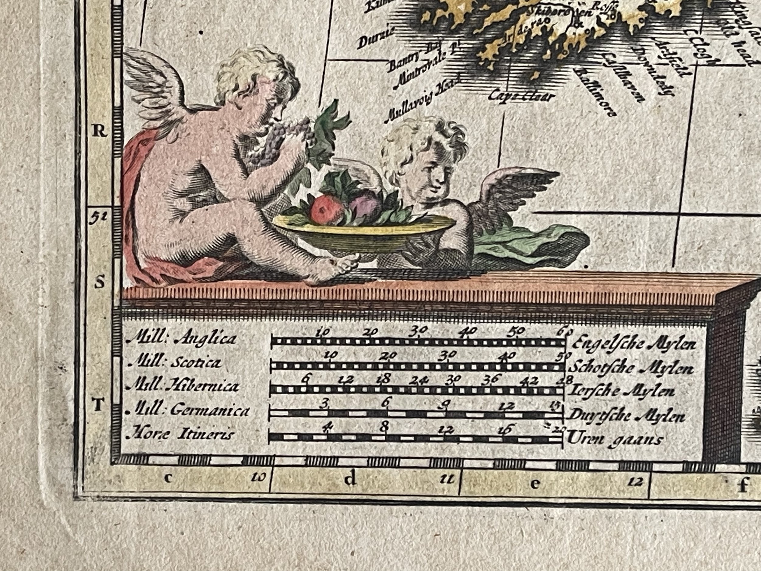
Size : Sheet size: Image Size: 61 x 52 cm
Availability : Available
Type - Genuine - Antique
Grading A-
Where Applicable - Folds as issued. Light box photo shows the folio leaf centre margin hinge ‘glue’, this is not visible otherwise.
Tracked postage, in casement. Please contact me for postal quotation outside of the UK.