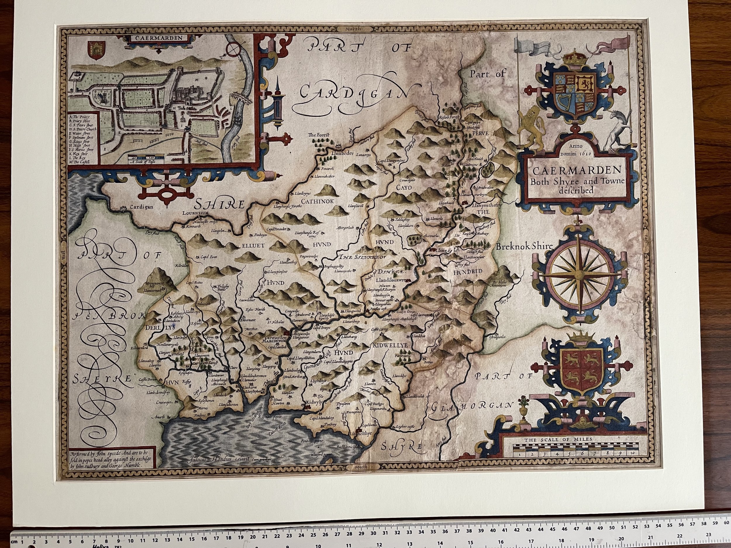
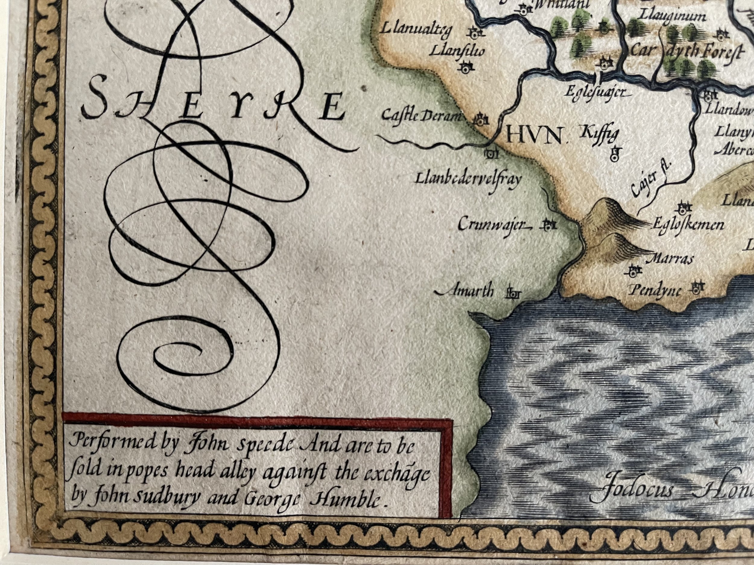
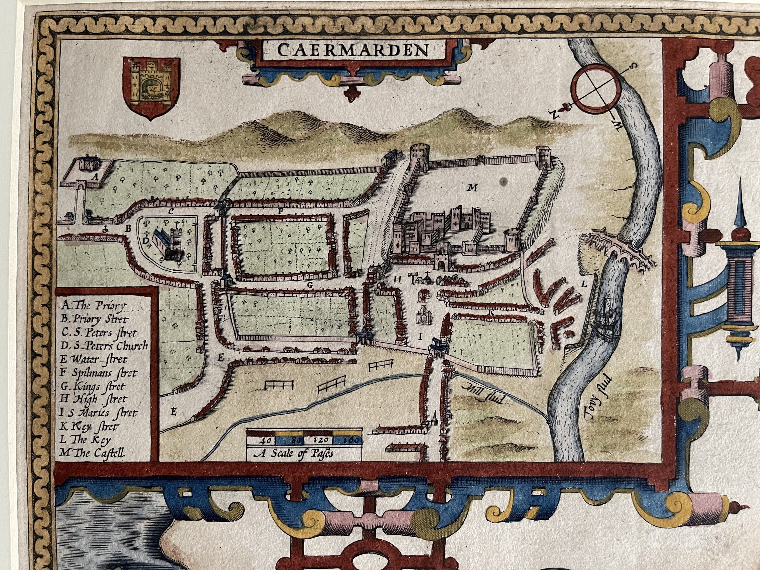
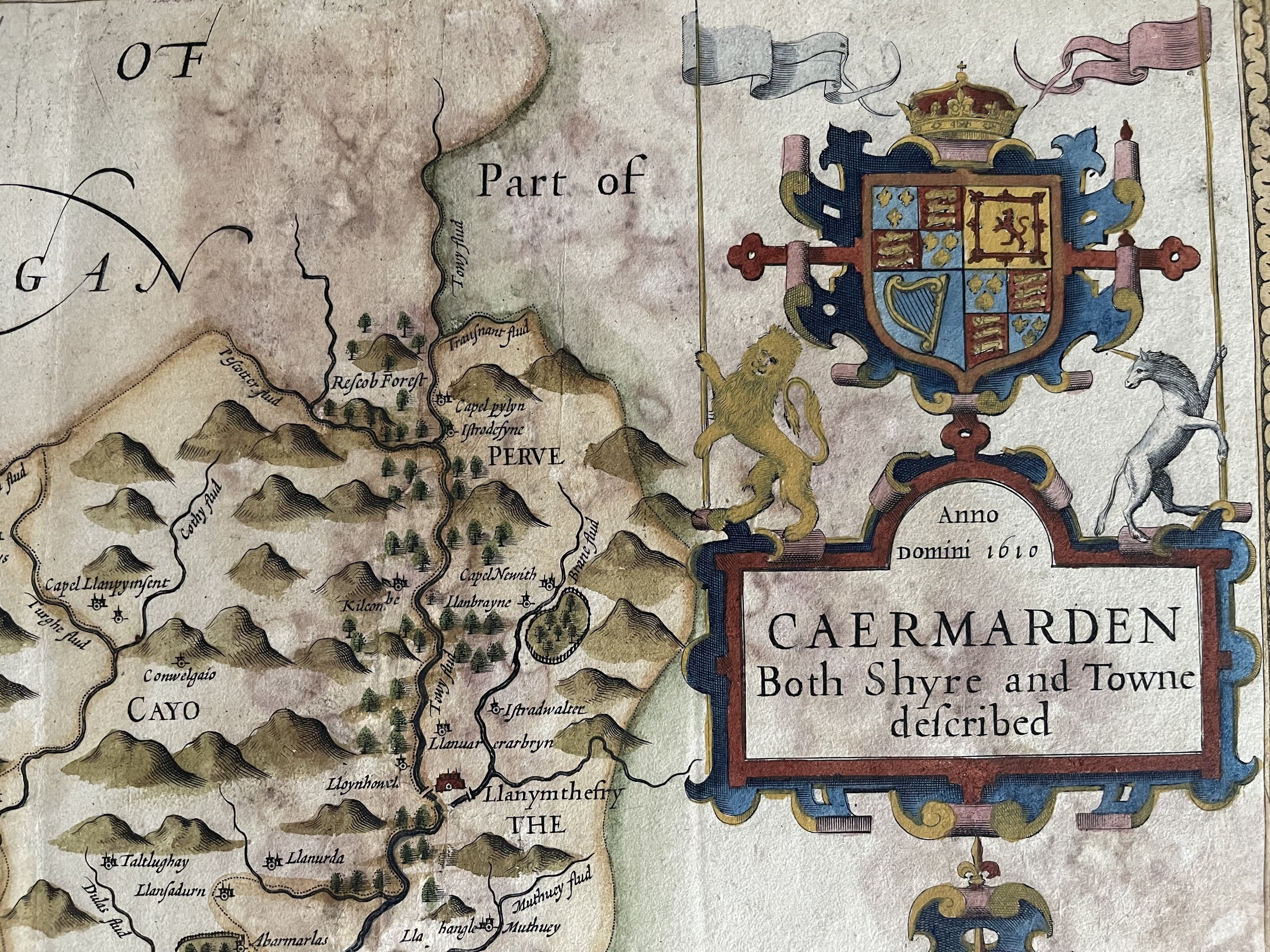
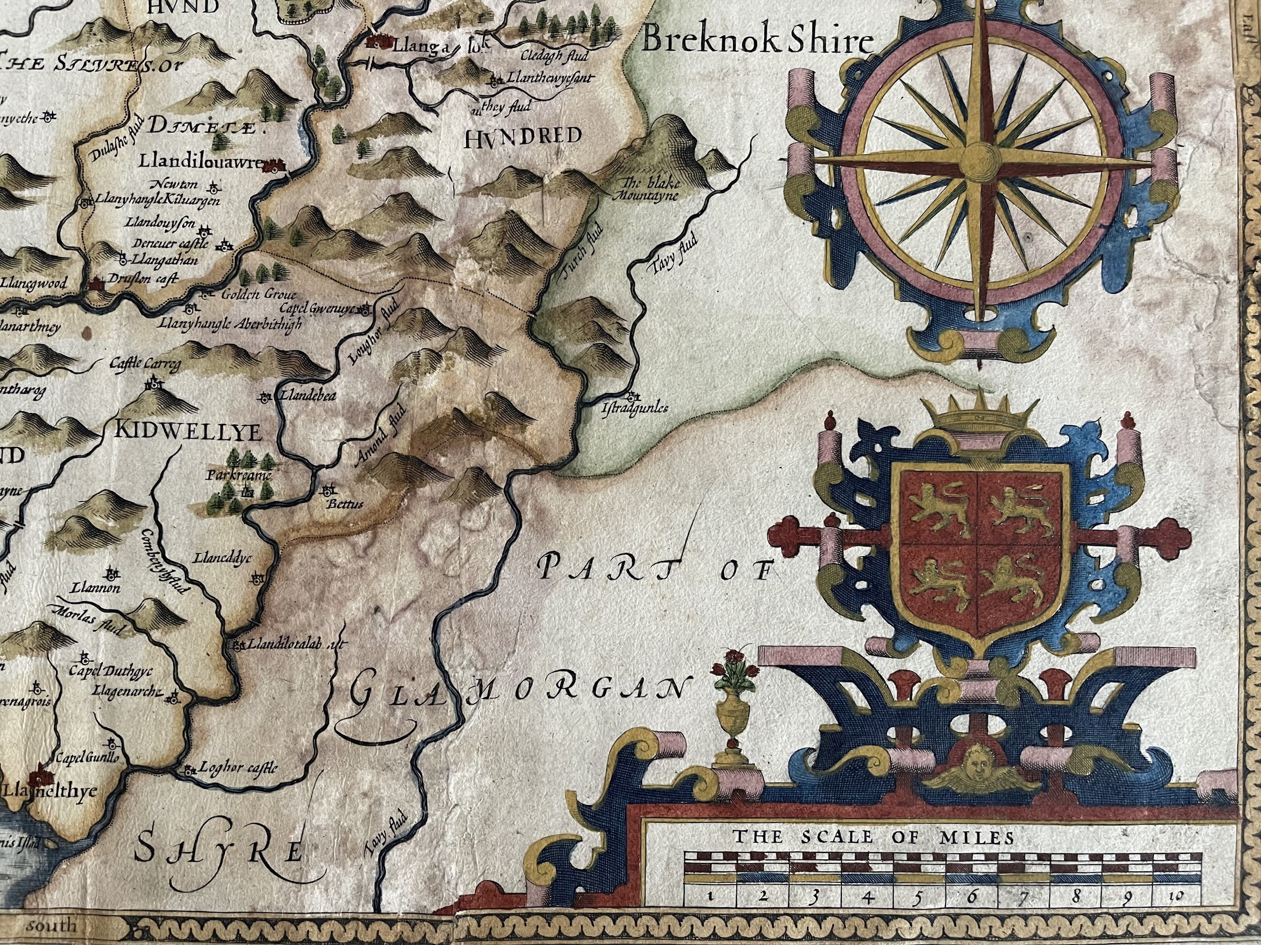
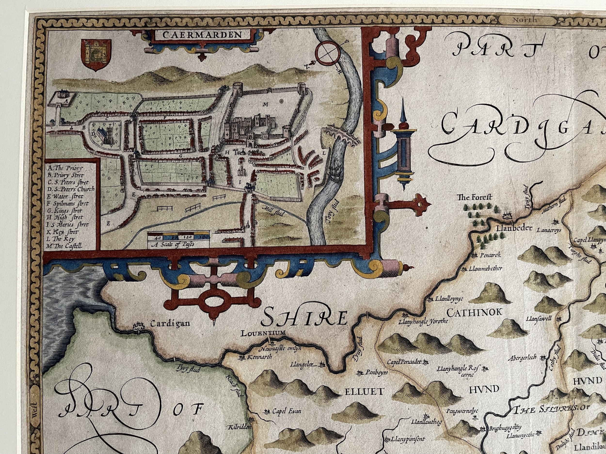
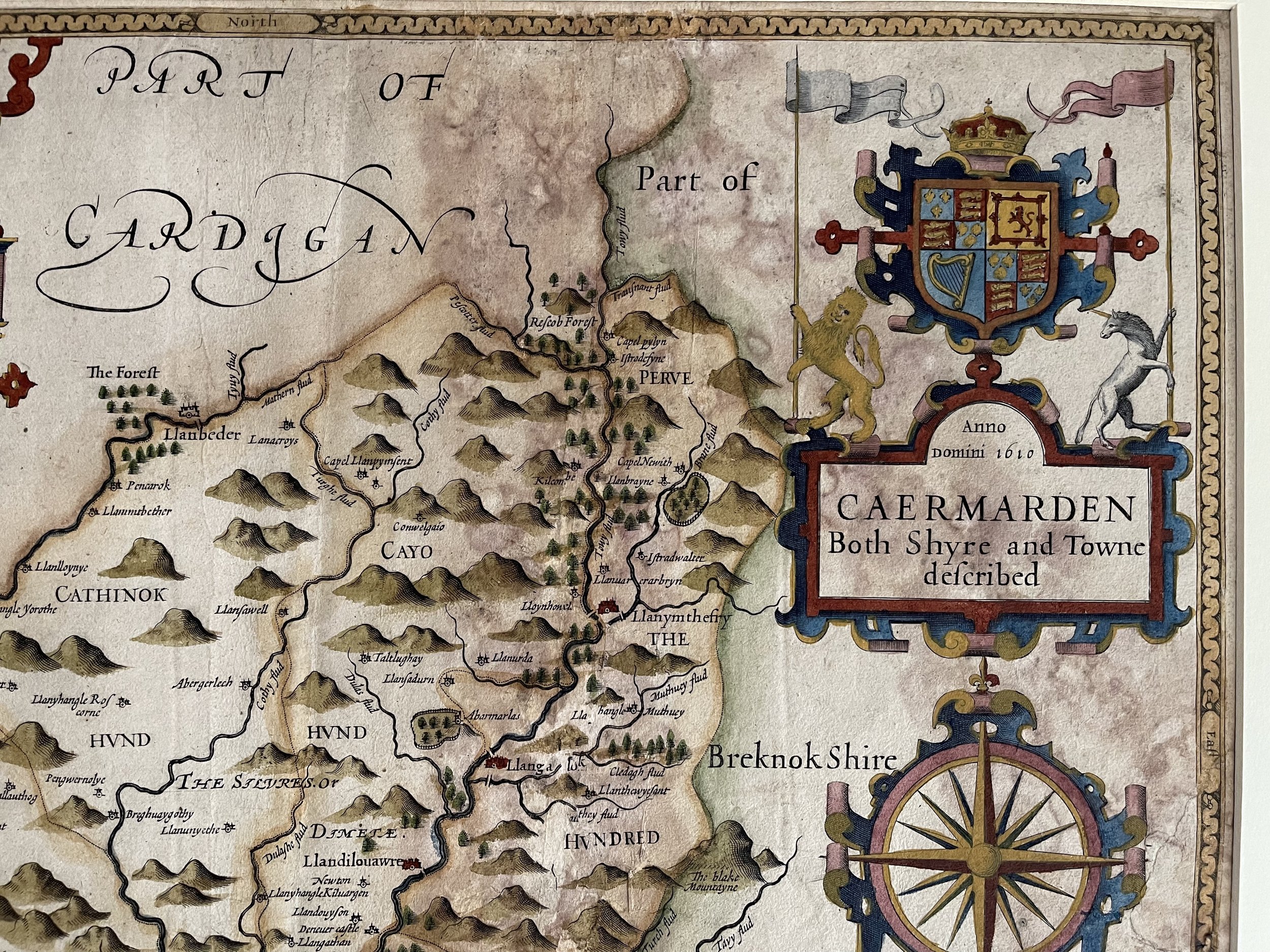

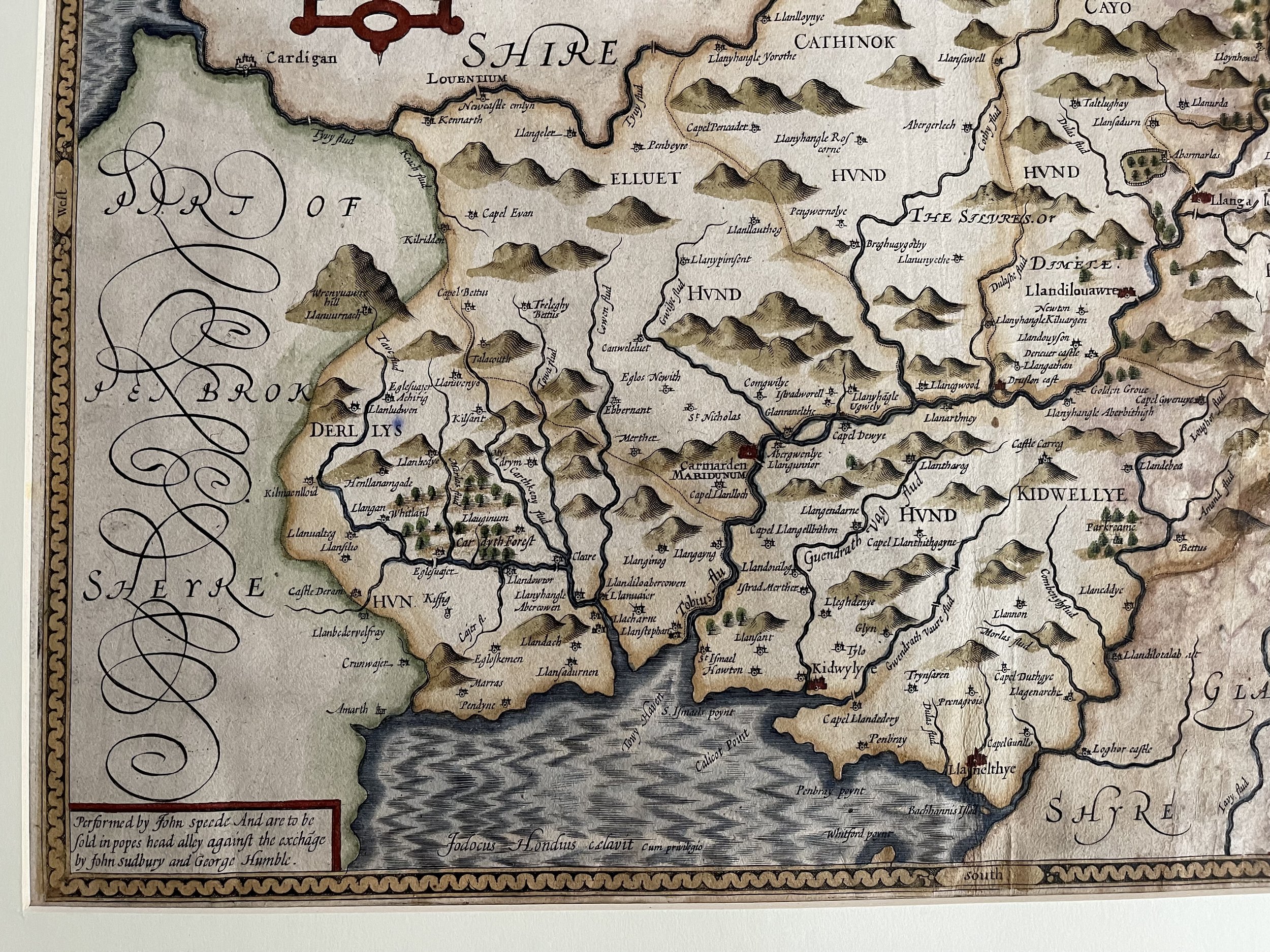
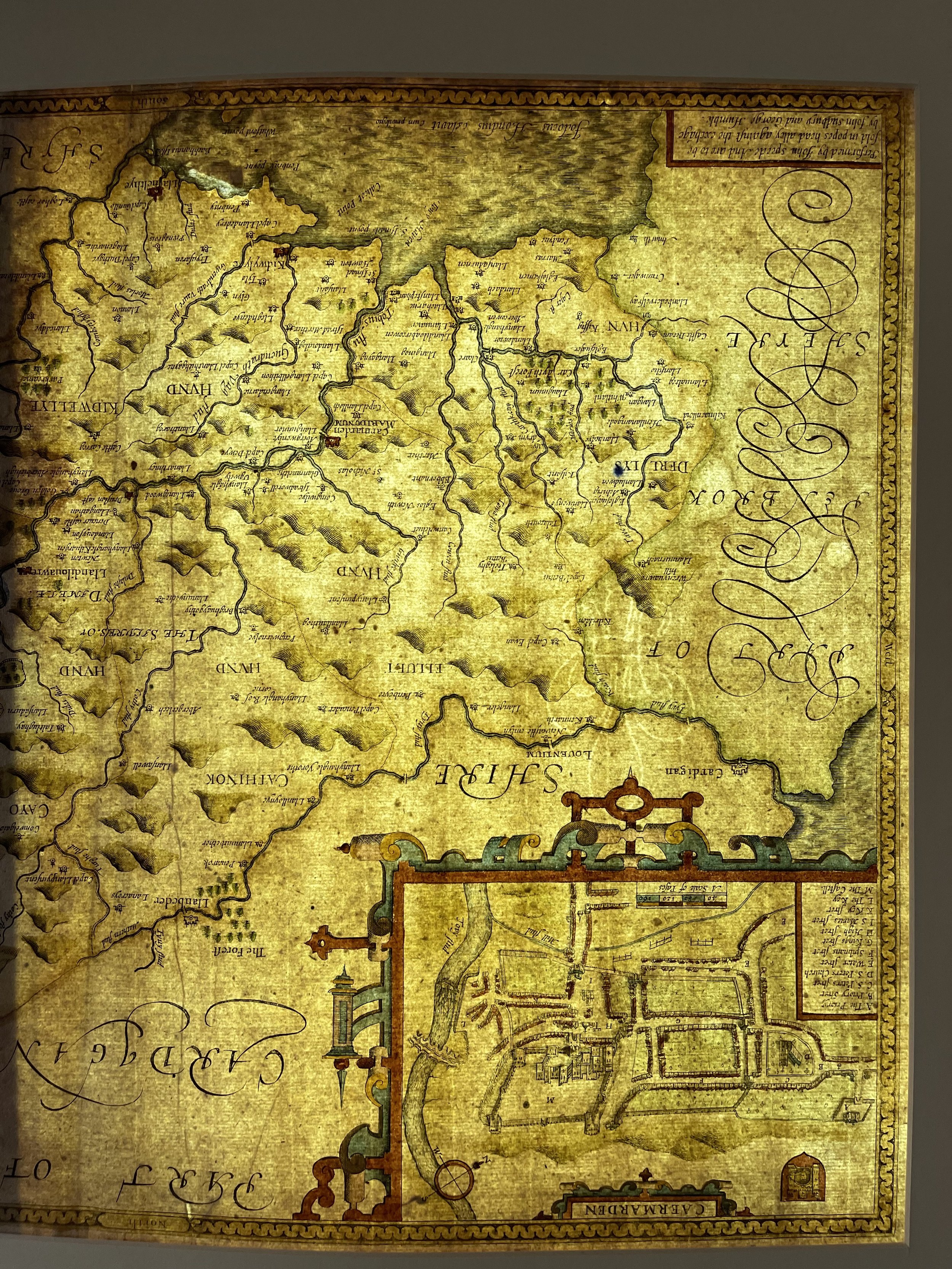
Carmarthen Wales - Caermarden Both Shyre and Towne - John Speed - 1611
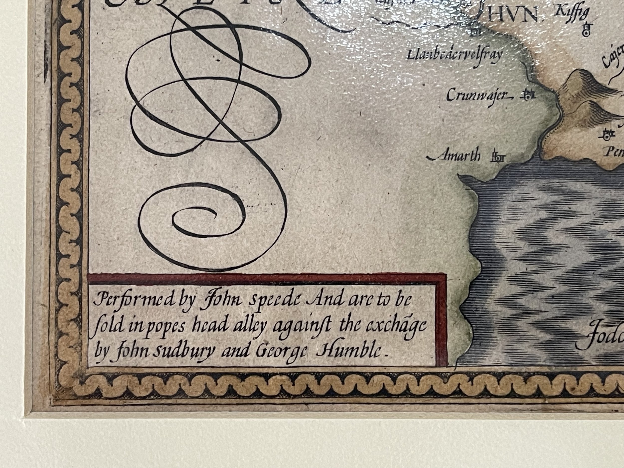
Caermarden Both Shyre and Towne described. Copper engraving, later but not modern hand colouring. Overall size : 55cms.x 42cms. Image size : 500mm.x 377mm. Title in cartouche surmounted by the royal lion and unicorn. Scale of miles and town plan of Caermarden. English text to verso describing the county and how they glory in ‘Merlin who (as they say) was therein borne the sonne of a bad Angell, or of an Incubus spirit, the Britaines great Apolo...’. Centre fold as issued. Cream border mount optional extra.
Water stained unfortunately, hardly noticeable unless you study closely, and this hasn't detracted from the beauty of the engraving.
Provenance - Thomas Chubb The Printed Maps in the Atlases of Great Britain and Ireland 1579-1870, Page 30, Number 13. Performed by John Speede and are to be solde in Popes head Alley against the exchange by John Sudbury and George Humble (SeePhoto). Anno Domini 1610 (Dated under the Carnarvon Arms.
John Speed (1551 or 1552 – 28 July 1629) was an English cartographer, chronologer and historian of Cheshire origins. The son of a citizen and Merchant Taylor in London, he rose from his family occupation to accept the task of drawing together and revising the histories, topographies and maps of the Kingdoms of Great Britain as an exposition of the union of their monarchies in the person of King James I and VI. He accomplished this with remarkable success, with the support and assistance of the leading antiquarian scholars of his generation. He drew upon and improved the shire maps of Christopher Saxton, John Norden and others, being the first to incorporate the hundred-boundaries into them, and he was the surveyor and originator of many of the town or city plans inset within them. His work helped to define early modern concepts of British national identity. His Biblical genealogies were also formally associated with the first edition of the King James Bible. He is among the most famous of English mapmakers.
Code : A47
Cartographer : Cartographer / Engraver / Publisher: John Speed
Date : Publication Place / Date - C1611
Size : Sheet size: Image Size: 58.5 x 46 cm Inclusive of mount
Availability : Available
Type - Genuine - Antique
Grading A-
Where Applicable - Folds as issued. Light box photo shows the folio leaf centre margin hinge ‘glue’, this is not visible otherwise.
Tracked postage, in casement. Please contact me for postal quotation outside of the UK.