Highly detailed large format map of the Southern Hemisphere, showing the tracks of the major voyages of exploration in the Southern Hemisphere from 1595 to 1775.
The map was prepared to illustrate the French edition of Cook's report of his voyages in the region. The map includes the coastlines of Australia, New Zealand and part of SE Asia, Africa and South America. The primary feature of the map is the remarkably detailed depiction of the various voyages in the Southern Hemisphere, including the voyages of Mendana (1595), Quiros (1606), Le Maire and Schoeten (1616), Tasman (1642), Halley (1700), Roggewein (1722), Bouvet (1738-39), Carteret (1767), Wallis (1767), Byron (1768), Bouganville (1768) Cook (1770-75), and others.
In addition to the map is a detailed set of tables of Latitudes and Discoveries, covering approximately 60 islands, bays, and other locales. A highly collectable map.
Detailed map of the Australia and the Indian Ocean, published in Paris by Bellin.
The map extends from South Africa and the Middle East to the west coast of Australia.
Jacques-Nicolas Bellin (1703-1772) is among the most important mapmakers of the 18th Century. Engraver - Jacques Renaud Benard - Robert Bénard (1734 in Paris – 1777) was a French engraver who specialised in the technique of engraving, Robert Bénard is mainly famous for having supplied a significant number of plates (at least 1,800) to the Encyclopédie by Diderot & d'Alembert from 1751. I also have Diderot plates available in my store.
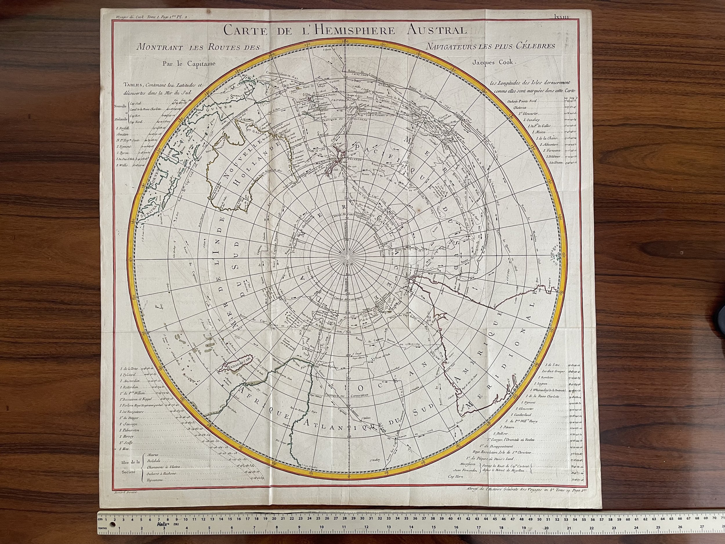 Image 1 of 6
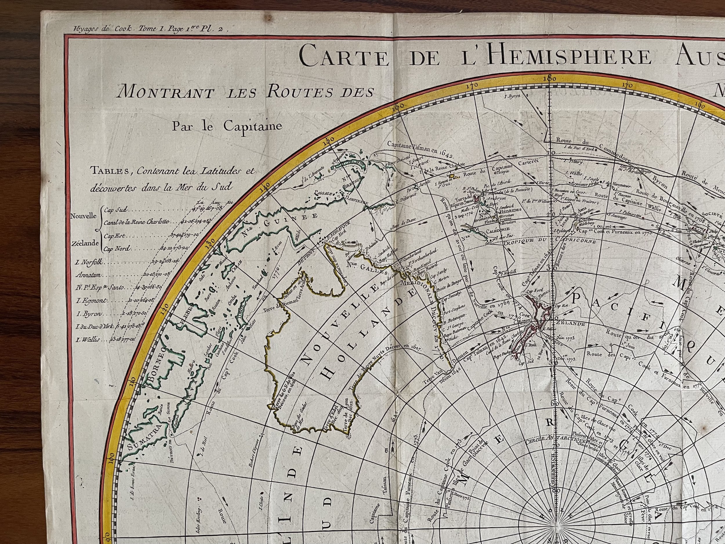 Image 2 of 6
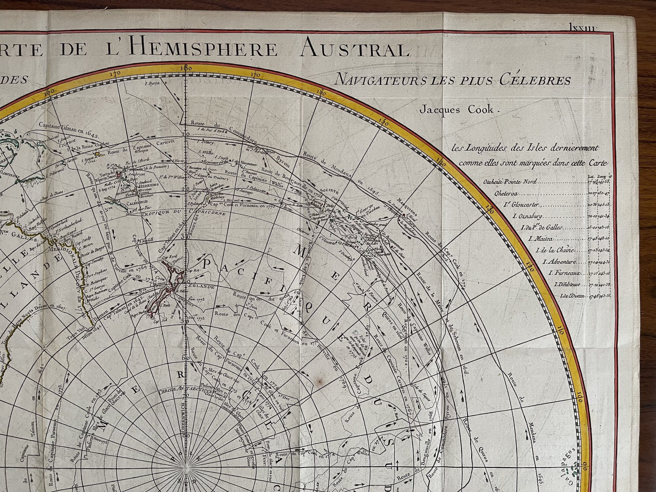 Image 3 of 6
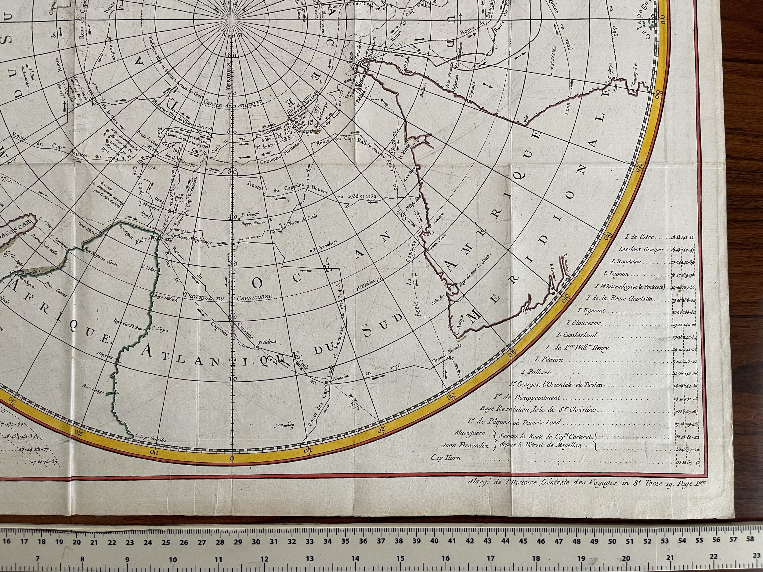 Image 4 of 6
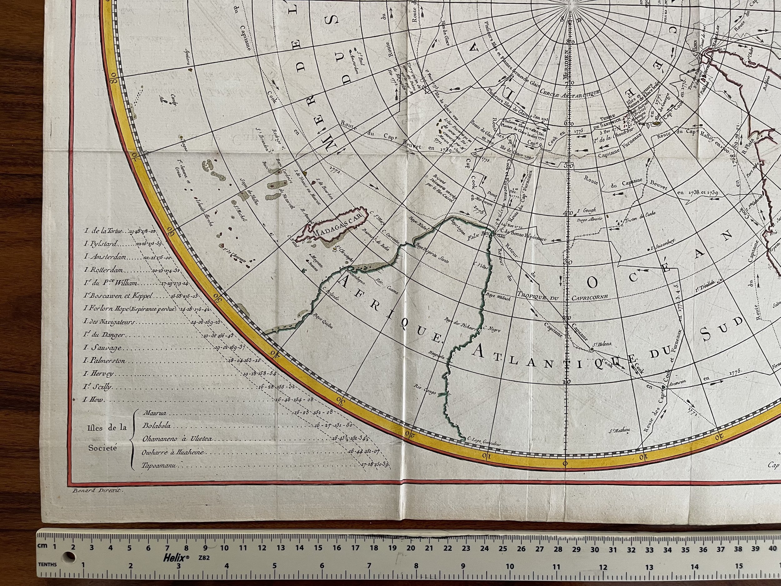 Image 5 of 6
 Image 6 of 6