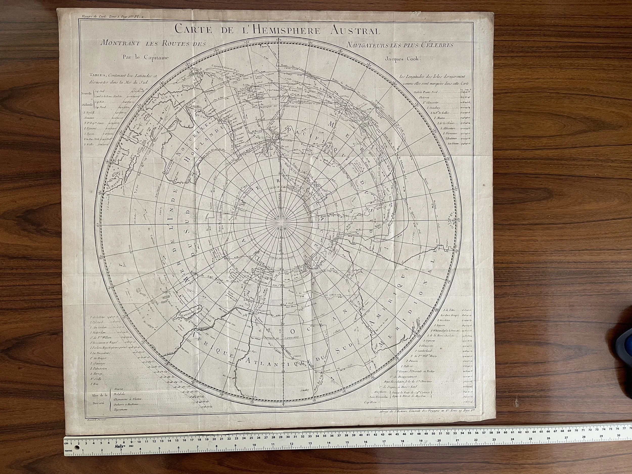
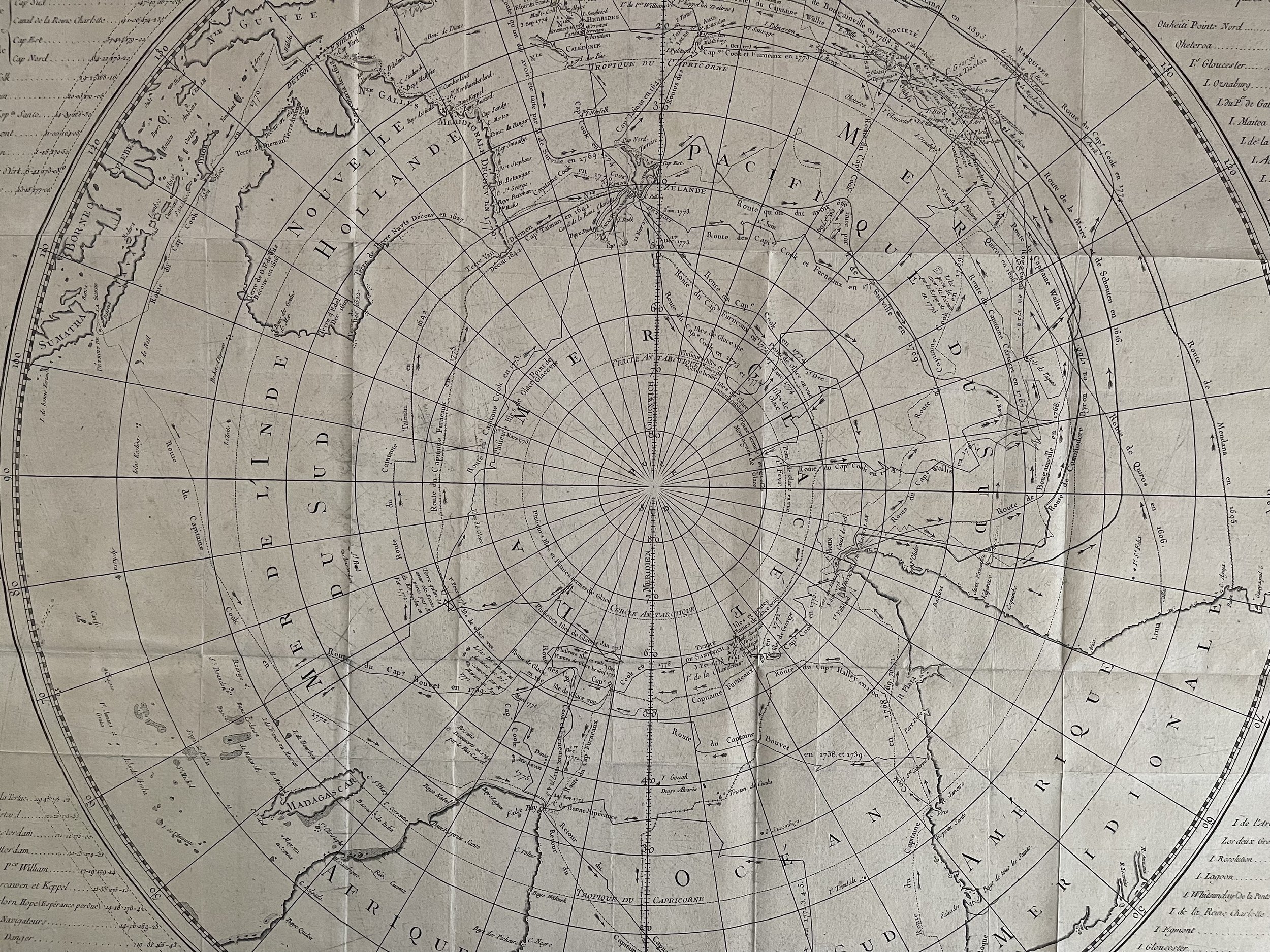
Carte de l'hemisphere Austral - Southern Hemisphere, Australia, Africa, South America - Jacques Renaud Benard / Captain James Cook
Southern Hemisphere, Australia, Africa, South America, map by Cook/Benard, 1775. A Chart of the Southern Hemisphere; showing the Tracks of some of the most distinguished Navigators: By Captain James Cook, of his Majesty's Navy. [French version]
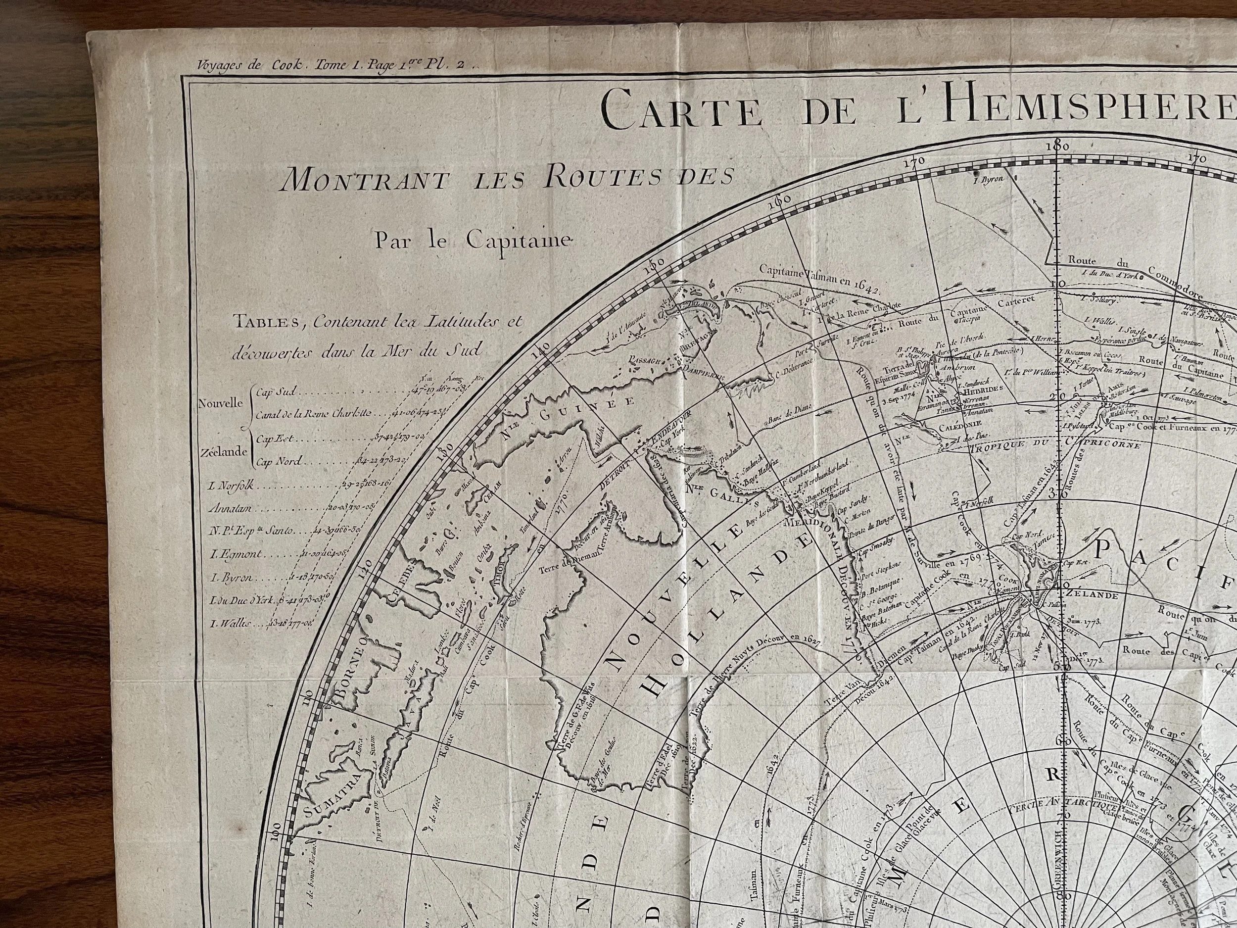
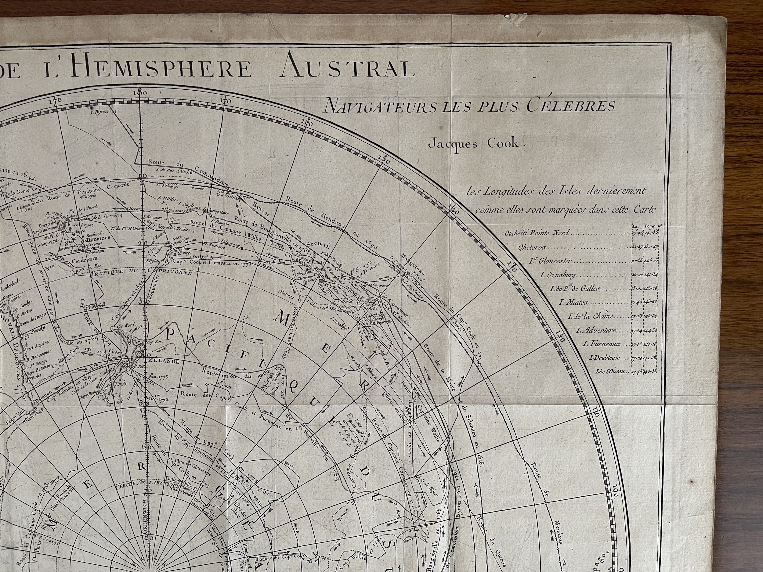
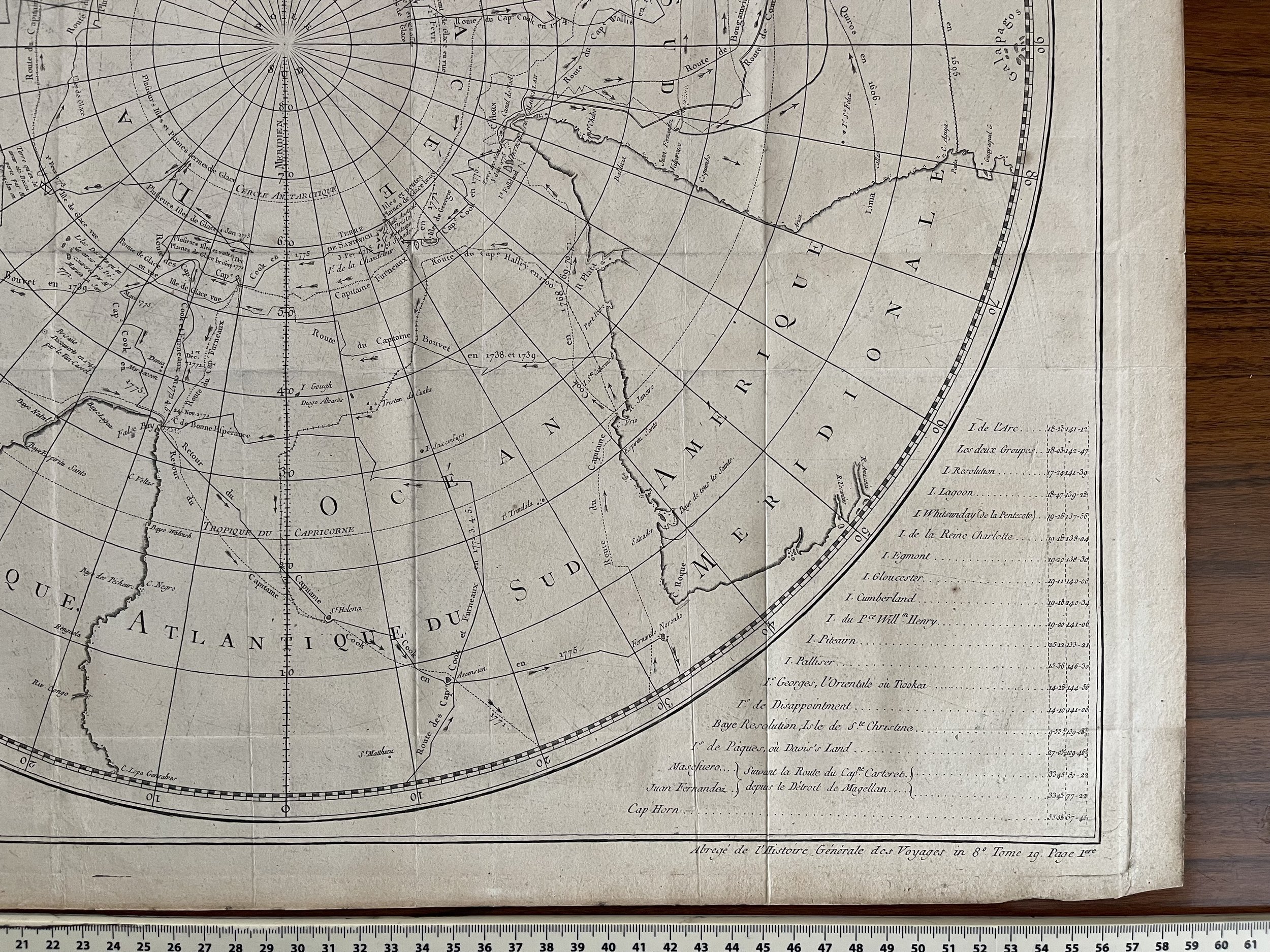
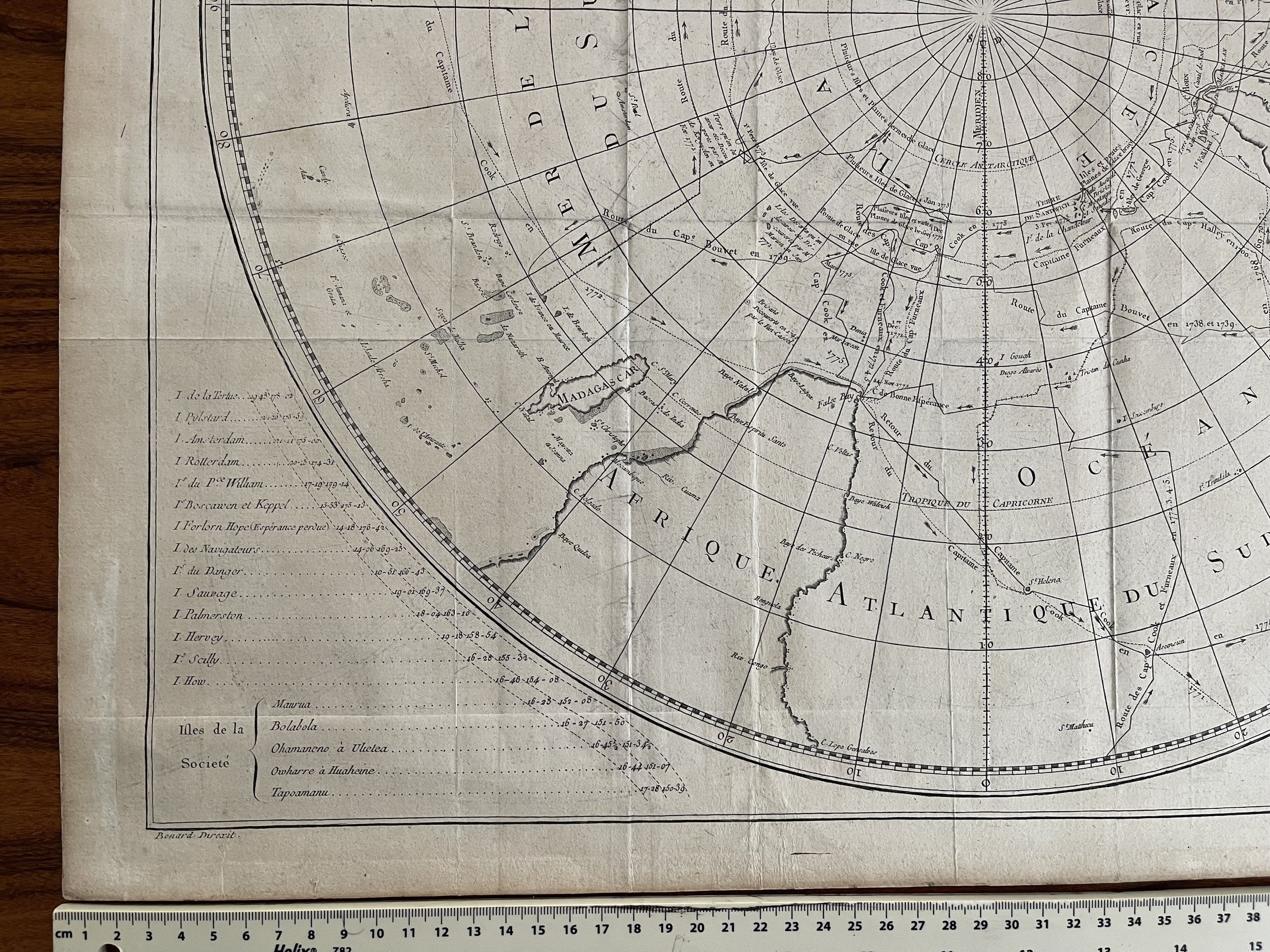
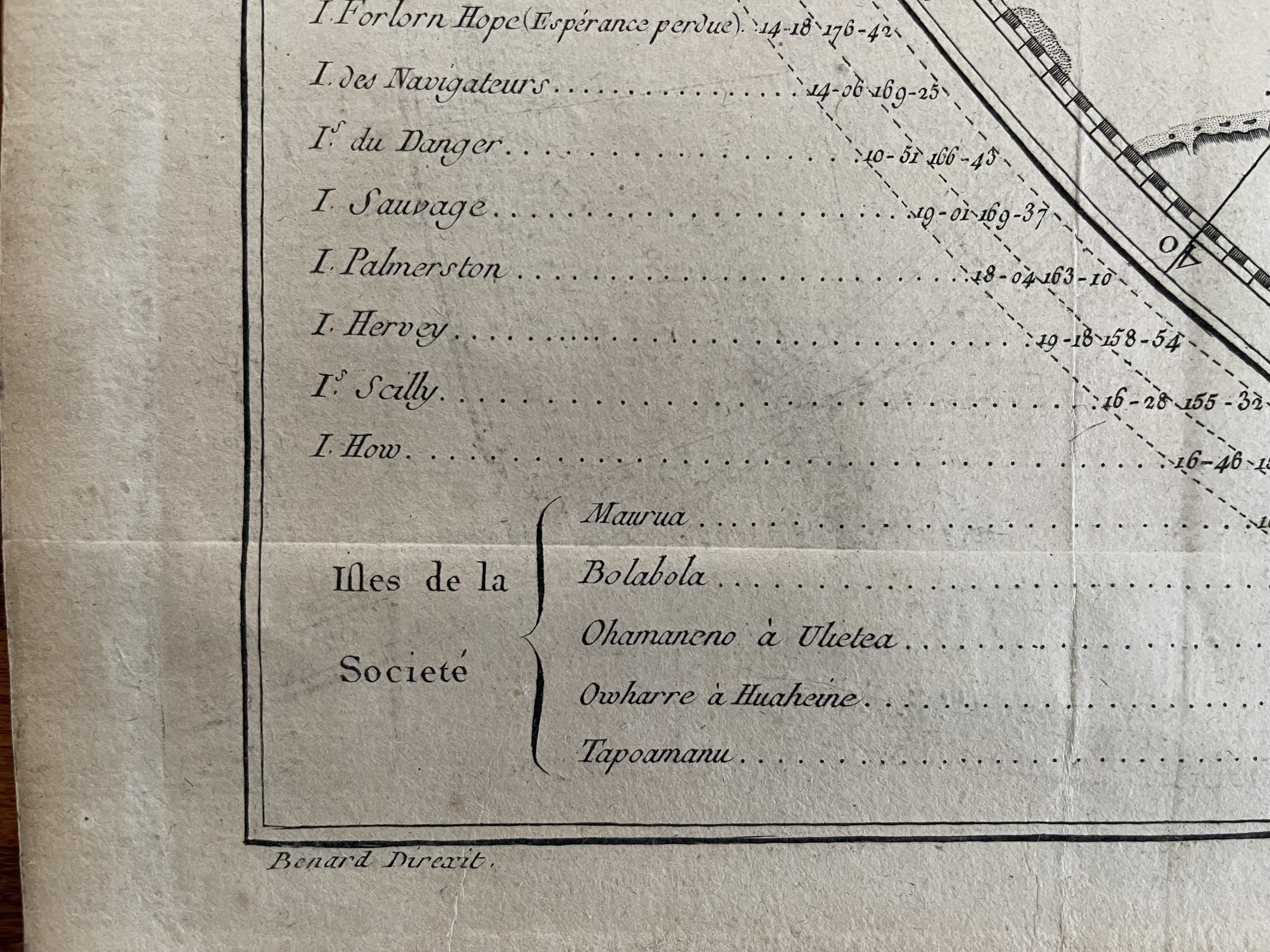
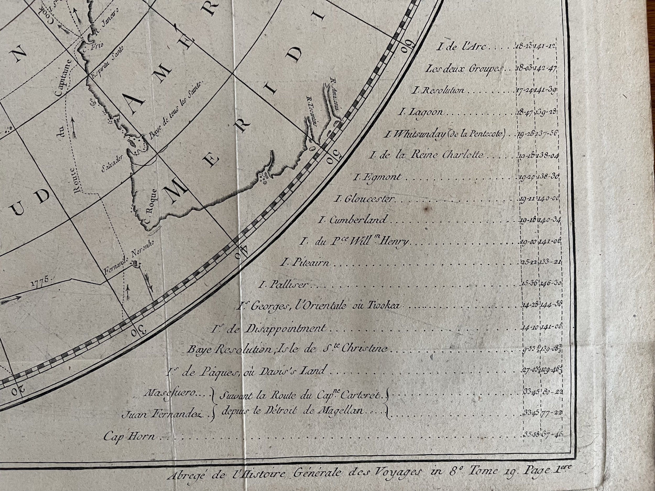
Polar projection map of the Southern Hemisphere with early, speculative coastlines for southern Australia (at this time "New Holland") and Papua New Guinea. With the outlines for South America, Africa and South East Asia from the equator south. This rather densely detailed map marks the tracks of early European explorers, marking the voyages of Cook, Byron, Dampier, Tasman, Bougainville, Furneaux amongst others. Circling the hemisphere, a table listing of the longitude and latitude positions for islands south of the equator.
This piece was originally published in the French edition of "Cook's Voyages", elegantly engraved by Robert Bénard (1734-77) and published by influential Parisian publisher and writer Charles-Joseph Pancoucke (1736-98) in five volumes.
Of particular interest on this map to collector's of both Cook and Antarctic material, and with the map originally being published in a compendium of Captain Cook's achievements, is the route marking his entry into the Antarctic Circle in 1774, during his Second Voyage (1772-75)
Southern Hemisphere, Australia, Africa, South America, map by Cook/Benard, 1775. A Chart of the Southern Hemisphere; showing the Tracks of some of the most distinguished Navigators: By Captain James Cook, of his Majesty's Navy. [French version]
Polar projection map of the Southern Hemisphere with early, speculative coastlines for southern Australia (at this time "New Holland") and Papua New Guinea. With the outlines for South America, Africa and South East Asia from the equator south. This rather densely detailed map marks the tracks of early European explorers, marking the voyages of Cook, Byron, Dampier, Tasman, Bougainville, Furneaux amongst others. Circling the hemisphere, a table listing of the longitude and latitude positions for islands south of the equator.
This piece was originally published in the French edition of "Cook's Voyages", elegantly engraved by Robert Bénard (1734-77) and published by influential Parisian publisher and writer Charles-Joseph Pancoucke (1736-98) in five volumes.
Of particular interest on this map to collector's of both Cook and Antarctic material, and with the map originally being published in a compendium of Captain Cook's achievements, is the route marking his entry into the Antarctic Circle in 1774, during his Second Voyage (1772-75)
Code : A417
Cartographer : Cartographer / engraver: Captain Cook / Jacques Renaud Benard / Jaques Nicolas Bellin
Date : 1775-1778
Size : Sheet size: 60cm X 55cm
Availability : Available
Type - Genuine Antique
Grading - A