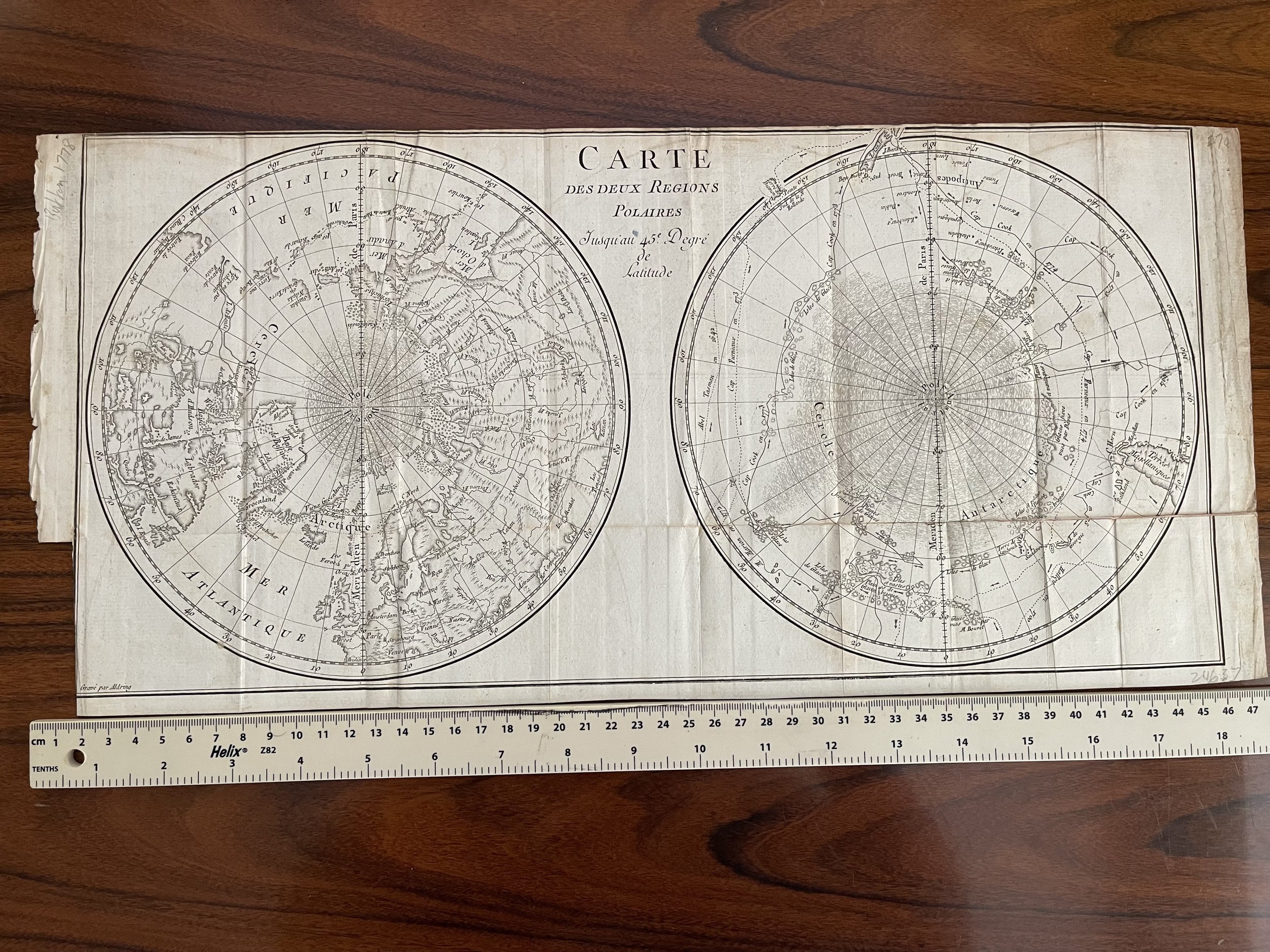
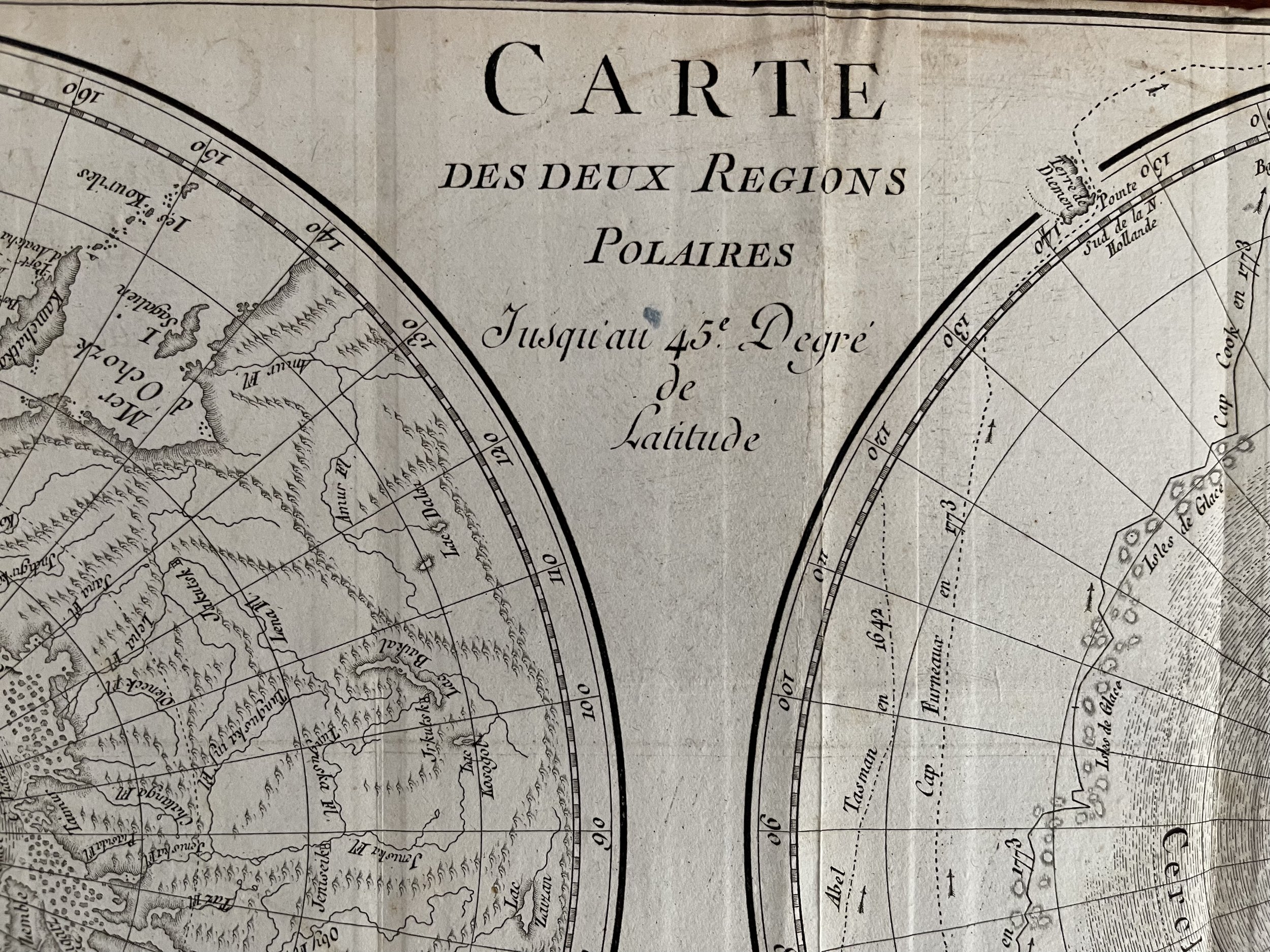
Carte Des Deux Regions Polaires, Paris, Antique World Map on a double hemispheric polar projection - Georges-Louis Leclerc de Buffon - 1778
Antique World Map on a double hemispheric polar projection
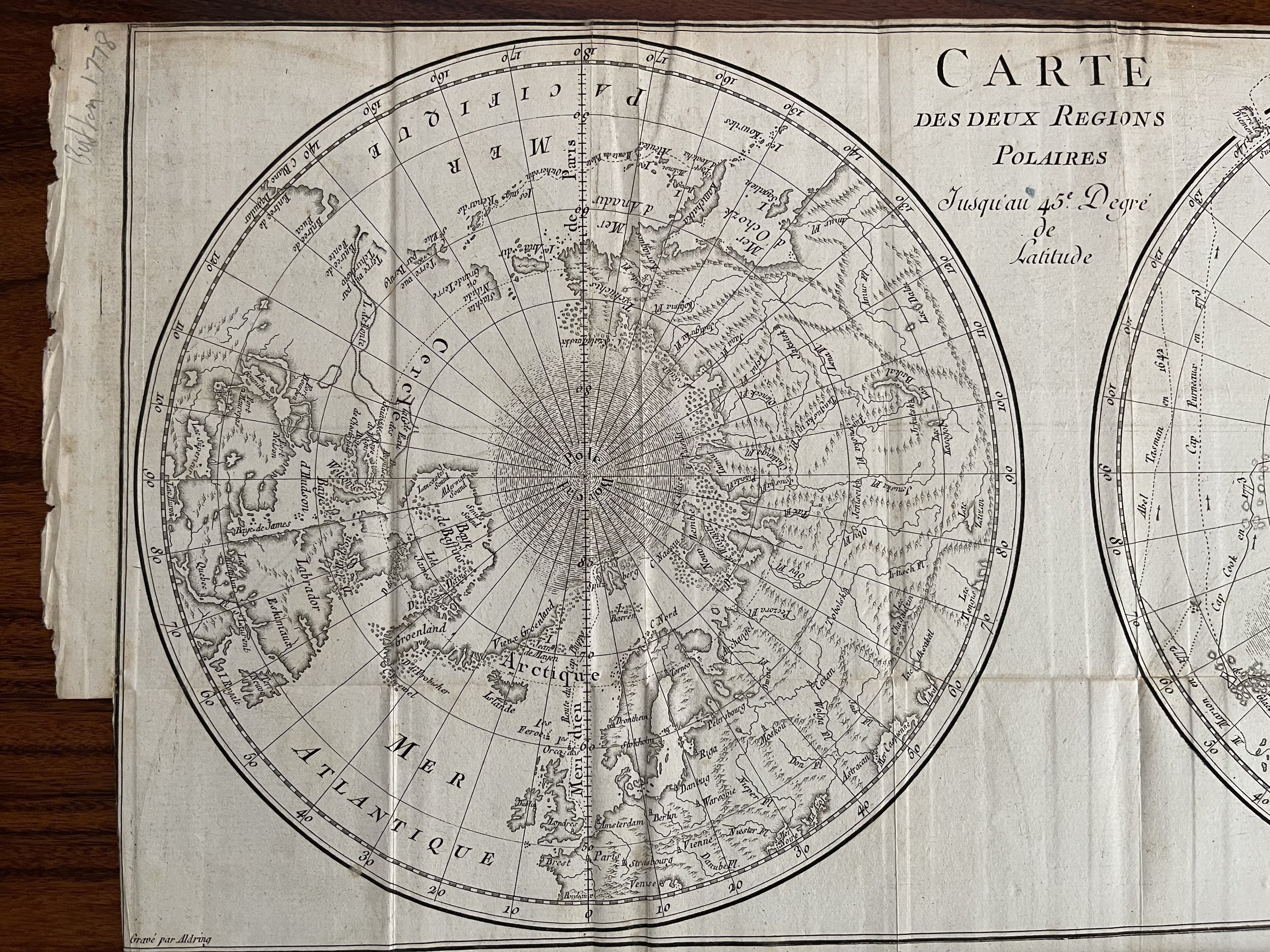
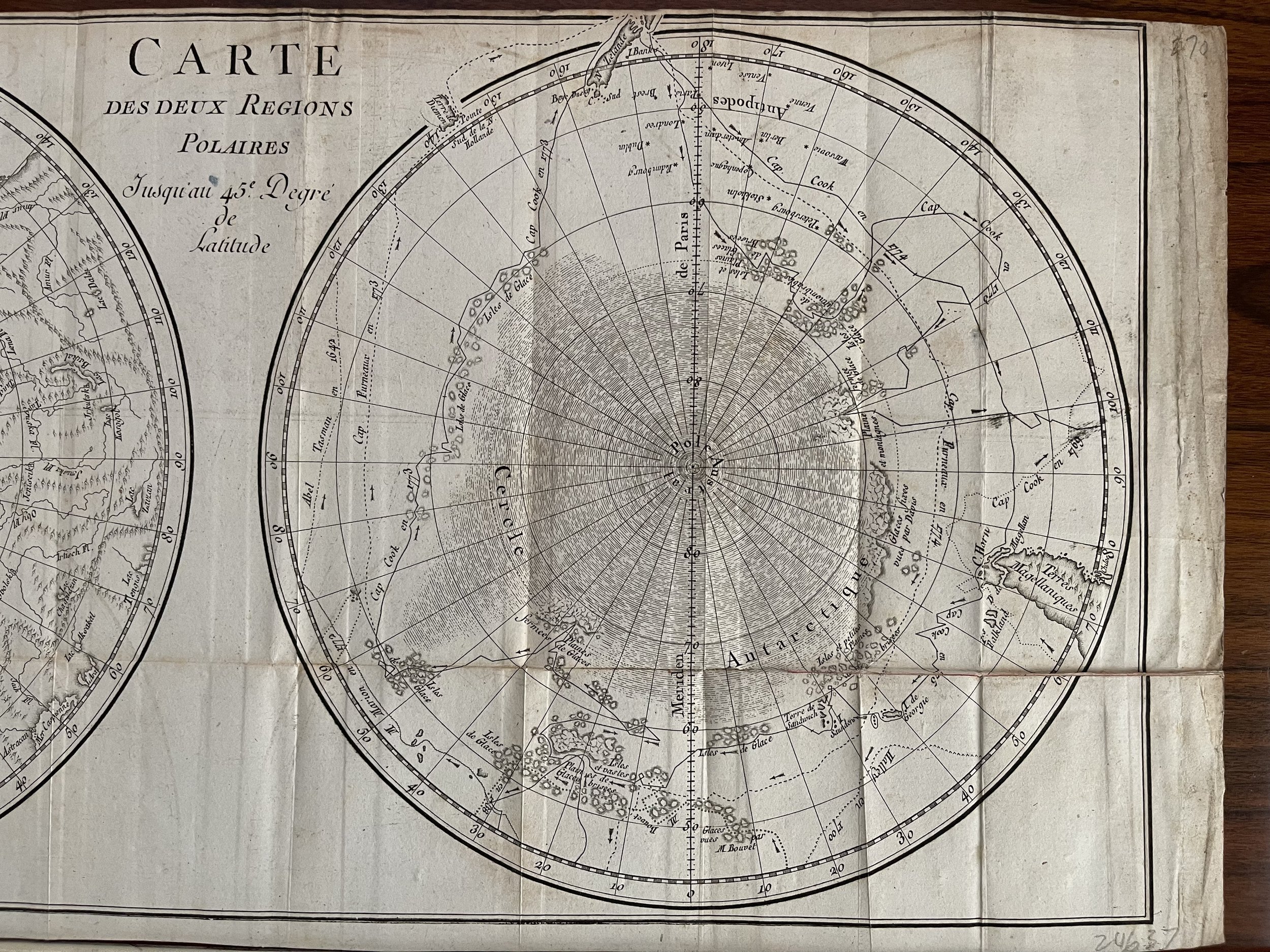
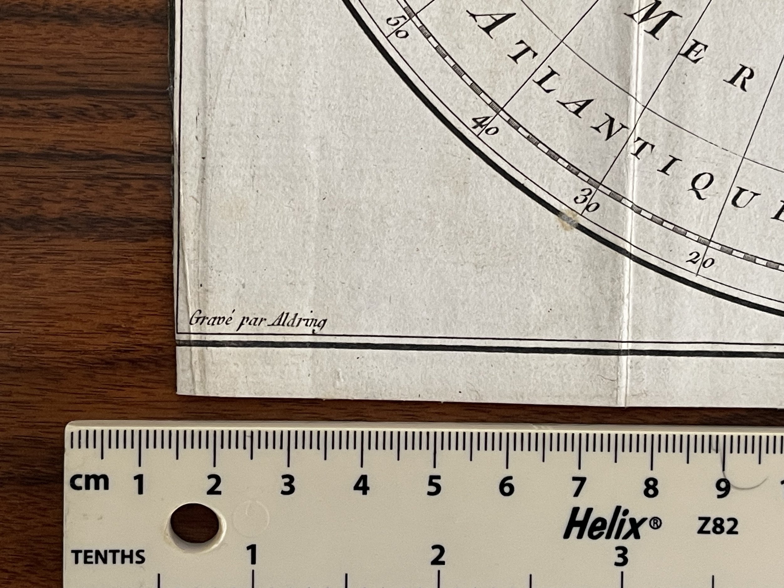
Rare map of the World on a polar projection, showing a contemporary knowledge of the Polar latitudes, including the routes of Abel Tasman, James Cook, Edmund Halley, and Furneaux and Marion in the South Polar Regions. The map is derived from works on the French Exploration of the South Pacific issued after 1773. The treatment of the NW Coast of America also reflects the information derived from Russian explorers in the mid-18th Century.
This map is from the Comte de Buffon's Histoire naturelle, générale et particulière. Specifically, it occurs at the end of Vol. 5 of the 7-volume Supplement a l'Histoire Naturelle, published in Paris in 1778.
Georges-Louis Leclerc de Buffon was a French naturalist in charge of the French royal natural history collection for much of the 18th Century. The principal product of Buffon's scientific and literary labors, Histoire naturelle, générale et particulière, was a work of vast magnitude (44 volumes total) and exceptional influence, the first volumes of which appeared in 1749; the set was completed posthumously in 1804. Buffon (1707 -1788) is best remembered for this work of great scientific importance which influenced the next two generations of naturalists, including Charles Darwin.
17.5 x 8.5 inches. First edition Paris 1778, originally as part of the Supplement a l'Histoire Naturelle marked Tome XIII top left. This brilliantly evocative map shows recent voyages of Cook, Tasman, Halley, Furneaux and Marion in the Southern hemisphere, an incomplete west coast of the Americas and a spurious Northwest passage.
Book Description Buffon G., 1707-88, 1707. Carte Des Deux Regions Polaires, Paris / 1778 Rare map of the World on a polar projection, showing a contemporary knowledge of the Polar latitudes, including the routes of Abel Tasman, James Cook, Edmund Halley., Furneaux and Marion in the South Polar Regions. The map is derived from works on the French Exploration of the South Pacific issued after 1773. The treatment of the NW Coast of America also reflects the information derived from Russian explorers in the mid-18th Century. This map is from the Comte de Buffon's Histoire naturelle, générale et particulière. Specifically, it occurs at the end of Vol. 5 of the 7-volume Supplement a l'Histoire Naturelle, published in Paris in 1778.
Buffon, Georges, Comte de (1707-1788) French naturalist who became keeper of the French botanical gardens. At first, he believed in Leibniz's Law of Continuity and disagreed with Linnaeus's system of nomenclature, maintaining that a species was an artificial category. He changed his mind, however, when he found that the offspring of some plant hybridizations were sterile. He proposed identifying species through their reproductive histories, with two animals belonging to the same species if they can produce fertile offspring. His monumental life's work, Historie Naturelle (Natural History) (1749), ran to 36 volumes and tried to show the continuity of nature. Buffon had no concept of evolution, believing that species are fixed. Buffon was a believer in Vitalism, Eric Weisstein's World of Chemistry stating that living organisms possessed "matiére vive" (living matter). He also speculated on the origin of the Earth, Eric Weisstein's World of Astronomy suggesting that it might have been created by the collision of a comet Eric Weisstein's World of Astronomy with the Sun. Eric Weisstein's World of Astronomy Based on the cooling rate of iron, he calculated that the age of the Earth Eric Weisstein's World of Astronomy was 75,000 years. This proclamation was condemned by the Catholic Church in France, who burned Buffon's books. Buffon also proposed the Buffon's needle problem, Eric Weisstein's World of Math which asks the probability that a needle of length l will fall on a line when a piece of paper is ruled with parallel lines a distance d apart. References Roger, J. Buffon: A Life in Natural History. Ithaca, NY: Cornell University Press, 1997
Antique World Map on a double hemispheric polar projection
Rare map of the World on a polar projection, showing a contemporary knowledge of the Polar latitudes, including the routes of Abel Tasman, James Cook, Edmund Halley, and Furneaux and Marion in the South Polar Regions. The map is derived from works on the French Exploration of the South Pacific issued after 1773. The treatment of the NW Coast of America also reflects the information derived from Russian explorers in the mid-18th Century.
This map is from the Comte de Buffon's Histoire naturelle, générale et particulière. Specifically, it occurs at the end of Vol. 5 of the 7-volume Supplement a l'Histoire Naturelle, published in Paris in 1778.
Georges-Louis Leclerc de Buffon was a French naturalist in charge of the French royal natural history collection for much of the 18th Century. The principal product of Buffon's scientific and literary labors, Histoire naturelle, générale et particulière, was a work of vast magnitude (44 volumes total) and exceptional influence, the first volumes of which appeared in 1749; the set was completed posthumously in 1804. Buffon (1707 -1788) is best remembered for this work of great scientific importance which influenced the next two generations of naturalists, including Charles Darwin.
17.5 x 8.5 inches. First edition Paris 1778, originally as part of the Supplement a l'Histoire Naturelle marked Tome XIII top left. This brilliantly evocative map shows recent voyages of Cook, Tasman, Halley, Furneaux and Marion in the Southern hemisphere, an incomplete west coast of the Americas and a spurious Northwest passage.
Book Description Buffon G., 1707-88, 1707. Carte Des Deux Regions Polaires, Paris / 1778 Rare map of the World on a polar projection, showing a contemporary knowledge of the Polar latitudes, including the routes of Abel Tasman, James Cook, Edmund Halley., Furneaux and Marion in the South Polar Regions. The map is derived from works on the French Exploration of the South Pacific issued after 1773. The treatment of the NW Coast of America also reflects the information derived from Russian explorers in the mid-18th Century. This map is from the Comte de Buffon's Histoire naturelle, générale et particulière. Specifically, it occurs at the end of Vol. 5 of the 7-volume Supplement a l'Histoire Naturelle, published in Paris in 1778.
Buffon, Georges, Comte de (1707-1788) French naturalist who became keeper of the French botanical gardens. At first, he believed in Leibniz's Law of Continuity and disagreed with Linnaeus's system of nomenclature, maintaining that a species was an artificial category. He changed his mind, however, when he found that the offspring of some plant hybridizations were sterile. He proposed identifying species through their reproductive histories, with two animals belonging to the same species if they can produce fertile offspring. His monumental life's work, Historie Naturelle (Natural History) (1749), ran to 36 volumes and tried to show the continuity of nature. Buffon had no concept of evolution, believing that species are fixed. Buffon was a believer in Vitalism, Eric Weisstein's World of Chemistry stating that living organisms possessed "matiére vive" (living matter). He also speculated on the origin of the Earth, Eric Weisstein's World of Astronomy suggesting that it might have been created by the collision of a comet Eric Weisstein's World of Astronomy with the Sun. Eric Weisstein's World of Astronomy Based on the cooling rate of iron, he calculated that the age of the Earth Eric Weisstein's World of Astronomy was 75,000 years. This proclamation was condemned by the Catholic Church in France, who burned Buffon's books. Buffon also proposed the Buffon's needle problem, Eric Weisstein's World of Math which asks the probability that a needle of length l will fall on a line when a piece of paper is ruled with parallel lines a distance d apart. References Roger, J. Buffon: A Life in Natural History. Ithaca, NY: Cornell University Press, 1997
Code : A94
Cartographer : Cartographer / Engraver / Publisher: Georges-Louis Leclerc de Buffon
Date : Paris 1778 Approx
Size : Sheet size: 17.5 x 8.5 inches.
Availability : Available
Type - Genuine Antique
Grading - B+
Tracked postage. in tubular casement. Please contact me for postal quotation outside of the UK.