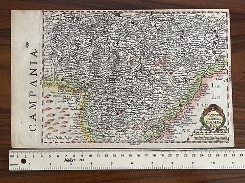
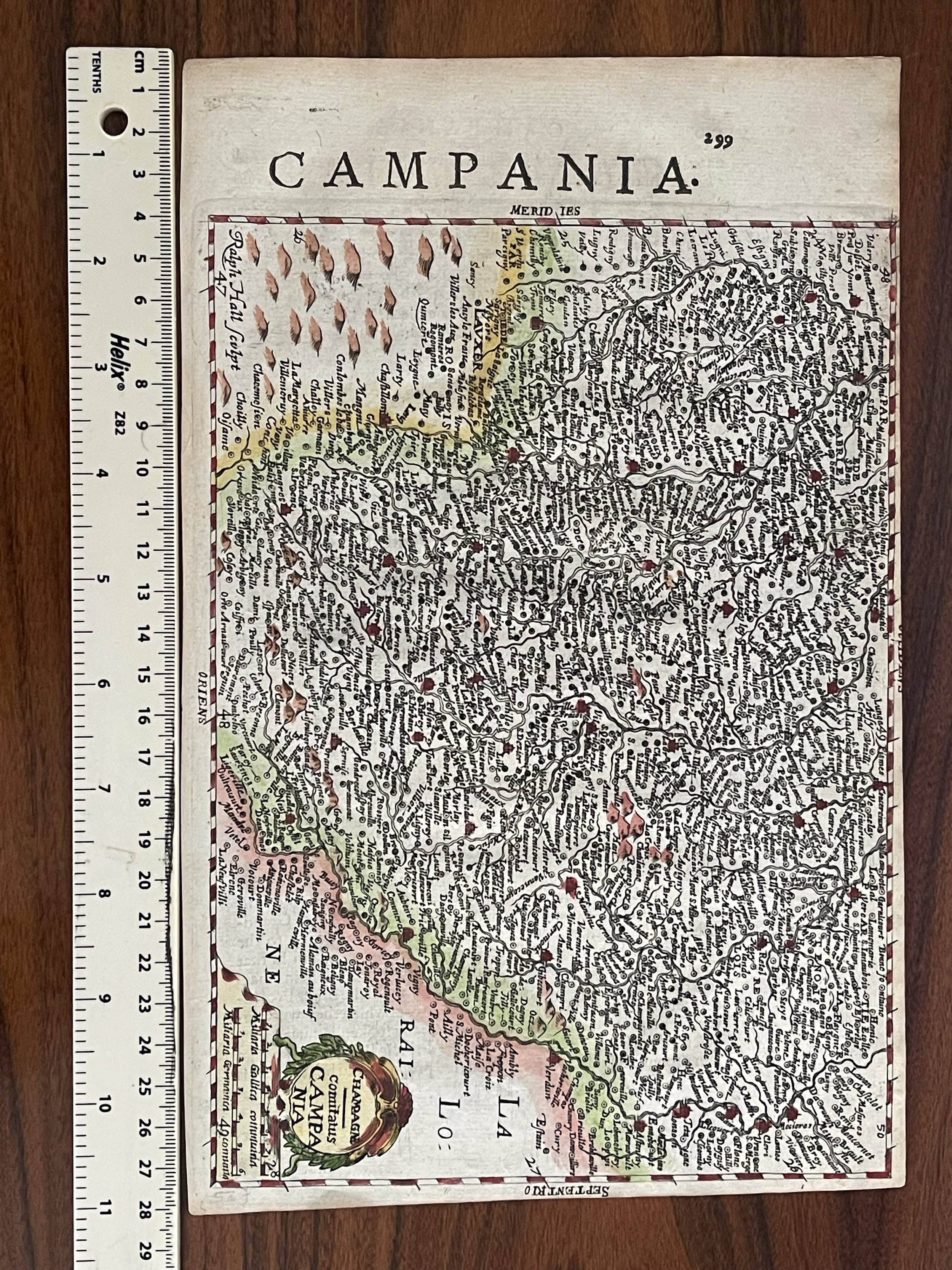
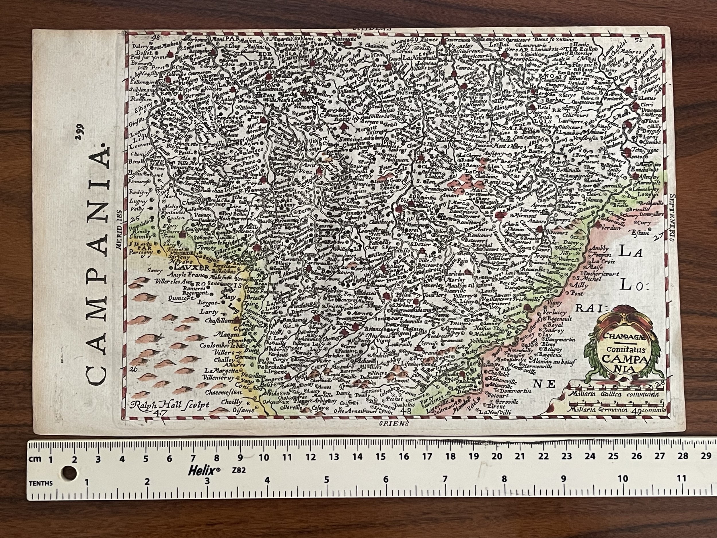
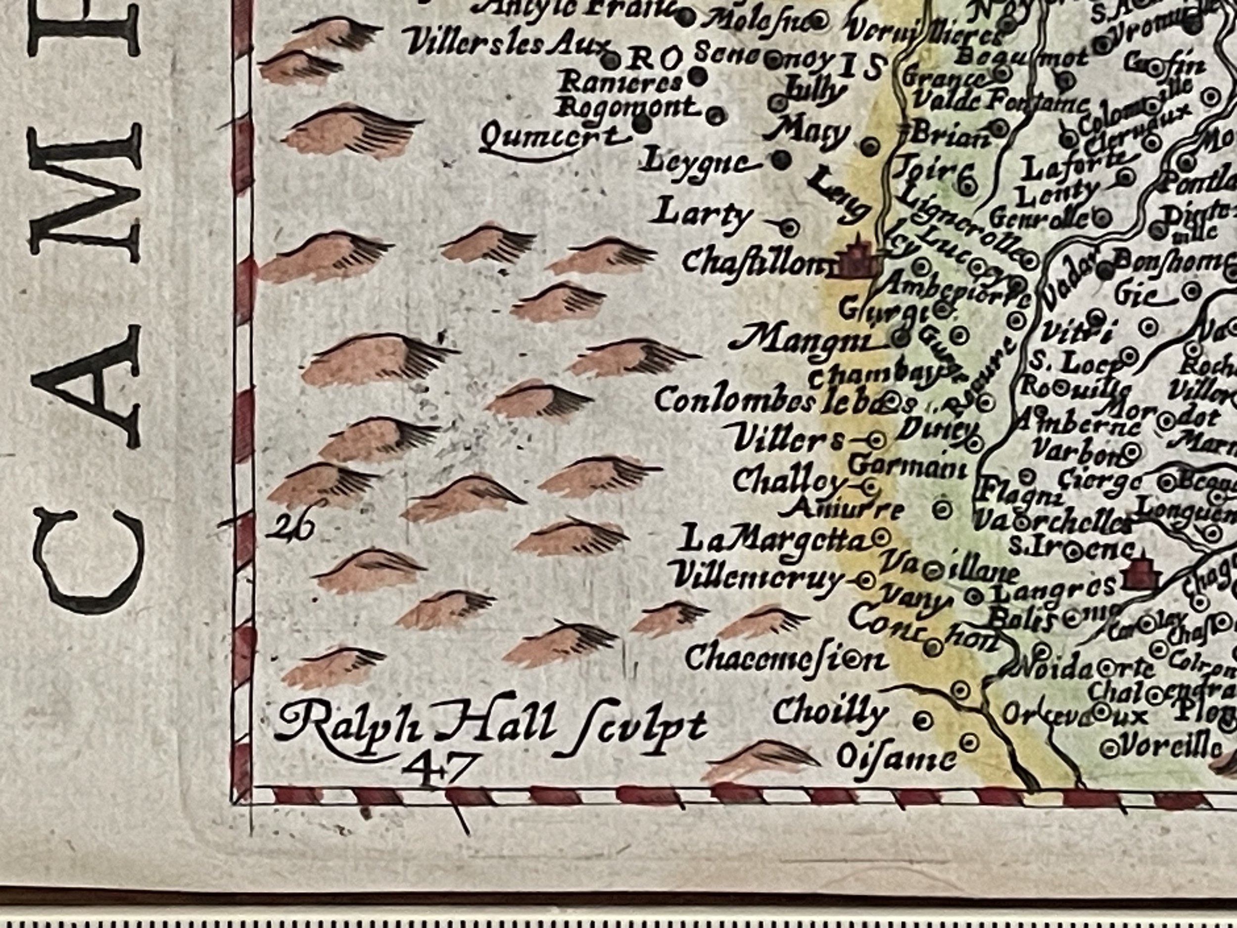
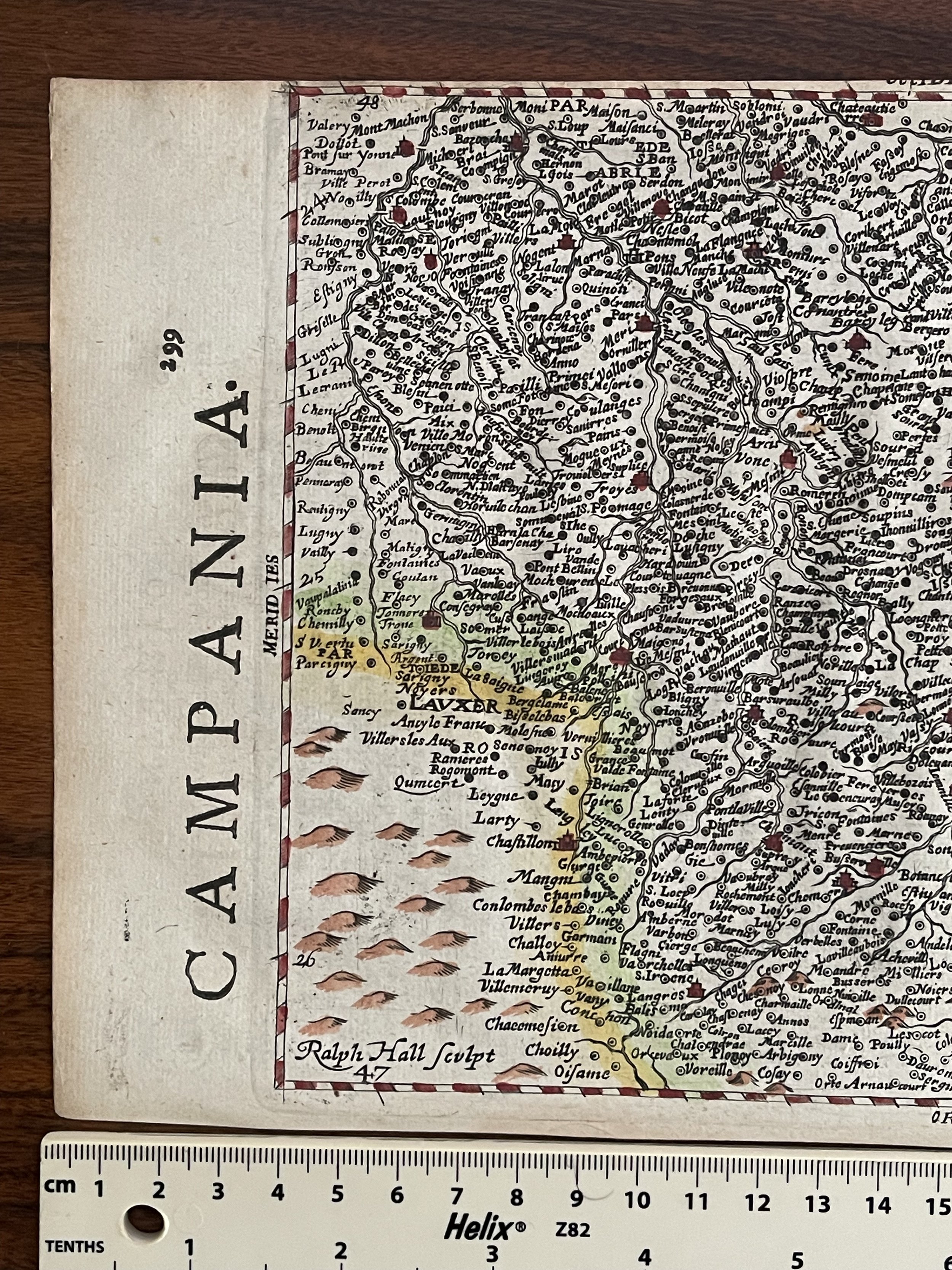
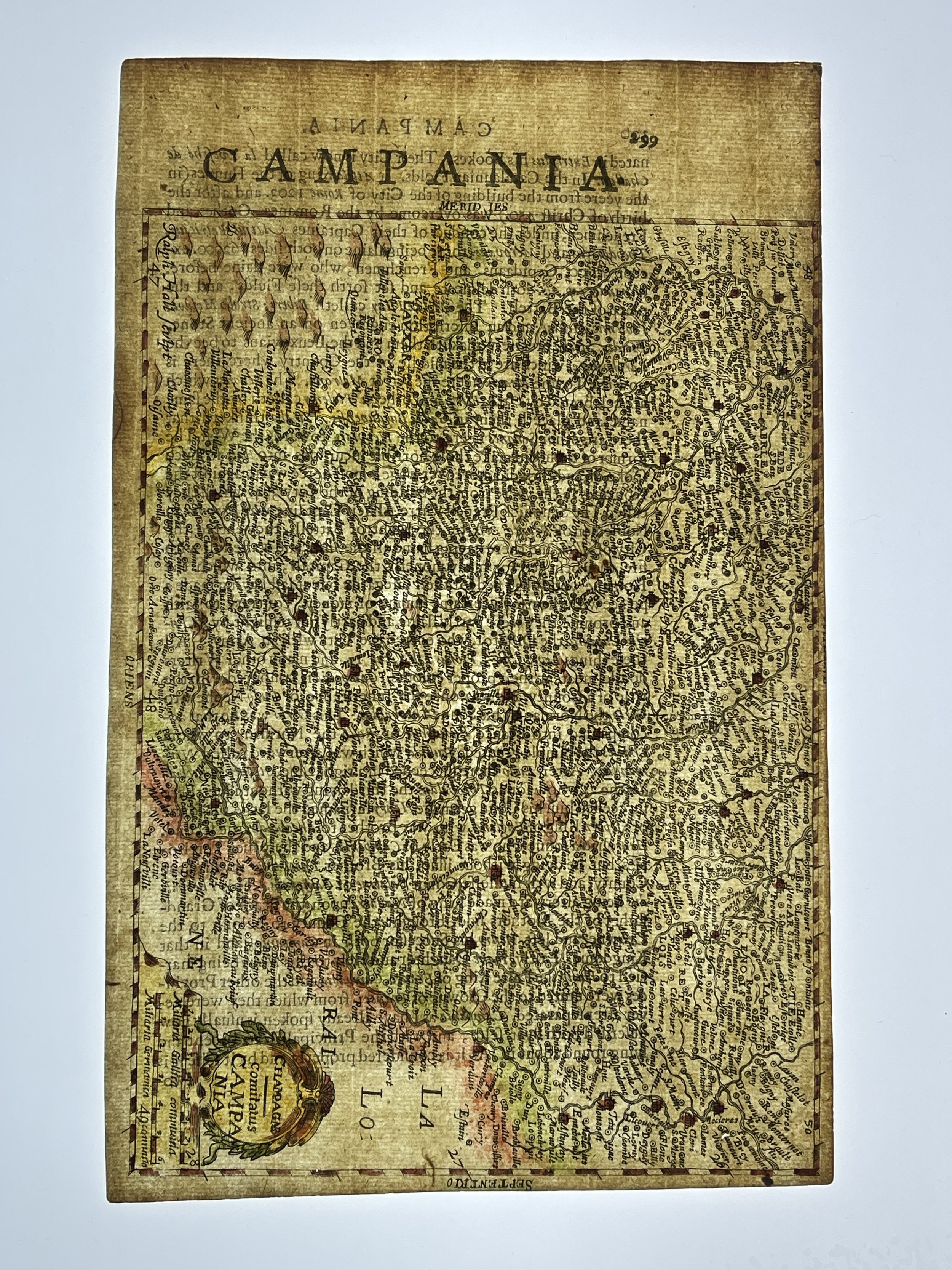
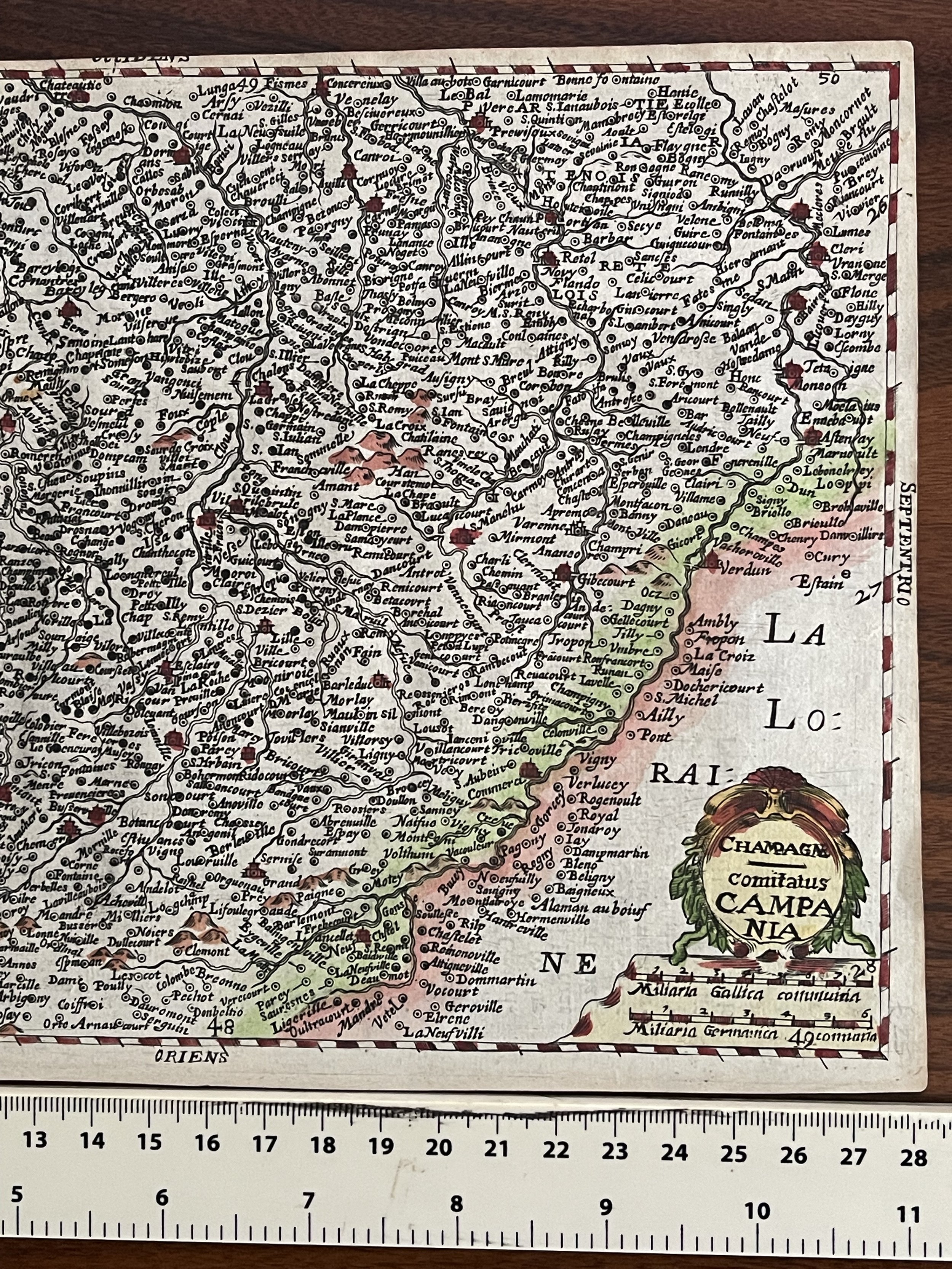
CHAMPAGNE comitatus CAMPANIA, France - Gerard Mercator / Hondius / Ralph Hall - 1637
This map comes from the English edition of Mercator's Atlas Minor, which was published under the title Historia Mundi or Mercators Atlas by Michael Spark and Samuel Cartwright. After acquiring the plates to the 1607 edition of the Mercator/Hondius Atlas Minor, Sparke republished the maps with text translated into English by Wye Saltonstall. Sparke also had 41 additional maps engraved for the Historia Mundi. Most of these maps were copied from Cloppenburg's edition of Atlas Minor and are therefore a bit larger, with some signed by the engravers Jacob van Langren and Ralph Hall. These additional maps only appeared in the 1635, 1637 and 1639 editions of the Historia Mundi and are therefore quite scarce. Period script on verso.
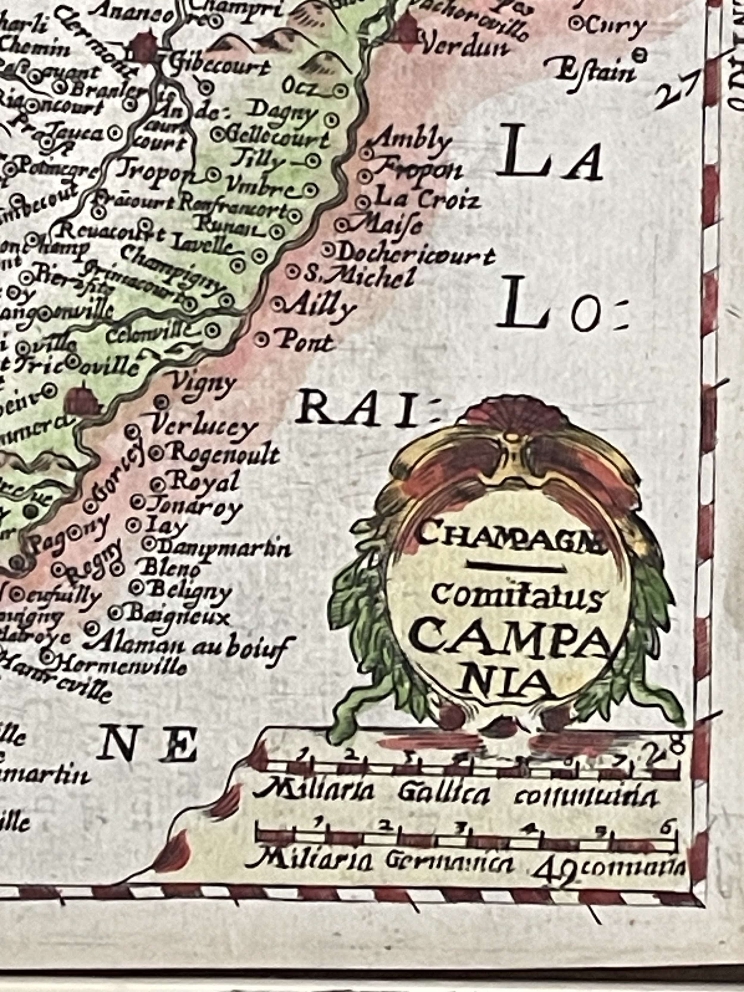
Ralph Hall sculpt
Copper engraving first issued by Flemish engraver Jodocus Hondius (1563-1612) in Atlas Minor c.1620. Hondius' work was largely comprised of reductions of Mercators plates. Several editions followed under various titles.
This example, with English text verso and with additional typeset English titles in the left margin, was issued in Historia Mundi: or Mercators Atlas containing his Cosmographical Description of the Fabricke and Figure of the World...London, T. Cotes for Michael Sparke and Samuel Cartwright, 1637.
Signed by engraver Ralph Hall (fl.1635-1639). Little is certain about Ralph Hall but he was possibly the Ralph Hall baptised 8 Jul 1610 at St. Mary Magdalene, Old Fish Street, London. Apprenticed to engraver Robert Vaughan (1597?-1663) for eleven years in September 1622. Most maps in The Hondius work are unsigned but it is likely that others were engraved by Hall.
Gerardus Mercator – (5 March 1512 – 2 December 1594) was a Flemish geographer, cosmographer and cartographer. He is most renowned for creating the 1569 world map based on a new projection which represented sailing courses of constant bearing (rhumb lines) as straight lines—an innovation that is still employed in nautical charts. Mercator was a notable maker of globes and scientific instruments. In addition, he had interests in theology, philosophy, history, mathematics and geomagnetism. He was also an accomplished engraver and calligrapher.
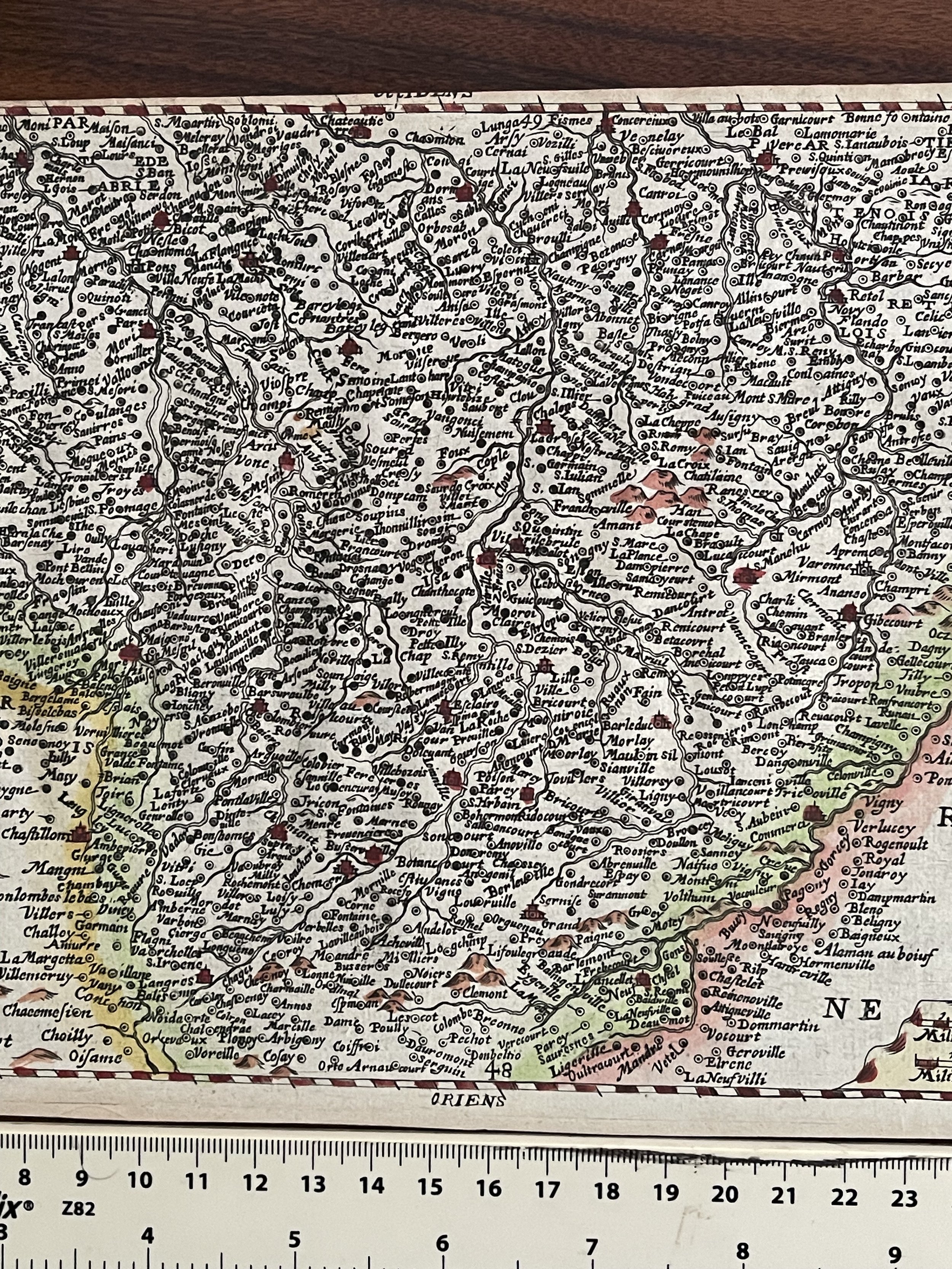
This map comes from the English edition of Mercator's Atlas Minor, which was published under the title Historia Mundi or Mercators Atlas by Michael Spark and Samuel Cartwright. After acquiring the plates to the 1607 edition of the Mercator/Hondius Atlas Minor, Sparke republished the maps with text translated into English by Wye Saltonstall. Sparke also had 41 additional maps engraved for the Historia Mundi. Most of these maps were copied from Cloppenburg's edition of Atlas Minor and are therefore a bit larger, with some signed by the engravers Jacob van Langren and Ralph Hall. These additional maps only appeared in the 1635, 1637 and 1639 editions of the Historia Mundi and are therefore quite scarce. Period script on verso.
Ralph Hall sculpt
Copper engraving first issued by Flemish engraver Jodocus Hondius (1563-1612) in Atlas Minor c.1620. Hondius' work was largely comprised of reductions of Mercators plates. Several editions followed under various titles.
This example, with English text verso and with additional typeset English titles in the left margin, was issued in Historia Mundi: or Mercators Atlas containing his Cosmographical Description of the Fabricke and Figure of the World...London, T. Cotes for Michael Sparke and Samuel Cartwright, 1637.
Signed by engraver Ralph Hall (fl.1635-1639). Little is certain about Ralph Hall but he was possibly the Ralph Hall baptised 8 Jul 1610 at St. Mary Magdalene, Old Fish Street, London. Apprenticed to engraver Robert Vaughan (1597?-1663) for eleven years in September 1622. Most maps in The Hondius work are unsigned but it is likely that others were engraved by Hall.
Gerardus Mercator – (5 March 1512 – 2 December 1594) was a Flemish geographer, cosmographer and cartographer. He is most renowned for creating the 1569 world map based on a new projection which represented sailing courses of constant bearing (rhumb lines) as straight lines—an innovation that is still employed in nautical charts. Mercator was a notable maker of globes and scientific instruments. In addition, he had interests in theology, philosophy, history, mathematics and geomagnetism. He was also an accomplished engraver and calligrapher.
Code : A169
Cartographer : Cartographer / Engraver / Publisher: Ralph Hall
Date : Publication Place / Date - 1637
Size : Sheet size: Image Size: 28 cm x 17.5 cm
Availability : Available
Type - Genuine - Antique
Grading A
Where Applicable - Folds as issued. Light box photo shows the folio leaf centre margin hinge ‘glue’, this is not visible otherwise.
Tracked postage, in casement. Please contact me for postal quotation outside of the UK.