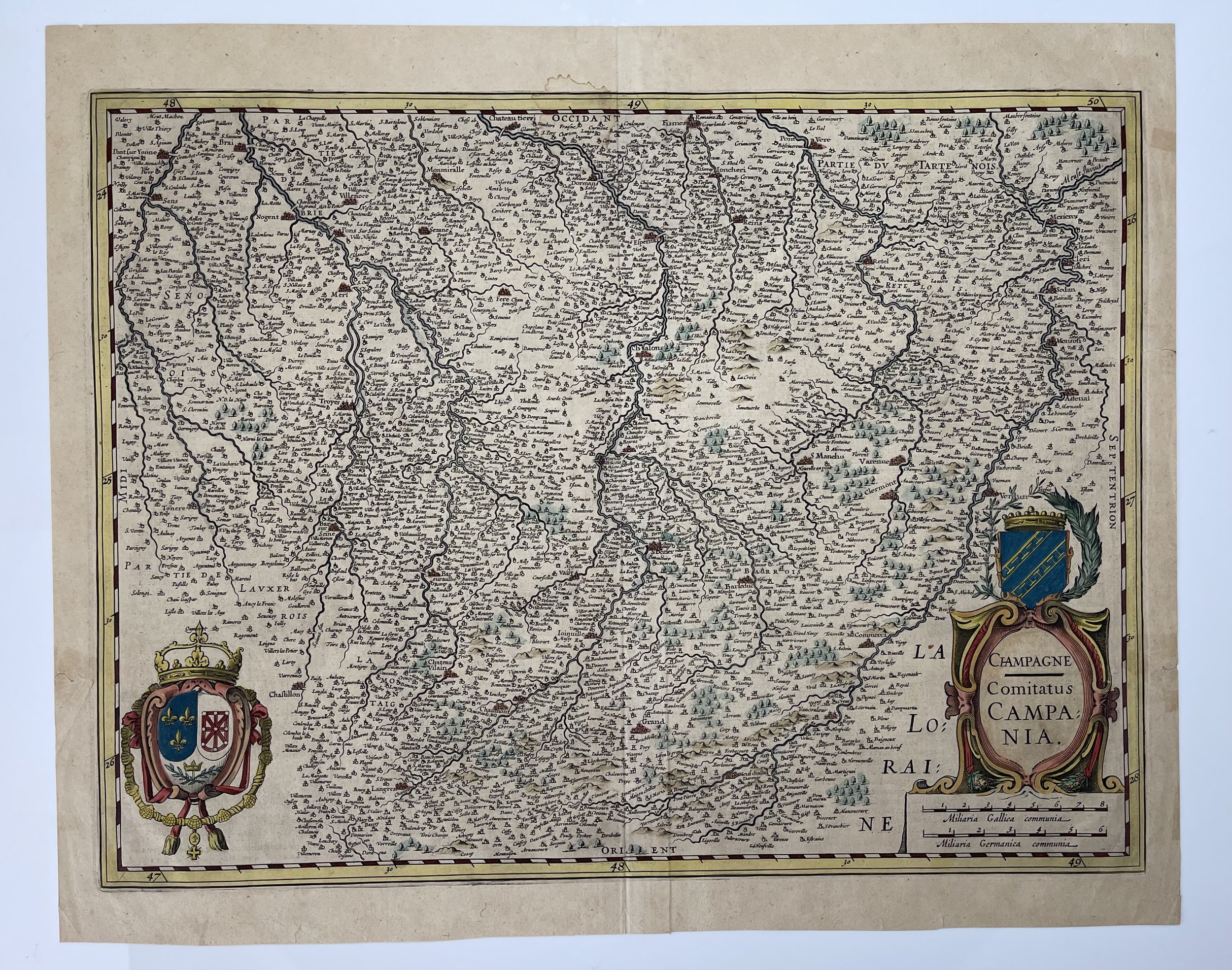
Champagne - Comitatus Campania - France - Johannes Janssonius / Jodocus Hendricus Hondius - 1638
France - Champagne Comitatus Campania Old Map Janssonius 1638
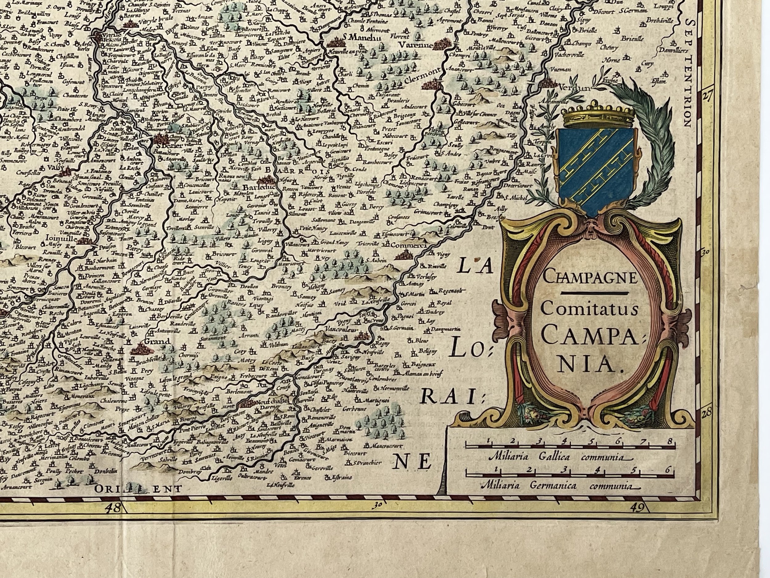
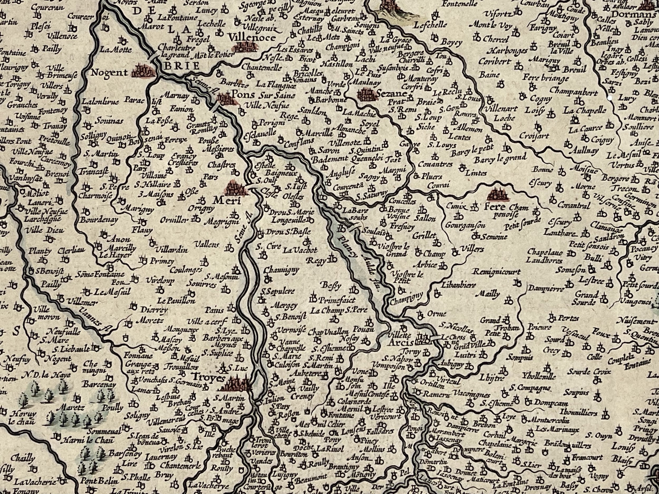
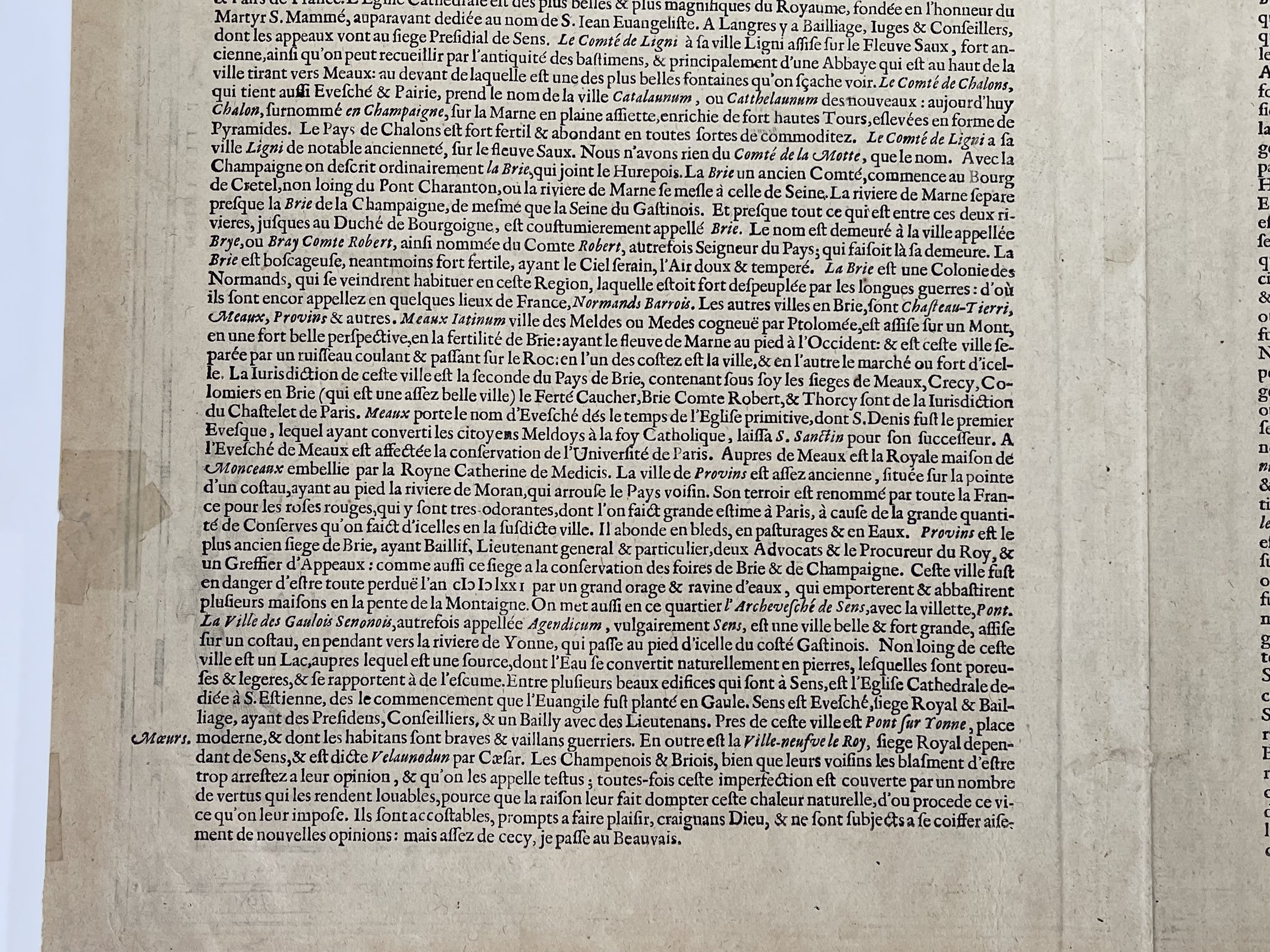
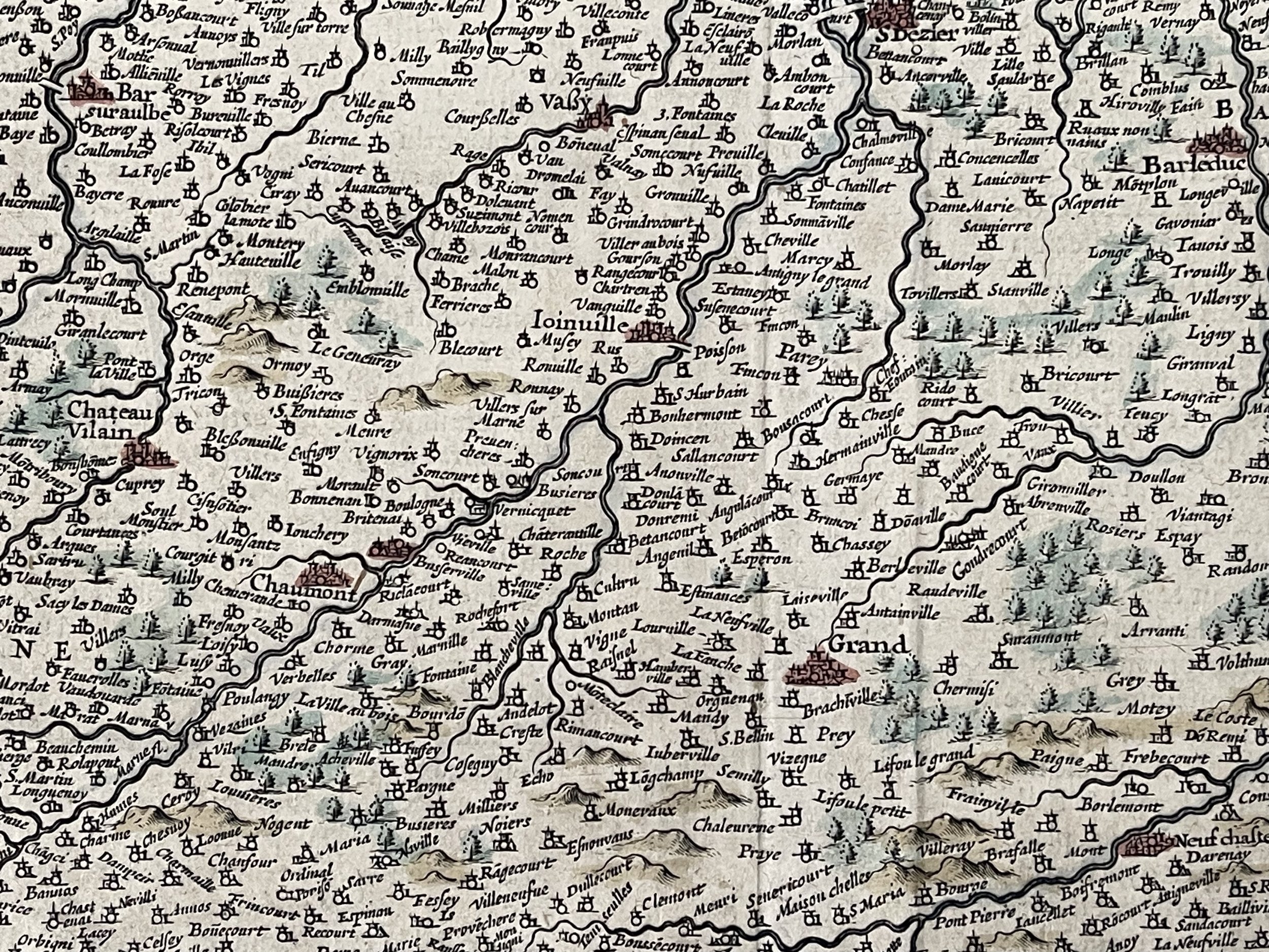
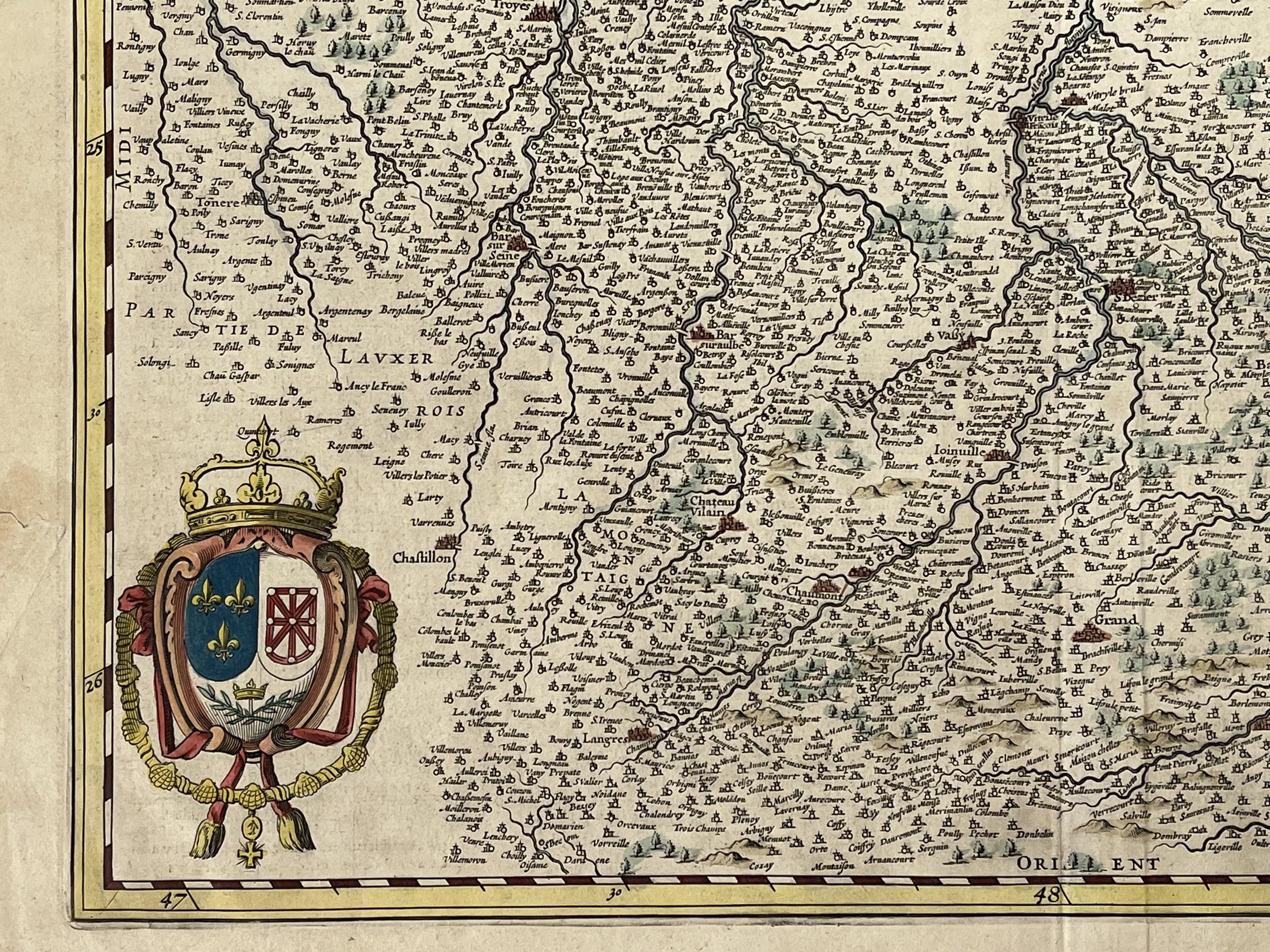
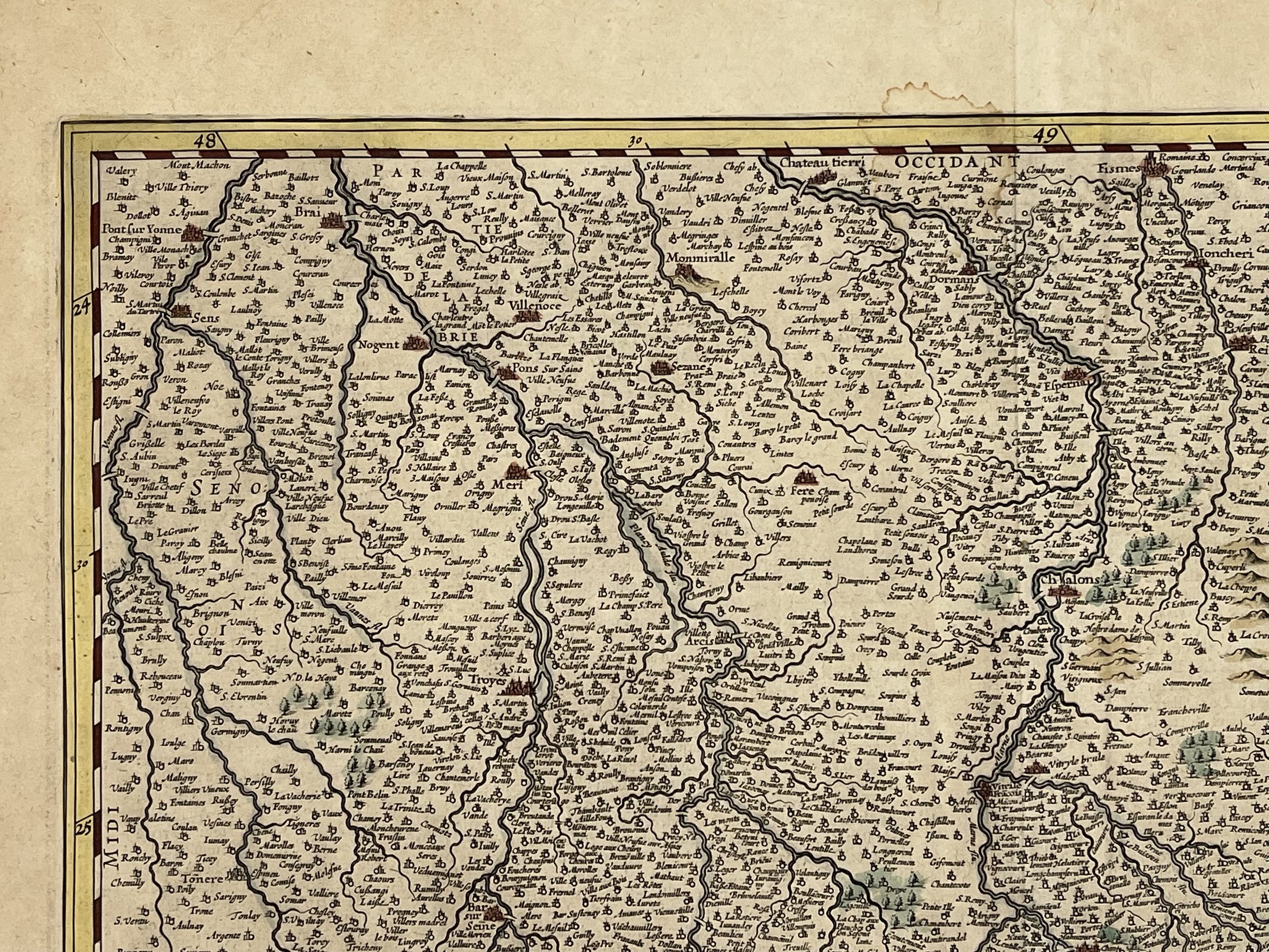
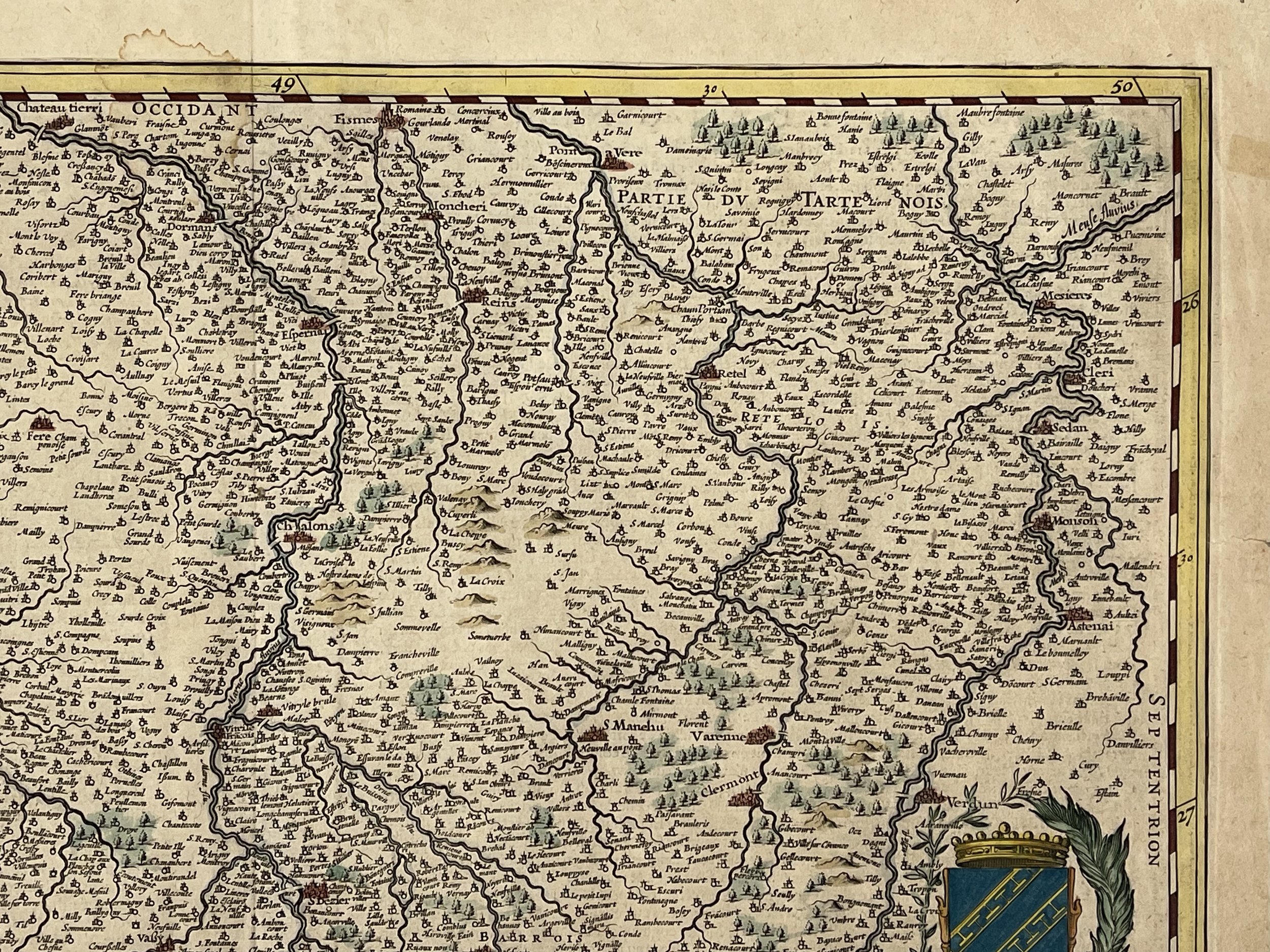
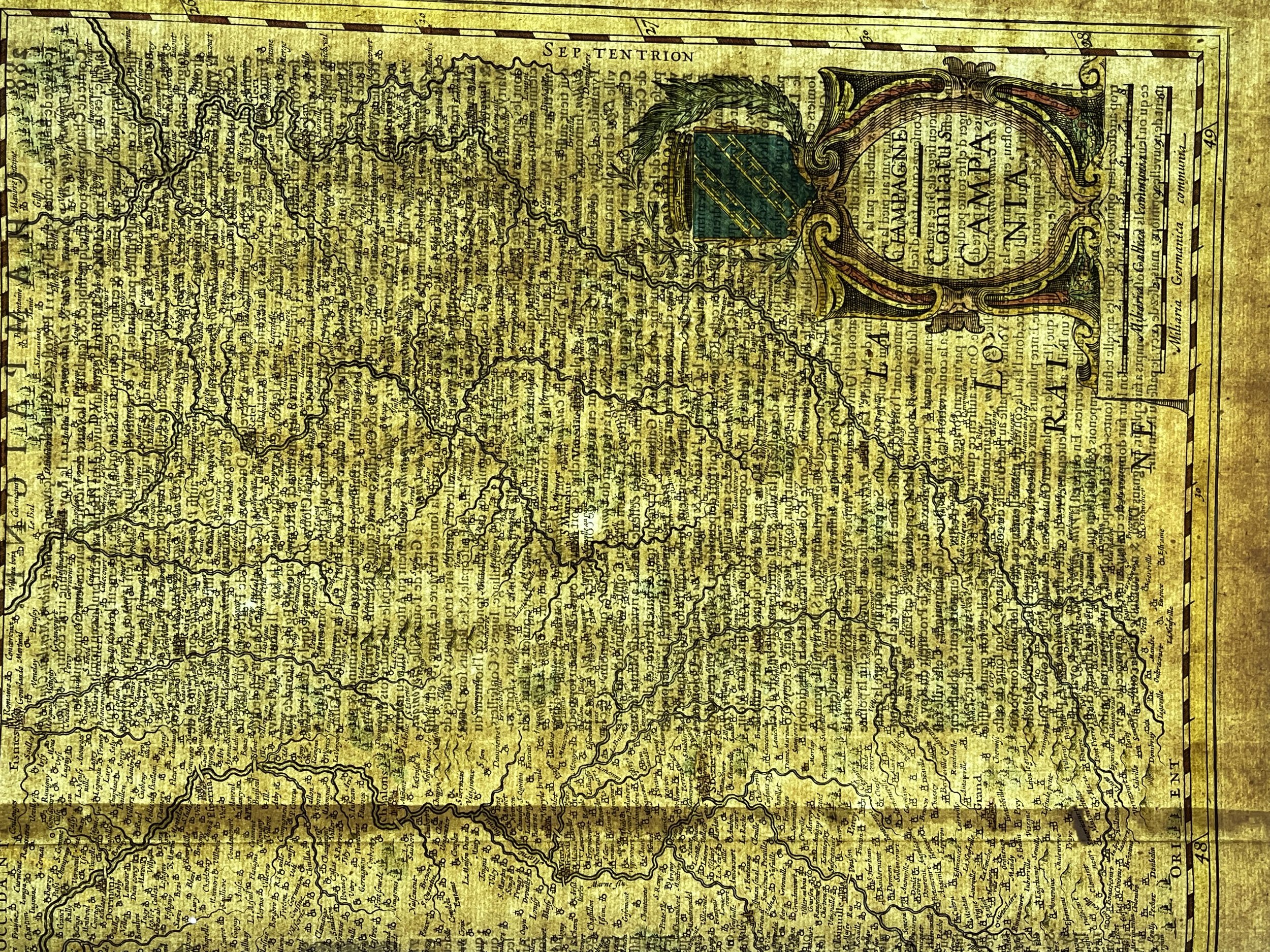
Decorative antique map of the Champagne Ardennes region and a part of Lorraine France.
Title: Champagne Comitatus Campania. Fine edition of the Hondius Janssonius atlas Nouveau Théatre du Monde. Beautiful map of the Champagne region. Two small tears to the top and right borders that have not affected the engraving. Excellent colour and representation otherwise.
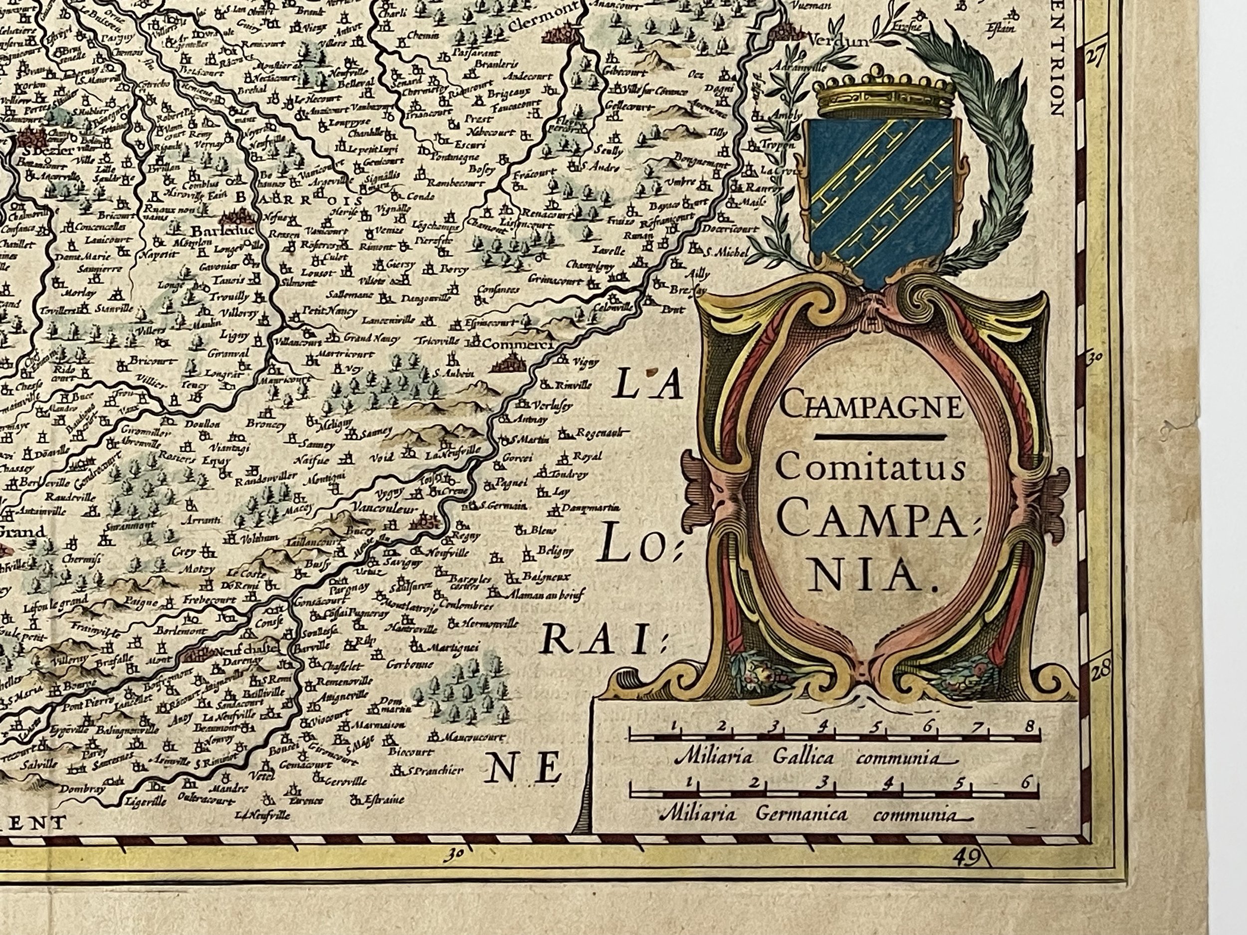
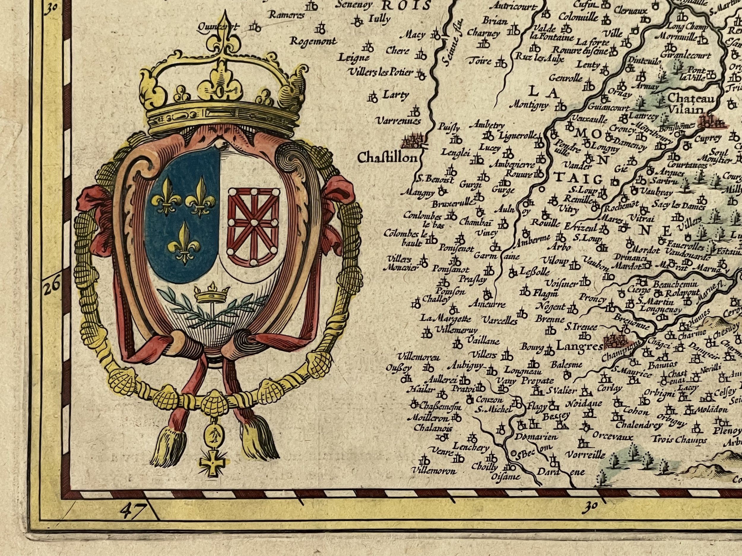
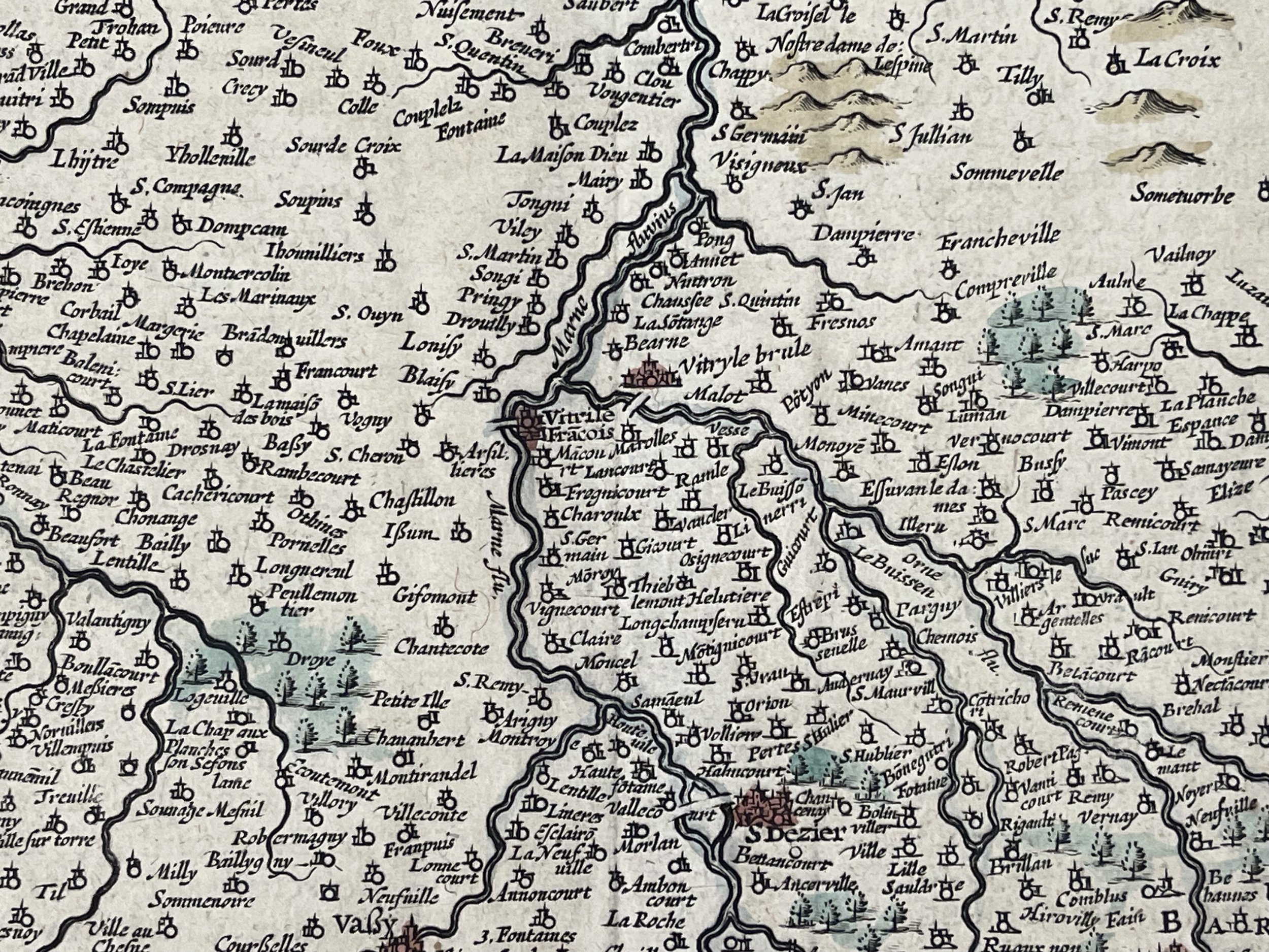
The map is very detailed with forest, rivers, mountains, towns and villages.
A decorative title cartouche with a coat of arms and a military French and German mile scale. To the lower left the royal arms of the Kingdom of France with down Amsteldami Apud Joannem Jansonium.
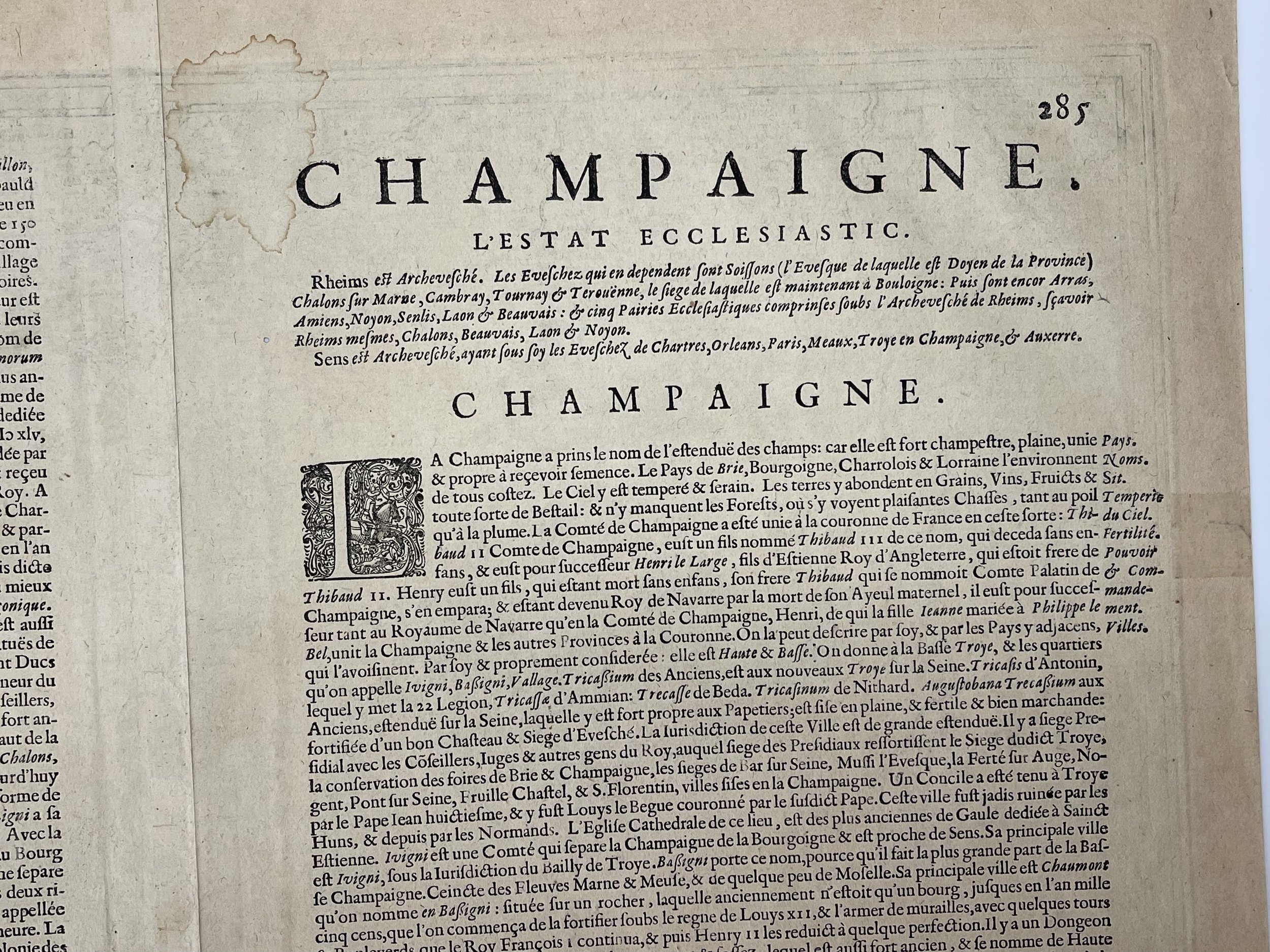
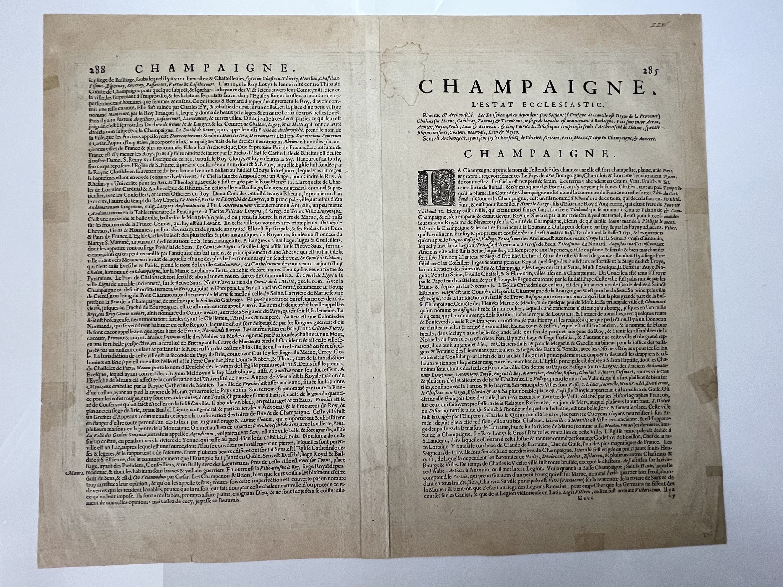
Text verso: CAMPANIA vulgo CHAMPAGNE. Text Latin.
(Koeman/Krogt, Atlantes Neerlandici 4200:1A.1 / 400/ 250)
Johannes Janssonius (Jan 1588, Arnhem – buried July 11, 1664, Amsterdam
Janszoon, in English often incorrect Jan Jansson) was a Dutch cartographer and publisher who lived and worked in Amsterdam in the 17th century.
Janssonius was born in Arnhem, the son of Jan Janszoon the Elder, a publisher and bookseller. In 1612 he married Elisabeth de Hondt, the daughter of Jodocus Hondius and Colette van den Keere. He produced his first maps in 1616 of France and Italy. In 1623 Janssonius owned a bookstore in Frankfurt am Main, later also in Danzig, Stockholm, Copenhagen, Berlin, Königsberg, Geneva and Lyon. His wife Elisabeth died in 1627 and he married Elisabeth Carlier in 1629. He formed a partnership with his brother-in-law Henricus Hondius,[3] and together they published atlases as Mercator/Hondius/Janssonius.
Under the leadership of Janssonius the Hondius Atlas was steadily enlarged. Renamed Atlas Novus, it had three volumes in 1638, one fully dedicated to Italy. In 1646, a fourth volume came out with "English County Maps", a year after a similar issue by Joan Blaeu. Janssonius' maps are like those of Blaeu, and he is often accused of copying from his rival, but many of his maps predate those of Blaeu and/or covered different regions. By 1660, at which point the atlas bore the appropriate name "Atlas Major", there were 11 volumes, containing the work of about a hundred credited authors and engravers. It included a description of "most of the cities of the world" (Town-atlas), of the water-world (Atlas Maritimus in 33 maps), and of the Ancient World (60 maps). The eleventh volume was titled Atlas of the Heavens (a type of celestial cartography) by Andreas Cellarius. Editions were printed in Dutch, Latin, French, and a few times in German.
After Janssonius's death, the publishing company was continued by his son-in law, Johannes van Waesbergen. The London bookseller Moses Pitt attempted publication of the Atlas Major in English but ran out of resources after the fourth volume in 1683.
Cartographer: Jodocus Hendricus Hondius
Jodocus Hondius (Latinized version of his Dutch name: Joost de Hondt) (14 October 1563 – 12 February 1612), sometimes called Jodocus Hondius the Elder to distinguish him from his son Jodocus Hondius II, was a Flemish / Dutch engraver, and cartographer. He is best known for his early maps of the New World and Europe, for re-establishing the reputation of the work of Gerard Mercator, and for his portraits of Francis Drake. He helped establish Amsterdam as the center of cartography in Europe in the 17th century.
France - Champagne Comitatus Campania Old Map Janssonius 1638
Decorative antique map of the Champagne Ardennes region and a part of Lorraine France.
Title: Champagne Comitatus Campania. Fine edition of the Hondius Janssonius atlas Nouveau Théatre du Monde. Beautiful map of the Champagne region. Two small tears to the top and right borders that have not affected the engraving. Excellent colour and representation otherwise.
The map is very detailed with forest, rivers, mountains, towns and villages.
A decorative title cartouche with a coat of arms and a military French and German mile scale. To the lower left the royal arms of the Kingdom of France with down Amsteldami Apud Joannem Jansonium.
Text verso: CAMPANIA vulgo CHAMPAGNE. Text Latin.
(Koeman/Krogt, Atlantes Neerlandici 4200:1A.1 / 400/ 250)
Johannes Janssonius (Jan 1588, Arnhem – buried July 11, 1664, Amsterdam
Janszoon, in English often incorrect Jan Jansson) was a Dutch cartographer and publisher who lived and worked in Amsterdam in the 17th century.
Janssonius was born in Arnhem, the son of Jan Janszoon the Elder, a publisher and bookseller. In 1612 he married Elisabeth de Hondt, the daughter of Jodocus Hondius and Colette van den Keere. He produced his first maps in 1616 of France and Italy. In 1623 Janssonius owned a bookstore in Frankfurt am Main, later also in Danzig, Stockholm, Copenhagen, Berlin, Königsberg, Geneva and Lyon. His wife Elisabeth died in 1627 and he married Elisabeth Carlier in 1629. He formed a partnership with his brother-in-law Henricus Hondius,[3] and together they published atlases as Mercator/Hondius/Janssonius.
Under the leadership of Janssonius the Hondius Atlas was steadily enlarged. Renamed Atlas Novus, it had three volumes in 1638, one fully dedicated to Italy. In 1646, a fourth volume came out with "English County Maps", a year after a similar issue by Joan Blaeu. Janssonius' maps are like those of Blaeu, and he is often accused of copying from his rival, but many of his maps predate those of Blaeu and/or covered different regions. By 1660, at which point the atlas bore the appropriate name "Atlas Major", there were 11 volumes, containing the work of about a hundred credited authors and engravers. It included a description of "most of the cities of the world" (Town-atlas), of the water-world (Atlas Maritimus in 33 maps), and of the Ancient World (60 maps). The eleventh volume was titled Atlas of the Heavens (a type of celestial cartography) by Andreas Cellarius. Editions were printed in Dutch, Latin, French, and a few times in German.
After Janssonius's death, the publishing company was continued by his son-in law, Johannes van Waesbergen. The London bookseller Moses Pitt attempted publication of the Atlas Major in English but ran out of resources after the fourth volume in 1683.
Cartographer: Jodocus Hendricus Hondius
Jodocus Hondius (Latinized version of his Dutch name: Joost de Hondt) (14 October 1563 – 12 February 1612), sometimes called Jodocus Hondius the Elder to distinguish him from his son Jodocus Hondius II, was a Flemish / Dutch engraver, and cartographer. He is best known for his early maps of the New World and Europe, for re-establishing the reputation of the work of Gerard Mercator, and for his portraits of Francis Drake. He helped establish Amsterdam as the center of cartography in Europe in the 17th century.
Code : A59
Cartographer : Cartographer / Engraver / Publisher: Johannes Janssonius / Jodocus Hendricus Hondius
Date : Publication Place / Date - Circa 1638
Size : Sheet size: Image Size: 53.5 x 43 cm
Availability : Available
Type - Genuine - Antique
Grading A
Where Applicable - Folds as issued. Light box photo shows the folio leaf centre margin hinge ‘glue’, this is not visible otherwise.
Tracked postage, in casement. Please contact me for postal quotation outside of the UK.