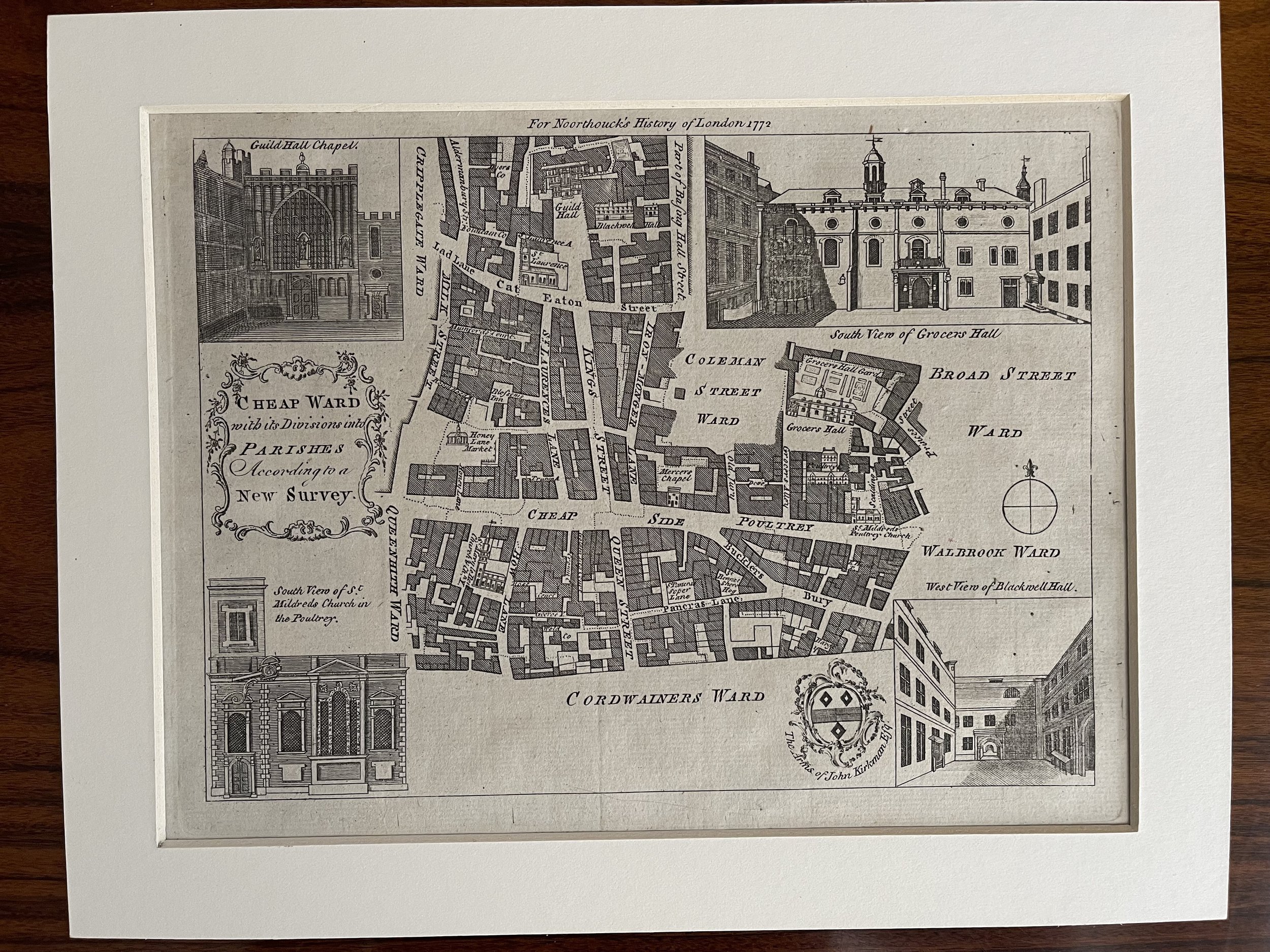
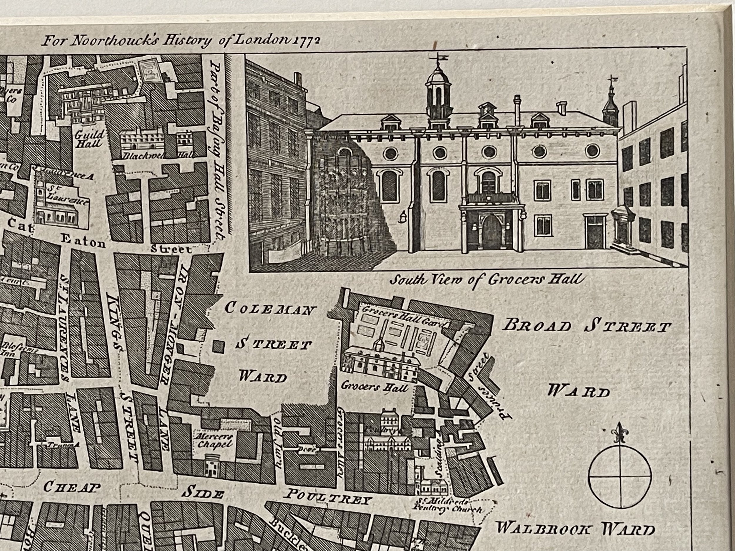
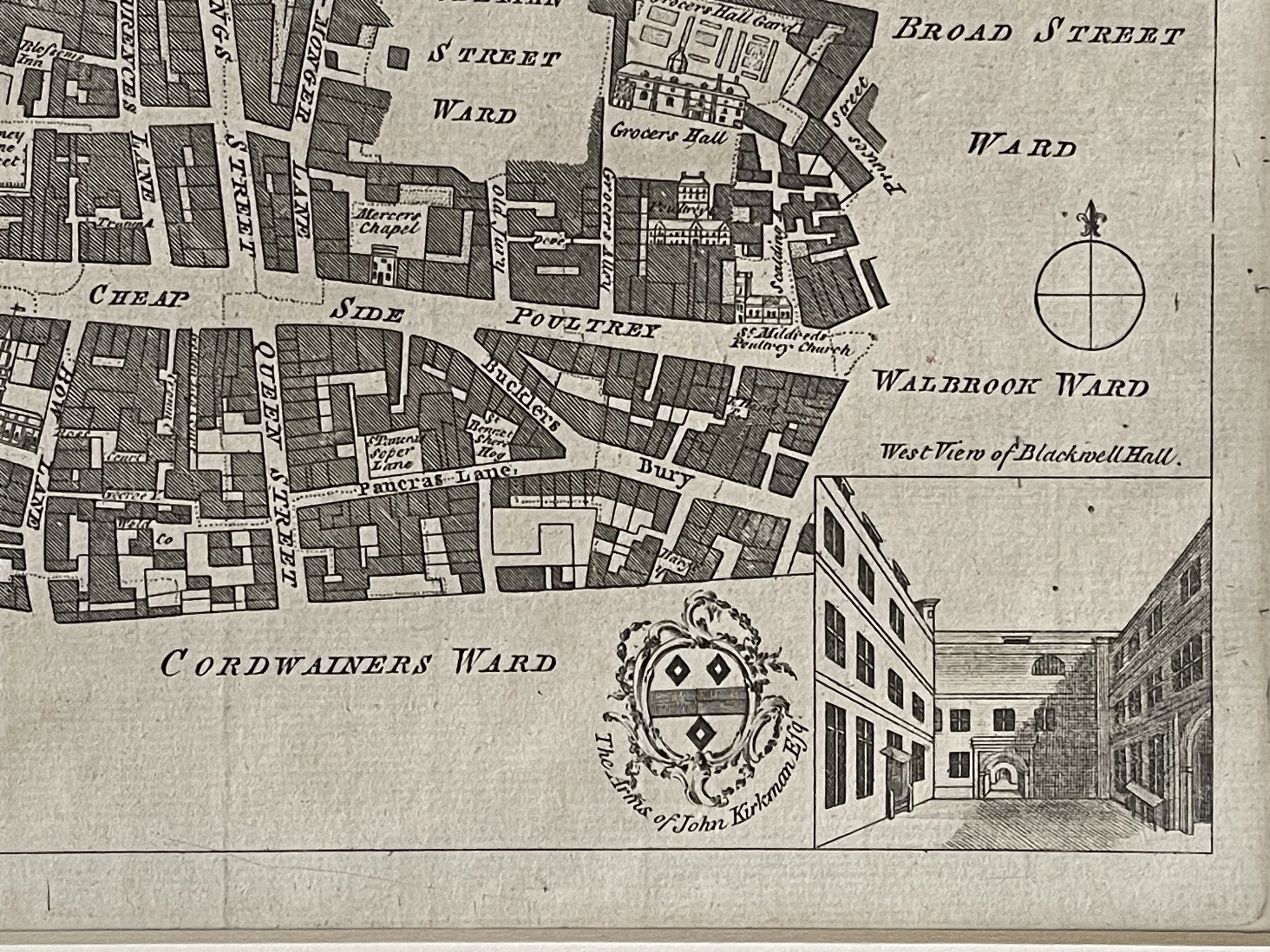
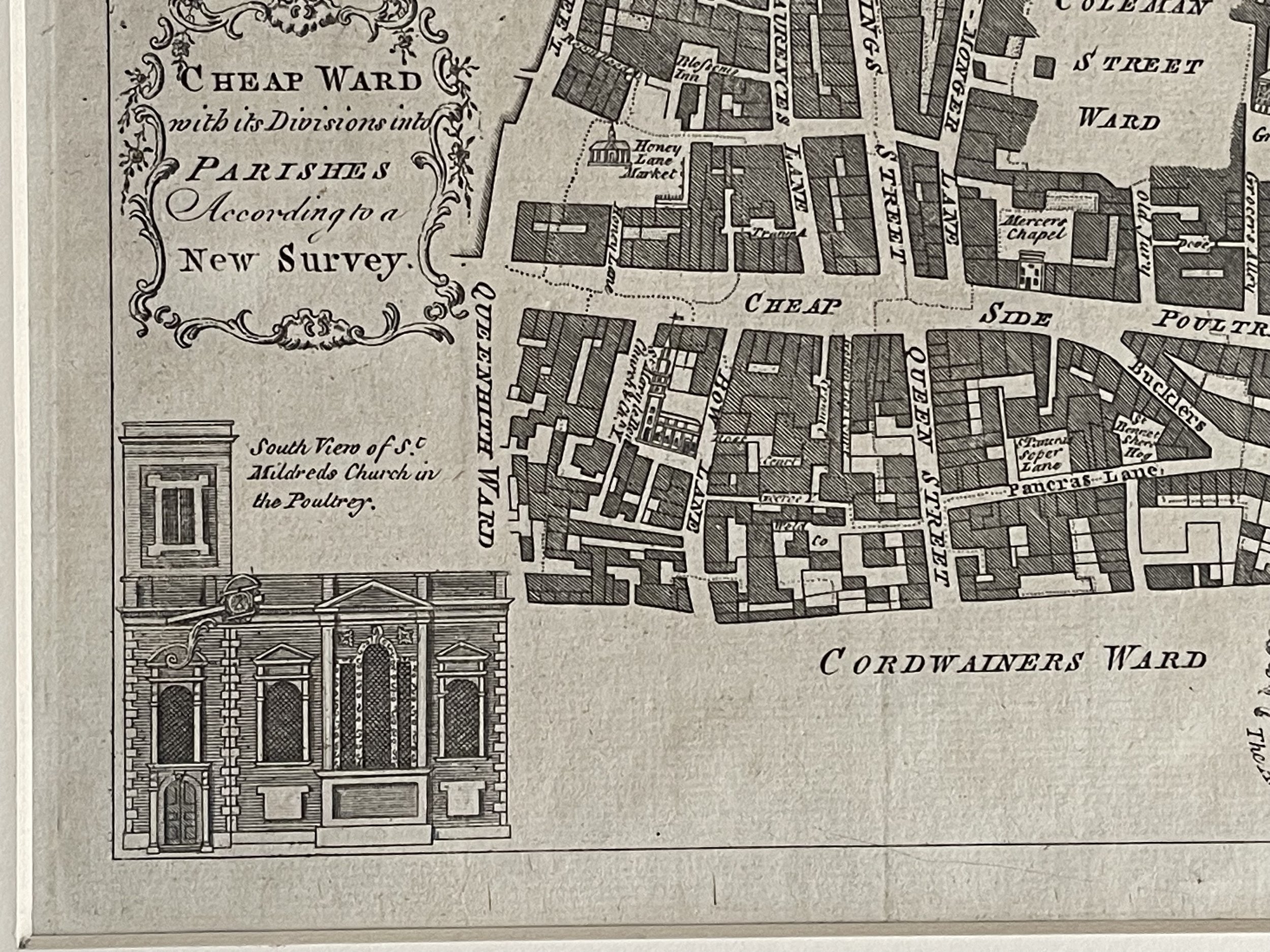
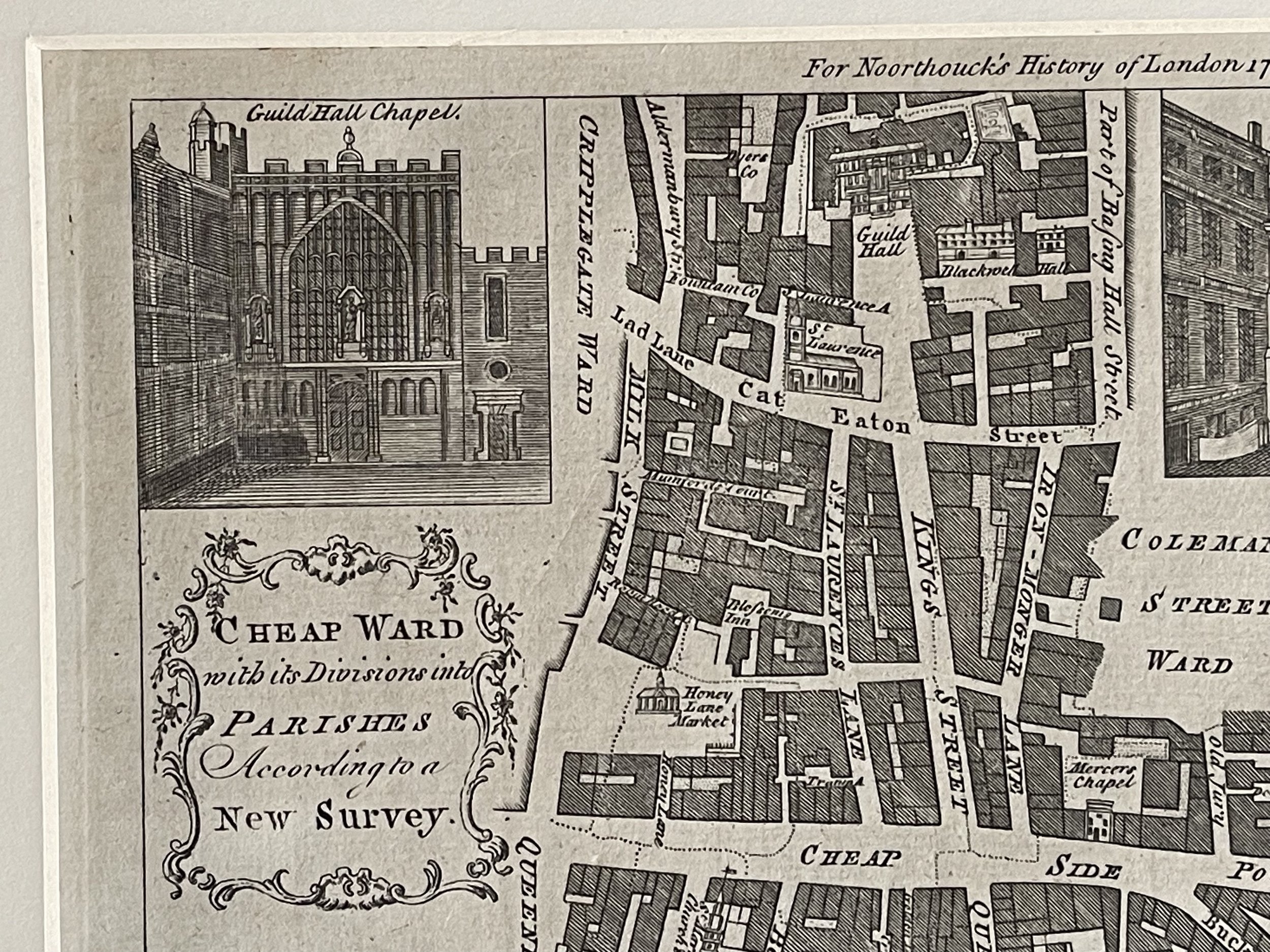
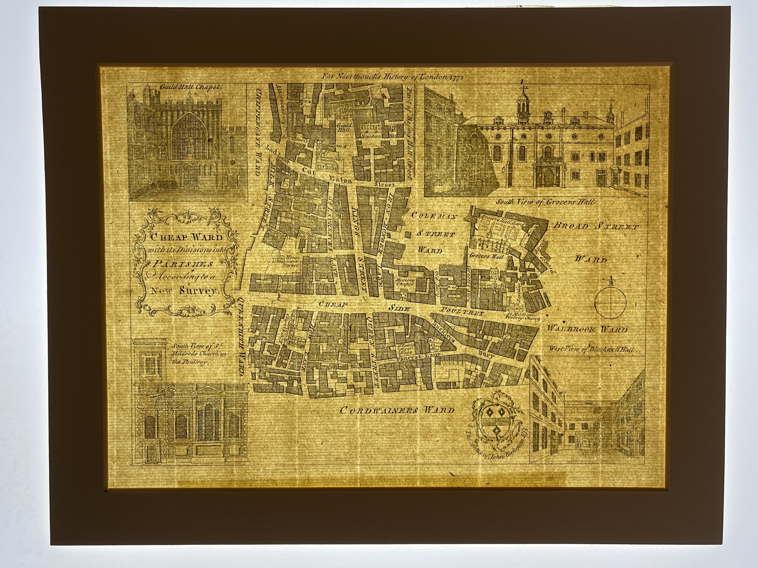
Cheap Ward London, with its Divisions into Parishes According to a New Survey - Thomas Bowen - 1772
Unusual Map of Cheap Ward London, with its Divisions into Parishes According to a New Survey'. Artist/engraver/cartographer: Thomas Bowen. Provenance: "A new history of London, including Westminster and Southwark. To which is added, a General Survey of the Whole, describing the Public Buildings, Late Improvements, etc. Illustrated with Copperplates", by John Noorthouck. Type: Copperplate antique map. Includes Cheapside, Poultry, Bucklersbury, King Street, Queen Street, the Guildhall, Grocer's Hall, Ironmonger Lane, Old Jewry, Eaton Street (now Gresham Street). Vignettes of Guildhall Chapel, St Mildred's Church in the Poultry, Blackwell Hall & Grocer's Hall, The Arms of John Kirkman Esq.
Thomas Bowen (died 1790) was a Welsh engraver of charts. He was the son of Emanuel Bowen (1693/4–1767),[1] map engraver to George II and Louis XV. He died in Clerkenwell workhouse early in 1790.
He engraved:
Maps and charts of the West Indies, published by the direction of the government from the surveys of Captain James Speer.
Maps of the country twenty miles round London and of the road between London and St. David's, about 1750.
A 'New Projection of the Eastern and Western Hemispheres of the Earth,' 1776; and
an 'Accurate Map of the Russian Empire in Europe and Asia,' 1778.
A New & Accurate Map Of Europe From The Latest Improvements And Regulated By Astronomical Observations", engraved for Mountague's History of England.
An 'English map of Persia and the Garden of Eden,' 1780
He also contributed to George Taylor and Andrew Skinner's Survey and Maps of the Roads of North Britain in 1776.
The City of London (also known simply as "the City") is divided into 25 wards. The city is the historic core of the much wider metropolis of Greater London, with an ancient and sui generis form of local government, which avoided the many local government reforms elsewhere in the country in the 19th and 20th centuries. Unlike other modern English local authorities, the City of London Corporation has two council bodies: the now largely ceremonial Court of Aldermen, and the Court of Common Council.
The wards are a survival of the medieval governmental system that allowed very small areas to exist as self-governing units within the wider city. They are both electoral/political sub-divisions and permanent ceremonial, geographic and administrative entities within the city. They had their boundaries changed in 2003, and to a lesser extent in 2013, though the number of wards and their names did not change.
I have other ward maps available, please browse our shop in the London section.
This map is in excellent condition for its age with no visible degradation and come with a border mount for framing.
Code : A840
Cartographer : Cartographer / Engraver / Publisher: Thomas Bowen
Date : Publication Place / Date - 1772
Size : Sheet size: Image Size: 24 x 30 cm
Availability : Available
Type - Genuine - Antique
Grading A+
Where Applicable - Folds as issued. Light box photo shows the folio leaf centre margin hinge ‘glue’, this is not visible otherwise.
Tracked postage, in casement. Please contact me for postal quotation outside of the UK.