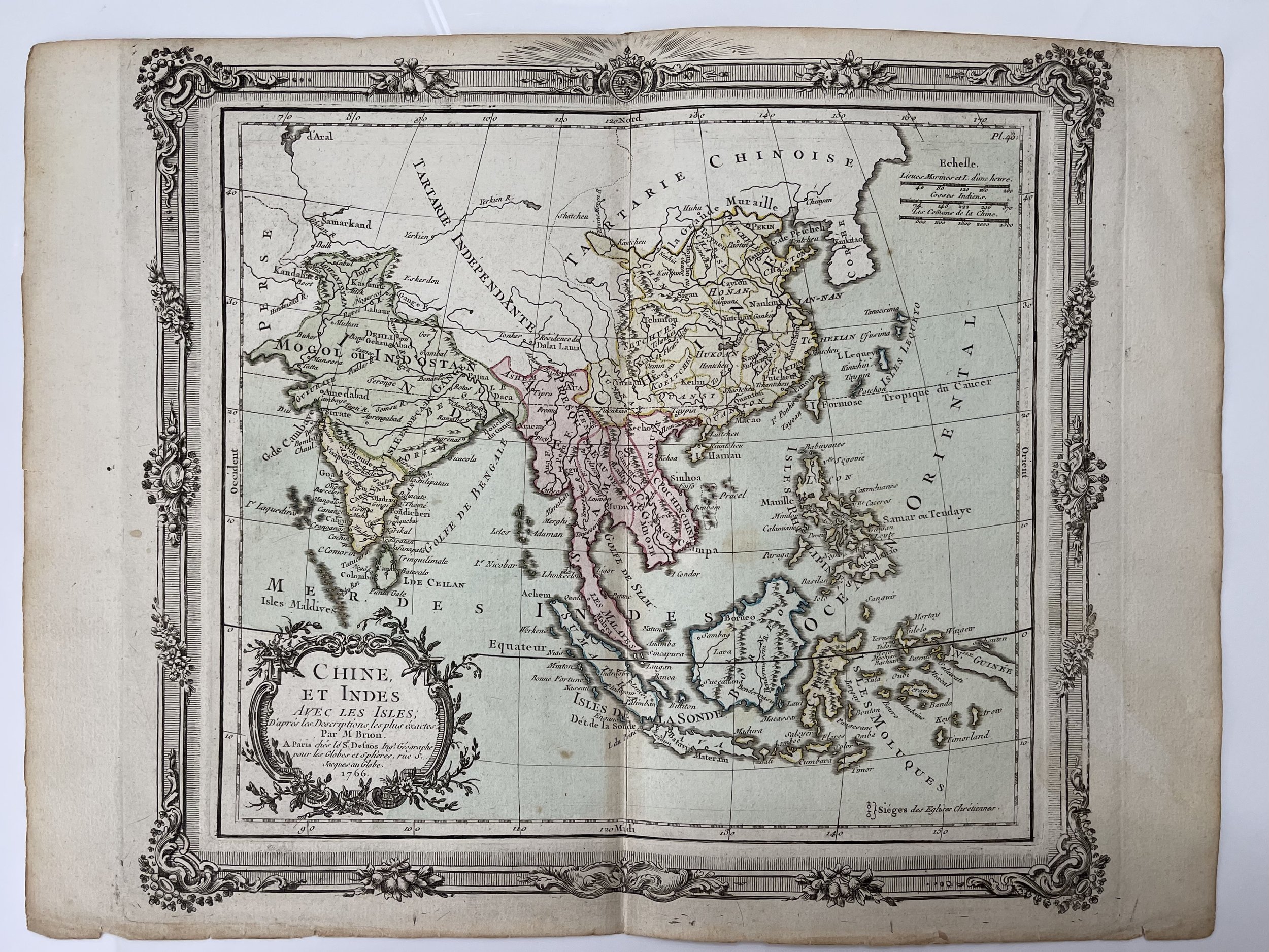
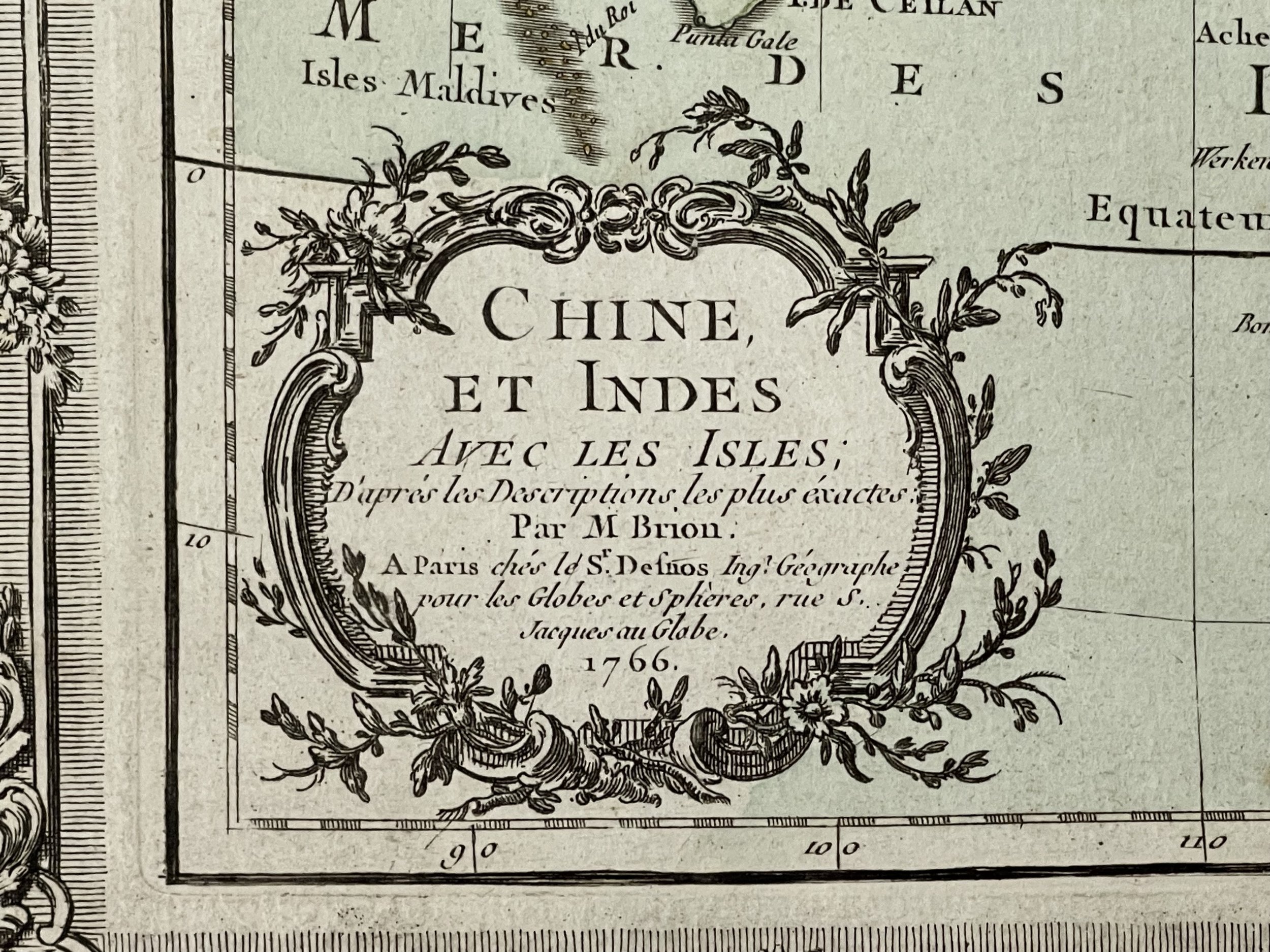
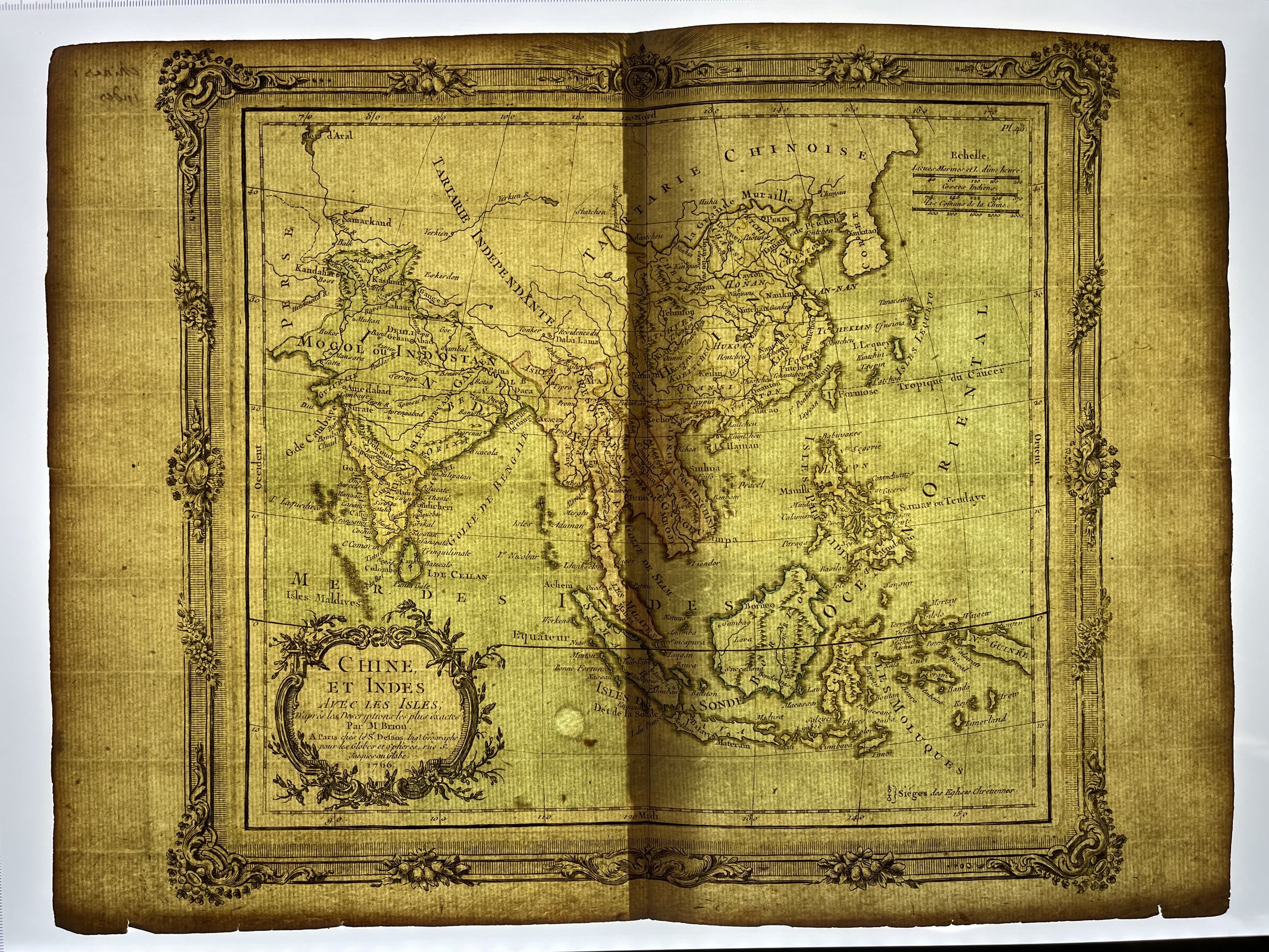
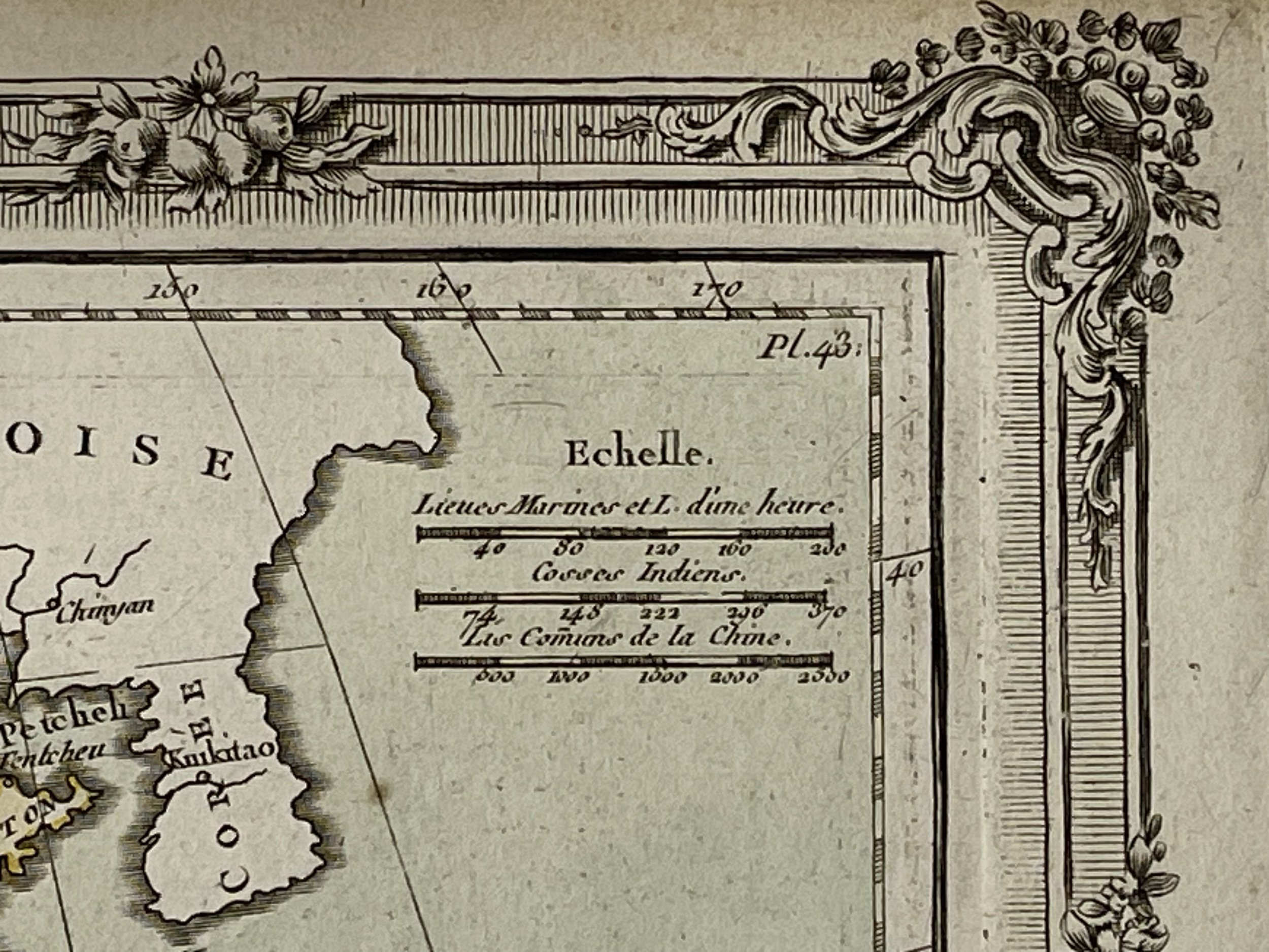
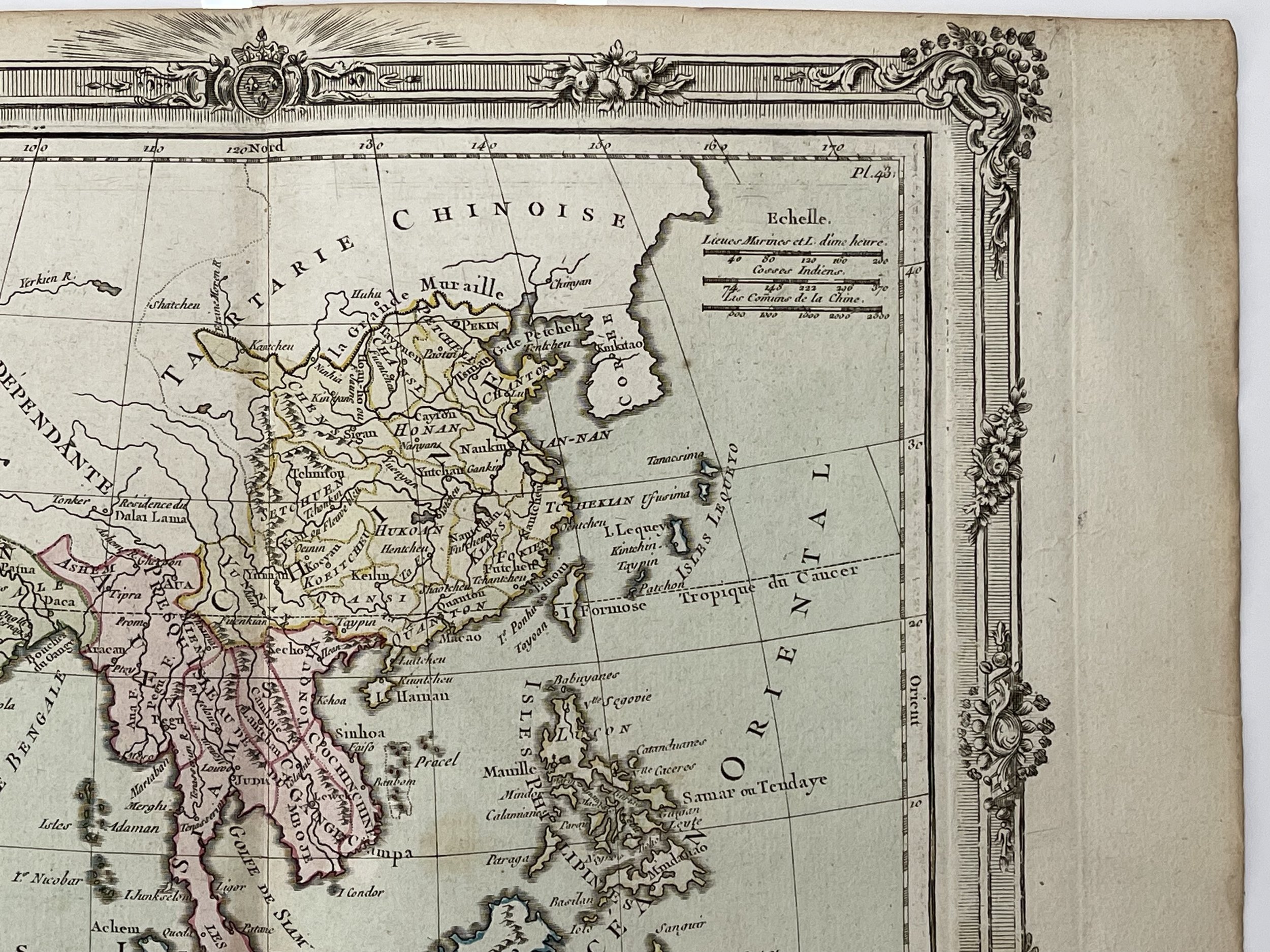
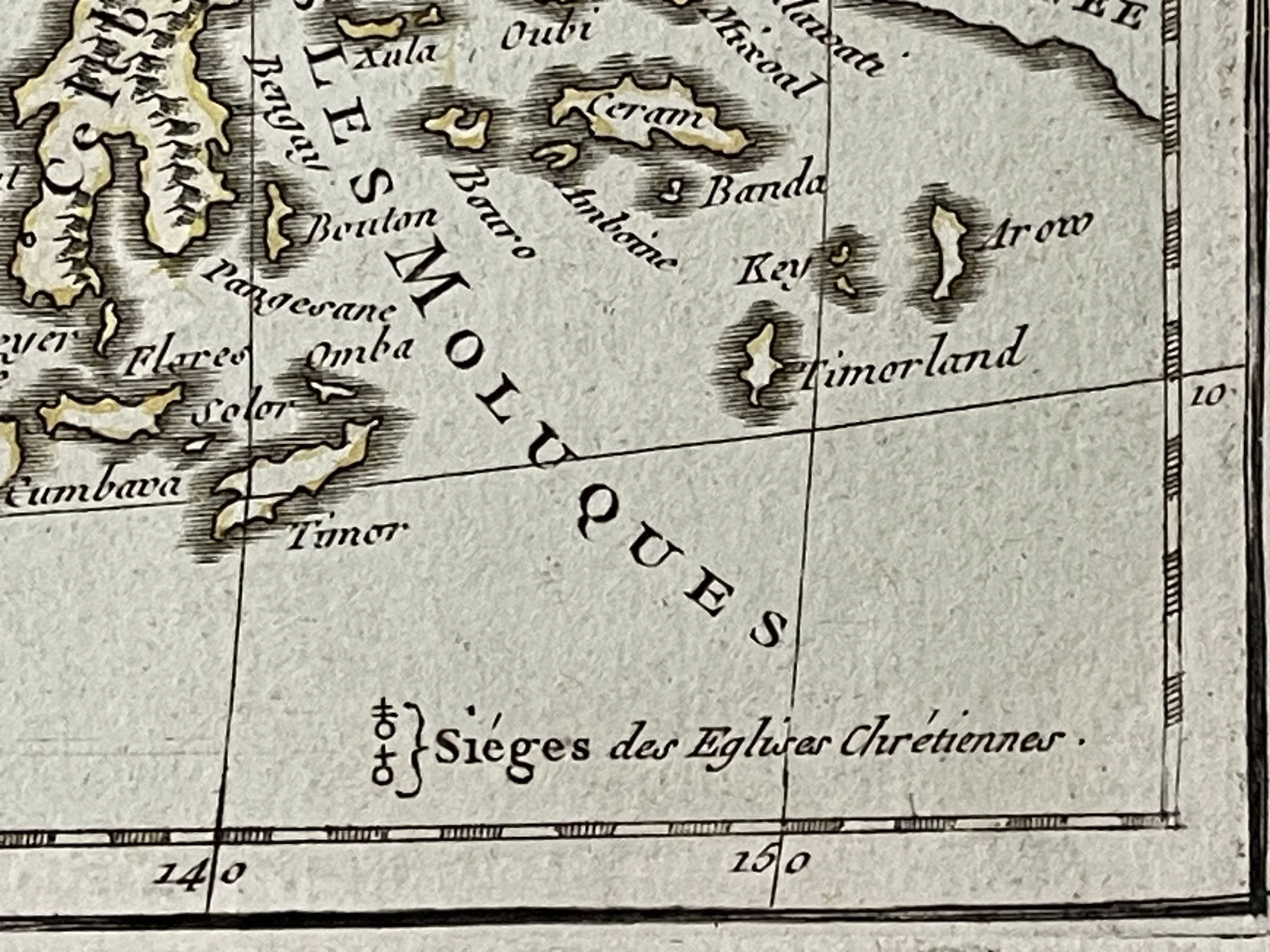
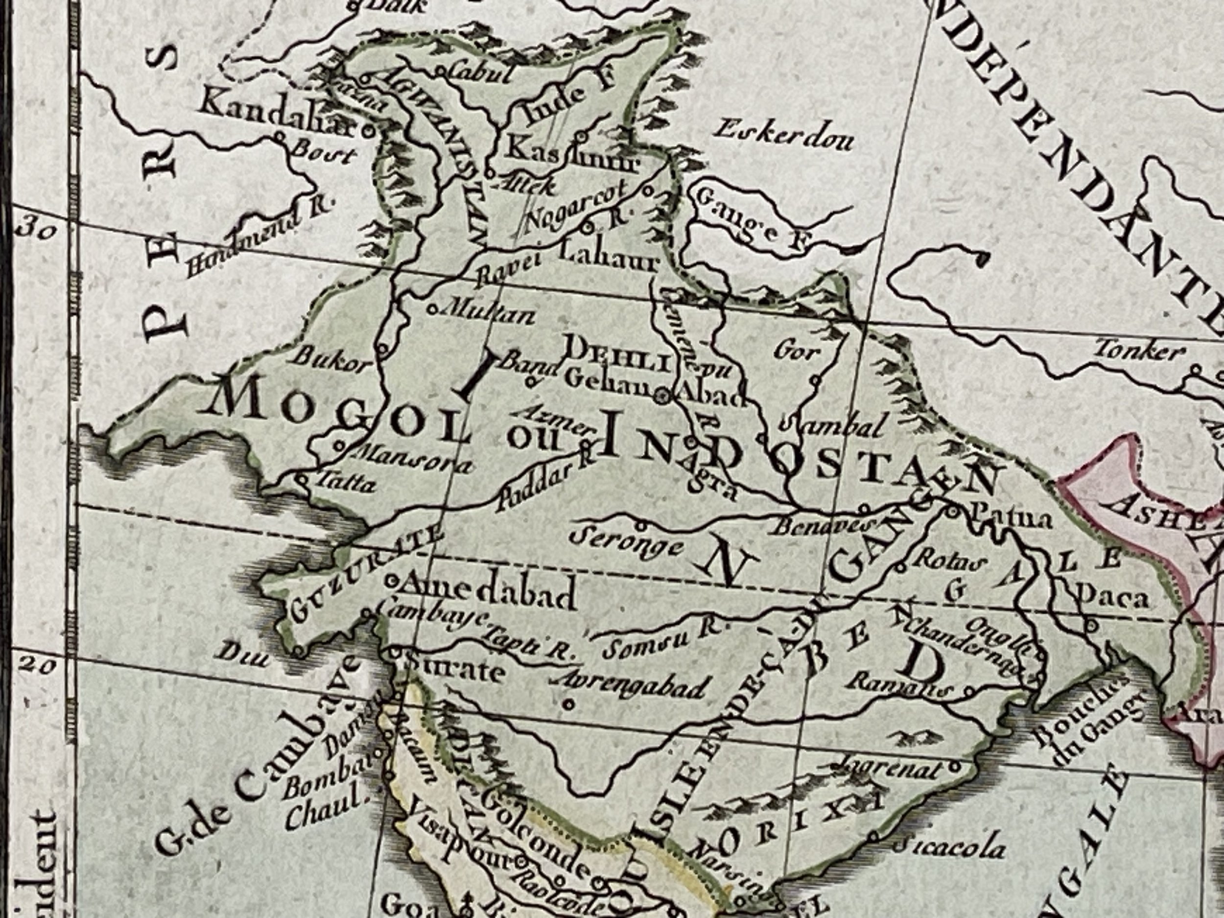
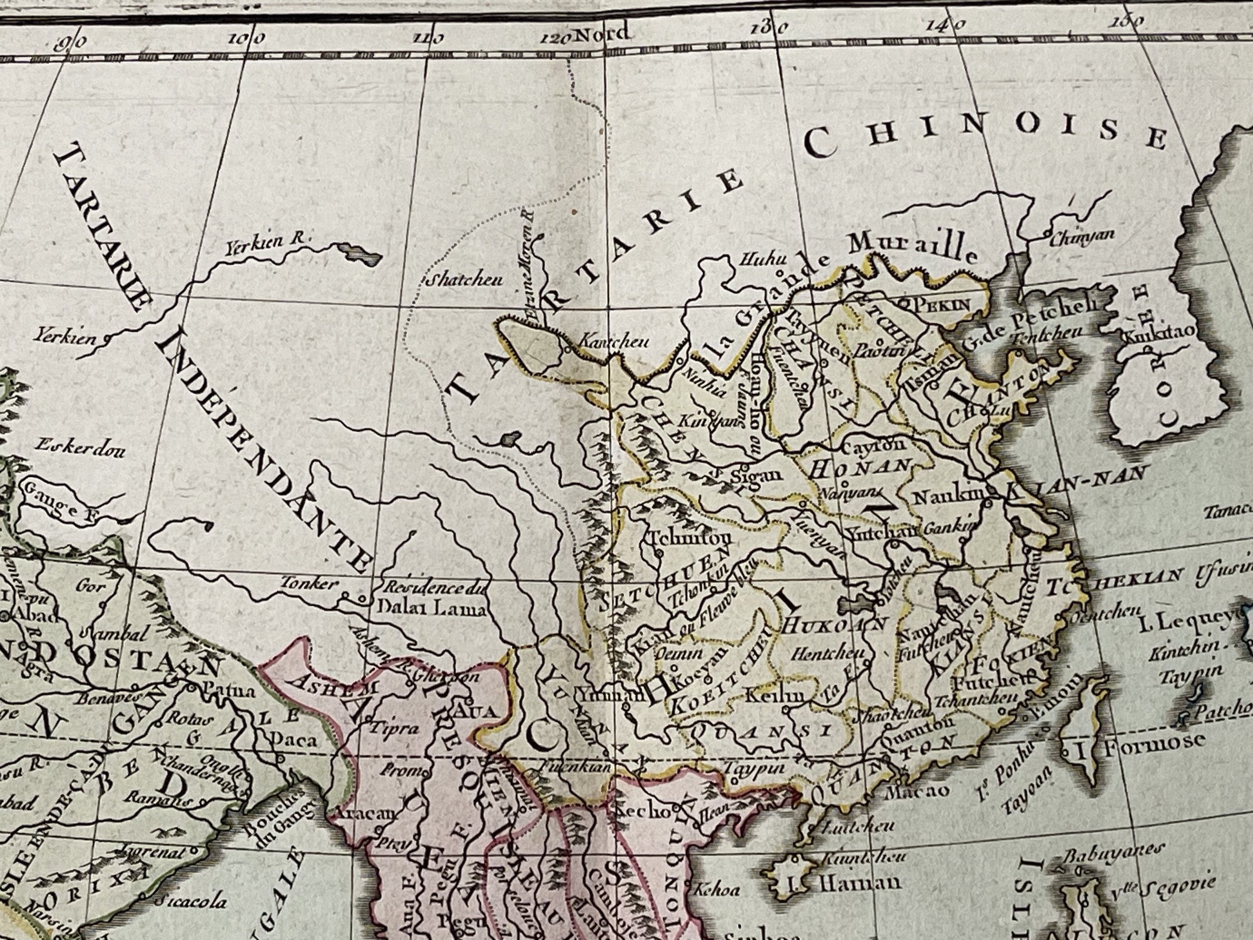
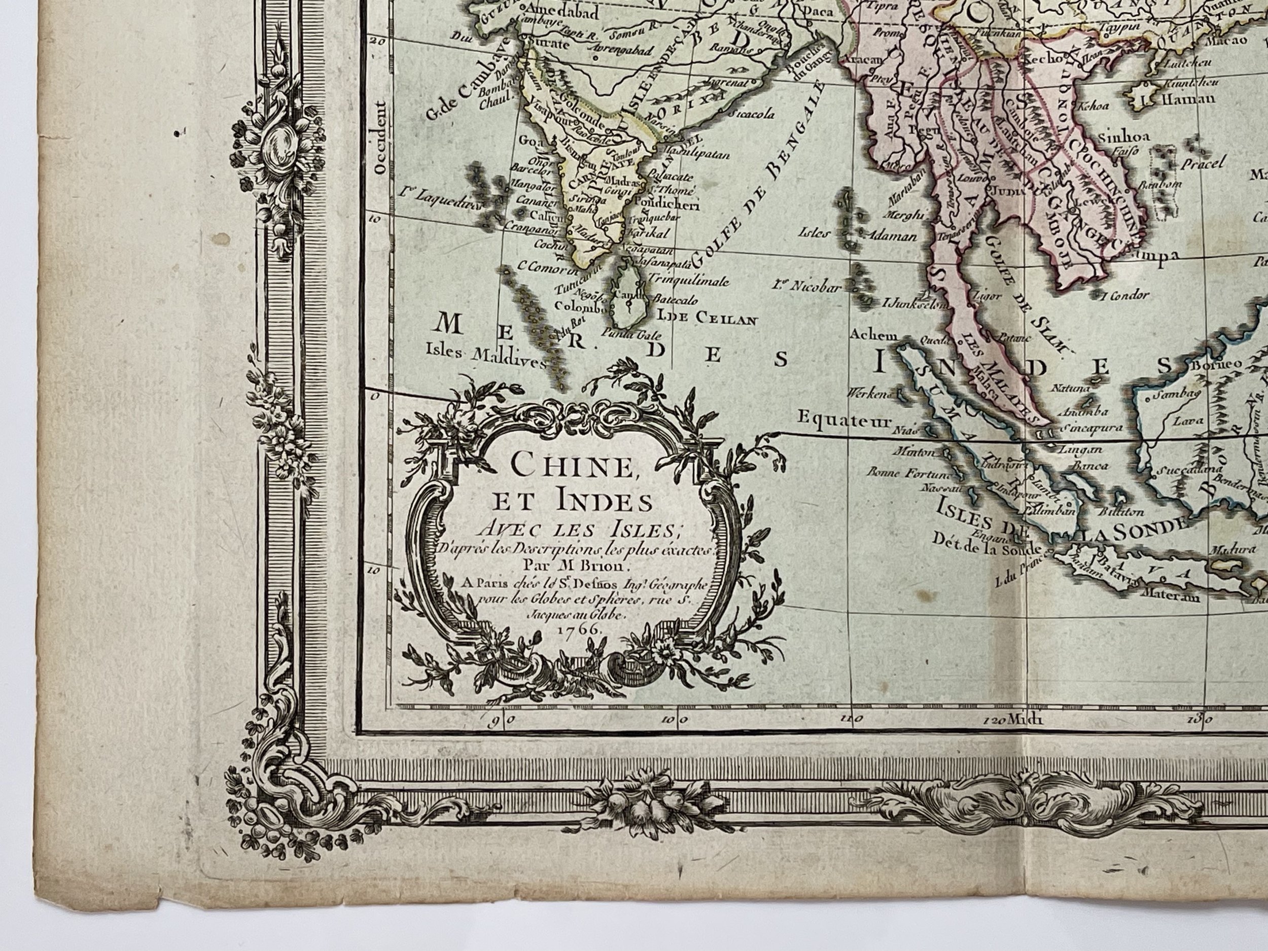
Chine, et Indes Avec Les Isles - Louis Charles Desnos / Louis Brion de la Tour - 1766
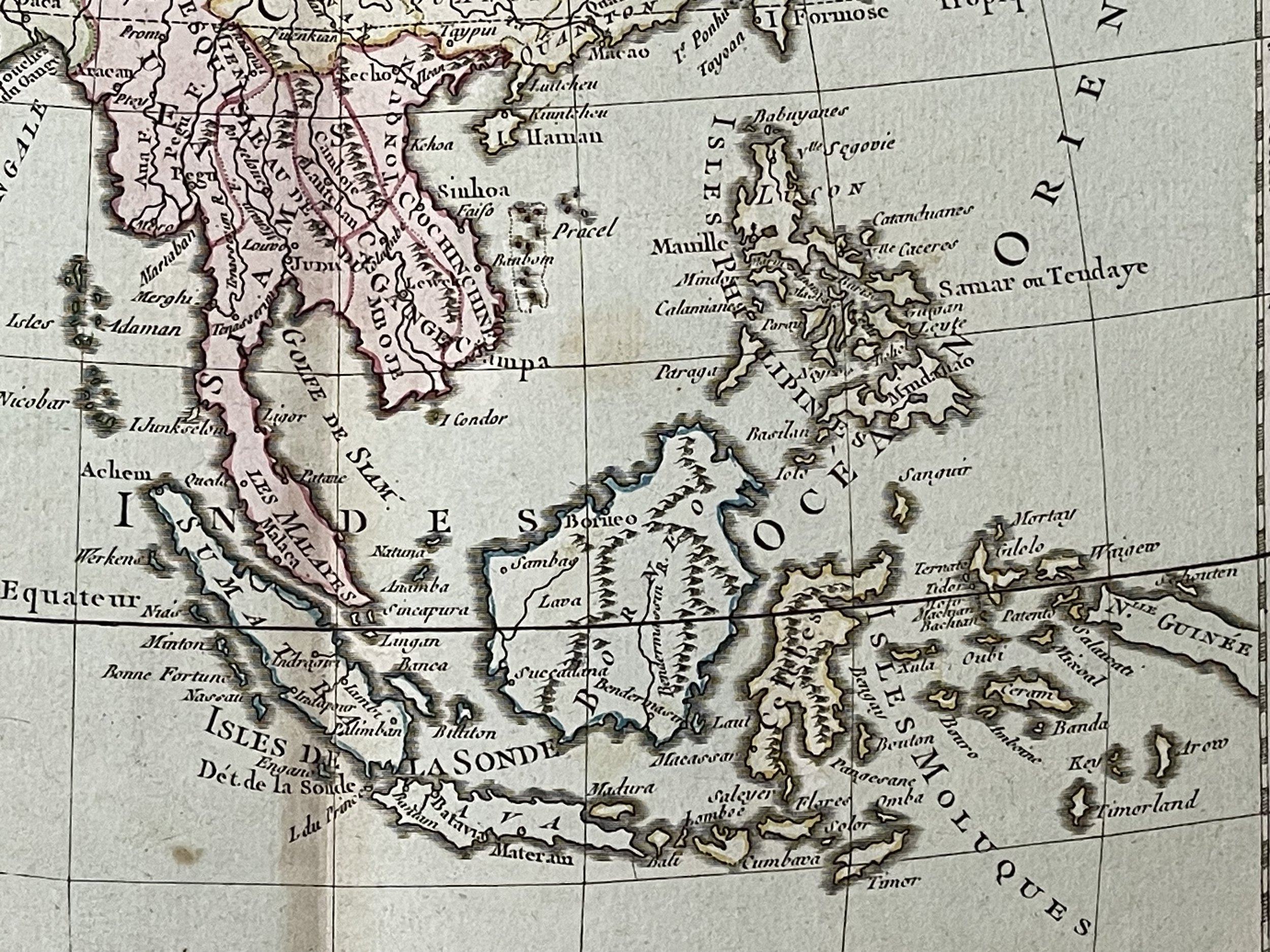
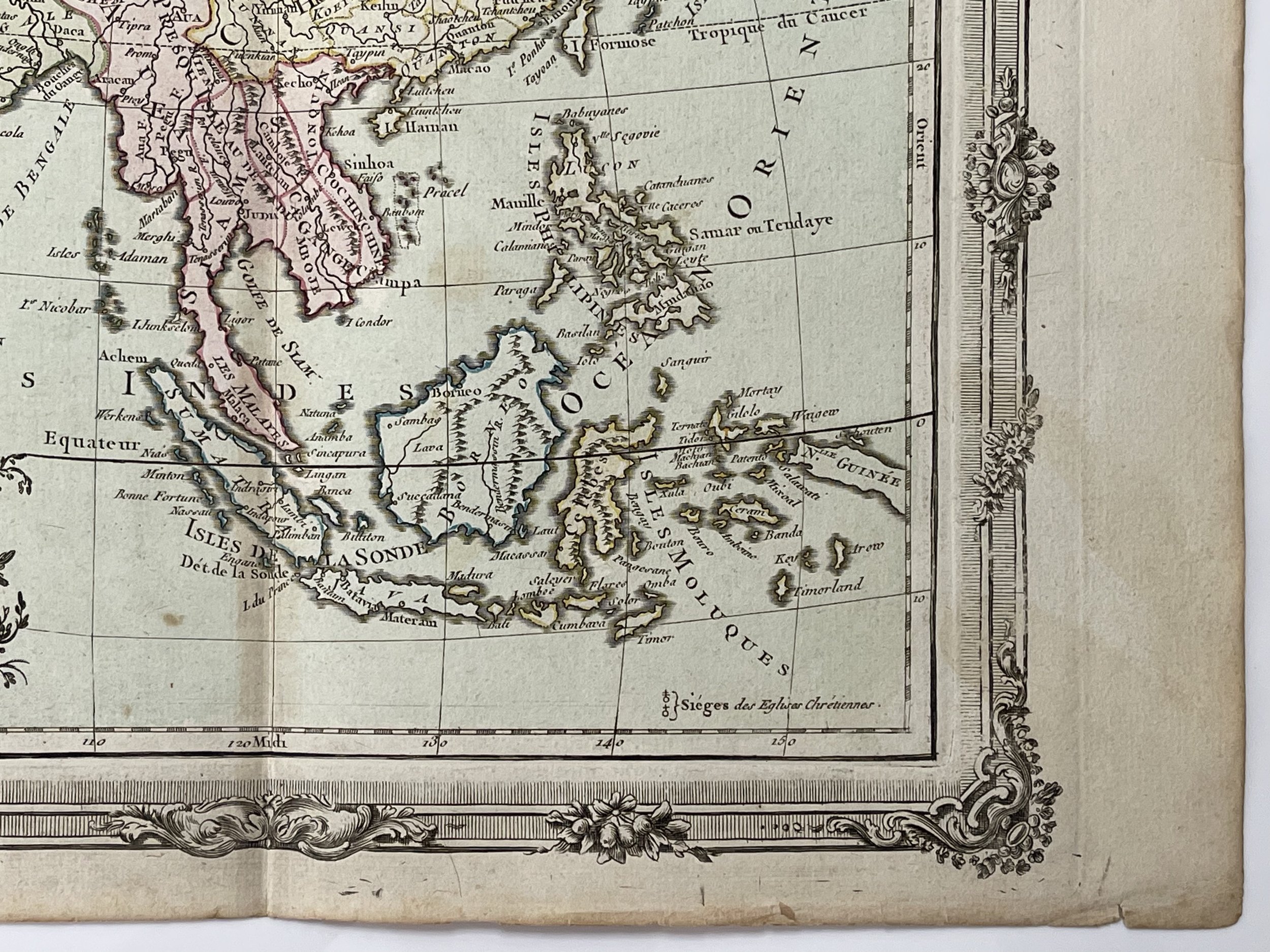
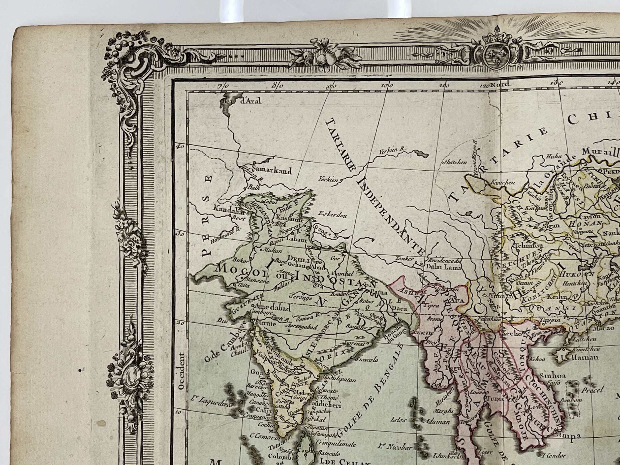
A striking map of Southeastern Asia, including the region from New Guinea to India and North to include China. Well engraved and detailed, including islands, towns, rivers, mountains, etc. Attractive wash colors. A decorative map from Brion De La Tour, one of the most prolific cartographic publishers of the mid 18th Century.
Louis Charles Desnos (1725 - April 18, 1805) was a significant 18th century craftsman, mapmaker, and globe maker, operating out of Paris, France. He was born in Pont-Sainte-Maxence, Oise, France, as the son of a cloth merchant. Desnos completed an apprenticeship at a metal foundry in April of 1745. Later on, he married the widow of Nicolas Hardy, who was the son of Jacques Hardy, a renowned dealer of maps, globes, and instruments. Desnos held the prestigious role of Royal Globemaker to Christian VII, King of Denmark, for which he received an annual stipend of 500 Livres. In return, he sent the King approximately 200 Livres worth of maps, books, and atlases each year. As a publisher, Desnos produced a large body of work, often in collaboration with Zannoni and Louis Brion de la Tour (1756-1823). However, his reputation amongst eminent cartographic experts was unsavory as they believed him to be negligent and unprincipled in terms of what he chose to publish. As a result, Desnos was involved in numerous legal disputes with other cartographers and publishers in Paris during his career. He operated his business from Rue St. Jacques in Paris.
Louis Brion de la Tour (1743 - 1803) was the Cartographer Royal to the King of France, holding the official title of Ingenieur-Geographe du Roi. Despite a prolific career in cartography and several notable atlases to his name, there is little information available about his personal life and professional journey. It is speculated that he may have been born in Bordeaux. His son, also named Louis, was born in 1763 and continued publishing until his death in 1832. Distinguishing the work of the father from that of the son is a challenging task as both used the same imprint and were active in a similar period. Notably, a significant amount of their work was produced in partnership with Louis Charles Desnos (active between 1750 and 1790). Their most remarkable collective achievement is often considered to be the 1766 Atlas General.
An exquisitely beautiful map of Asia, complete with cartouche and intricate border-work. Blemishes and slight foxing indicative of age and tactile use. Excellent condition, pricing and grading commensurate.
Code : A1063
Cartographer : Cartographer / Engraver / Publisher: Louis Charles Desnos / Louis Brion de la Tour
Date : Publication Place / Date - 1766
Size : Sheet size: 38 x 29 Cm
Availability : Available
Type - Genuine - Antique
Grading A
Where Applicable - Folds as issued. Light box photo shows the folio leaf centre margin hinge ‘glue’, this is not visible otherwise.
Tracked postage, in casement. Please contact me for postal quotation outside of the UK.