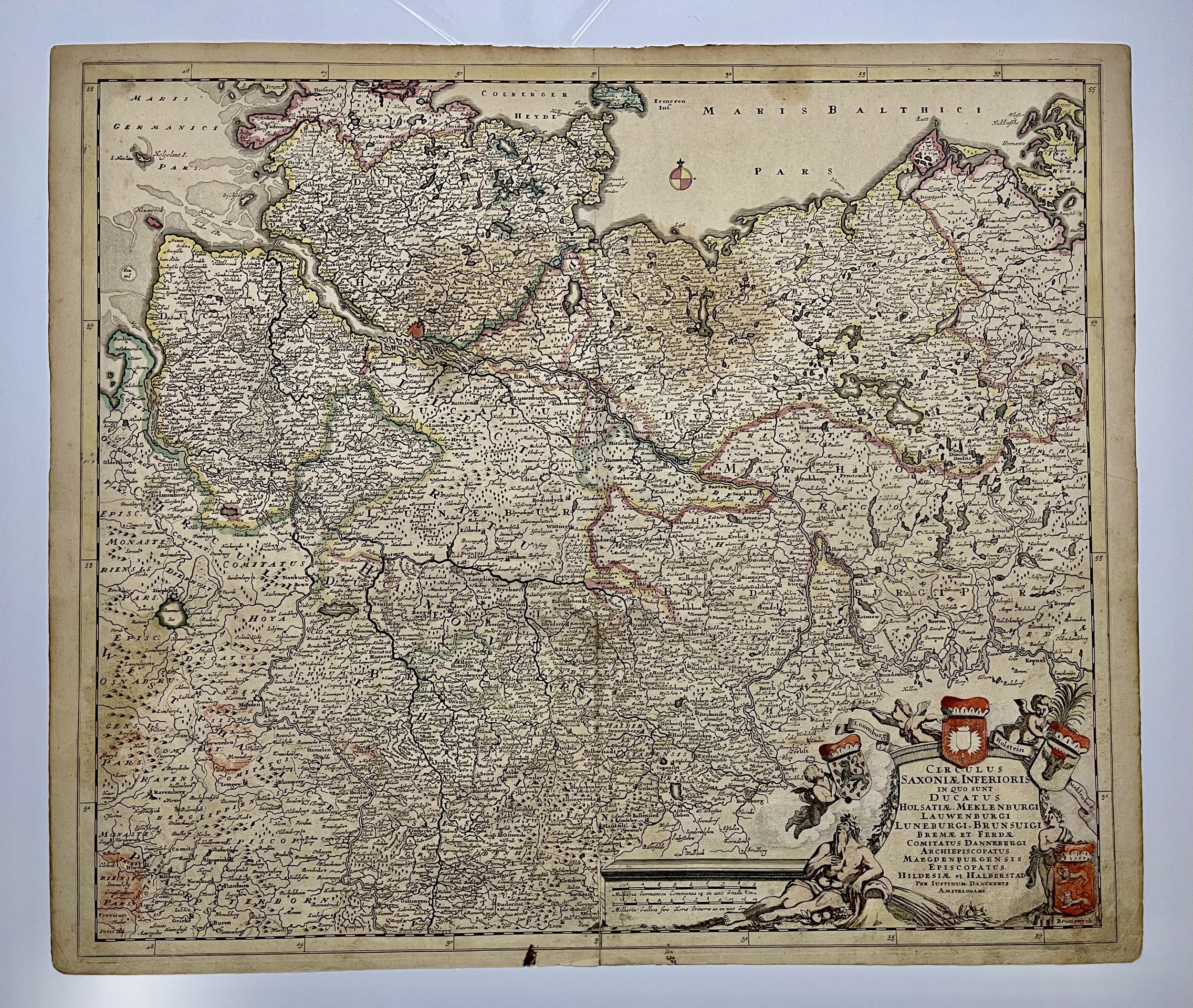
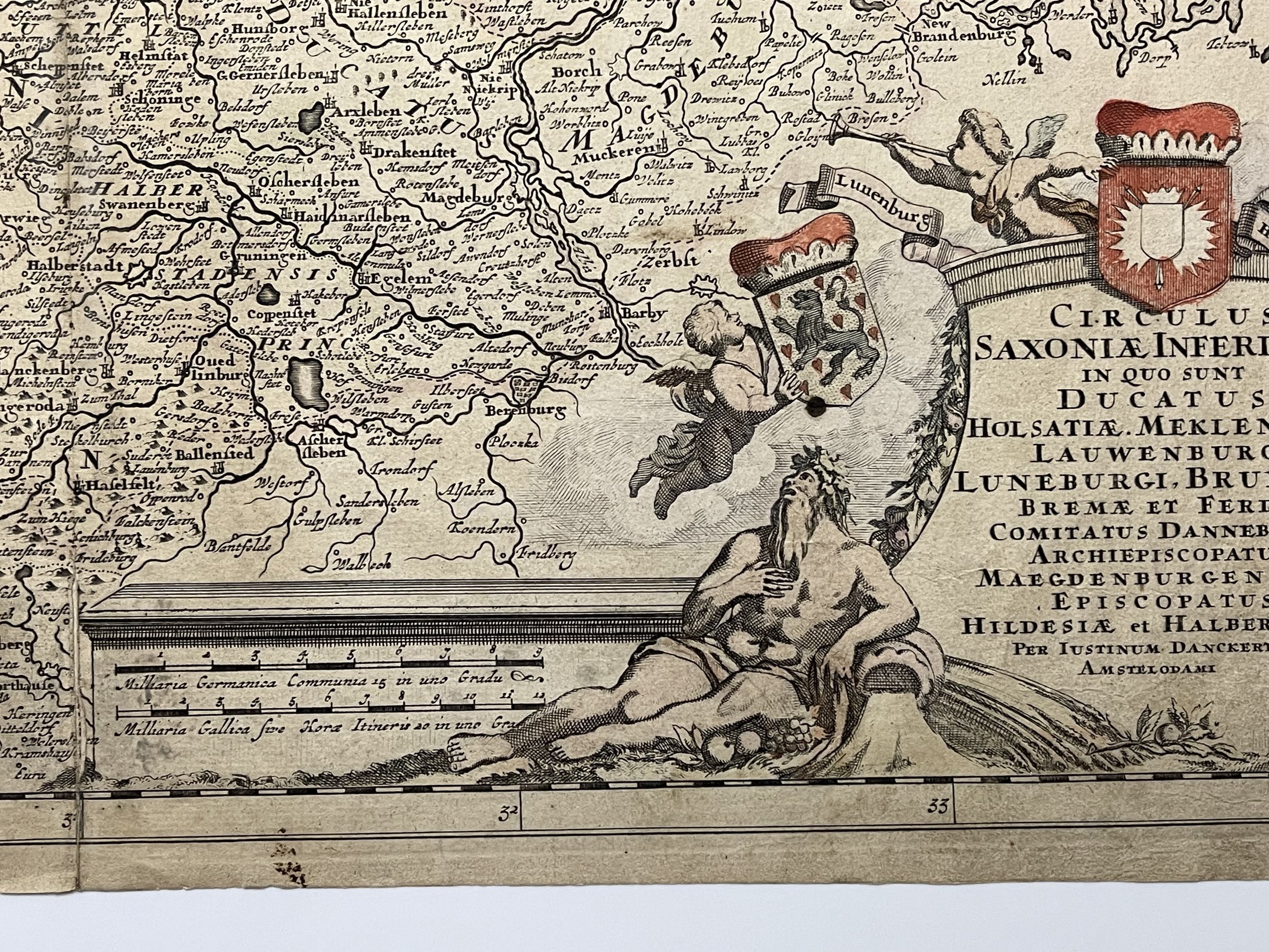
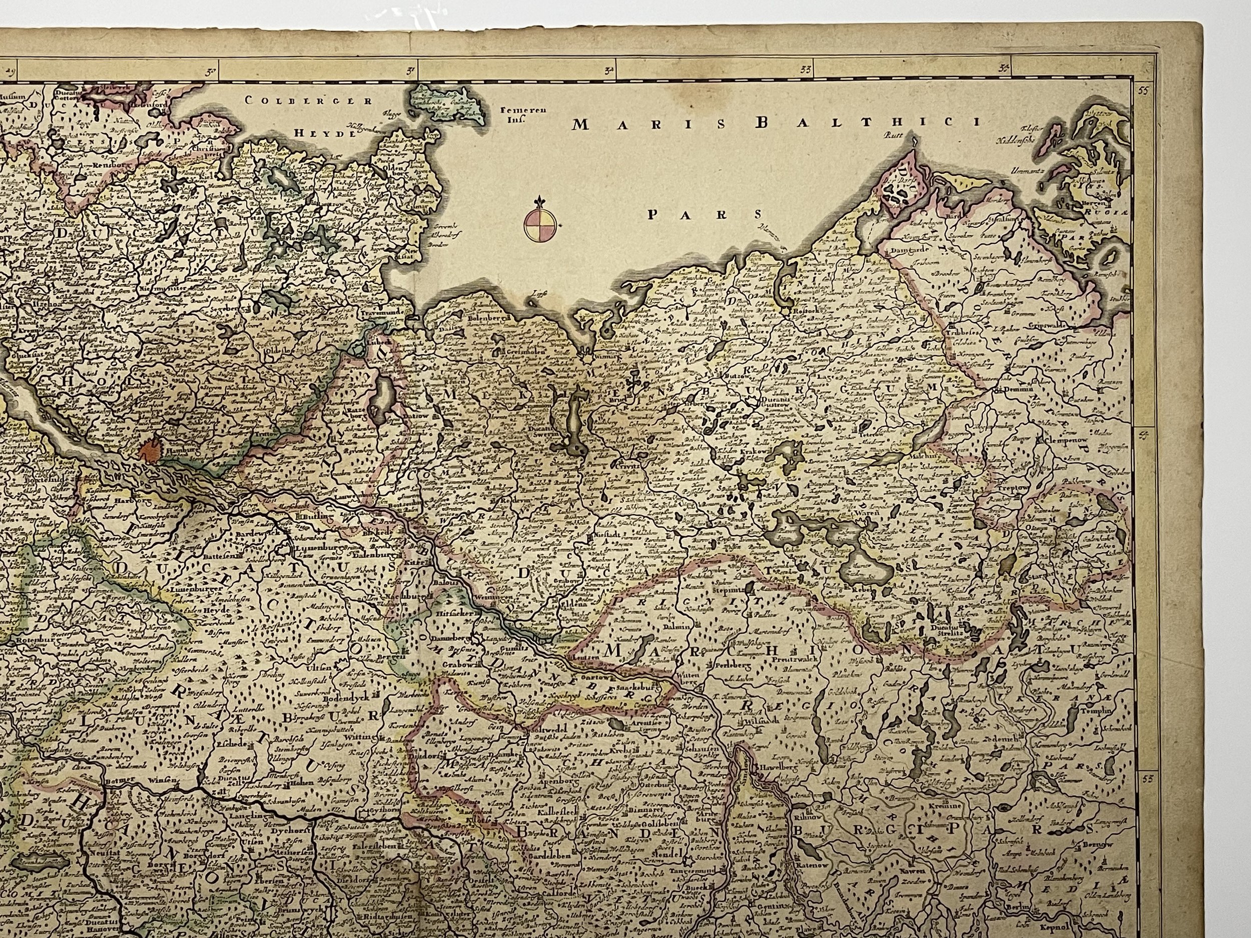
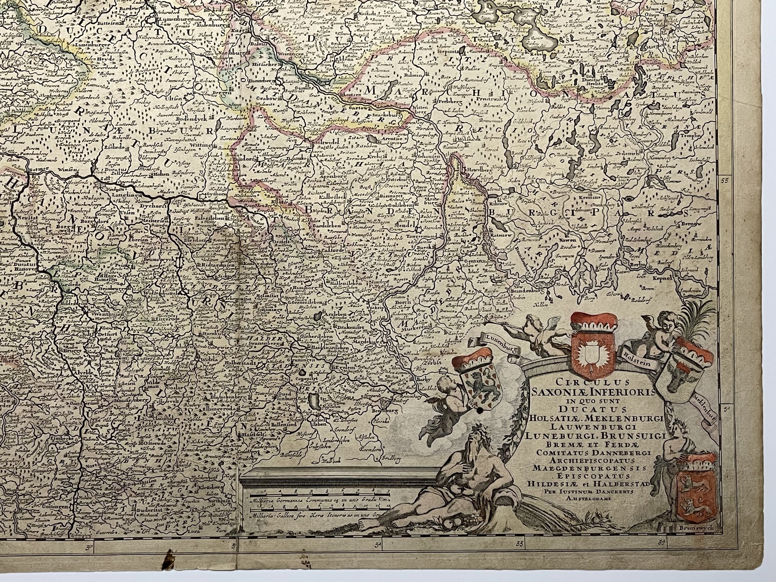
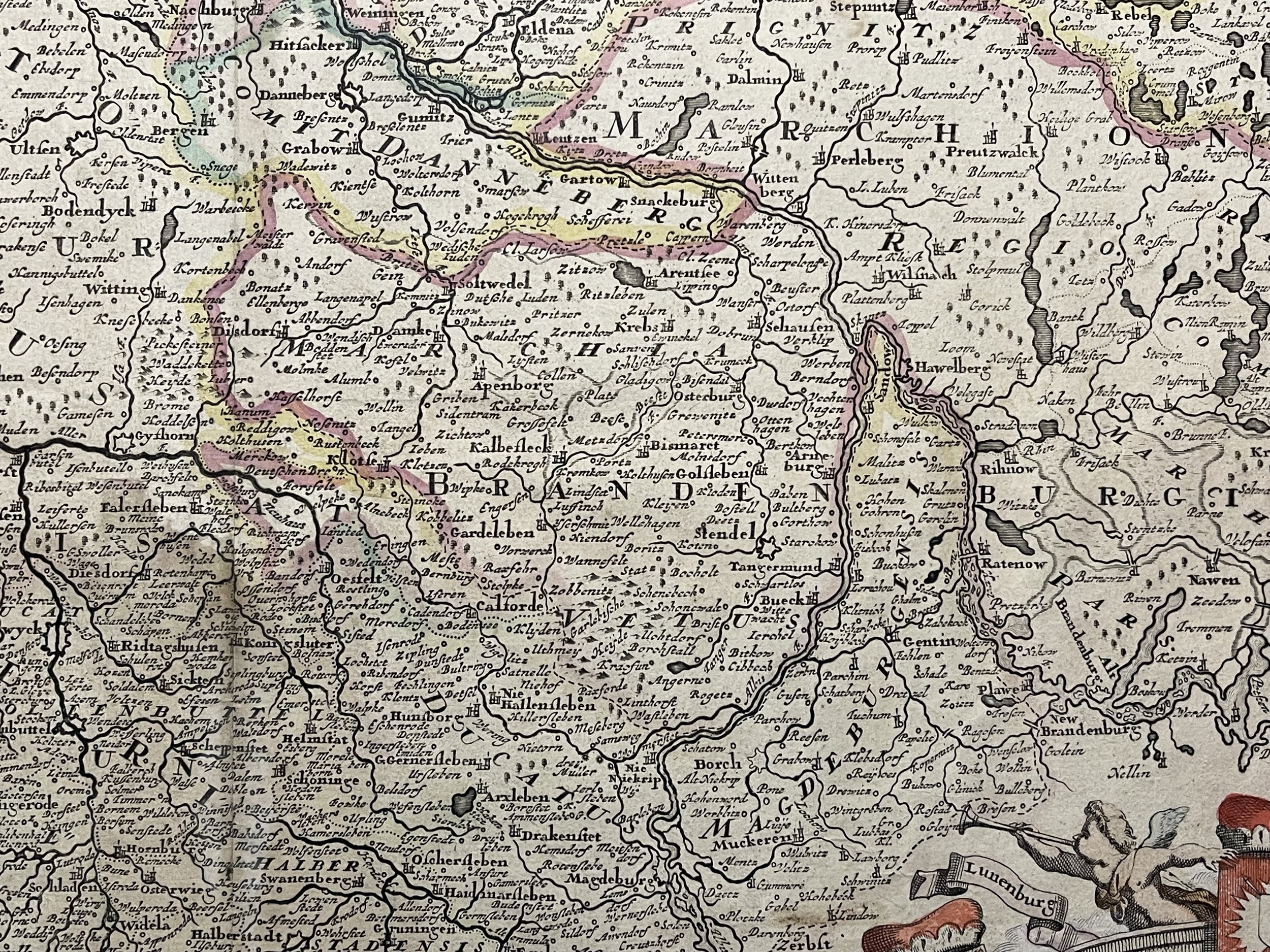
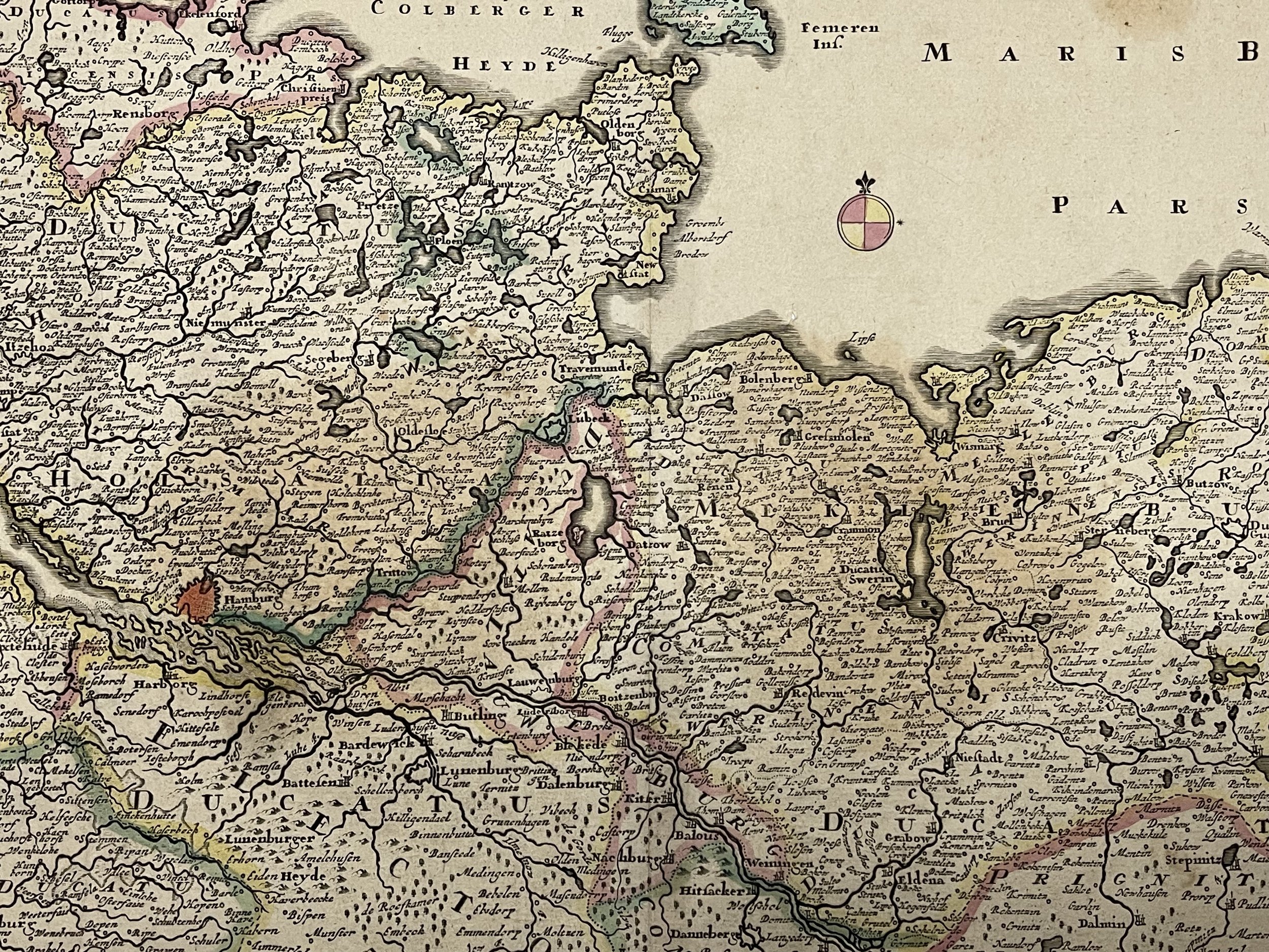
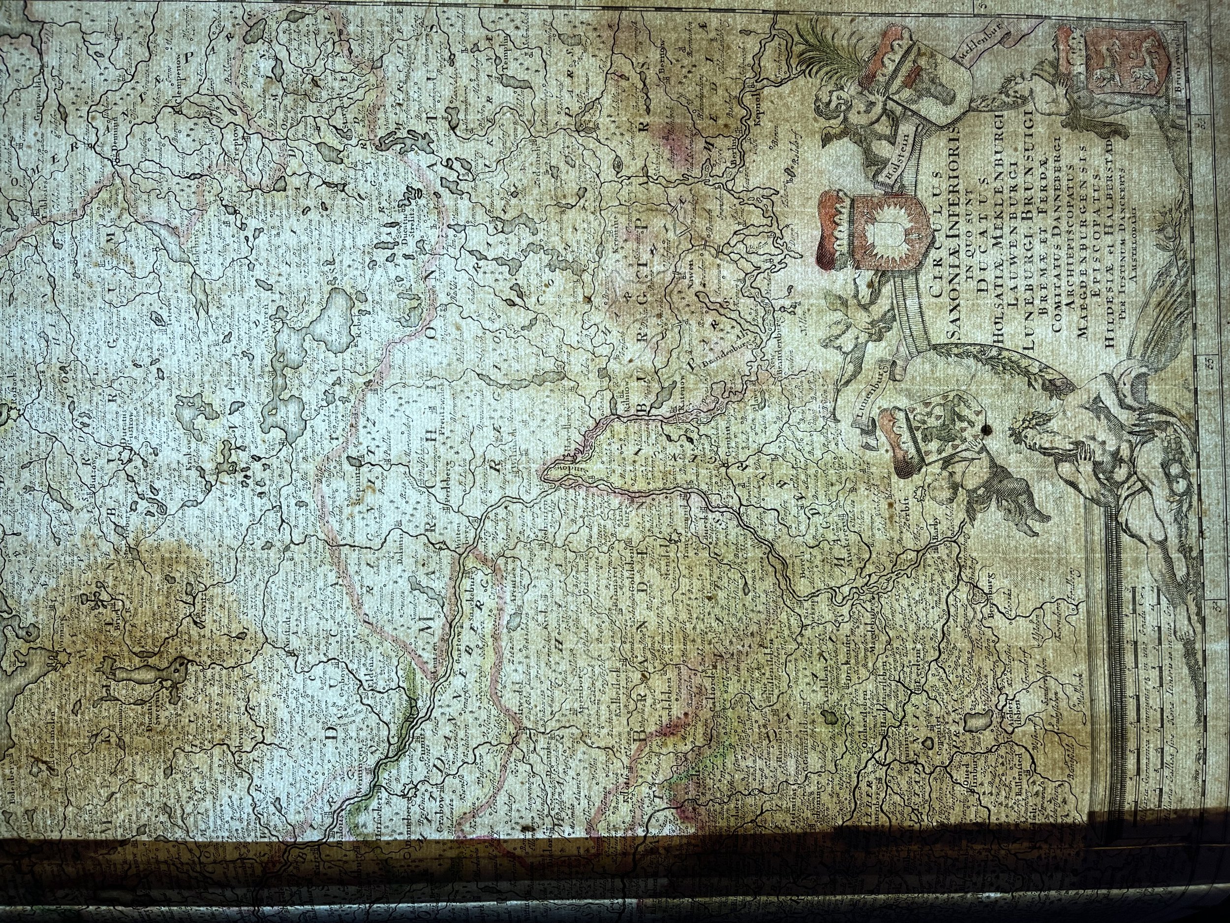
Circulus Saxoniae Inferioris in quo sunt Ducatus Holsatiae - Northwestern Germany - Justus Danckerts - 1690
Circulus Saxoniae Inferioris in quo sunt Ducatus Holsatiae. Meklenburgi Lauwenburgi Luneburgi, Brunsuigi Bremae et Ferdae...", Danckerts, Justus - J Danckerts - 1690
Beautiful colour example of Justus Danckerts's scarce map of northwestern Germany, published in Amsterdam. Some staining in places but engraving is clear and bright. Pricing and grading commensurate.
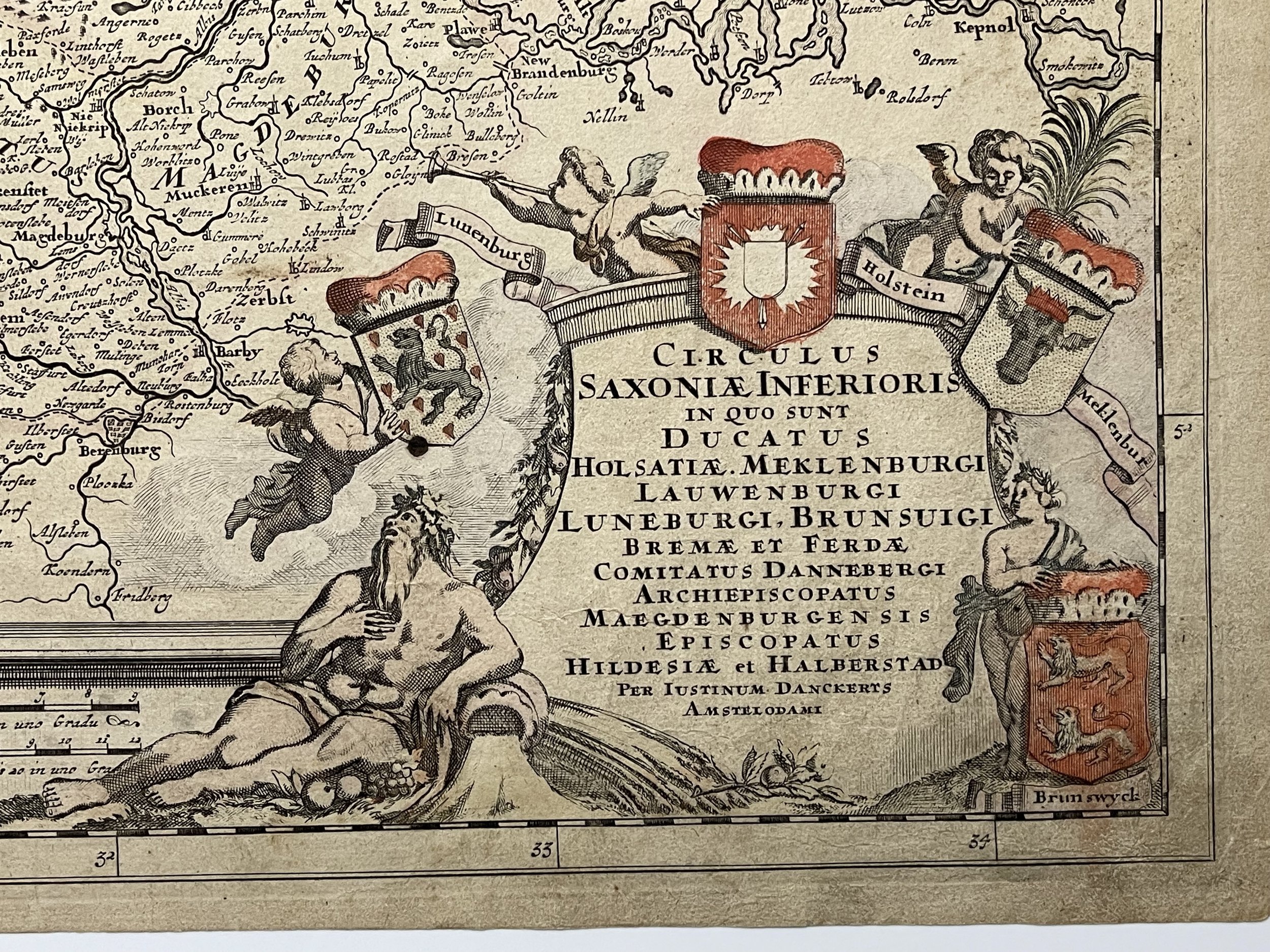
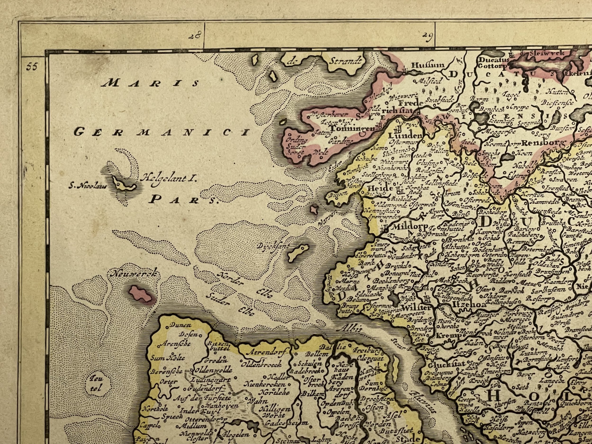
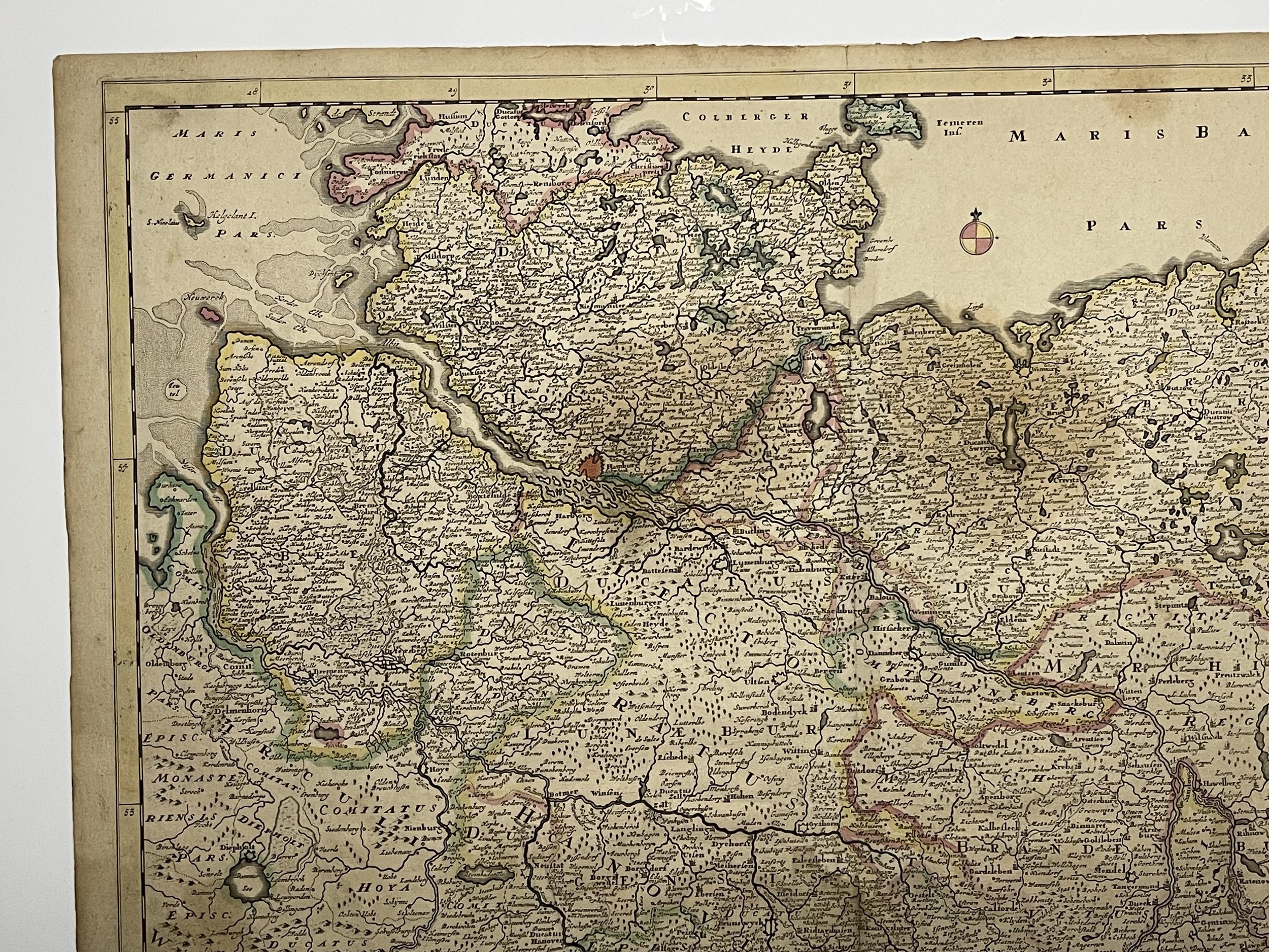
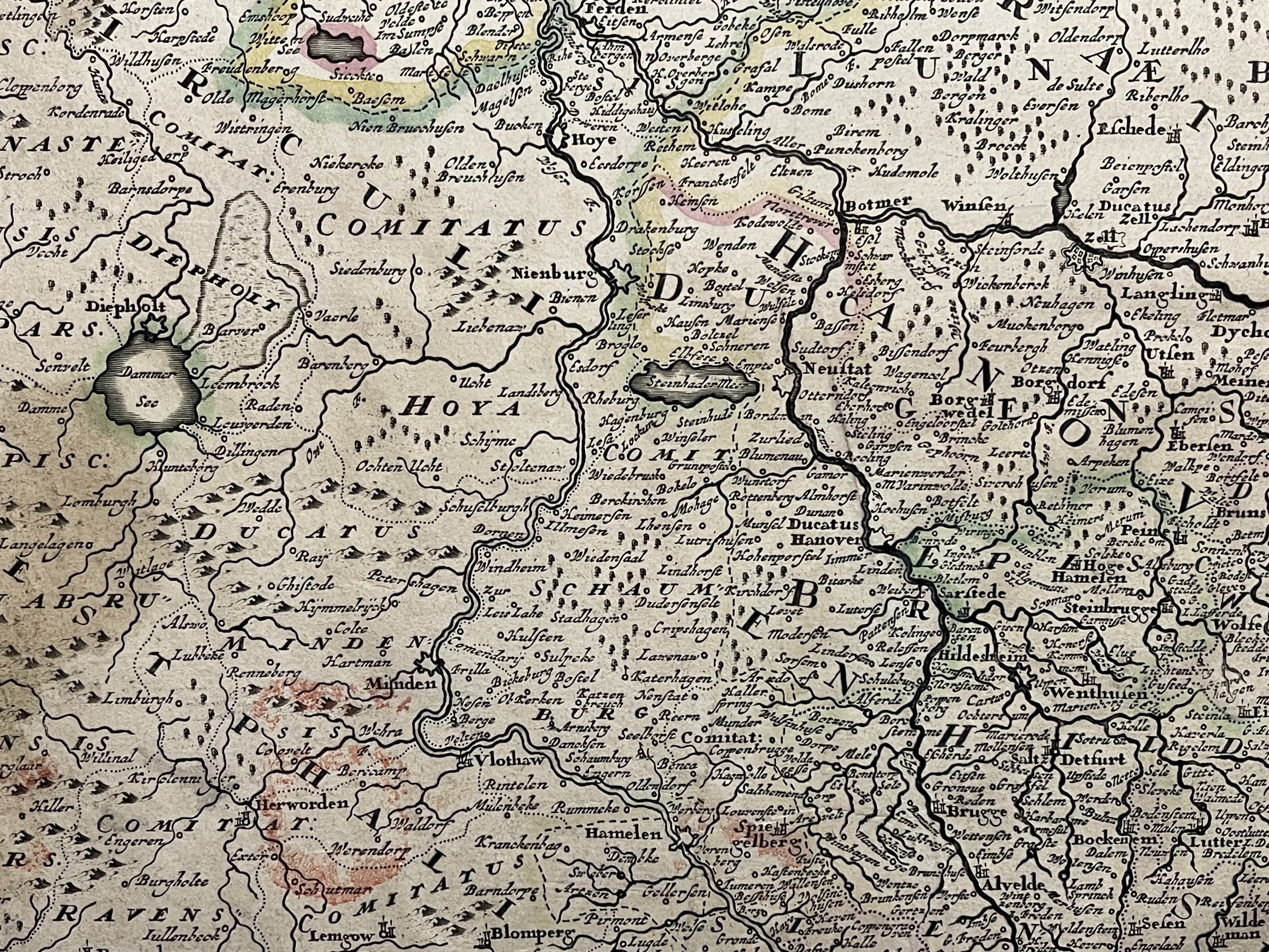
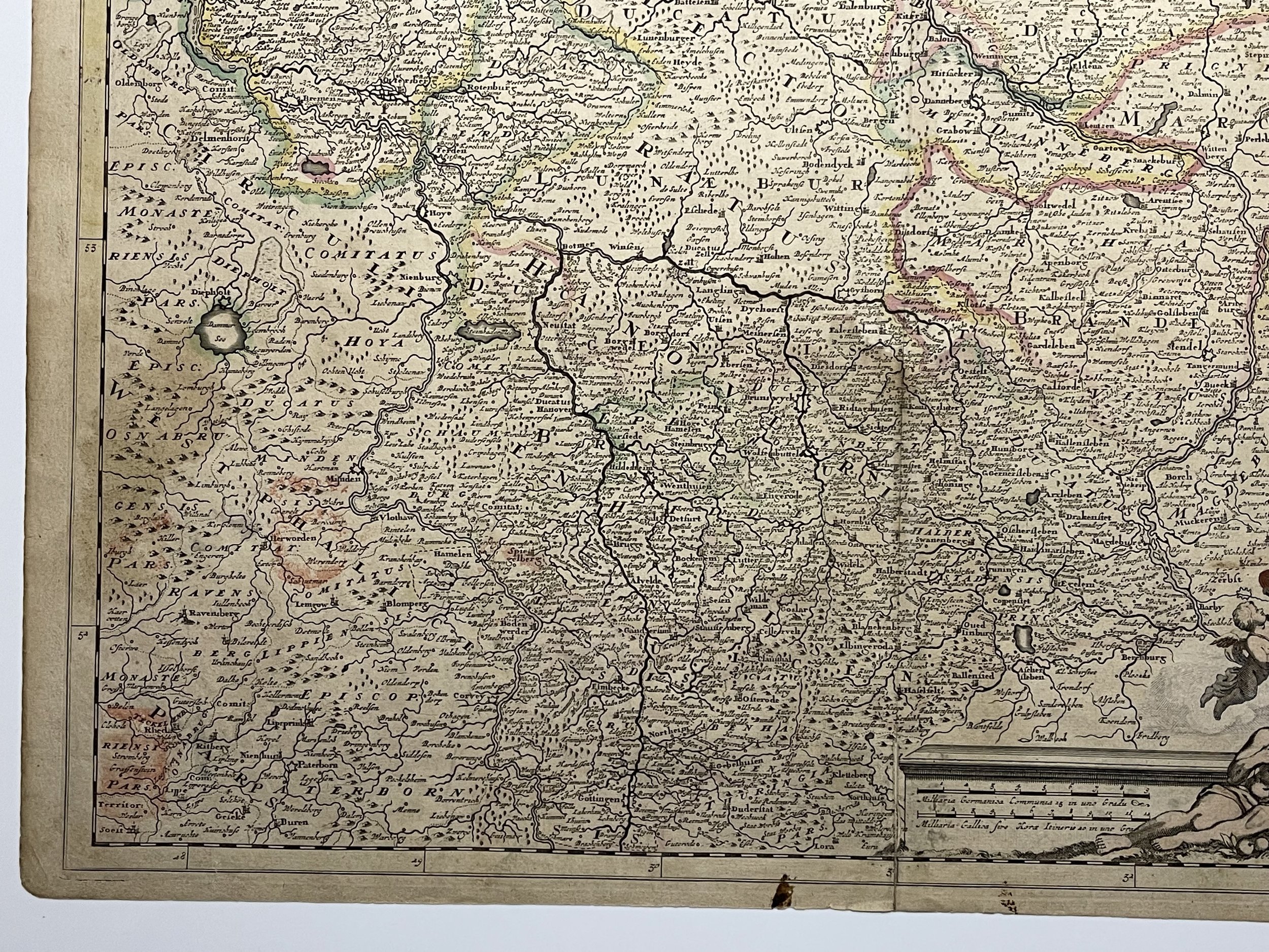
Major cities include Hamburg, Bremen, Hanover, Luneburg, Brunswick, Hildesheim, Halderstadt, Magdeburg, Wiemar and Gottingen, with Berlin at the far east. Elaborate cartouche with the coats of arms of Luneburg, Holstein, Mecklenburg and Brunswick.
The Danckerts were a family of Dutch engravers and geographers who produced geographic materials, including a series of original atlases. Initially, Justus I Danckerts (1635-1701) was a book and print publisher based in Amsterdam. His great-uncle, Cornelis Danckerts de Rij, (1561-1634) was a surveyor who produced a Kaert-boeck showing various views of Amsterdam. His brother, Dancker Danckerts (1634-1666), was a skilled engraver who produced several maps. Justus I was most likely influenced by their work when he followed his father, Cornelis I Danckerts (1603-1656), into the publishing business.
In the early 1680s, Justus decided to embark upon a new project, an atlas with all the maps made in house. Such a project was feasible because two of his sons with his wife, Elisabeth Vorsterman, Theodorus I (ca. 1663-ca. 1720) and Cornelis II (1664-1717) had recently come of age and were trained in engraving and etching. Justus’ decision was most likely influenced by his surroundings; Amsterdam was the centre of map publishing in the seventeenth century and in the 1680s several local publishers sought to join the atlas market then dominated by the Blaeu and the Hondius-Janssonius atlases.
Together, the brothers created their first maps in the mid-1680s. In 1684, the family received a 15-year privilege to protect their maps and they were then publishing both folios sized maps, the basis of an atlas, and wall maps for sale. Their first atlases contained around 20 original maps and 4-5 maps by other cartographers like Visscher and De Wit. The first known atlas to contain only Danckert maps was a 26-sheet volume published in 1690. As a guide, the Danckerts turned to similar atlases by De Wit, but by 1690 they clearly had the knowledge and capacity to produce their own original work.
After the first 26-sheet atlas, the Danckerts released a 37-sheet (1692-4), a 50-sheet (1694-6), and a 60-sheet (1698-1700) atlas. Several of the maps added to the atlases in the 1690s reflect the theatre of the Great Alliance War (1688-1697). Other political events also influenced the contents of the atlases. For example, the English and Irish sheet maps were altered in 1688-9 and 1689-91 respectively, just after the Glorious Revolution of 1688.
In 1692, Justus II (?-1692), a third son of Justus I, died. A series of maps bearing a distinct style which abruptly stopped at this time have been attributed to him. A family member assumed to be another son of Justus I, Eduard (?-after 1721) came of age around the same time. Analysis of engraving style suggests that Eduard was heavily involved in the engraving process, working alongside Theodorus I and with another relation, also presumed to be a younger son of Justus I, Johannes (?-1712), thereafter.
Justus I drew up his will in 1696 and most likely retired from daily management of the shop at this time, although he lived until 1701. Johannes, who had a distinct engraving style, began contributing to the map engraving in 1700, although most of the maps he worked on are published under the name of another brother. The privilege had expired in 1699 and its renewal in the same year, before the death of Justus I, could explain why his sons continued to publish in his name after his death. Using the well-known name of Justus could protect the younger sons whose own reputation was not yet established.
In the new century, many of the maps were reworked or completely redone, as was the case with the world map and those of the continents. New maps were added to reflect the new areas of fighting in the War of the Spanish Succession, including new depictions of Italian states, the southern Netherlands, and the German provinces. In 1706, Albert Schut joined the business as an engraver and etcher and his name appears on maps from then onward. Between 1700 and 1712, the number of atlas maps increased to 75 and then 100 sheets. It seems Cornelis II was the main voice in atlas contents during this time, while Theodorus I’s role is unclear.
Circulus Saxoniae Inferioris in quo sunt Ducatus Holsatiae. Meklenburgi Lauwenburgi Luneburgi, Brunsuigi Bremae et Ferdae...", Danckerts, Justus - J Danckerts - 1690
Beautiful colour example of Justus Danckerts's scarce map of northwestern Germany, published in Amsterdam. Some staining in places but engraving is clear and bright. Pricing and grading commensurate.
Major cities include Hamburg, Bremen, Hanover, Luneburg, Brunswick, Hildesheim, Halderstadt, Magdeburg, Wiemar and Gottingen, with Berlin at the far east. Elaborate cartouche with the coats of arms of Luneburg, Holstein, Mecklenburg and Brunswick.
The Danckerts were a family of Dutch engravers and geographers who produced geographic materials, including a series of original atlases. Initially, Justus I Danckerts (1635-1701) was a book and print publisher based in Amsterdam. His great-uncle, Cornelis Danckerts de Rij, (1561-1634) was a surveyor who produced a Kaert-boeck showing various views of Amsterdam. His brother, Dancker Danckerts (1634-1666), was a skilled engraver who produced several maps. Justus I was most likely influenced by their work when he followed his father, Cornelis I Danckerts (1603-1656), into the publishing business.
In the early 1680s, Justus decided to embark upon a new project, an atlas with all the maps made in house. Such a project was feasible because two of his sons with his wife, Elisabeth Vorsterman, Theodorus I (ca. 1663-ca. 1720) and Cornelis II (1664-1717) had recently come of age and were trained in engraving and etching. Justus’ decision was most likely influenced by his surroundings; Amsterdam was the centre of map publishing in the seventeenth century and in the 1680s several local publishers sought to join the atlas market then dominated by the Blaeu and the Hondius-Janssonius atlases.
Together, the brothers created their first maps in the mid-1680s. In 1684, the family received a 15-year privilege to protect their maps and they were then publishing both folios sized maps, the basis of an atlas, and wall maps for sale. Their first atlases contained around 20 original maps and 4-5 maps by other cartographers like Visscher and De Wit. The first known atlas to contain only Danckert maps was a 26-sheet volume published in 1690. As a guide, the Danckerts turned to similar atlases by De Wit, but by 1690 they clearly had the knowledge and capacity to produce their own original work.
After the first 26-sheet atlas, the Danckerts released a 37-sheet (1692-4), a 50-sheet (1694-6), and a 60-sheet (1698-1700) atlas. Several of the maps added to the atlases in the 1690s reflect the theatre of the Great Alliance War (1688-1697). Other political events also influenced the contents of the atlases. For example, the English and Irish sheet maps were altered in 1688-9 and 1689-91 respectively, just after the Glorious Revolution of 1688.
In 1692, Justus II (?-1692), a third son of Justus I, died. A series of maps bearing a distinct style which abruptly stopped at this time have been attributed to him. A family member assumed to be another son of Justus I, Eduard (?-after 1721) came of age around the same time. Analysis of engraving style suggests that Eduard was heavily involved in the engraving process, working alongside Theodorus I and with another relation, also presumed to be a younger son of Justus I, Johannes (?-1712), thereafter.
Justus I drew up his will in 1696 and most likely retired from daily management of the shop at this time, although he lived until 1701. Johannes, who had a distinct engraving style, began contributing to the map engraving in 1700, although most of the maps he worked on are published under the name of another brother. The privilege had expired in 1699 and its renewal in the same year, before the death of Justus I, could explain why his sons continued to publish in his name after his death. Using the well-known name of Justus could protect the younger sons whose own reputation was not yet established.
In the new century, many of the maps were reworked or completely redone, as was the case with the world map and those of the continents. New maps were added to reflect the new areas of fighting in the War of the Spanish Succession, including new depictions of Italian states, the southern Netherlands, and the German provinces. In 1706, Albert Schut joined the business as an engraver and etcher and his name appears on maps from then onward. Between 1700 and 1712, the number of atlas maps increased to 75 and then 100 sheets. It seems Cornelis II was the main voice in atlas contents during this time, while Theodorus I’s role is unclear.
Code : A57
Cartographer : Cartographer / Engraver / Publisher: Justus Danckerts
Date : Publication Place / Date - Circa 1690
Size : Sheet size: Image Size: 60.5 x 51 cm
Availability : Available
Type - Genuine - Antique
Grading A-
Where Applicable - Folds as issued. Light box photo shows the folio leaf centre margin hinge ‘glue’, this is not visible otherwise.
Tracked postage, in casement. Please contact me for postal quotation outside of the UK.