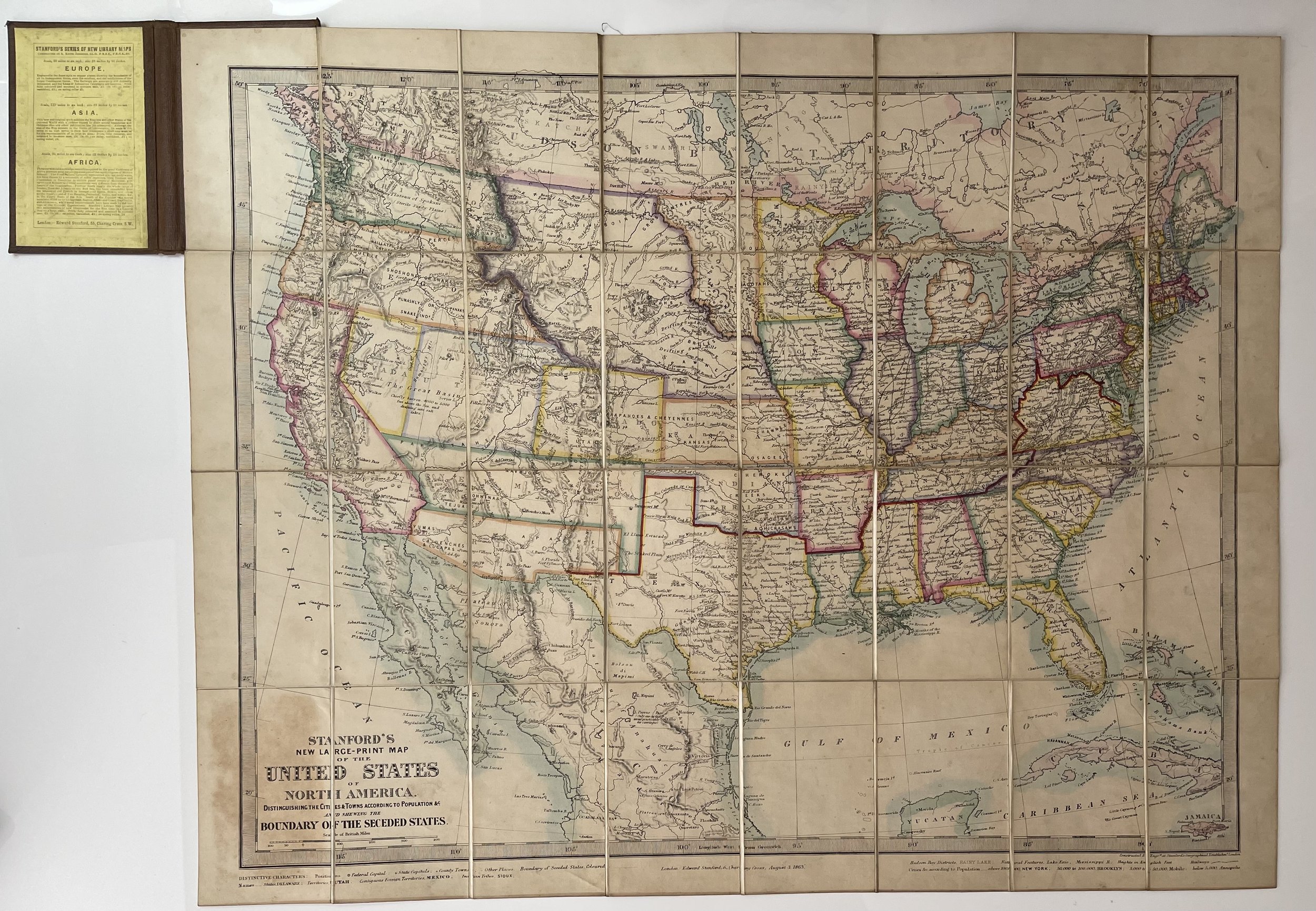
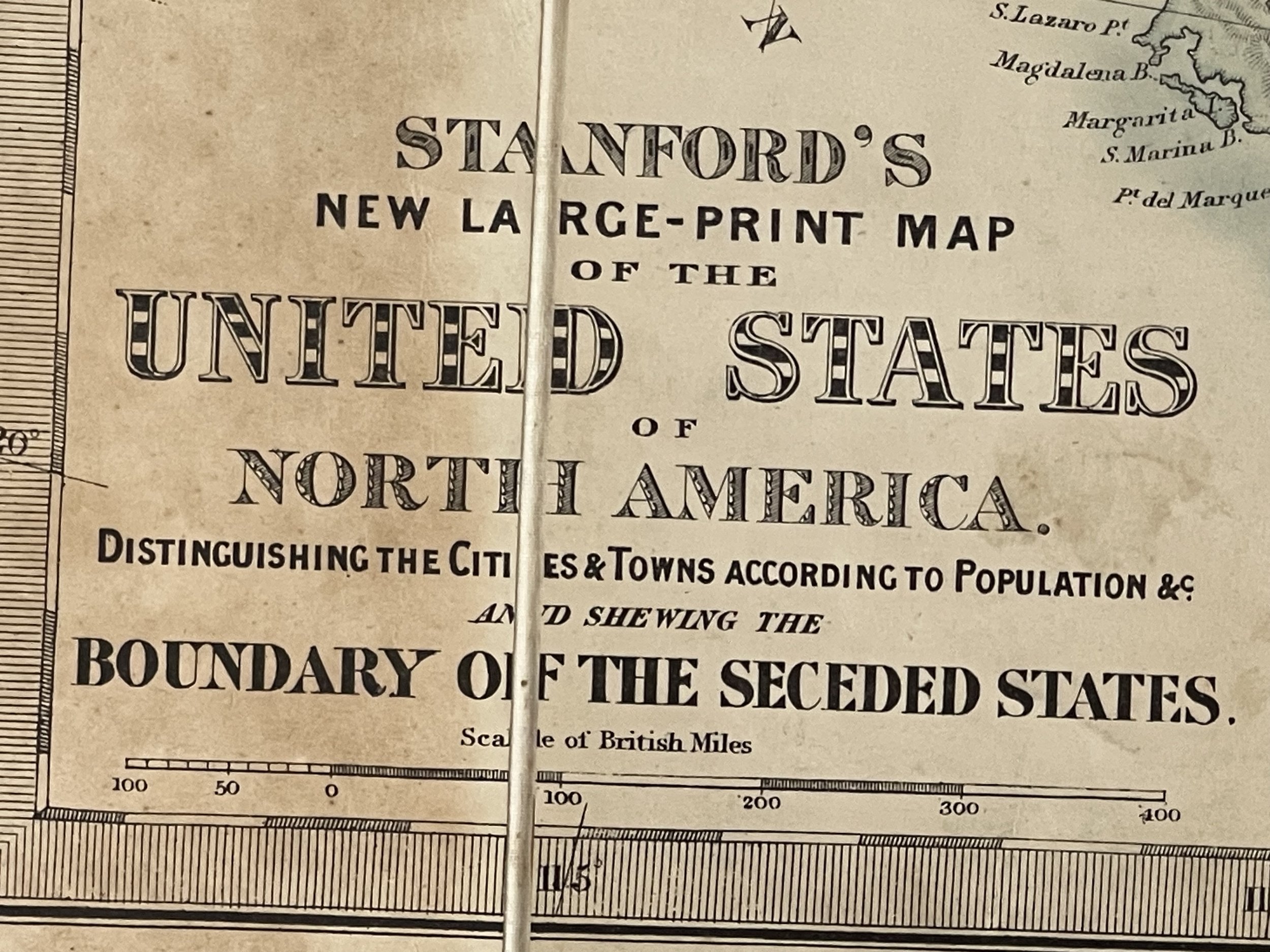


CIVIL WAR Era United States - Edward Stanford - 1863 - RARE
Rare Edward Stanford Map Of The United States & Shewing Boundary Of Seceded States dating from 3 August 1863.
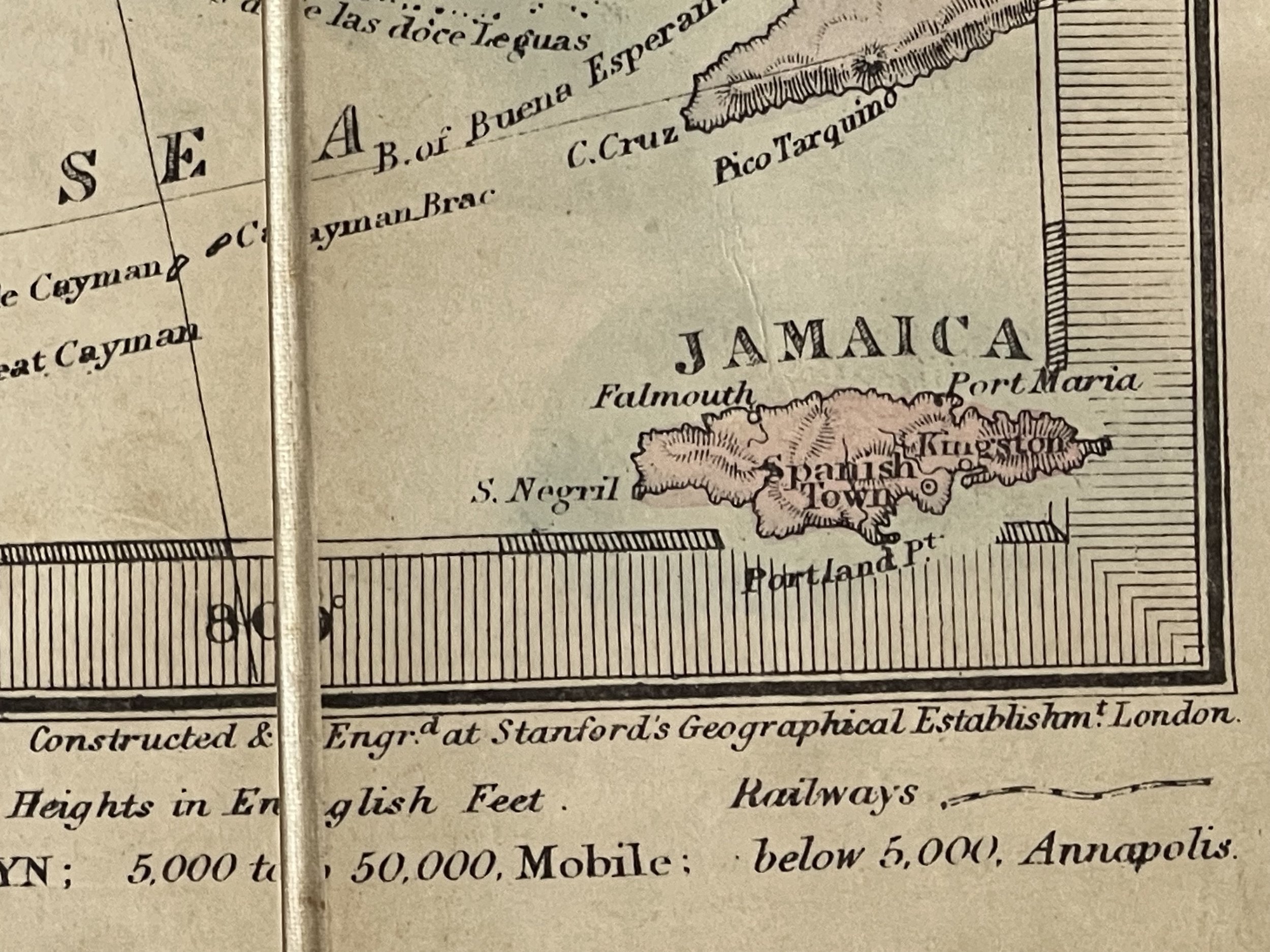
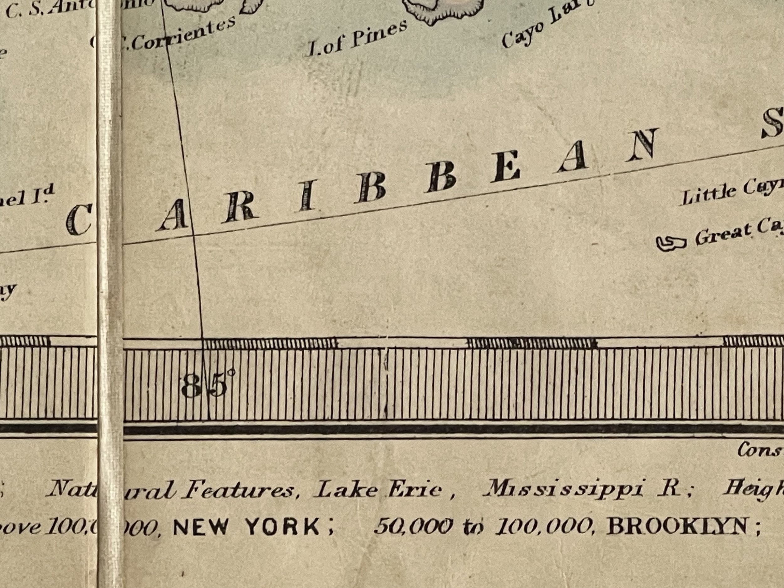
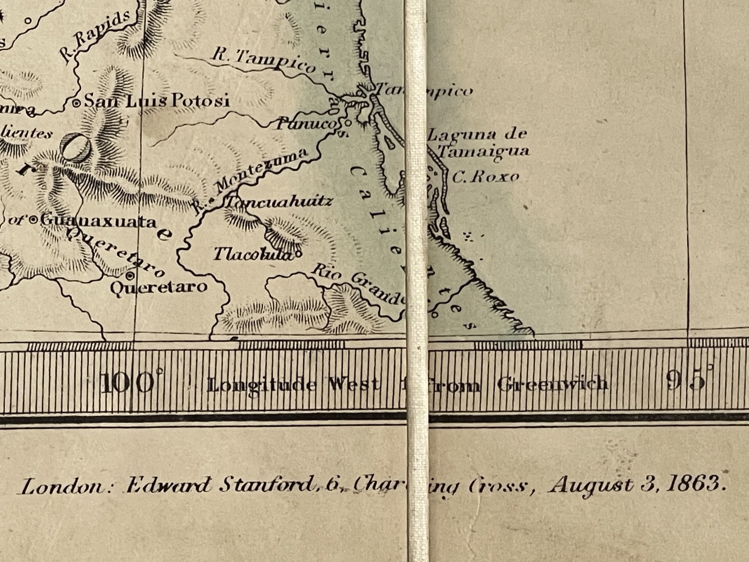
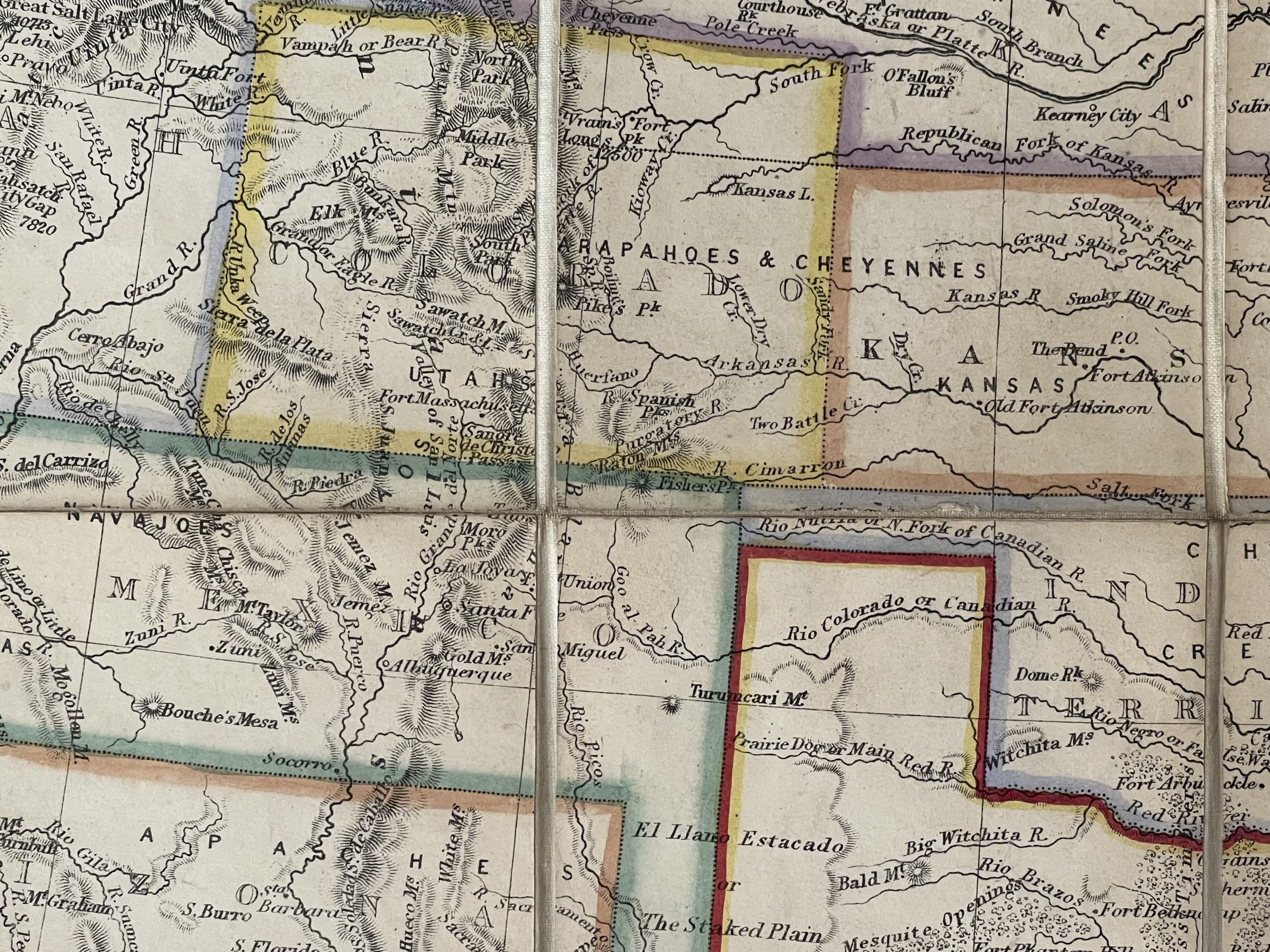
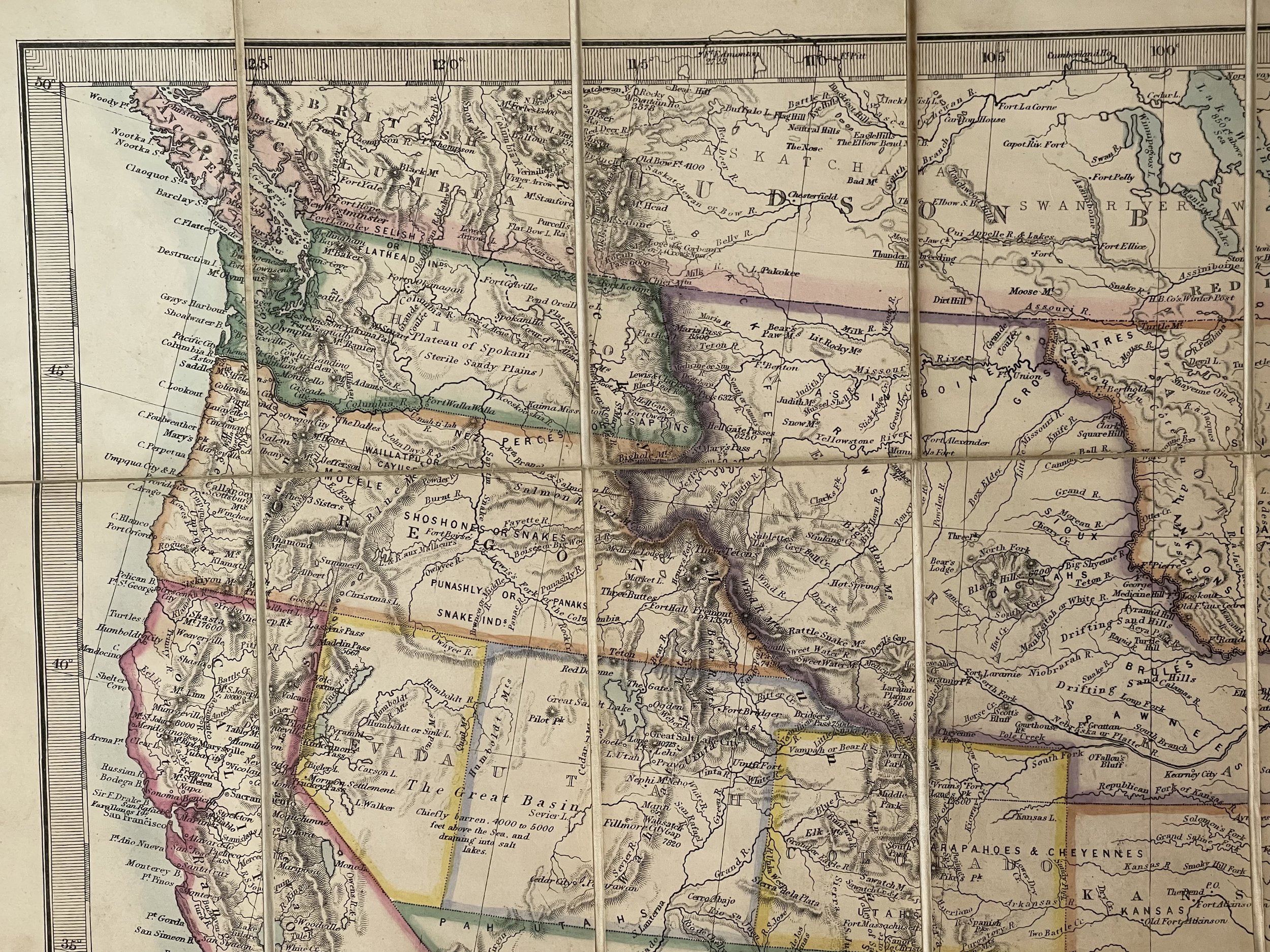
Rare separately issued map of the United States, published by Edward Stanford & Co. Stanford was catering for the demand in England for information concerning the Civil War in America.
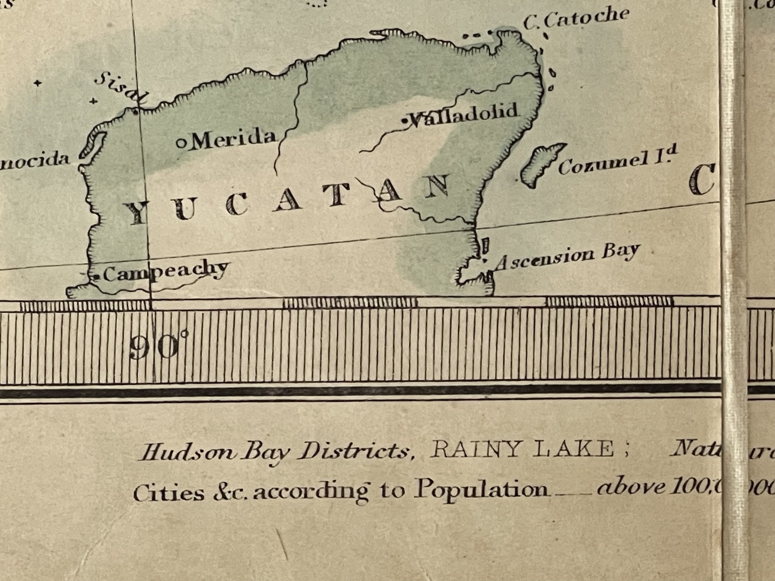
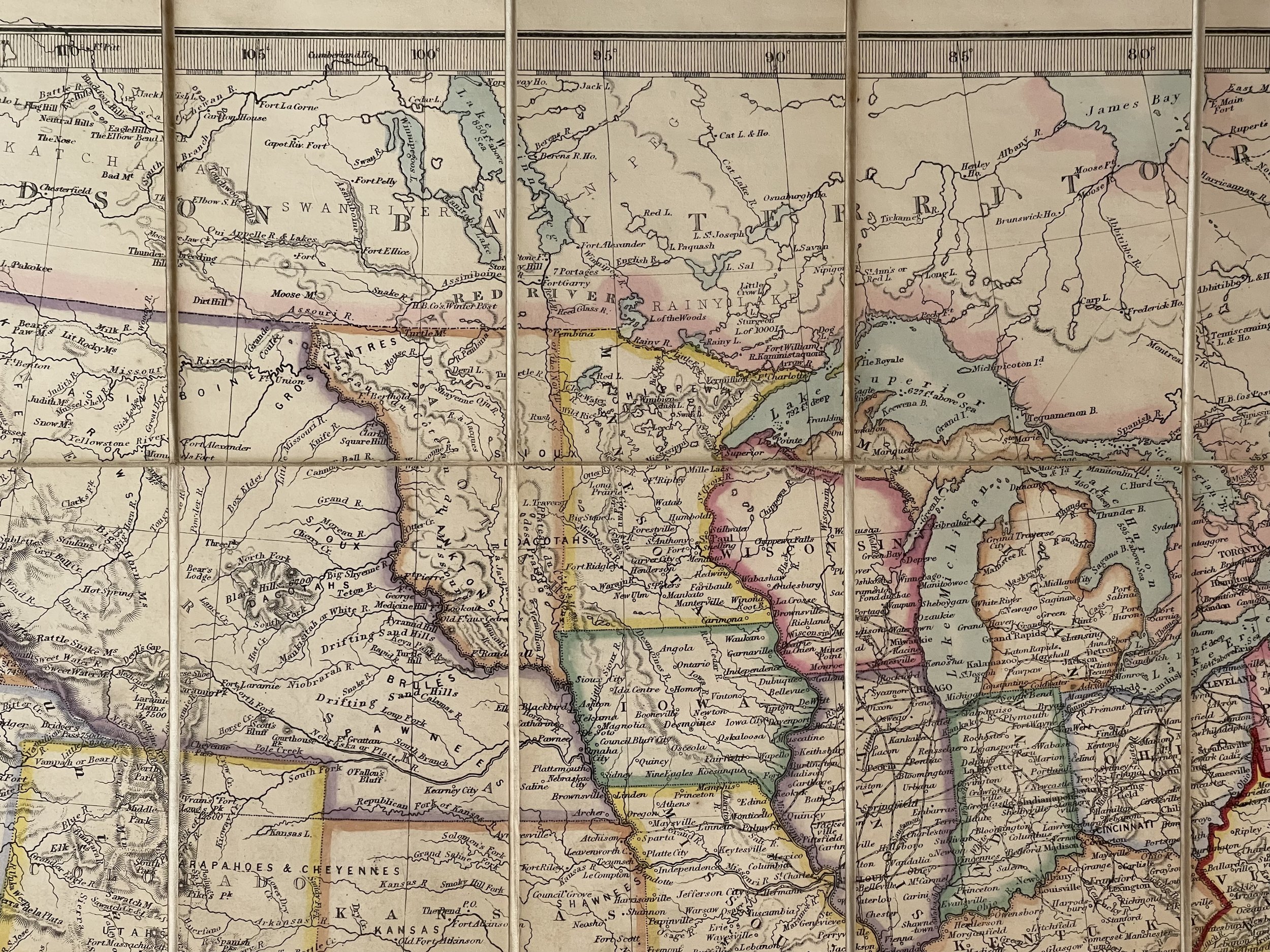
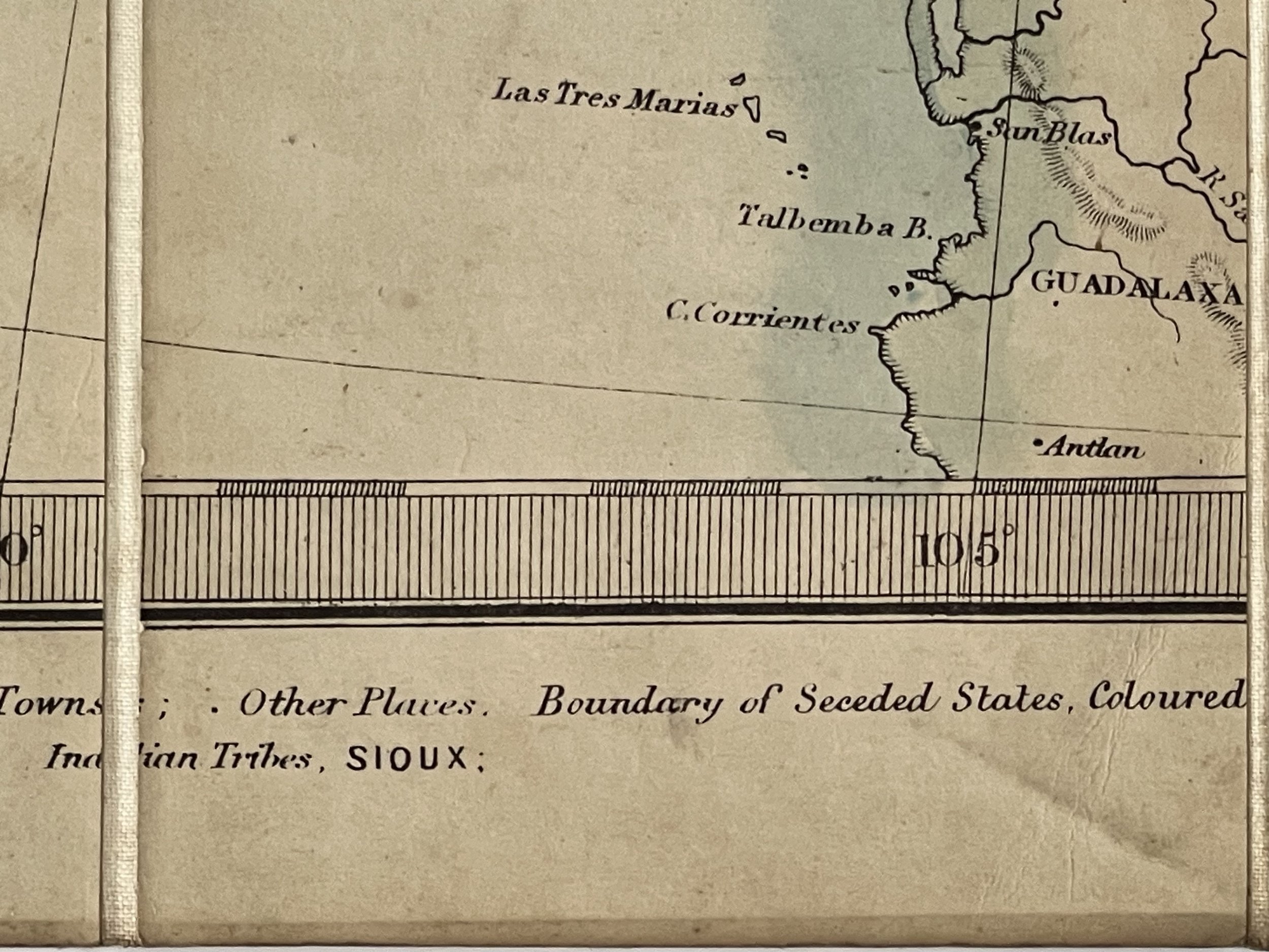
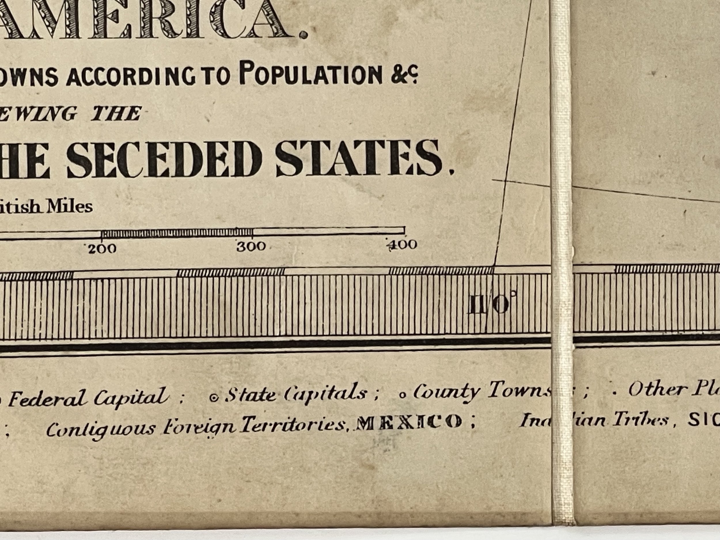
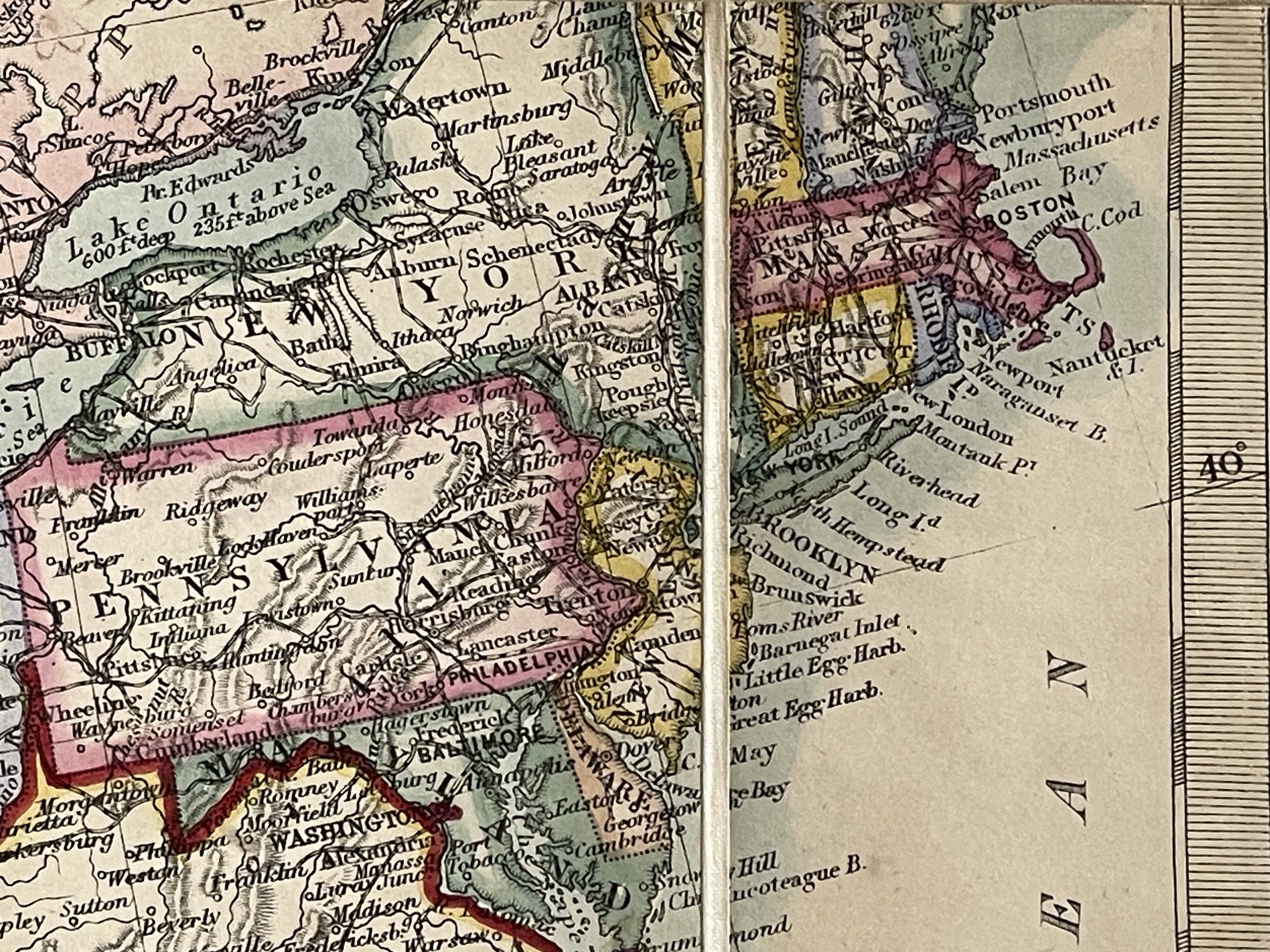
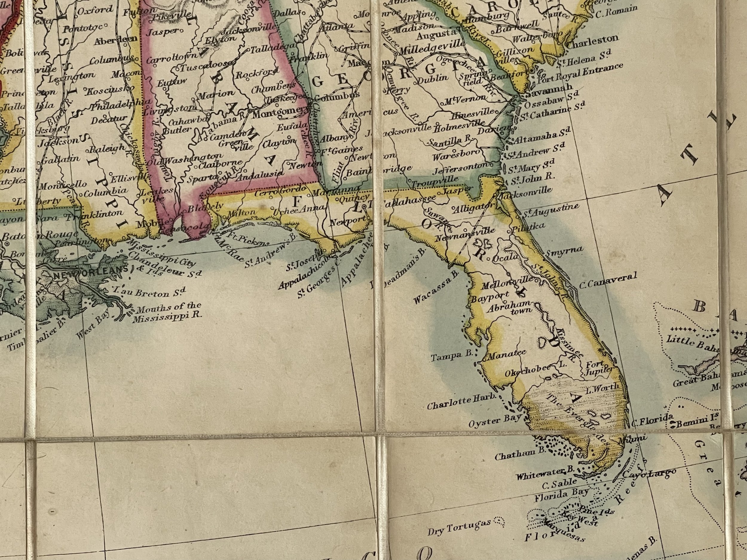
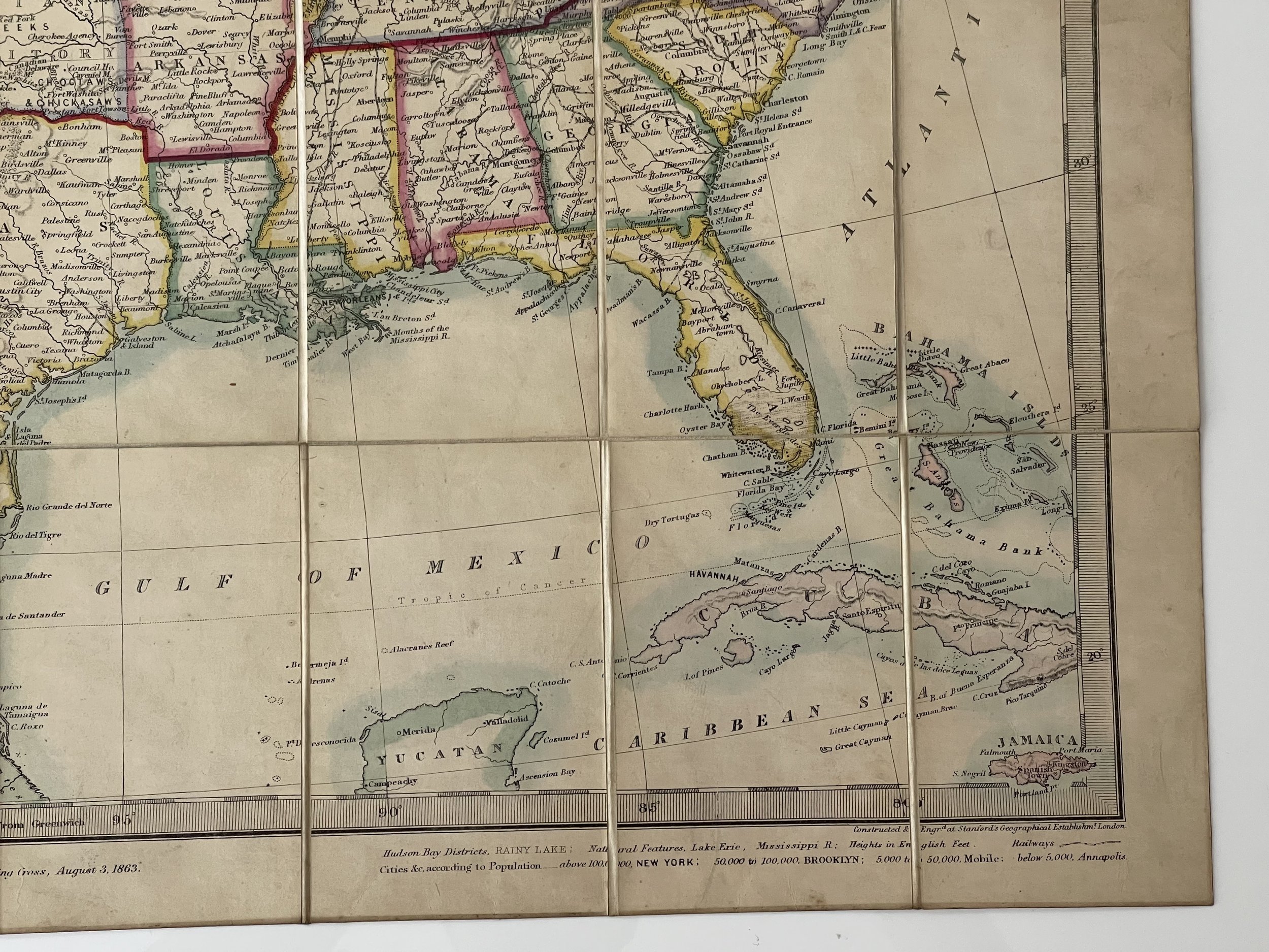
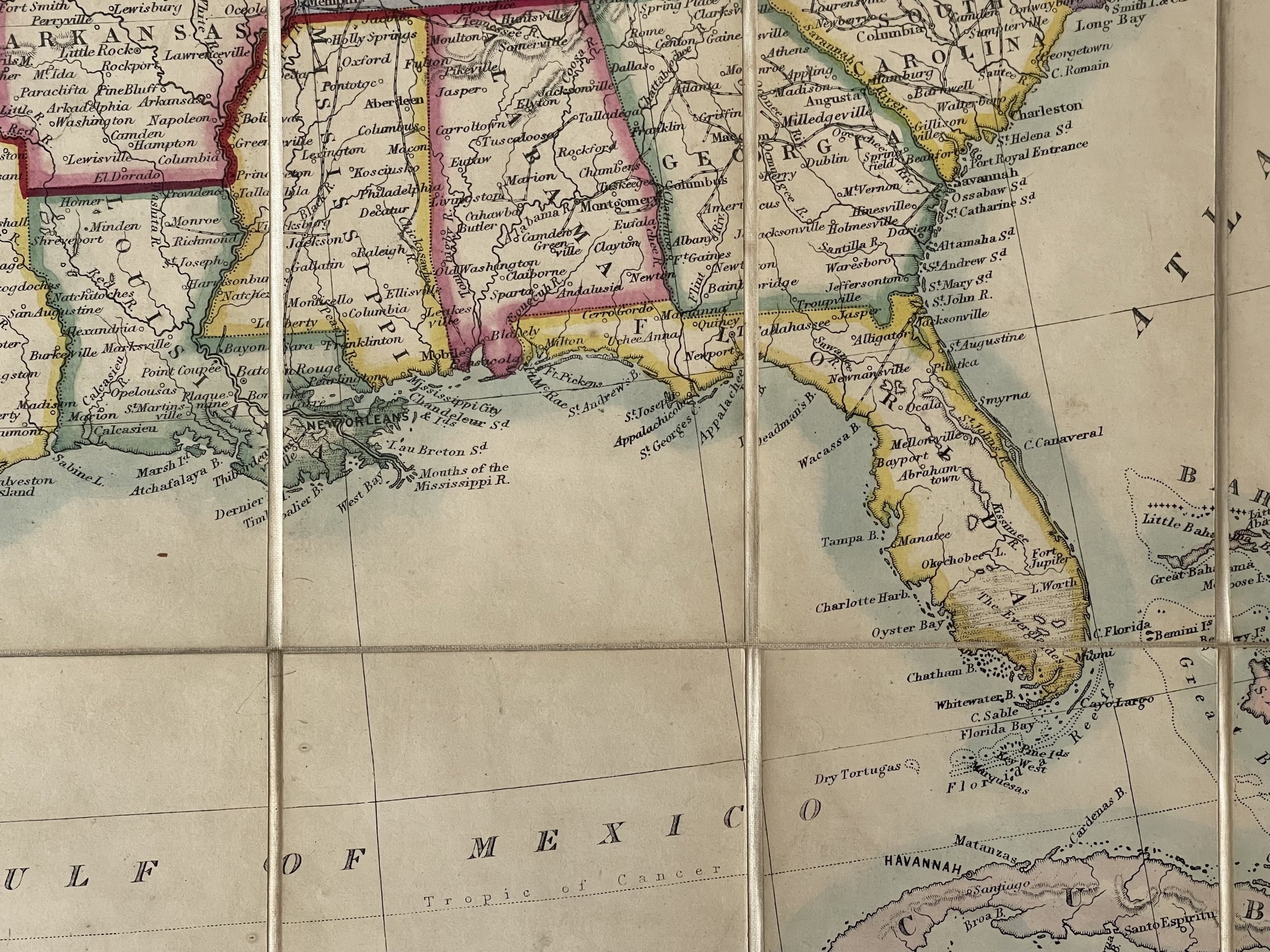
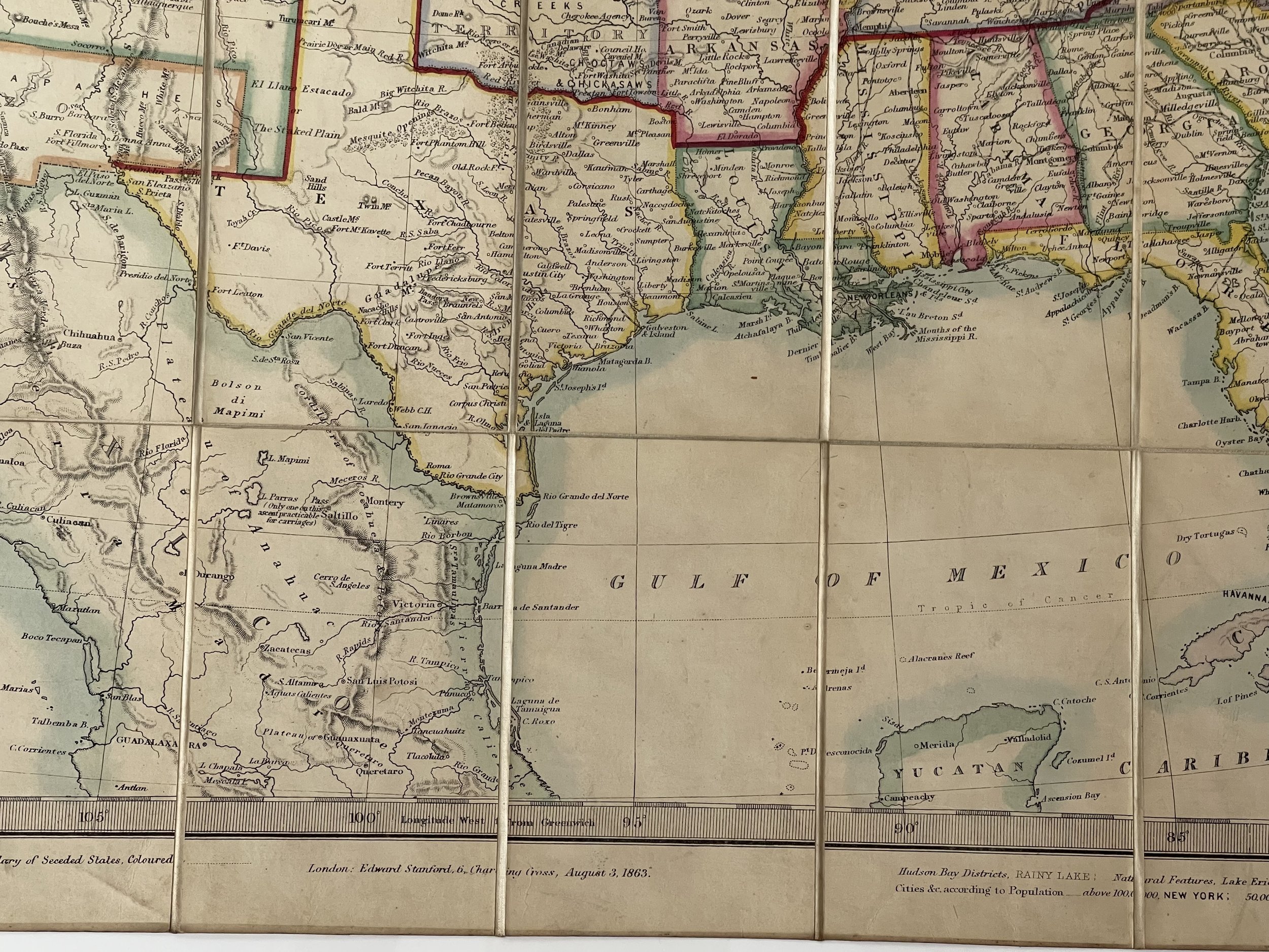
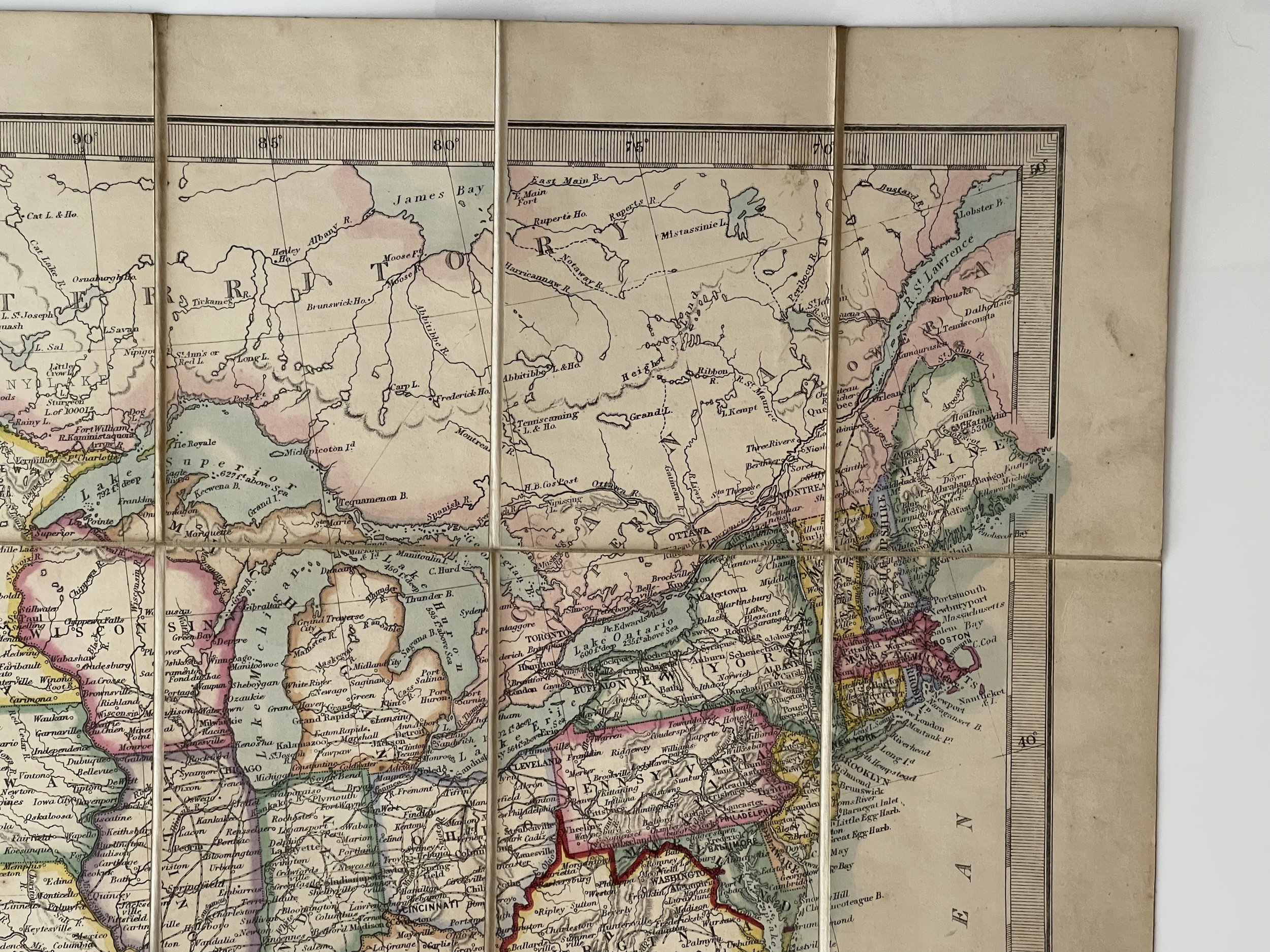
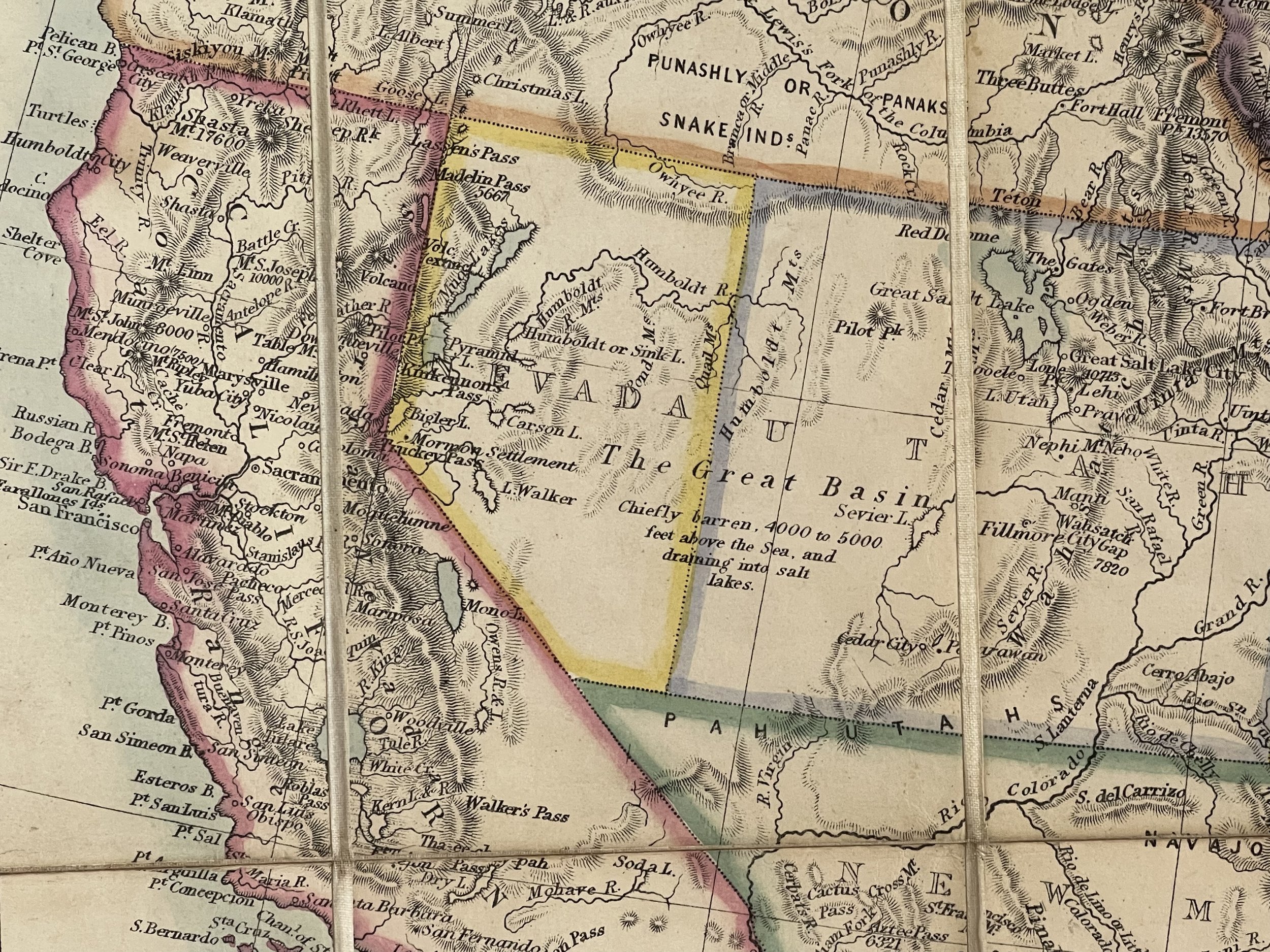
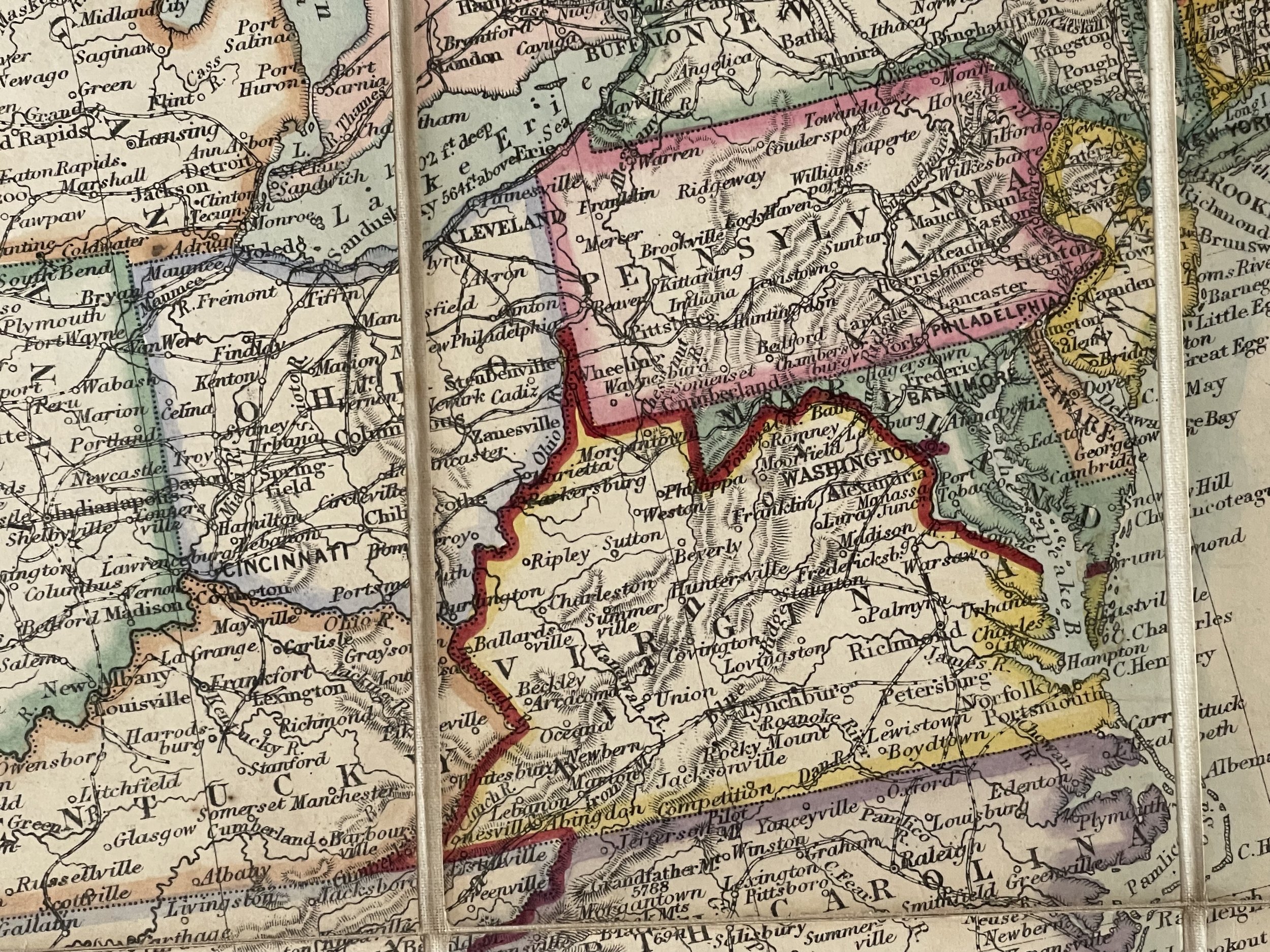
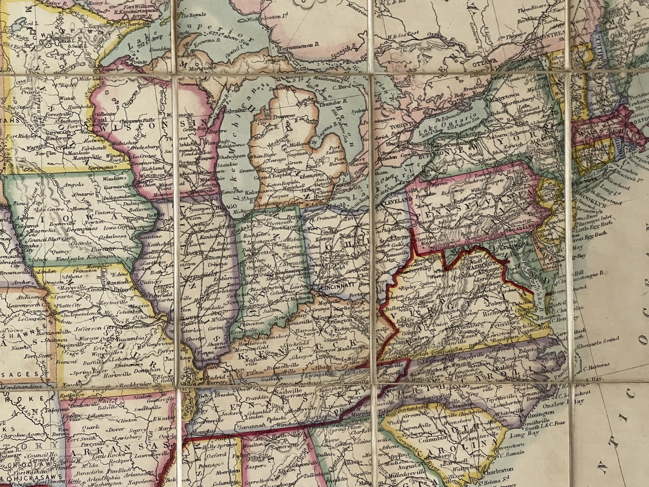
The map highlights the Southern United States which had seceded from the Union and were then at War with the Northern States, which are divided from the Northern States by a red line.
The map is of the utmost rarity. OCLC locates only a single example of the 1861 edition of this map, in the collection of David Rumsey. No examples of the 1863 edition are recorded. There doesn’t seem to be an 1863 map version in archives regarding this 1863 version of the map which makes it very rare.
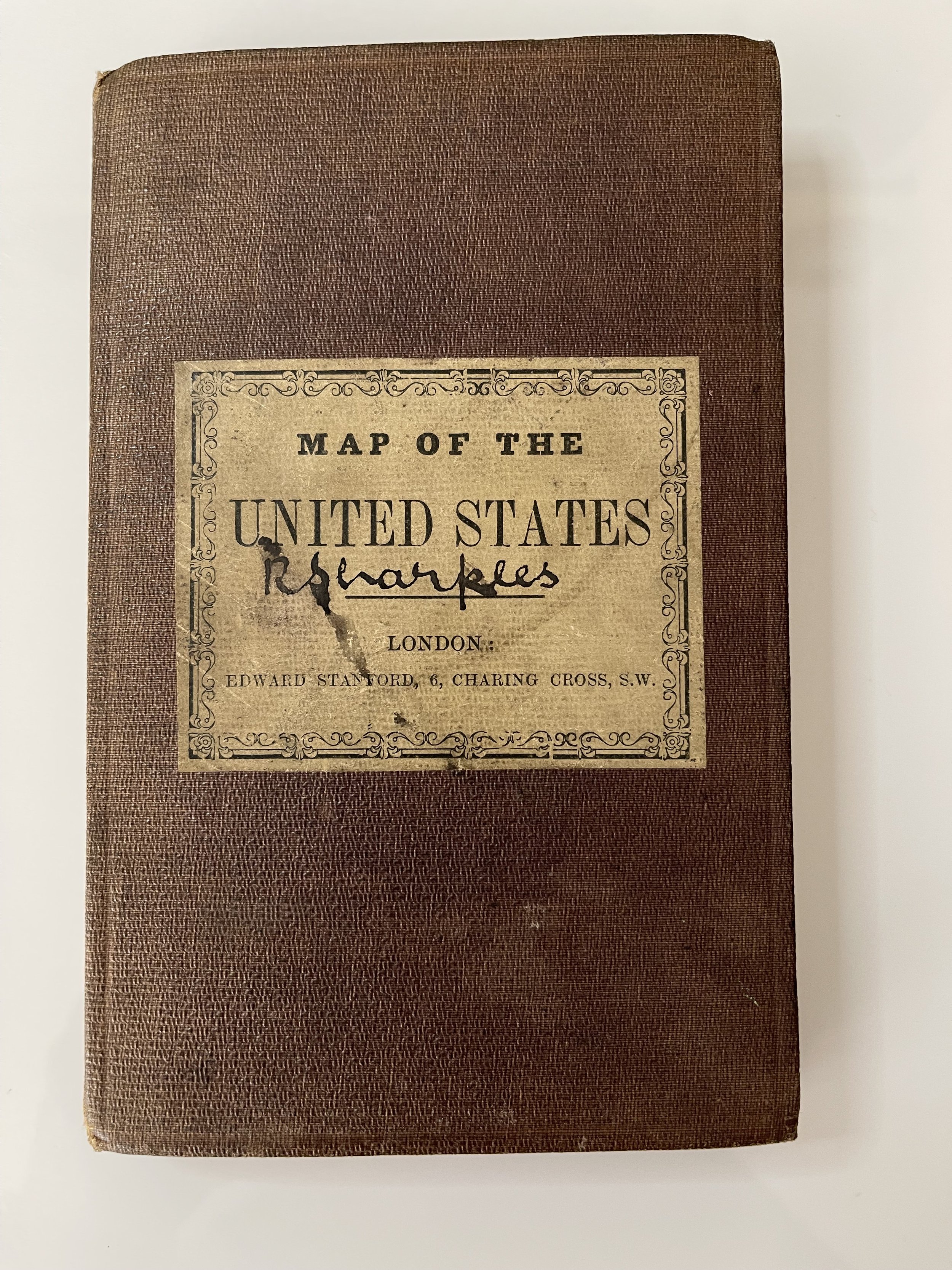
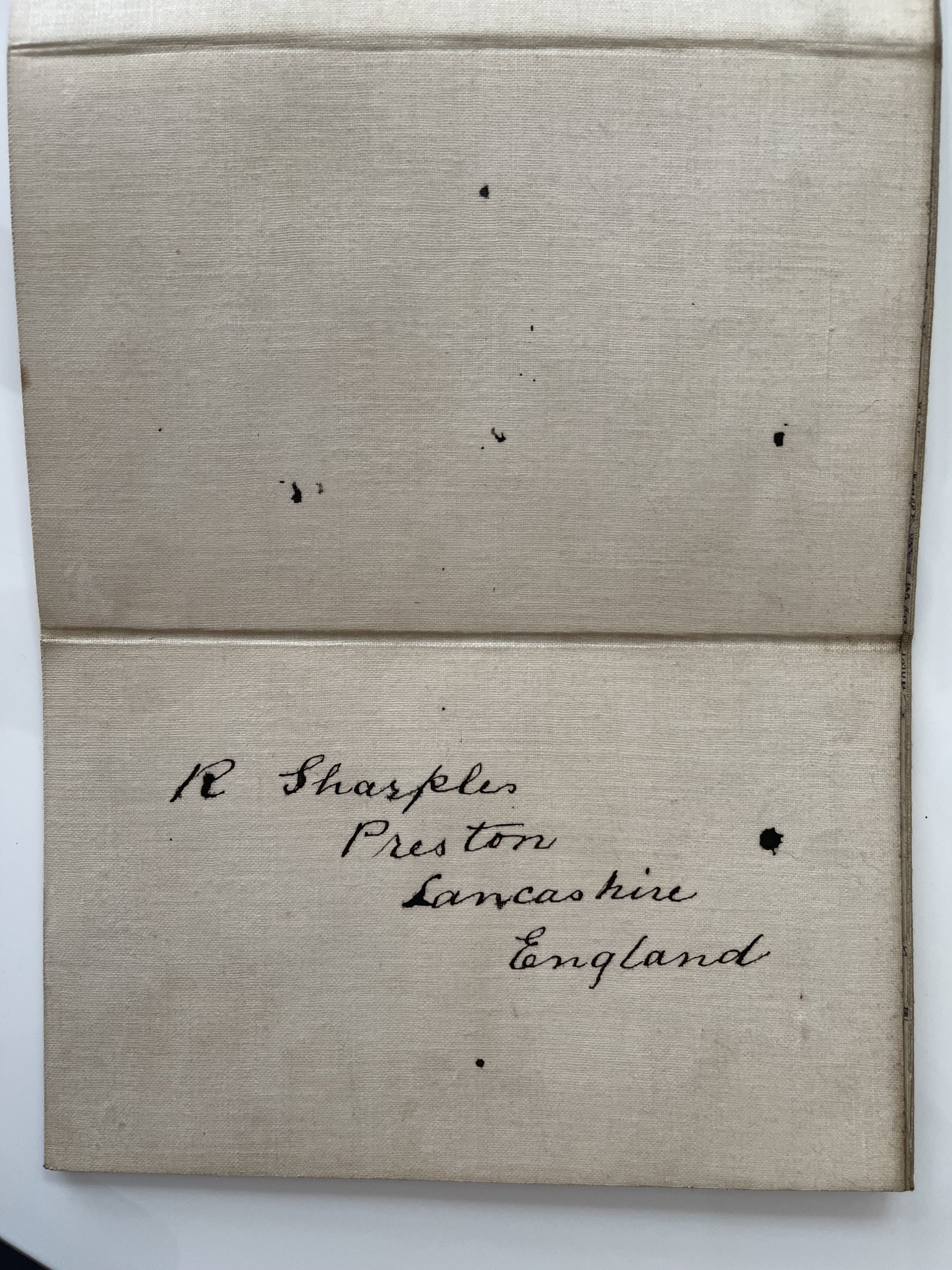
The map is signed for R. Sharple, Preston, Lancashire, England on the back.
The condition is consistent with age and use. There is a light stain on the lower left side when the map is open. Slight yellow tint on the pages. You may notice the August 1863 date versus West Virginia becoming a state on June 20 of 63.
Edward Stanford (1827-1904) was a prominent British mapmaker and publisher. A native of Holborn in the heart of London, Edward was apprenticed to a printer and stationer at the age of 14. After his first master died, he worked with several others, including Trelawny W. Saunders of Charing Cross. Saunders oversaw young Edward’s early career, ensuring that he became a Fellow of the Royal Geographical Society. Associations with the Society eventually brought Sanders much business and gave him a reputation as a publisher of explorers. As testament to this reputation, the Stanford Range in British Columbia was named for him by John Palliser.
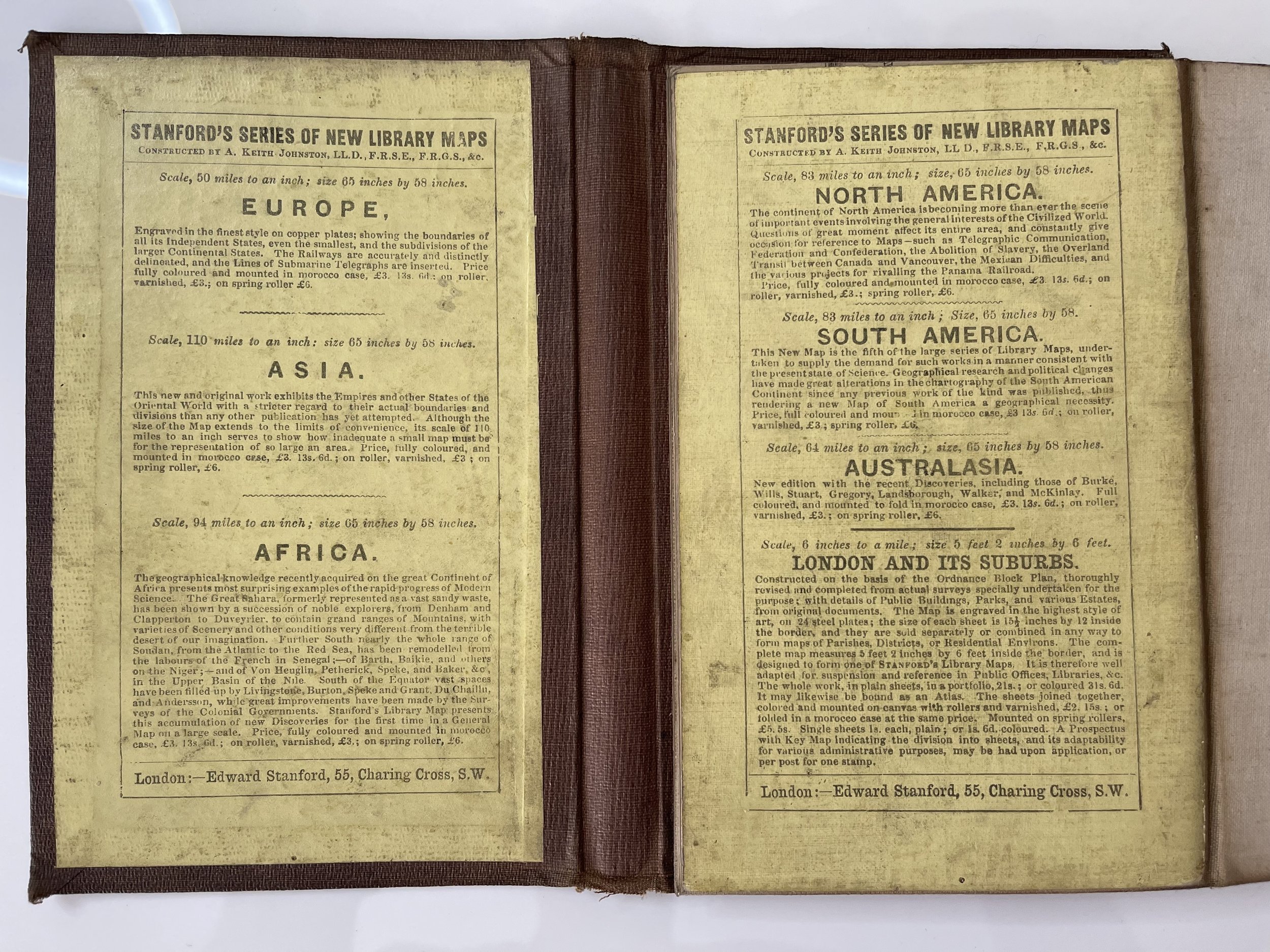
Stanford briefly partnered with Saunders in 1852 before striking out on his own in 1853. He was an agent for the Ordnance Survey, the Admiralty, the Geological Survey, the Trigonometrical Survey of India, and the India Office. He also controlled the maps of the Society for the Diffusion of Useful Knowledge, another lucrative source of income. In 1857, Stanford founded his namesake Geographical Establishment, with Saunders and A. K. Johnston as engravers. Thereafter, Stanford was known for his “library maps”, particularly those of Africa and Asia.
As sole agents for Ordnance Survey Maps, the company's influence and reputation grew, culminating in the Stanford’s London Atlas of Universal Geography, which was presented to Queen Victoria in 1887. The transition into the 20th century saw further integration of retail, print, and cartographic operations at Long Acre.
During World War I, Stanford's became an essential publisher for the War Office. Edward Fraser Stanford took over in 1917, steering the company through the interwar period and innovations, such as the world’s smallest maps in 1922 and the Daily Mail Motor Road Map in 1926.
Withstanding a bombing in WWII, the company continued under the stewardship of John Keith Stanford and was sold to George Philip & Son in 1947. As it adapted to the digital age, Stanfords received the Ordnance Survey Premier Partner status in 2007 and ventured into online mapping and data services.
Stanfords, now an icon for travellers and explorers, has maintained its cultural relevance and retail success well into the 21st century, underpinned by a legacy of entrepreneurial spirit and commitment to cartographic excellence.
Pricing and grading commensurate.
Rare Edward Stanford Map Of The United States & Shewing Boundary Of Seceded States dating from 3 August 1863.
Rare separately issued map of the United States, published by Edward Stanford & Co. Stanford was catering for the demand in England for information concerning the Civil War in America.
The map highlights the Southern United States which had seceded from the Union and were then at War with the Northern States, which are divided from the Northern States by a red line.
The map is of the utmost rarity. OCLC locates only a single example of the 1861 edition of this map, in the collection of David Rumsey. No examples of the 1863 edition are recorded. There doesn’t seem to be an 1863 map version in archives regarding this 1863 version of the map which makes it very rare.
The map is signed for R. Sharple, Preston, Lancashire, England on the back.
The condition is consistent with age and use. There is a light stain on the lower left side when the map is open. Slight yellow tint on the pages. You may notice the August 1863 date versus West Virginia becoming a state on June 20 of 63.
Edward Stanford (1827-1904) was a prominent British mapmaker and publisher. A native of Holborn in the heart of London, Edward was apprenticed to a printer and stationer at the age of 14. After his first master died, he worked with several others, including Trelawny W. Saunders of Charing Cross. Saunders oversaw young Edward’s early career, ensuring that he became a Fellow of the Royal Geographical Society. Associations with the Society eventually brought Sanders much business and gave him a reputation as a publisher of explorers. As testament to this reputation, the Stanford Range in British Columbia was named for him by John Palliser.
Stanford briefly partnered with Saunders in 1852 before striking out on his own in 1853. He was an agent for the Ordnance Survey, the Admiralty, the Geological Survey, the Trigonometrical Survey of India, and the India Office. He also controlled the maps of the Society for the Diffusion of Useful Knowledge, another lucrative source of income. In 1857, Stanford founded his namesake Geographical Establishment, with Saunders and A. K. Johnston as engravers. Thereafter, Stanford was known for his “library maps”, particularly those of Africa and Asia.
As sole agents for Ordnance Survey Maps, the company's influence and reputation grew, culminating in the Stanford’s London Atlas of Universal Geography, which was presented to Queen Victoria in 1887. The transition into the 20th century saw further integration of retail, print, and cartographic operations at Long Acre.
During World War I, Stanford's became an essential publisher for the War Office. Edward Fraser Stanford took over in 1917, steering the company through the interwar period and innovations, such as the world’s smallest maps in 1922 and the Daily Mail Motor Road Map in 1926.
Withstanding a bombing in WWII, the company continued under the stewardship of John Keith Stanford and was sold to George Philip & Son in 1947. As it adapted to the digital age, Stanfords received the Ordnance Survey Premier Partner status in 2007 and ventured into online mapping and data services.
Stanfords, now an icon for travellers and explorers, has maintained its cultural relevance and retail success well into the 21st century, underpinned by a legacy of entrepreneurial spirit and commitment to cartographic excellence.
Pricing and grading commensurate.
Code : A962
Cartographer : Cartographer / Engraver / Publisher: Edward Stanford
Date : Publication Place / Date - 1863
Size : Sheet size: 31 x 23.5 Inches
Availability : Available
Type - Genuine - Antique
Grading A-
Where Applicable - Folds as issued. Light box photo shows the folio leaf centre margin hinge ‘glue’, this is not visible otherwise.
Tracked postage, in casement. Please contact me for postal quotation outside of the UK.