
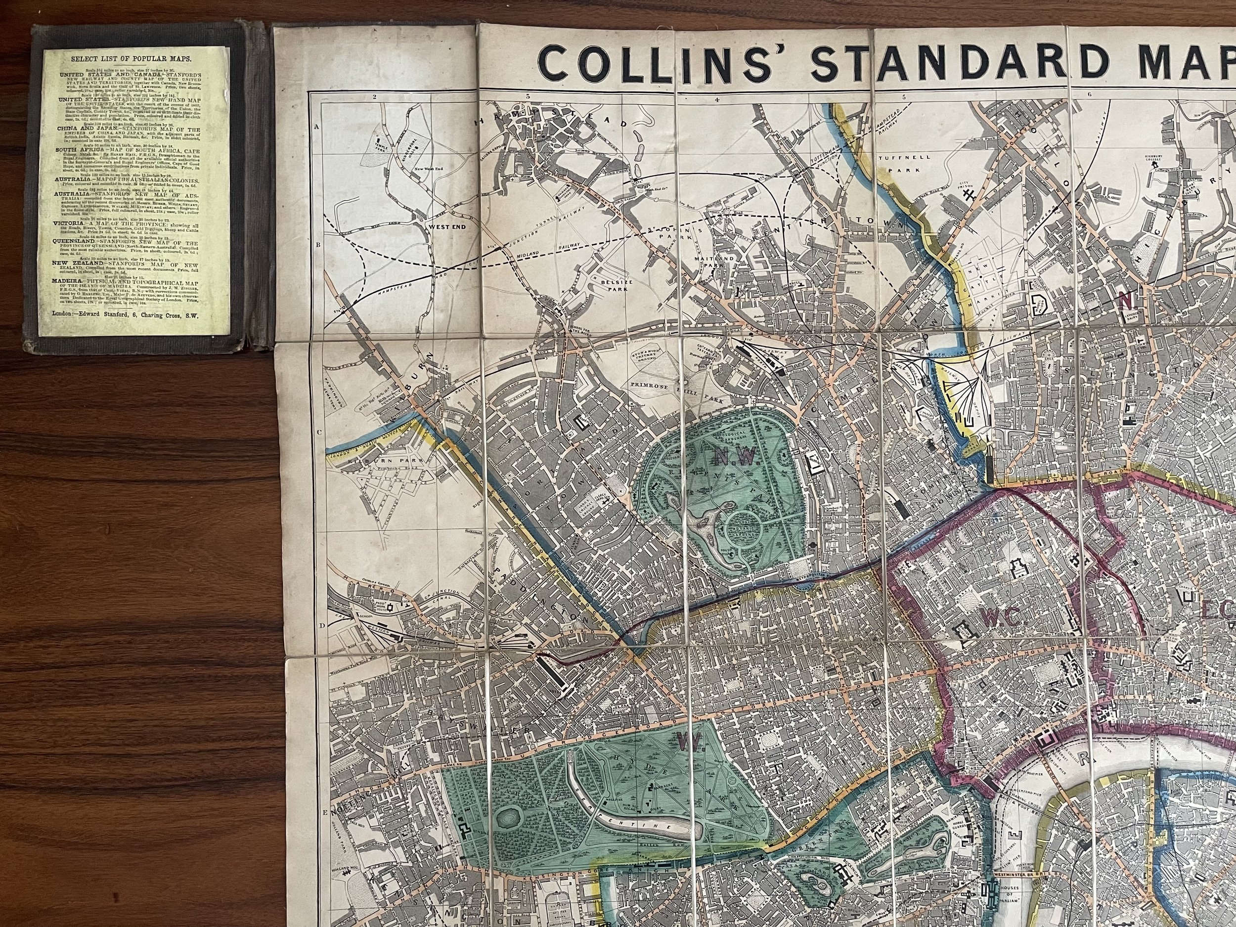

Collins standard map of London - Henry George Collins / Edward Stanford - circa 1860
H G Collins standard map of London published Edward Stanford circa 1860
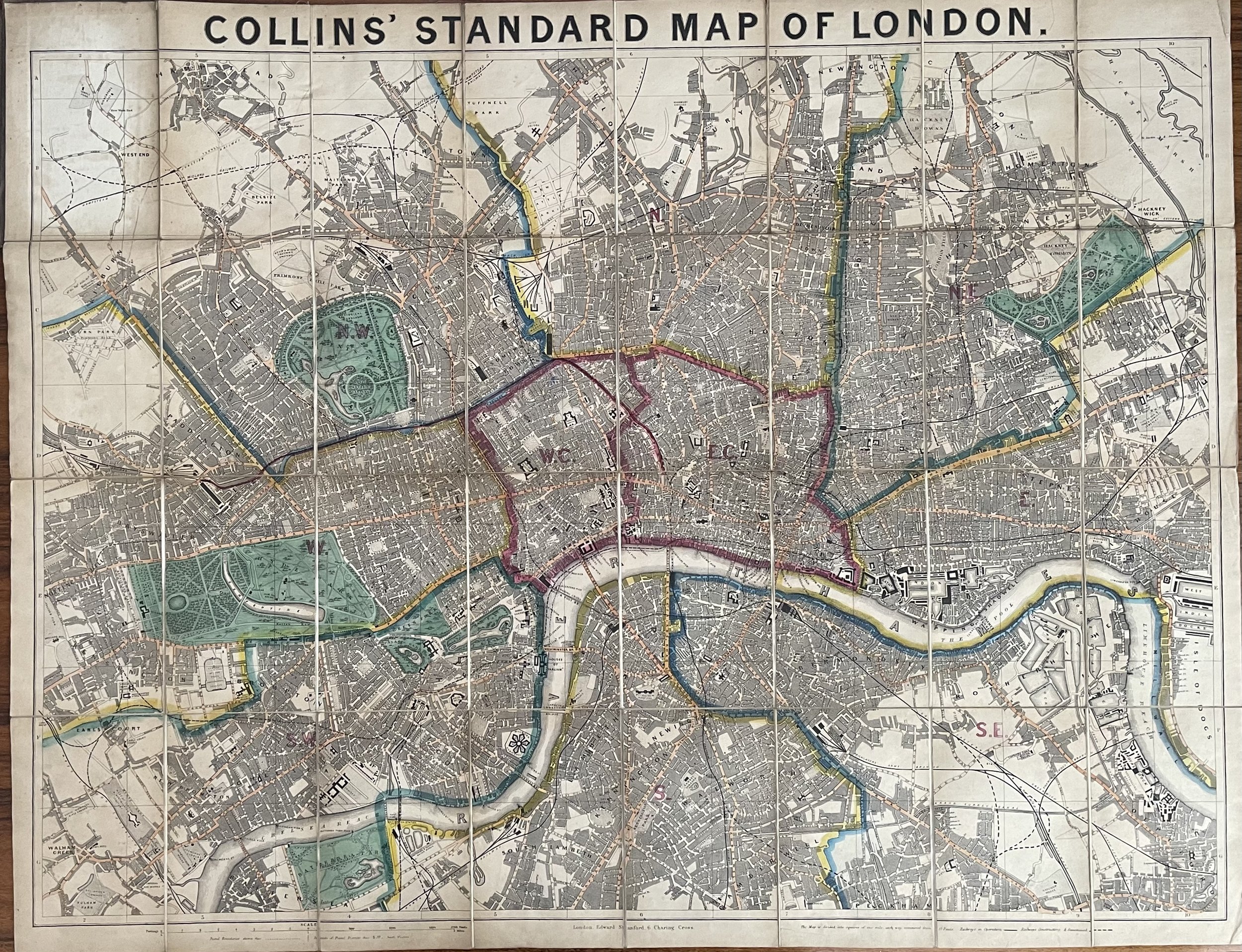
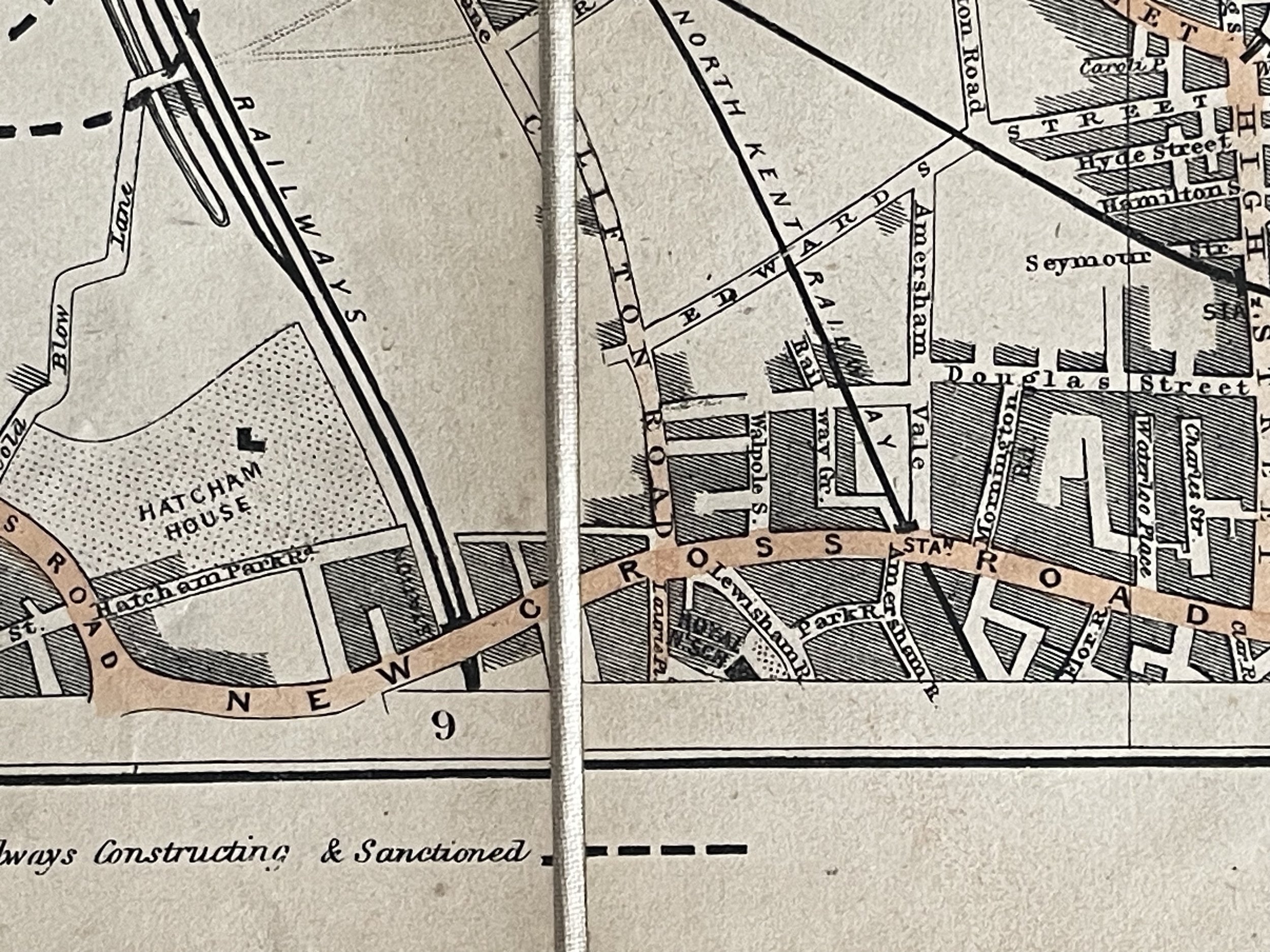
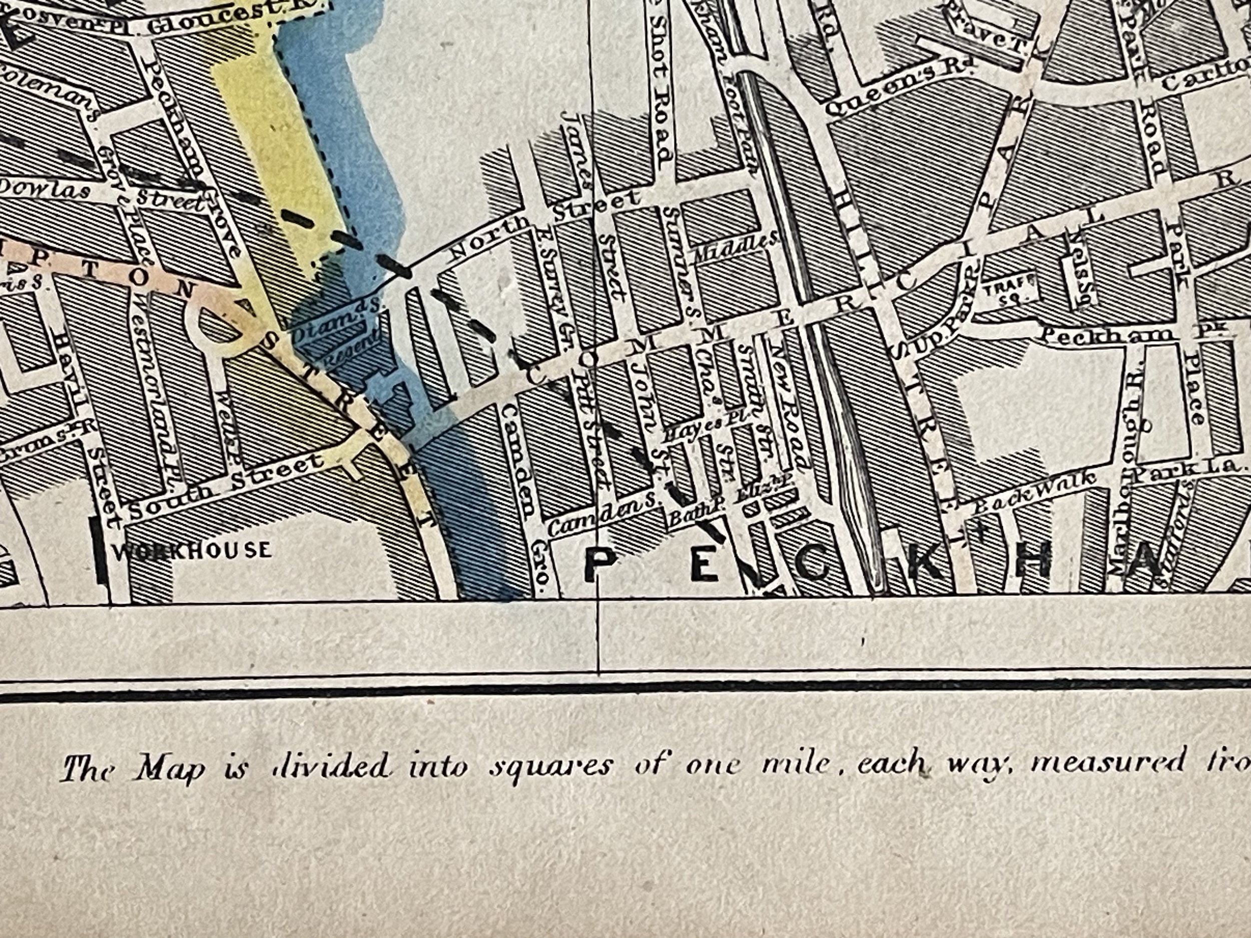
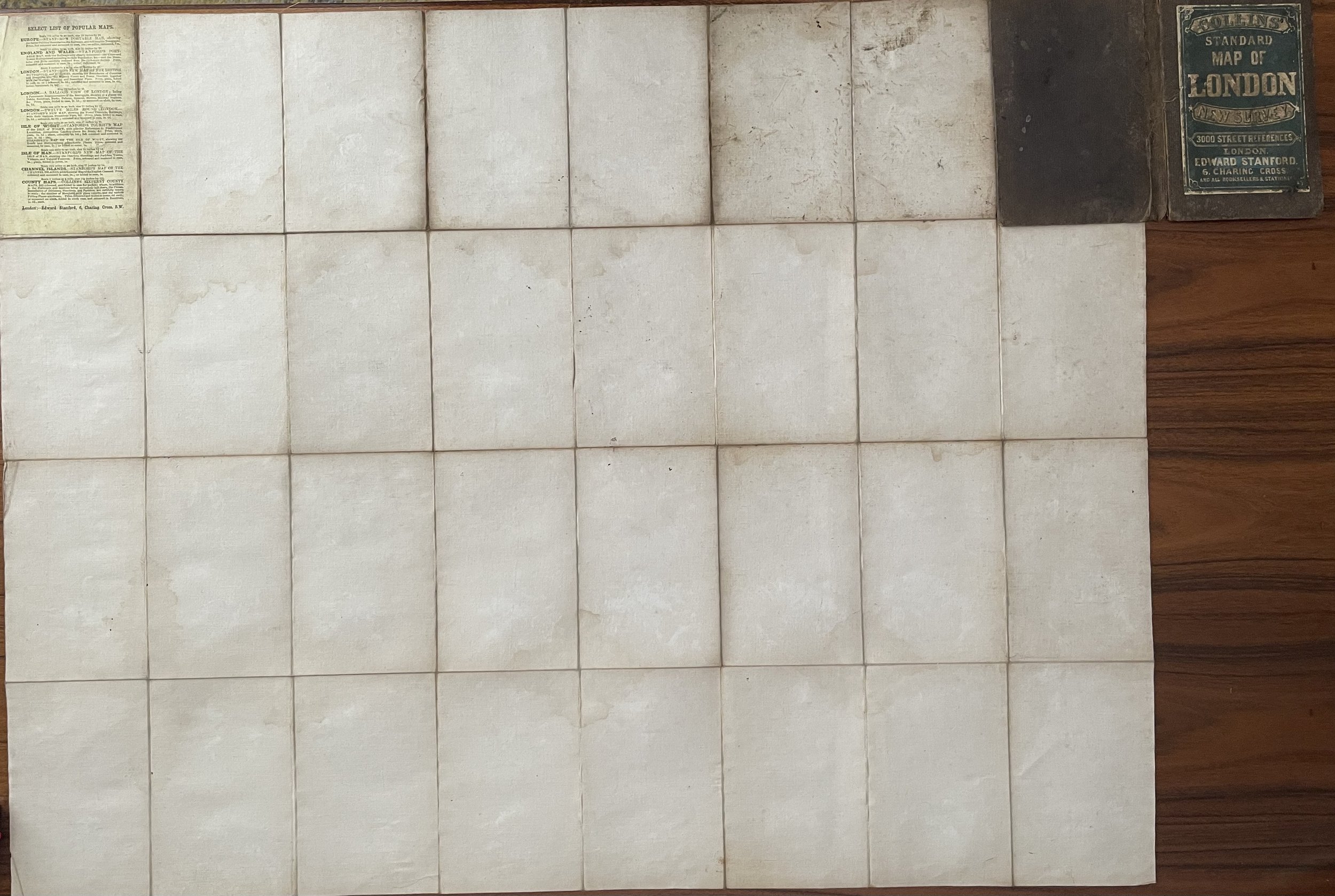
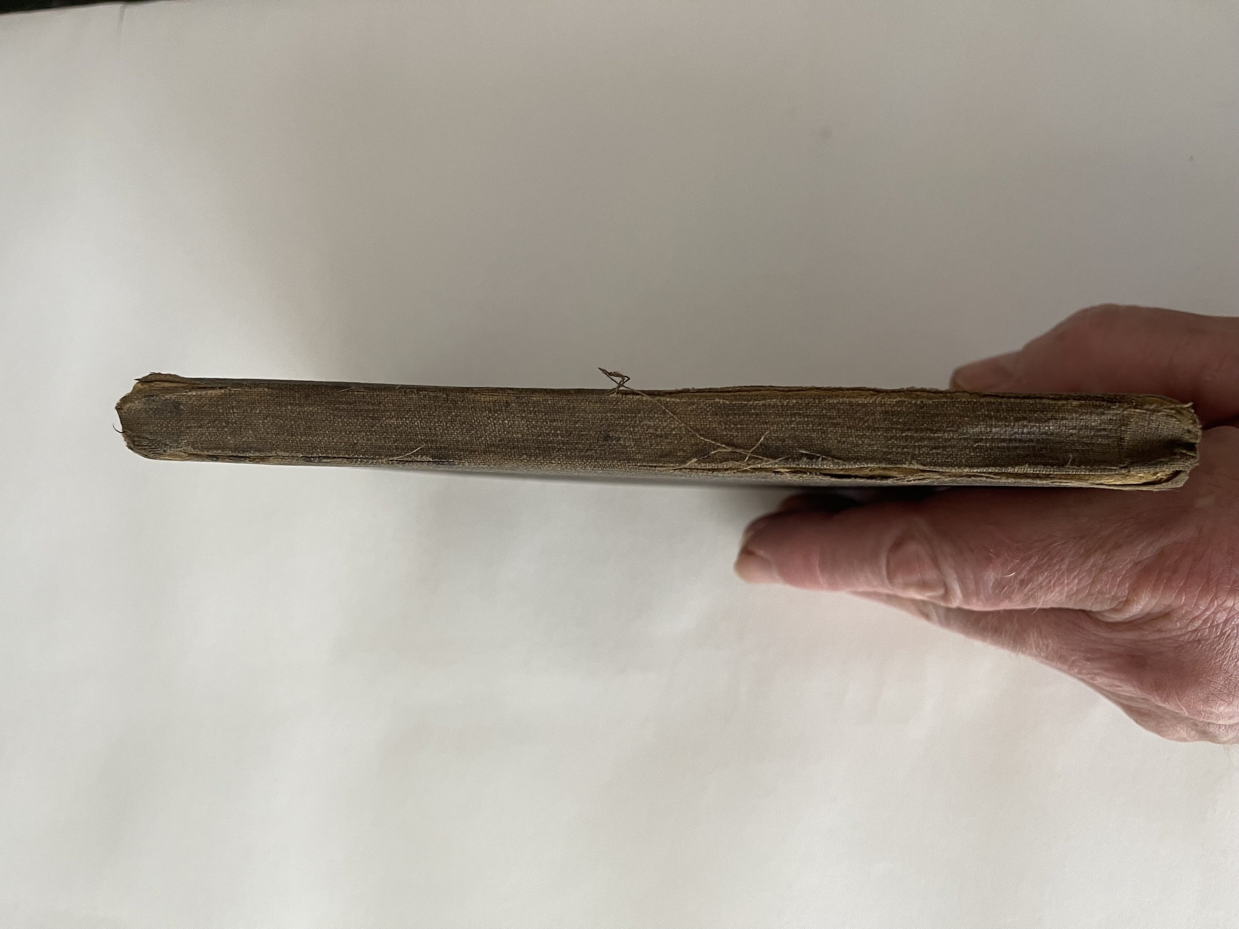
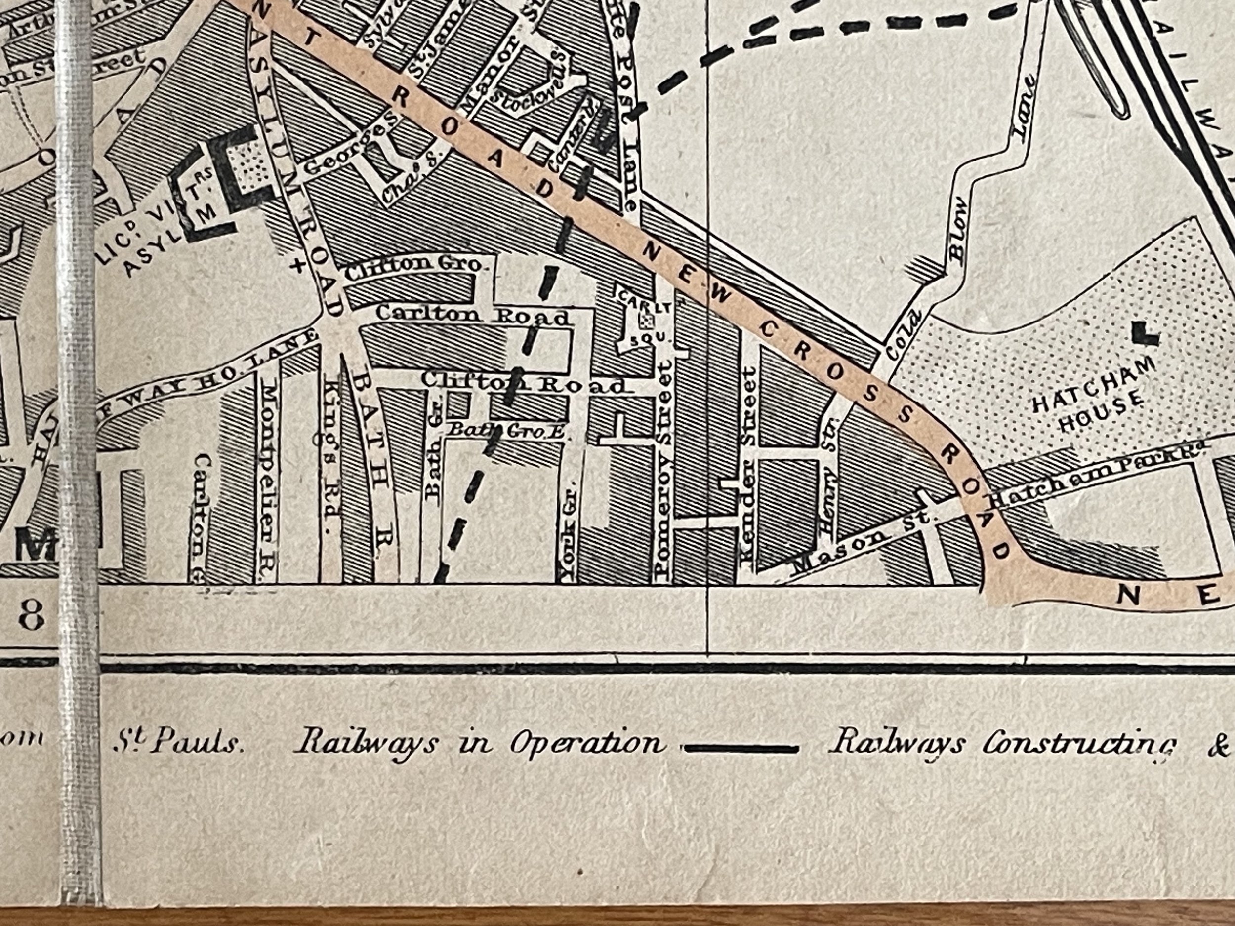
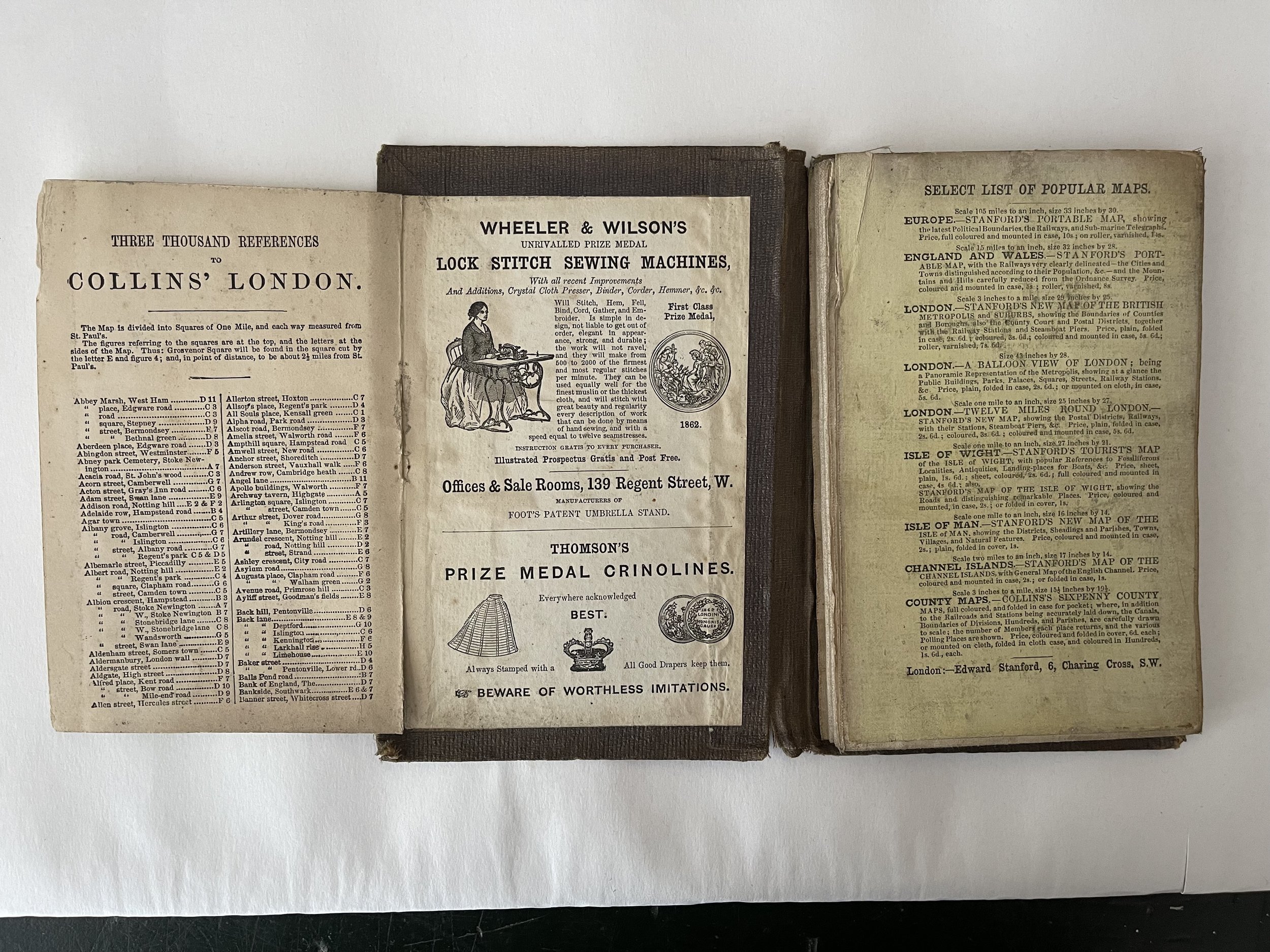
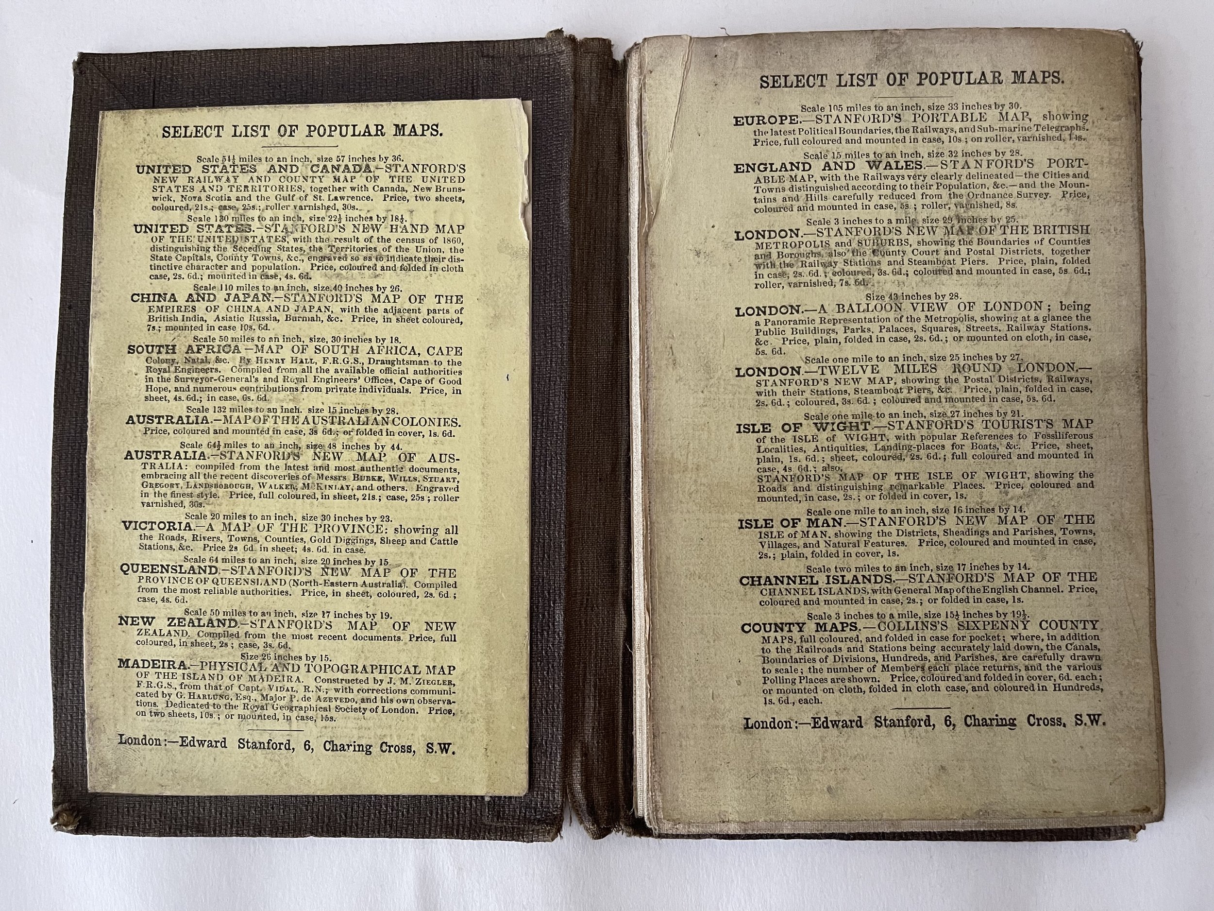
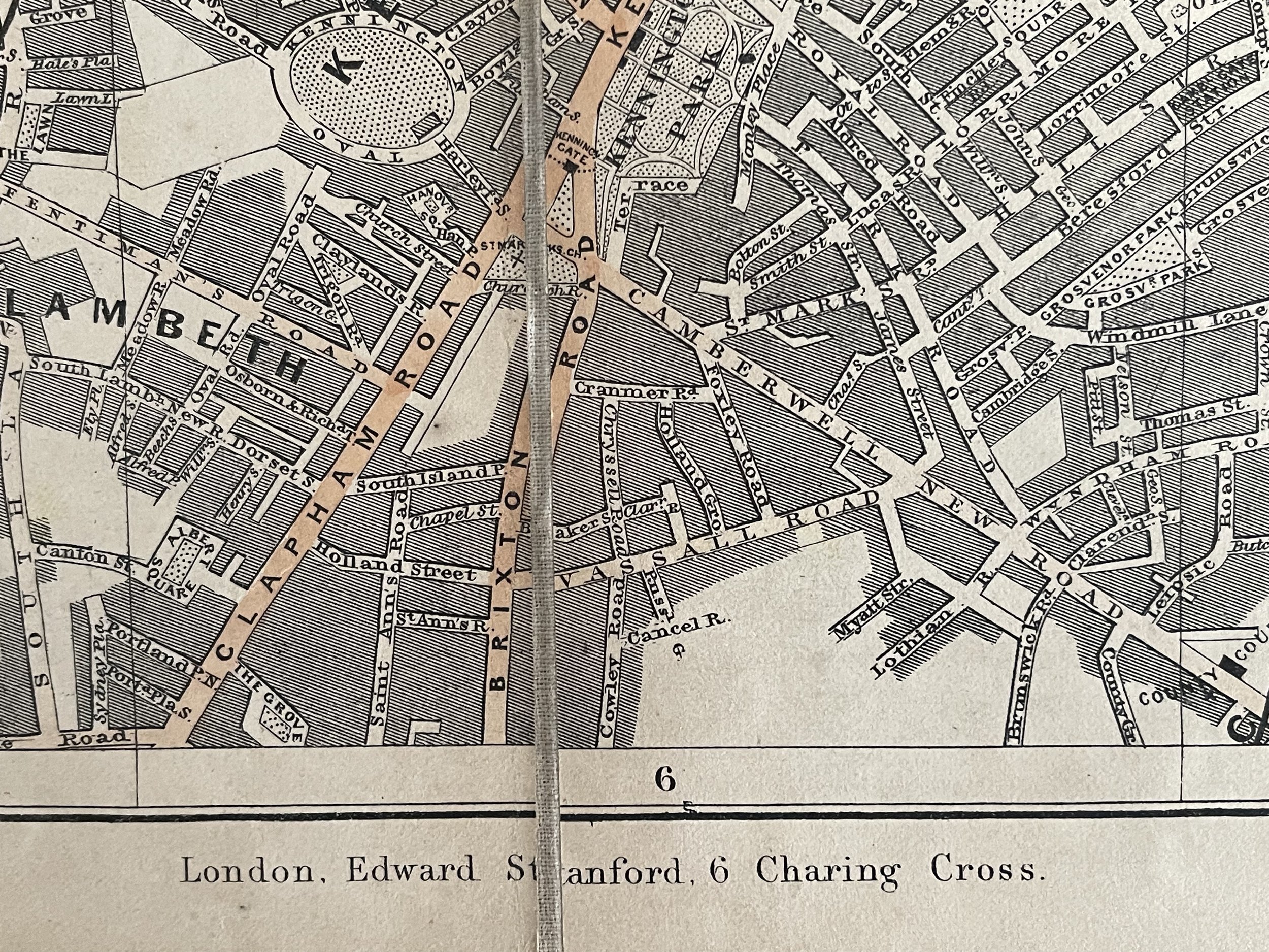
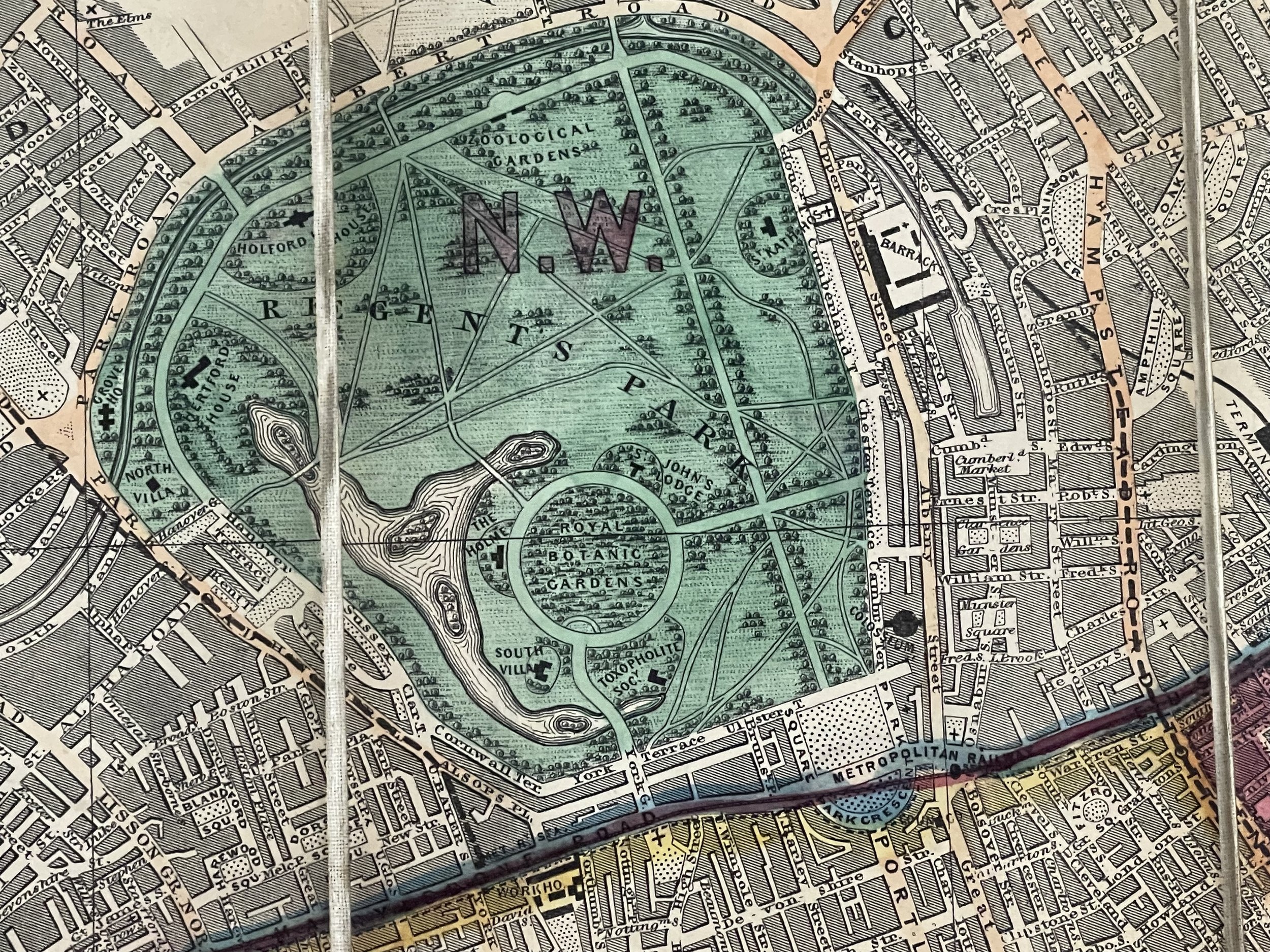
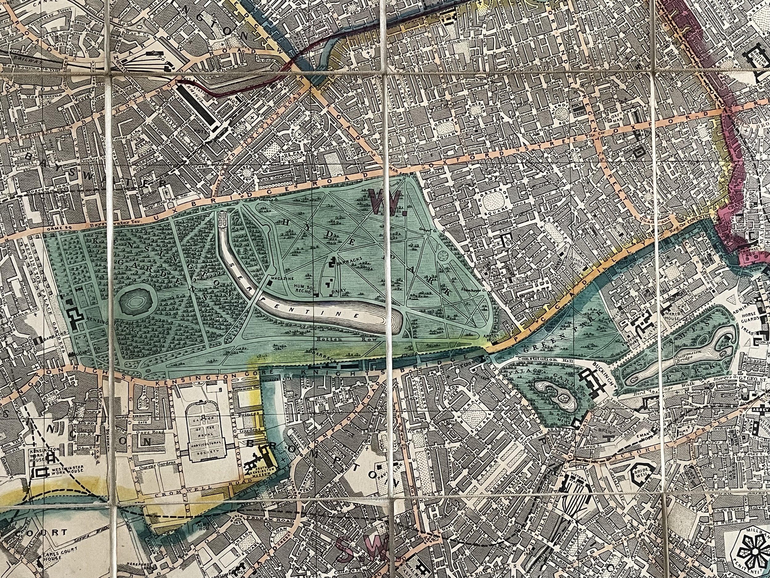
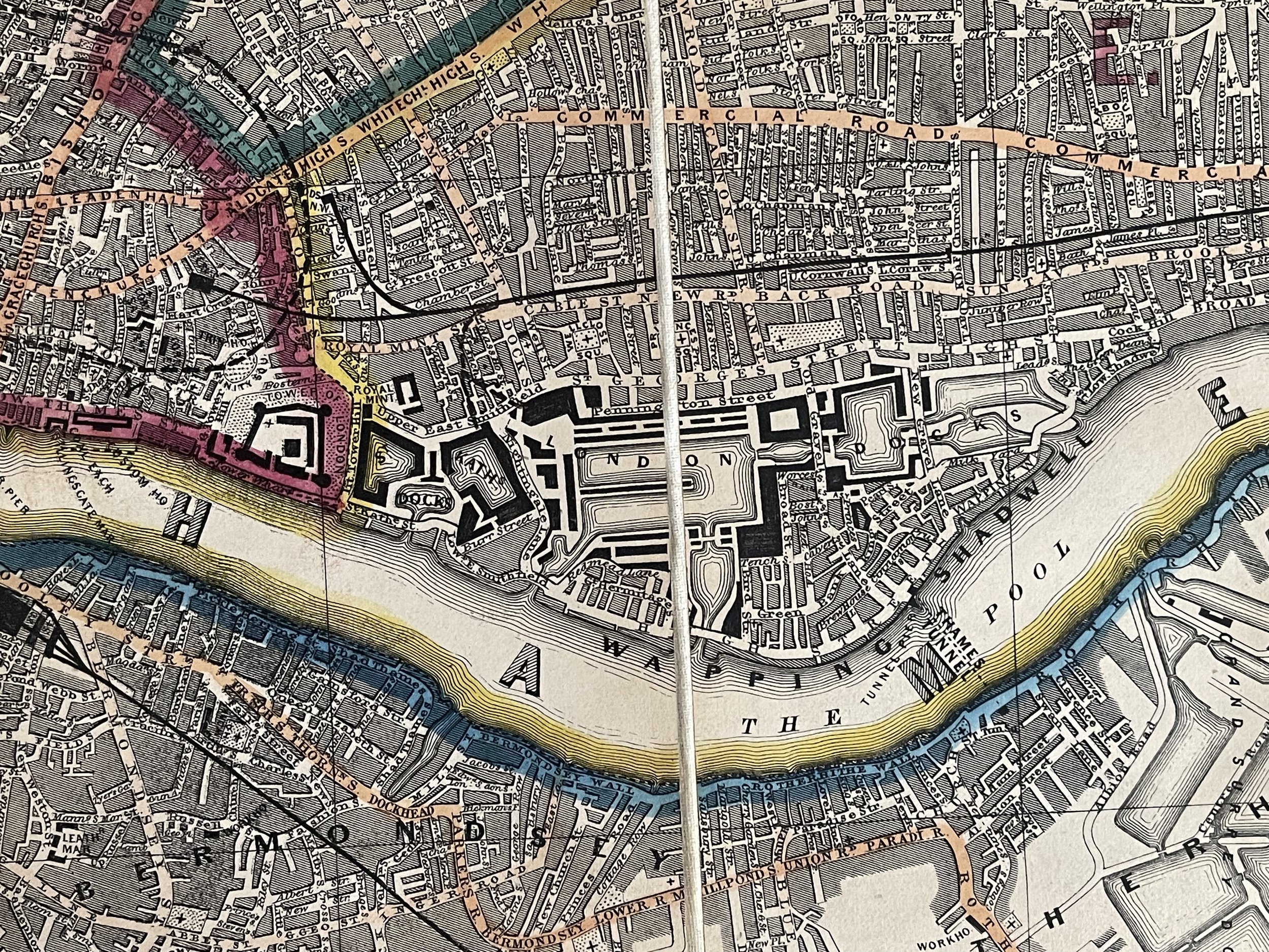
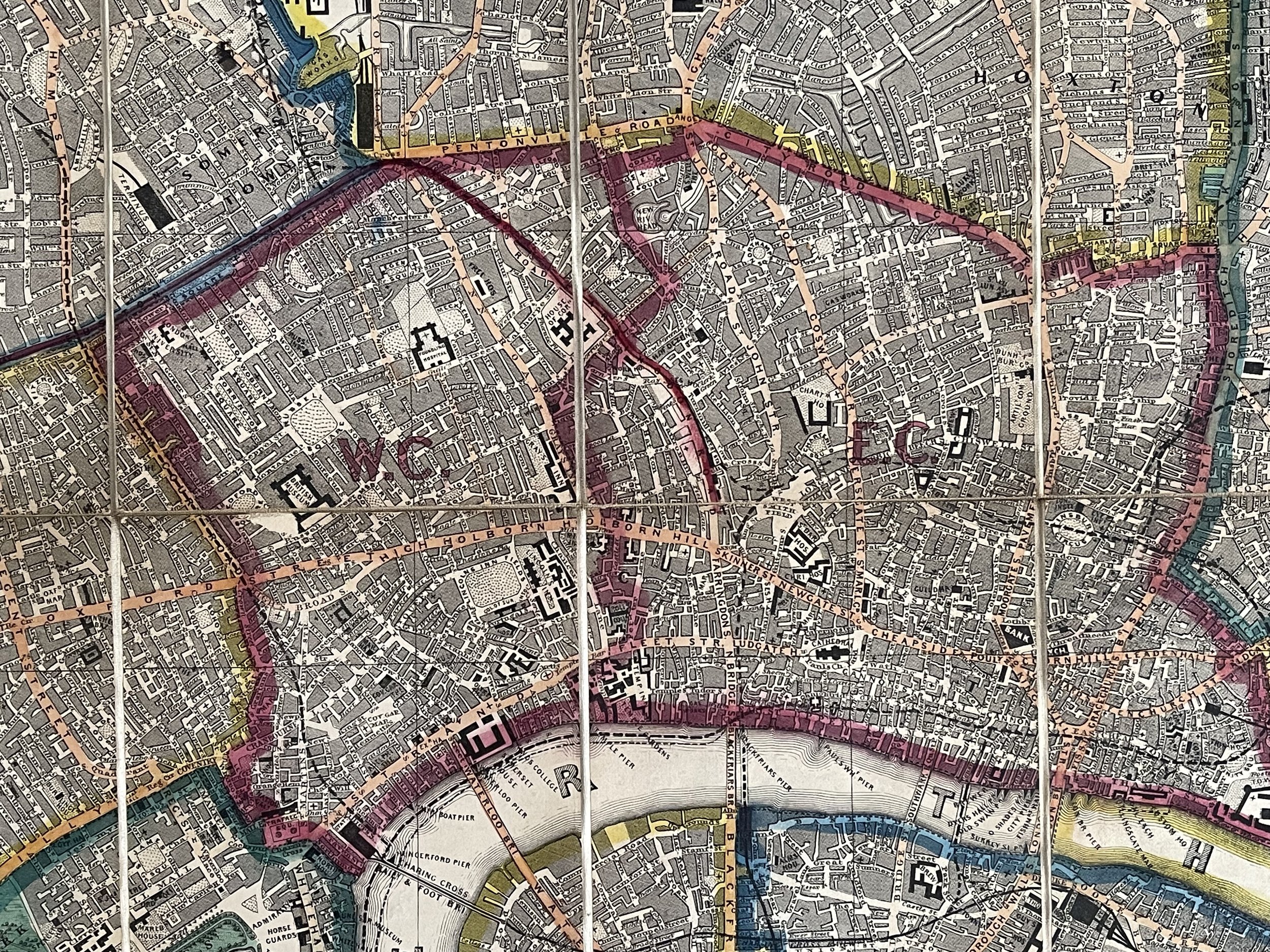
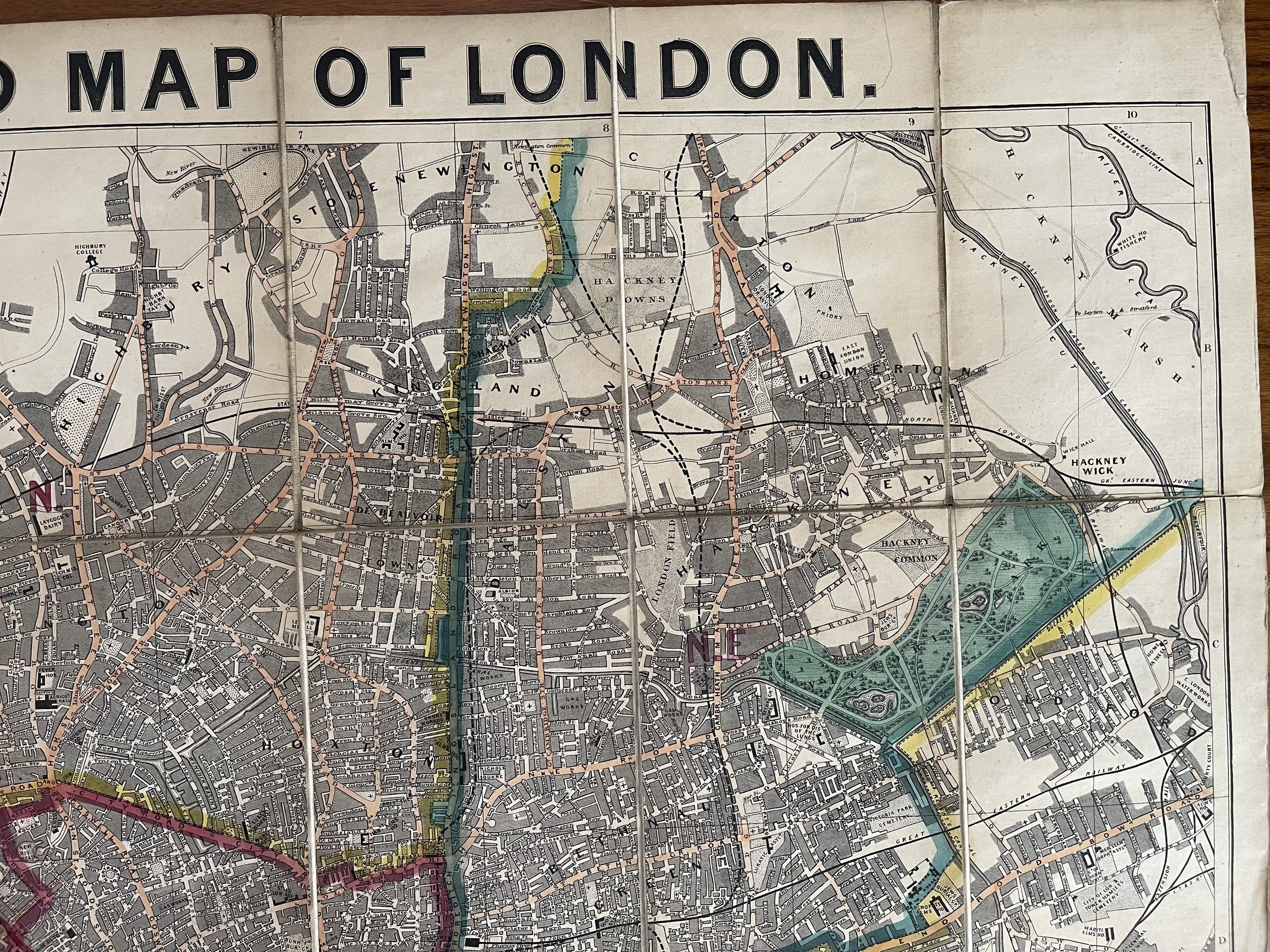
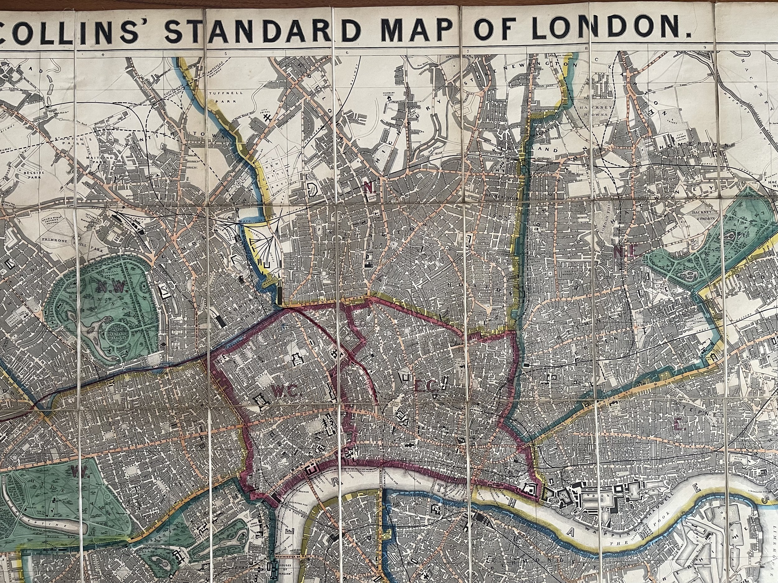
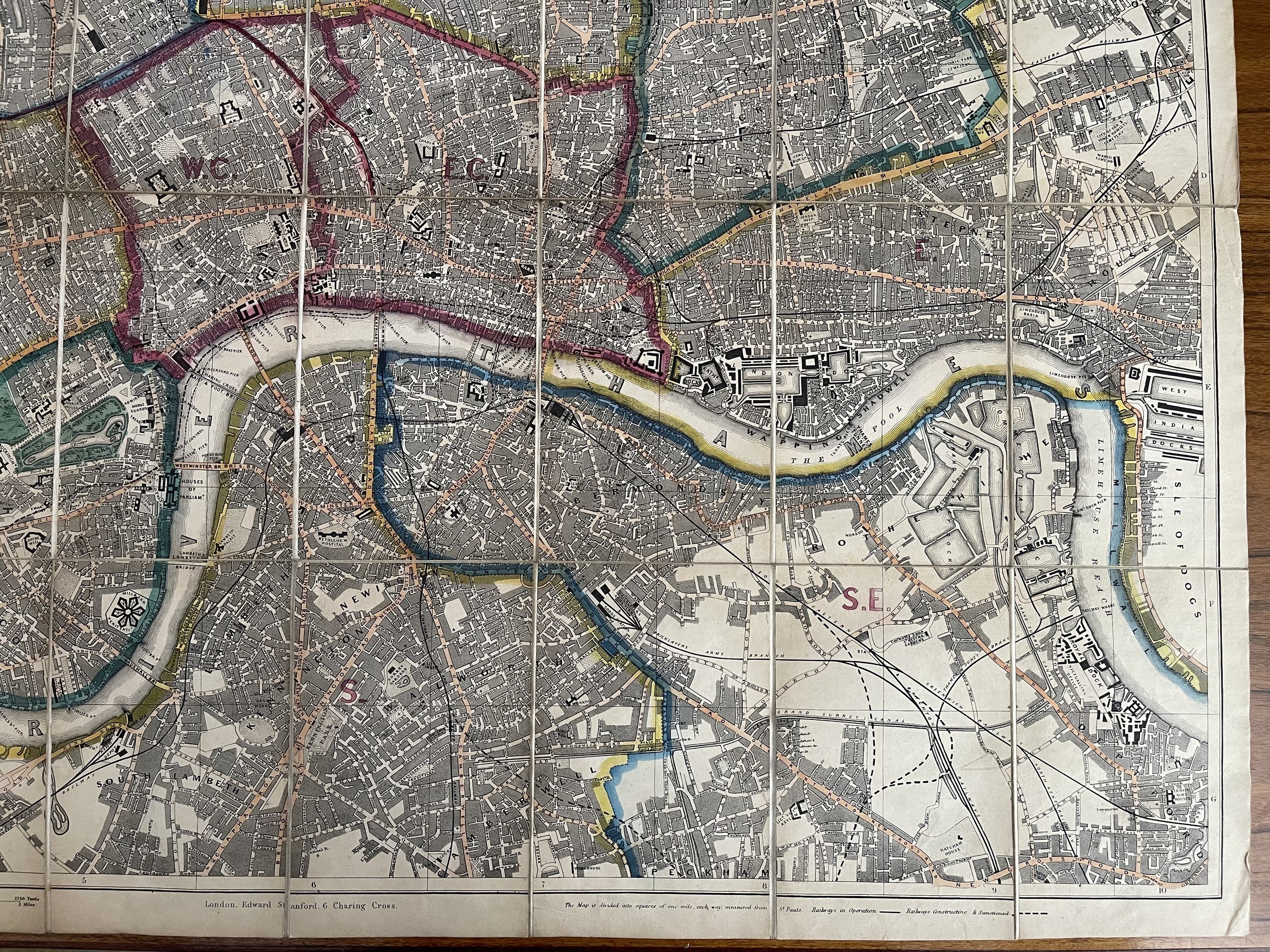
A very clean copy of Collins Standard Map of London published by Edward Stanford on a scale of 4 inches to the mile. No date but probably published in the 1860's as Stanford acquired the rights to publish the map from the bankrupt Henry George Collins in 1857 and the site of the Royal Albert Hall, completed in 1871, still appears as the Gardens of the Royal horticultural Society. Cloth backed, mounted in 32 sections and in very good condition. Slight fraying to the spine, as shown. Lithograph, in original outline colour, dissected and mounted on linen, folding into the original cloth boards.
Famous map of London, drawn by Richard Jarman in 1858, at a scale of four inches to one statute mile, and originally published by Henry George Collins. When that business failed, the printing plates were acquired by Edward Stanford, one of the two largest map sellers and publishers in London of the period, the firm still in business today.
Richard Jarman (born 1807, London, England – died 1877, Hobart, Tasmania, Australia) was an artist, mapmaker, and engraver who was active in London prior to 1857 and in Tasmania between 1857 and the 1870s.
Jarman was born in 1807 in Whitechapel, in London's East End, the son of Robert Jarman, a carpenter, and Amelia Dede. He married Ann Bouchier (or Busher) in 1830. By the 1850s, Jarman had become a successful London mapmaker and engraver working from premises in St. Bartholomew's Close in the City of London.
His most significant work during this time was The Collins' Illustrated Atlas of London published in 1854 and described by Prof. H. J. Dyos in his introduction to the 1973 re-publication as the first pocket city map of London. Another surviving map drawn by Jarman is Reynolds Map of Modern London published in 1857.
Henry George Collins (January 17, 1808 - c. 1871) was a British engraver, bookseller, and map publisher active in London from about 1832 to 1858. Collins started his career as a bookbinder but was ultimately unsuccessful in this field declaring bankruptcy in 1839. Later Collins worked as a stationer for William and Henry Rock who subsequently pressed charges against him for embezzlement - for which he was found guilty and served four months in prison. After being released Collins embraced a future in map publishing and established an office among London's printers at 22 Paternoster Row. He partnered with Anthony la Riviere (lithographer) and John Kelly (colorist) and began producing atlases, globes, and pocket maps, most of which focused on the London area. Despite producing fine maps, Collins was a poor businessman, and sales were slow. This possibly explains the medallion appearing on many of his map’s c. 1854 on-ward, where he claims to have received the "Only medal awarded to England in the New York Exhibition or Maps, Atlases, and Globes". This is a highly unlikely claim for which we can find no substantiation and was most likely a fiction intended to appeal to the American tourist market in London. Apparently, it didn't work, for in 1857 he again declared bankruptcy, signing over most of his assets to George Chater and Ephraim Brain. Most of his map plates and printing stock were subsequently acquired by George Stanford who succeeded where Collins failed, publishing numerous editions of many of Collins' fine maps. Some of Collins' maps were also republished by his sons, under the imprint "Collins Brothers", but by 1859 this firm too had failed. The last known reference to Collins in 1871, where he referred to himself as a "retired publisher", he must have died shortly afterwards. (Worms, L. and Baynton-William, A., British Map Engravers, (London) 2011, p. 156.
Edward Stanford 1827-1904 - Born in 1827, and educated at the City of London School, Edward Stanford developed his interest in maps after being employed by Mr Trelawney Saunders at his map and stationery shop. He became a partner to Saunders in 1852 at the age of 25. In 1853,[2] the company was dissolved, and Stanford took over the remains of the business with the intent of turning it into a map specialist. With British colonial expansion pushing the demand for maps worldwide, and being the sole specialist of maps in London, the move was both obvious and lucrative.
The name Stanford’s became prominent in 1862 when his project to make the most accurate map of London possible was published. Stanford's Library Map of London[3] is still on sale today, over 150 years later.
Company ownership remained in the family until 1947, when it was absorbed into George Philip & Son. However, in 2001 Stanford’s separated from George Philip & Son and the name Stamford’s is displayed on both stores and on many lines of maps and books produced by the company.
H G Collins standard map of London published Edward Stanford circa 1860
A very clean copy of Collins Standard Map of London published by Edward Stanford on a scale of 4 inches to the mile. No date but probably published in the 1860's as Stanford acquired the rights to publish the map from the bankrupt Henry George Collins in 1857 and the site of the Royal Albert Hall, completed in 1871, still appears as the Gardens of the Royal horticultural Society. Cloth backed, mounted in 32 sections and in very good condition. Slight fraying to the spine, as shown. Lithograph, in original outline colour, dissected and mounted on linen, folding into the original cloth boards.
Famous map of London, drawn by Richard Jarman in 1858, at a scale of four inches to one statute mile, and originally published by Henry George Collins. When that business failed, the printing plates were acquired by Edward Stanford, one of the two largest map sellers and publishers in London of the period, the firm still in business today.
Richard Jarman (born 1807, London, England – died 1877, Hobart, Tasmania, Australia) was an artist, mapmaker, and engraver who was active in London prior to 1857 and in Tasmania between 1857 and the 1870s.
Jarman was born in 1807 in Whitechapel, in London's East End, the son of Robert Jarman, a carpenter, and Amelia Dede. He married Ann Bouchier (or Busher) in 1830. By the 1850s, Jarman had become a successful London mapmaker and engraver working from premises in St. Bartholomew's Close in the City of London.
His most significant work during this time was The Collins' Illustrated Atlas of London published in 1854 and described by Prof. H. J. Dyos in his introduction to the 1973 re-publication as the first pocket city map of London. Another surviving map drawn by Jarman is Reynolds Map of Modern London published in 1857.
Henry George Collins (January 17, 1808 - c. 1871) was a British engraver, bookseller, and map publisher active in London from about 1832 to 1858. Collins started his career as a bookbinder but was ultimately unsuccessful in this field declaring bankruptcy in 1839. Later Collins worked as a stationer for William and Henry Rock who subsequently pressed charges against him for embezzlement - for which he was found guilty and served four months in prison. After being released Collins embraced a future in map publishing and established an office among London's printers at 22 Paternoster Row. He partnered with Anthony la Riviere (lithographer) and John Kelly (colorist) and began producing atlases, globes, and pocket maps, most of which focused on the London area. Despite producing fine maps, Collins was a poor businessman, and sales were slow. This possibly explains the medallion appearing on many of his map’s c. 1854 on-ward, where he claims to have received the "Only medal awarded to England in the New York Exhibition or Maps, Atlases, and Globes". This is a highly unlikely claim for which we can find no substantiation and was most likely a fiction intended to appeal to the American tourist market in London. Apparently, it didn't work, for in 1857 he again declared bankruptcy, signing over most of his assets to George Chater and Ephraim Brain. Most of his map plates and printing stock were subsequently acquired by George Stanford who succeeded where Collins failed, publishing numerous editions of many of Collins' fine maps. Some of Collins' maps were also republished by his sons, under the imprint "Collins Brothers", but by 1859 this firm too had failed. The last known reference to Collins in 1871, where he referred to himself as a "retired publisher", he must have died shortly afterwards. (Worms, L. and Baynton-William, A., British Map Engravers, (London) 2011, p. 156.
Edward Stanford 1827-1904 - Born in 1827, and educated at the City of London School, Edward Stanford developed his interest in maps after being employed by Mr Trelawney Saunders at his map and stationery shop. He became a partner to Saunders in 1852 at the age of 25. In 1853,[2] the company was dissolved, and Stanford took over the remains of the business with the intent of turning it into a map specialist. With British colonial expansion pushing the demand for maps worldwide, and being the sole specialist of maps in London, the move was both obvious and lucrative.
The name Stanford’s became prominent in 1862 when his project to make the most accurate map of London possible was published. Stanford's Library Map of London[3] is still on sale today, over 150 years later.
Company ownership remained in the family until 1947, when it was absorbed into George Philip & Son. However, in 2001 Stanford’s separated from George Philip & Son and the name Stamford’s is displayed on both stores and on many lines of maps and books produced by the company.
Code : A1030
Cartographer : Cartographer / Engraver / Publisher: Henry George Collins / Edward Stanford
Date : Publication Place / Date - 1860 circa
Size : Sheet size: Image Size: 87 X 66 cm
Availability : Available
Type - Genuine - Antique
Grading A-
Where Applicable - Folds as issued. Light box photo shows the folio leaf centre margin hinge ‘glue’, this is not visible otherwise.
Tracked postage, in casement. Please contact me for postal quotation outside of the UK.