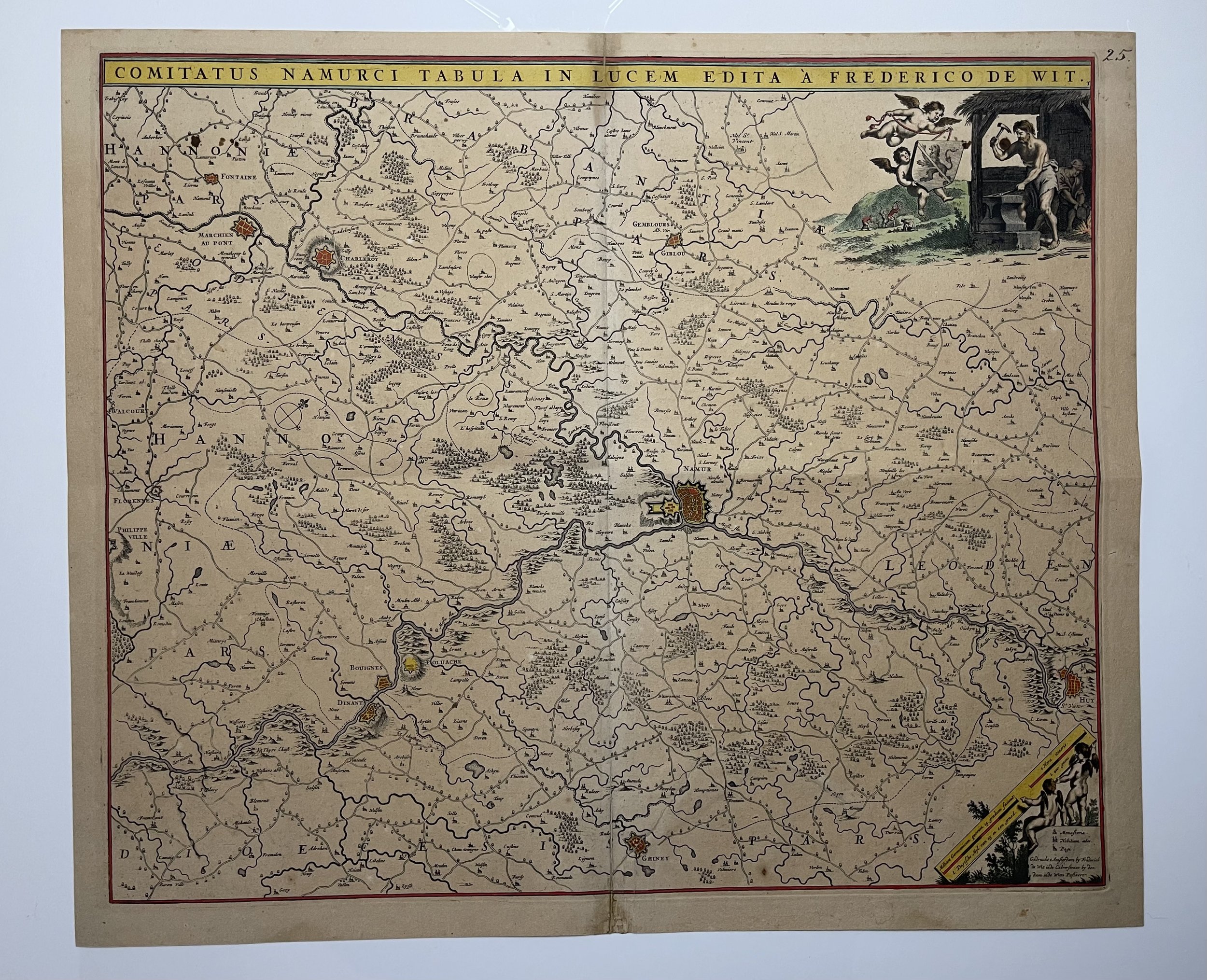
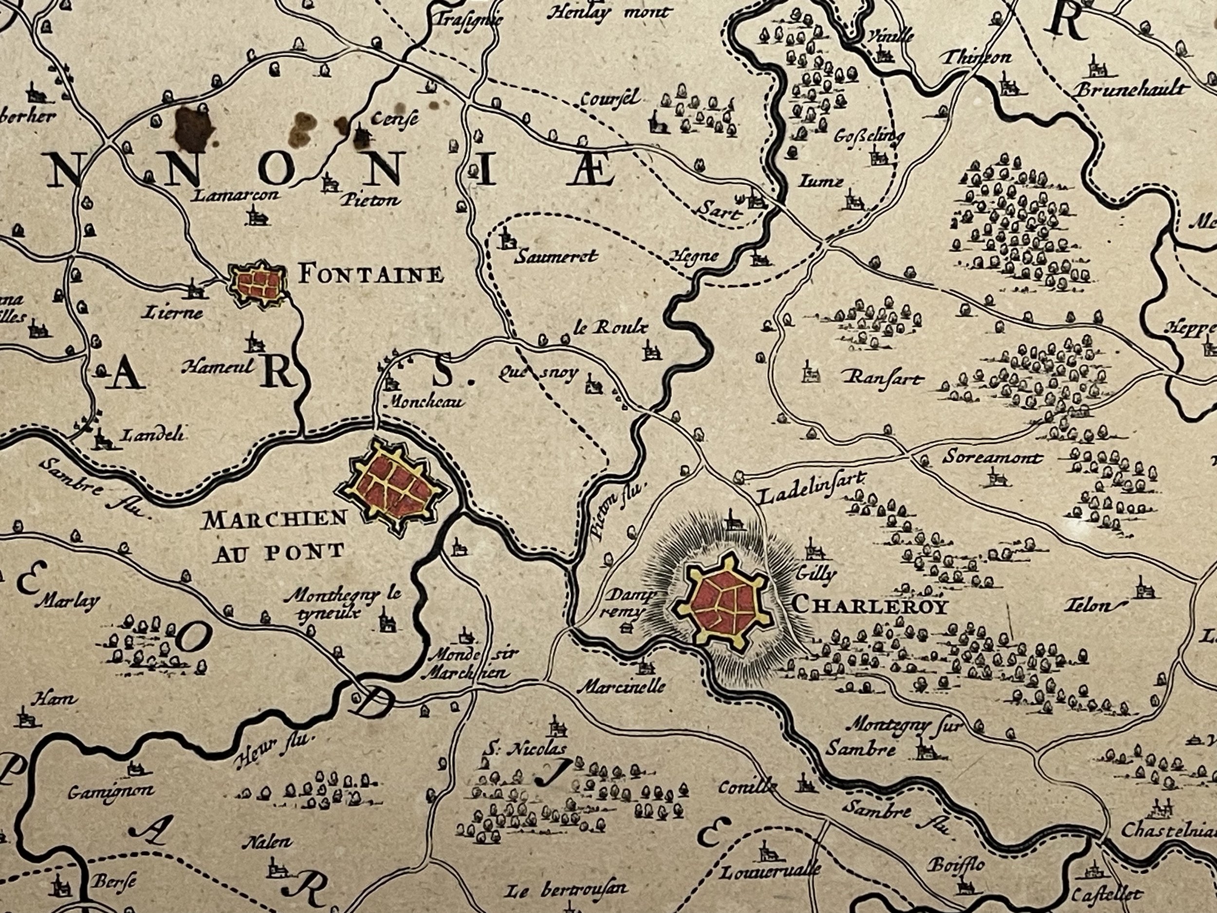
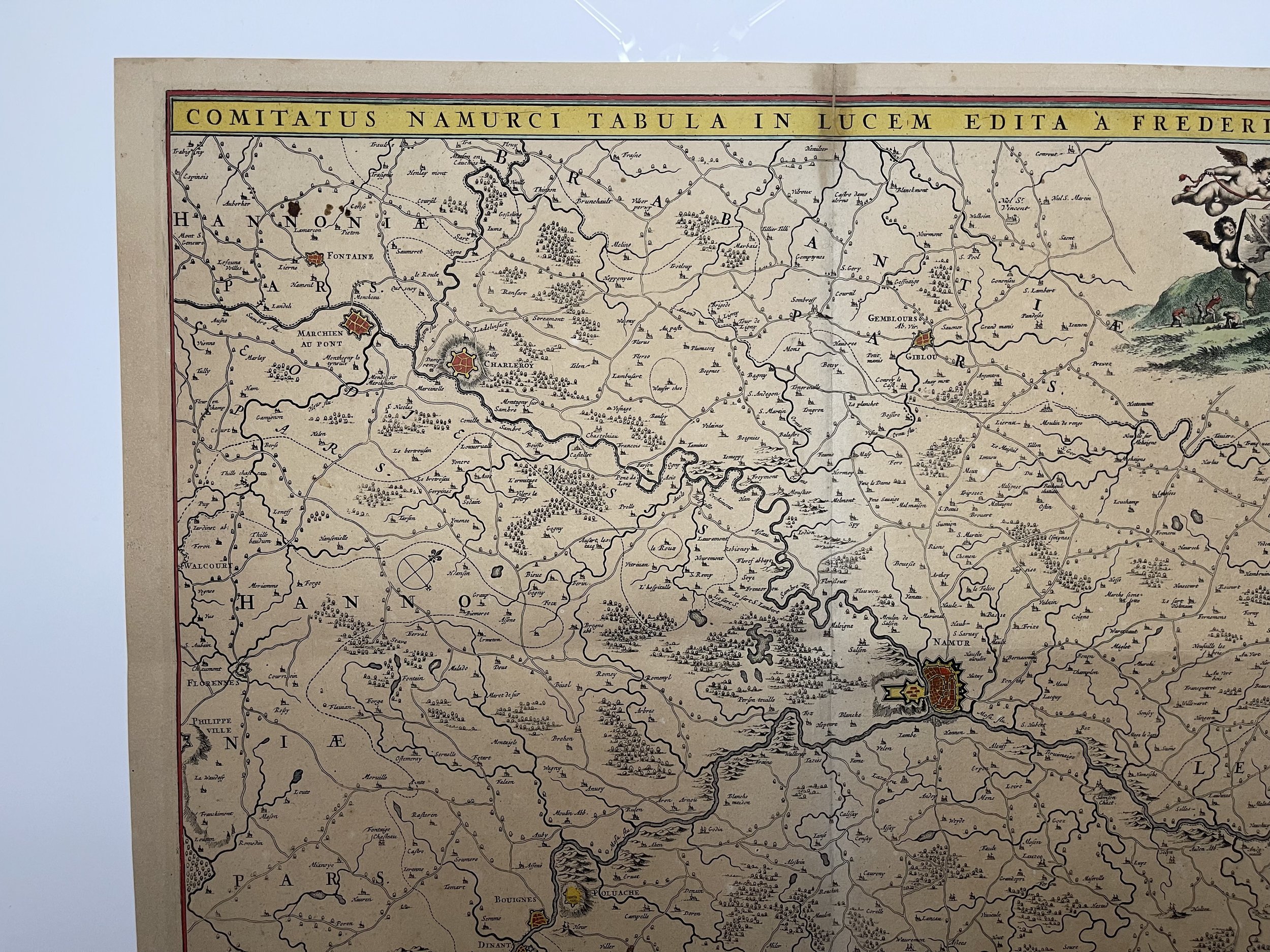
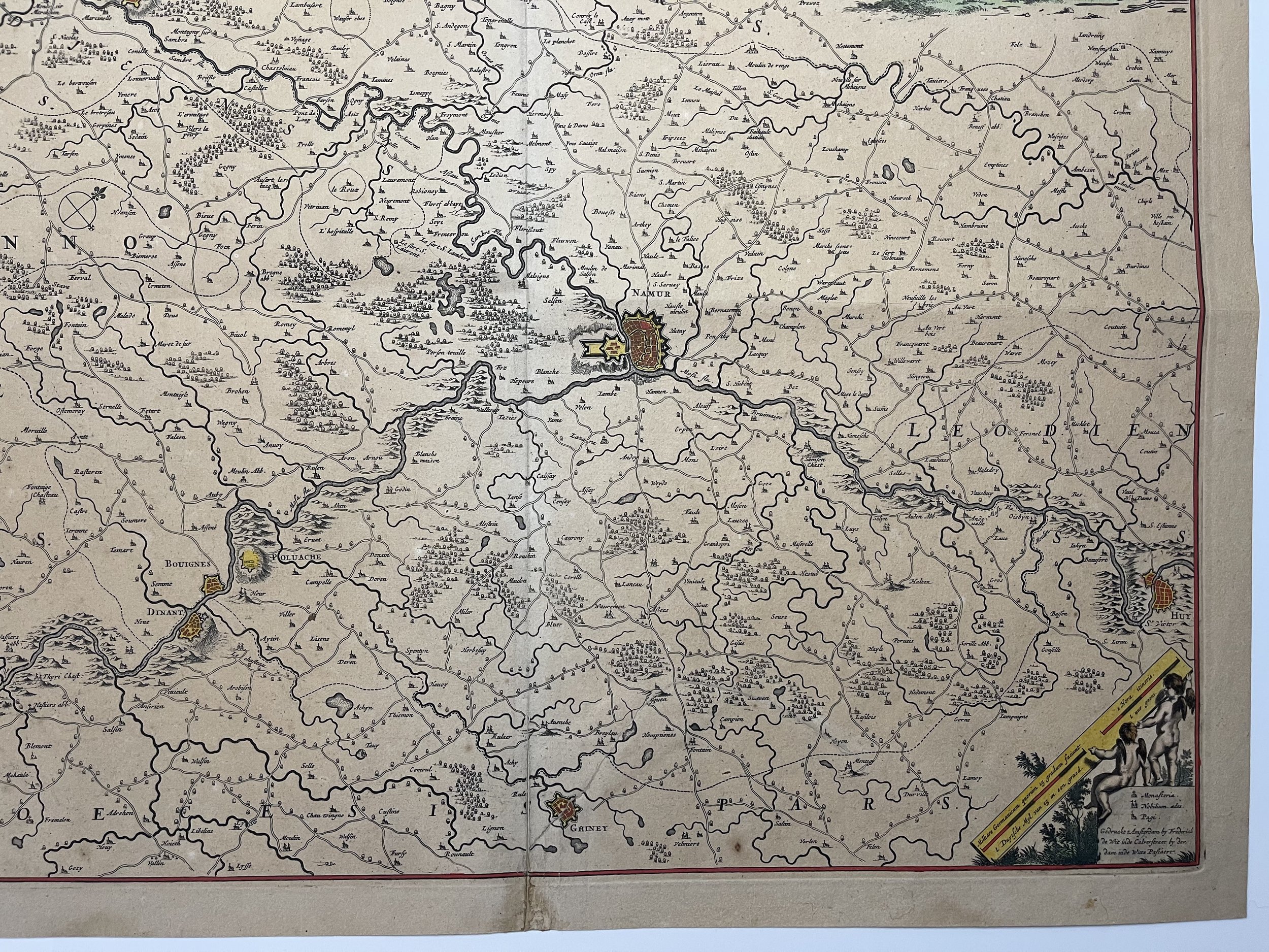
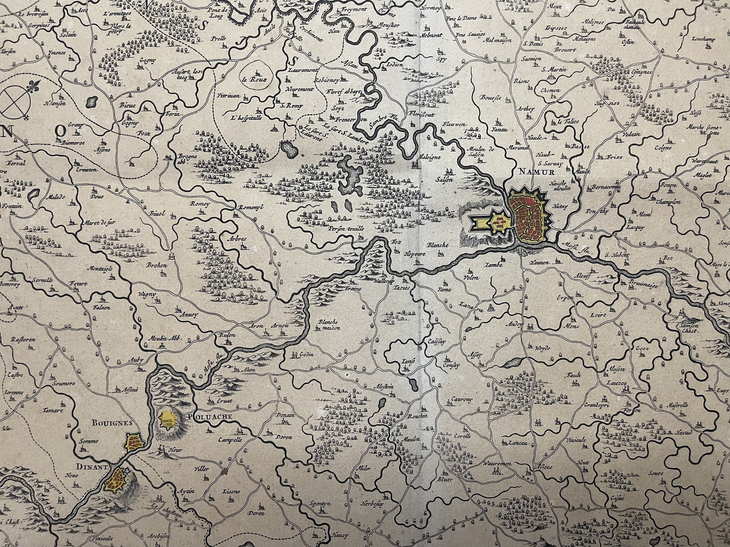
Comitatus Namurci Tabula in Lucem edita á (Namur Belgium) - Frederico de Wit - Amsterdam 1680
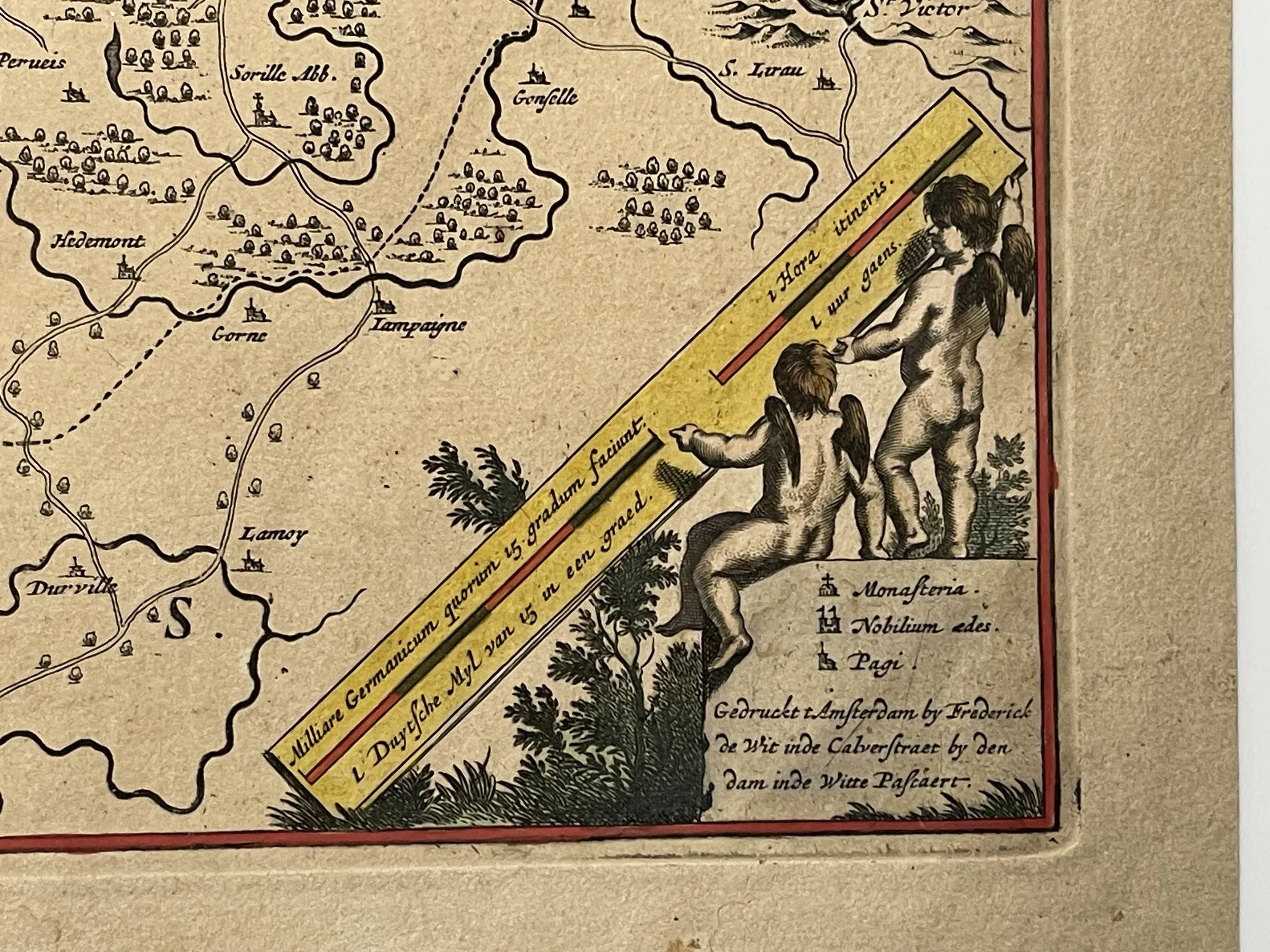
Detailed map of Namur (Belgium), centred on the Meuse River, published by Frederick De Wit. Includes a decorative cartouche and coat of arms.
Frederick De Wit (1629 ca.-1706) was a mapmaker and map seller who was born in Gouda but who worked and died in Amsterdam. He moved to the city in 1648, where he opened a printing operation under the name of The Three Crabs; later, he changed the name of his shop to The White Chart. From the 1660s onward, he published atlases with a variety of maps; he is best known for these atlases and his Dutch town maps. After Frederik’s death in 1706, his wife Maria ran the shop for four years before selling it. Their son, Franciscus, was a stockfish merchant and had no interest in the map shop. At the auction to liquidate the de Wit stock, most of the plates went to Pieter Mortier, whose firm eventually became Covens & Mortier, one of the biggest cartography houses of the eighteenth century.
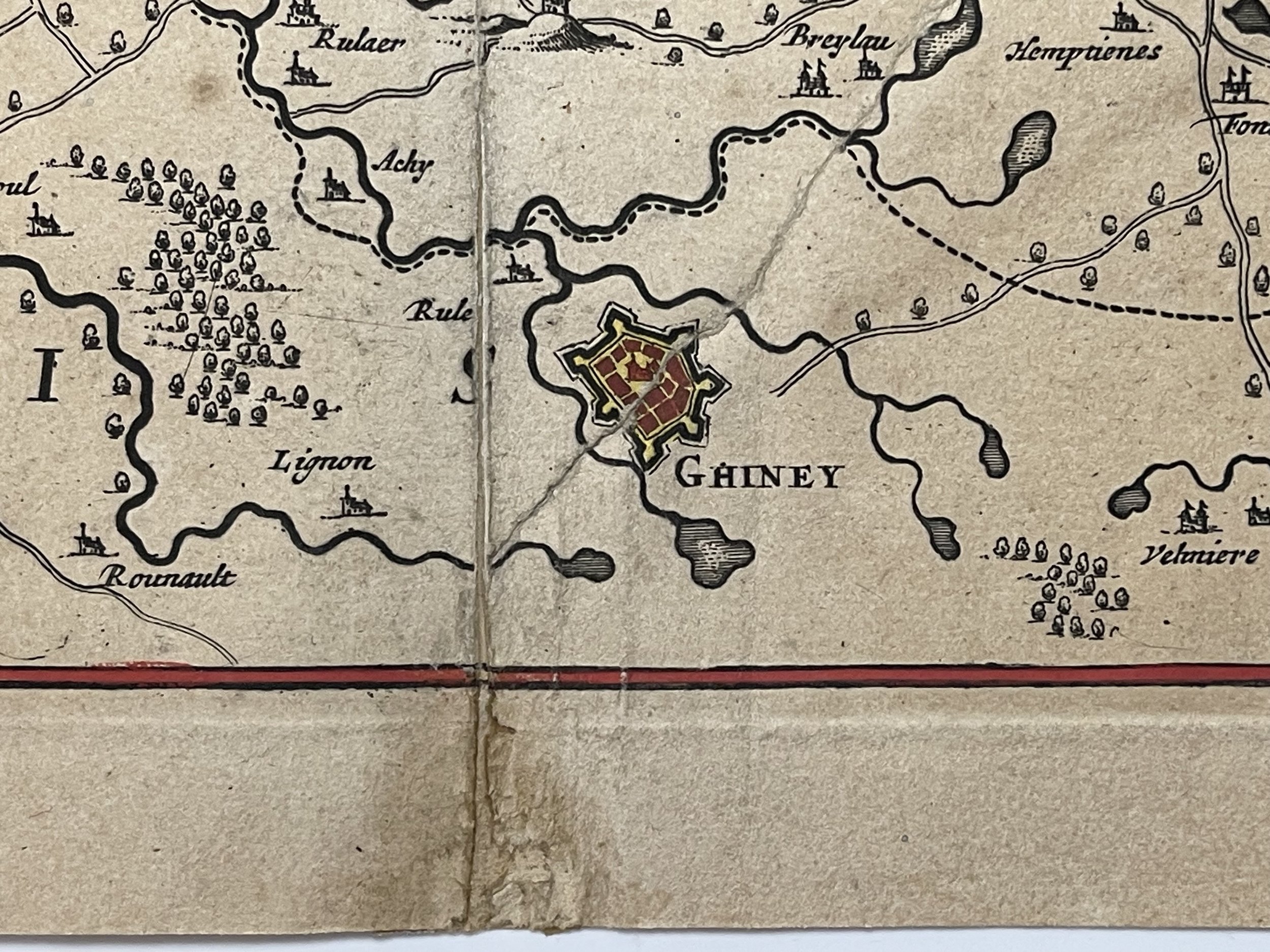
Excellent condition with small professional repair to a tear at the bottom middle, only recognisable from the rear. Small insignificant stain top and bottom middle. Pricing and grading commensurate.
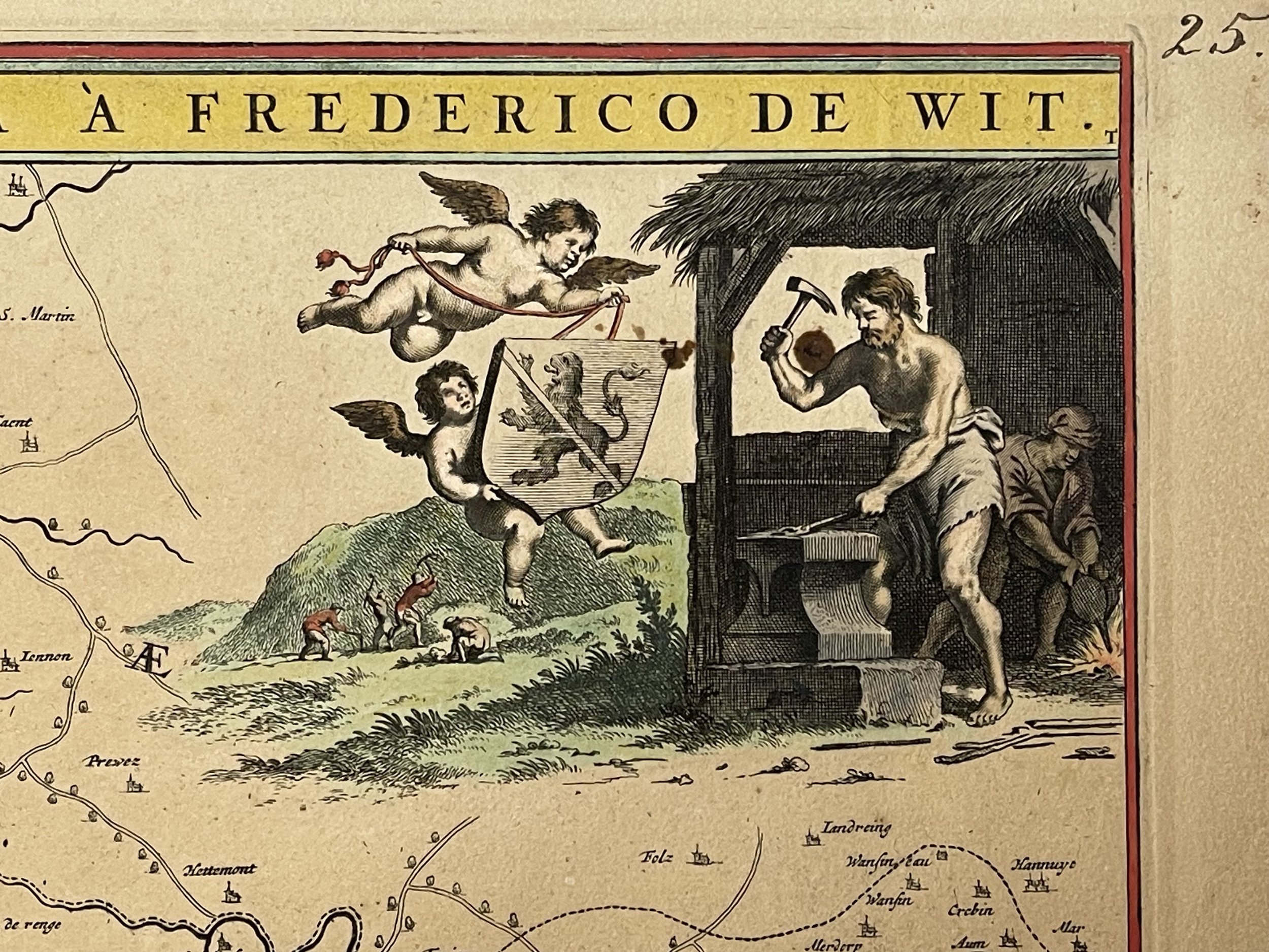
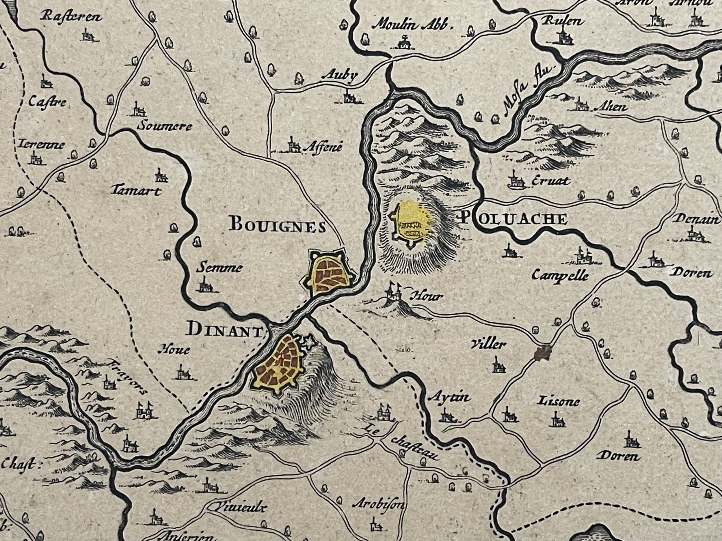
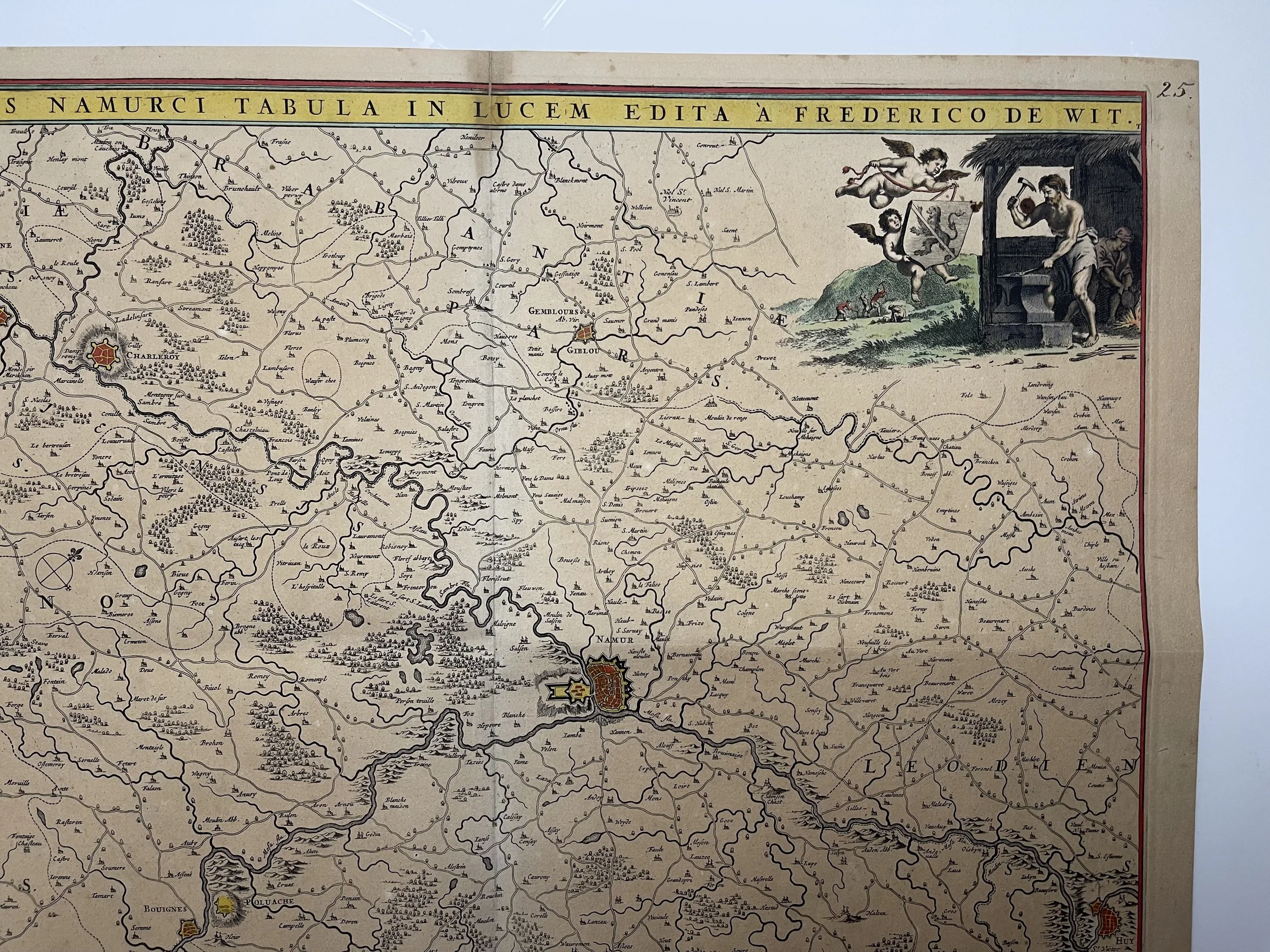
Detailed map of Namur (Belgium), centred on the Meuse River, published by Frederick De Wit. Includes a decorative cartouche and coat of arms.
Frederick De Wit (1629 ca.-1706) was a mapmaker and map seller who was born in Gouda but who worked and died in Amsterdam. He moved to the city in 1648, where he opened a printing operation under the name of The Three Crabs; later, he changed the name of his shop to The White Chart. From the 1660s onward, he published atlases with a variety of maps; he is best known for these atlases and his Dutch town maps. After Frederik’s death in 1706, his wife Maria ran the shop for four years before selling it. Their son, Franciscus, was a stockfish merchant and had no interest in the map shop. At the auction to liquidate the de Wit stock, most of the plates went to Pieter Mortier, whose firm eventually became Covens & Mortier, one of the biggest cartography houses of the eighteenth century.
Excellent condition with small professional repair to a tear at the bottom middle, only recognisable from the rear. Small insignificant stain top and bottom middle. Pricing and grading commensurate.
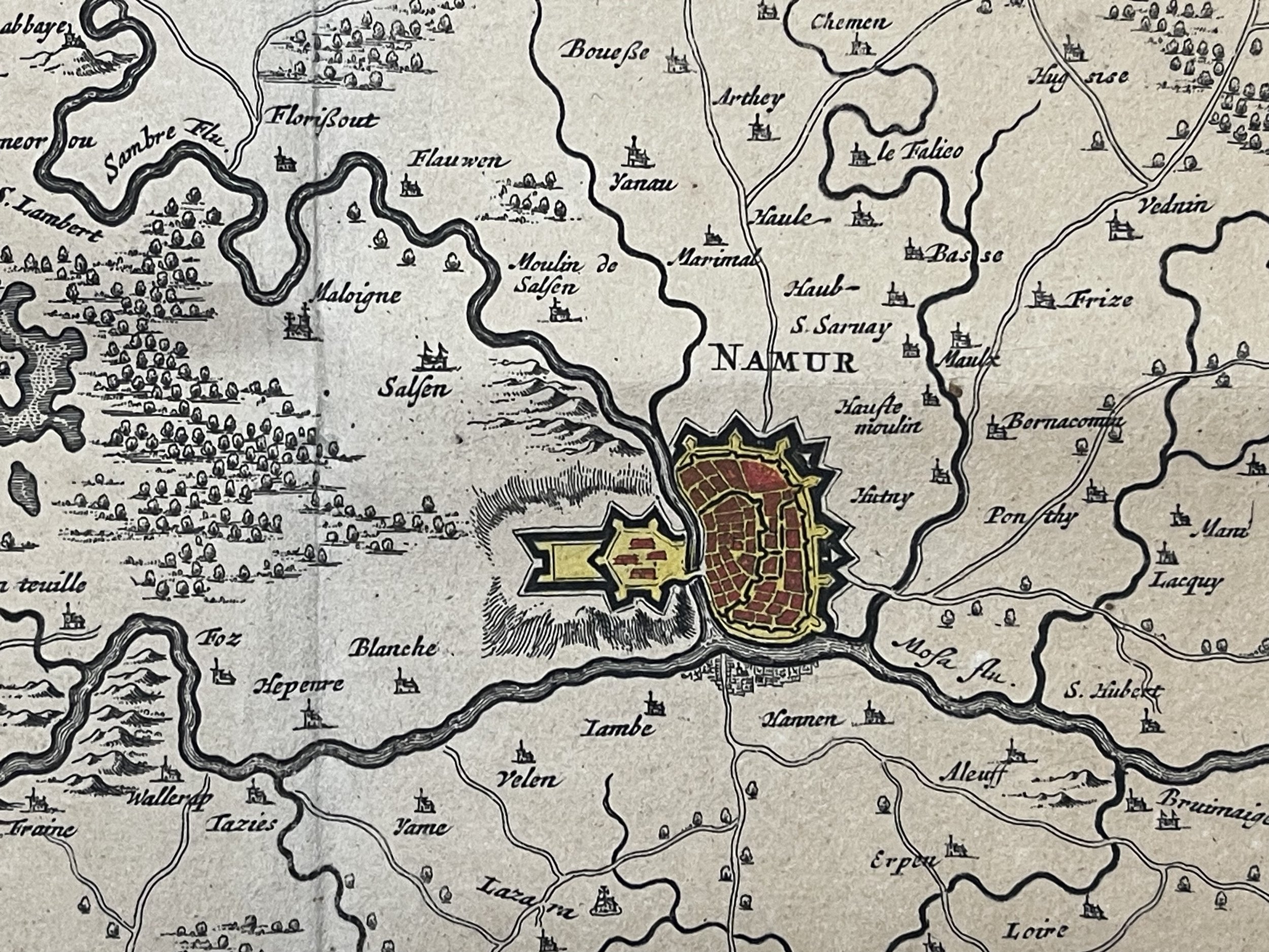
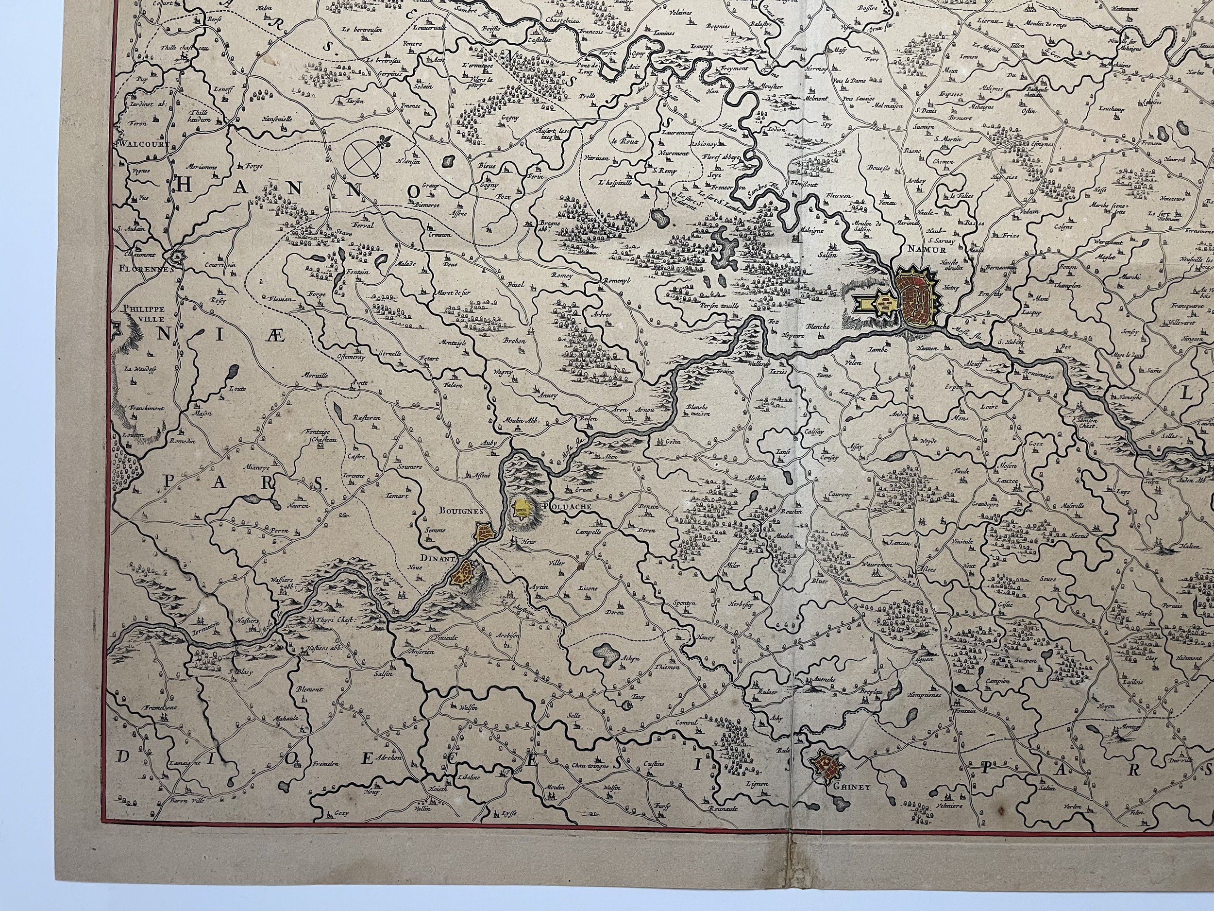
Code : A662
Cartographer : Cartographer / Engraver / Publisher: Frederick De Wit
Date : Publication Place / Date - Circa 1680
Size : Sheet size: Image Size: 59 x 50 cm
Availability : Available
Type - Genuine - Antique
Grading A-
Where Applicable - Folds as issued. Light box photo shows the folio leaf centre margin hinge ‘glue’, this is not visible otherwise.
Tracked postage, in casement. Please contact me for postal quotation outside of the UK.