Continental Europe – Sidney Hall Circa 1830
Continental Europe – Sidney Hall 1830
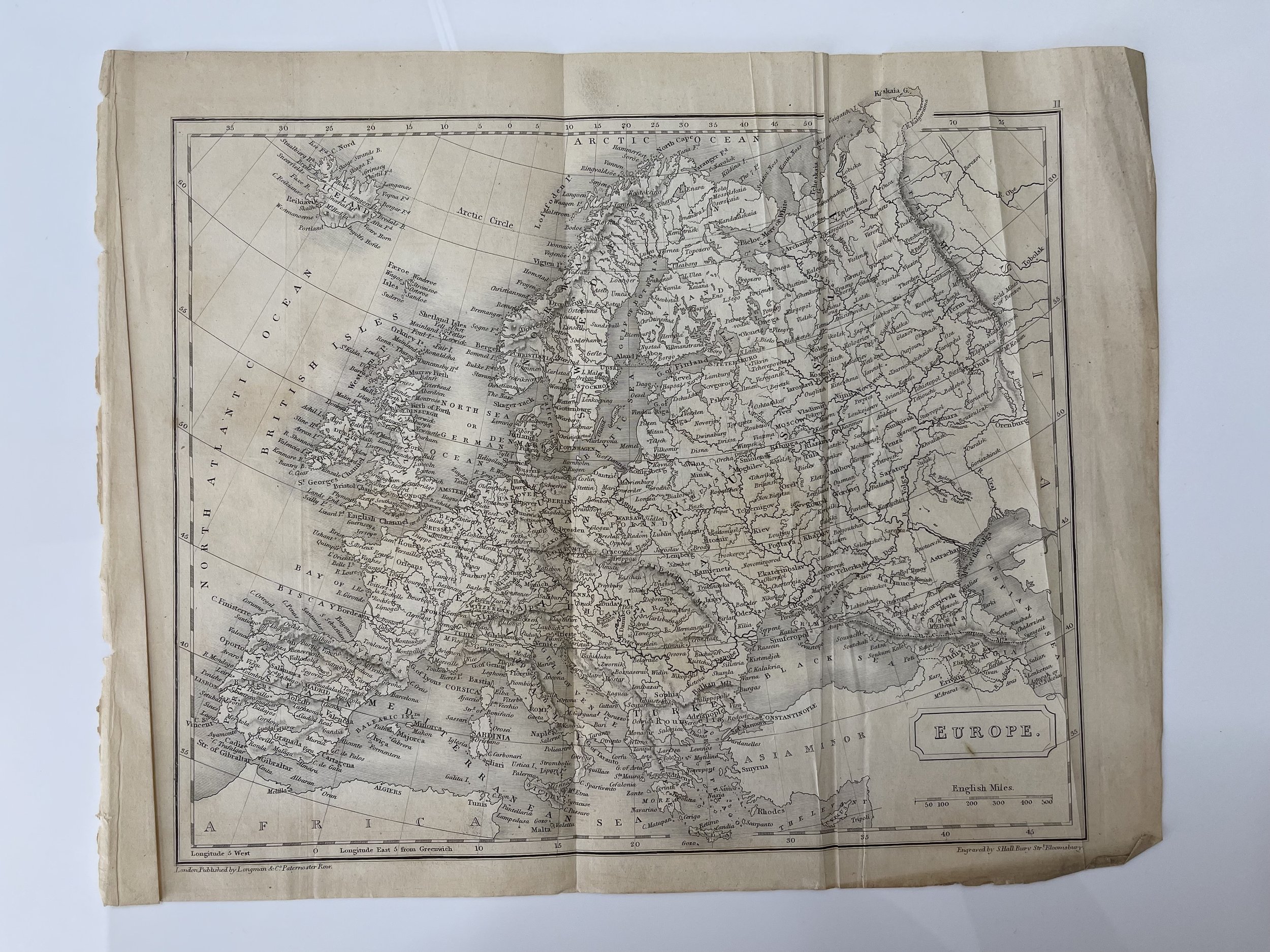
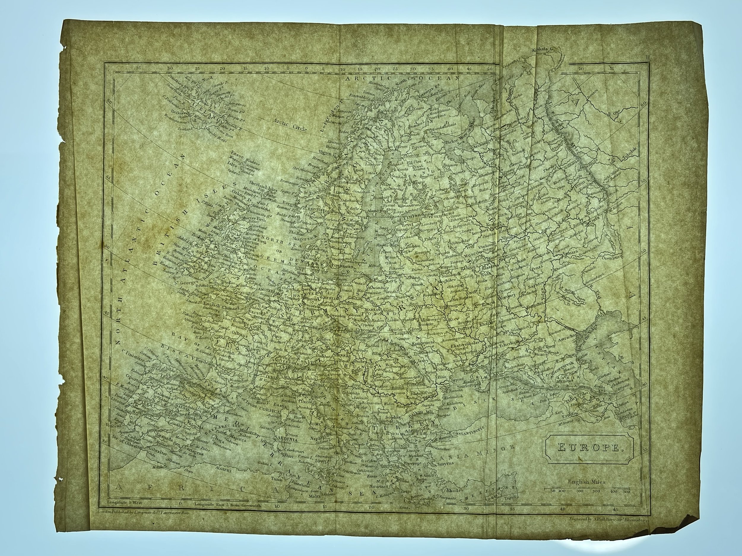
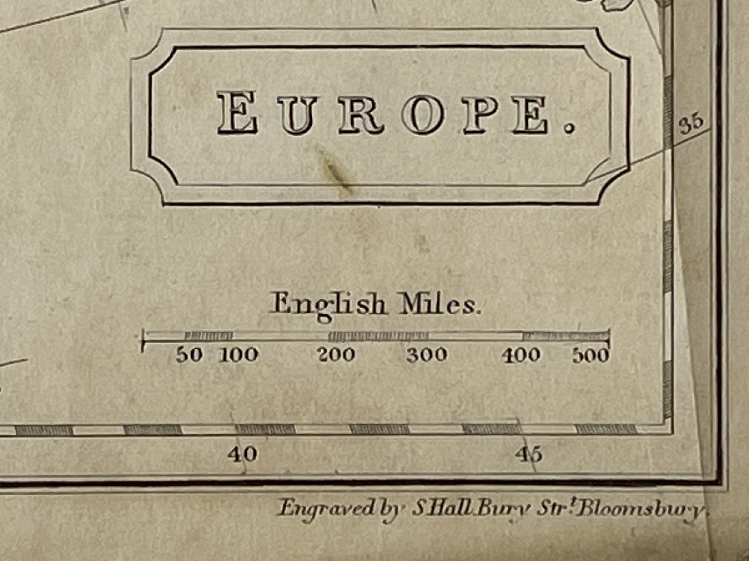
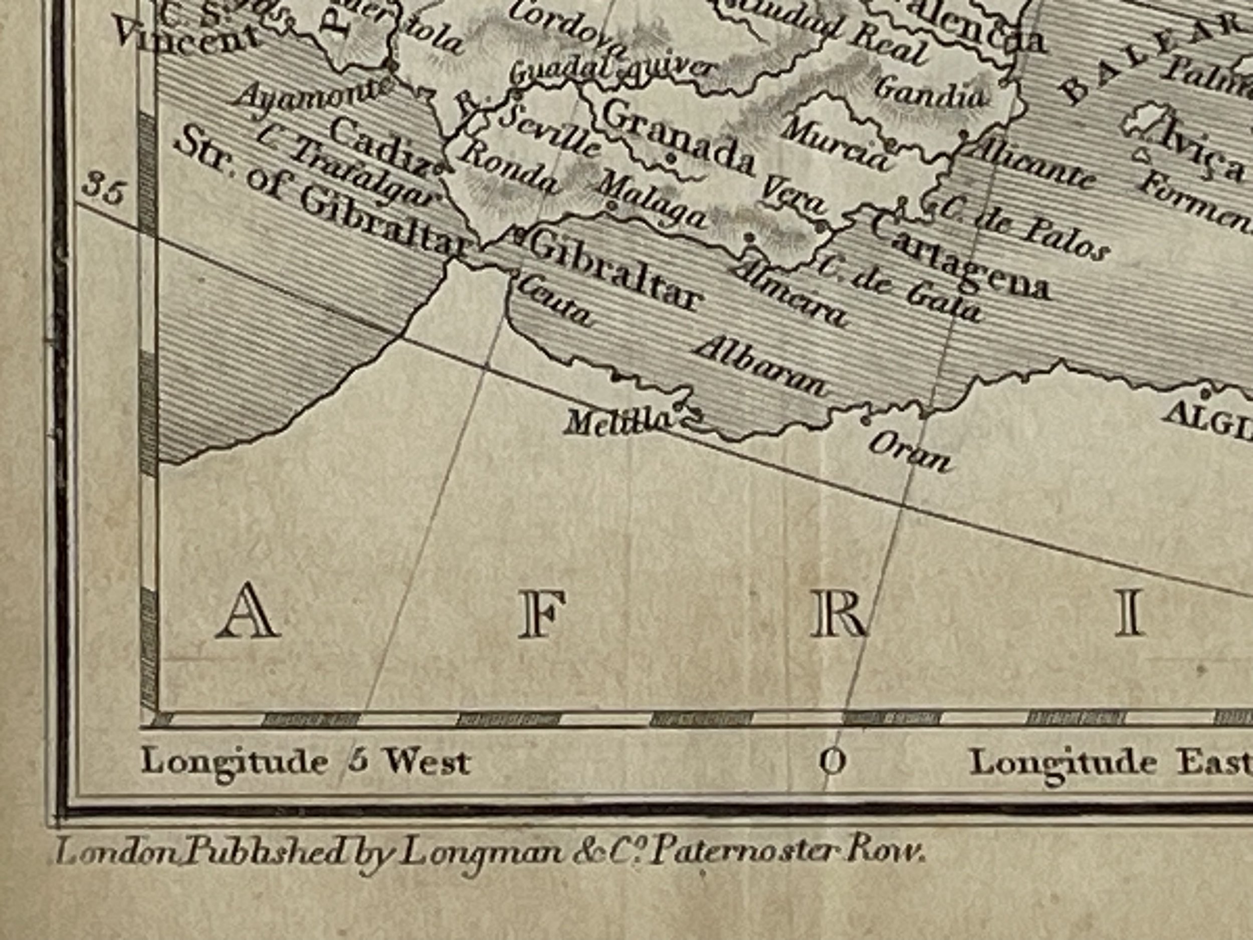
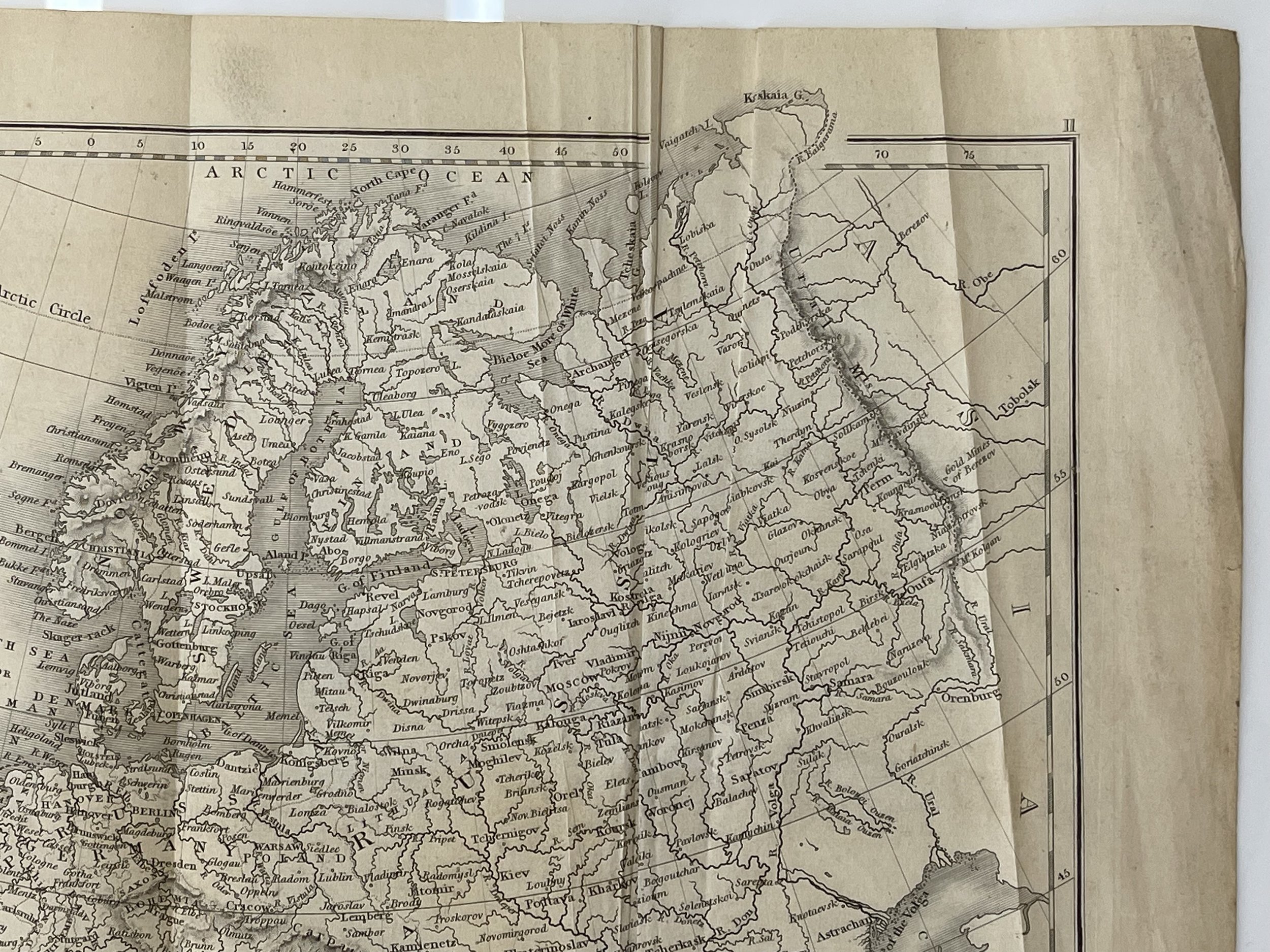
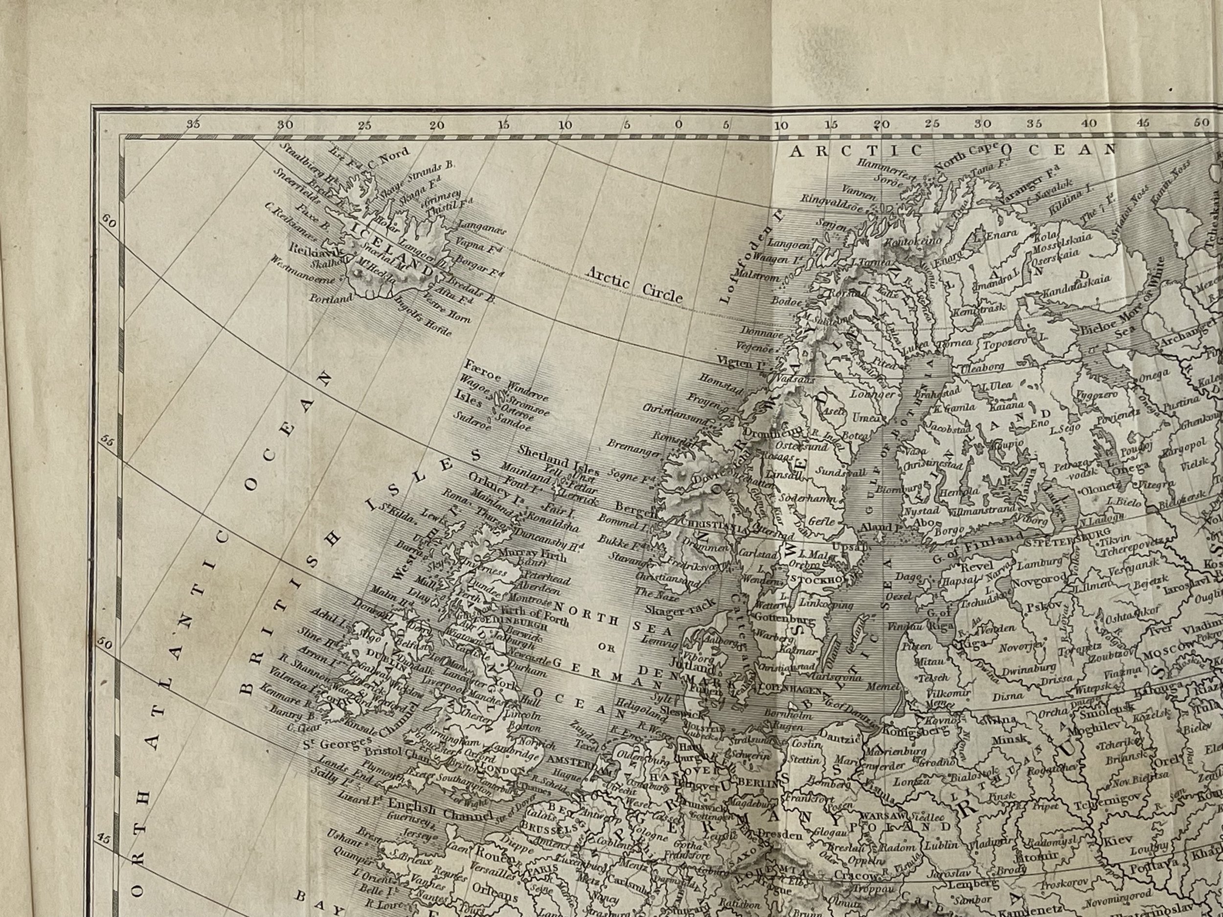
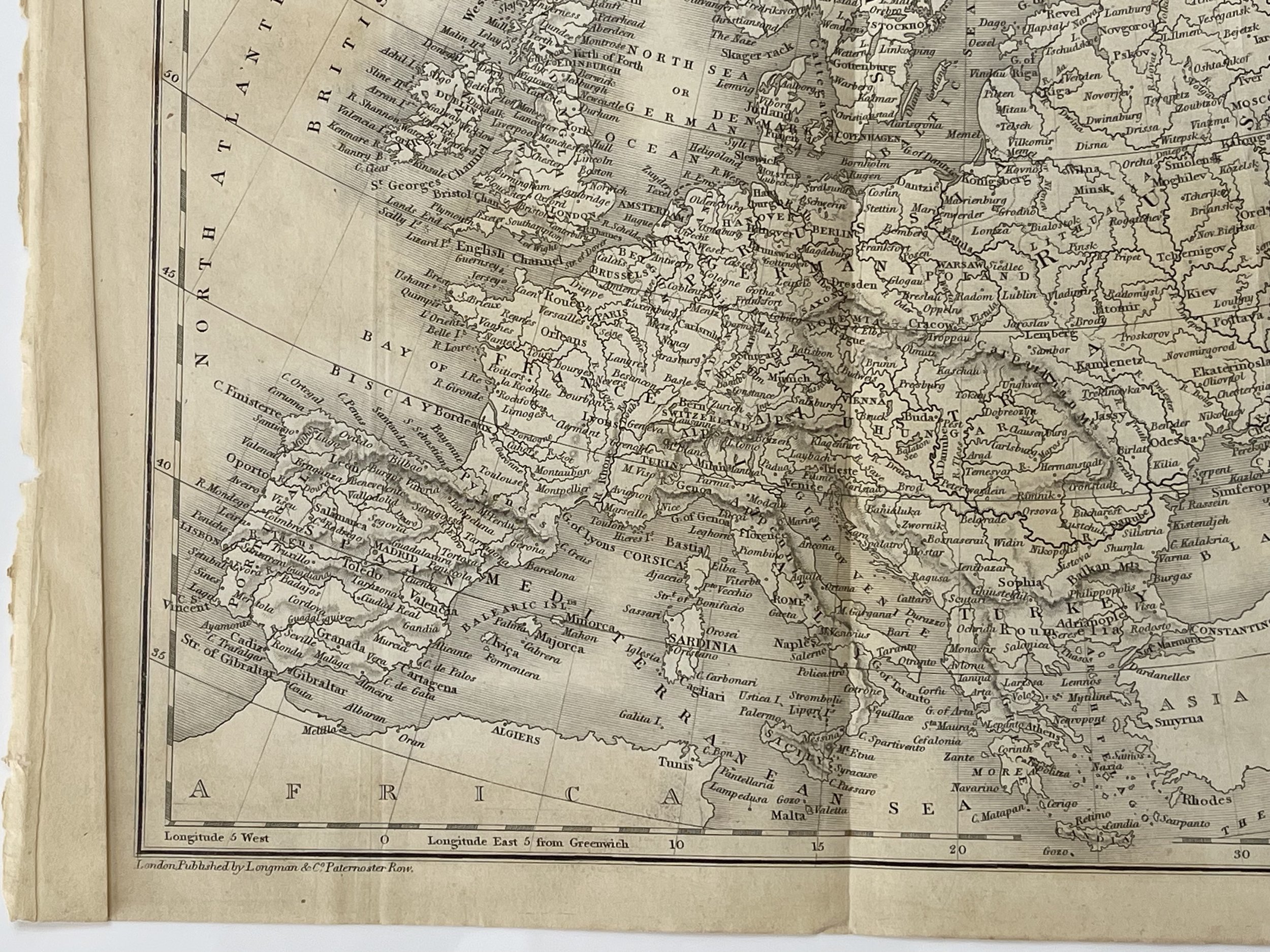
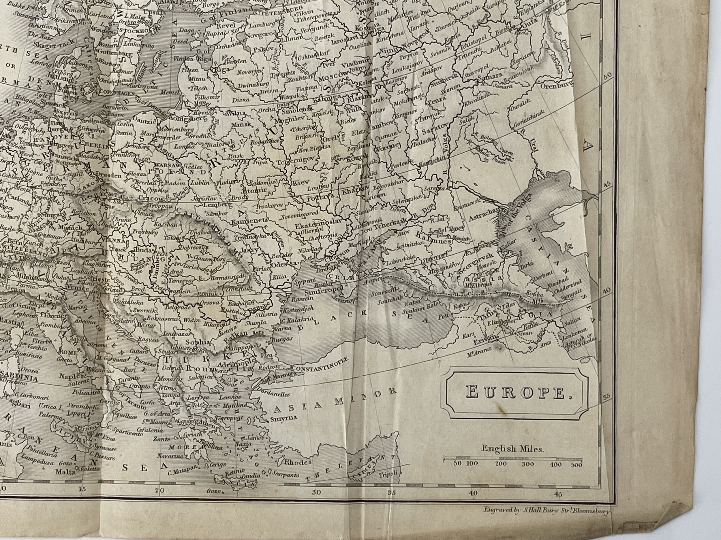
This scarce 1830 map of Europe is from a smaller version of A New General Atlas with the divisions and boundaries. Constructed entirely from new drawings and engraved by Sidney Hall. London, engraved for Longman, Rees, Orme, Brown and Green, Paternoster Row, Circa 1830. It spans the entire continent, encompassing the Atlantic Ocean to the Ural Mountains and from the Arctic Ocean to northern Africa and Turkey, even including Iceland. Notable topographical details such as towns, rivers, mountains, steppes, and islands are clearly marked throughout. Elevation is depicted through hachure and political and territorial boundaries are highlighted in colour. The map also points out significant battlegrounds, such as the Battle of Groix (1795) and multiple sites for the Battle of Trafalgar (1805).
The map reflects the peak of the British Empire and the decline of the Ottoman Empire, as well as the absence of Poland, which was divided among neighbouring Russia, Austria, and Prussia. Published after the Congress of Vienna and Napoleon's defeat, the map shows a new balance of power in Europe, cantered on the five Great Powers: the United Kingdom, France, Russia, Prussia, and the Austrian Empire. However, this so-called "peace" was short-lived as old rivalries resurfaced and forces such as nationalism, liberalism, and industrial revolutions gained momentum.
Issued from 1830 to 1857, Sidney Hall's New General Atlas features elegant engravings and decorative keyboard-style borders in some editions. The maps were most likely created using the advanced technique of steel plate engraving, making it a pioneering work in the field. This method was adopted to prevent counterfeiting, as copper plates used in printing bank notes proved to be easily duplicated. In response to the Bank of England's call for an unforgeable printing method, American inventors Jacob Perkins and Asa Spencer developed a process for engraving steel plates and an engraving lathe capable of creating complex designs with accuracy and efficiency.
Sidney Hall (1788?–1831) was a British engraver and cartographer well known and popular for his early nineteenth century atlases containing maps of the United Kingdom and of the ancient world reproduced from Hall's engravings. Hall made engravings for several international atlases at a time when cartography and atlases were very popular. He also engraved a series of cards for the various constellations, published c.1825 in a boxed set called Urania's Mirror. Hall engraved maps for William Faden, Aaron Arrowsmith, and Chapman & Hall, among many others.
In 1809 he operated at 5 Vine Street, Piccadilly, London. In 1814 he was in partnership with Michael Thomson operating at 14 Bury Street in the Bloomsbury District and later was listed at 18 Bury Street. Hall is credited with "almost certainly" being the first engraver to use steel plates in map engraving.
Hall died in 1831 at the age of 42. The business was carried on by map engraver Selina Hall, his widow.
Publisher: Longman, Hurst, Rees, Orme & Brown, London
Longman & Company.
Engraving in very good condition. Pricing and grading commensurate.
Publishers of books and prints, known under a series of names reflecting successive partnerships. On the database the term Longman is used for the firm at all periods of its history.
The founder of the firm, Thomas Longman (1699-1755) was apprenticed in 1716 to John Osborn, the London bookseller, and eventually married his daughter. In1724, he took over the business of William Taylor at the Black Swan and the Ship in Paternoster Row. In 1754, he took his nephew, also Thomas Longman (1730-1797), into partnership; one of the younger Longman's sons, Thomas Norton Longman (1771-1842) succeeded to the business, in turn his sons, Thomas (1804-1879) and William (1813-1877) took over, to be followed by the former's son, Thoms Norton Longman. A succession of partners joined: 1794, Owen Rees; 1804, Hurst and Orme; 1811, Thomas Brown (1777-1869); 1824, Green. Around 1817 Longman & Co published some drawing books after Brookshaw together with John Lepard (q.v.). In 1863 the firm took over the business of John W. Parker, Son, & Bourne, and in 1890, the firm of Rivington (q.v.). Robert Guy and William L Longman became partners in 1909.
In the 1950s the firm moved from Paternoster Row to Harlow, Essex. In 1968, it was taken over by the Financial and Provincial Publishing Company, and in 1970 (under the management of Mark Longman) merged with Penguin Books, becoming the Pearson Longman Group. Extensive archives are preserved at the University of Reading.
Continental Europe – Sidney Hall 1830
This scarce 1830 map of Europe is from a smaller version of A New General Atlas with the divisions and boundaries. Constructed entirely from new drawings and engraved by Sidney Hall. London, engraved for Longman, Rees, Orme, Brown and Green, Paternoster Row, Circa 1830. It spans the entire continent, encompassing the Atlantic Ocean to the Ural Mountains and from the Arctic Ocean to northern Africa and Turkey, even including Iceland. Notable topographical details such as towns, rivers, mountains, steppes, and islands are clearly marked throughout. Elevation is depicted through hachure and political and territorial boundaries are highlighted in colour. The map also points out significant battlegrounds, such as the Battle of Groix (1795) and multiple sites for the Battle of Trafalgar (1805).
The map reflects the peak of the British Empire and the decline of the Ottoman Empire, as well as the absence of Poland, which was divided among neighbouring Russia, Austria, and Prussia. Published after the Congress of Vienna and Napoleon's defeat, the map shows a new balance of power in Europe, cantered on the five Great Powers: the United Kingdom, France, Russia, Prussia, and the Austrian Empire. However, this so-called "peace" was short-lived as old rivalries resurfaced and forces such as nationalism, liberalism, and industrial revolutions gained momentum.
Issued from 1830 to 1857, Sidney Hall's New General Atlas features elegant engravings and decorative keyboard-style borders in some editions. The maps were most likely created using the advanced technique of steel plate engraving, making it a pioneering work in the field. This method was adopted to prevent counterfeiting, as copper plates used in printing bank notes proved to be easily duplicated. In response to the Bank of England's call for an unforgeable printing method, American inventors Jacob Perkins and Asa Spencer developed a process for engraving steel plates and an engraving lathe capable of creating complex designs with accuracy and efficiency.
Sidney Hall (1788?–1831) was a British engraver and cartographer well known and popular for his early nineteenth century atlases containing maps of the United Kingdom and of the ancient world reproduced from Hall's engravings. Hall made engravings for several international atlases at a time when cartography and atlases were very popular. He also engraved a series of cards for the various constellations, published c.1825 in a boxed set called Urania's Mirror. Hall engraved maps for William Faden, Aaron Arrowsmith, and Chapman & Hall, among many others.
In 1809 he operated at 5 Vine Street, Piccadilly, London. In 1814 he was in partnership with Michael Thomson operating at 14 Bury Street in the Bloomsbury District and later was listed at 18 Bury Street. Hall is credited with "almost certainly" being the first engraver to use steel plates in map engraving.
Hall died in 1831 at the age of 42. The business was carried on by map engraver Selina Hall, his widow.
Publisher: Longman, Hurst, Rees, Orme & Brown, London
Longman & Company.
Engraving in very good condition. Pricing and grading commensurate.
Publishers of books and prints, known under a series of names reflecting successive partnerships. On the database the term Longman is used for the firm at all periods of its history.
The founder of the firm, Thomas Longman (1699-1755) was apprenticed in 1716 to John Osborn, the London bookseller, and eventually married his daughter. In1724, he took over the business of William Taylor at the Black Swan and the Ship in Paternoster Row. In 1754, he took his nephew, also Thomas Longman (1730-1797), into partnership; one of the younger Longman's sons, Thomas Norton Longman (1771-1842) succeeded to the business, in turn his sons, Thomas (1804-1879) and William (1813-1877) took over, to be followed by the former's son, Thoms Norton Longman. A succession of partners joined: 1794, Owen Rees; 1804, Hurst and Orme; 1811, Thomas Brown (1777-1869); 1824, Green. Around 1817 Longman & Co published some drawing books after Brookshaw together with John Lepard (q.v.). In 1863 the firm took over the business of John W. Parker, Son, & Bourne, and in 1890, the firm of Rivington (q.v.). Robert Guy and William L Longman became partners in 1909.
In the 1950s the firm moved from Paternoster Row to Harlow, Essex. In 1968, it was taken over by the Financial and Provincial Publishing Company, and in 1970 (under the management of Mark Longman) merged with Penguin Books, becoming the Pearson Longman Group. Extensive archives are preserved at the University of Reading.
Code : A1056
Cartographer : Cartographer / Engraver / Publisher: Sidney Hall
Date : Publication Place / Date - 1830
Size : Sheet size: 22 x 29 Cm
Availability : Available
Type - Genuine - Antique
Grading A
Where Applicable - Folds as issued. Light box photo shows the folio leaf centre margin hinge ‘glue’, this is not visible otherwise.
Tracked postage, in casement. Please contact me for postal quotation outside of the UK.