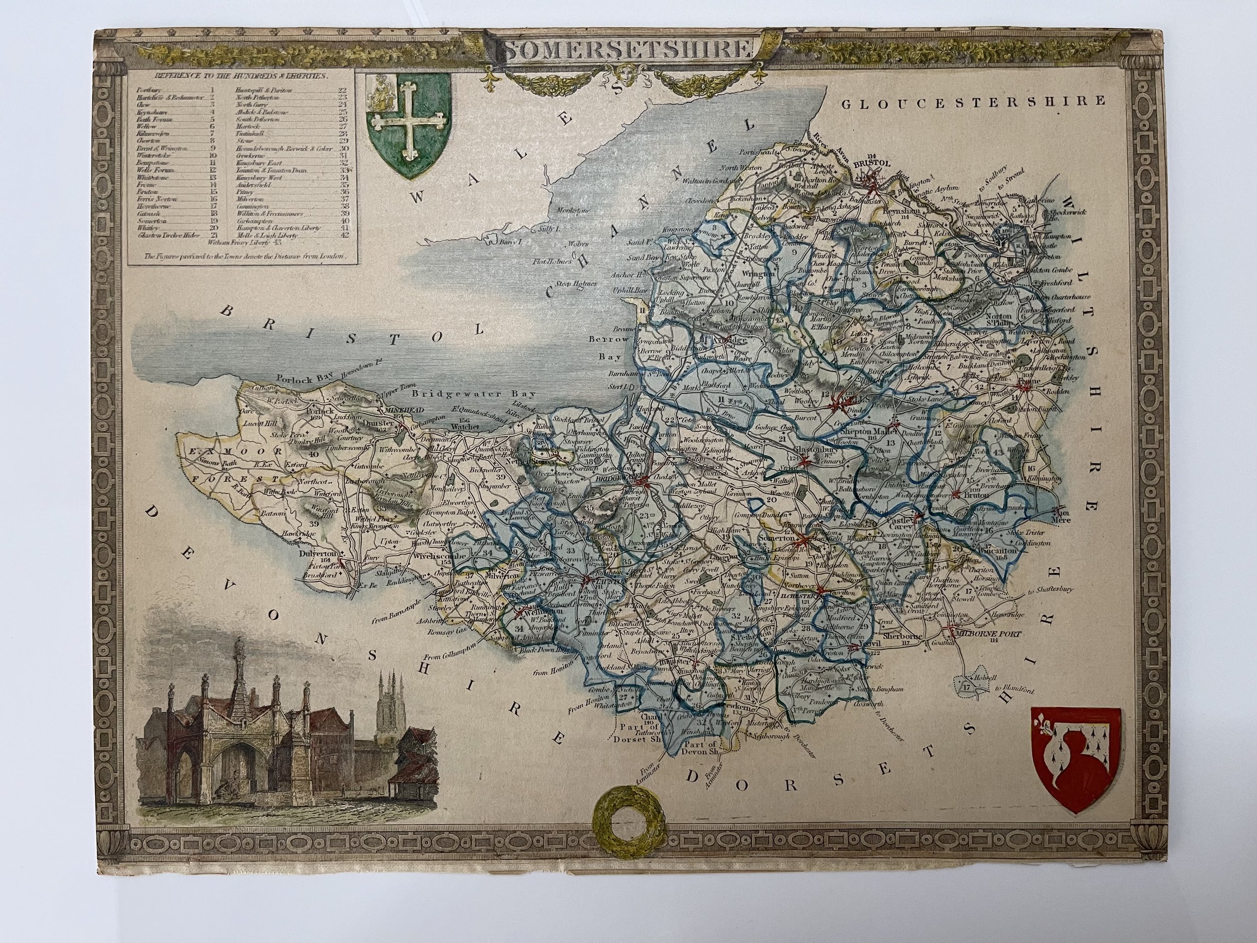
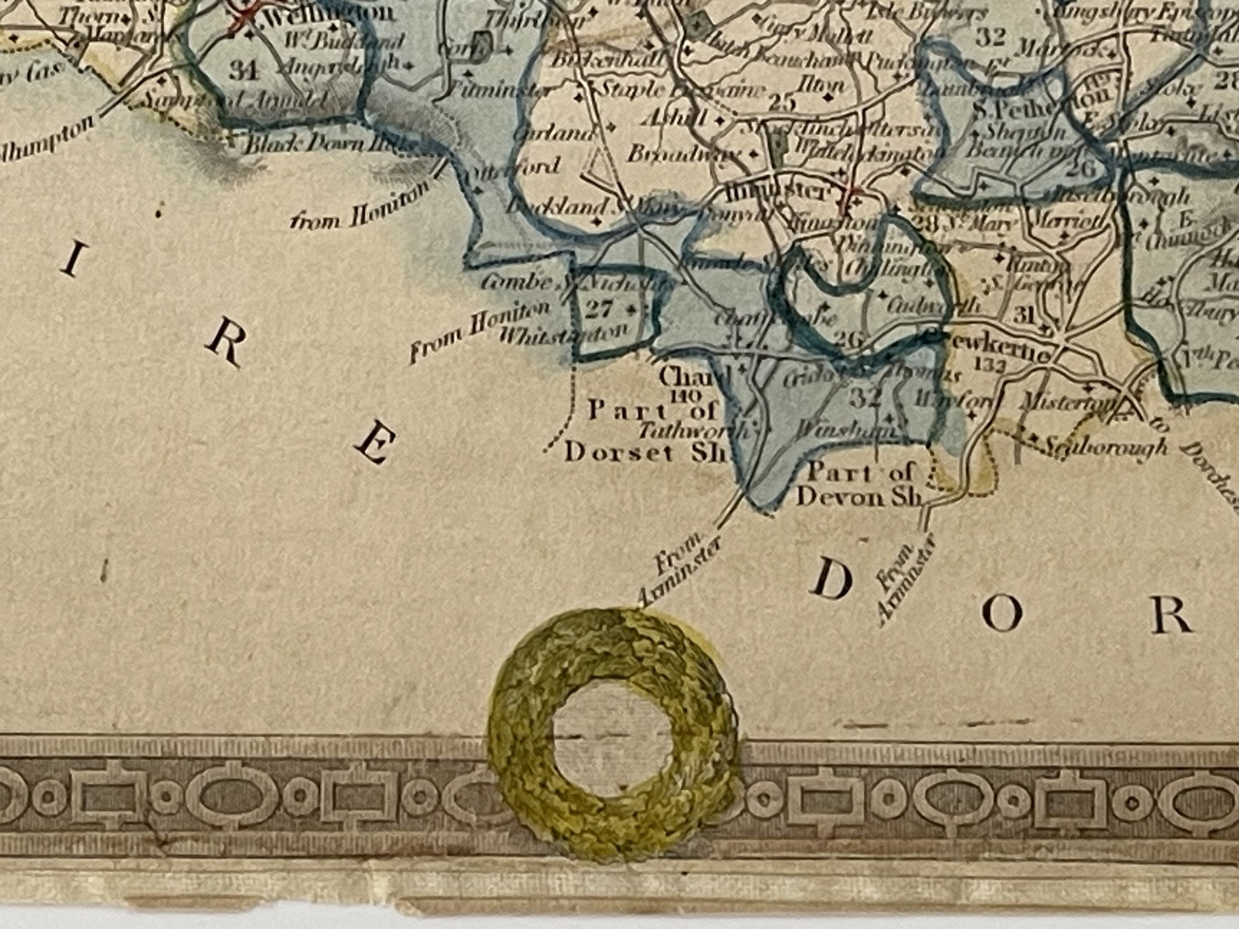
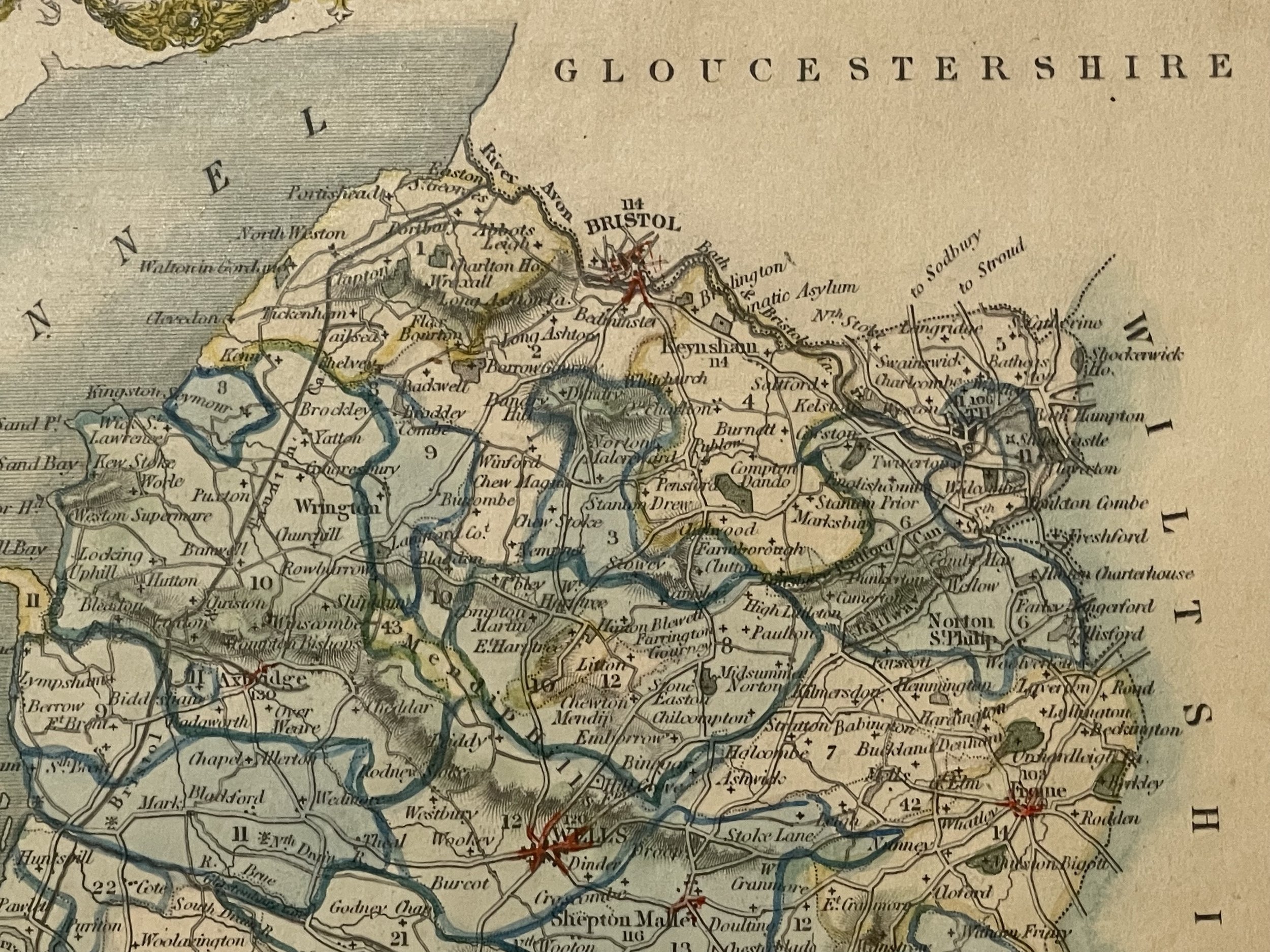
County Map Of Somerset by Thomas Moule - 1836-1848
County Map Of Somerset by Thomas Moule - 1836-1848
Possibly from the Reverent James Barclay's English Dictionary that was first published in 1774. The dictionary went through many editions over the following seventy-five years. The work is noted for its introduction into the world of lexicography synonymy, which prior to the first edition had not been treated in any English dictionary. The dictionary had several maps and portraits included in its editions.
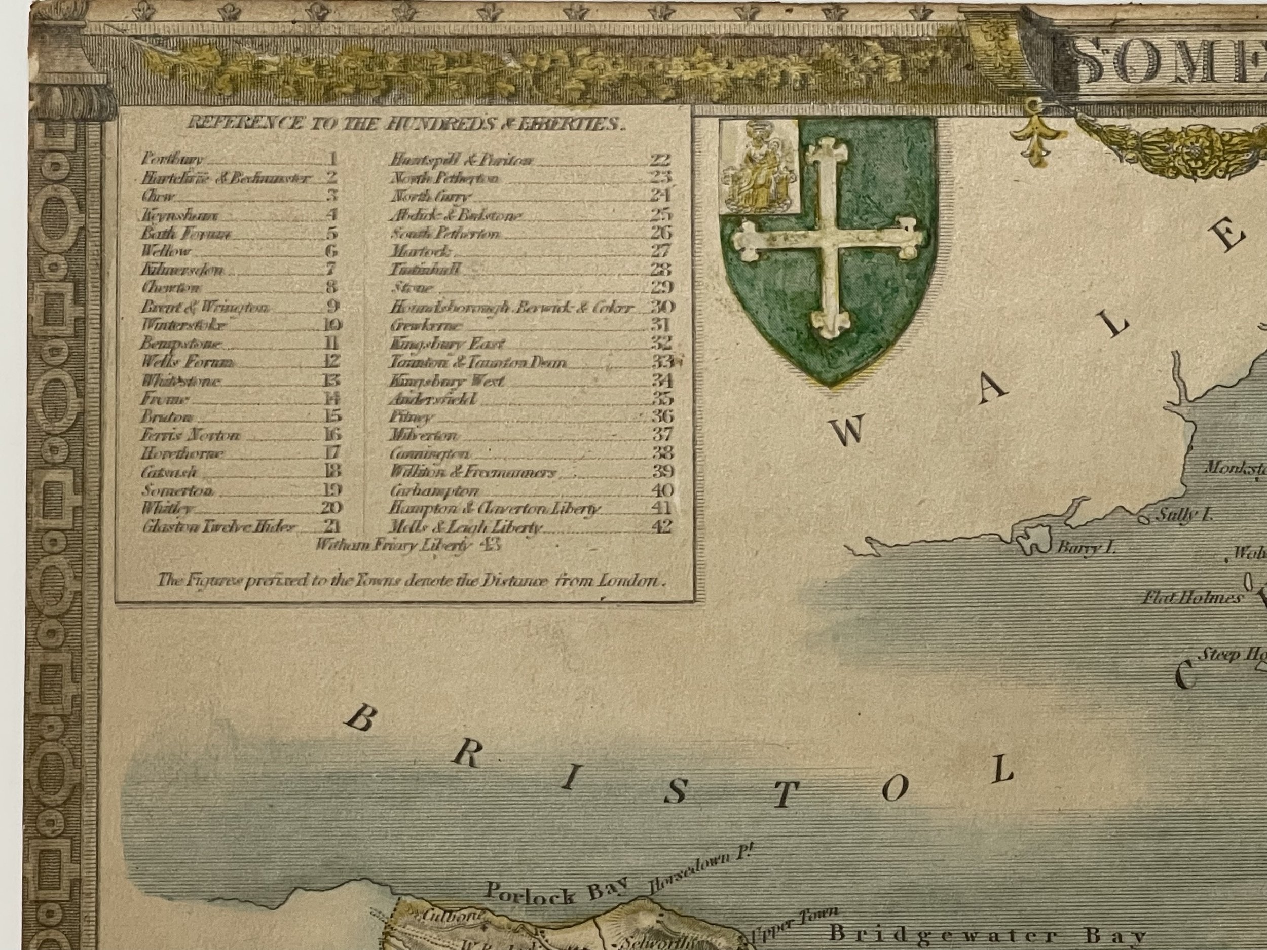
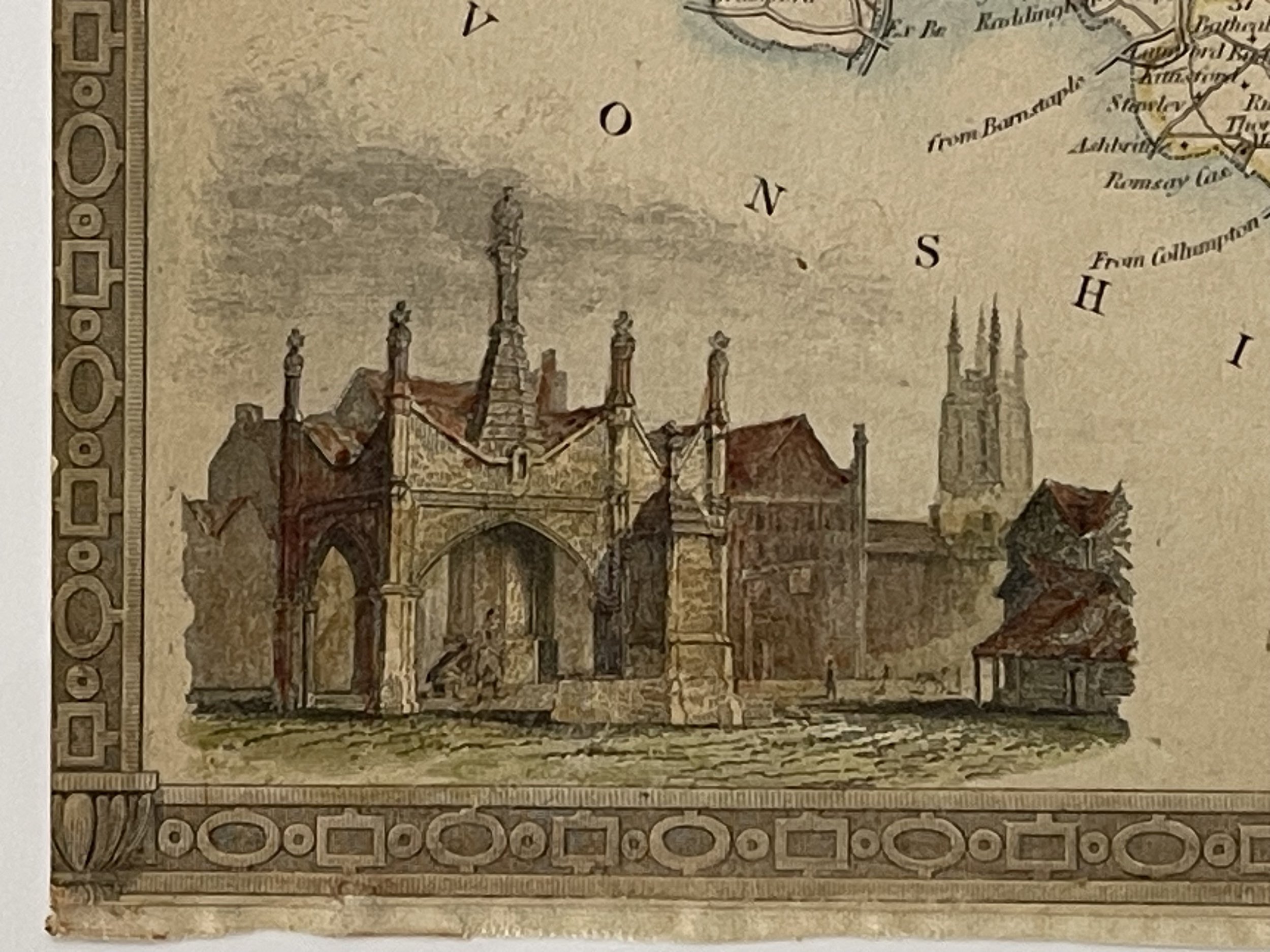
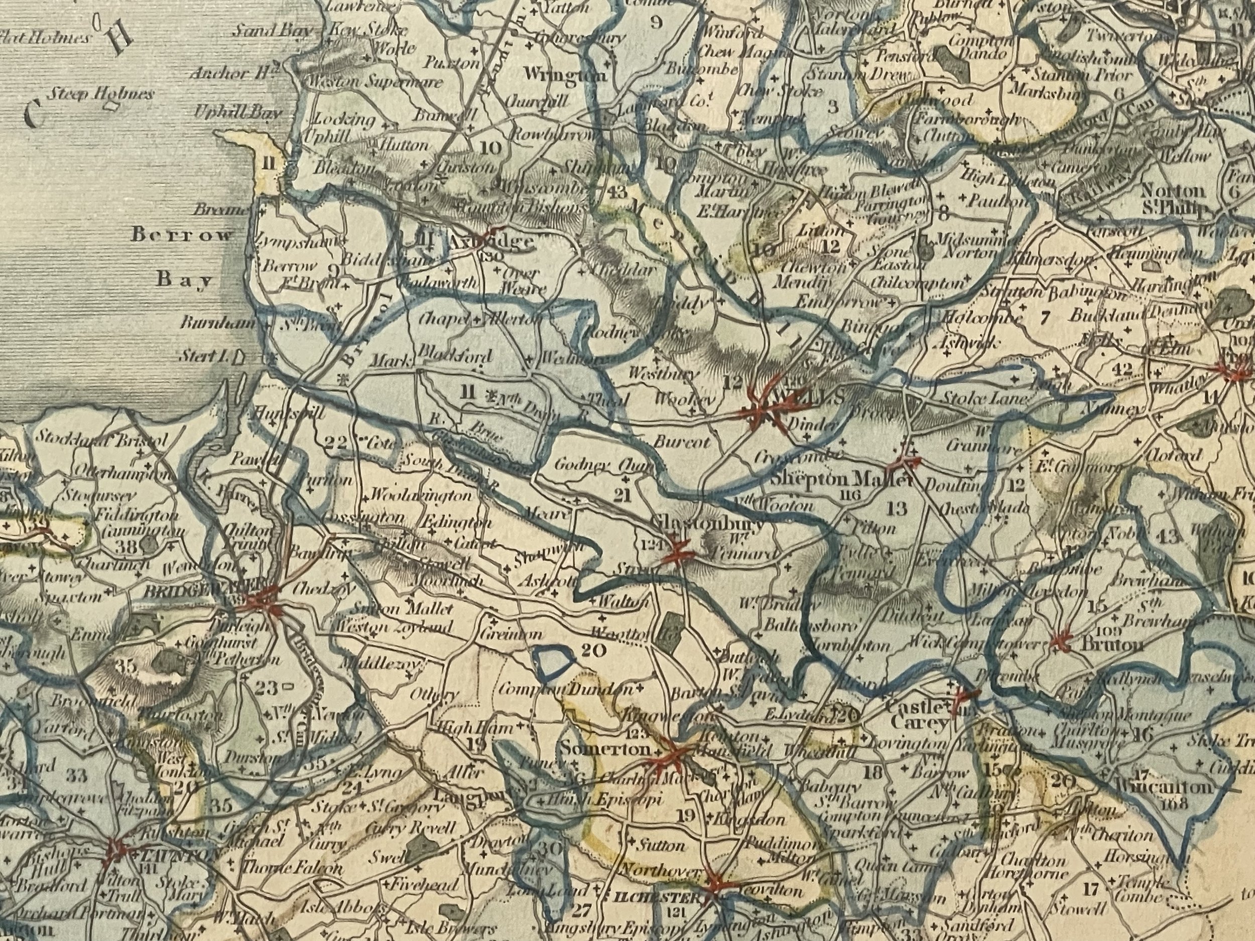
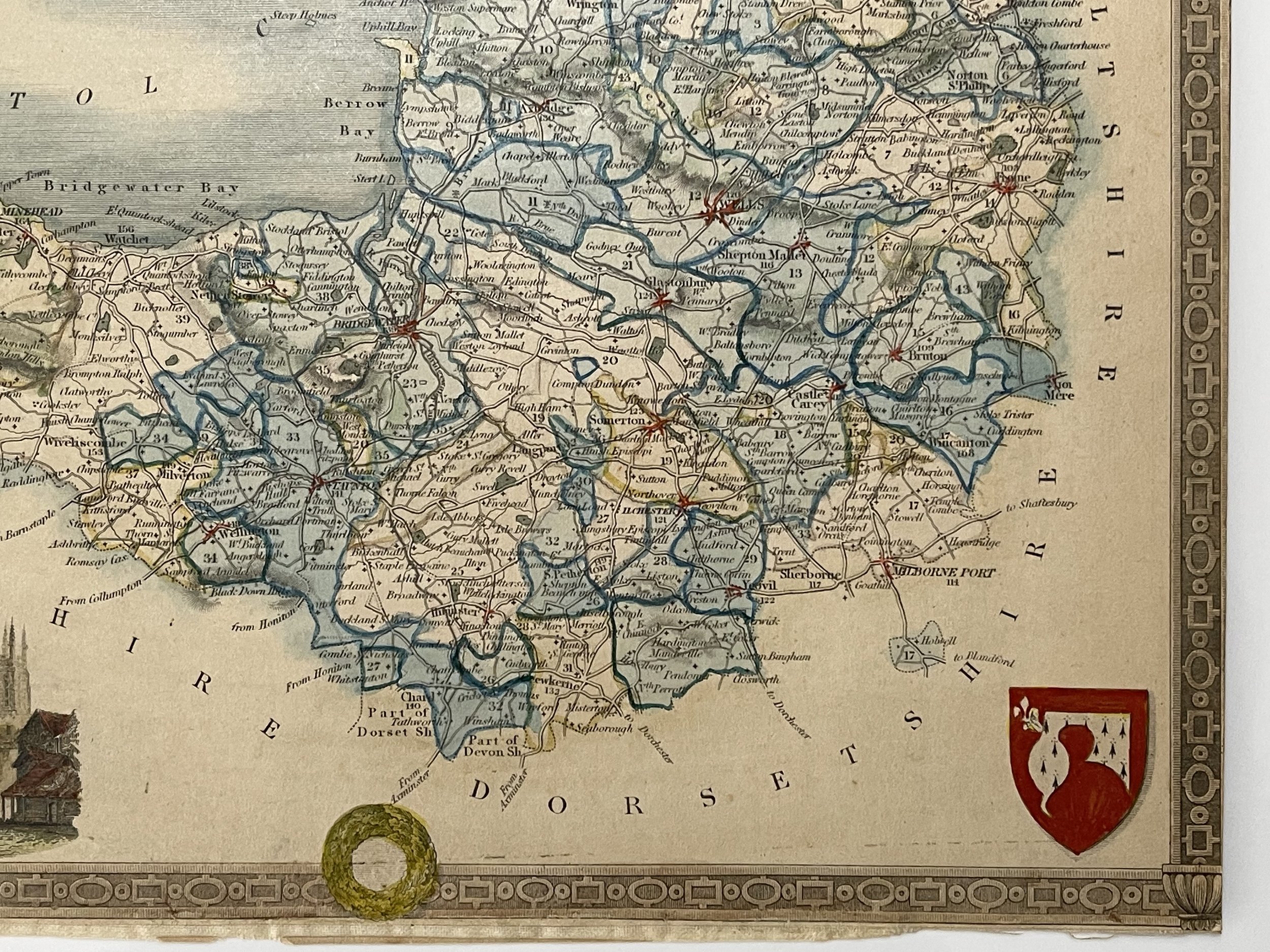
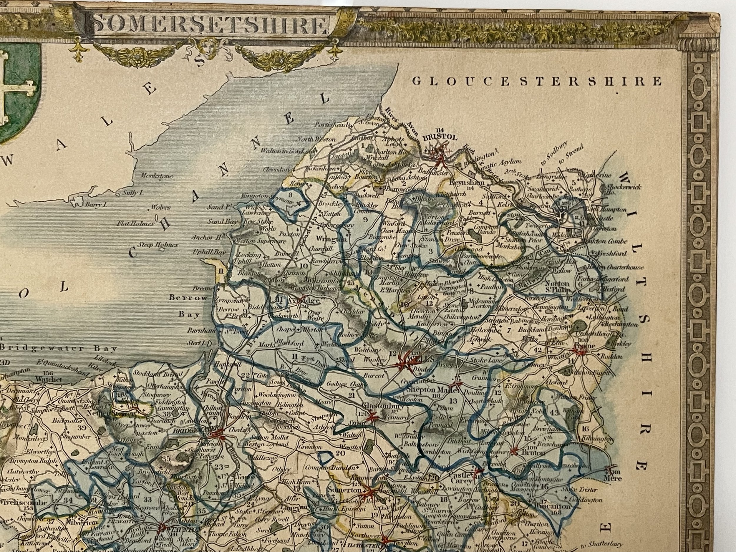
The map features a vignette of Glastonbury Cross, also name places include Taunton, Wellington, Bridgewater, Wells, Shepton Mallet, Bath, Street, Minehead, Ilchester, Ilminster, Castle Cary, Wincanton.
Thomas Moule (14 January 1784 – January 1851) was an English antiquarian, writer on heraldry, and one of Victorian England's most influential mapmakers. He is best known for his popular and highly decorated county maps of England, steel-engraved and first published separately between 1830 and 1832.
Moule was born in Marylebone, London. He sold books in Duke Street, Grosvenor Square, from 1816 to 1822. Later, he became an inspector of 'blind' (illegibly addressed) letters at the General Post Office. He died at his residence in St. James's Palace, to which he was entitled as Chamber-keeper in the Lord Chamberlain's Department.
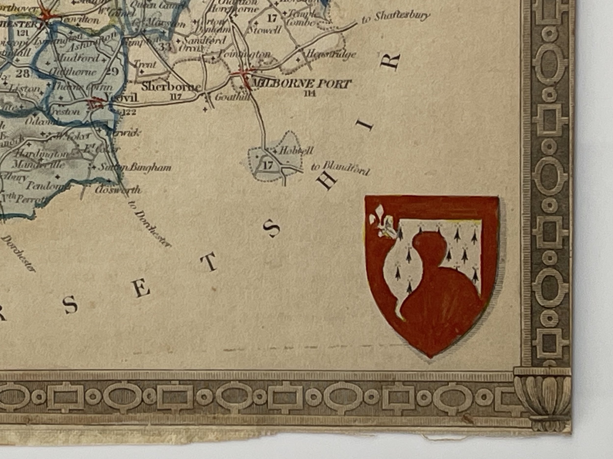
The map is in good condition, additional hessian backed. Pricing and grading commensurate.
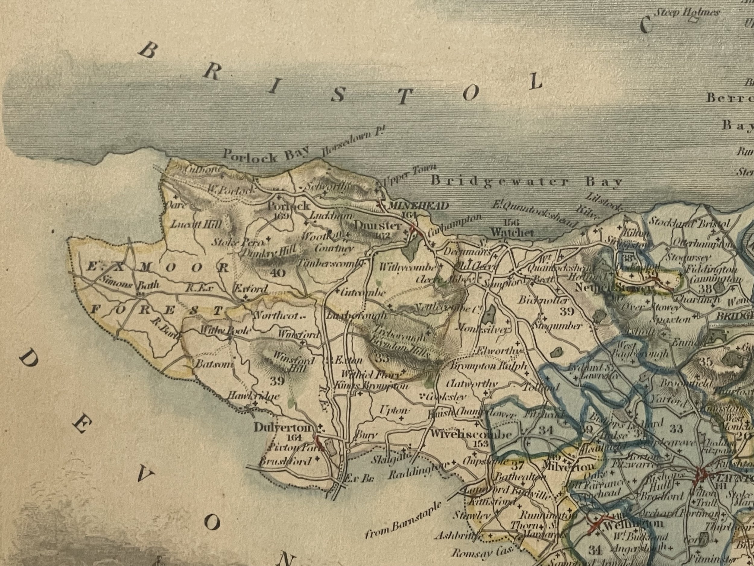
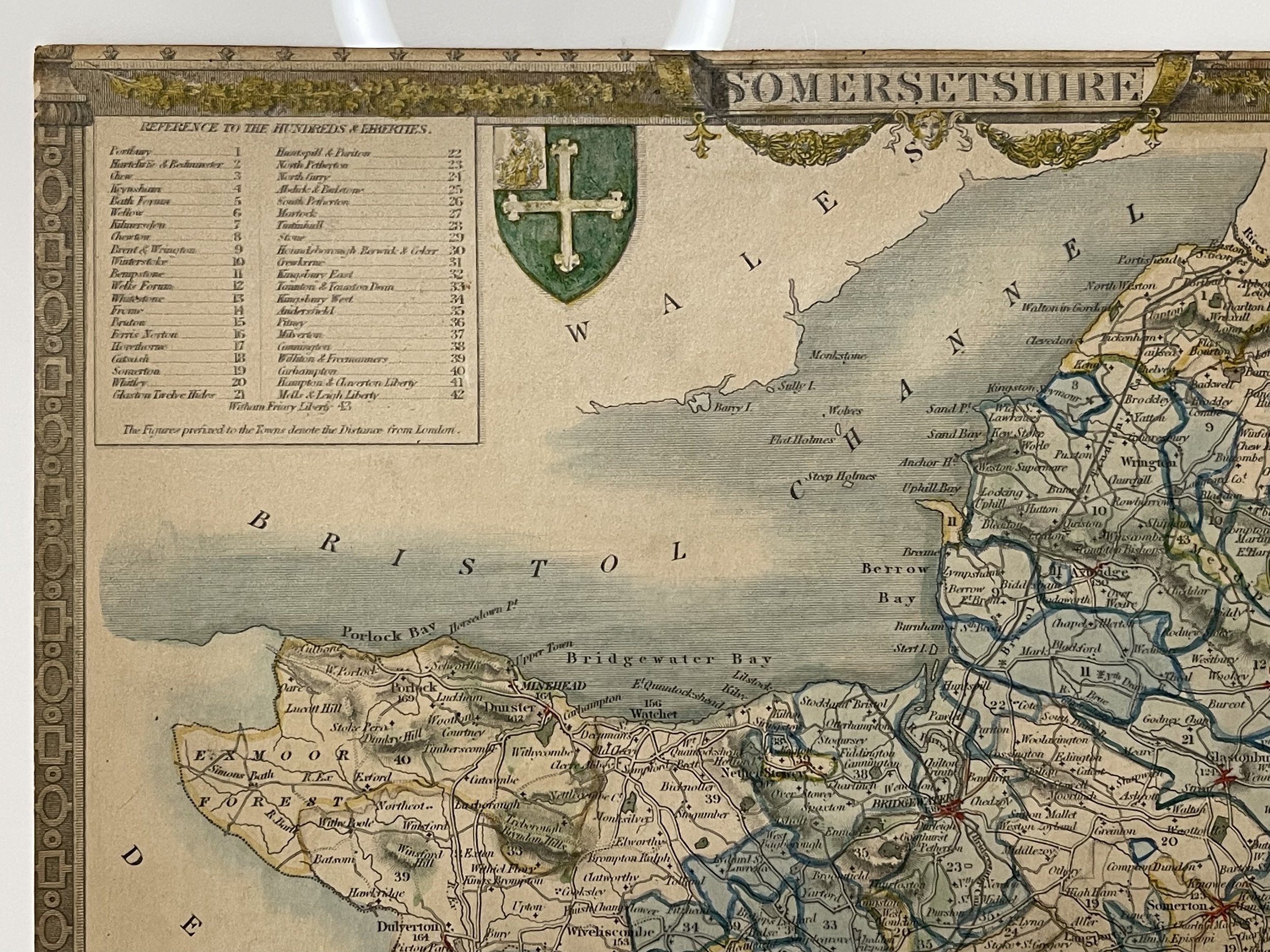
County Map Of Somerset by Thomas Moule - 1836-1848
Possibly from the Reverent James Barclay's English Dictionary that was first published in 1774. The dictionary went through many editions over the following seventy-five years. The work is noted for its introduction into the world of lexicography synonymy, which prior to the first edition had not been treated in any English dictionary. The dictionary had several maps and portraits included in its editions.
The map features a vignette of Glastonbury Cross, also name places include Taunton, Wellington, Bridgewater, Wells, Shepton Mallet, Bath, Street, Minehead, Ilchester, Ilminster, Castle Cary, Wincanton.
Thomas Moule (14 January 1784 – January 1851) was an English antiquarian, writer on heraldry, and one of Victorian England's most influential mapmakers. He is best known for his popular and highly decorated county maps of England, steel-engraved and first published separately between 1830 and 1832.
Moule was born in Marylebone, London. He sold books in Duke Street, Grosvenor Square, from 1816 to 1822. Later, he became an inspector of 'blind' (illegibly addressed) letters at the General Post Office. He died at his residence in St. James's Palace, to which he was entitled as Chamber-keeper in the Lord Chamberlain's Department.
The map is in good condition, additional hessian backed. Pricing and grading commensurate.
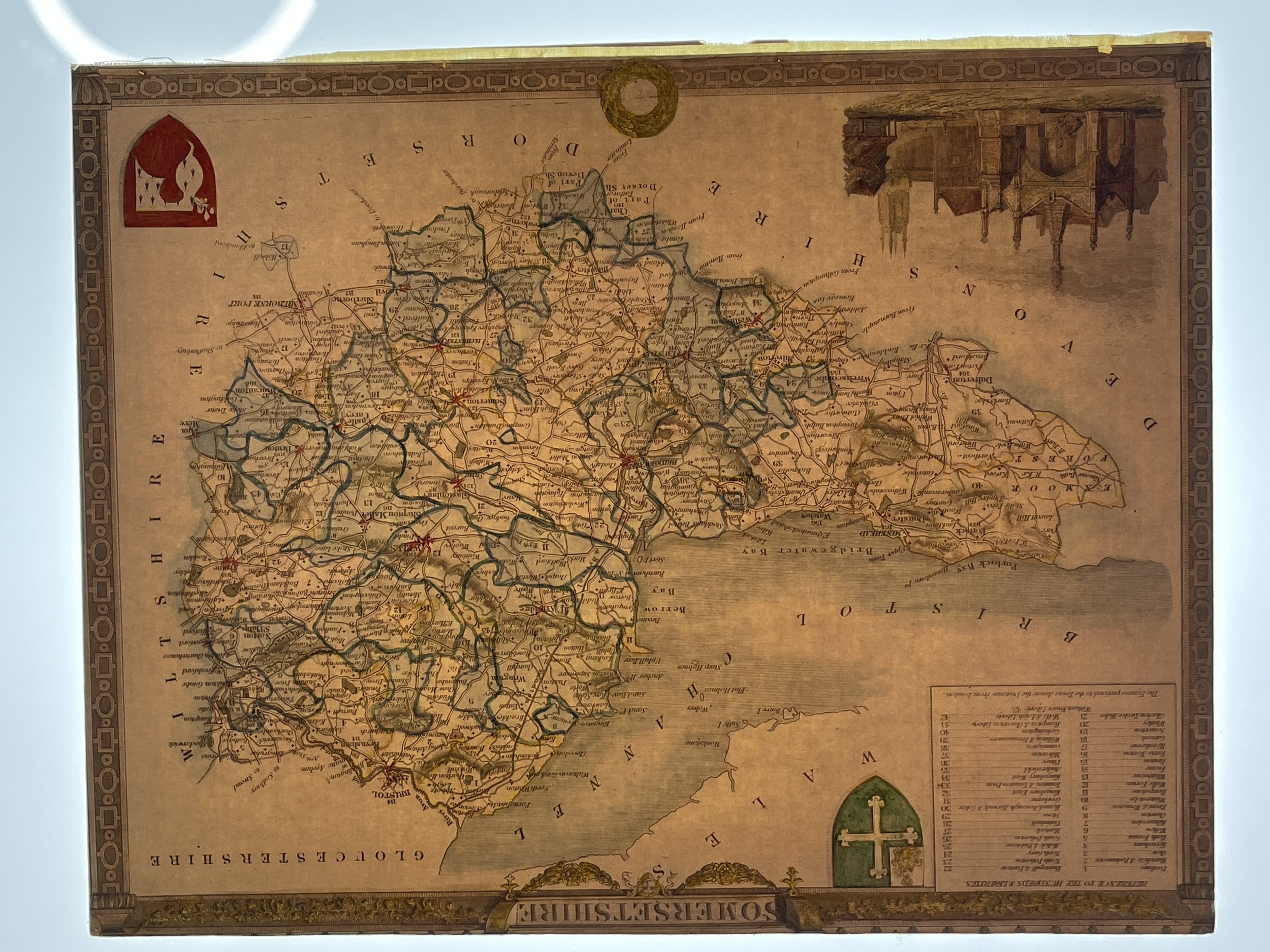
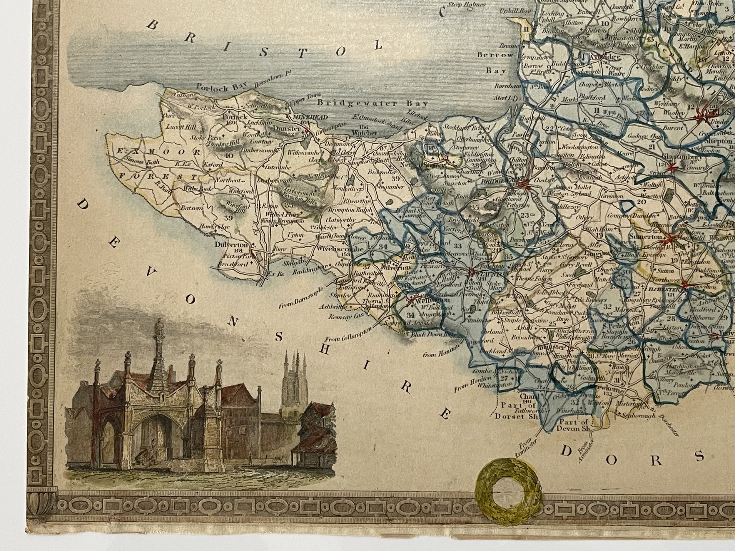
County Map Of Somerset by Thomas Moule - 1836-1848
Possibly from the Reverent James Barclay's English Dictionary that was first published in 1774. The dictionary went through many editions over the following seventy-five years. The work is noted for its introduction into the world of lexicography synonymy, which prior to the first edition had not been treated in any English dictionary. The dictionary had several maps and portraits included in its editions.
The map features a vignette of Glastonbury Cross, also name places include Taunton, Wellington, Bridgewater, Wells, Shepton Mallet, Bath, Street, Minehead, Ilchester, Ilminster, Castle Cary, Wincanton.
Thomas Moule (14 January 1784 – January 1851) was an English antiquarian, writer on heraldry, and one of Victorian England's most influential mapmakers. He is best known for his popular and highly decorated county maps of England, steel-engraved and first published separately between 1830 and 1832.
Moule was born in Marylebone, London. He sold books in Duke Street, Grosvenor Square, from 1816 to 1822. Later, he became an inspector of 'blind' (illegibly addressed) letters at the General Post Office. He died at his residence in St. James's Palace, to which he was entitled as Chamber-keeper in the Lord Chamberlain's Department.
The map is in good condition, additional hessian backed. Pricing and grading commensurate.
Code : A582
Cartographer : Cartographer / Engraver / Publisher: Thomas Moule
Date : Publication Place / Date - c.1836-48
Size : Sheet size: approx 21 x 27 Cm
Availability : Available
Type - Genuine - Antique
Grading B+
Where Applicable - Folds as issued. Light box photo shows the folio leaf centre margin hinge ‘glue’, this is not visible otherwise.
Tracked postage, in casement. Please contact me for postal quotation outside of the UK.