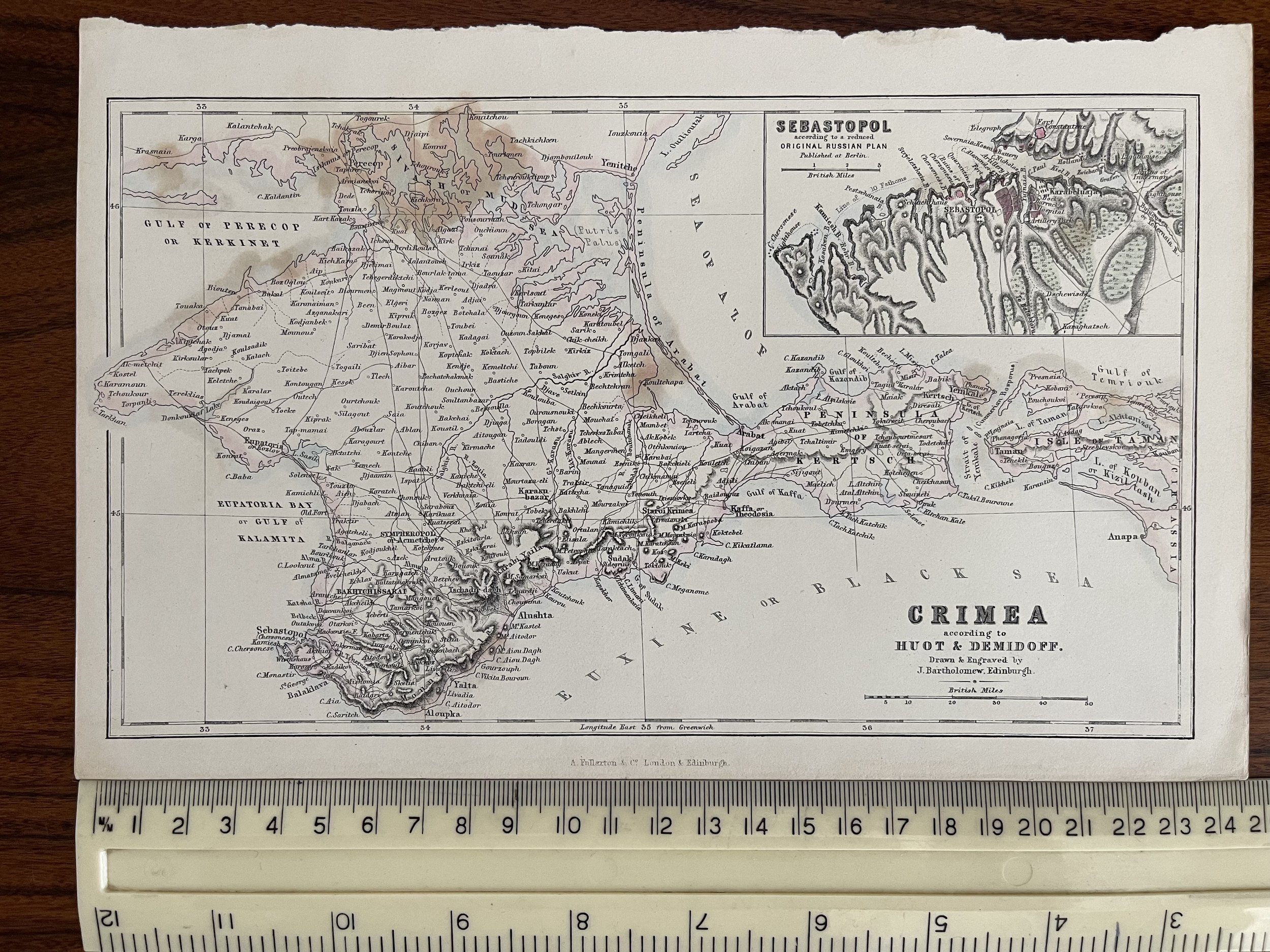
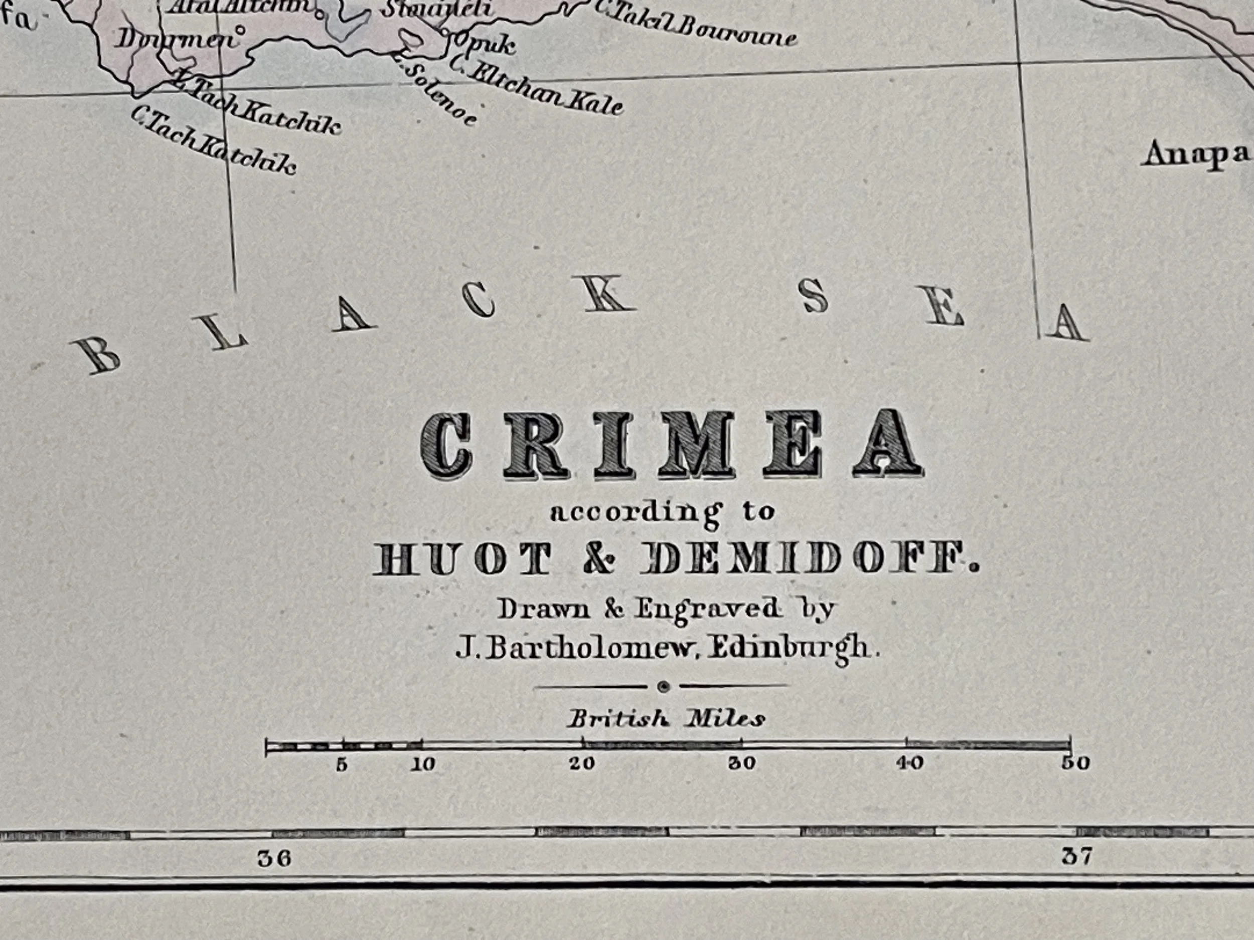

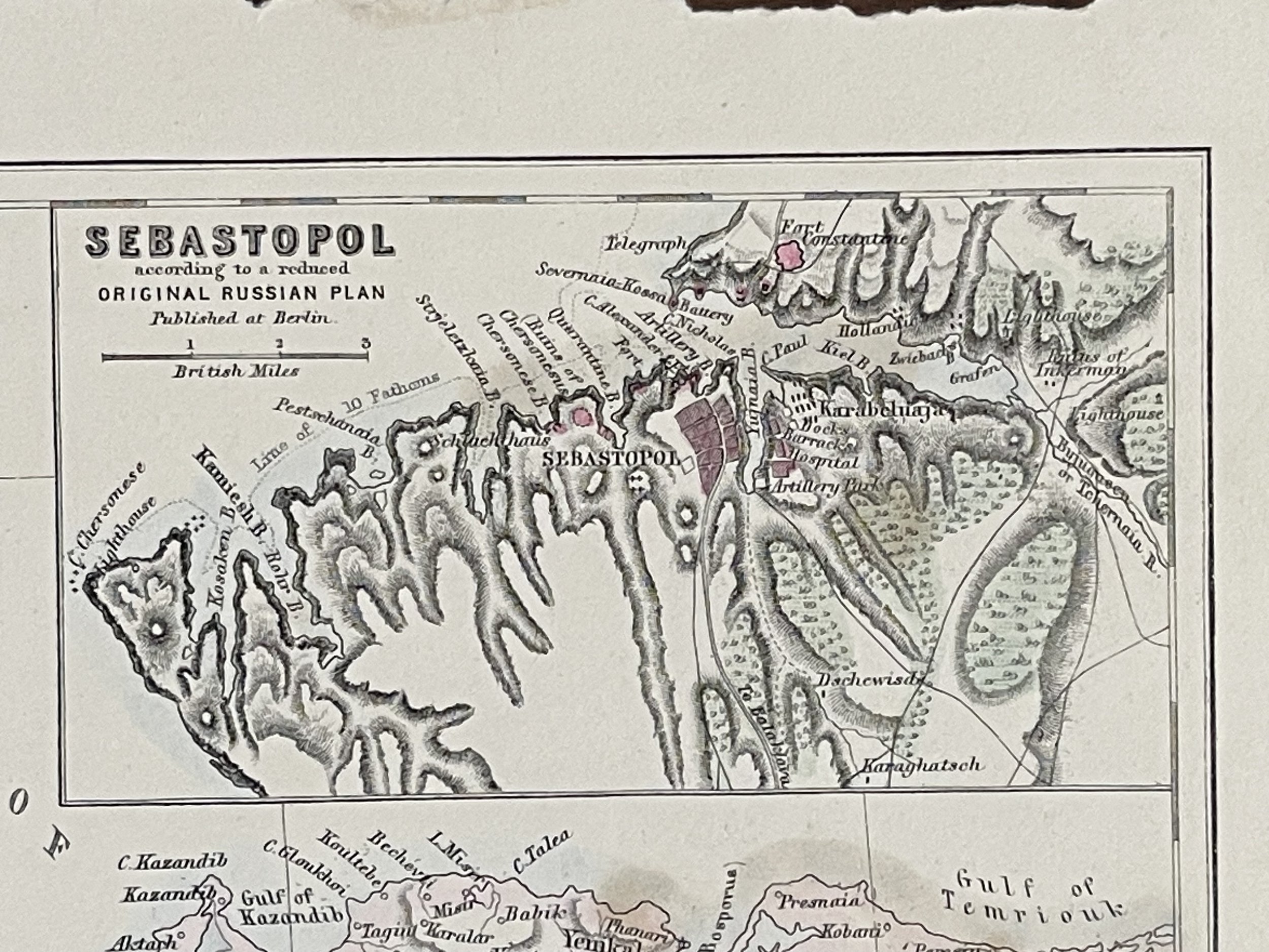
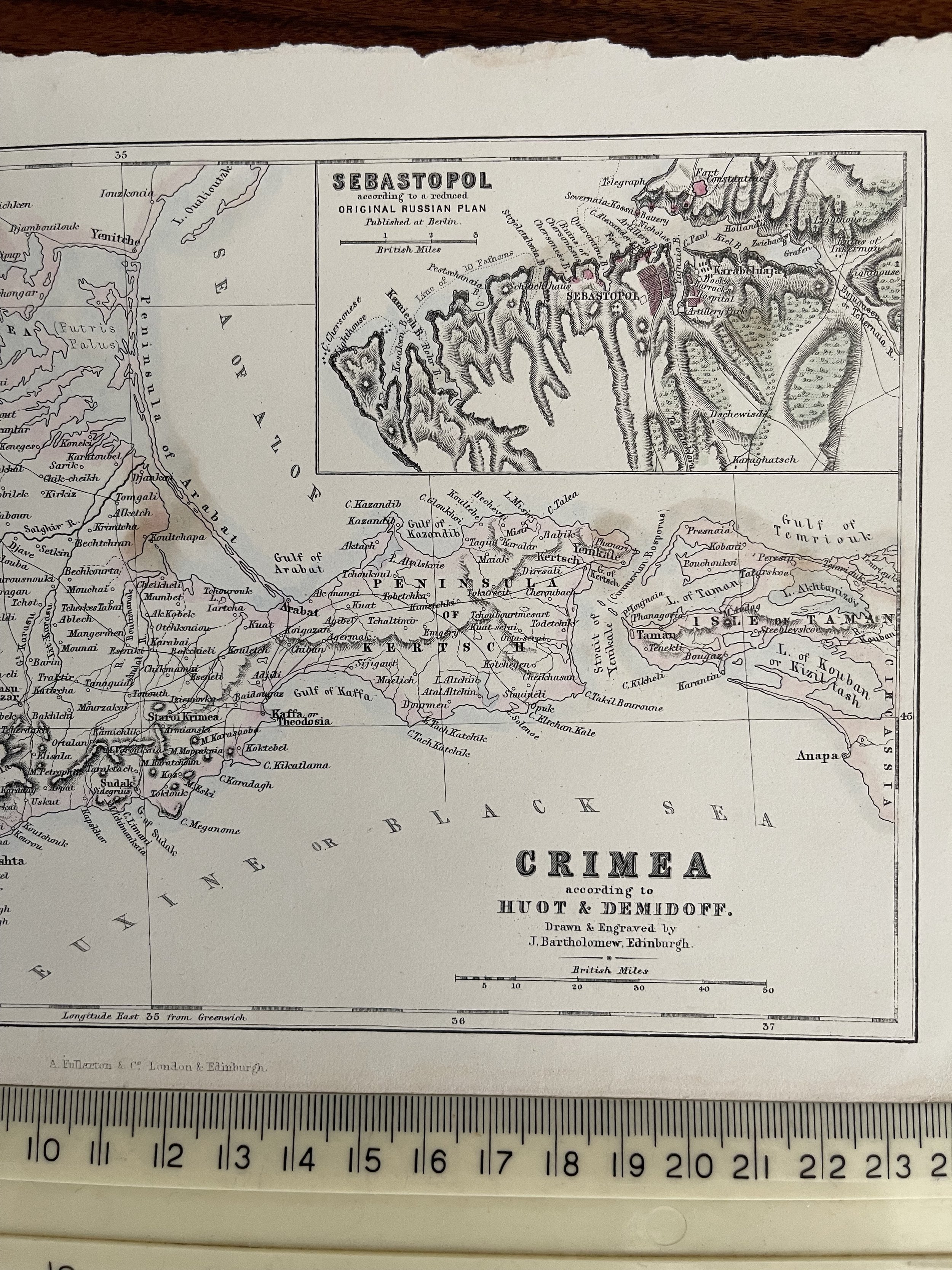
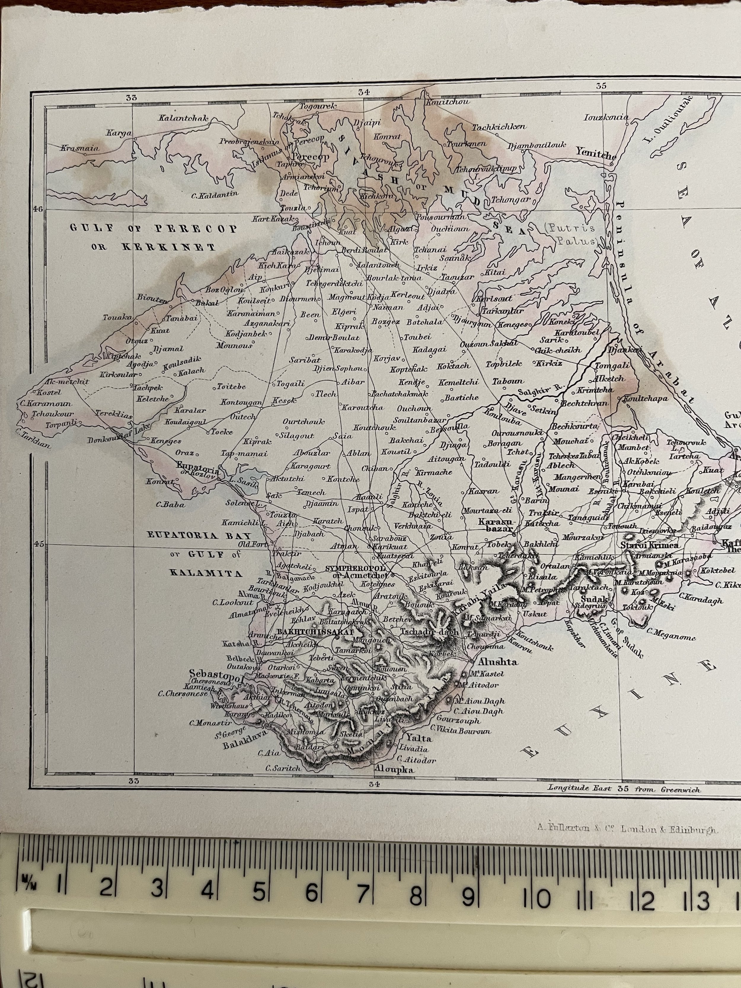
Crimea according to Huot & Demidoff - John Bartholomew - Archibald Fullarton and Co - 1865
Crimea according to Huot & Demidoff Original Antique Map with inset map of Sebastopol - Ukraine - Russia
John Bartholomew (25 December 1831 – 30 March 1893) was a Scottish cartographer
Bartholomew was born in Edinburgh, Scotland. His father, John Bartholomew Sr., started a cartographical establishment in Edinburgh, and he was educated in the work.
He was subsequently assistant to the German geographer August Petermann, until in 1856 he took up the management of his father's firm. For this establishment, now known as the Edinburgh Geographical Institute, Bartholomew built up a reputation unsurpassed in Great Britain to produce the finest cartographical work.
Bartholomew was an in-house cartographer for George Philip. He is best known for the development of colour contouring (or hypsometric tints), the system of representing altitudes on a graduated colour scale, with areas of high altitude in shades of brown and areas of low altitude in shades of green. He first showcased his colour contouring system at the Paris Exhibition of 1878; although it initially met with scepticism, it went on to become standard cartographical practice.
Among his numerous publications, particularly worthy of note is the series of maps of Great Britain reduced from the Ordnance Survey to scales of ½ inch and ¾ inch to 1 mile, with relief shown by contour lines and hypsometric tints. The ½ inch series is among the finest of its kind ever produced.
Upon his retirement in 1888, John Bartholomew was succeeded in the firm by his son John George, who extended the ½-inch series, and applied its principles to many other works. For the last six years of his life Bartholomew was living at 32 Royal Terrace in Edinburgh.
Archibald Fullarton and Co. was a prominent publisher in Glasgow in the 1800s, and maintained a prodigious output of books, atlases and maps. The company produced the last maps to boast decorative vignettes, often done by George Heriot Swanston, the Scottish cartographer and engraver. Fullarton was in partnership with John Blackie in Glasgow until 1831, when the stock, plant and agencies were equally shared out. Fullarton's Parliamentary Gazetteer of England and Wales, was a set of finely engraved maps of the counties, recording the changes brought about by the Great Reform Bill, which was the basis of Britain's modern parliamentary constituencies, and went through a large number of editions. Some maps were engraved by Robert Scott, who made use of vignette views to decorate the map border. Another monumental work by the firm was the Royal Illustrated AtlasJames Bell (1769–1836) published his New and Comprehensive Gazetteer of England and Wales in 1833–34. Bell was a writer on geography who edited Rollin's Ancient History in 1828 and wrote a System of Geography in 1830. The maps in his gazetteer all bear the imprint of the publisher and were engraved by Gray and Son, Josiah Neele & Co or Robert Scott.
Fullarton republished extracts from Bell's Gazetteer in his Parliamentary Gazetteer, acknowledging that some material had been included. He was therefore angry at what he saw as an accusation of plagiarism and 'extremely disingenuous attempt to underrate the value and importance of their laborious and accurate Compilation' stating that 'these materials do not constitute one third part of the present Publication'. Curiously, James Bell had pirated the work of Samuel Lewis' Topographical Dictionary. Lewis obtained an injunction in 1839 and Bell's Gazetteer was withdrawn. Fullarton, who had been Bell's publisher, bought the plates, and issued the maps in his own Parliamentary Gazetteer. Fullarton was also responsible for Rev. J. M. Wilson's Imperial Gazetteer of Scotland, its companion volume Imperial Gazetteer of England and Wales and Bartholomew's Imperial Map.
Another major work was A Gazetteer of the World: Or, Dictionary of Geographical Knowledge, edited by George Godfrey Cunningham, who was a partner at Fullarton, and published in 1856. This provided a concise description of towns, cities, provinces and countries around the world, all beyond the British Isles.
On 20 November 1809 Fullarton, William Sommerville and John Blackie entered into a partnership, taking over the business of publisher A. & W. D. Brownlie, where they had previously worked. Archibald Fullarton was made a Burgess and Guild Brother of Glasgow on 18 December 1815, as he had earlier married Jean, the daughter of John M'Naught, a weaver, who had served in the Glasgow Regiment
Code : A206
Cartographer : Cartographer / Engraver / Publisher: John Bartholomew
Date : Publication Place / Date - 1865
Size : Sheet size: Image Size: 16.5 x 25 cm
Availability : Available
Type - Genuine - Antique
Grading A
Where Applicable - Folds as issued. Light box photo shows the folio leaf centre margin hinge ‘glue’, this is not visible otherwise.
Tracked postage, in casement. Please contact me for postal quotation outside of the UK.