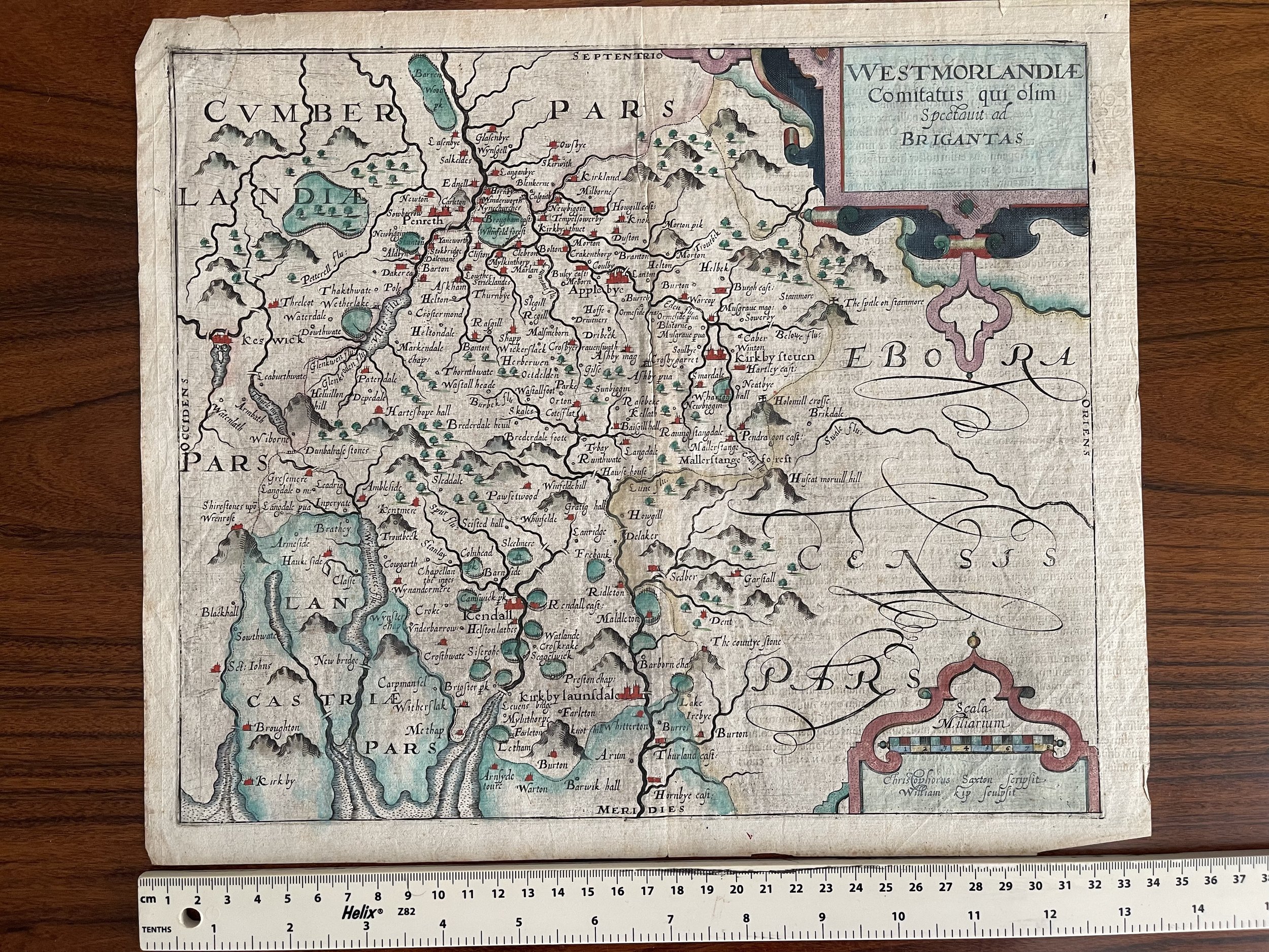
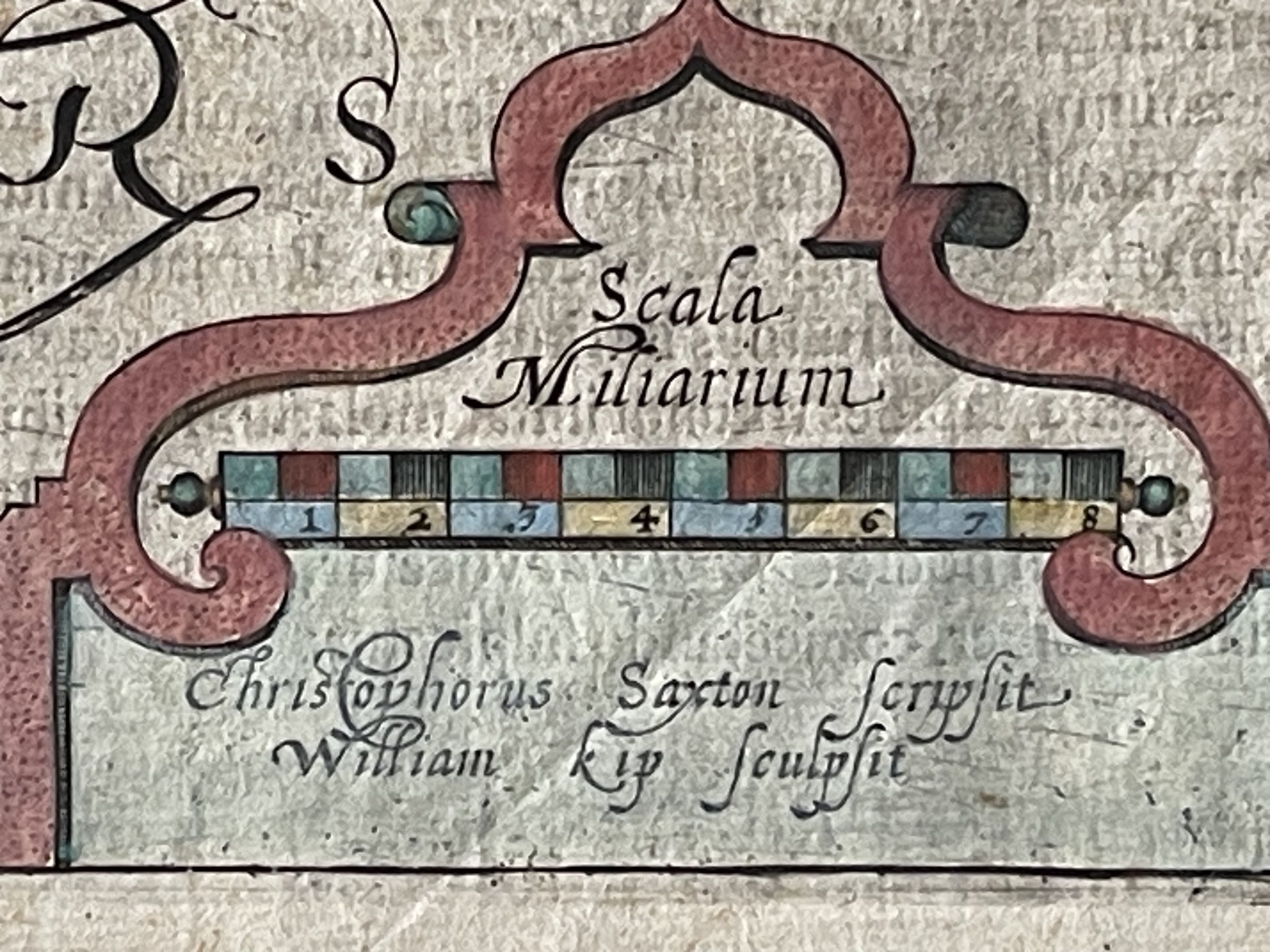
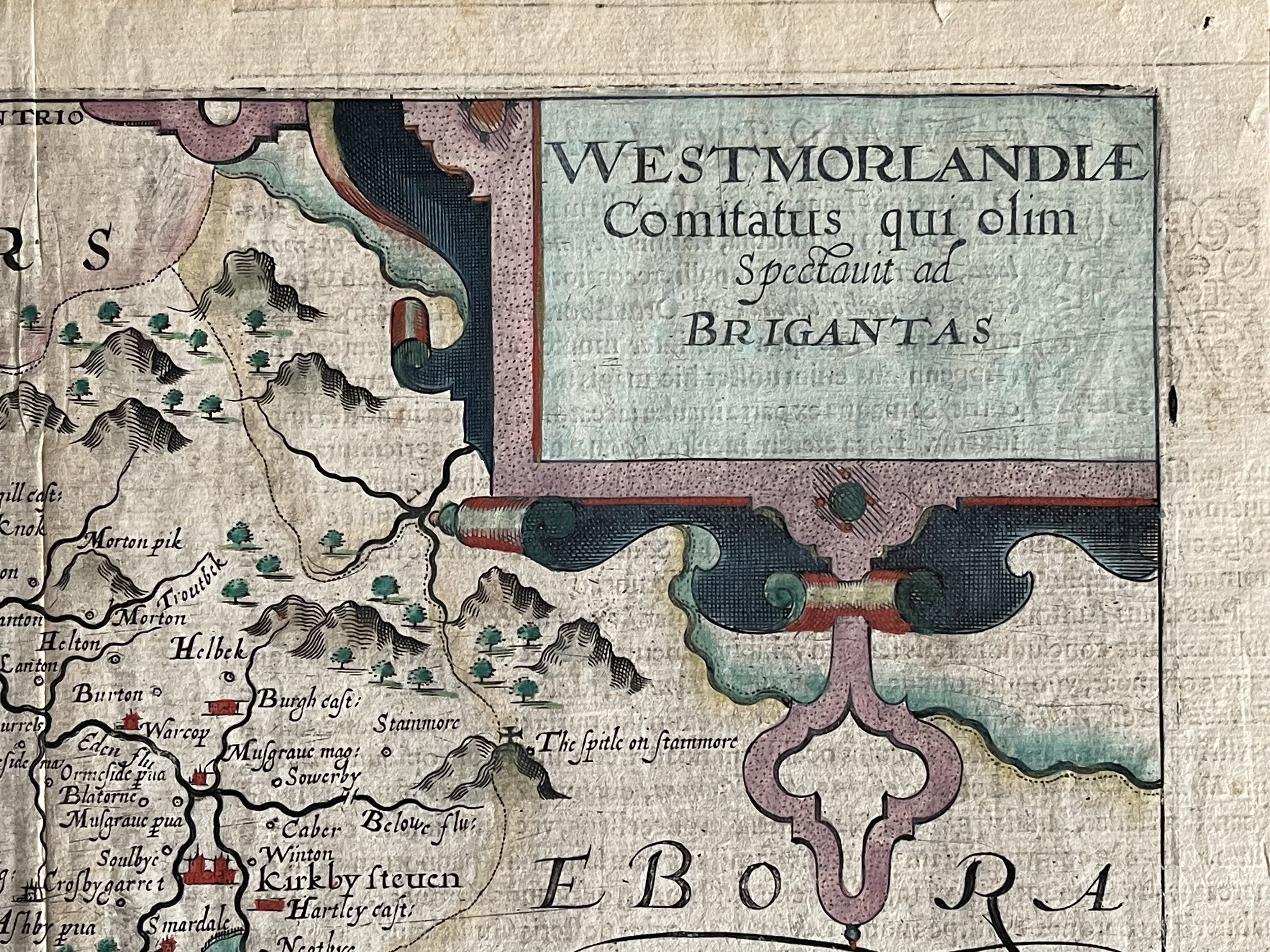
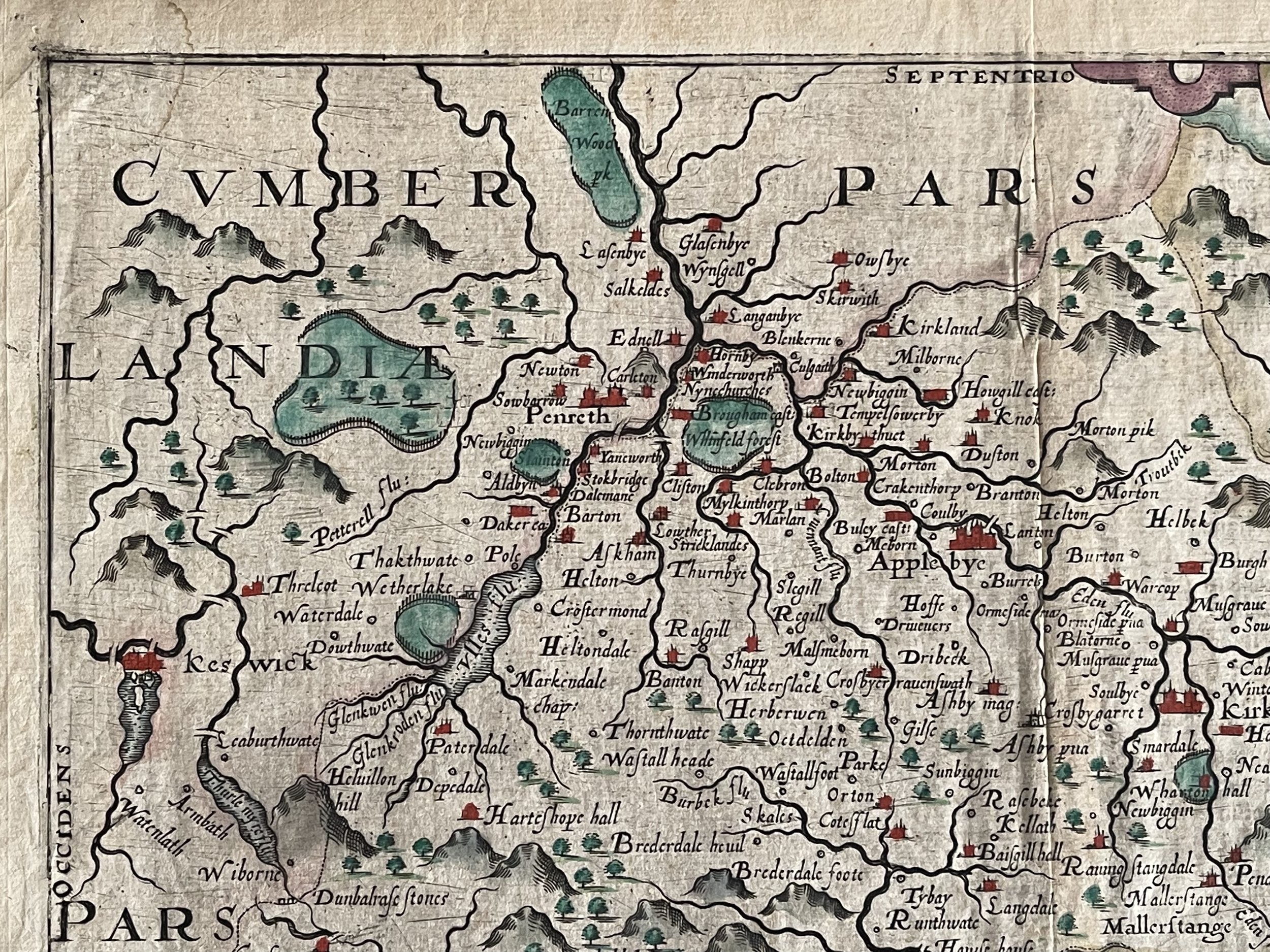
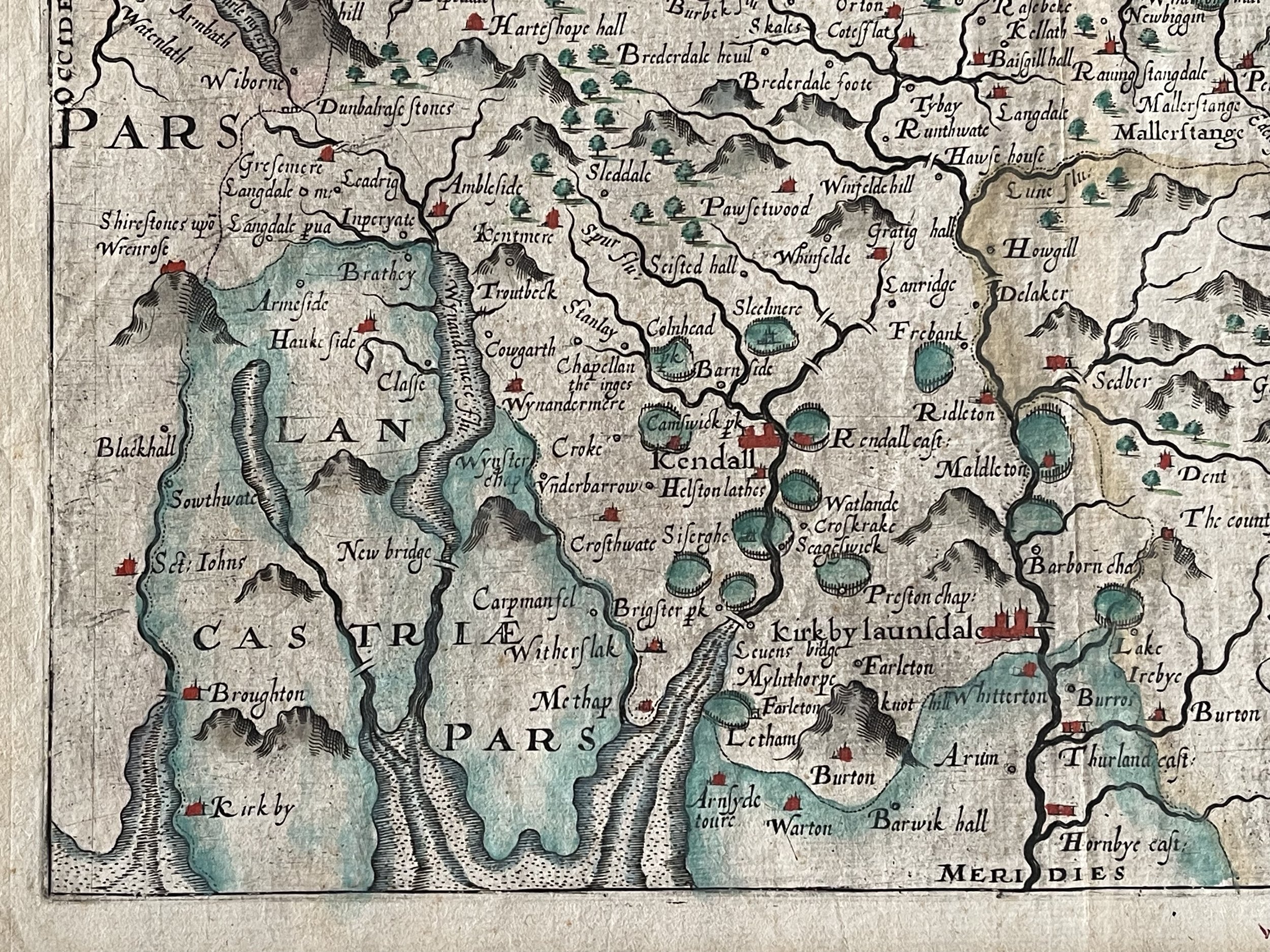
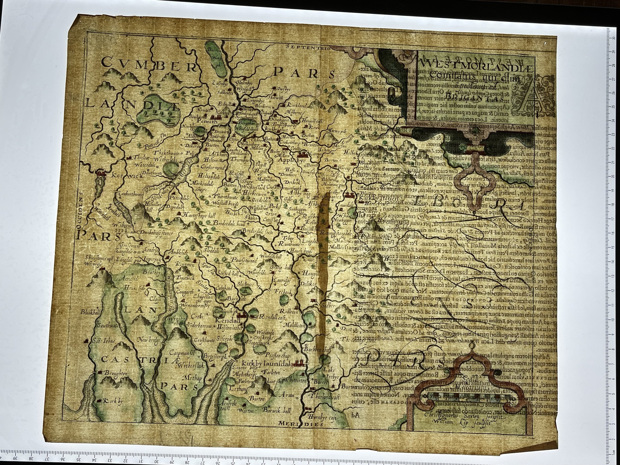
Cumbria England - Westmorlandiae Comitatus qui olim Spectaint ad Brigantas - Christopher Saxton - London 1607 - 1637
Attractive full colour example of Christopher Saxton's map of Westmoreland, from the 1637 edition of Camden's Britannia. The map includes 2 decorative cartouches. William Camden first issued his Britannia in 1586, but did not include maps until the 1607 edition. The maps in the 1637 edition are essentially unchanged from the 1607 edition.
This beautiful county map of Westmorland (now part of Cumbria) is one of the earliest printed maps of the county. It was published by Johannes Kip in 1637 to illustrate a new edition of William Camden's Britannia. The geography is derived from the first printed map of Westmorland, published by Christopher Saxton in his Atlas of the Counties of England and Wales (1579), the first atlas of British counties. Kip gives credit to Saxton for the creation of the map in the lower-left corner, claiming only the honour of engraving the map for himself.
Kip's map is smaller and lacking in some of the grander decorative elements of Saxton's earlier map, but it retains much of the charm associated with early 17th century cartography with large strap work cartouches, swash lettering, and crudely-drawn features. These Saxton/Kip maps remain desirable as they are more commercially available than Saxton's much rarer originals.
Christopher Saxton was probably born in Sowood, Ossett in the parish of Dewsbury, in the west riding of Yorkshire in either 1542 or 1544. his family subsequently moved to the hamlet of Dunningley near Tingley in the parish of Woodkirk where the Saxton name is recorded in 1567. it is speculated that Saxton may have attended the predecessor school to queen Elizabeth grammar school, Wakefield and also speculated that he was a student at cambridge university but neither is corroborated. it is most likely that john Rudd, the vicar of Dewsbury and Thornhill, a keen cartographer passed his skills to Saxton.
Saxton married and had three children. Robert, born in 1585, was his father's assistant in 1601 and drew a map of Snapethorpe in Wakefield when it was surveyed by his father. Robert was commissioned to survey sandal magna in 1607. Christopher Saxton died in either 1610 or 1611
Wiliiam Kip - Fl 1588-1635 (active) - Goldsmith and engraver, especially of maps. Erna Auerbach drew attention (in Burlington Magazine, LXXXIV 1957, p.97) to a document of 1618 which states that 'William Kip, goaldsmith, borne in Utrest, hath been dweller here above thirty years and is no denizen'; he was then living in Candlewick Street (first published in the Huguenot Society X 3 p.194). This establishes Kip's Dutch origins in Utrecht, and the fact that he was a goldsmith who had been living in London since before 1588. Nothing, however, is known of his metalwork.
Moens (p.41) noted two entries in the register of the Dutch Reformed Church of Austin Friars of the baptisms of his son Emmanuel in 1597 and daughter Deborah in 1601. Deborah married no less a man than Balthasar Gerbier in or before 1618, and was later painted with her children by Rubens (Oud Holland XXI 1903, p.135, footnote 3, and W.N.Sainsbury, 'Original unpublished papers ... of Sir Peter Paul Rubens', London 1859, p.318).
Hind catalogues nine of Kip's engravings or series (I pp.210-11 and II pp.17-34). The earliest of them are some maps engraved for John Norden's Speculum Britanniae in 1598; the latest is a world chart made in c.1610. Almost all Kip's engraved work was in the field of cartography, and he worked for various publishers, among them Hans Woutneel for whom he made a four-plate map of the British Isles. His masterpiece is undoubtedly the plates for Harrison's Arches of Triumph.
Code : A182
Cartographer : Cartographer / Engraver / Publisher: Christopher Saxton / William Kip
Date : Publication Place / Date - London 1607 approx
Size : Sheet size: Image Size: 29 cm x 34 cm
Availability : Available
Type - Genuine - Antique
Grading A-
Where Applicable - Folds as issued. Light box photo shows the folio leaf centre margin hinge ‘glue’, this is not visible otherwise.
Tracked postage, in casement. Please contact me for postal quotation outside of the UK.