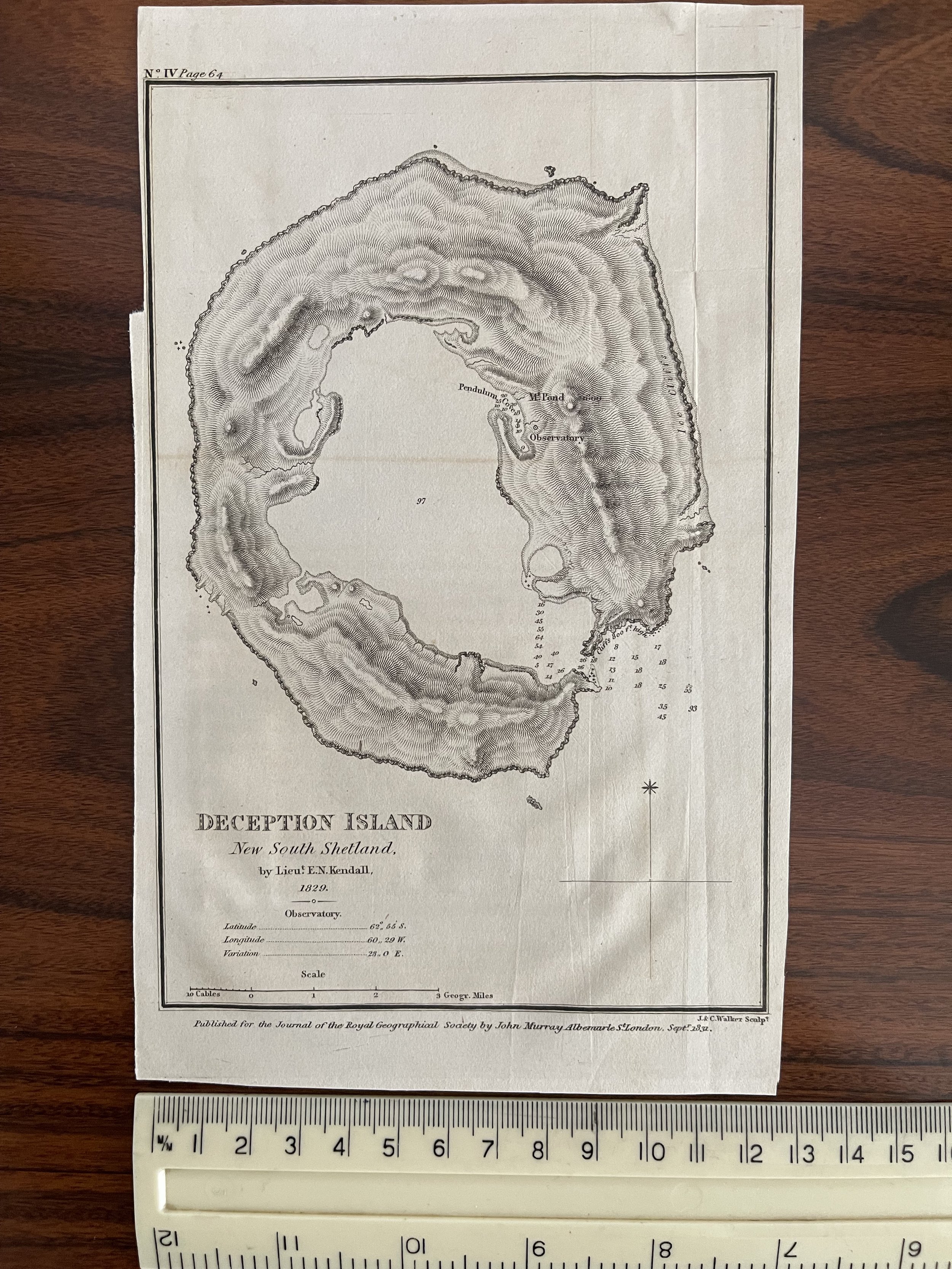
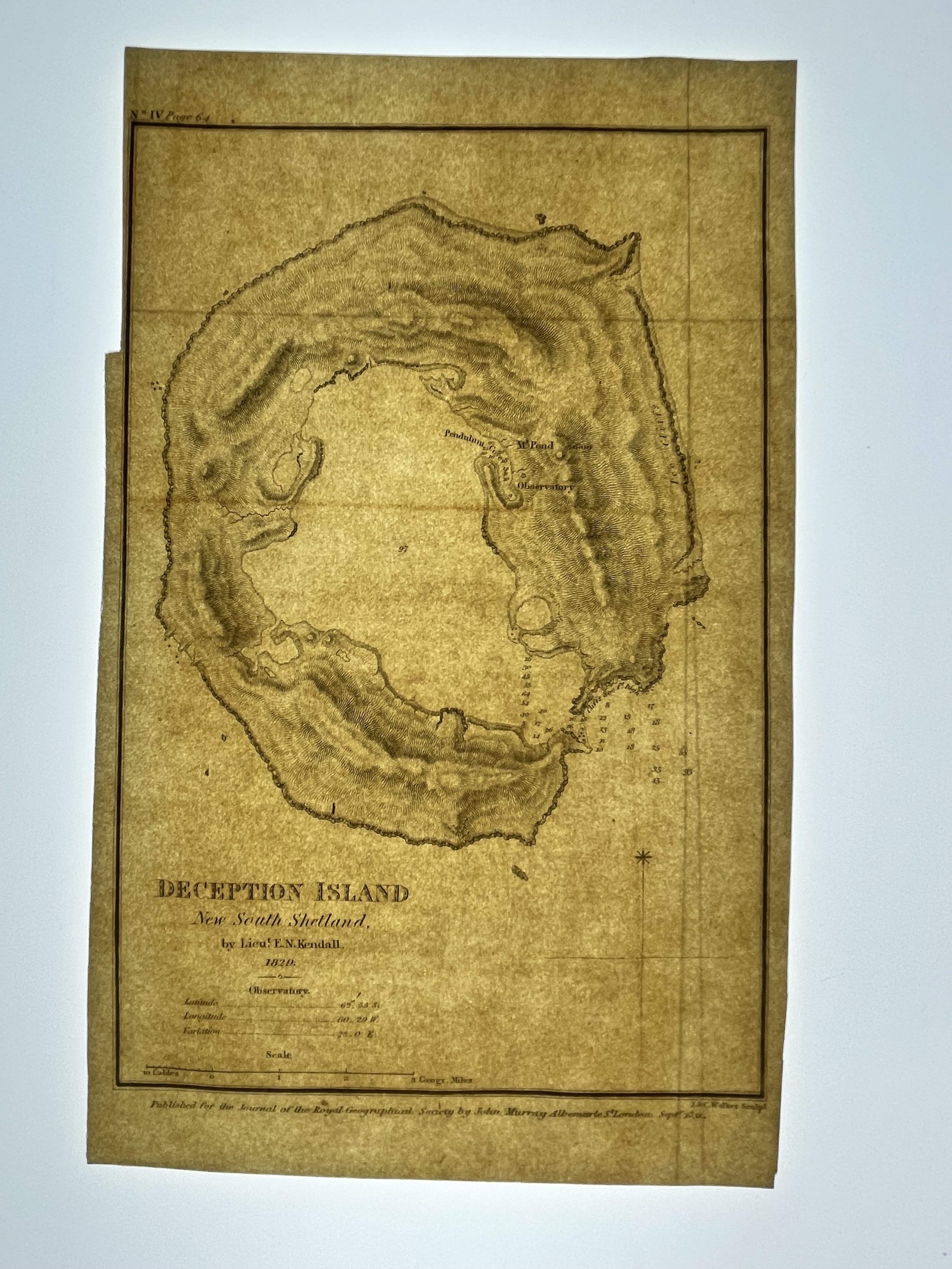
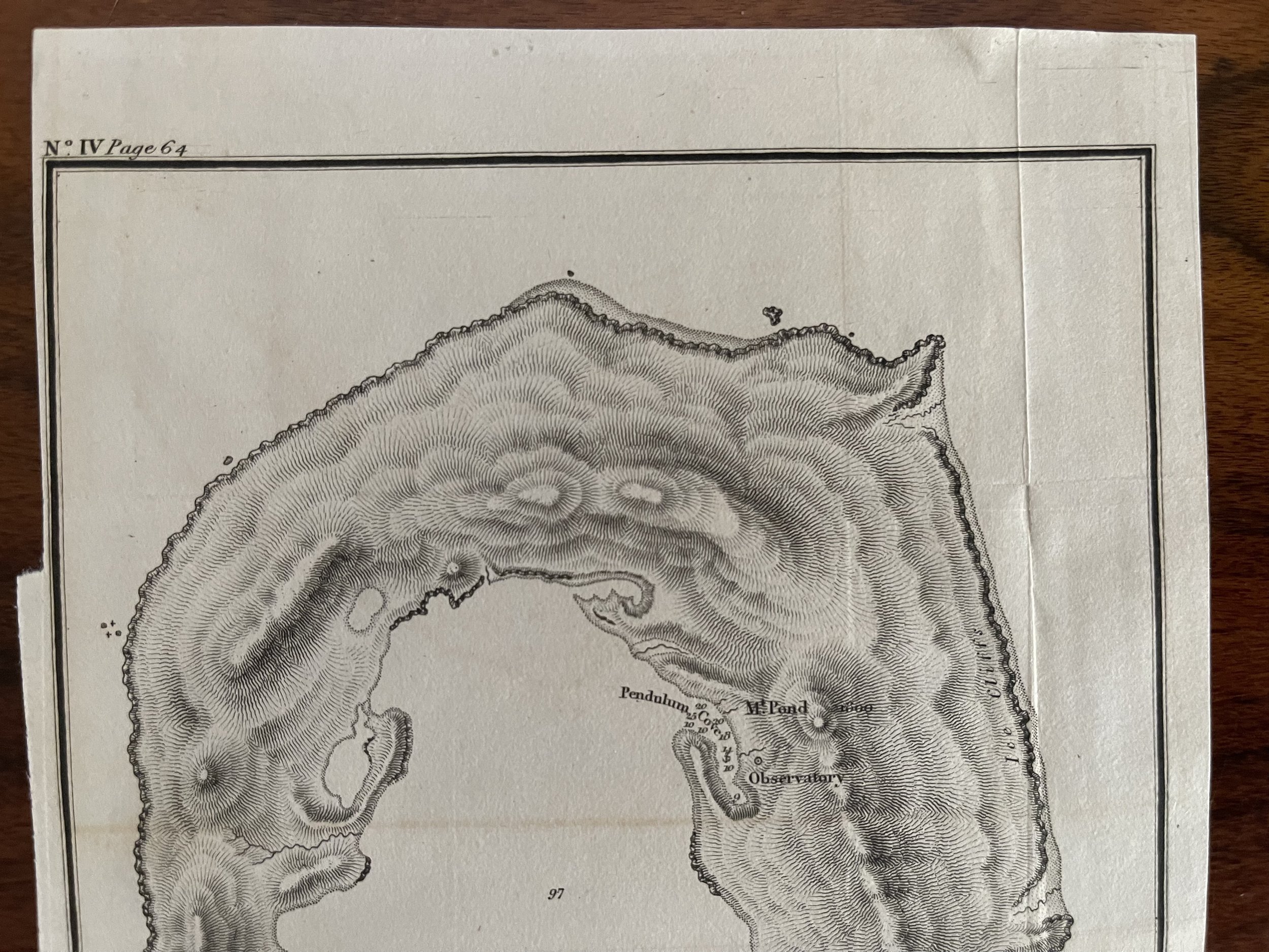
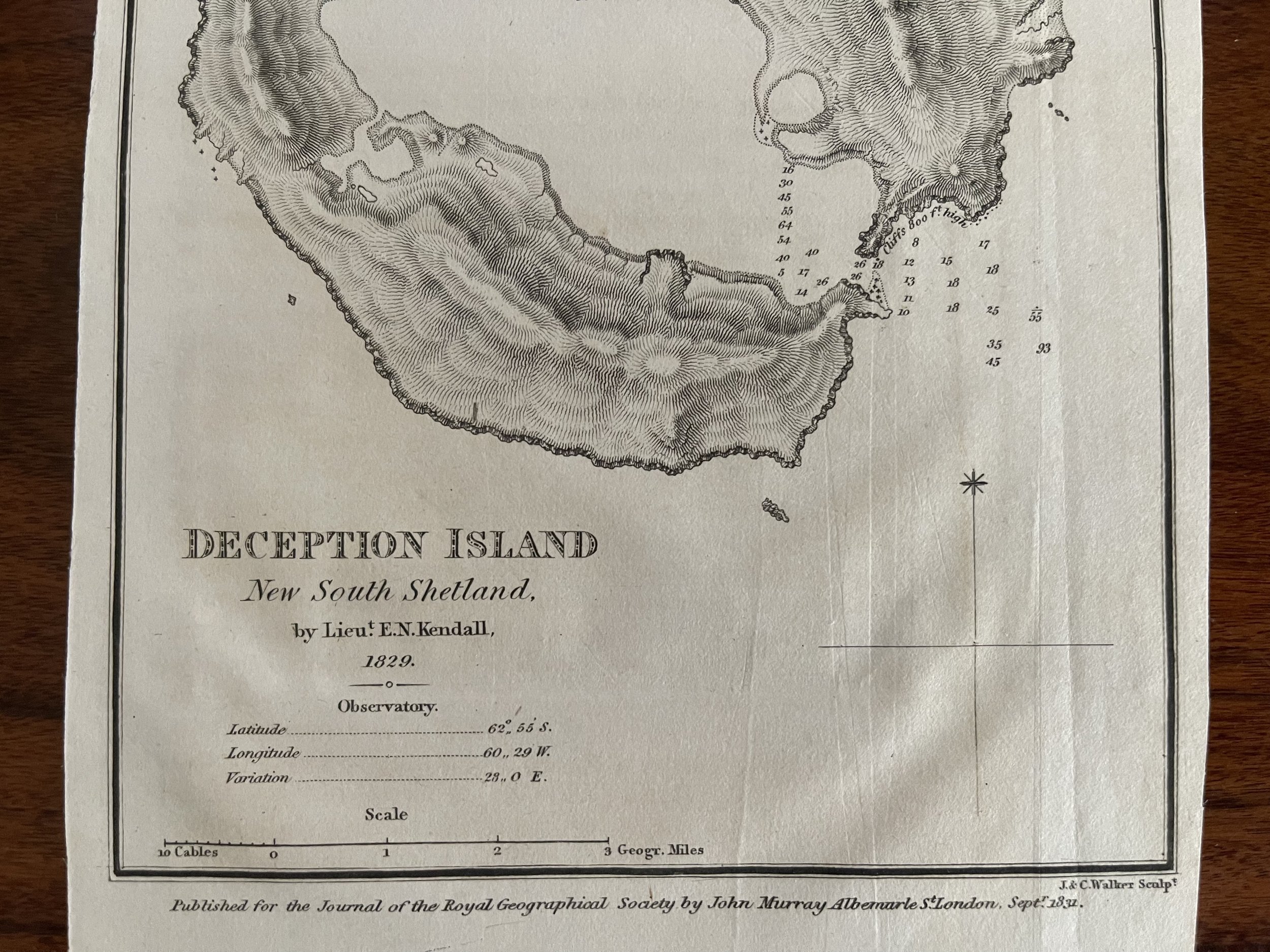
RARE example of Deception Island Antarctic Southern Ocean - Lieutenant E.N.Kendal / J&C Walker - 1829
Map created on the first scientific expedition to Deception Island in 1829 under the command of captain Henry Foster. Originally published in Journal of the Royal Geographic Society Vol. 1 facing page 65.
KENDALL, Lieut. E. N.
Manuscript map of Deception Island, New South Shetland, Antarctica
Manuscript map, 183 x 120 mm (image), hand coloured, a nineteenth century copy of Kendall's map created in 1829. Deception Island, in the South Shetland Islands, Antarctica, was first discovered by sealers in 1820. In 1829, the British Naval Expedition to the South Atlantic made a scientific survey of the island, and Lieutenant Kendall of the HMS Chanticleer made the first map, which is the first accurately surveyed map of any part of the Antarctic continent or islands. Deception Island remains an important base for scientific research. This manuscript copy of Kendall's map is an unusual nineteenth century map of Antarctica.
Code : A167
Cartographer : Cartographer / Engraver / Publisher: Lieutenant E.N.Kendal / J&C Walker
Date : Publication Place / Date - 1829
Size : Sheet size: Image Size: 21.5 x 13 cm
Availability : Available
Type - Genuine - Antique
Grading A-
Where Applicable - Folds as issued. Light box photo shows the folio leaf centre margin hinge ‘glue’, this is not visible otherwise.
Tracked postage, in casement. Please contact me for postal quotation outside of the UK.