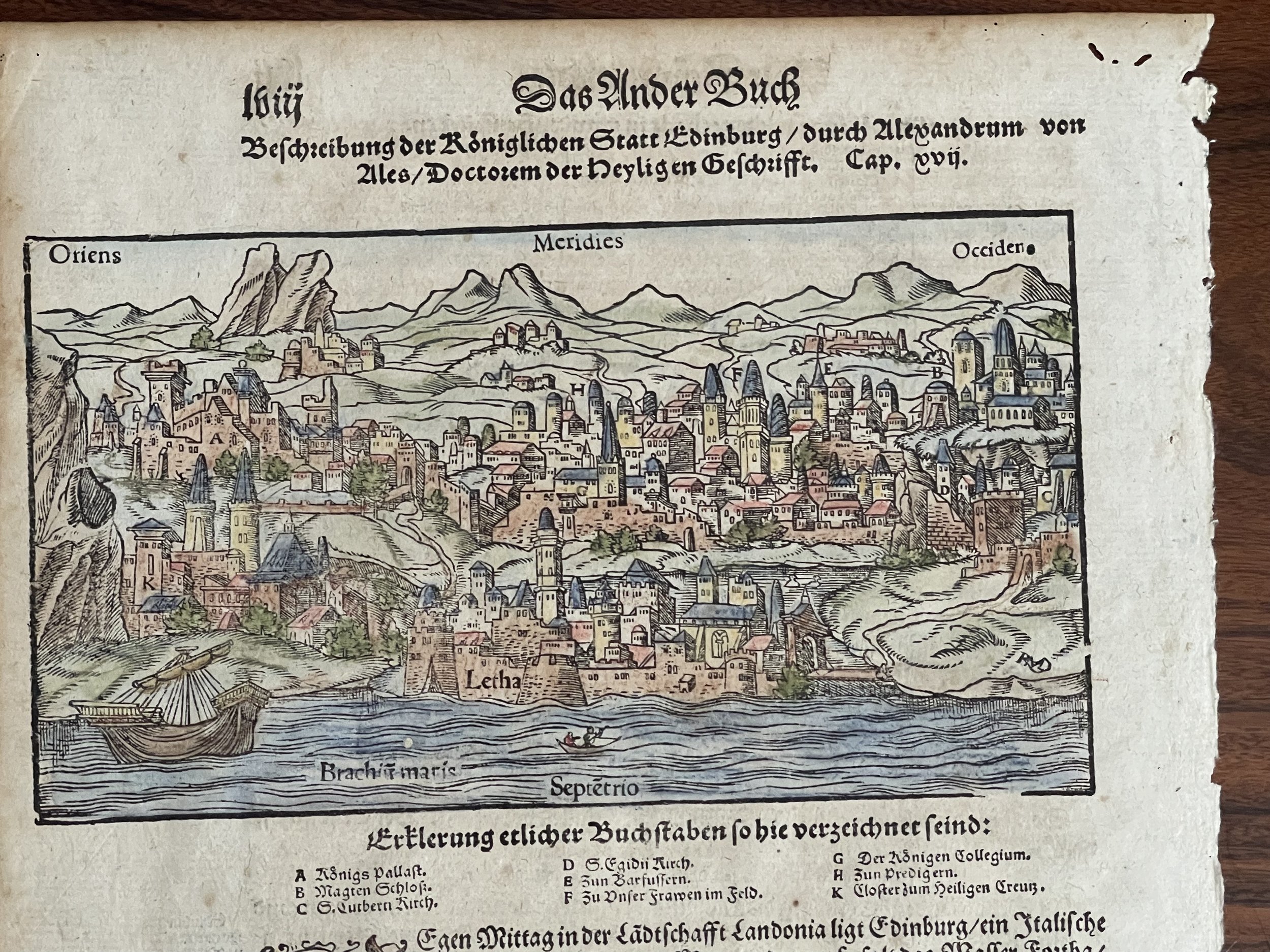

Edinburgh, Scotland - Cosmographia - Sebastian Münster - 1578
Coloured Woodcut Map - Scotland, Edinburgh, Münster, 1578, Beschreibung der Königlichen Statt Edinburg - One of the earliest obtainable views of Edinburgh, from an early example of Munster's Cosmography.
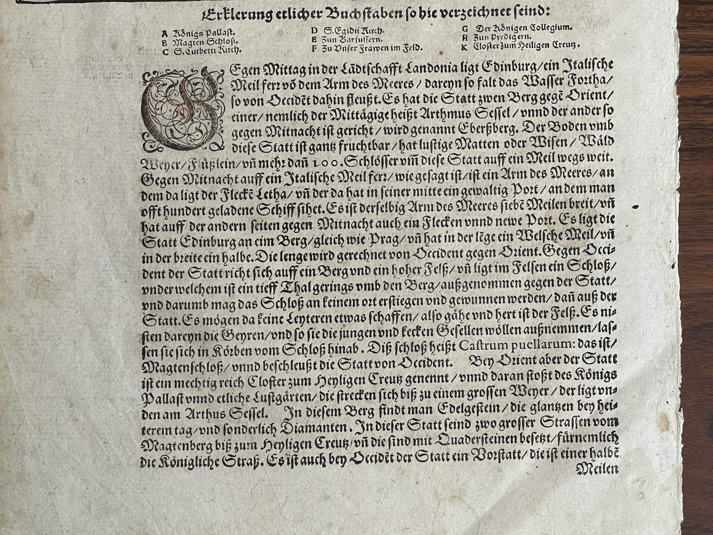
A very detailed view of the fortified city and harbour. Munster's Cosmography was one of the most influential geographical works of the 16th Century. It was published in several editions over a half century and was continuously revised and updated to include new illustrations and updated information. Early woodcut view of Edinburgh in Scotland. From the German edition of Sebastian Münster's Cosmography, Cosmographey oder beschreibung aller Länder, on the full page.
The sheet was published 1574 by Heinrich Petri in Basel - Sebastian Munster Biography
Sebastian Münster (1488-1552) was a cosmographer and professor of Hebrew who taught at Tübingen, Heidelberg, and Basel. He settled in the latter in 1529 and died there, of plague, in 1552. Münster made himself the centre of a large network of scholars from whom he obtained geographic descriptions, maps, and directions.
As a young man, Münster joined the Franciscan order, in which he became a priest. He then studied geography at Tübingen, graduating in 1518. He moved to Basel, where he published a Hebrew grammar, one of the first books in Hebrew published in Germany. In 1521 Münster moved again, to Heidelberg, where he continued to publish Hebrew texts and the first German-produced books in Aramaic. After converting to Protestantism in 1529, he took over the chair of Hebrew at Basel, where he published his main Hebrew work, a two-volume Old Testament with a Latin translation.
Münster published his first known map, a map of Germany, in 1525. Three years later, he released a treatise on sundials. In 1540, he published Geographia universalis vetus et nova, an updated edition of Ptolemy’s Geographia. In addition to the Ptolemaic maps, Münster added 21 modern maps. One of Münster’s innovations was to include one map for each continent, a concept that would influence Ortelius and other early atlas makers. The Geographia was reprinted in 1542, 1545, and 1552.
He is best known for his Cosmographia universalis, first published in 1544 and released in at least 35 editions by 1628. It was the first German-language description of the world and contained 471 woodcuts and 26 maps over six volumes. Many of the maps were taken from the Geographia and modified over time. The Cosmographia was widely used in the sixteenth and seventeenth centuries. The text, woodcuts, and maps all influenced geographical thought for generations.
Munster was one of the three most renowned cartographers of the sixteenth century, along with Mercator and Ortelius. Munster's Geographia and Cosmographia Universalis were two of the most widely read and influential books of the period. His editions of Ptolemy's Geographia, published between 1540 and 1552, were illustrated with 48 woodcut maps, the standard 27 Ptolemaic maps supplemented by 21 new maps. These new maps included a separate map of each of the known continents and marked the development of regional cartography in Central Europe. The antique geography was a prelude to Munster's major work, the Cosmographia, which was published in nearly 30 editions in six languages between 1544 and 1578 and then was revised and reissued by Sebastian Petri from 1588 to 1628. The Cosmographia was a geographical as well as historical and ethnographic description of the world. It contained the maps from the Geographia plus additional regional maps and city views with nearly 500 illustrations which made it one of the most popular pictorial encyclopaedias of the sixteenth century.
This view of Edinburgh is rendered in the unique woodblock style. The city is viewed from the north, looking across the Firth of Forth.
Some foxing and staining corresponding with its near 450 year age. Incredible survivor.
Pricing and grading commensurate.
Coloured Woodcut Map - Scotland, Edinburgh, Münster, 1578, Beschreibung der Königlichen Statt Edinburg - One of the earliest obtainable views of Edinburgh, from an early example of Munster's Cosmography.
A very detailed view of the fortified city and harbour. Munster's Cosmography was one of the most influential geographical works of the 16th Century. It was published in several editions over a half century and was continuously revised and updated to include new illustrations and updated information. Early woodcut view of Edinburgh in Scotland. From the German edition of Sebastian Münster's Cosmography, Cosmographey oder beschreibung aller Länder, on the full page.
The sheet was published 1574 by Heinrich Petri in Basel - Sebastian Munster Biography
Sebastian Münster (1488-1552) was a cosmographer and professor of Hebrew who taught at Tübingen, Heidelberg, and Basel. He settled in the latter in 1529 and died there, of plague, in 1552. Münster made himself the centre of a large network of scholars from whom he obtained geographic descriptions, maps, and directions.
As a young man, Münster joined the Franciscan order, in which he became a priest. He then studied geography at Tübingen, graduating in 1518. He moved to Basel, where he published a Hebrew grammar, one of the first books in Hebrew published in Germany. In 1521 Münster moved again, to Heidelberg, where he continued to publish Hebrew texts and the first German-produced books in Aramaic. After converting to Protestantism in 1529, he took over the chair of Hebrew at Basel, where he published his main Hebrew work, a two-volume Old Testament with a Latin translation.
Münster published his first known map, a map of Germany, in 1525. Three years later, he released a treatise on sundials. In 1540, he published Geographia universalis vetus et nova, an updated edition of Ptolemy’s Geographia. In addition to the Ptolemaic maps, Münster added 21 modern maps. One of Münster’s innovations was to include one map for each continent, a concept that would influence Ortelius and other early atlas makers. The Geographia was reprinted in 1542, 1545, and 1552.
He is best known for his Cosmographia universalis, first published in 1544 and released in at least 35 editions by 1628. It was the first German-language description of the world and contained 471 woodcuts and 26 maps over six volumes. Many of the maps were taken from the Geographia and modified over time. The Cosmographia was widely used in the sixteenth and seventeenth centuries. The text, woodcuts, and maps all influenced geographical thought for generations.
Munster was one of the three most renowned cartographers of the sixteenth century, along with Mercator and Ortelius. Munster's Geographia and Cosmographia Universalis were two of the most widely read and influential books of the period. His editions of Ptolemy's Geographia, published between 1540 and 1552, were illustrated with 48 woodcut maps, the standard 27 Ptolemaic maps supplemented by 21 new maps. These new maps included a separate map of each of the known continents and marked the development of regional cartography in Central Europe. The antique geography was a prelude to Munster's major work, the Cosmographia, which was published in nearly 30 editions in six languages between 1544 and 1578 and then was revised and reissued by Sebastian Petri from 1588 to 1628. The Cosmographia was a geographical as well as historical and ethnographic description of the world. It contained the maps from the Geographia plus additional regional maps and city views with nearly 500 illustrations which made it one of the most popular pictorial encyclopaedias of the sixteenth century.
This view of Edinburgh is rendered in the unique woodblock style. The city is viewed from the north, looking across the Firth of Forth.
Some foxing and staining corresponding with its near 450 year age. Incredible survivor.
Pricing and grading commensurate.
Code : A285
Cartographer : Cartographer / Engraver / Publisher: Sebastian Munster
Date : Publication Place / Date - Circa 1578
Size : Sheet size: Image Size: 32.5 x 21 cm (Page), 10.5 x 18.5 (Image)
Availability : Available
Type - Genuine - Antique
Grading A-
Where Applicable - Folds as issued. Light box photo shows the folio leaf centre margin hinge ‘glue’, this is not visible otherwise.
Tracked postage, in casement. Please contact me for postal quotation outside of the UK.