
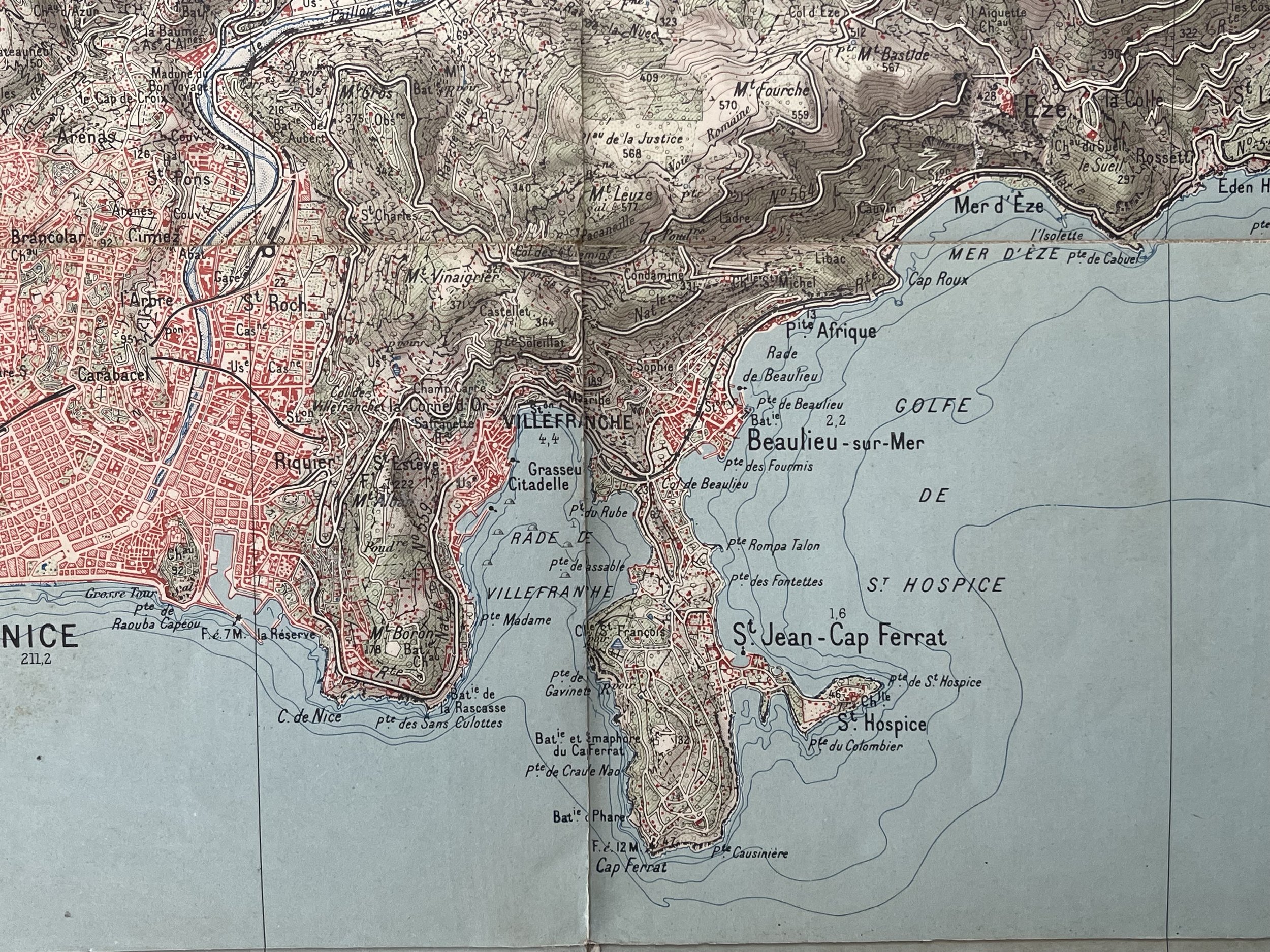
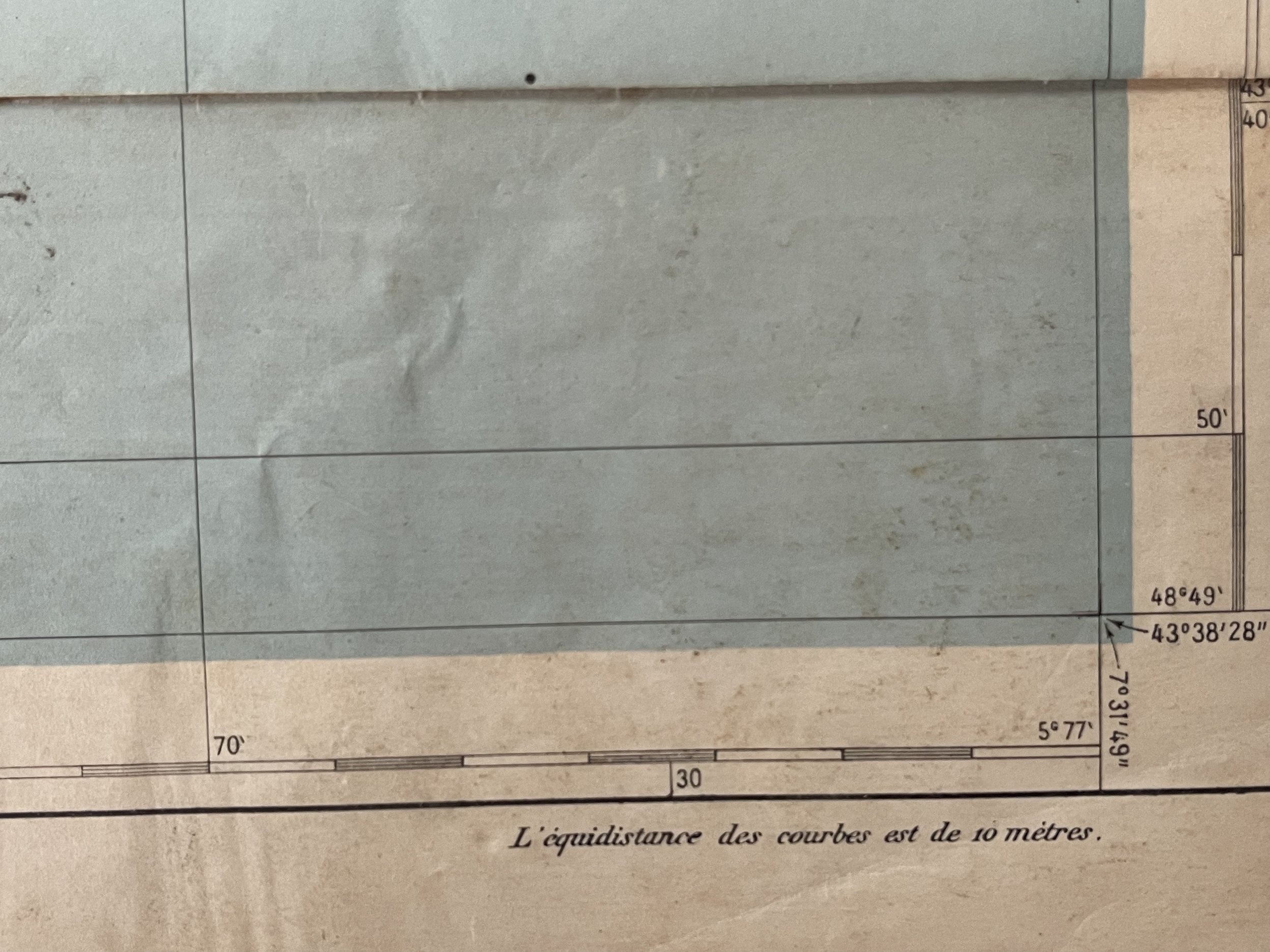
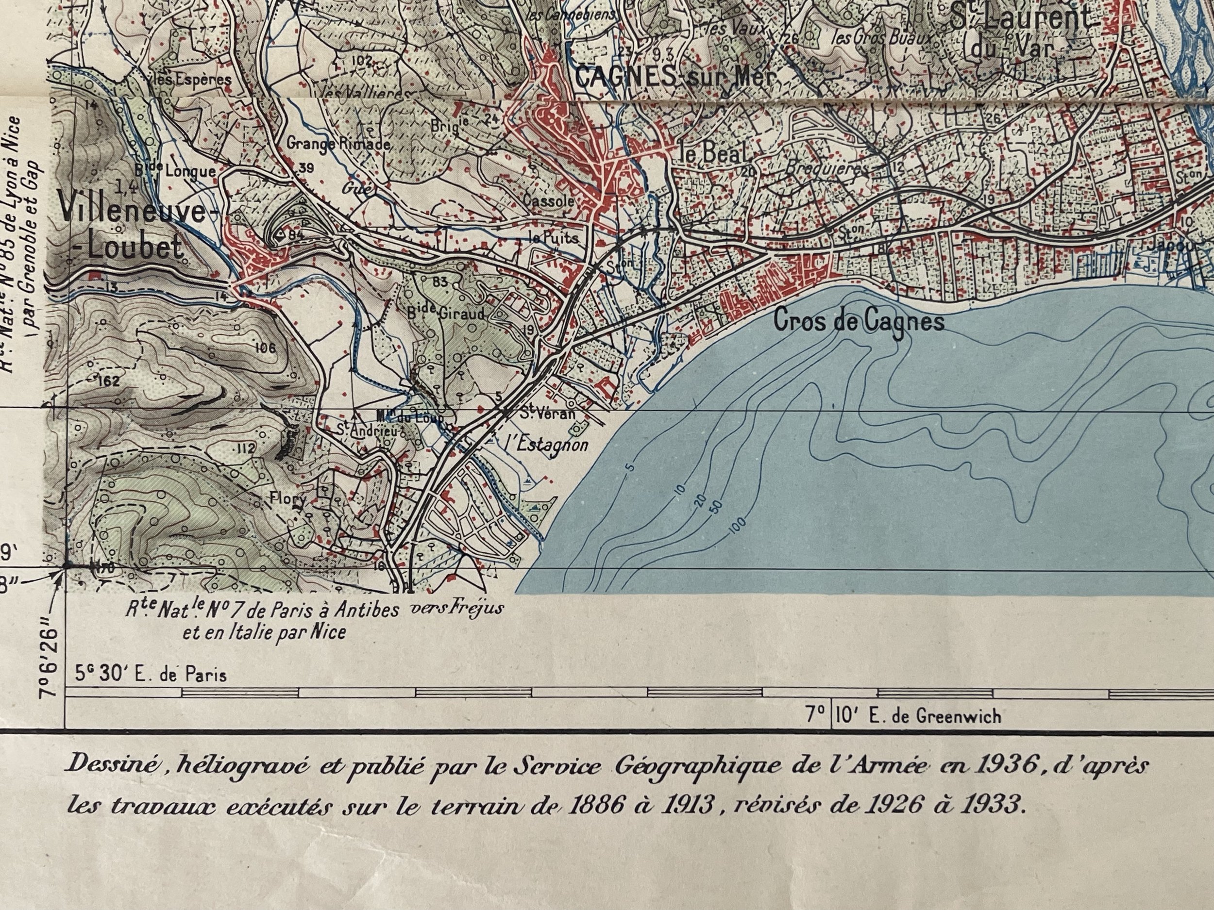
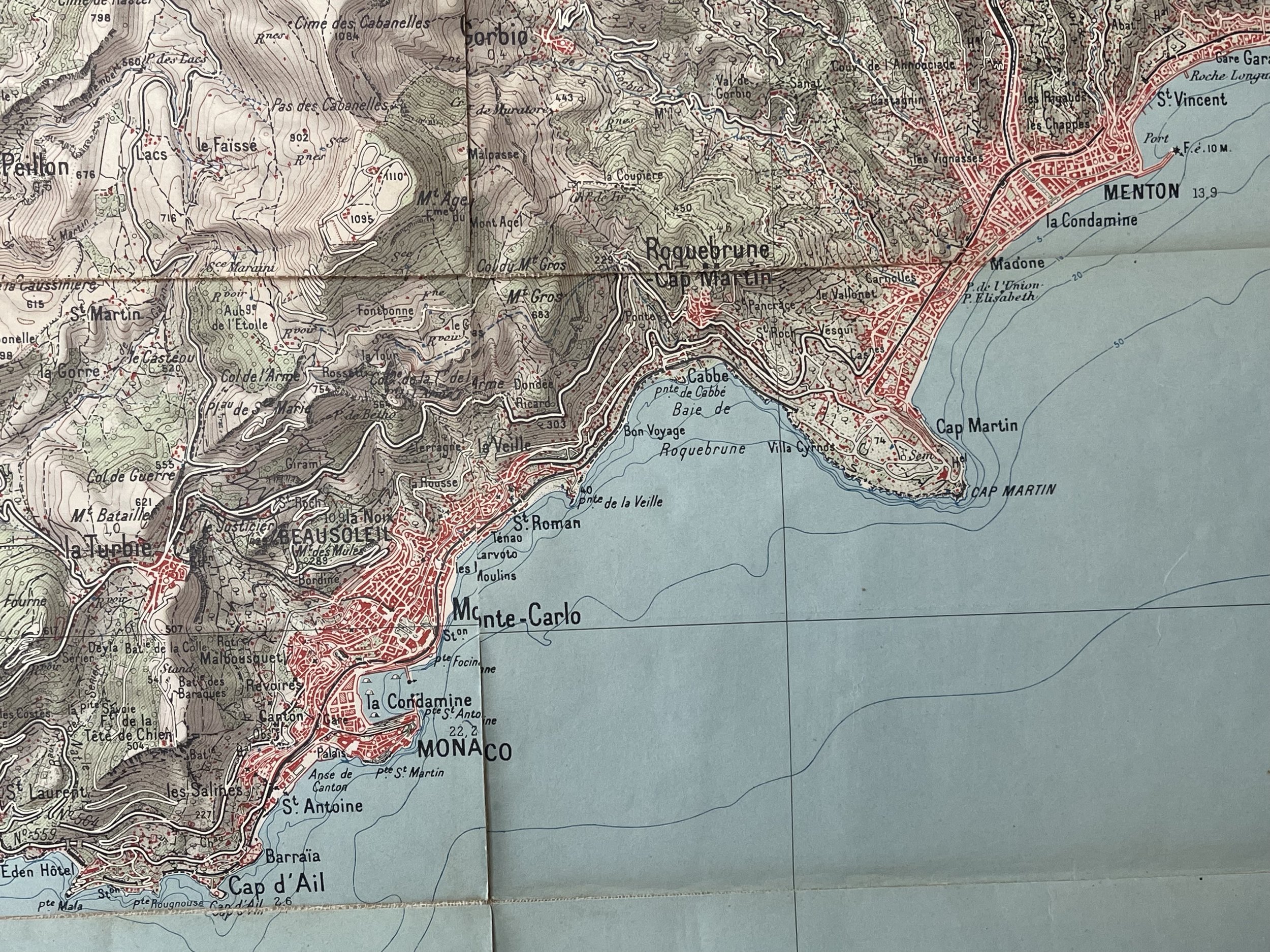
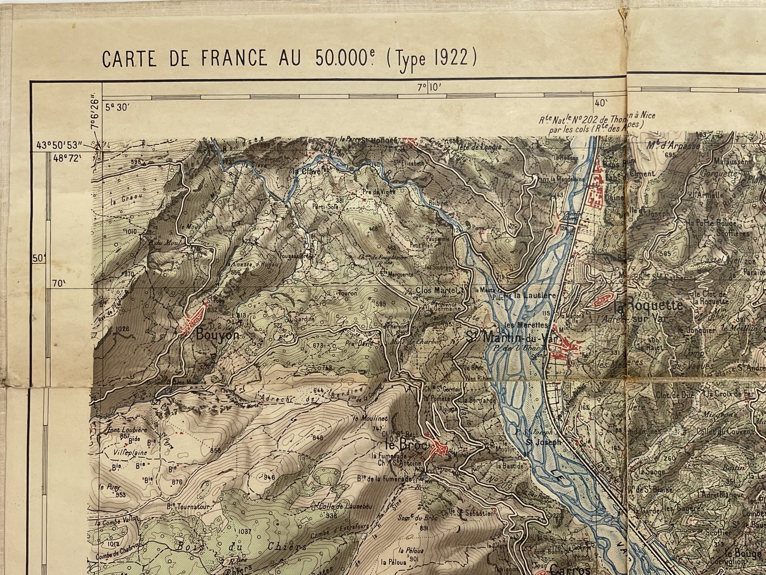
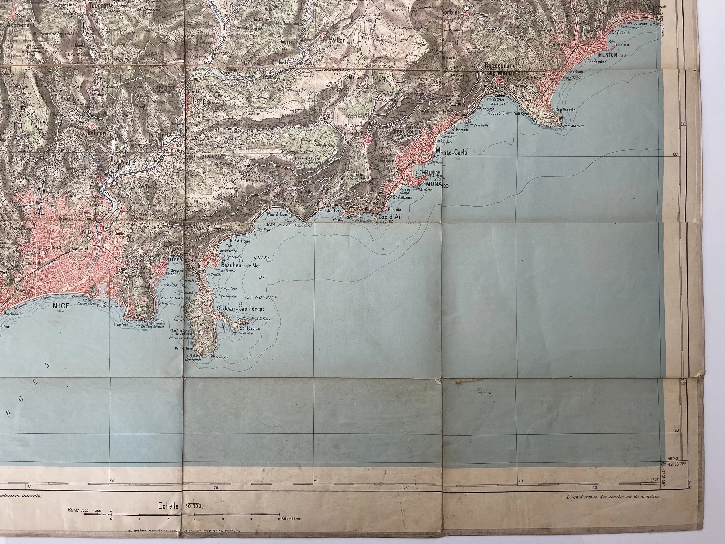
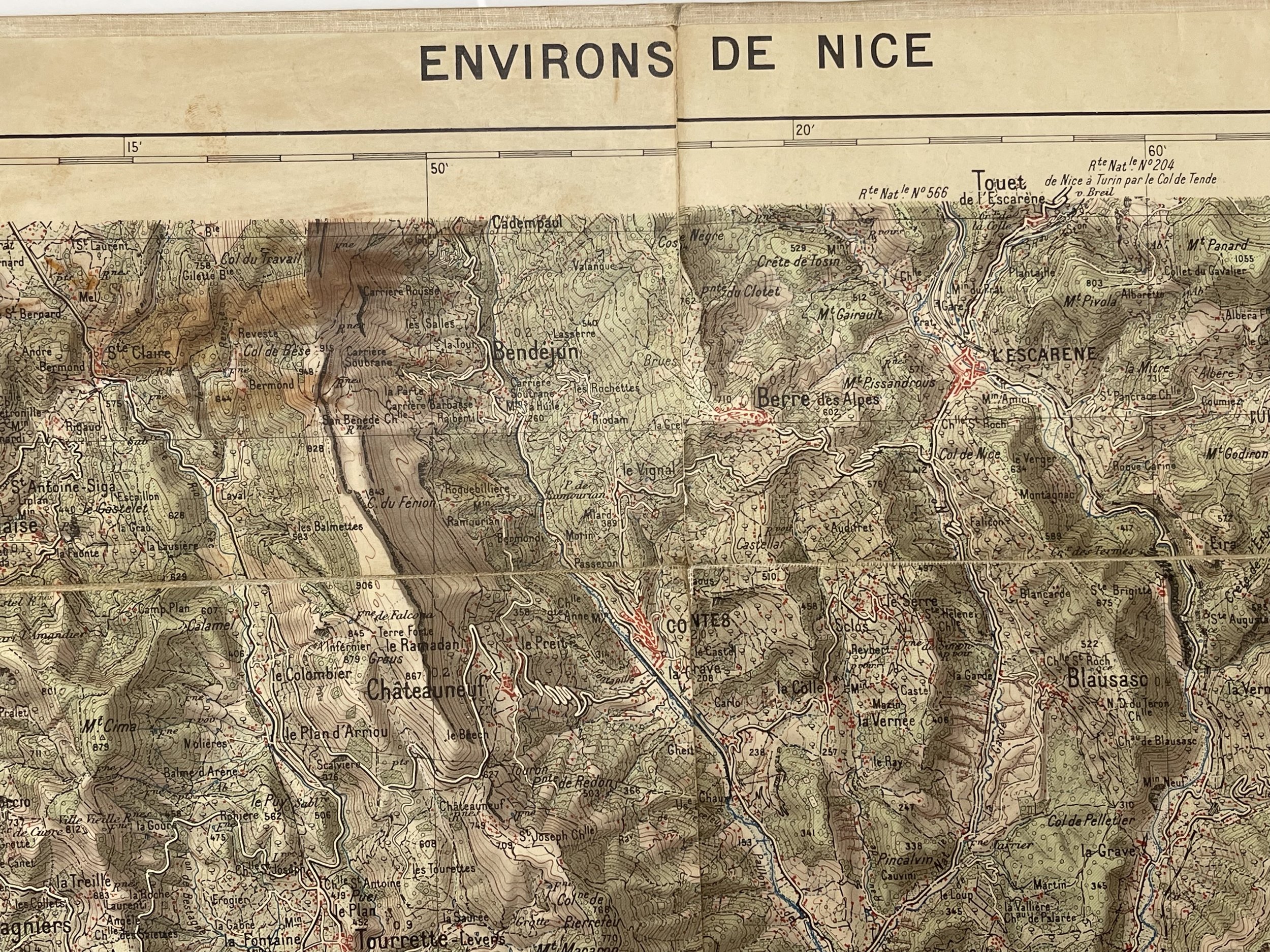
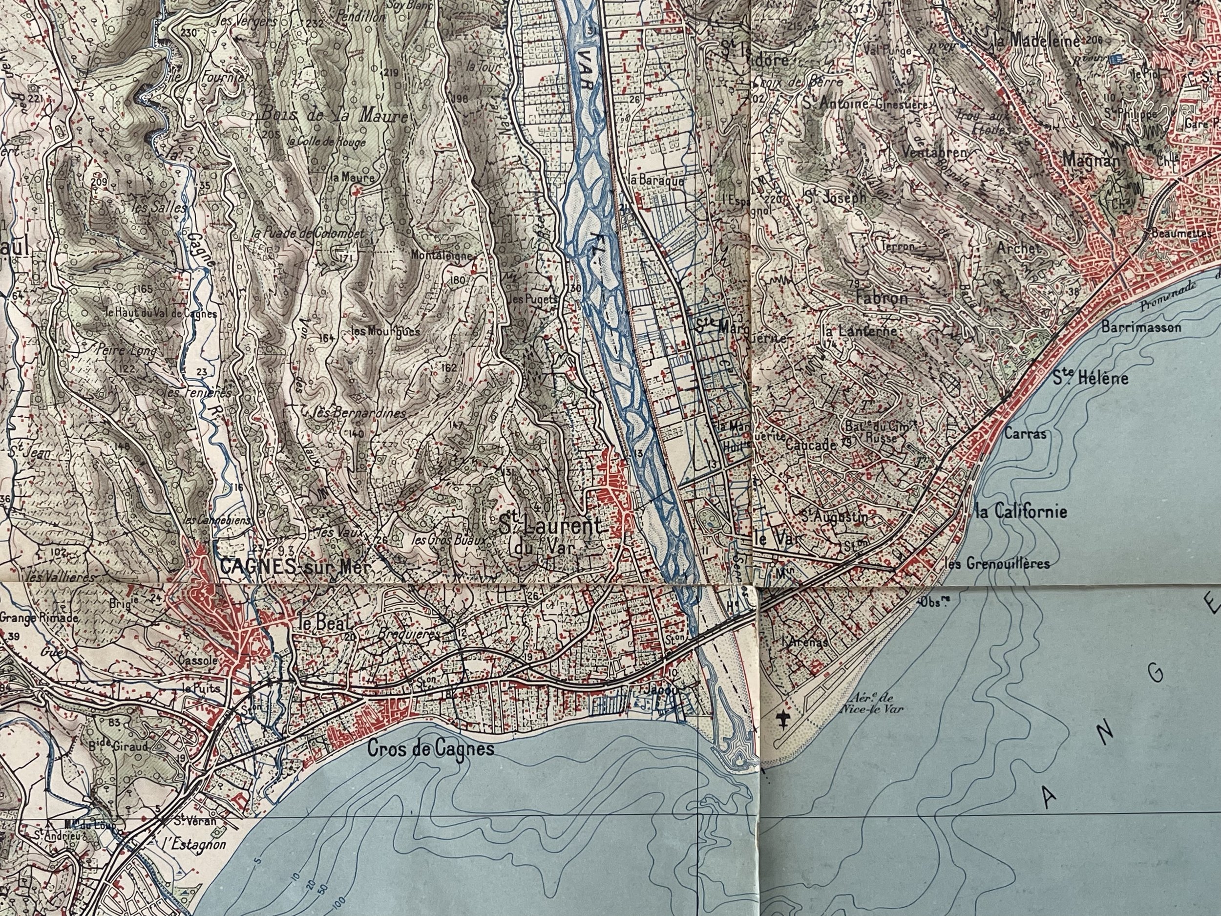
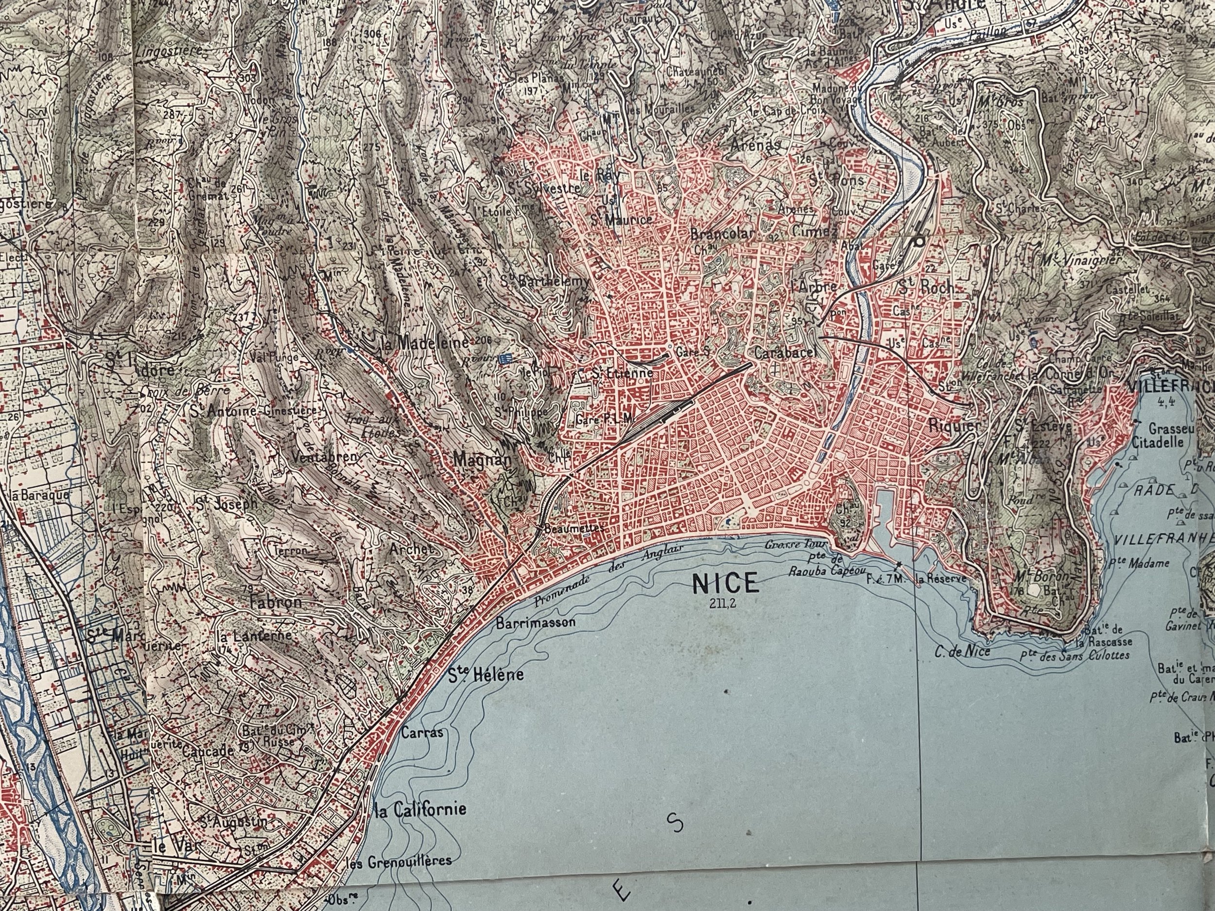
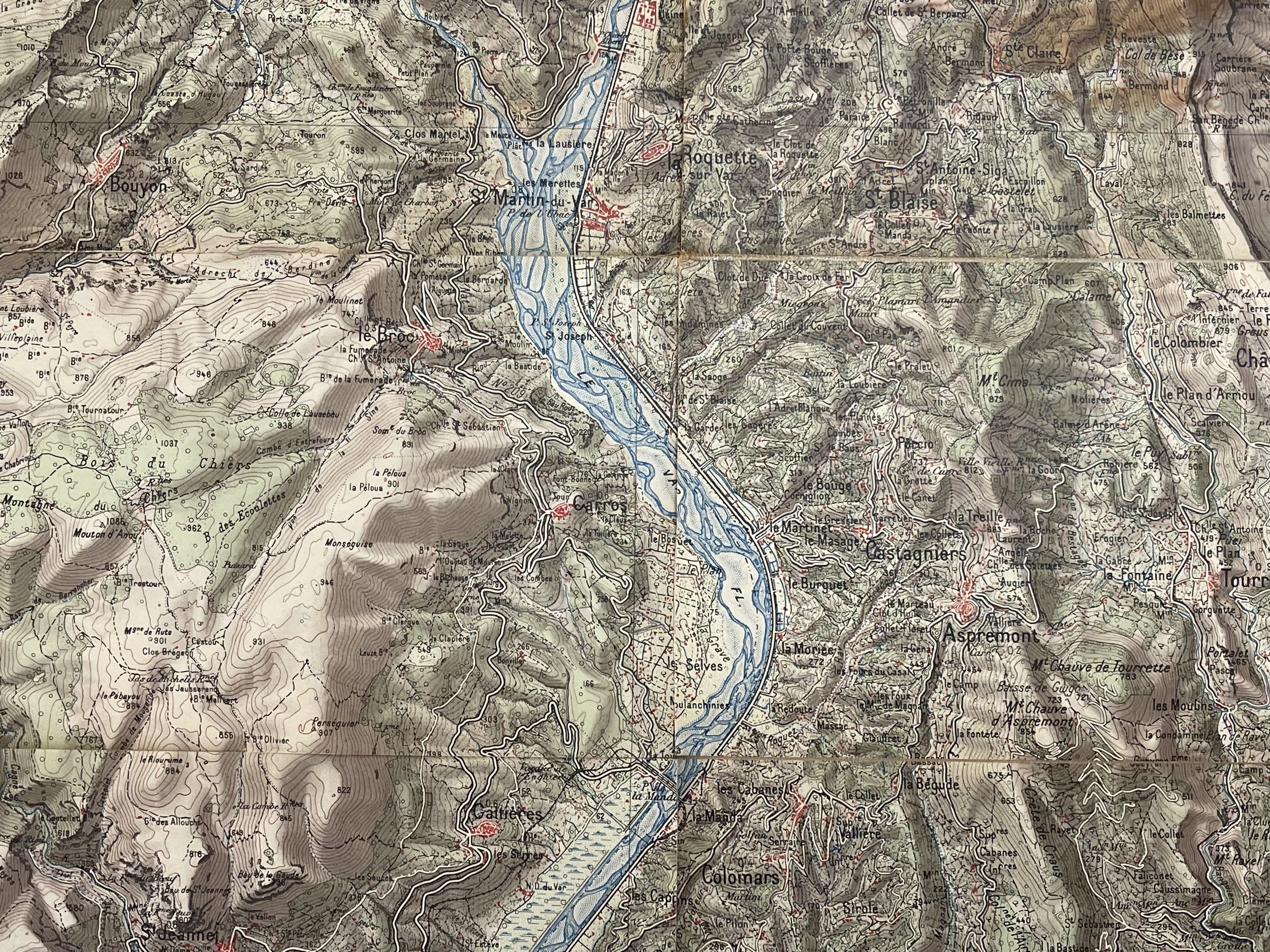
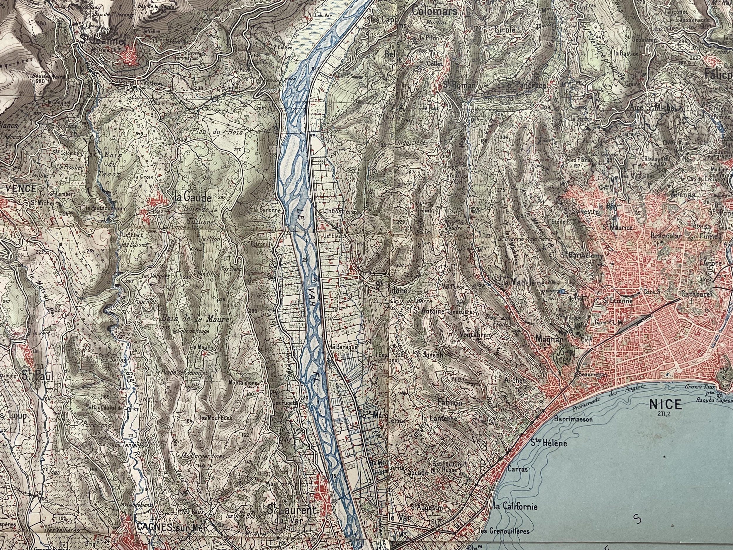
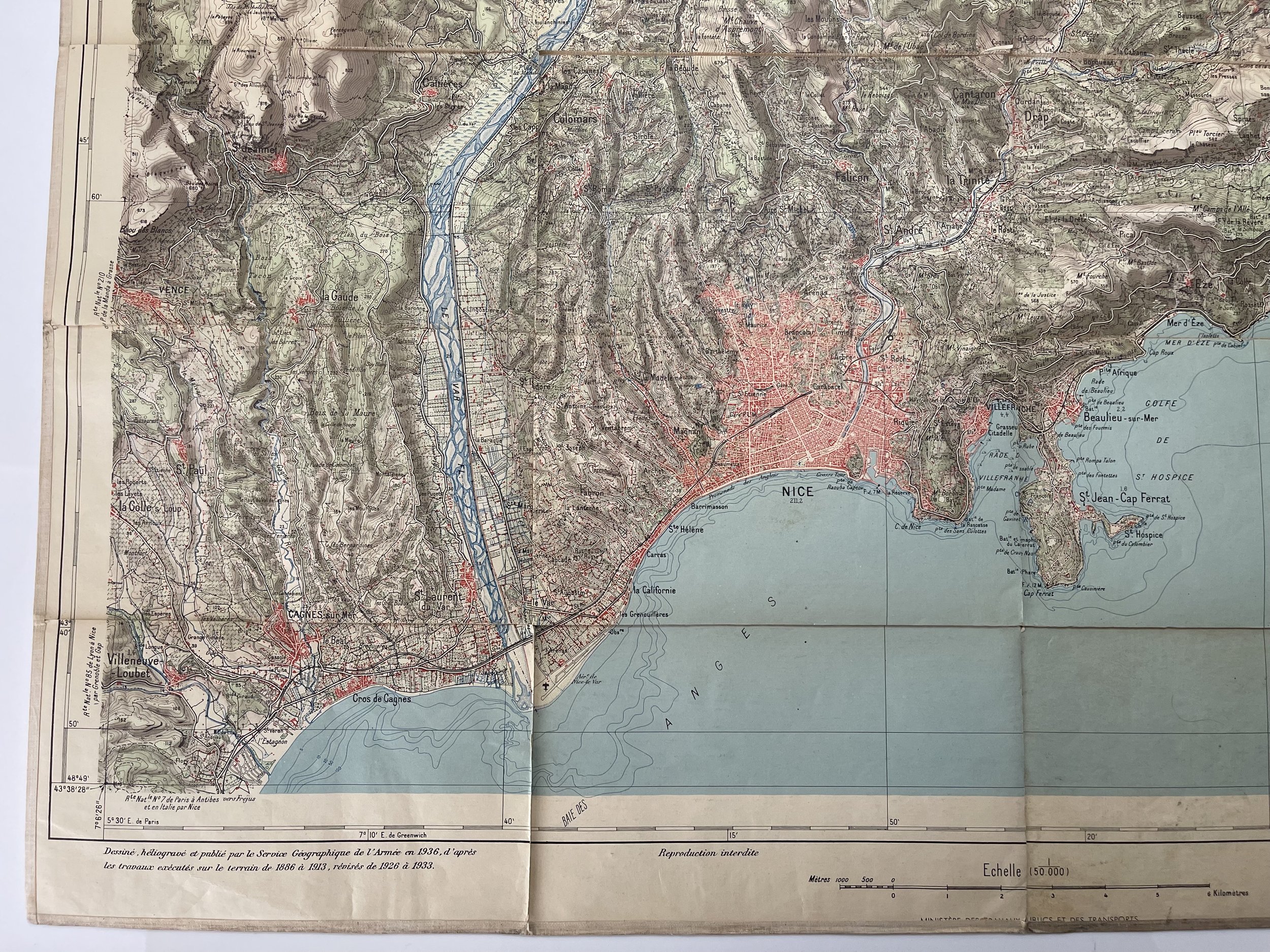
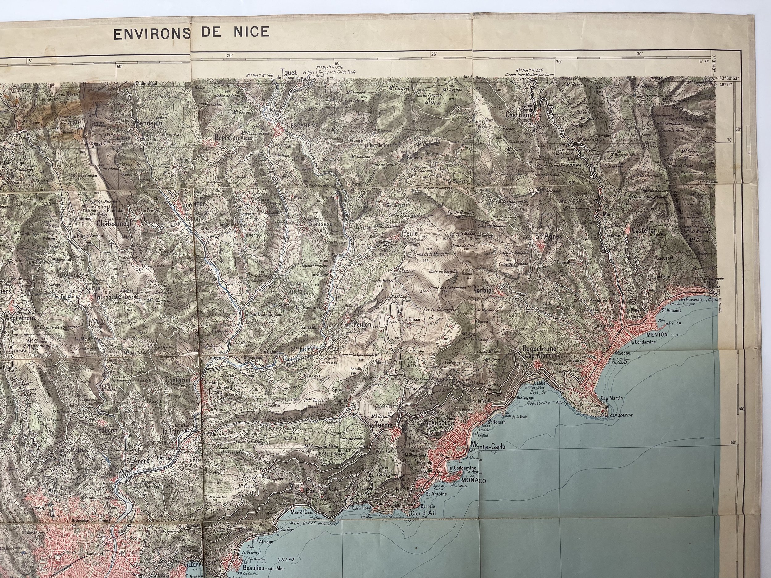

Environs De Nice - France - Service géographique de l'armée (War Depot) - 1936
War Depot - Environs de Nice : Carte de France au 50.000e (Type 1922) / Dessiné, héliogravé et publié par Service Géographique de l'Armée en 1936, d'après les travaux exécutés sur le terrain de 1886 à 1913, révisés de 1926 à 1933 France. Service géographique de l'armée. Cartographe
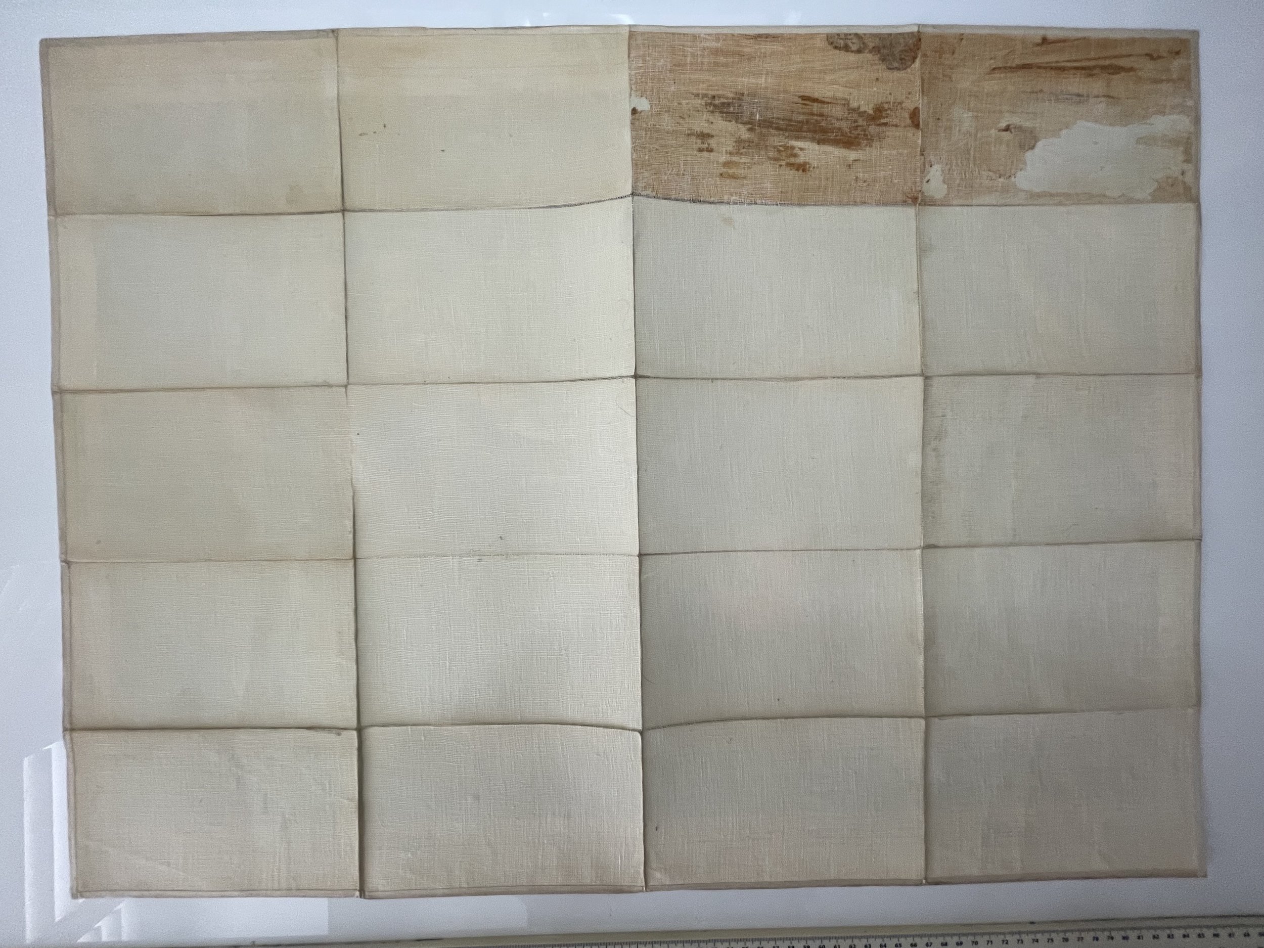
Nice bright War map of Nice France on hessian. Map intact in good condition with wear. No front or backboards. Pricing and Grading commensurate.
The War Depot was the cartography and archives office of military interest of the French army since Louis XIV. Its role was amplified under the Revolution and the Empire .
Created by Louvois in 1688, the War Depot was responsible for collecting and preserving historical archives, military memoirs, plans and maps, having them engraved and published, and finally for dealing with everything concerning topographical operations. In the 18th century , the role of Lieutenant-General de Vault was notable.
Virtually dissolved in the first years of the Revolution by the decision of the Constituent Assembly to abolish the corps of military geographical engineers 1 , it was reestablished by General Calon d'April 1793hasMay 17972. It then took the name of the General Depot of War and Geography 3 , emphasizing the importance, for the conduct of armies, of the establishment and updating of detailed maps, which would long retain the name of " Major State Maps " in France. But the resources allocated to the service were not commensurate with the initial ambition: a good part of its personnel moved to the Bureau of Longitudes and the Hydrological Service of the Navy 1 .
The management of the Depot briefly passed to General Dupont de l'Étang from May to September 1797, then to General Ernouf of September 1797hasOctober 1798, and to General Meunier until December 17992 .
Under Bonaparte and the Empire , the War Depot was headed by General Clarke deDecember 1799hasSeptember 1800, General Andréossy ofAugust 1802hasMay 1803, then by General Sanson deJune 1803hasJune 18052. During this period, the situation of the War Depot was flourishing having 90 geographical engineers and an enormous documentary fund, it also undertook the mapping of the Cisalpine Republic , Liguria, the newly annexed Cisrhenian Republic , etc. The corps of military geographical engineers was definitively recreated in January 18091 .
The service was reorganised in 1814, then in 1823.
November 20, 1830, it was General Baron Pelet who became director of the War Depot. He reorganized and modernized the various and very numerous services. He developed and published the large map of France of the General Staff at 1/80,000 4 .
The war depot was abolished in 1887, when it was split into two separate organisations:
The Army Geographic Service (SGA), which became the National Geographic Institute (IGN) in 1940; the Army Historical Service (SHA), later the Army Historical Service (SHAT), currently the Defence Historical Service (SHD).
The archives of the War Depot can be consulted at the SHD, Château de Vincennes site, avenue de Paris in Vincennes
War Depot - Environs de Nice : Carte de France au 50.000e (Type 1922) / Dessiné, héliogravé et publié par Service Géographique de l'Armée en 1936, d'après les travaux exécutés sur le terrain de 1886 à 1913, révisés de 1926 à 1933 France. Service géographique de l'armée. Cartographe
Nice bright War map of Nice France on hessian. Map intact in good condition with wear. No front or backboards. Pricing and Grading commensurate.
The War Depot was the cartography and archives office of military interest of the French army since Louis XIV. Its role was amplified under the Revolution and the Empire .
Created by Louvois in 1688, the War Depot was responsible for collecting and preserving historical archives, military memoirs, plans and maps, having them engraved and published, and finally for dealing with everything concerning topographical operations. In the 18th century , the role of Lieutenant-General de Vault was notable.
Virtually dissolved in the first years of the Revolution by the decision of the Constituent Assembly to abolish the corps of military geographical engineers 1 , it was reestablished by General Calon d'April 1793hasMay 17972. It then took the name of the General Depot of War and Geography 3 , emphasizing the importance, for the conduct of armies, of the establishment and updating of detailed maps, which would long retain the name of " Major State Maps " in France. But the resources allocated to the service were not commensurate with the initial ambition: a good part of its personnel moved to the Bureau of Longitudes and the Hydrological Service of the Navy 1 .
The management of the Depot briefly passed to General Dupont de l'Étang from May to September 1797, then to General Ernouf of September 1797hasOctober 1798, and to General Meunier until December 17992 .
Under Bonaparte and the Empire , the War Depot was headed by General Clarke deDecember 1799hasSeptember 1800, General Andréossy ofAugust 1802hasMay 1803, then by General Sanson deJune 1803hasJune 18052. During this period, the situation of the War Depot was flourishing having 90 geographical engineers and an enormous documentary fund, it also undertook the mapping of the Cisalpine Republic , Liguria, the newly annexed Cisrhenian Republic , etc. The corps of military geographical engineers was definitively recreated in January 18091 .
The service was reorganised in 1814, then in 1823.
November 20, 1830, it was General Baron Pelet who became director of the War Depot. He reorganized and modernized the various and very numerous services. He developed and published the large map of France of the General Staff at 1/80,000 4 .
The war depot was abolished in 1887, when it was split into two separate organisations:
The Army Geographic Service (SGA), which became the National Geographic Institute (IGN) in 1940; the Army Historical Service (SHA), later the Army Historical Service (SHAT), currently the Defence Historical Service (SHD).
The archives of the War Depot can be consulted at the SHD, Château de Vincennes site, avenue de Paris in Vincennes
Code : A893
Cartographer : Cartographer / Engraver / Publisher: Service géographique de l'armée (War Depot)
Date : Publication Place / Date - Circa 1936
Size : Sheet size: Image Size: 75 x 55 cm
Availability : Available
Type - Genuine - Vintage
Grading A-
Where Applicable - Folds as issued. Light box photo shows the folio leaf centre margin hinge ‘glue’, this is not visible otherwise.
Tracked postage, in casement. Please contact me for postal quotation outside of the UK.