Environs London - Iron Railway Antique Map - Moule Barclay Virtue Wandsworth - 1845
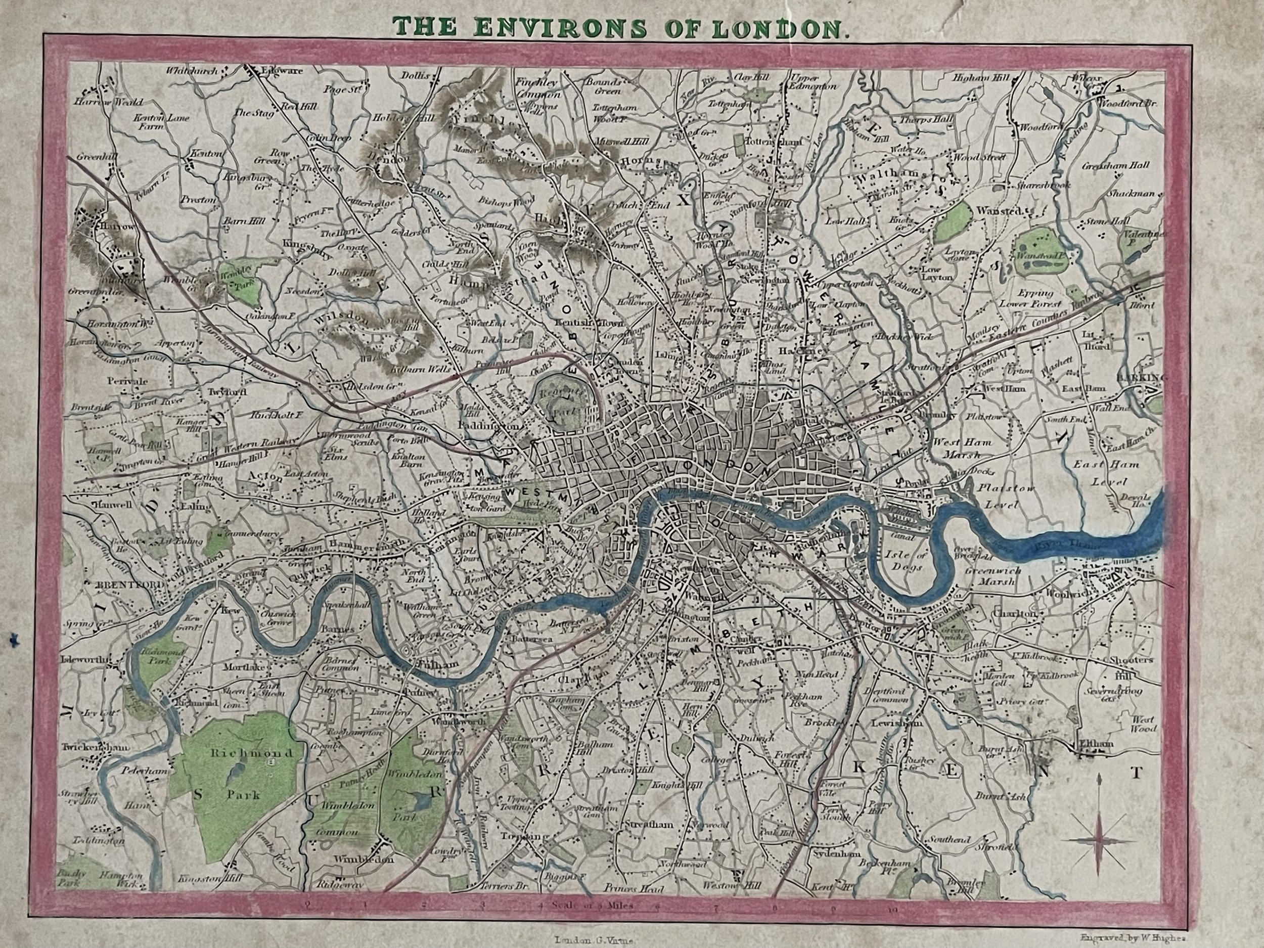
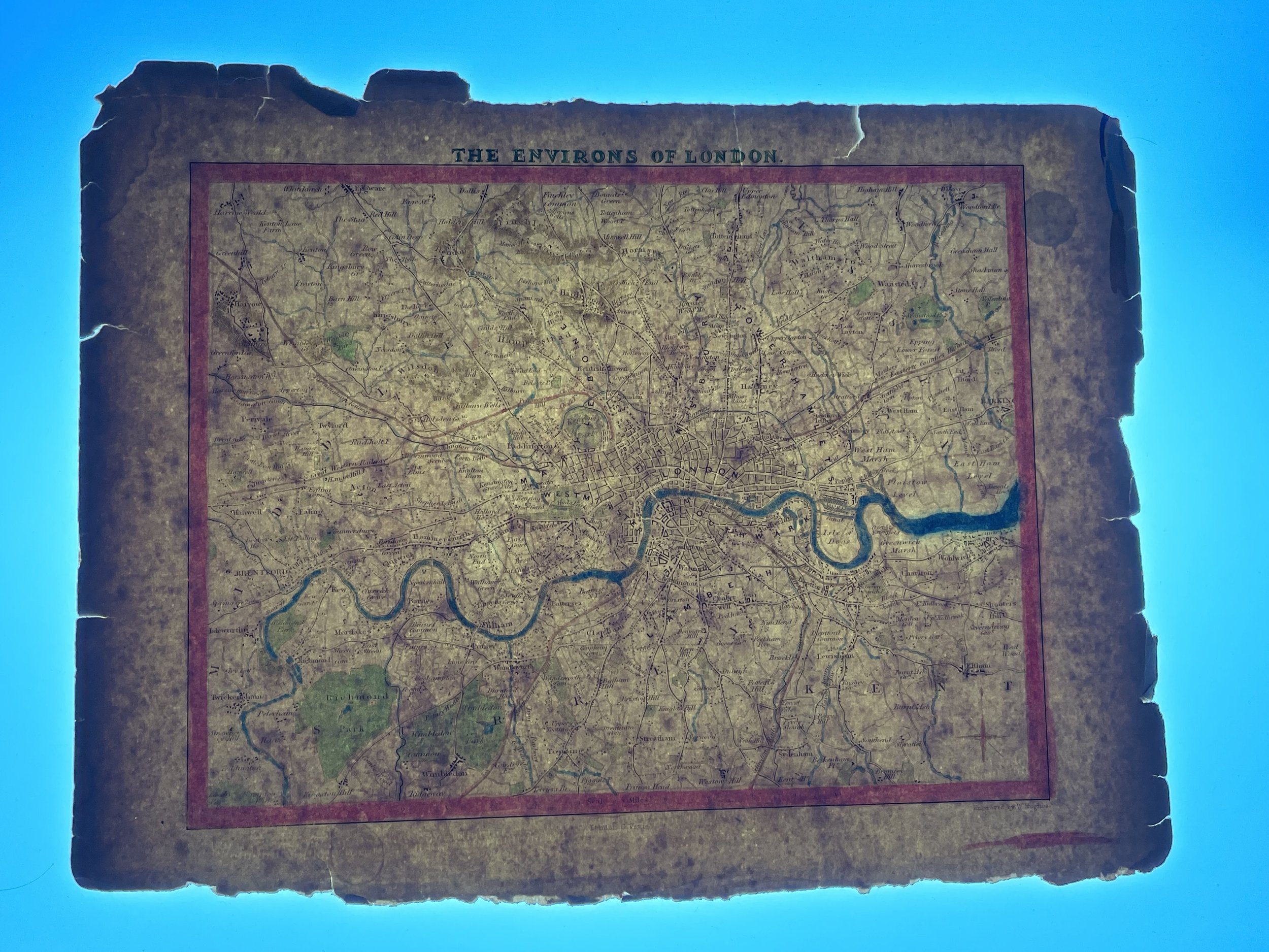
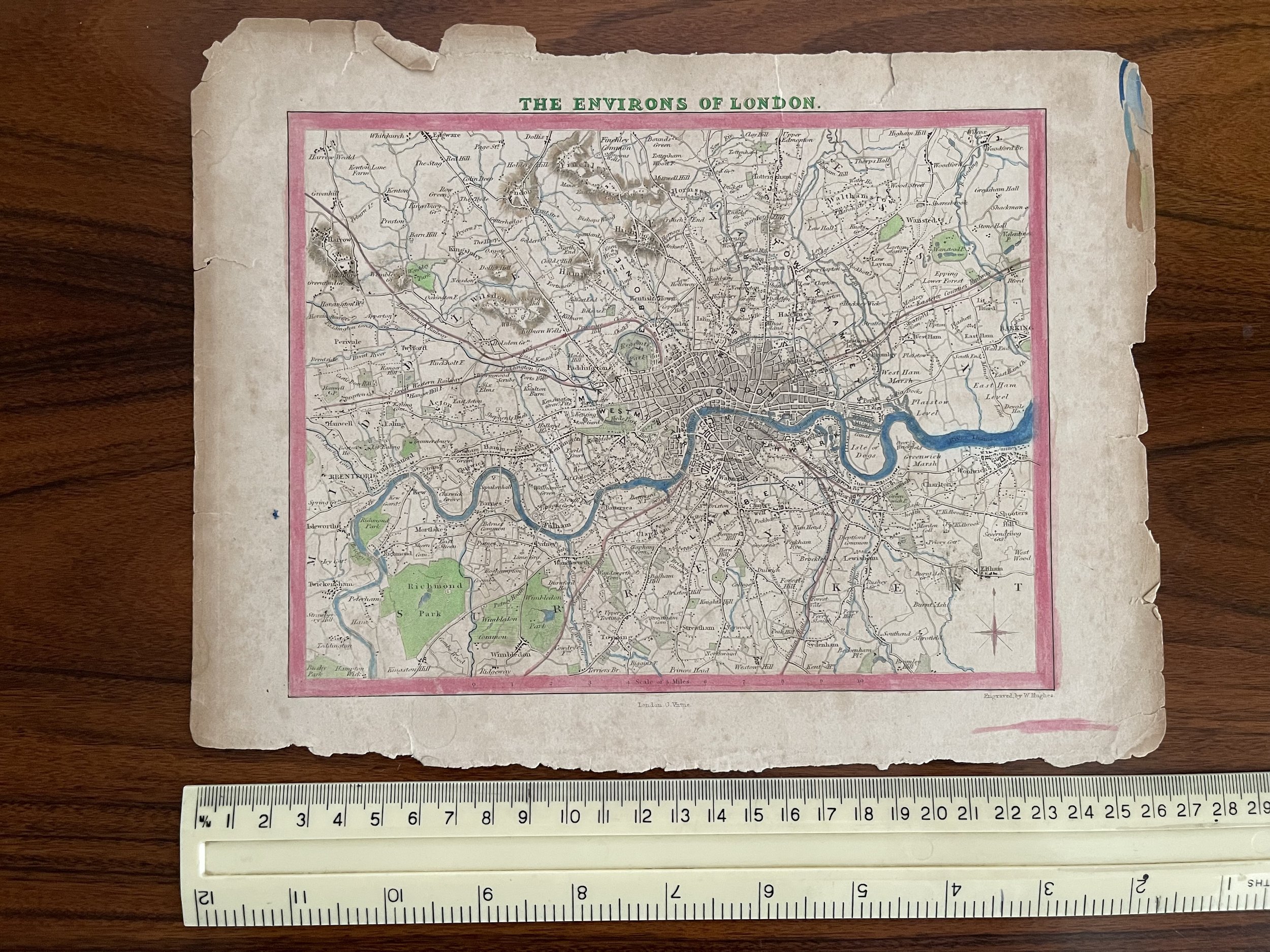
"The Environs of London."
A map "engraved by W. Hughes" (bottom right), published in "London. G. Virtue" (at the bottom). No date, but this map appeared in Barclay's Complete and Universal English Dictionary, together with the Moule County maps of England. It was published c1845.
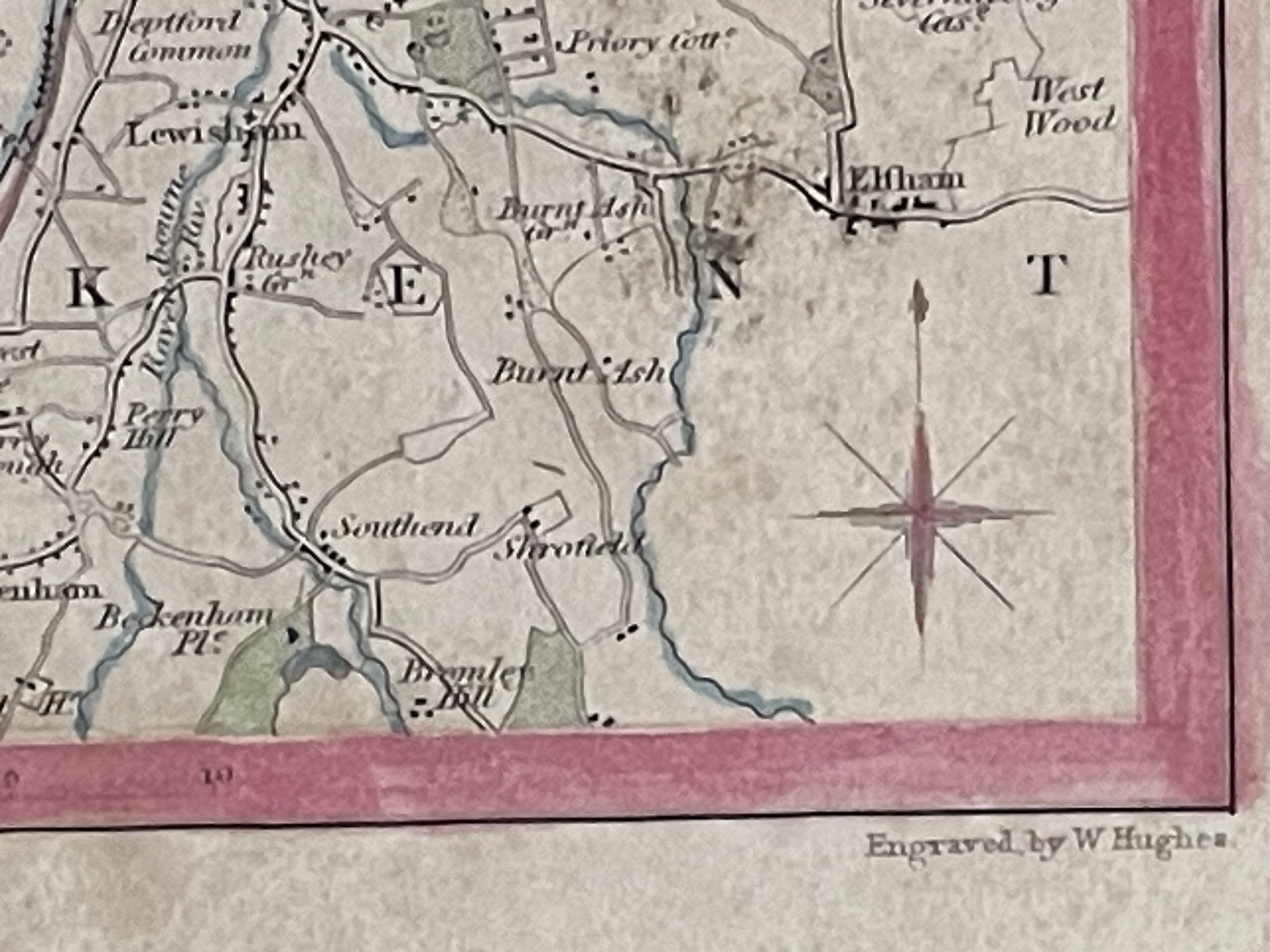
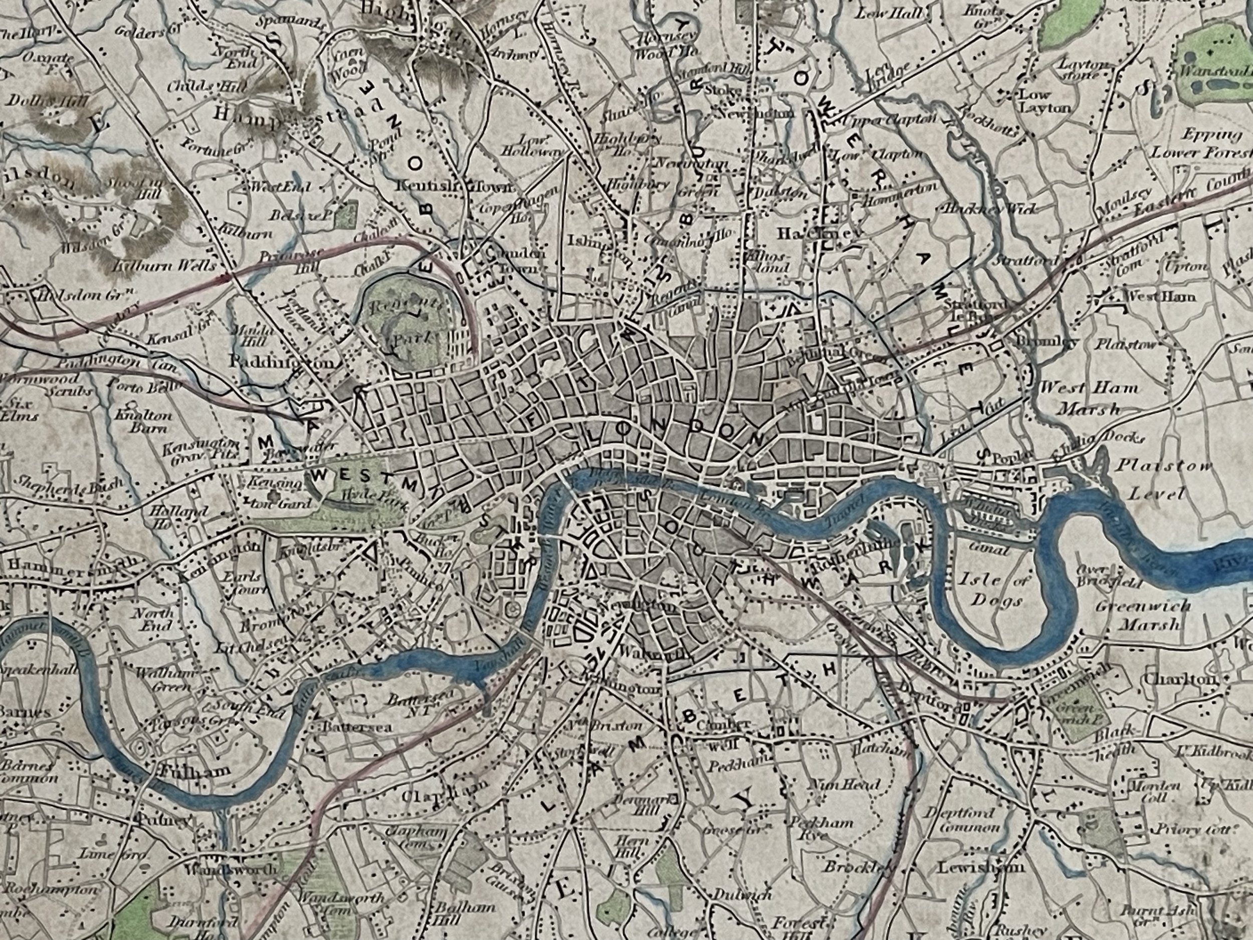
An interesting map which extends as far south as Tooting and Sydenham, west to Brentford and Harrow, north to Finchley Common and Edmonton, and east to Barking. In other words, what is now much of Greater London. The built-up area here can be seen to extend not even as far as Brixton and Kennington in the south, Pimlico and Kensington in the west, Camden Town and Islington in the north, and Stratford and Poplar in the east. The capital was to grow at a phenomenal rate over the next decades.
The map has interesting early railway information. The Greenwich line still terminates at Greenwich. This line provided the first passenger service in London, and the first completely elevated railway. The terminus remained at Greenwich until 1878. The 'Iron Railway' is still shown heading south from Wandsworth. This was a much earlier track, opened in 1803, which used horses to pull the carriages. its use was industrial.
The map has been attractively handcoloured
William Hughes
Born in Westminster, London in about 1818, William Hughes was a prolific mapmaker, geographer, engraver, printer and publisher. Maps were published in the "Modern Atlas of the Earth", published by Frederick Warne & Co. in 1876, the year of his death.
George C. Virtue (1794 – 8 December 1868)
Virtue was a 19th-century London-based publisher. His publishing house was located at 26 Ivy Lane, Paternoster Row.
Virtue selected accomplished artists, employed the best engravers, and produced books that were rarely surpassed in elegance and correctness for the period. Chief among his publications were the following, all illustrated by William Henry Bartlett: Switzerland, by William Beattie, 2 vols. 1836; Scotland, by W. Beattie, 1838; The Waldenses, by W. Beattie, 1838; American Scenery, 2 vols. 1840; Description of the Beauties of the Bosphorus, by Julia Pardoe, 1840; and The Danube, its History and Scenery, by W. Beattie, 1844. Virtue created a prodigious business, issuing upwards of twenty thousand copper and steel engravings through his career.
"The Environs of London."
A map "engraved by W. Hughes" (bottom right), published in "London. G. Virtue" (at the bottom). No date, but this map appeared in Barclay's Complete and Universal English Dictionary, together with the Moule County maps of England. It was published c1845.
An interesting map which extends as far south as Tooting and Sydenham, west to Brentford and Harrow, north to Finchley Common and Edmonton, and east to Barking. In other words, what is now much of Greater London. The built-up area here can be seen to extend not even as far as Brixton and Kennington in the south, Pimlico and Kensington in the west, Camden Town and Islington in the north, and Stratford and Poplar in the east. The capital was to grow at a phenomenal rate over the next decades.
The map has interesting early railway information. The Greenwich line still terminates at Greenwich. This line provided the first passenger service in London, and the first completely elevated railway. The terminus remained at Greenwich until 1878. The 'Iron Railway' is still shown heading south from Wandsworth. This was a much earlier track, opened in 1803, which used horses to pull the carriages. its use was industrial.
The map has been attractively handcoloured
William Hughes
Born in Westminster, London in about 1818, William Hughes was a prolific mapmaker, geographer, engraver, printer and publisher. Maps were published in the "Modern Atlas of the Earth", published by Frederick Warne & Co. in 1876, the year of his death.
George C. Virtue (1794 – 8 December 1868)
Virtue was a 19th-century London-based publisher. His publishing house was located at 26 Ivy Lane, Paternoster Row.
Virtue selected accomplished artists, employed the best engravers, and produced books that were rarely surpassed in elegance and correctness for the period. Chief among his publications were the following, all illustrated by William Henry Bartlett: Switzerland, by William Beattie, 2 vols. 1836; Scotland, by W. Beattie, 1838; The Waldenses, by W. Beattie, 1838; American Scenery, 2 vols. 1840; Description of the Beauties of the Bosphorus, by Julia Pardoe, 1840; and The Danube, its History and Scenery, by W. Beattie, 1844. Virtue created a prodigious business, issuing upwards of twenty thousand copper and steel engravings through his career.
Code : A195
Cartographer : Cartographer / Engraver / Publisher: William Hughes & George Virtue
Date : Publication Place / Date - 1845 approx
Size : Sheet size: Image Size: 20 x 26.75 cm
Availability : Available
Type - Genuine - Antique
Grading B+
Where Applicable - Folds as issued. Light box photo shows the folio leaf centre margin hinge ‘glue’, this is not visible otherwise.
Tracked postage, in casement. Please contact me for postal quotation outside of the UK.