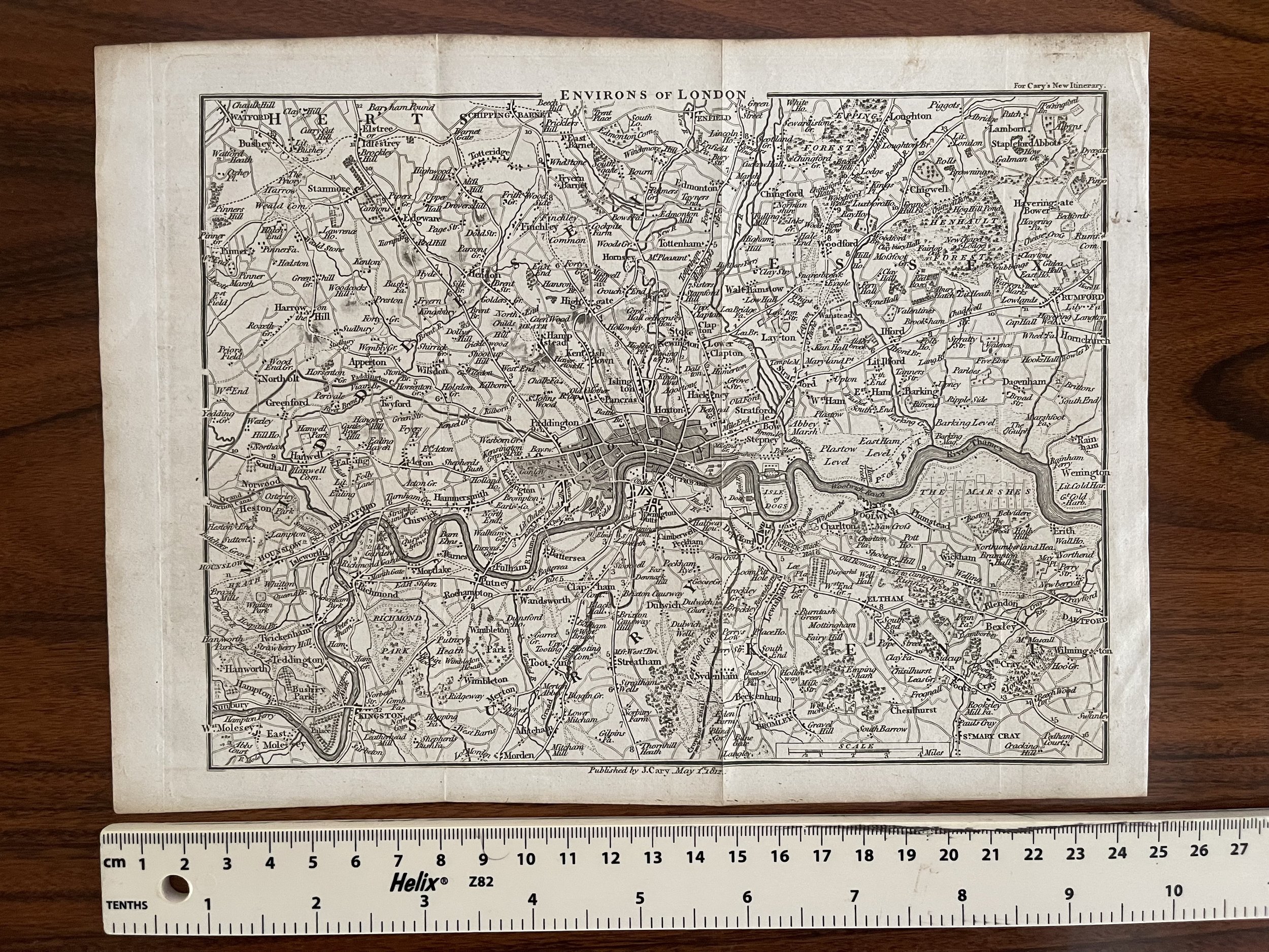
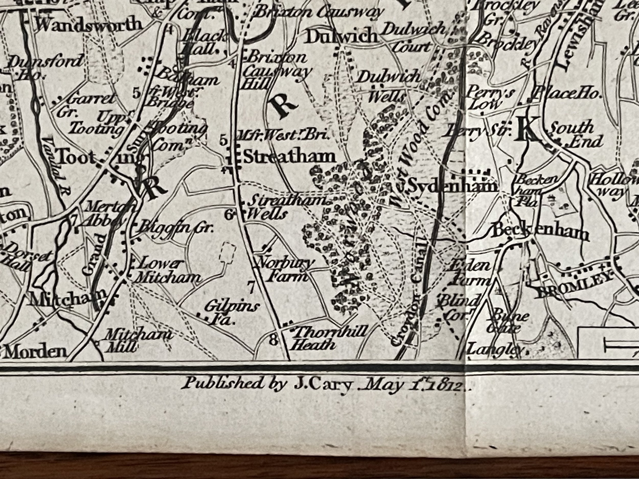
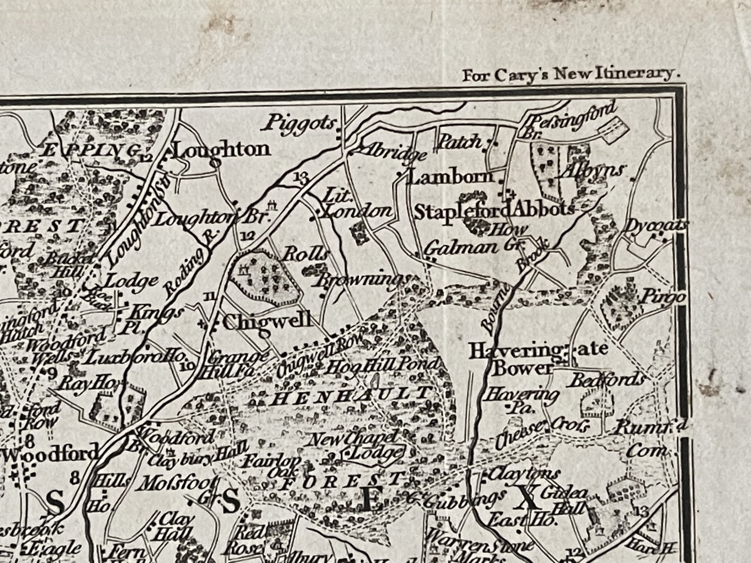
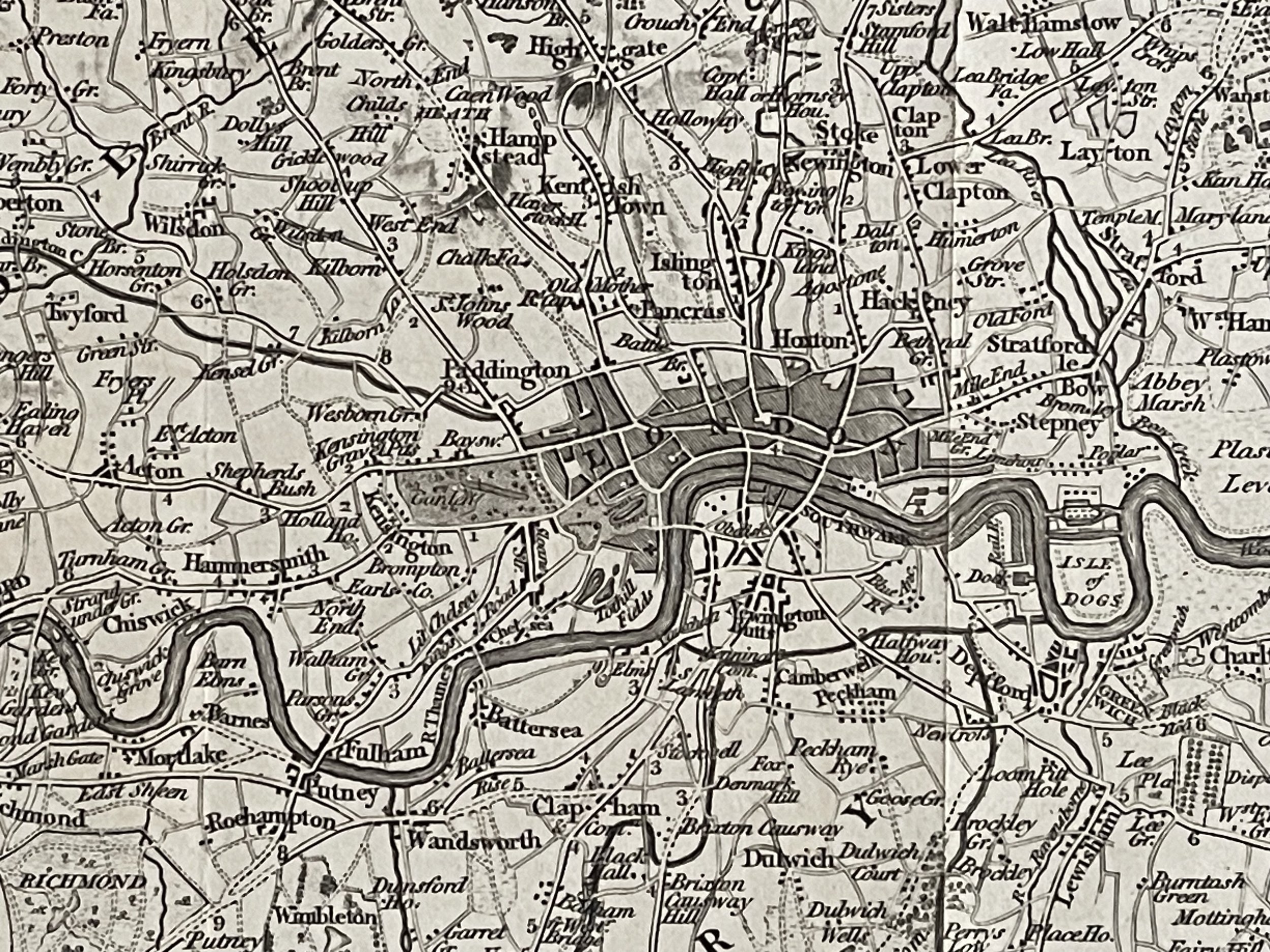
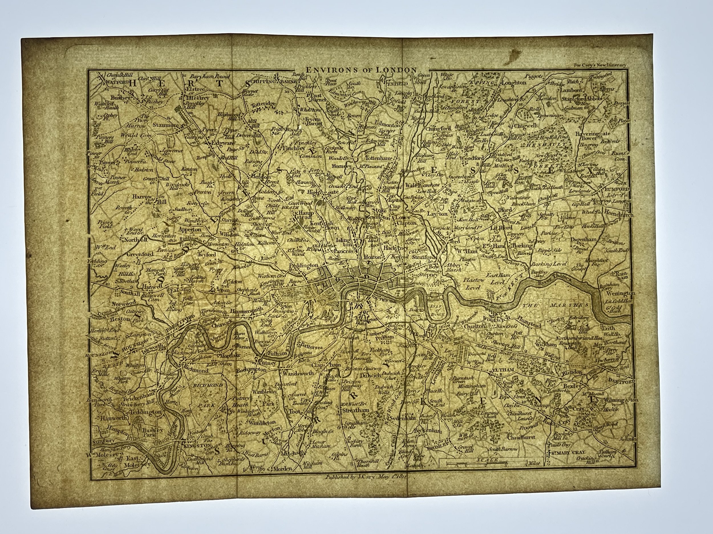
Environs of London (Miniature Map) - John Cary - 1812
ENVIRONS OF LONDON by John CARY. Miniature antique map. Original colour - 1812 - old antique vintage map - printed maps of London
CARY, John. Cary's New Itinerary: or, an Accurate Delineation of the Great Roads, Both Direct and Cross throughout England and Wales … Sixth edition, with Improvements. London, Printed for J. Cary, 1815.
One of the most detailed handbooks for travellers in Regency Britain, with maps of London and the fashionable destinations of the day, the Isle of Wight, Bath, Brighton, Margate and Cheltenham Spa. Cary was one of the most accurate and innovative map makers of the period. 'Despite the high quality of his maps, Cary's only public recognition was the award of the Society of Arts gold medal (1804) for publishing Singer's Cardiganshire survey (1803). Cary's appointment as surveyor of the roads to the General Post Office (1794) led to his publication of authoritative road measurements (measured by perambulator) in his influential New Itinerary (numerous editions from 1798). This volume contains an amazing amount of information, ranging from stage coach inss, postal services, exact distances between towns.
Code : A170
Cartographer : Cartographer / Engraver / Publisher: John Cary
Date : Publication Place / Date - 1812
Size : Sheet size: Image Size: 25 cm x 18.5 cm
Availability : Available
Type - Genuine - Antique
Grading A
Where Applicable - Folds as issued. Light box photo shows the folio leaf centre margin hinge ‘glue’, this is not visible otherwise.
Tracked postage, in casement. Please contact me for postal quotation outside of the UK.