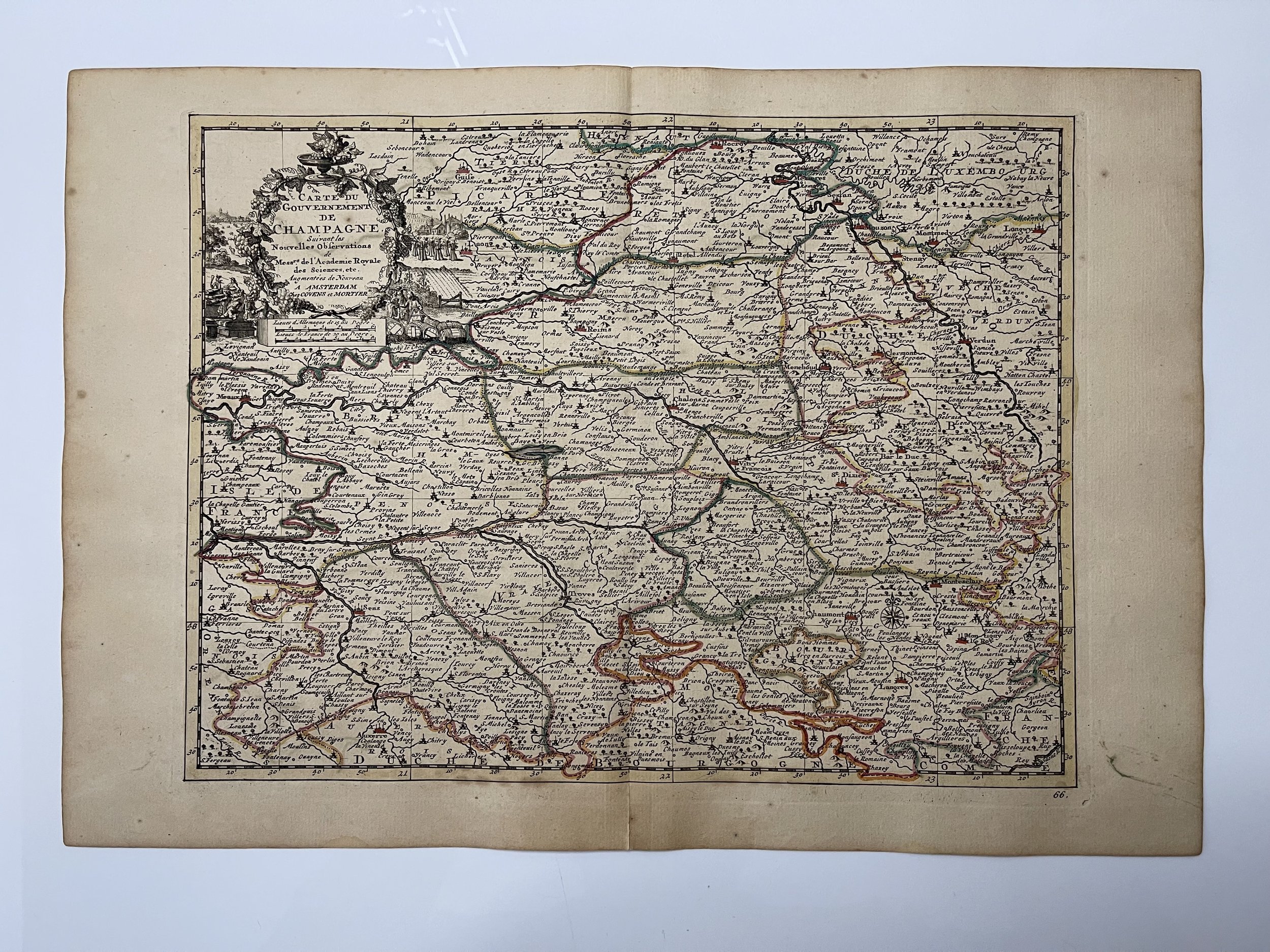
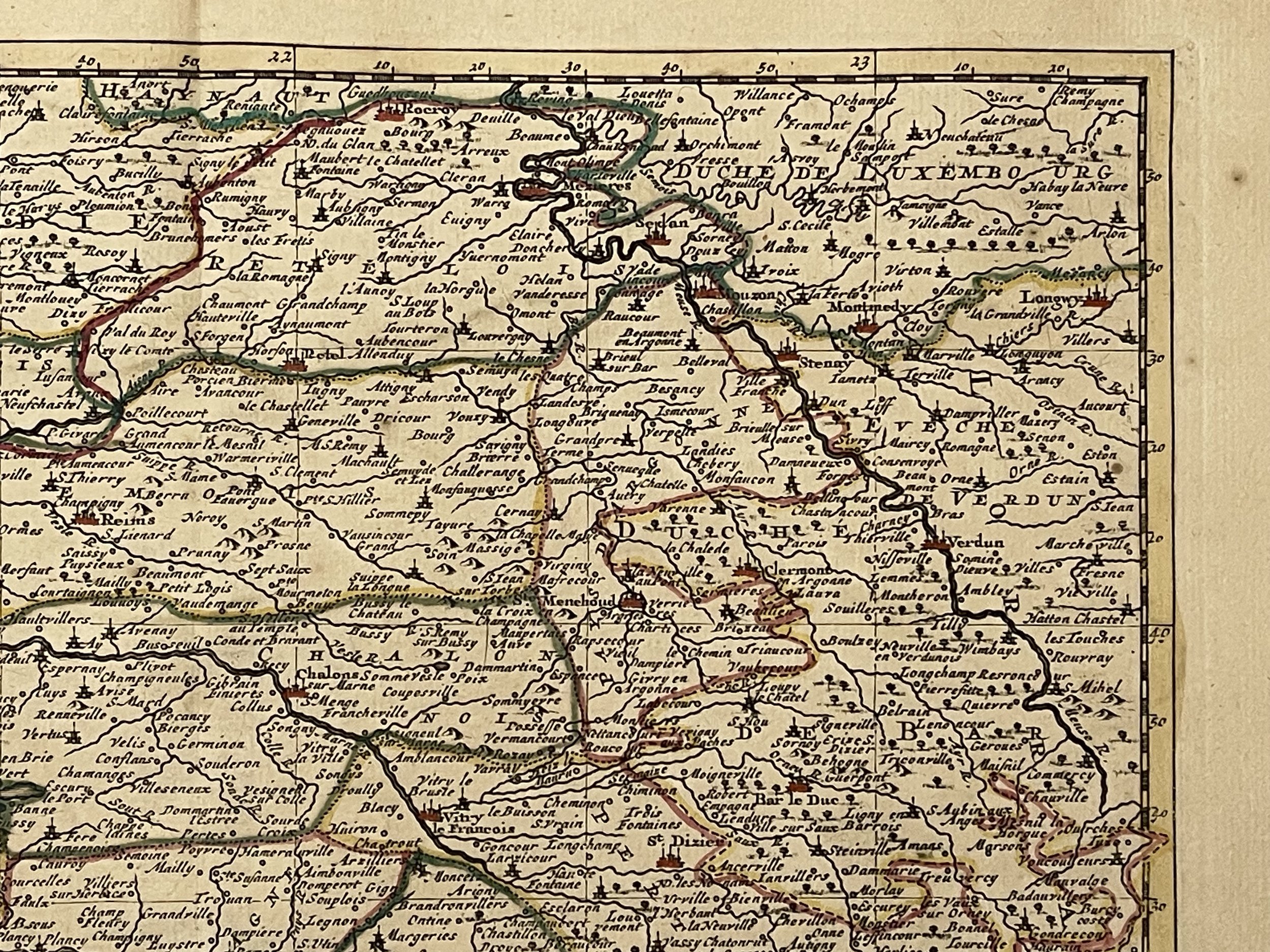
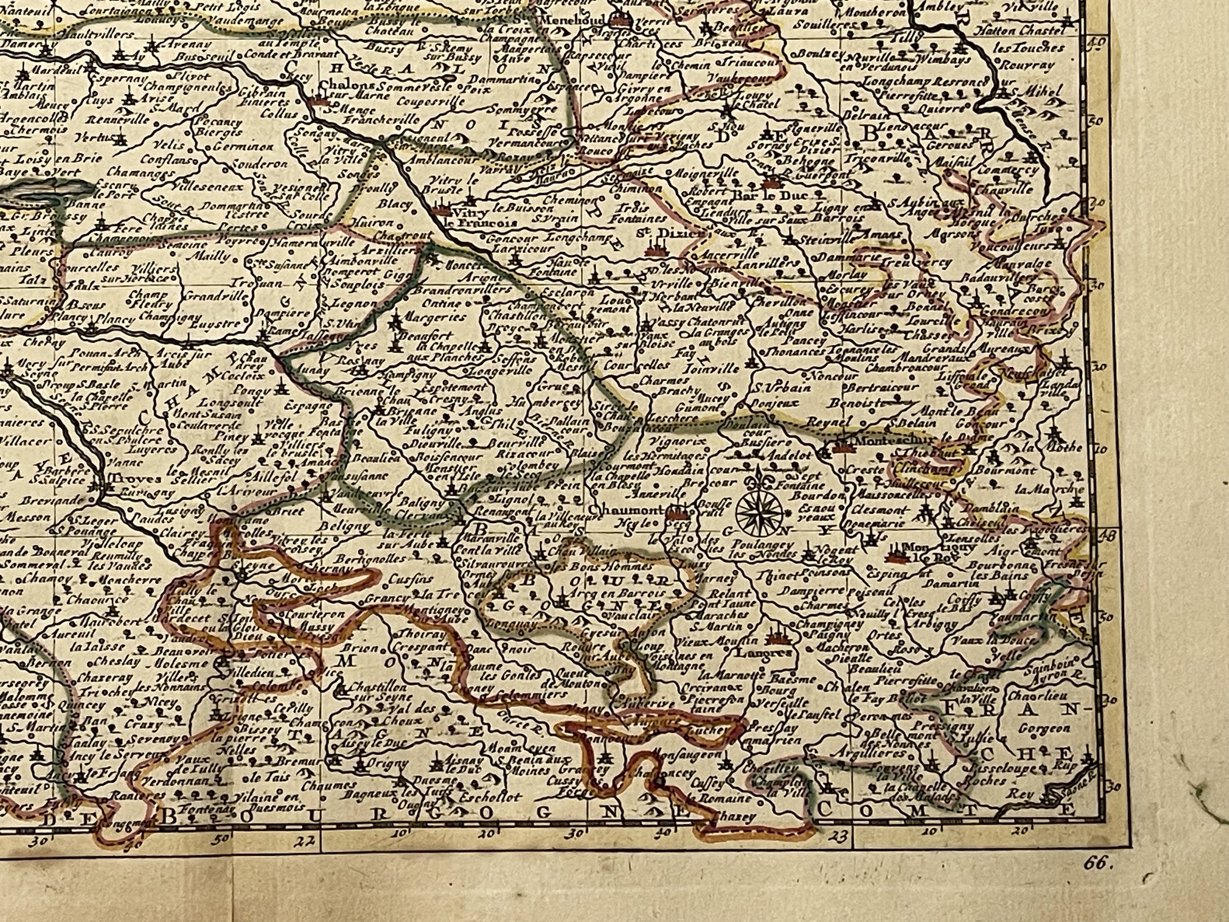
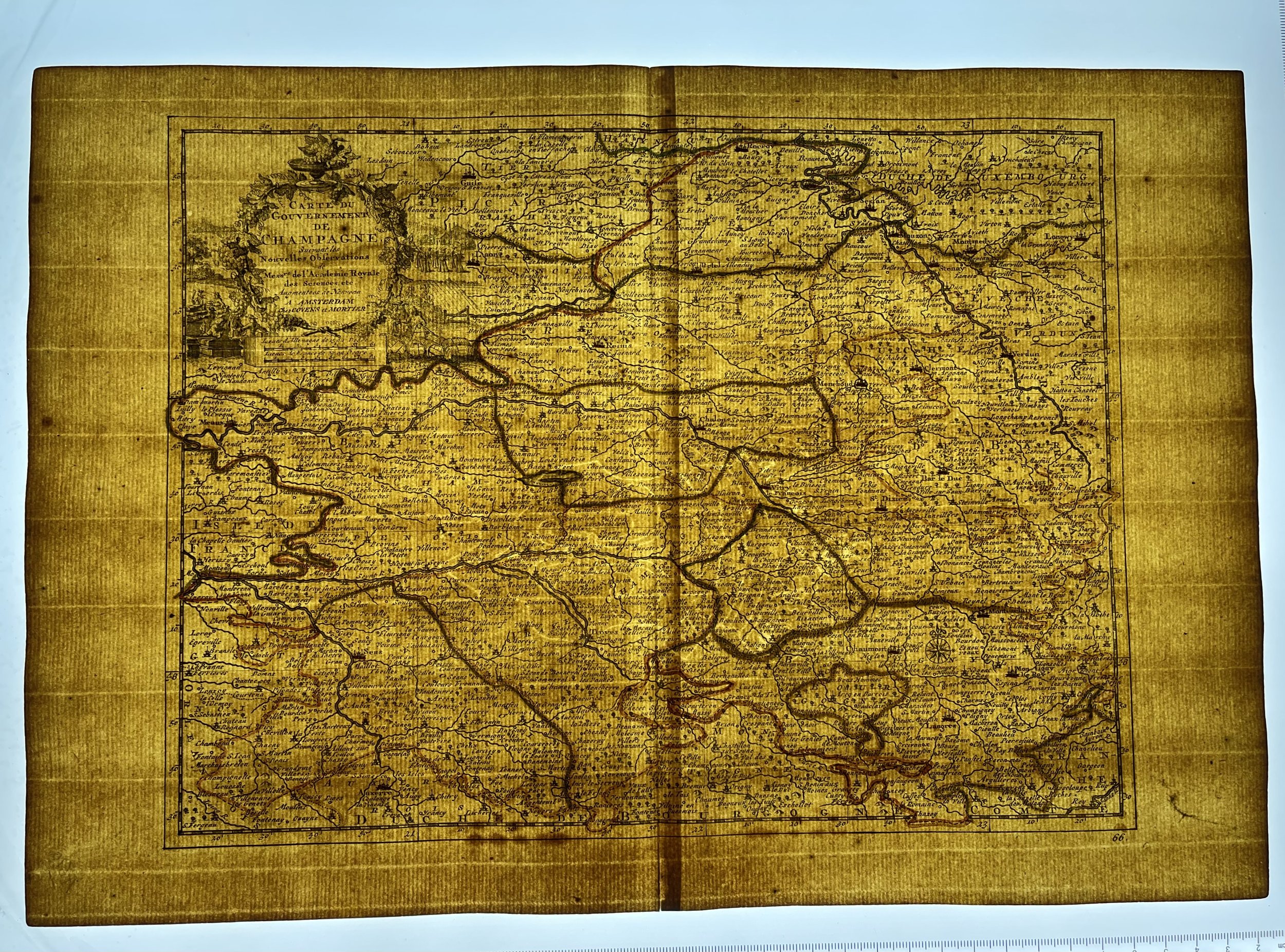
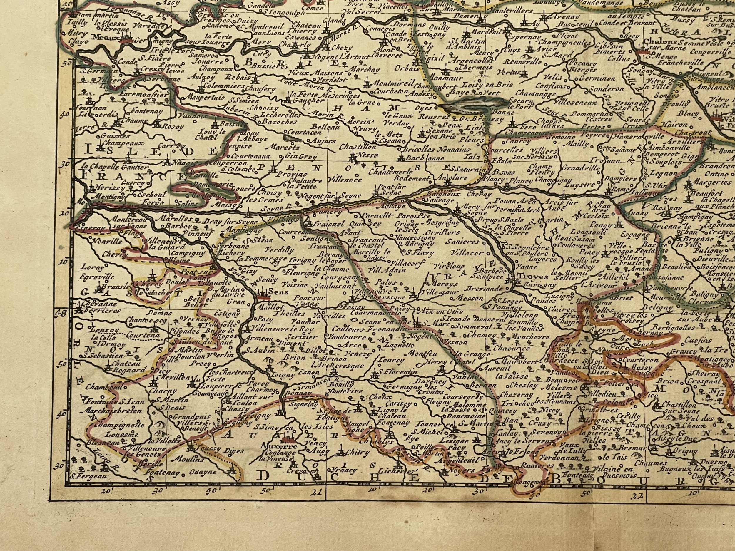
France - Champagne Region - Peter Van Der Aa, Johannes Covens, Cornelis Mortier - 1735
France - Champagne Region - Peter Van Der Aa, Johannes Covens, Cornelis Mortier - 1735
Peter Van Der Aa (1659-1733) was a prolific publisher, working in Leiden during the first three decades of the 18th. century. Much of his output consisted of re-issues and re-engravings of maps and view plates that he had acquired from earlier mapmakers. Little of his output was original, though that which is has a very distinct style, precisely and elegantly engraved, and is much sought-after today.
Pieter van der Aa was already in 1682 owner of a bookshop and auction house. During his life, he has published an enormous amount of printed material. After 1700, van der Aa increasingly specialised in books on geography and travel. He published composite atlases, a series of geographical descriptions of European countries, and some very spectacular works. Between 1706 and 1708 he published the Naauweurige versameling der gedenkwaardigste zee- en land-reysen, in 28 volumes. Many of Van der Aa’s publications are richly illustrated with maps and plates. He took over many copperplates and prints from other publishers such as Carel Allard and Frederik De Wit. The composite atlases that appeared from his workshop contain a curious mixture of his own material, copies of maps from other publishers, and reprints made from old copper plates, now with his own imprint. The Galérie agréable du monde, was completed in 1729, and comprised 66 parts, bound in 27 volumes. Van der Aa presented it as a good investment; after publication, the antiquarian value of the work would double, the more so since it was printed in a limited edition of only one hundred copies.
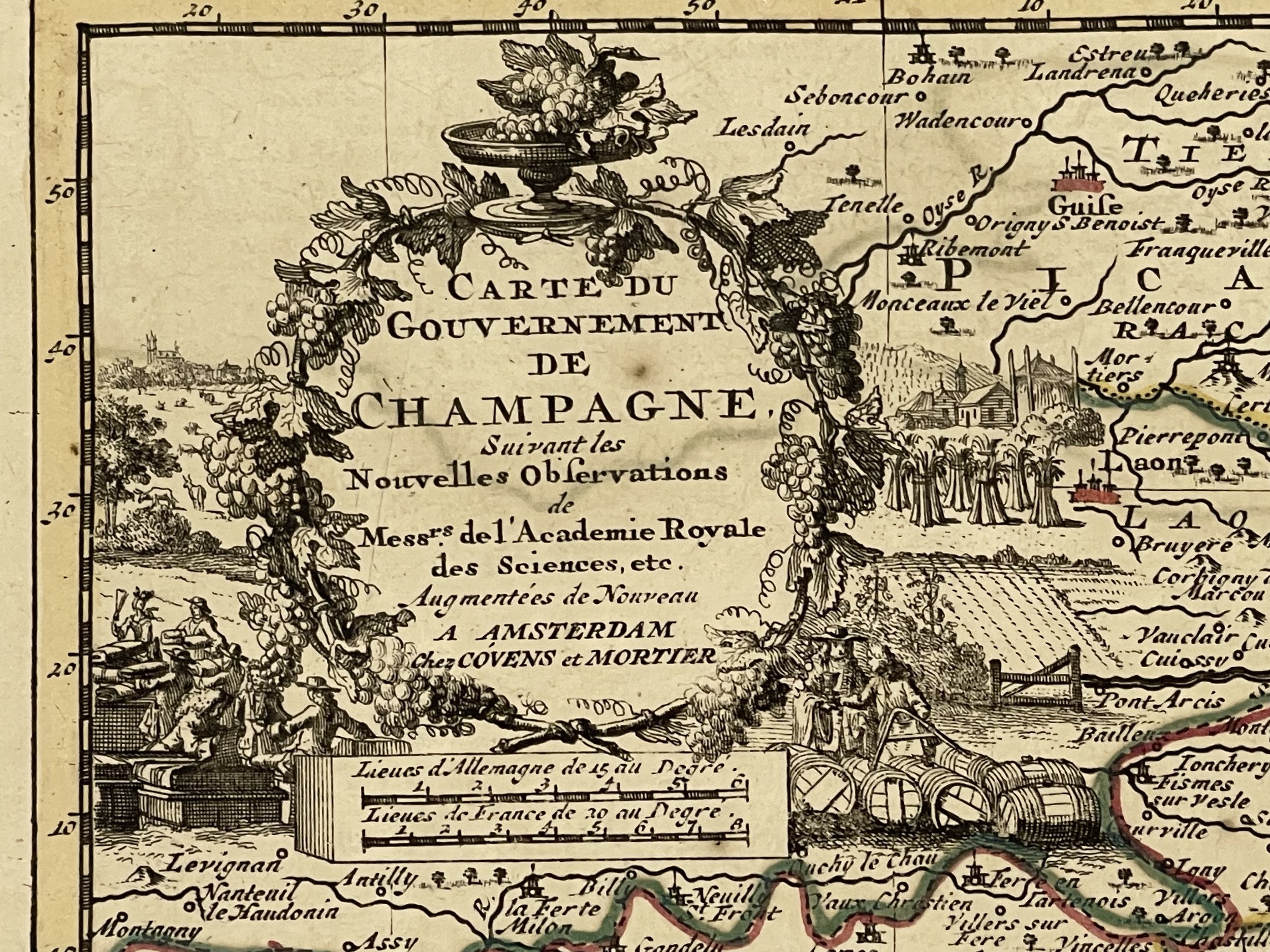
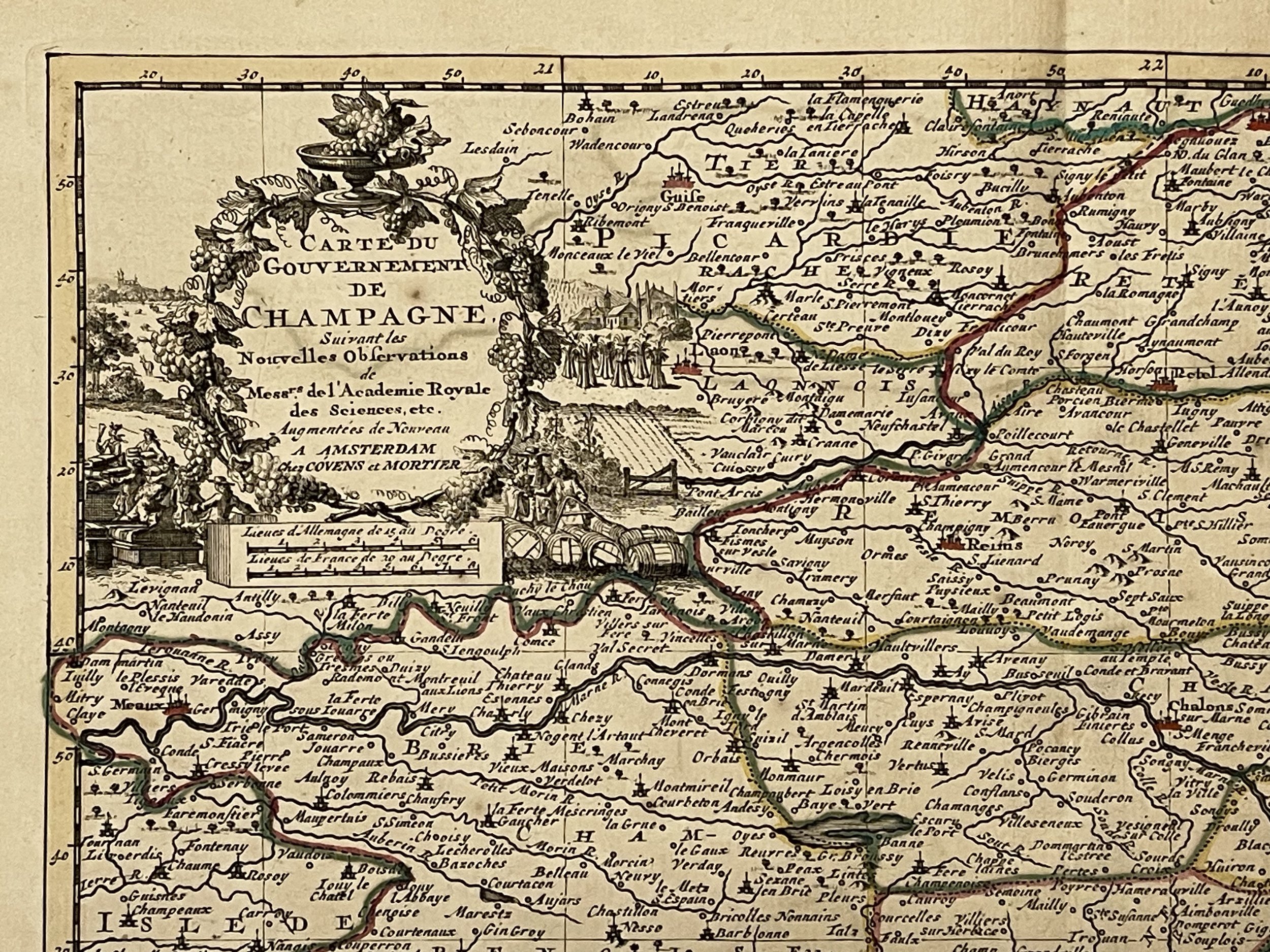
This is a copper engraved map plate from the second edition of “Van Der Aa "Nouvel Atlas" who sold his rights and copper plates to Covens & Mortier before dying in 1733. This company then reprinted this important Atlas in 1735 from which this map comes along. An interesting feature of Van Der Aa's method is that several of his atlases include maps printed within large, separately engraved, elaborately designed mock-frame borders, which were prepared with a blank centre so that individual maps could be over-printed on that area.
Despite the quantity and variety of Van Der Aa's publications they seem to have had only a limited circulation, and so are now scarce.
Johannes Covens and Cornelis Mortier were responsible of one of the most prolific map-making and publishing houses during the second and third quarters of the 18th century. They worked in Amsterdam where they were well situated to acquire the plates and rights from many earlier atlases. Johannes was the brother-in-law of Cornelis and the son of Pieter Mortier, a mapmaker and publisher in his own right.
The output of Covens & Mortier was vast and the business was continued until as late as 1866 by various relatives. Covens & Mortier were responsible for the re-issue of atlases, pocket atlases, wall maps and town plans by such important mapmakers as Sanson, Jaillot, Visscher, Van Der Aa, De L’Isle and De Wit amongst others. Some of their well-known reissues include the Atlas Nouveau of Guillaume De L’Isle, the Nieuwe Atlas of Sanson and the Nouvel Atlas by Pieter Van Der Aa amongst others.
Condition: Very good overall, with light yellowing and minor oxidation spots here and there. Folded at middle area as issued. Strong and dark impression on good watermarked paper, hand coloured. Blank verso. 20 mm (13/16") tear at bottom middle fold, not reaching image area, easily restorable. Pricing and grading commensurate.
France - Champagne Region - Peter Van Der Aa, Johannes Covens, Cornelis Mortier - 1735
Peter Van Der Aa (1659-1733) was a prolific publisher, working in Leiden during the first three decades of the 18th. century. Much of his output consisted of re-issues and re-engravings of maps and view plates that he had acquired from earlier mapmakers. Little of his output was original, though that which is has a very distinct style, precisely and elegantly engraved, and is much sought-after today.
Pieter van der Aa was already in 1682 owner of a bookshop and auction house. During his life, he has published an enormous amount of printed material. After 1700, van der Aa increasingly specialised in books on geography and travel. He published composite atlases, a series of geographical descriptions of European countries, and some very spectacular works. Between 1706 and 1708 he published the Naauweurige versameling der gedenkwaardigste zee- en land-reysen, in 28 volumes. Many of Van der Aa’s publications are richly illustrated with maps and plates. He took over many copperplates and prints from other publishers such as Carel Allard and Frederik De Wit. The composite atlases that appeared from his workshop contain a curious mixture of his own material, copies of maps from other publishers, and reprints made from old copper plates, now with his own imprint. The Galérie agréable du monde, was completed in 1729, and comprised 66 parts, bound in 27 volumes. Van der Aa presented it as a good investment; after publication, the antiquarian value of the work would double, the more so since it was printed in a limited edition of only one hundred copies.
This is a copper engraved map plate from the second edition of “Van Der Aa "Nouvel Atlas" who sold his rights and copper plates to Covens & Mortier before dying in 1733. This company then reprinted this important Atlas in 1735 from which this map comes along. An interesting feature of Van Der Aa's method is that several of his atlases include maps printed within large, separately engraved, elaborately designed mock-frame borders, which were prepared with a blank centre so that individual maps could be over-printed on that area.
Despite the quantity and variety of Van Der Aa's publications they seem to have had only a limited circulation, and so are now scarce.
Johannes Covens and Cornelis Mortier were responsible of one of the most prolific map-making and publishing houses during the second and third quarters of the 18th century. They worked in Amsterdam where they were well situated to acquire the plates and rights from many earlier atlases. Johannes was the brother-in-law of Cornelis and the son of Pieter Mortier, a mapmaker and publisher in his own right.
The output of Covens & Mortier was vast and the business was continued until as late as 1866 by various relatives. Covens & Mortier were responsible for the re-issue of atlases, pocket atlases, wall maps and town plans by such important mapmakers as Sanson, Jaillot, Visscher, Van Der Aa, De L’Isle and De Wit amongst others. Some of their well-known reissues include the Atlas Nouveau of Guillaume De L’Isle, the Nieuwe Atlas of Sanson and the Nouvel Atlas by Pieter Van Der Aa amongst others.
Condition: Very good overall, with light yellowing and minor oxidation spots here and there. Folded at middle area as issued. Strong and dark impression on good watermarked paper, hand coloured. Blank verso. 20 mm (13/16") tear at bottom middle fold, not reaching image area, easily restorable. Pricing and grading commensurate.
Code : A610
Cartographer : Cartographer / Engraver / Publisher: Peter Van Der Aa, Johannes Covens, Cornelis Mortier
Date : Publication Place / Date - Circa 1735
Size : Sheet size: Image Size: 38 x 26.5 cm
Availability : Available
Type - Genuine - Antique
Grading A-
Where Applicable - Folds as issued. Light box photo shows the folio leaf centre margin hinge ‘glue’, this is not visible otherwise.
Tracked postage, in casement. Please contact me for postal quotation outside of the UK.