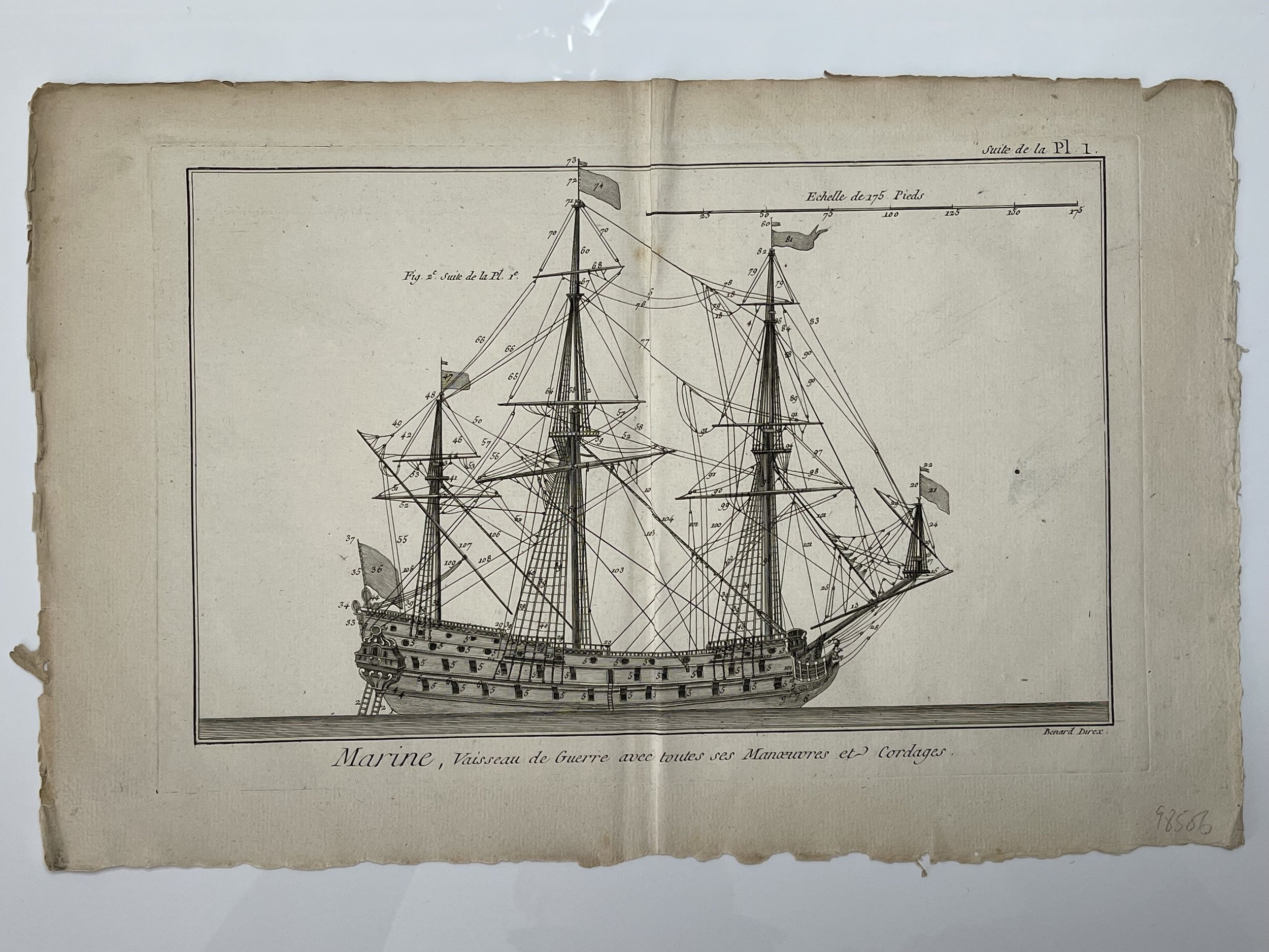
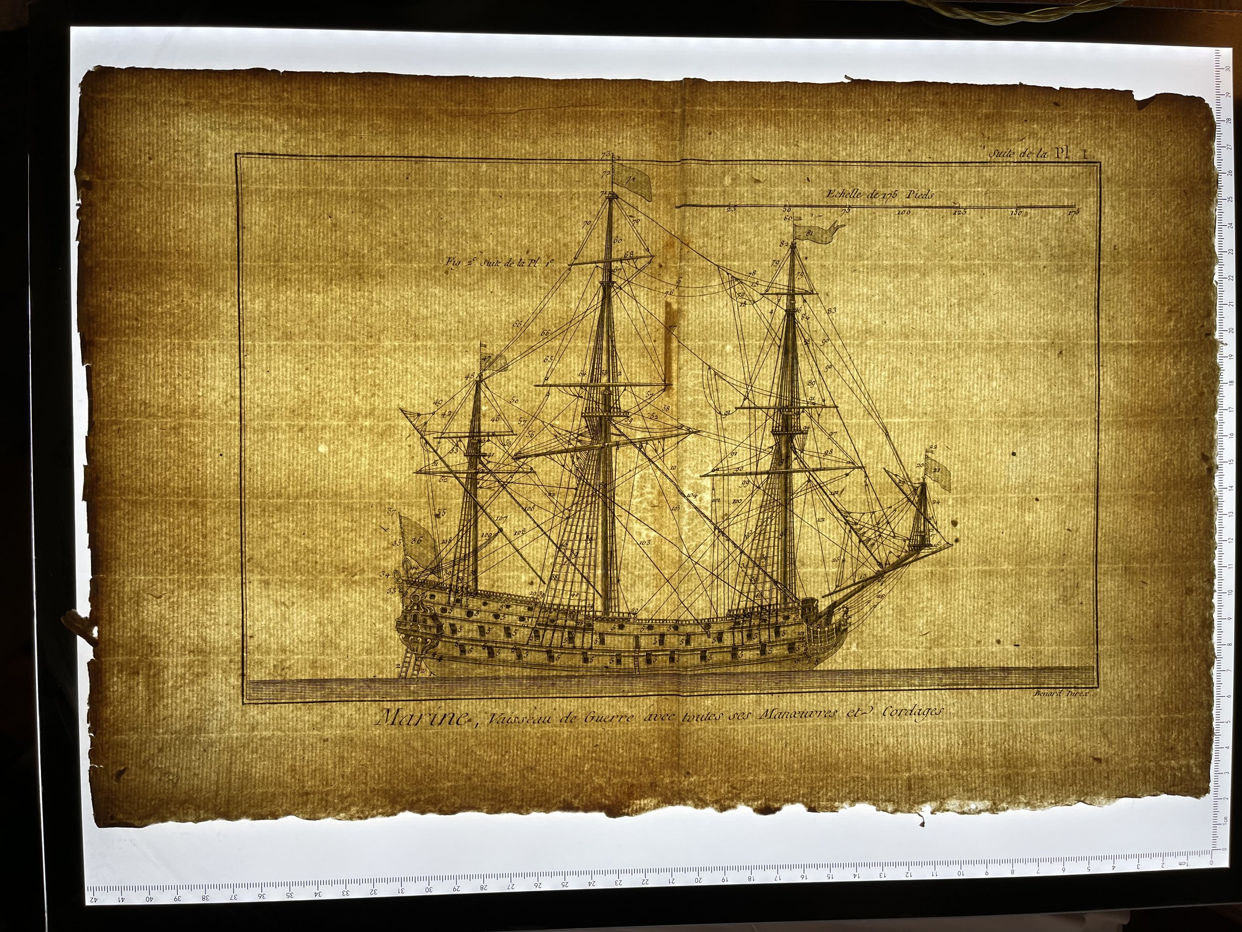
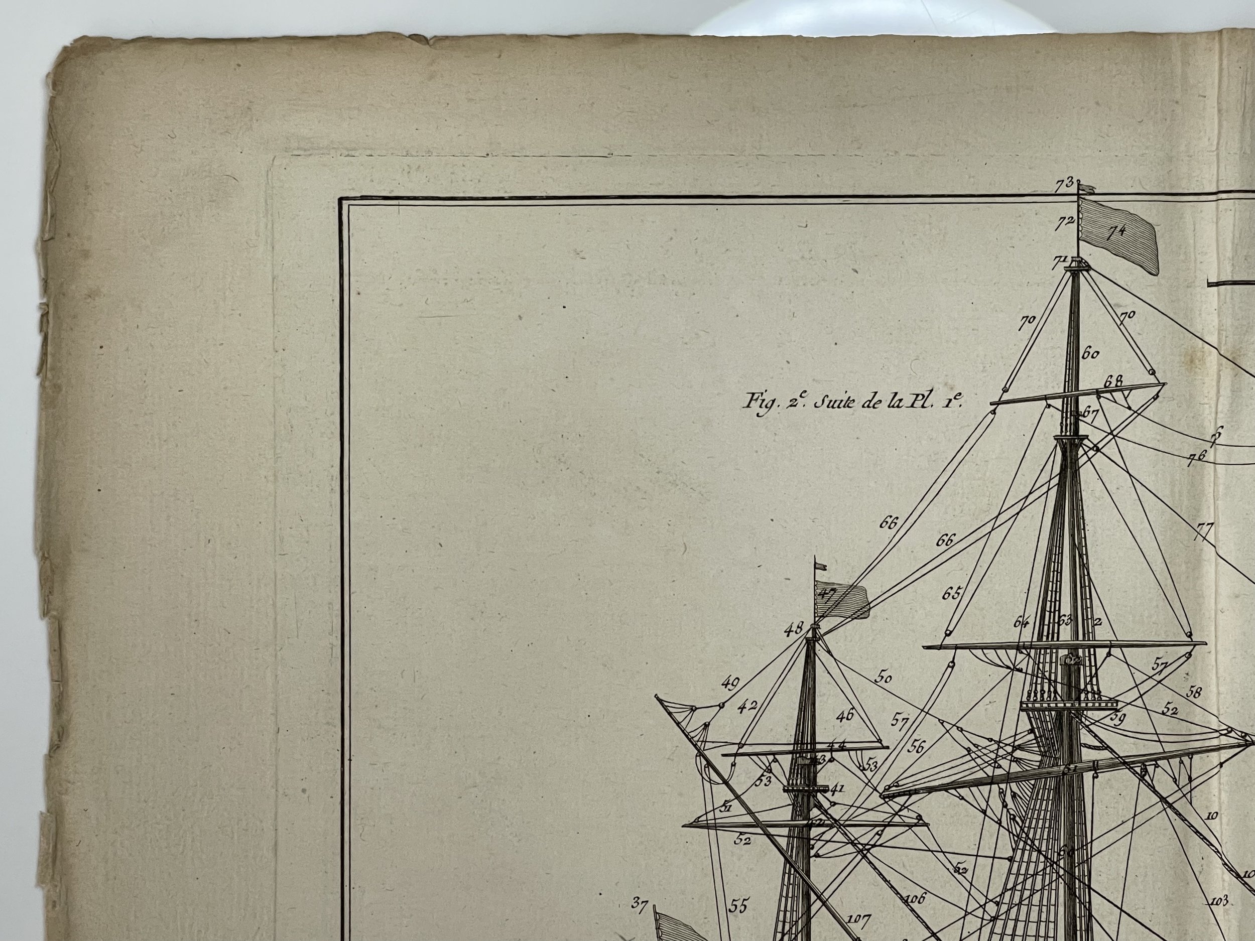
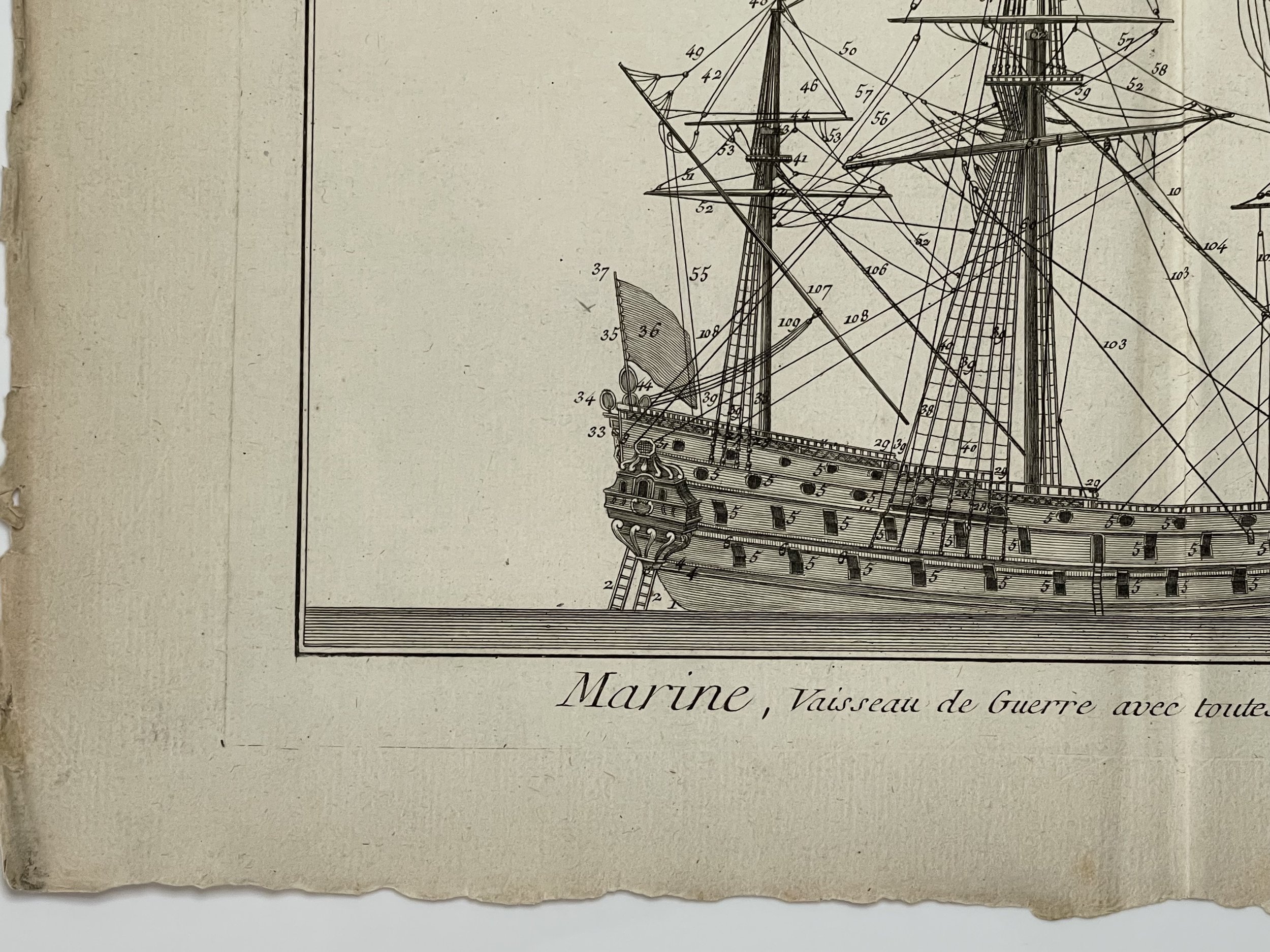
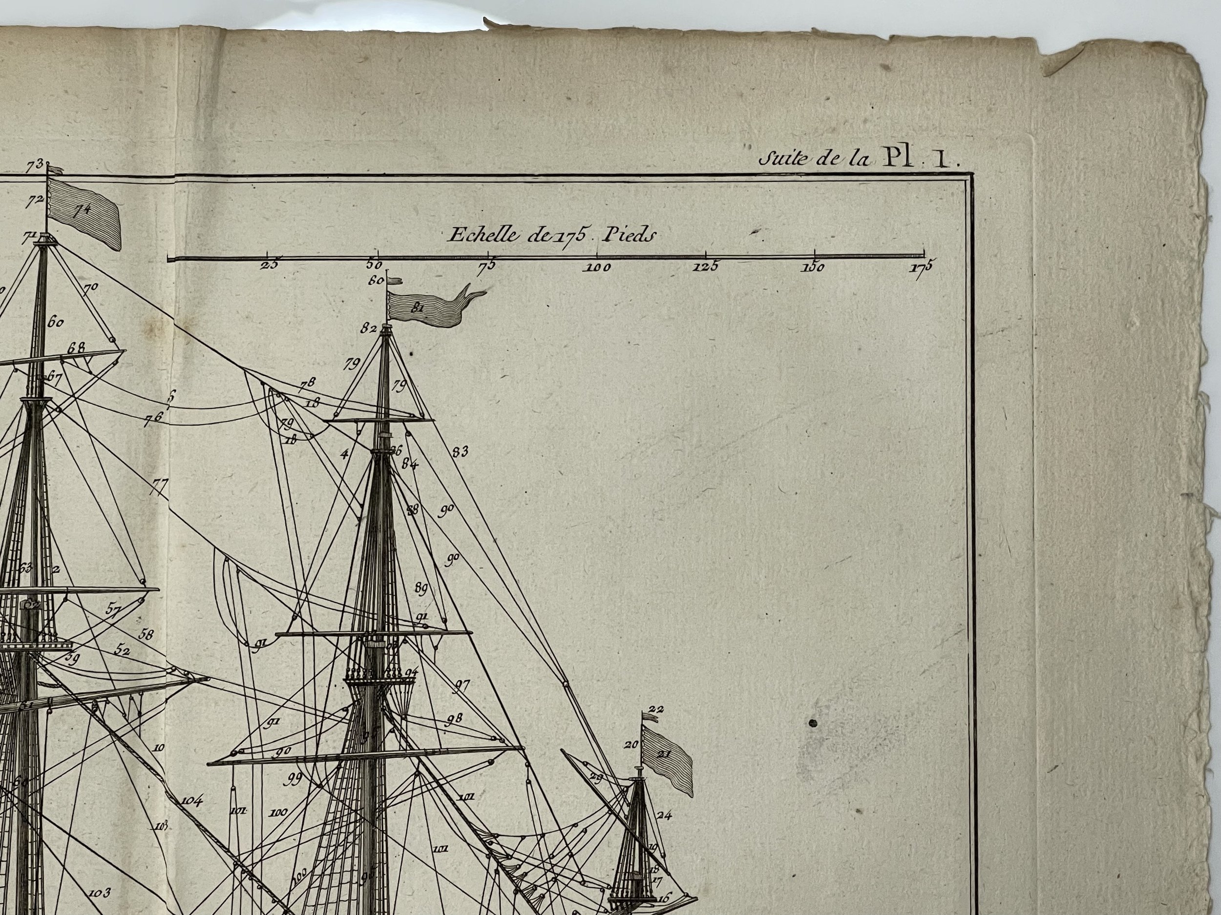
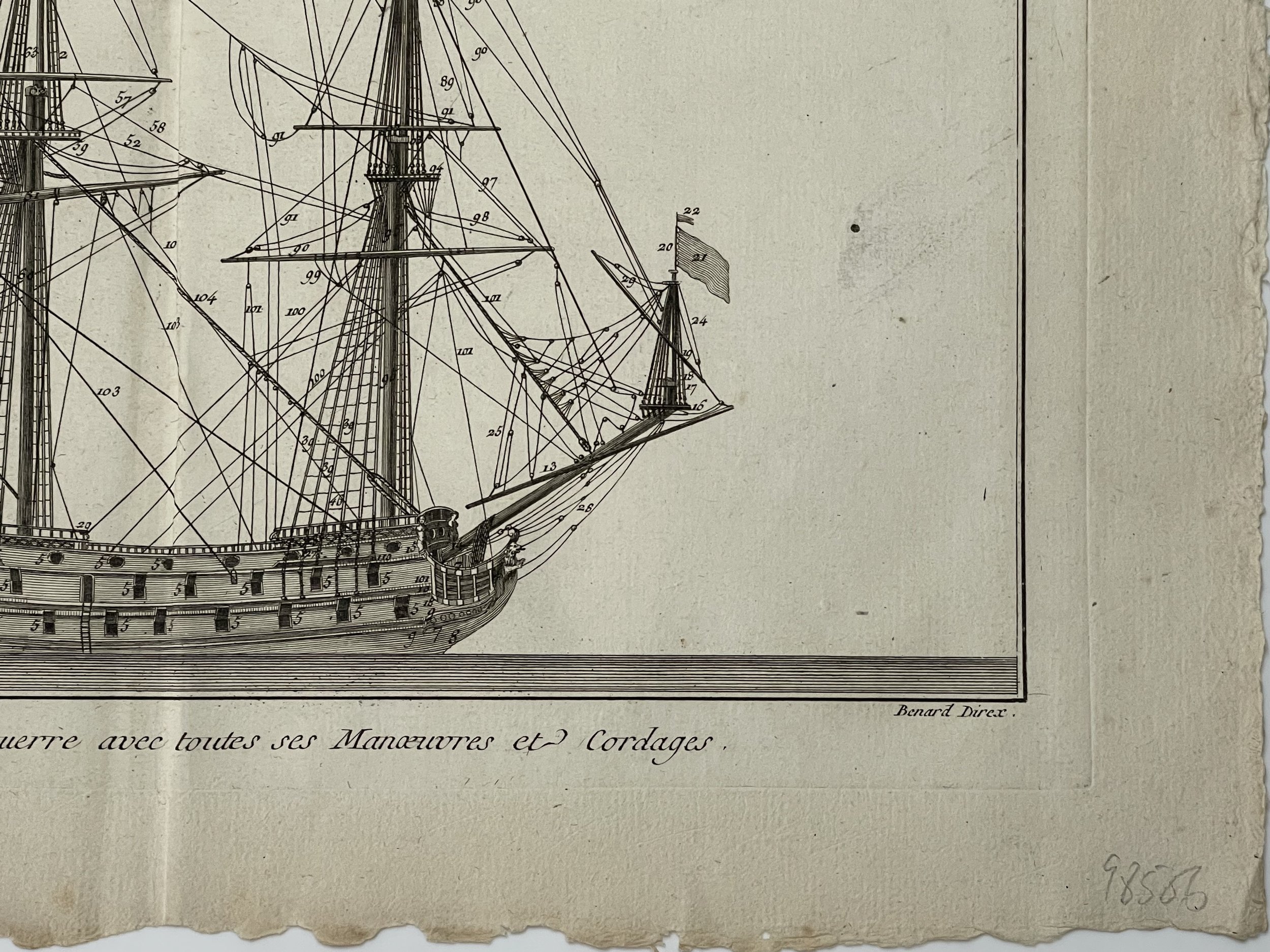
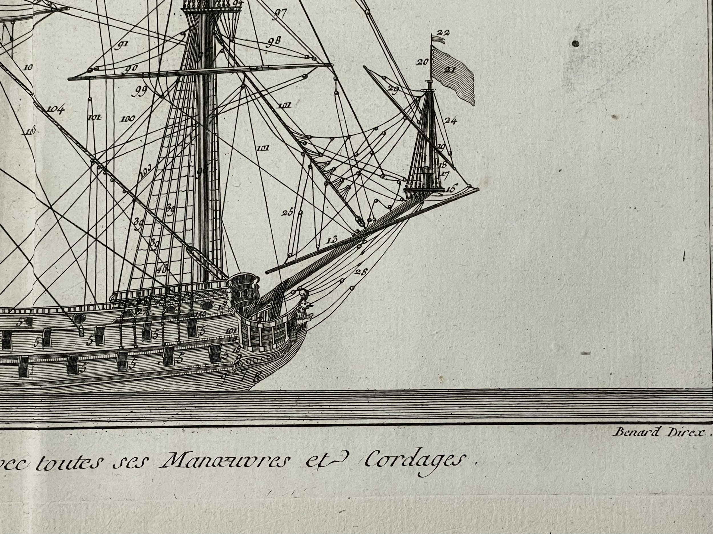
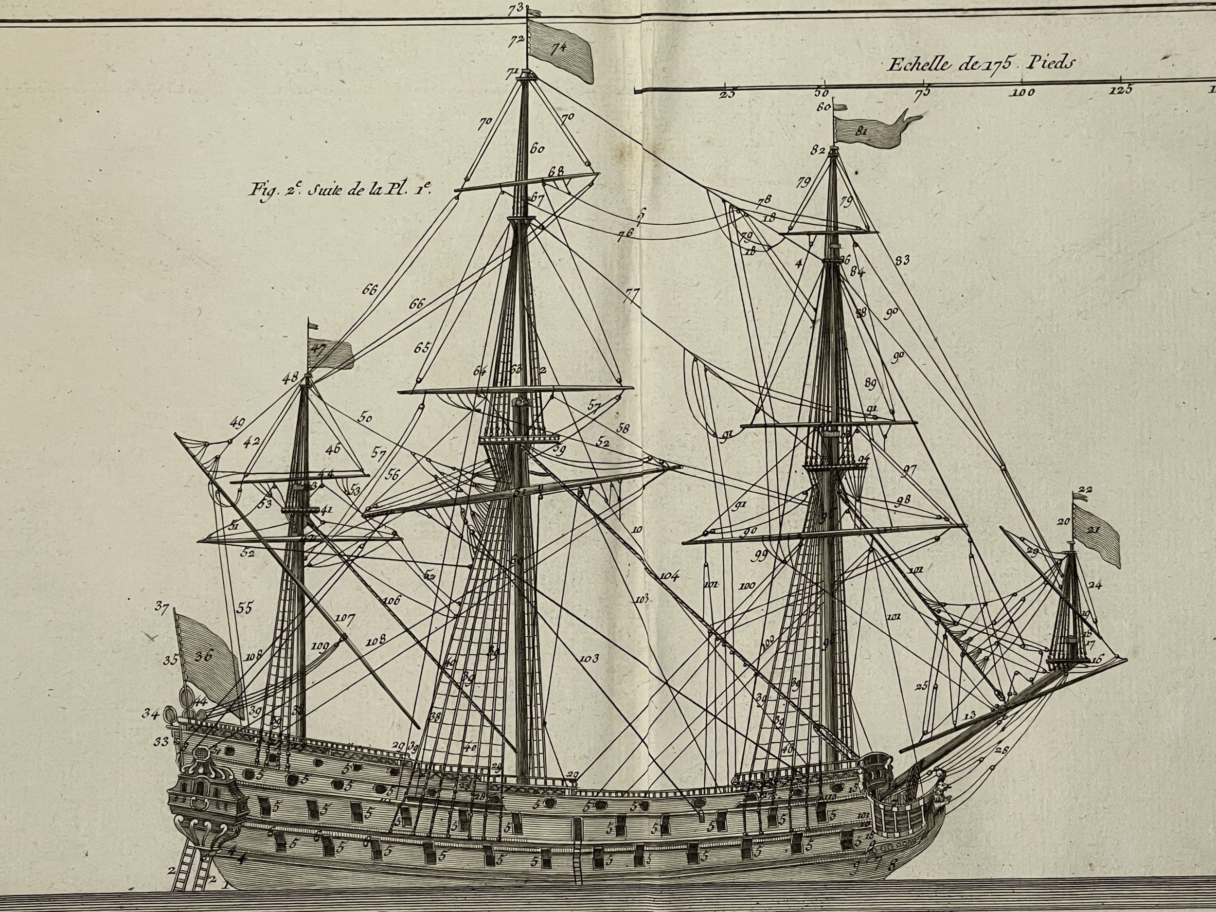
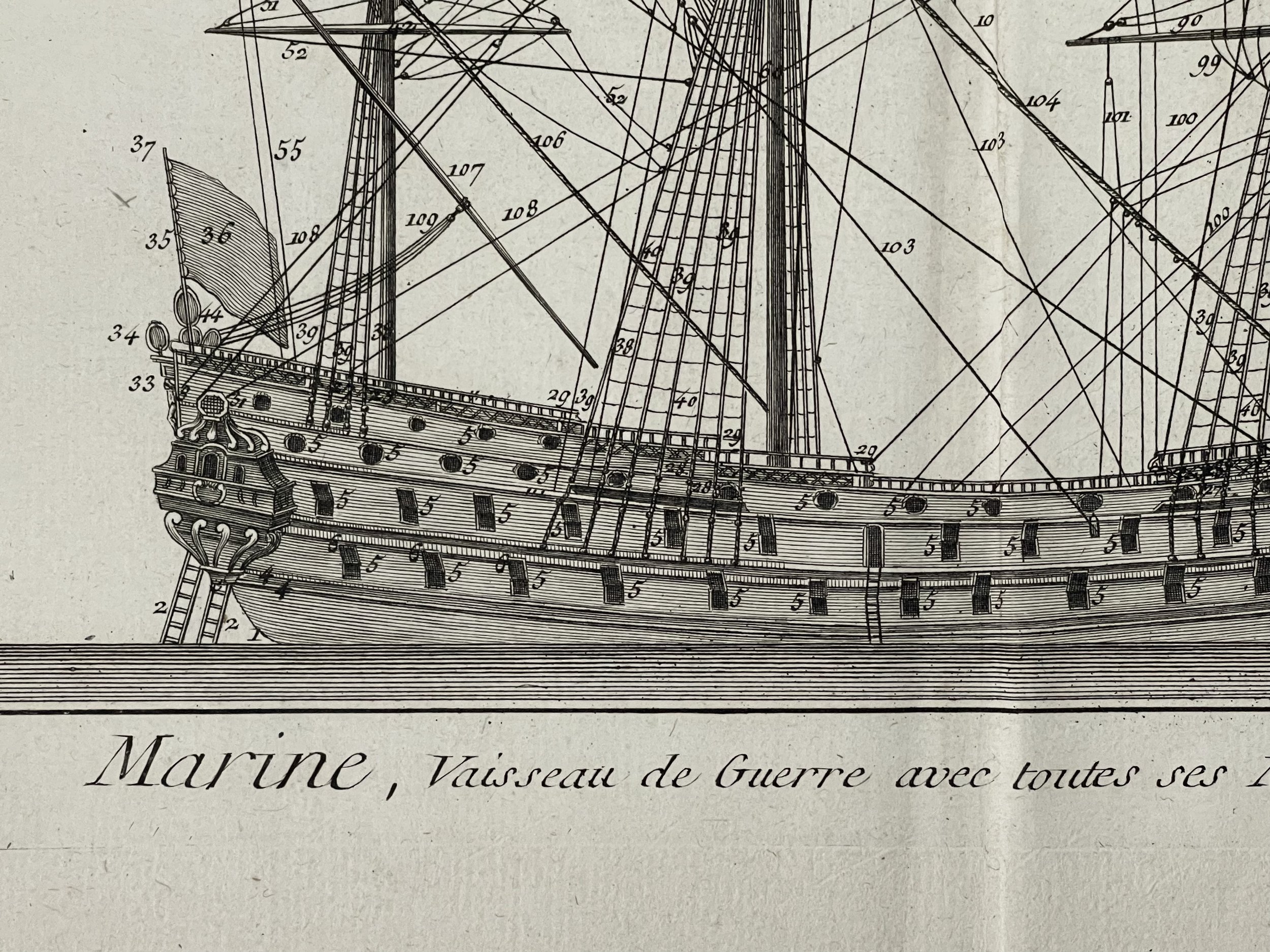
French Warship - Denis Diderot / Jacques-Nicolas Bellin / Jacques Renaud Benard - 1770
An earlier edition of Marine Plate 1 French Warship by - Denis Diderot / Jacques-Nicolas Bellin / Jacques Renaud Benard - 1770.
Medium: Etching/engraving on a verge type hand laid paper with watermark, not visible on every sheet. This plate is engraved by Robert Benard. Condition: Excellent with mild foxing. Pricing and grading commensurate.
This old antique print originates from: 'Encyclopedie ou Dictionnaire raisonne des sciences, des arts et des metiers, par une Societe de Gens de lettres.' which was published under the direction of Diderot and d'Alembert, with 17 volumes of text and 11 volumes of plates between 1751 and 1772. In 1776-1777, Charles-Joseph Panckoucke and Jean-Baptiste-René Robinet published a Supplement in 4 volumes of texts and 1 of plates.
Galleys had previously seen their hey-day on the Mediterranean, having predominated since Roman times until the 16th century. They were replaced by sailing vessels which could carry larger complements of guns in open waters.
The engraving appeared in Diderot's monumental Encyclopedie. The engraving is based on an earlier depiction by Nicholas Bellin, the primary cartographer for the French Navy.
This encyclopaedia was a massive reference work for the arts and sciences, as well to propagate the ideas of the French Enlightment. The impact of this encyclopaedia was enormous.
Direction and Engravers: Denis Diderot (1713-1784) was a French philosopher, art critic and writer. Jean le Rond d'Alembert (1717-1783) was a French mathematician, mechanician, physicist and philosopher. These plates are drawn by M. Belin (naval engineer) and engraved by Robert Benard .
Robert Bénard (1734 in Paris – 1794) was a French engraver.
Specialised in the technique of engraving, Robert Bénard is mainly famous for having supplied a significant number of plates (at least 1,800) to the Encyclopédie by Diderot & d'Alembert from 1751.Later, publisher Charles-Joseph Panckoucke reused many of his productions to illustrate the works of his catalog.
Biographical research established in 2019 that his real name was Jacques Renaud Benard, that he was born in 1731 at Rosny-sous-Bois, and that he died in Paris in 1794.
The signature "Benard fecit" on plates probably indicates the work of his own hand; the signatures "Benard Direx" and "Benard Direxit" indicate the work of the atelier of engravers he directed for many years. This plate indicates that Bernard produced this engraving himself.
Publishers and Printer : Briasson, rue Saint Jacques, a la Science- Paris, Le Breton -Premier Imprimeur du Roy, rue de la Harpe- Paris.
This encyclopdia was a massive reference work for the arts and sciences, as well to propagate the ideas of the French Enlightenment. The impact of this encyclopaedia was enormous.
Direction and Engravers: Denis Diderot (1713-1784) was a French philosopher, art critic and writer. Jean le Rond d'Alembert (1717-1783) was a French mathematician, mechanician, physicist and philosopher. These plates are drawn by M. Belin (naval engineer) and engraved by Robert Benard .
Jacques-Nicolas Bellin (1703-1772) was among the most important mapmakers of the eighteenth century. In 1721, at only the age of 18, he was appointed Hydrographer to the French Navy. In August 1741, he became the first Ingénieur de la Marine of the Dépôt des cartes et plans de la Marine (the French Hydrographic Office) and was named Official Hydrographer of the French King.
During his term as Official Hydrographer, the Dépôt was the one of the most active centers to produce sea charts and maps in Europe. Their output included a folio-format sea atlas of France, the Neptune Francois. He also produced a number of sea atlases of the world, including the Atlas Maritime and the Hydrographie Francaise. These gained fame and distinction all over Europe and were republished throughout the eighteenth and even in the nineteenth century.
Bellin also produced smaller format maps such as the 1764 Petit Atlas Maritime, containing 580 finely-detailed charts. He also contributed a number of maps for the 15-volume Histoire Generale des Voyages of Antoine François Prévost.
Bellin set a very high standard of workmanship and accuracy, cementing France's leading role in European cartography and geography during this period. Many of his maps were copied by other mapmakers across the continent.
Code : A397
Cartographer : Cartographer / Engraver / Publisher: Charles - Denis Diderot / Jacques-Nicolas Bellin / Jacques Renaud Benard
Date : Publication Place / Date - Circa 1770
Size : Sheet size: Image Size: 41.5 x 27 cm
Availability : Available
Type - Genuine - Antique
Grading A
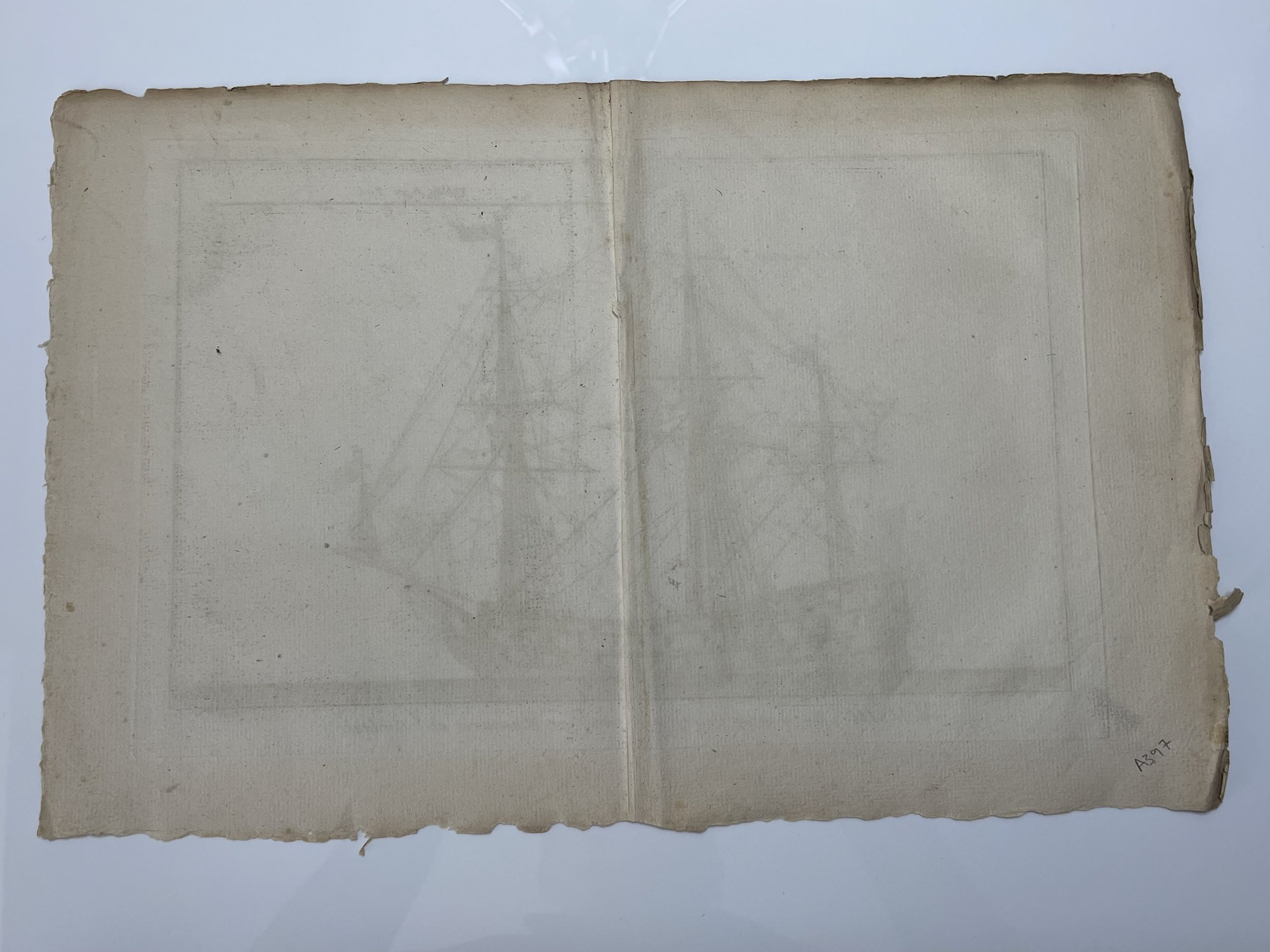
Where Applicable - Folds as issued. Light box photo shows the folio leaf centre margin hinge ‘glue’, this is not visible otherwise.
Tracked postage, in casement. Please contact me for postal quotation outside of the UK.