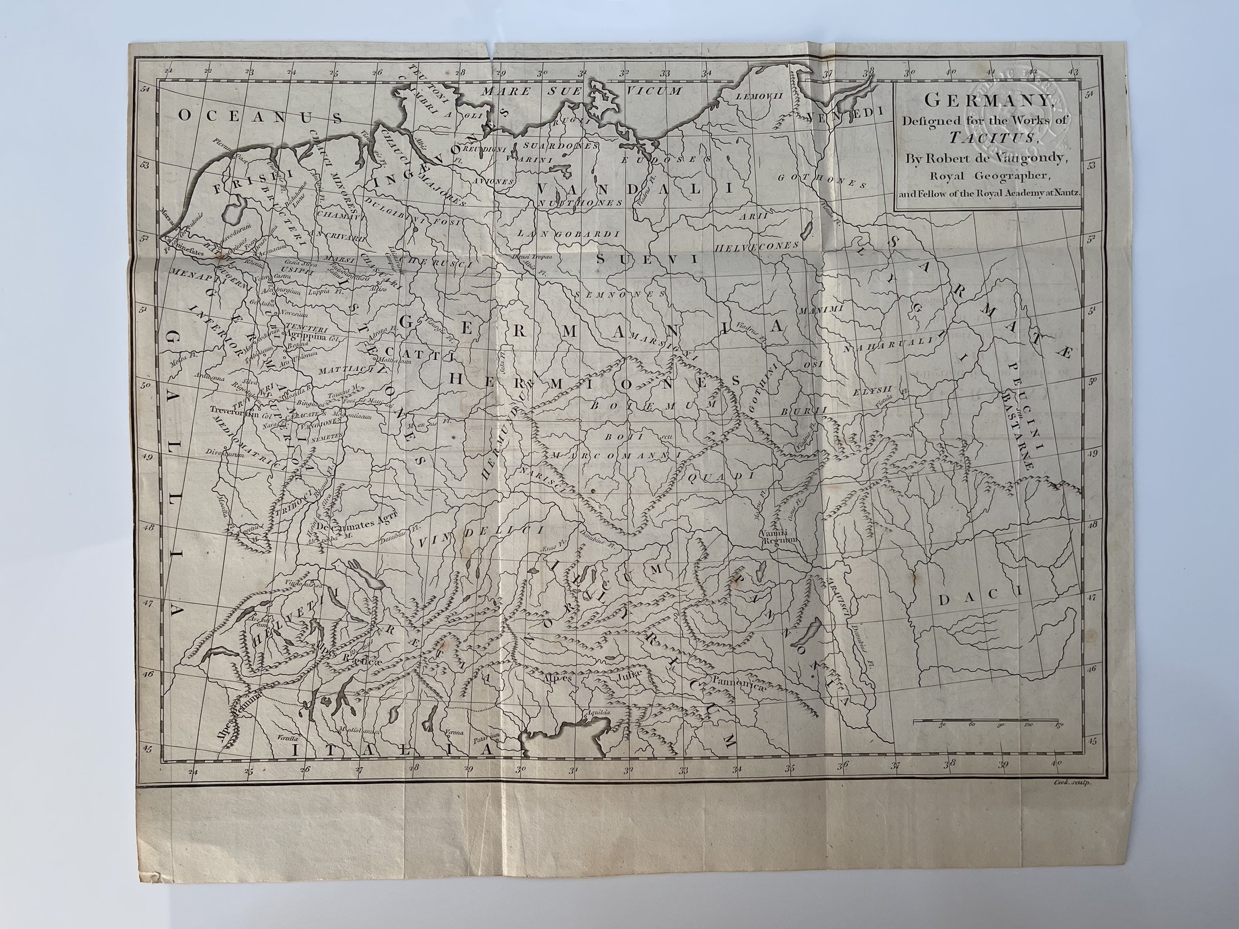
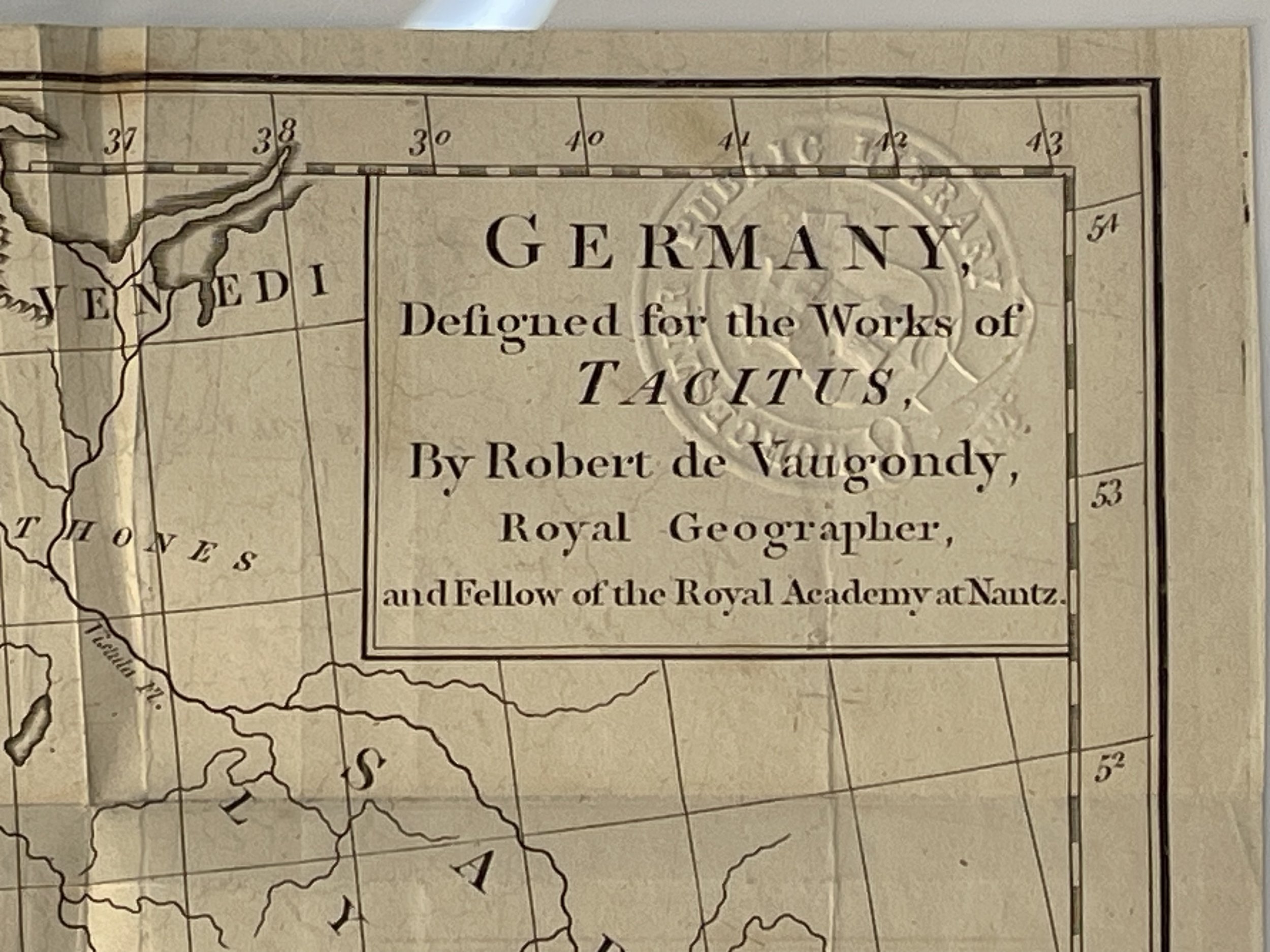

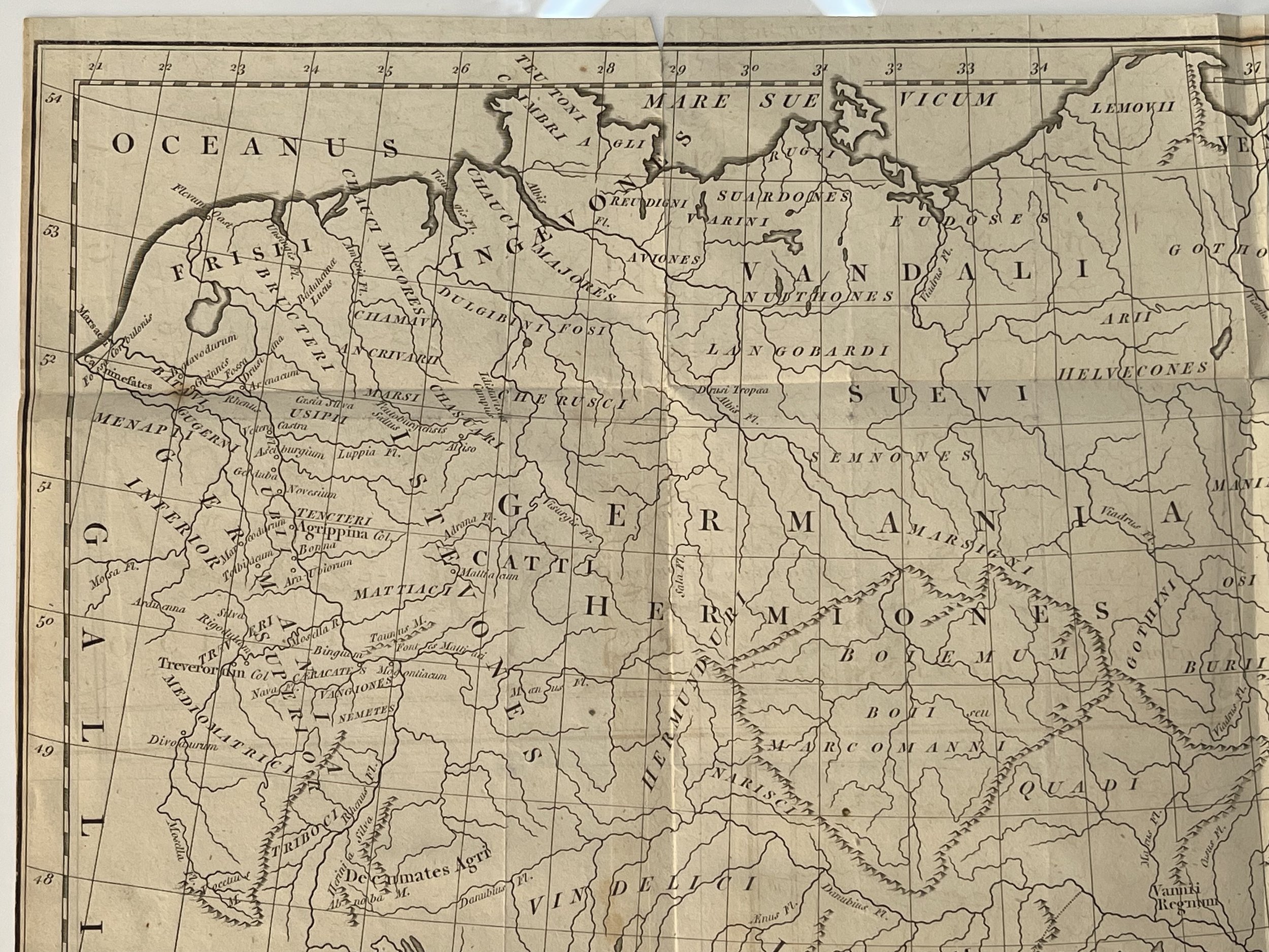
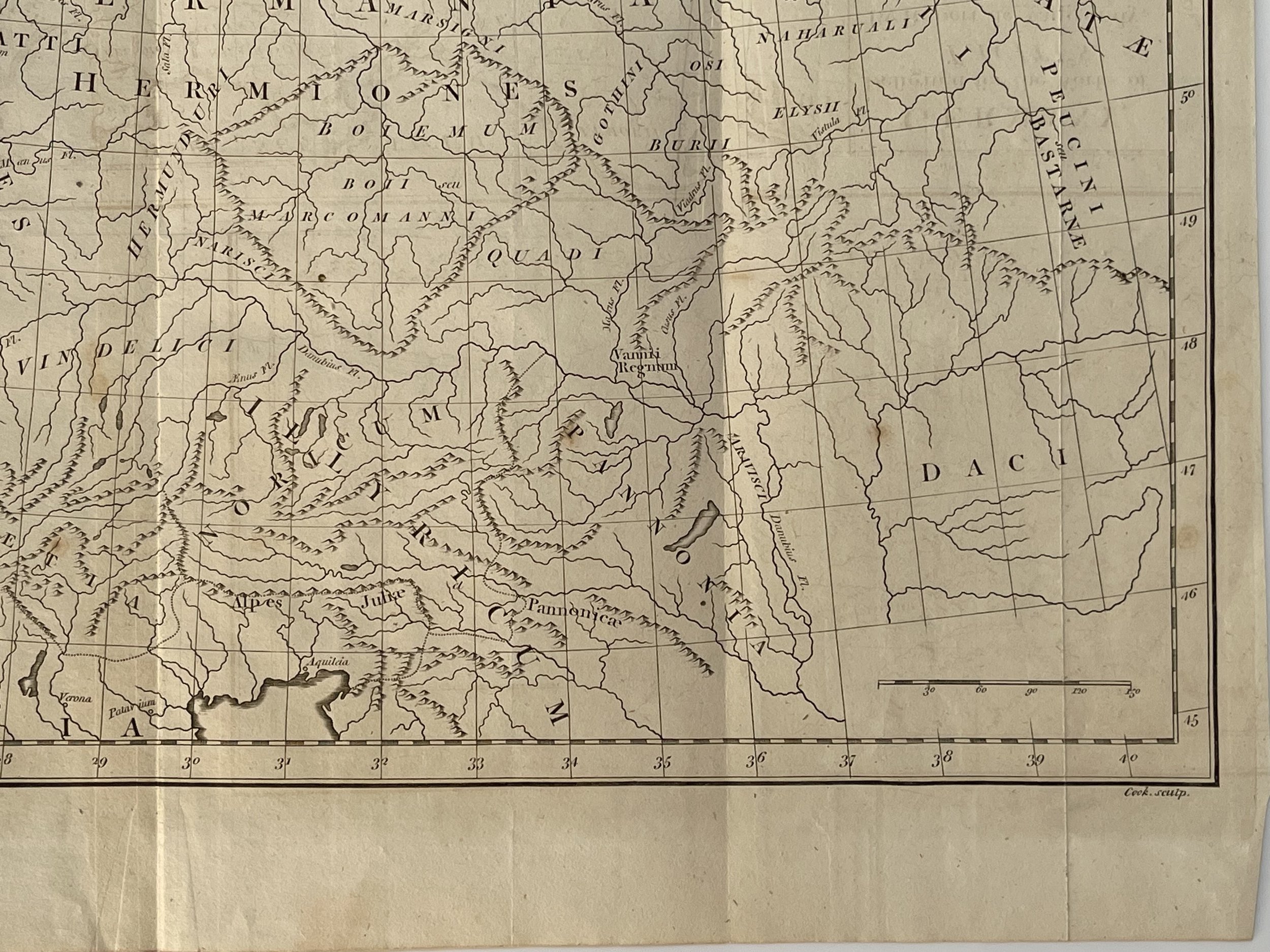
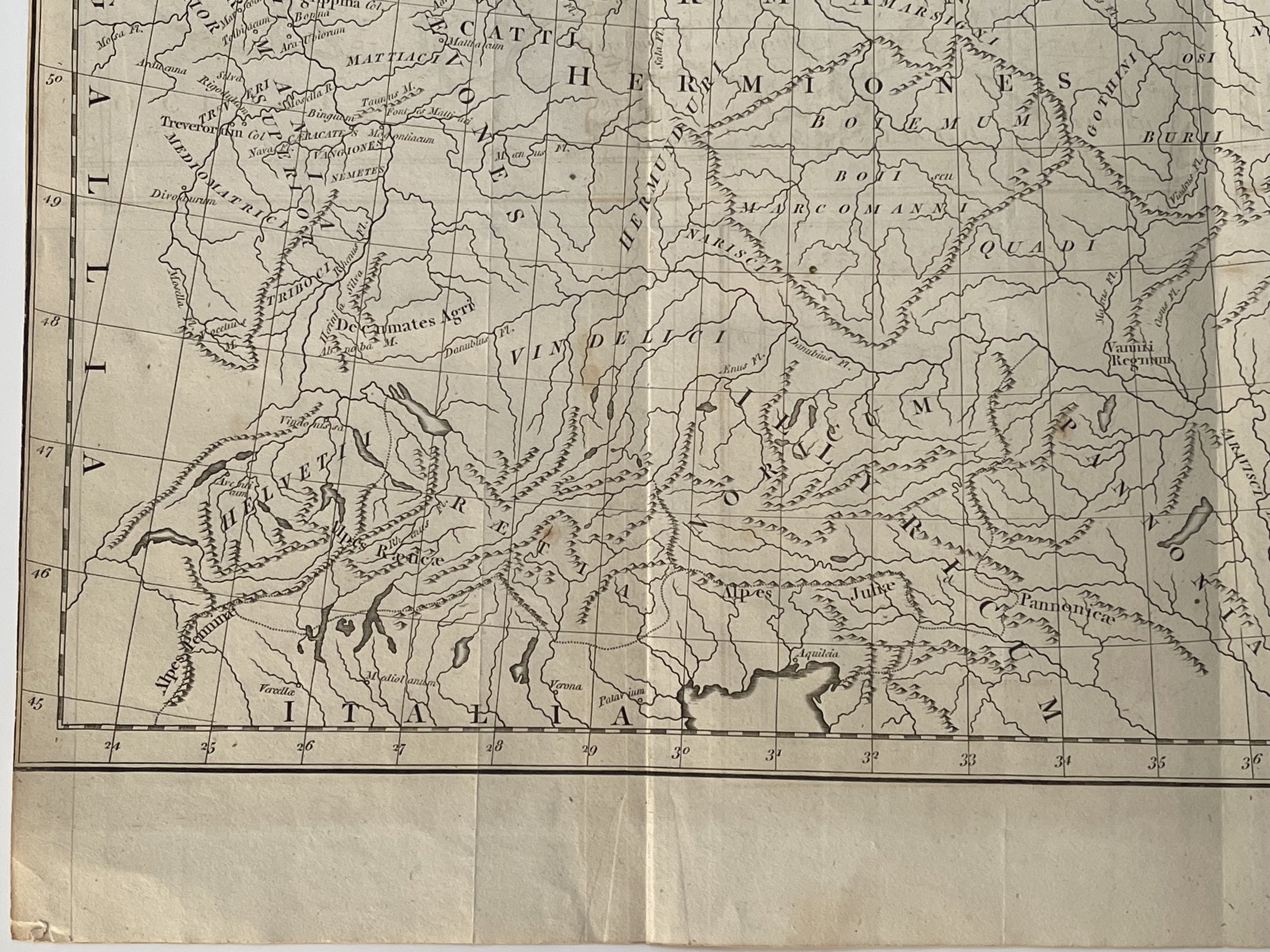
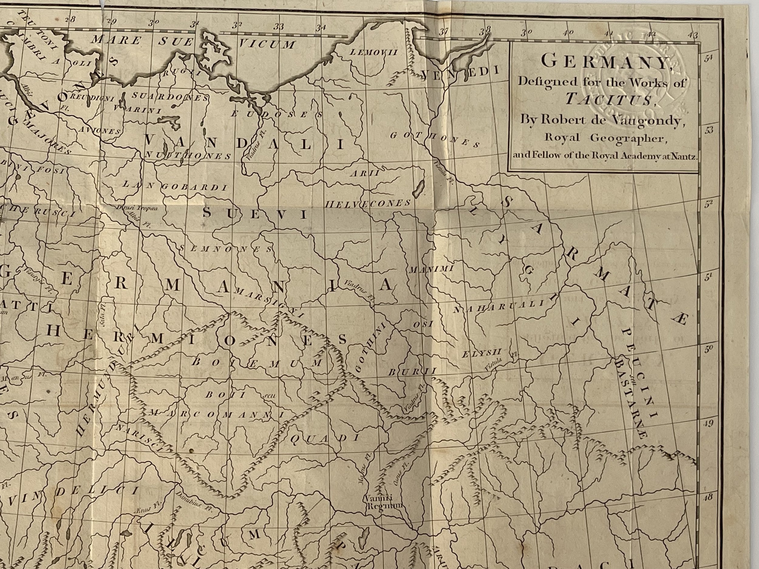
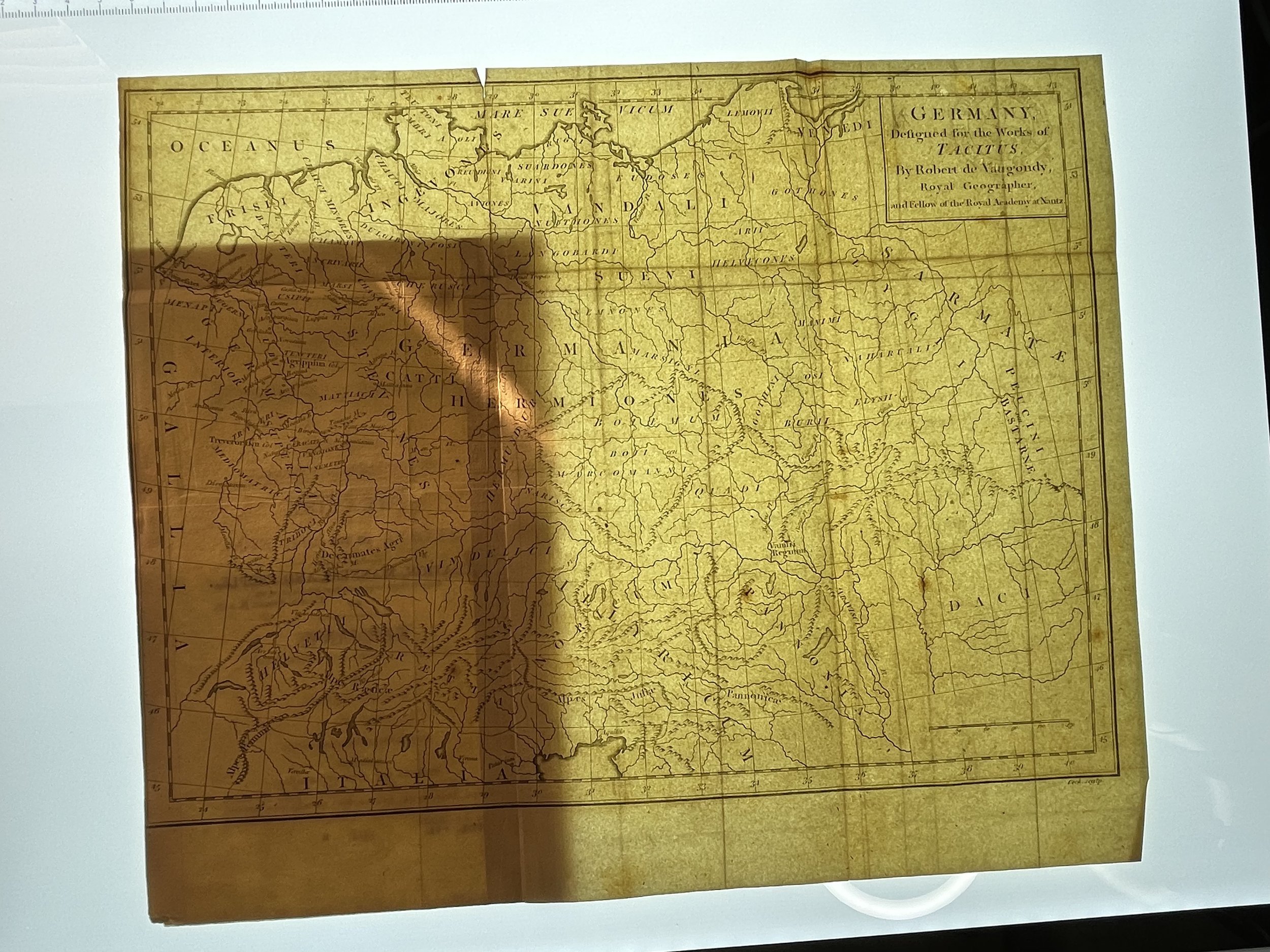
Germany - Didier Robert de Vaugondy / Thomas Cook - Pre - 1811
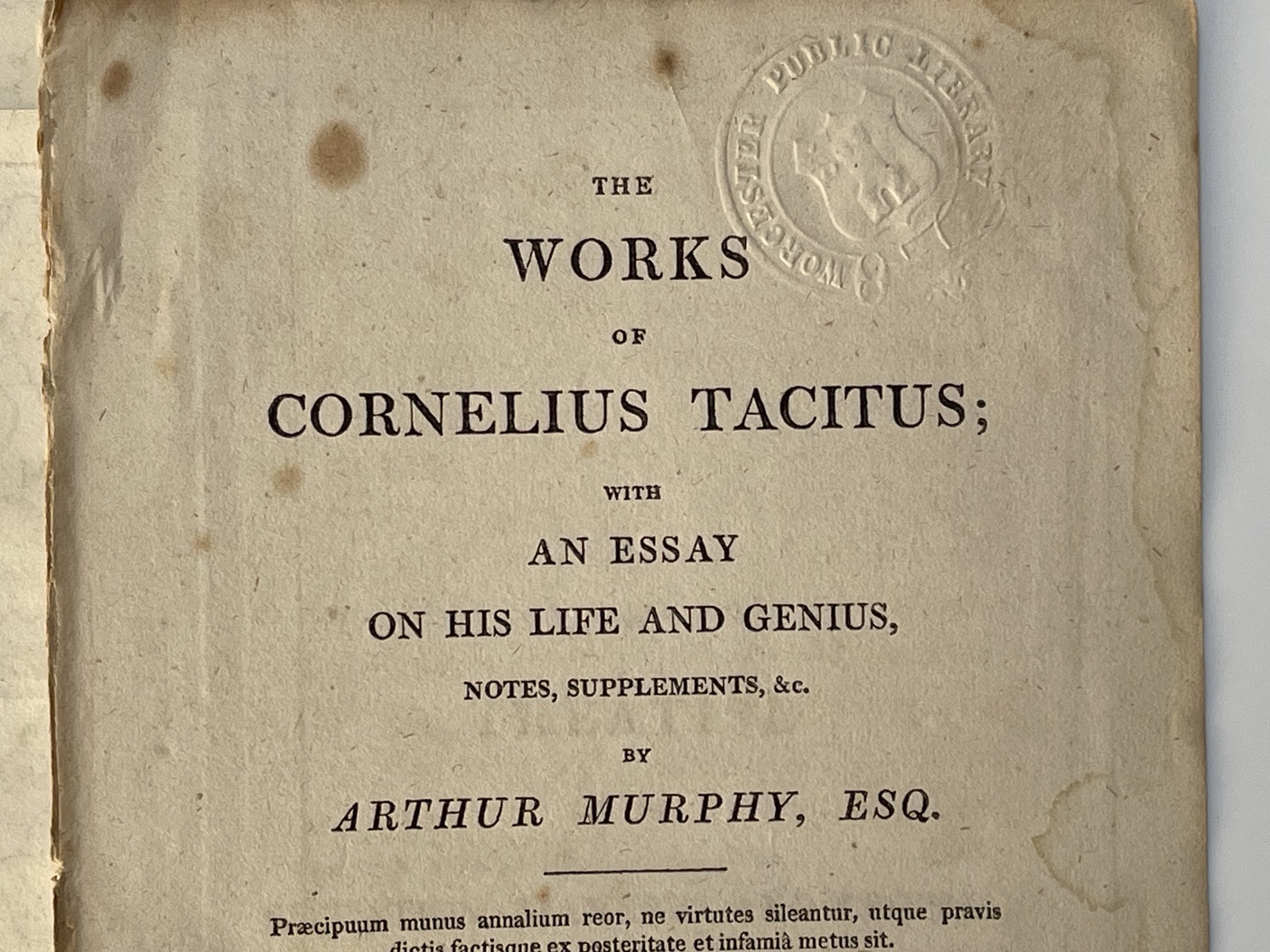
Map of Germany by Didier Robert De Vaugondy from The Works of Cornelius Tacitus. a New Edition, with the Author's Last Corrections. In Eight Volumes Hardcover - 1811 by Cornelius Tacitus; with an Essay on His Life and Genius, Notes, Supplements, &c. by Arthur Murphy , Esq. The maps were quite possibly engraved before 1811 then added to the folio.
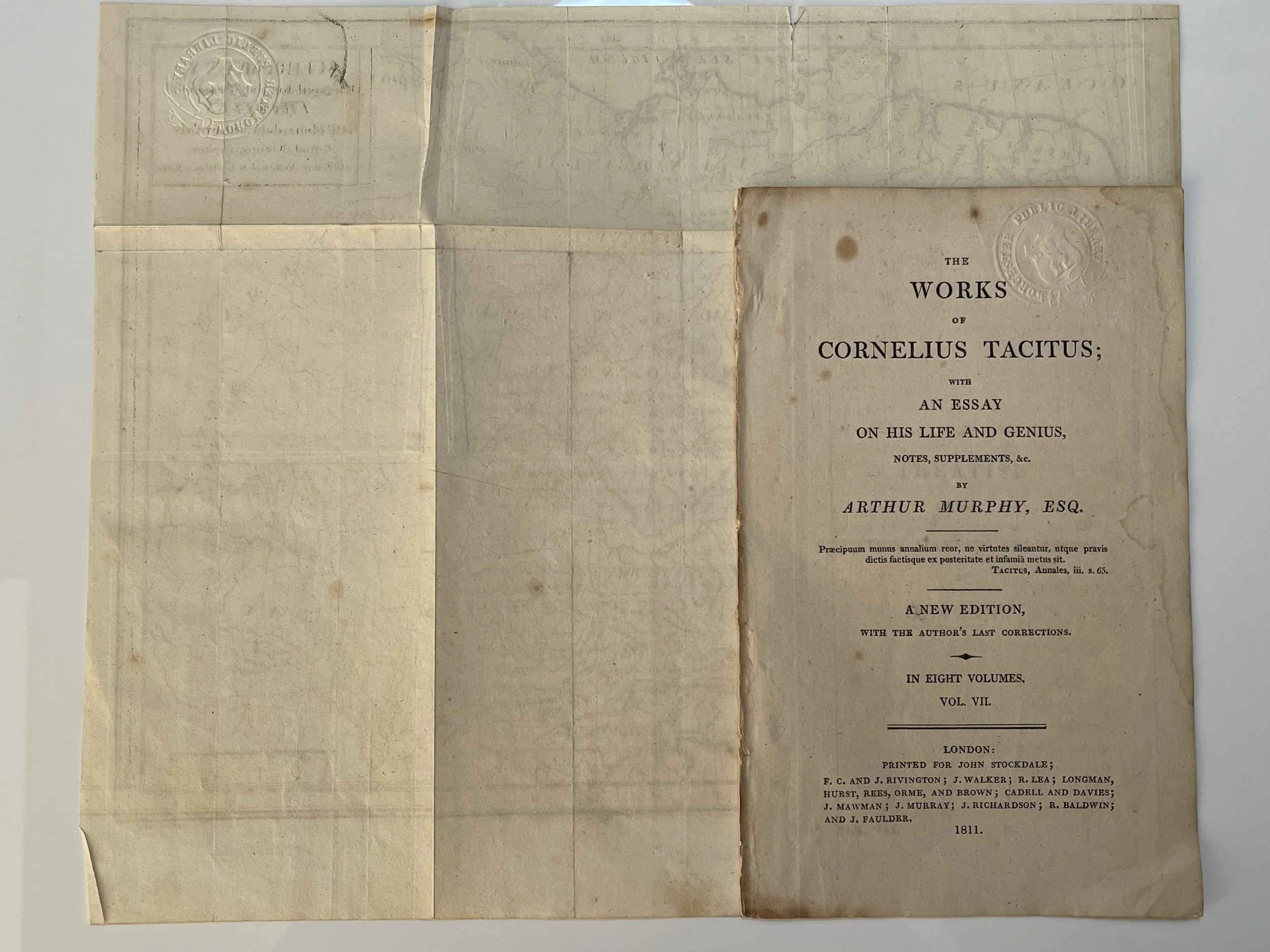
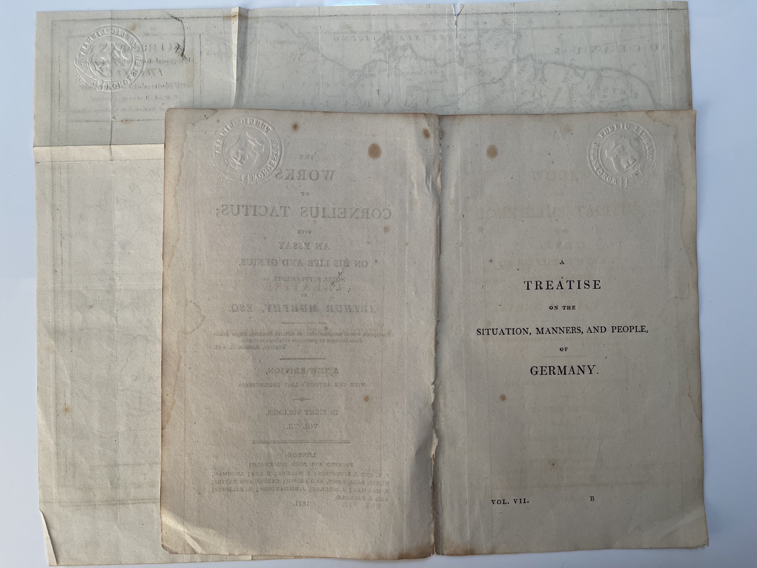
This map and accompanying adjoined pages (See Photos) is from volume VII, of an 8-volume edition that included four, fold out maps. The four maps are Plan of Jerusalem, map of Italy. Vol. 1; Asia, Vol. 2; Ancient World, Vol. 5; Plan of Jerusalem, Vol. 6; Germany, Vol. 7. This map of Germany by Robert De Vaugondy is from Volume 7.
London: Printed for John Stockdale; F.C. & J. Rivington; J. Walker; et al. 1811. The first edition of Tacitus, was from 1793.
Gilles Robert de Vaugondy (1688–1766), also known as Le Sieur or Monsieur Robert, and his son, Didier Robert de Vaugondy (c.1723–1786), were leading cartographers in France during the 18th century.
In 1757, Gilles and Didier Robert De Vaugondy published The Atlas Universel, one of the most important atlases of the 18th century. To produce the atlas, the Vaugondys integrated older sources with more modern surveyed maps. They verified and corrected the latitude and longitude of many regional maps in the atlas with astronomical observations. The older material was revised with the addition of many new place names. In 1760, Didier Robert de Vaugondy was appointed geographer to Louis XV.
Gilles and Didier Robert De Vaugondy produced their maps and terrestrial globes working together as father and son. Globes of a variety of sizes were made by gluing copperplate-printed gores on a plaster-finished papier-mache core, a complicated and expensive manufacturing process, employing several specialists. In some cases, it is uncertain whether Gilles or Didier made a given map. Gilles often signed maps as "M.Robert", while Didier commonly signed his maps as "Robert de Vaugondy” or added "fils" or "filio" after his name.
The Robert de Vaugondys was descended from the Nicolas Sanson family through Sanson's grandson, Pierre Moulard-Sanson. From him, they inherited much of Sanson's cartographic material, which they combined with maps and plates acquired after Hubert Jaillot's death in 1712 to form the basis the Atlas Universel. Sources from the Dépôt de la Marine, the official French repository for maritime-related information, were used for their maps of Canada and South America.
Like Ortelius and Mercator, the Vaugondy's credited their sources, which has greatly benefited the study of the history of cartography during that period.
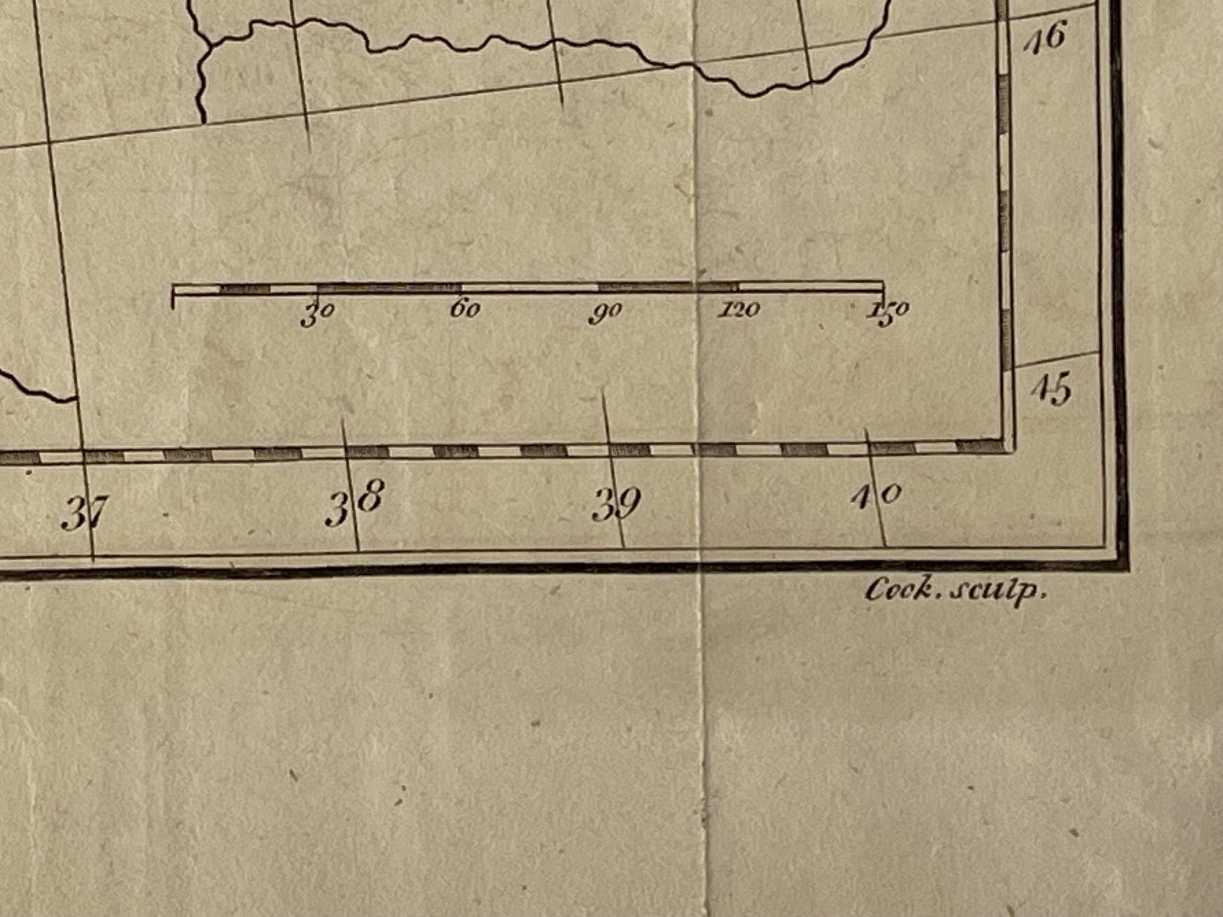
Thomas Cook (c. 1744 – 1818) was an English engraver, known particularly for his engravings of the works of William Hogarth.
Cook was a pupil of Simon François Ravenet, who at the time was resident in London. Cook was very industrious, and, soon reaching a high position in his art, was employed by John Boydell and other art publishers on works which had a large circulation. He is best known from having copied the complete engraved work of William Hogarth, to which he devoted the years 1795 to 1803, and which was published in 1806 under the title of Hogarth Restored. This is a very valuable collection, as many of Hogarth's prints were of great rarity, and had not been made public before. He executed a reduced set of his Hogarth engravings for Nichol and Stevens's Genuine Works of William Hogarth (1808–1817).
Cook was employed also in engraving history, architecture, and plates for magazines. Among his works are Jupiter and Semele and Jupiter and Europa, after Benjamin West; The English Setter, after John Milton, engraved with S. Smith in 1770 as a pendant to The Spanish Pointer, by William Woollett; The Wandering Musicians, a copy of Johann Georg Wille's engraving, after Christian Wilhelm Ernst Dietrich; St Cecilia, after Richard Westall, and several views after Paul Sandby for The Copperplate Magazine.
He also engraved many portraits, for The Gentleman's Magazine and others, and as frontispieces. Among these were Thomas Howard, Earl of Arundel, George Washington, Samuel Johnson, Oliver Goldsmith, Charles Churchill, John Cunningham, William Harvey, David Hume and Joseph Spence. Cook died in London in 1818, aged 74.
The rare folio engraving with accompanying folio frontispiece pages, is in excellent condition with a Worcester Public Library embossed stamp present. Pricing and grading commensurate.
Map of Germany by Didier Robert De Vaugondy from The Works of Cornelius Tacitus. a New Edition, with the Author's Last Corrections. In Eight Volumes Hardcover - 1811 by Cornelius Tacitus; with an Essay on His Life and Genius, Notes, Supplements, &c. by Arthur Murphy , Esq. The maps were quite possibly engraved before 1811 then added to the folio.
This map and accompanying adjoined pages (See Photos) is from volume VII, of an 8-volume edition that included four, fold out maps. The four maps are Plan of Jerusalem, map of Italy. Vol. 1; Asia, Vol. 2; Ancient World, Vol. 5; Plan of Jerusalem, Vol. 6; Germany, Vol. 7. This map of Germany by Robert De Vaugondy is from Volume 7.
London: Printed for John Stockdale; F.C. & J. Rivington; J. Walker; et al. 1811. The first edition of Tacitus, was from 1793.
Gilles Robert de Vaugondy (1688–1766), also known as Le Sieur or Monsieur Robert, and his son, Didier Robert de Vaugondy (c.1723–1786), were leading cartographers in France during the 18th century.
In 1757, Gilles and Didier Robert De Vaugondy published The Atlas Universel, one of the most important atlases of the 18th century. To produce the atlas, the Vaugondys integrated older sources with more modern surveyed maps. They verified and corrected the latitude and longitude of many regional maps in the atlas with astronomical observations. The older material was revised with the addition of many new place names. In 1760, Didier Robert de Vaugondy was appointed geographer to Louis XV.
Gilles and Didier Robert De Vaugondy produced their maps and terrestrial globes working together as father and son. Globes of a variety of sizes were made by gluing copperplate-printed gores on a plaster-finished papier-mache core, a complicated and expensive manufacturing process, employing several specialists. In some cases, it is uncertain whether Gilles or Didier made a given map. Gilles often signed maps as "M.Robert", while Didier commonly signed his maps as "Robert de Vaugondy” or added "fils" or "filio" after his name.
The Robert de Vaugondys was descended from the Nicolas Sanson family through Sanson's grandson, Pierre Moulard-Sanson. From him, they inherited much of Sanson's cartographic material, which they combined with maps and plates acquired after Hubert Jaillot's death in 1712 to form the basis the Atlas Universel. Sources from the Dépôt de la Marine, the official French repository for maritime-related information, were used for their maps of Canada and South America.
Like Ortelius and Mercator, the Vaugondy's credited their sources, which has greatly benefited the study of the history of cartography during that period.
Thomas Cook (c. 1744 – 1818) was an English engraver, known particularly for his engravings of the works of William Hogarth.
Cook was a pupil of Simon François Ravenet, who at the time was resident in London. Cook was very industrious, and, soon reaching a high position in his art, was employed by John Boydell and other art publishers on works which had a large circulation. He is best known from having copied the complete engraved work of William Hogarth, to which he devoted the years 1795 to 1803, and which was published in 1806 under the title of Hogarth Restored. This is a very valuable collection, as many of Hogarth's prints were of great rarity, and had not been made public before. He executed a reduced set of his Hogarth engravings for Nichol and Stevens's Genuine Works of William Hogarth (1808–1817).
Cook was employed also in engraving history, architecture, and plates for magazines. Among his works are Jupiter and Semele and Jupiter and Europa, after Benjamin West; The English Setter, after John Milton, engraved with S. Smith in 1770 as a pendant to The Spanish Pointer, by William Woollett; The Wandering Musicians, a copy of Johann Georg Wille's engraving, after Christian Wilhelm Ernst Dietrich; St Cecilia, after Richard Westall, and several views after Paul Sandby for The Copperplate Magazine.
He also engraved many portraits, for The Gentleman's Magazine and others, and as frontispieces. Among these were Thomas Howard, Earl of Arundel, George Washington, Samuel Johnson, Oliver Goldsmith, Charles Churchill, John Cunningham, William Harvey, David Hume and Joseph Spence. Cook died in London in 1818, aged 74.
The rare folio engraving with accompanying folio frontispiece pages, is in excellent condition with a Worcester Public Library embossed stamp present. Pricing and grading commensurate.
Code : A1060
Cartographer : Cartographer / Engraver / Publisher: Didier Robert de Vaugondy
Date : Publication Place / Date - Before 1811
Size : Sheet size: 27 x 32 Cm
Availability : Available
Type - Genuine - Antique
Grading A
Where Applicable - Folds as issued. Light box photo shows the folio leaf centre margin hinge ‘glue’, this is not visible otherwise.
Tracked postage, in casement. Please contact me for postal quotation outside of the UK.