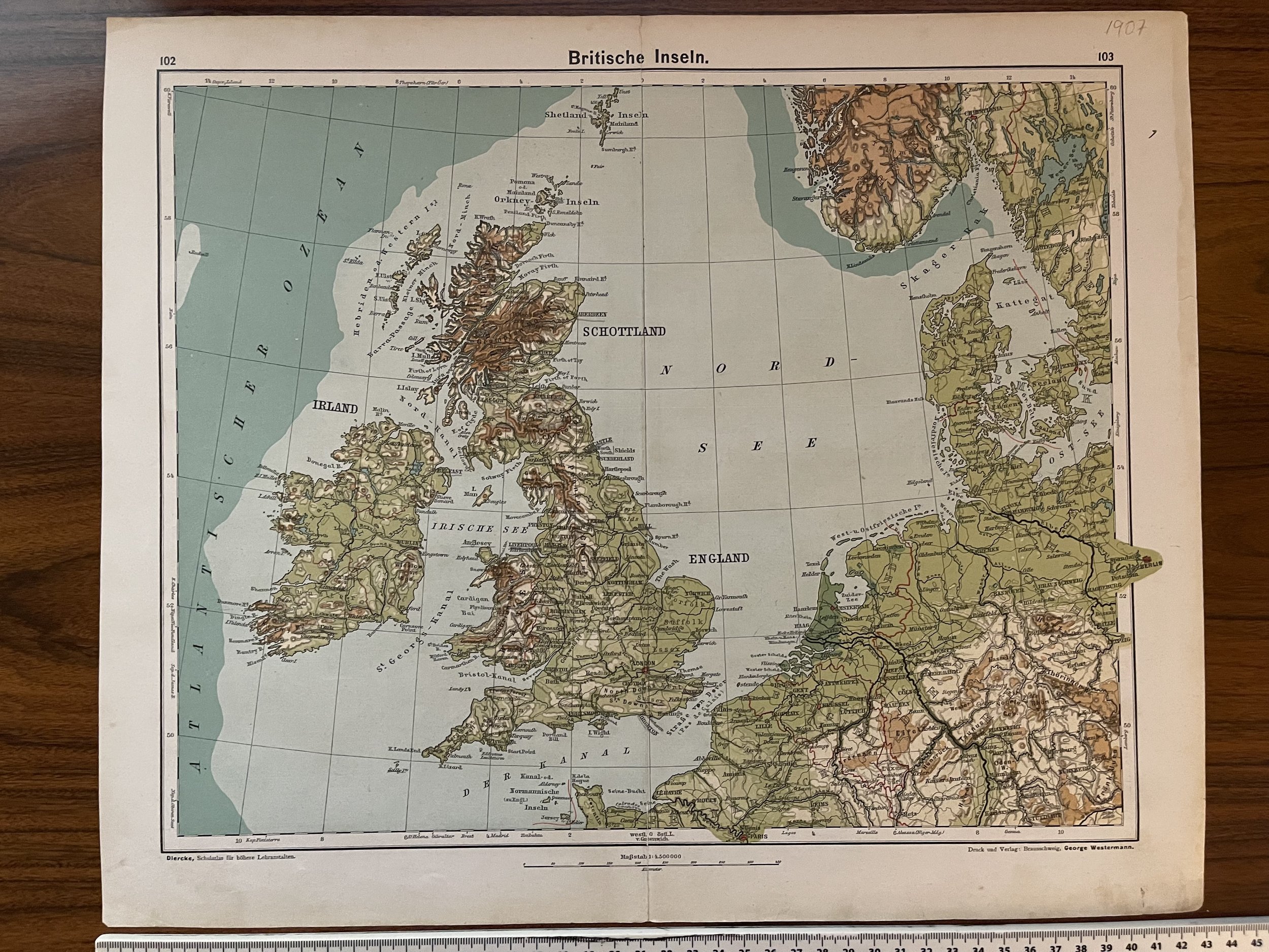
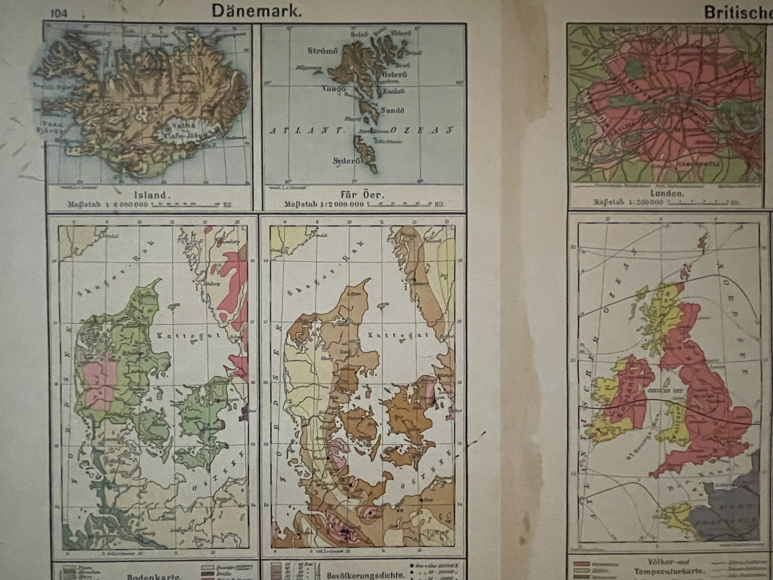
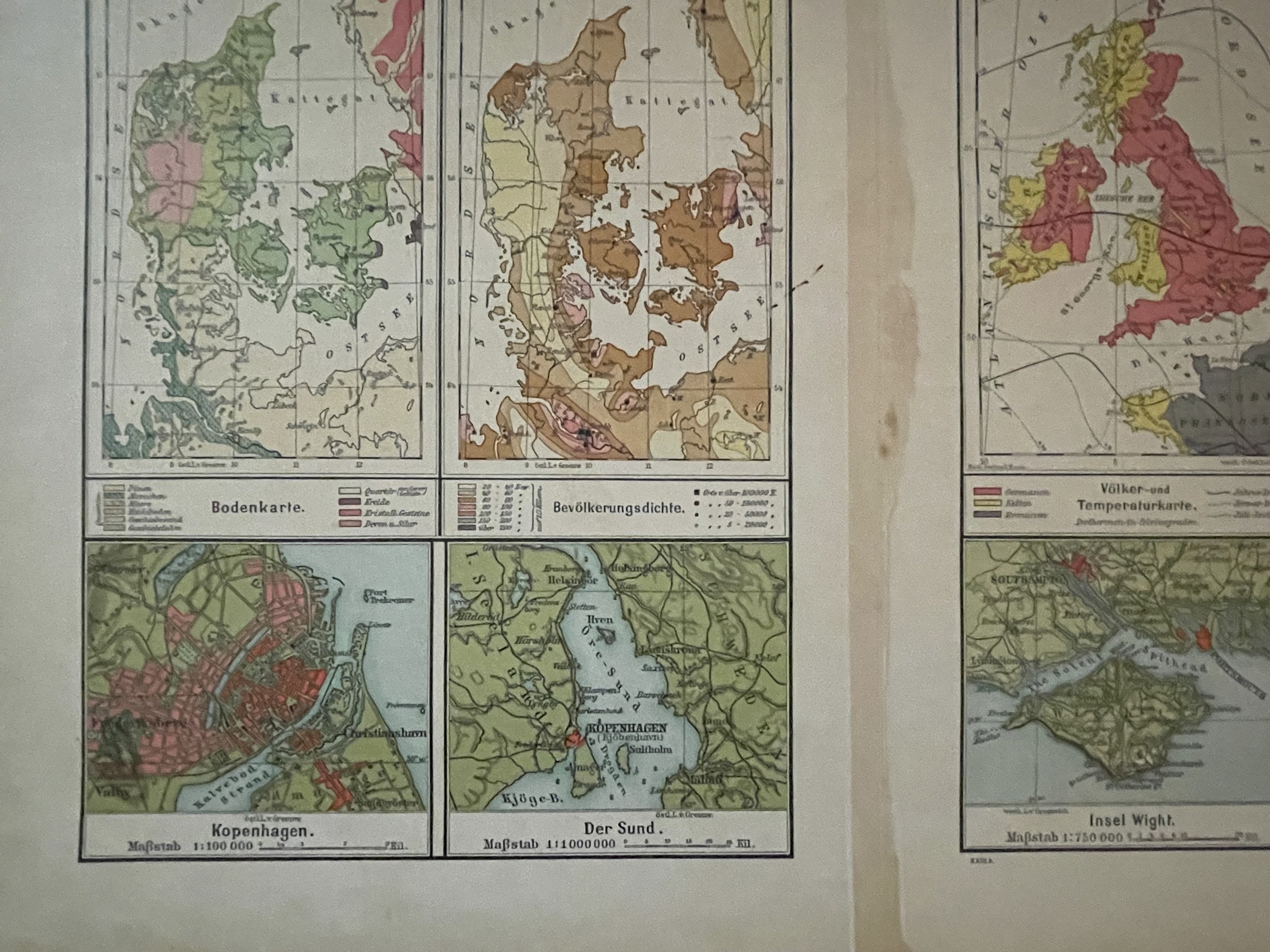
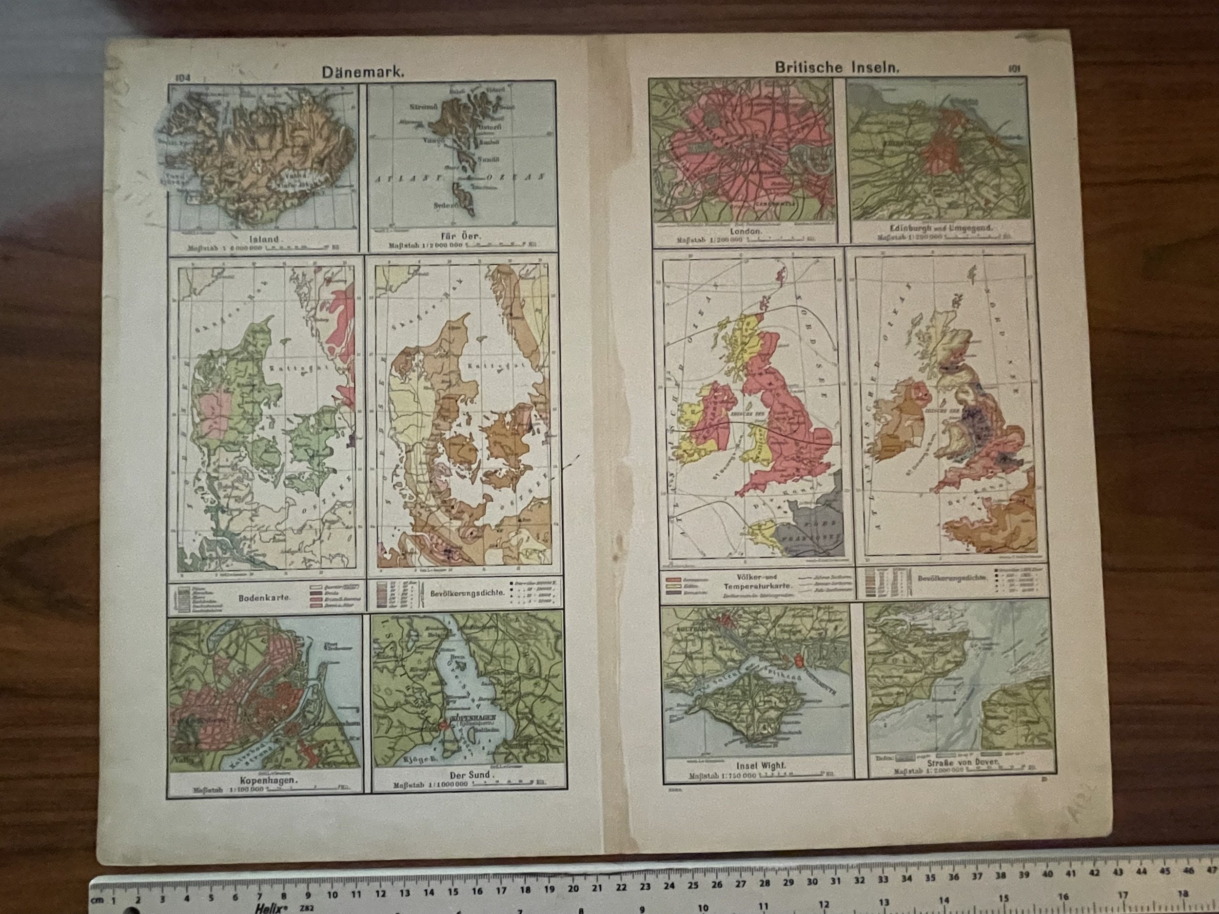
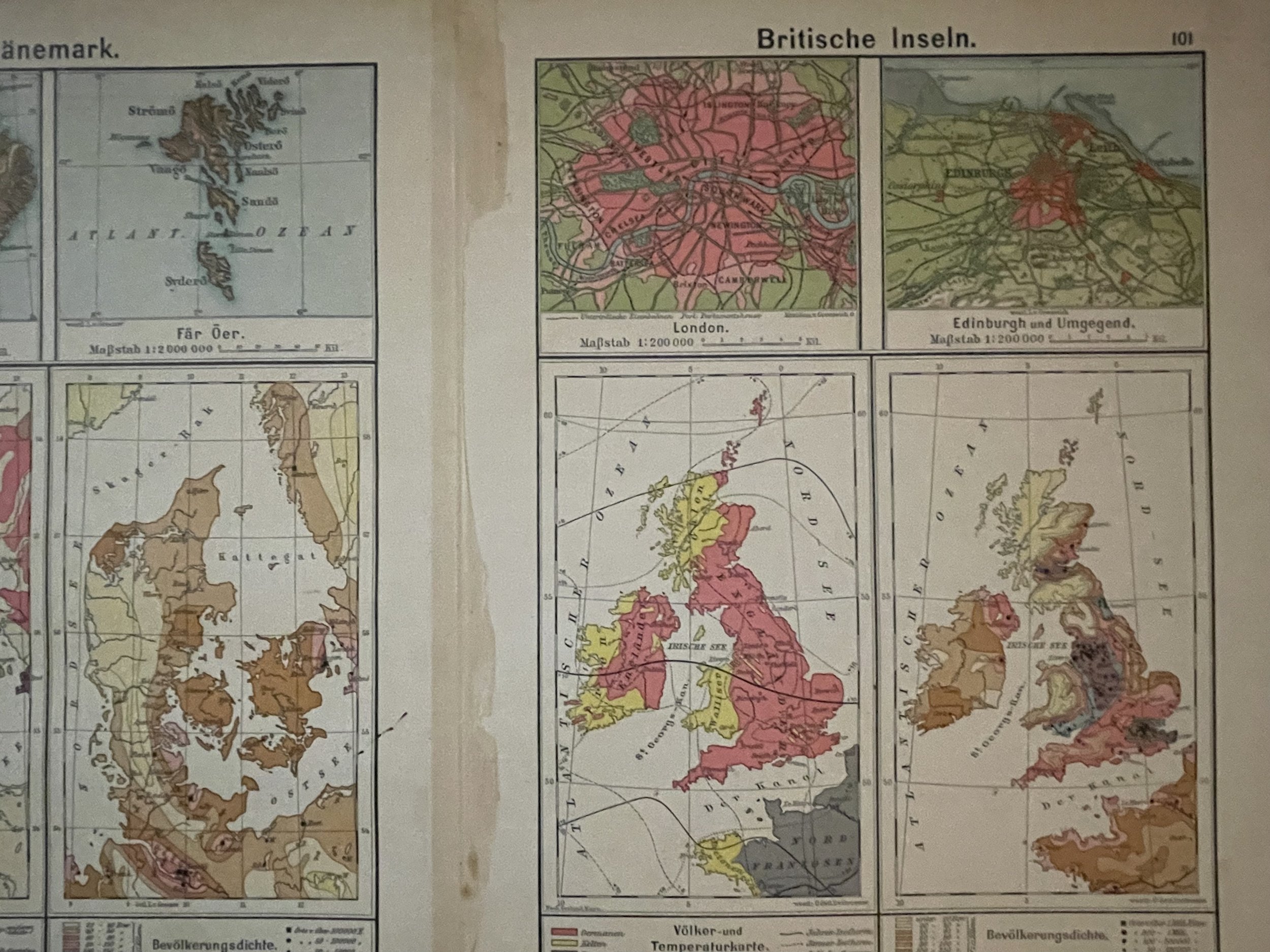
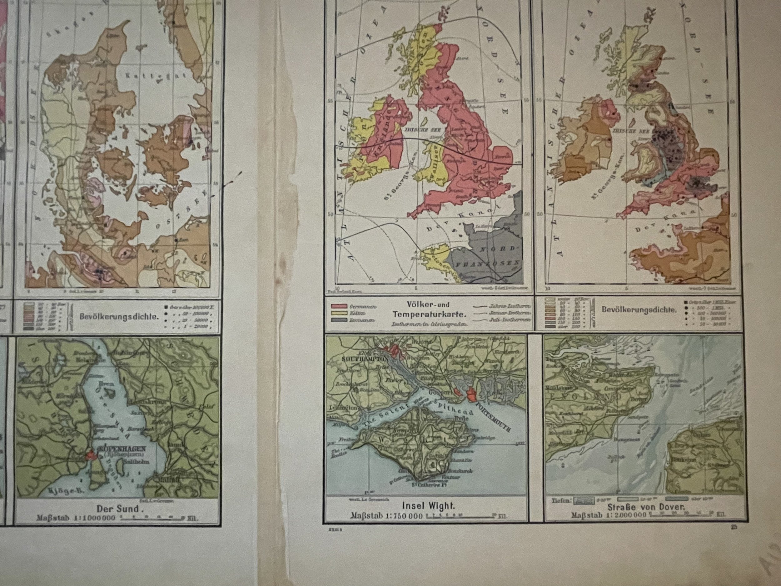
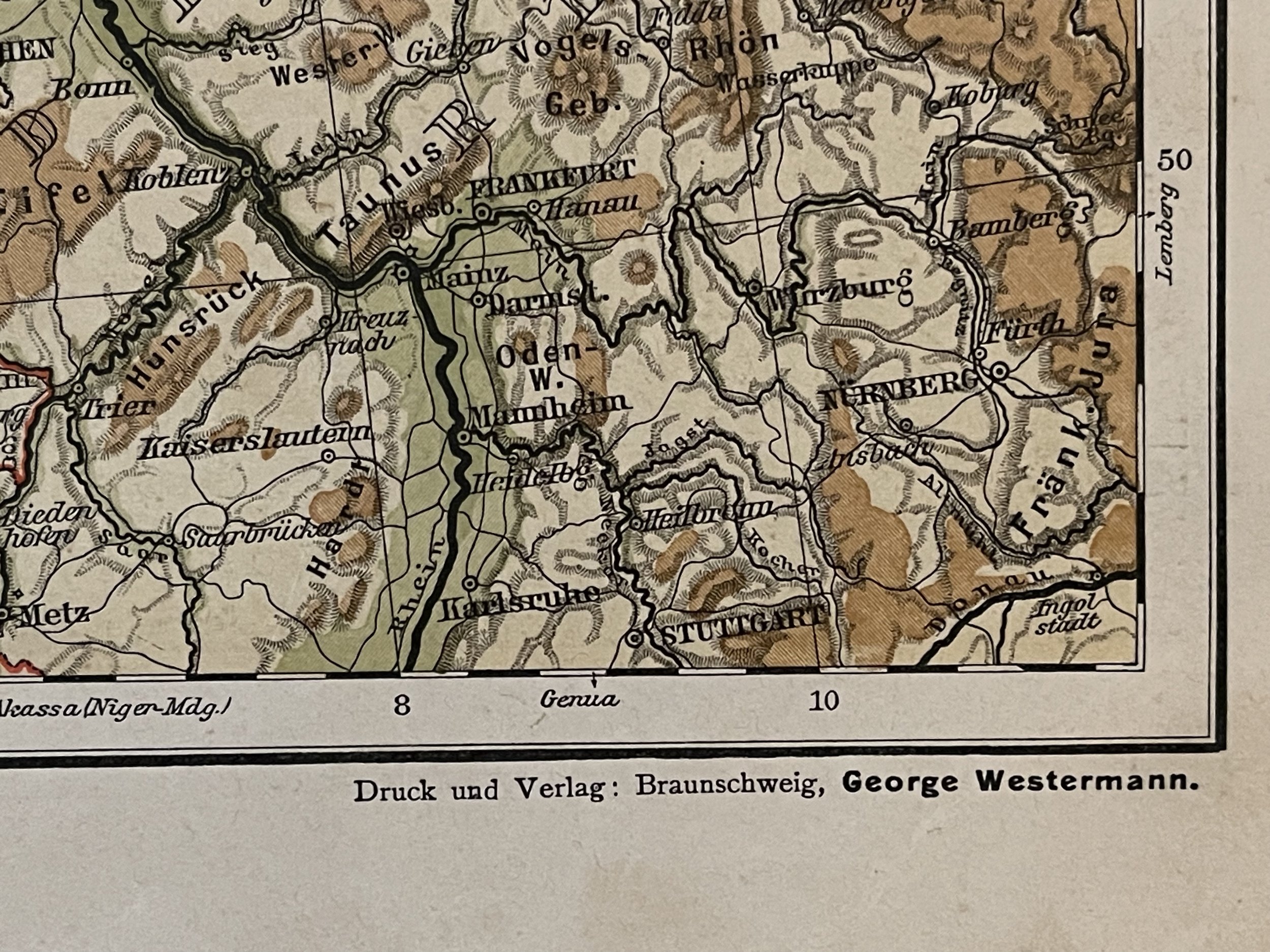
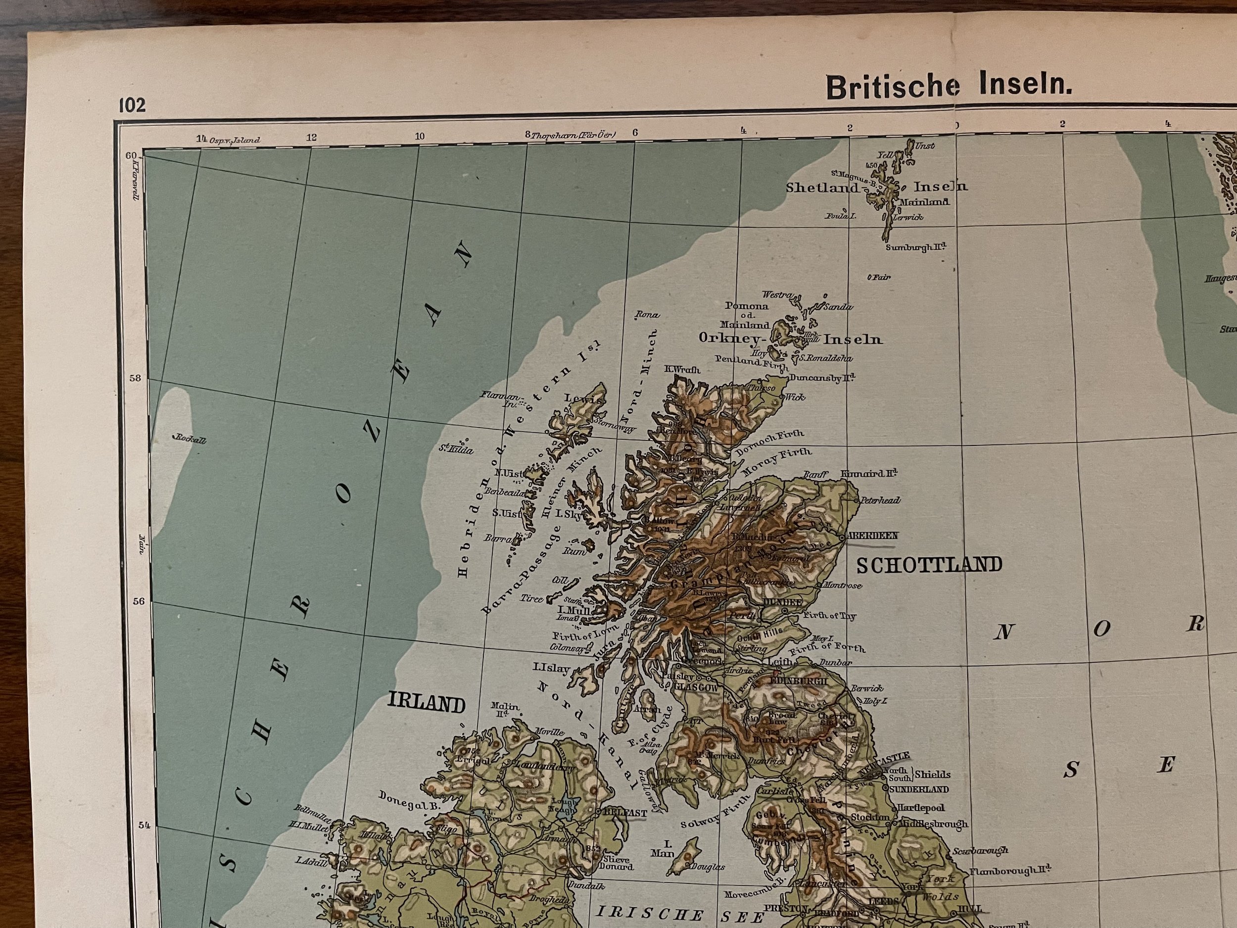

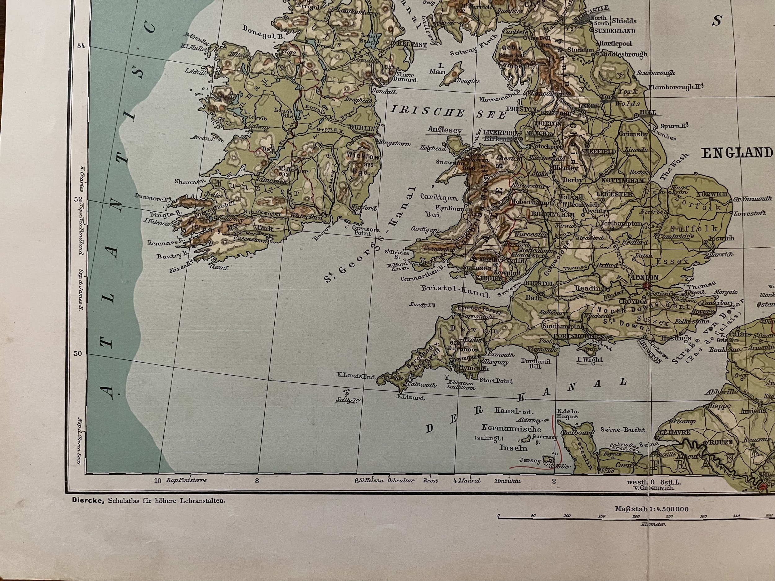
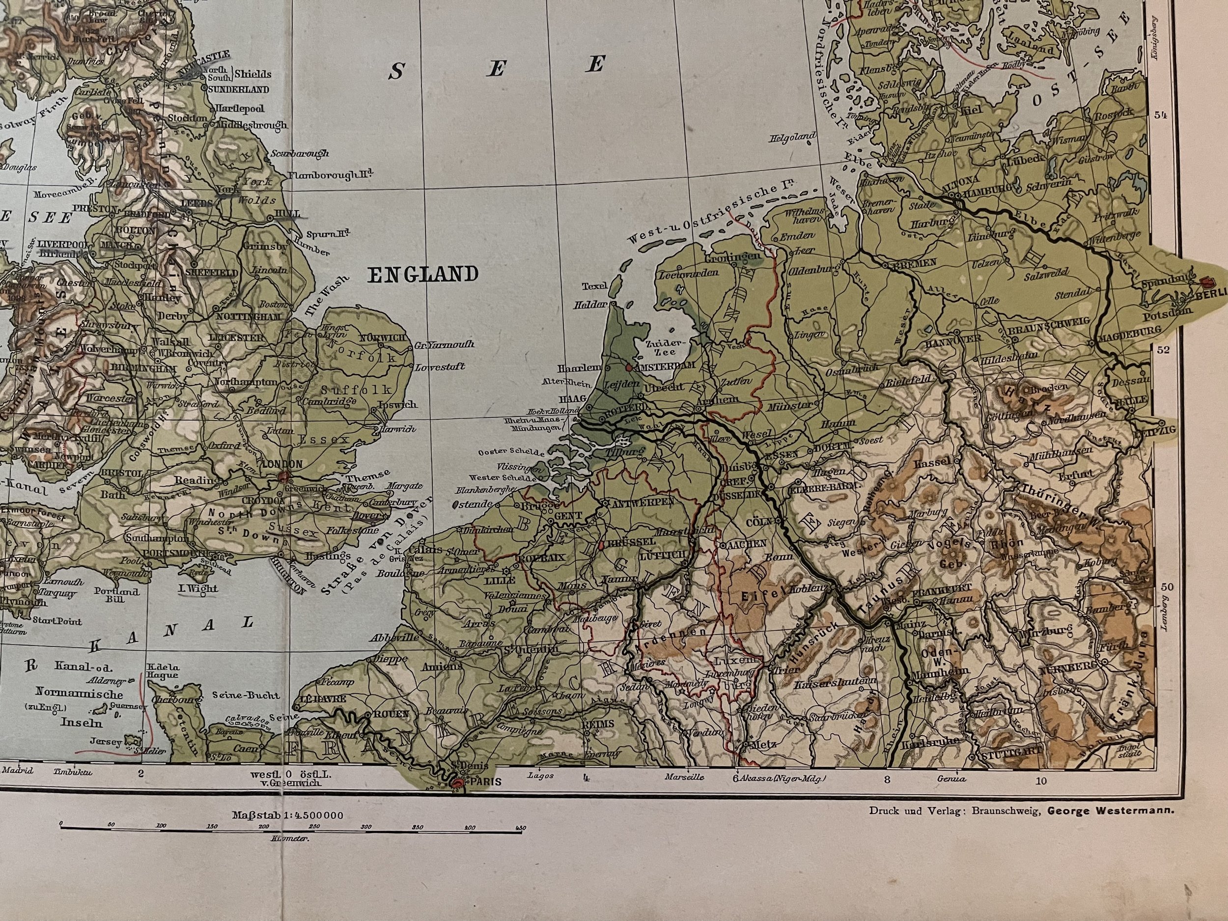
Great Britain - Die Britischen Inseln - Adolf Stieler, Justus Perthes Geographical Institute - Circa 1907
Stieler, Adolf; George Westermann - Justus Perthes Geographical Institute
Stielers Hand-Atlas. 100 Karten in Kupferstich mit 162 Nebenkarten herausgegeben von Justus Perthes' Geographischer Anstalt in Gotha.Adolf Stieler (26 February 1775 – 13 March 1836) was a German cartographer and lawyer who worked most of his life in the Justus Perthes Geographical Institute in Gotha. Although he studied law and would serve in government for his entire career, he maintained an interest in cartography and published many famous works. His Handatlas was the leading German world atlas until the middle of the 20th century.
Stielers HandatlasHand-Atlas über alle Theile der Erde und über das Weltgebäude (after Adolf Stieler, 1775–1836), formally titled Handy atlas of all parts of the world and of the universe, was the leading German world atlas of the last three decades of the 19th and the first half of the 20th century. The ninth edition, edited by Habenicht, with one hundred maps, over double the number of the initial edition, was the first one printed on cylinder machines by means of lithography, which halved the price and made the Stieler accessible to a broad public. This atlas is popular for beginner collectors because of its affordability. It is less obtainable than the more common "Andrees Hand-Atlas".
Code : A122
Cartographer : Cartographer / Engraver / Publisher: Adolf Stieler, George Westermann
Date : Publication Place / Date - Circa 1907
Size : Sheet size: Image Size: 43 by 36 cm.
Availability : Available
Type - Genuine - Antique
Grading A
Where Applicable - Folds as issued. Light box photo shows the folio leaf centre margin hinge ‘glue’, this is not visible otherwise.
Tracked postage, in casement. Please contact me for postal quotation outside of the UK.