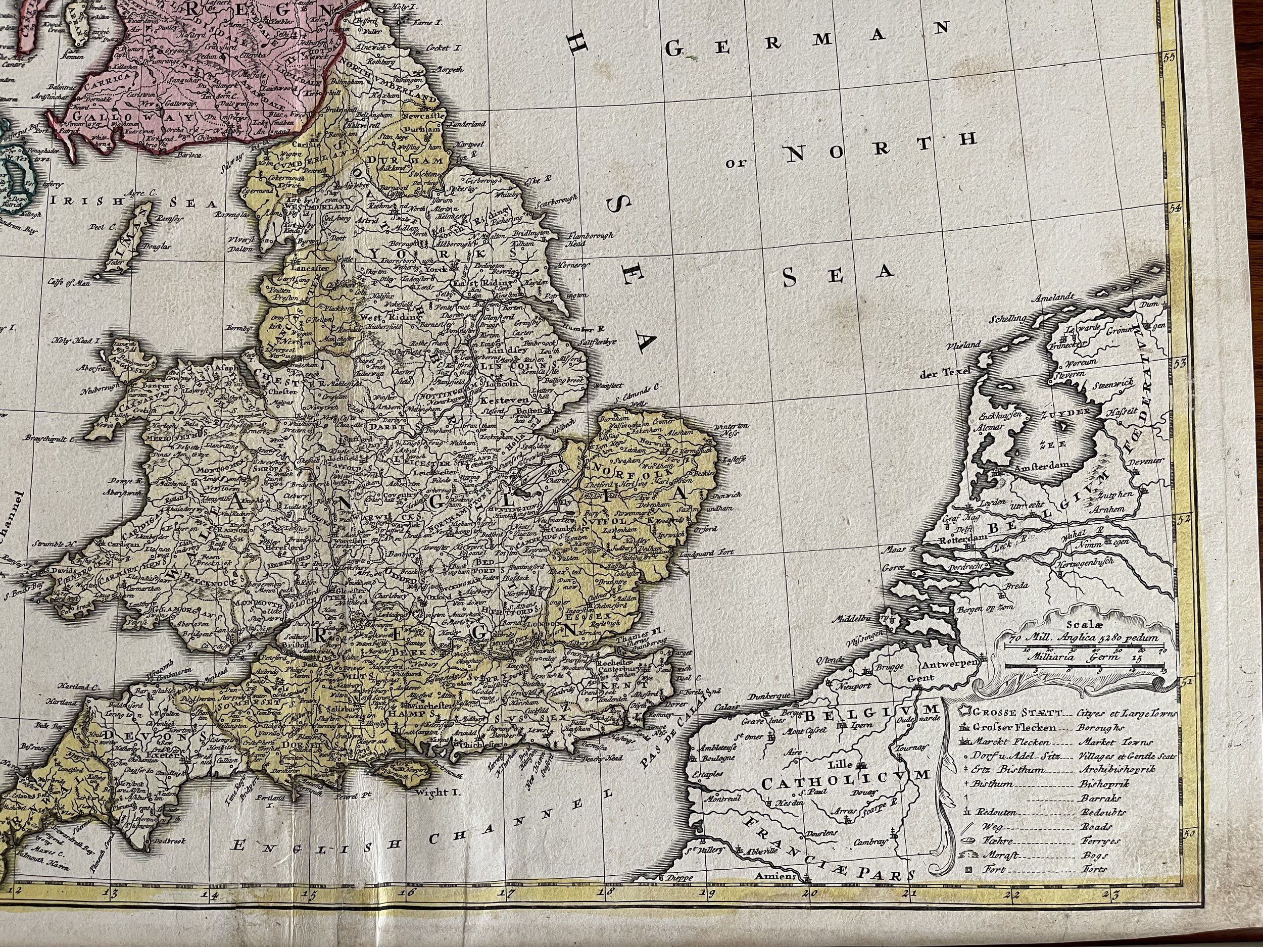
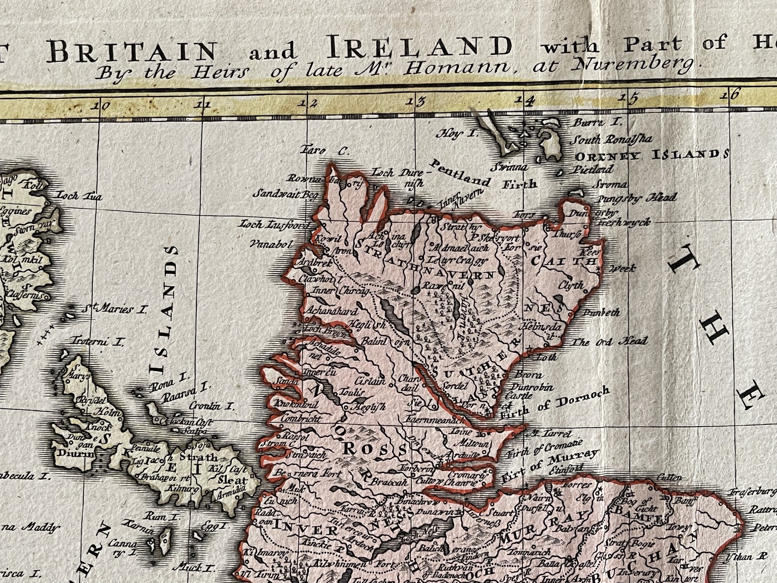
Great Britain & Ireland - Magna Britannia - Johann Baptist Homann - Nuremberg 1740
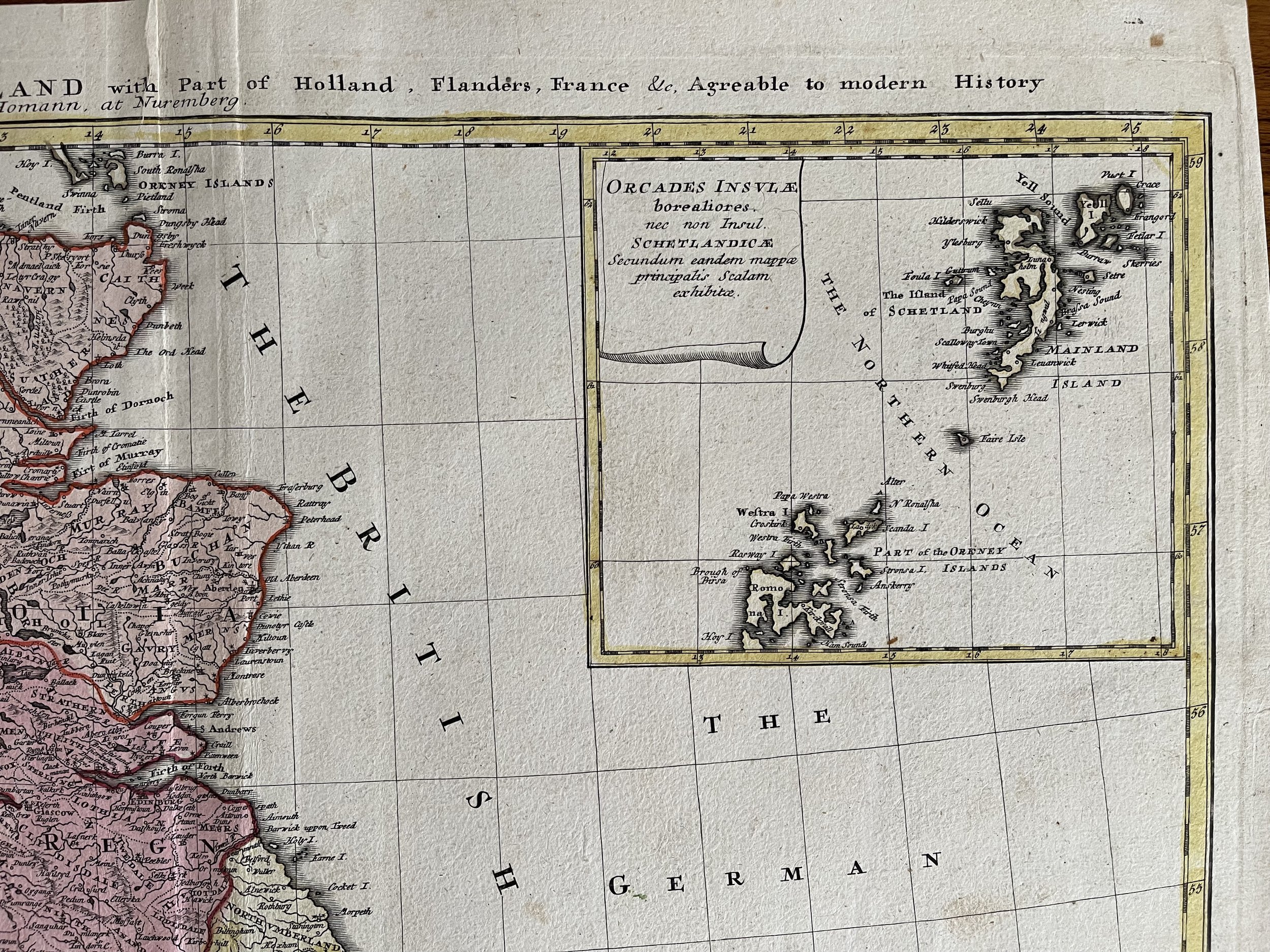
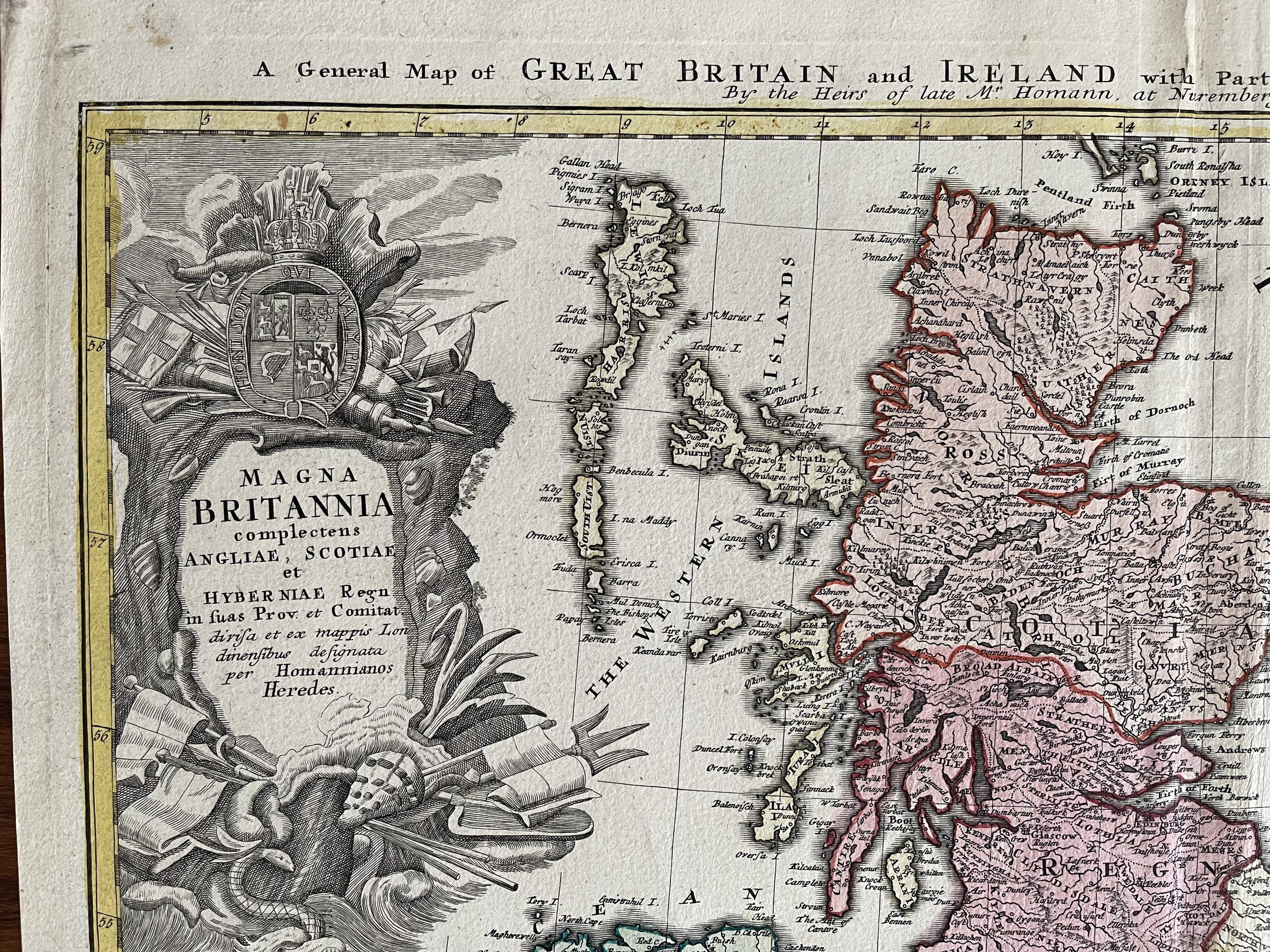
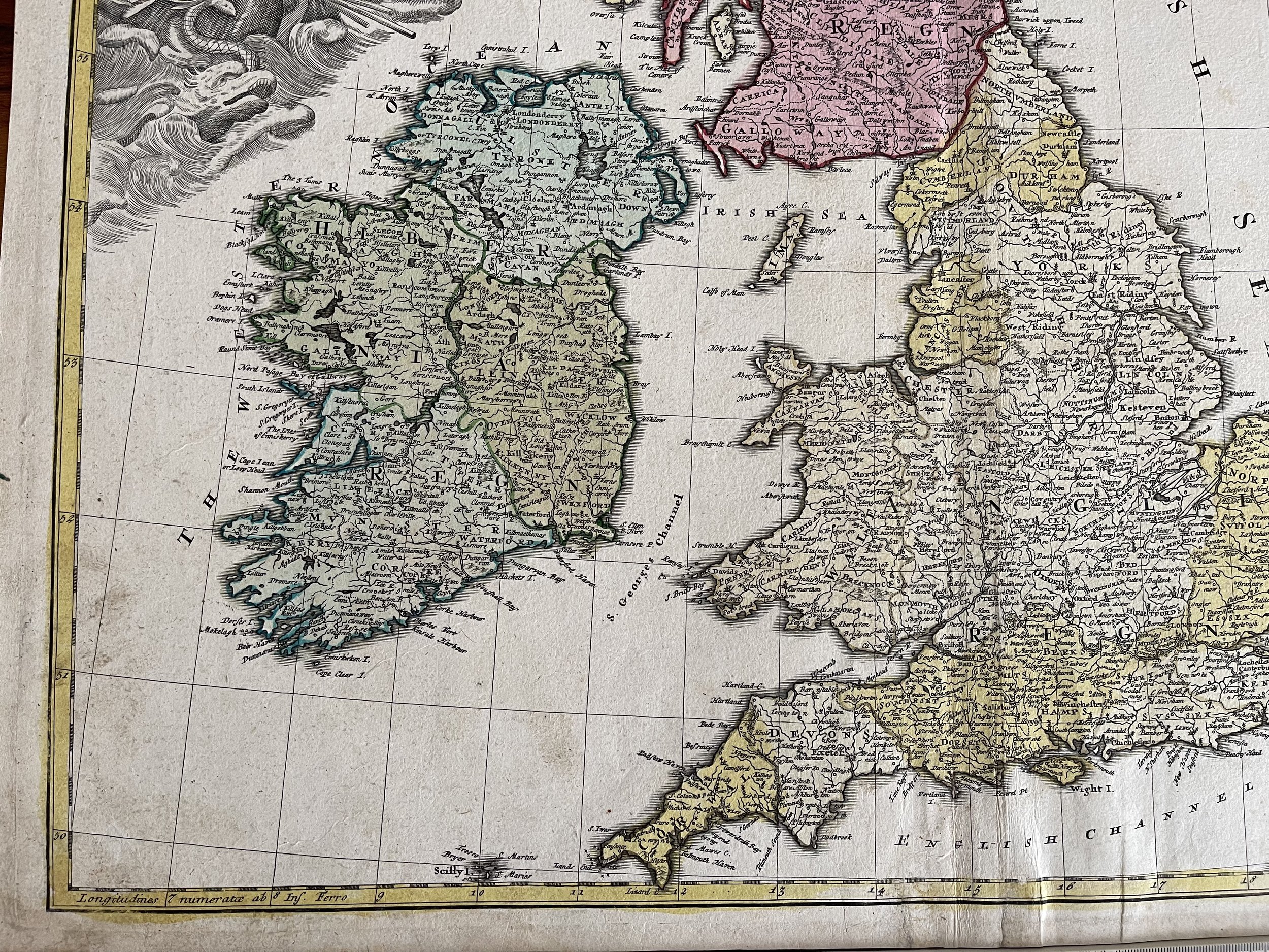
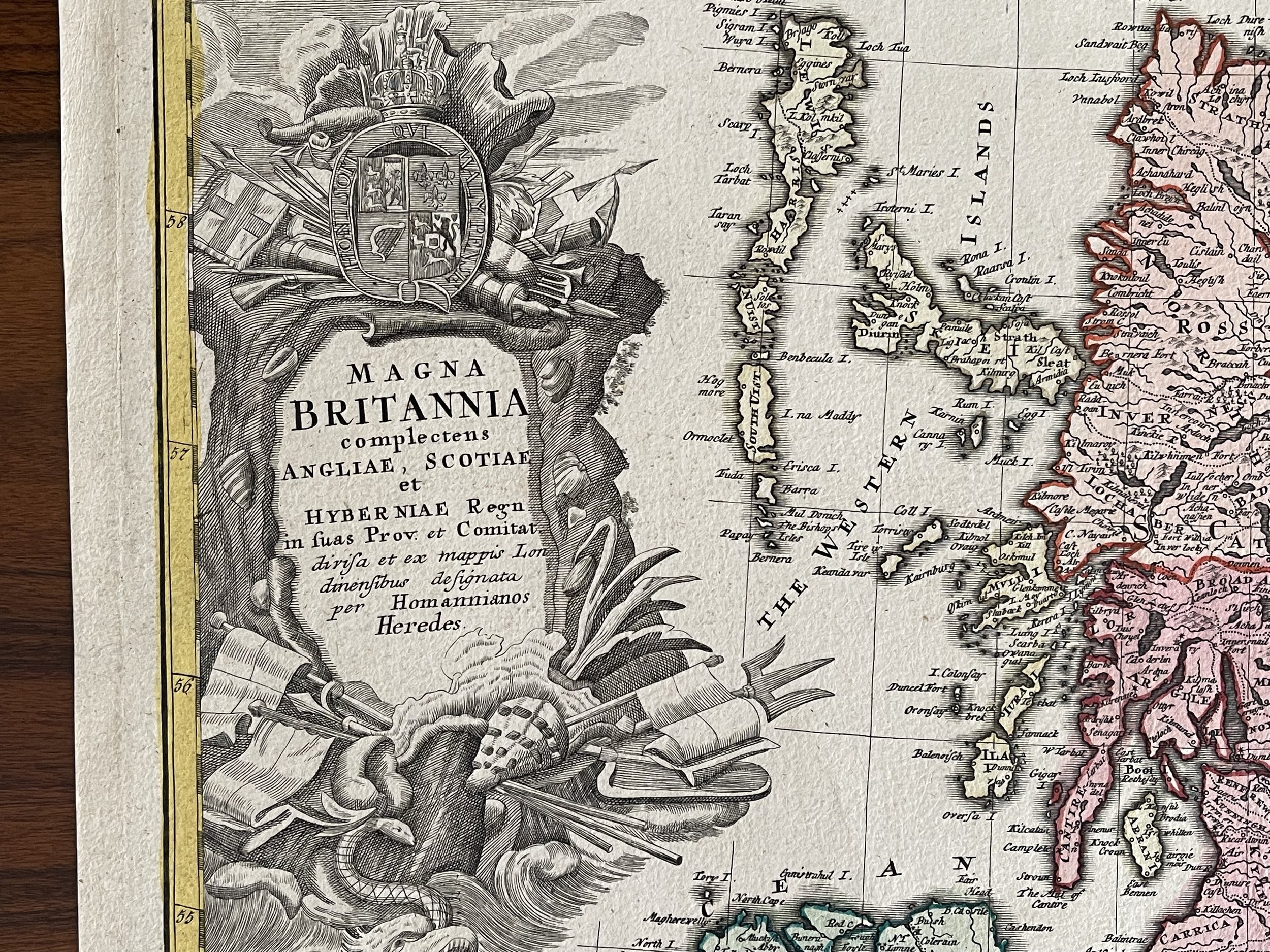
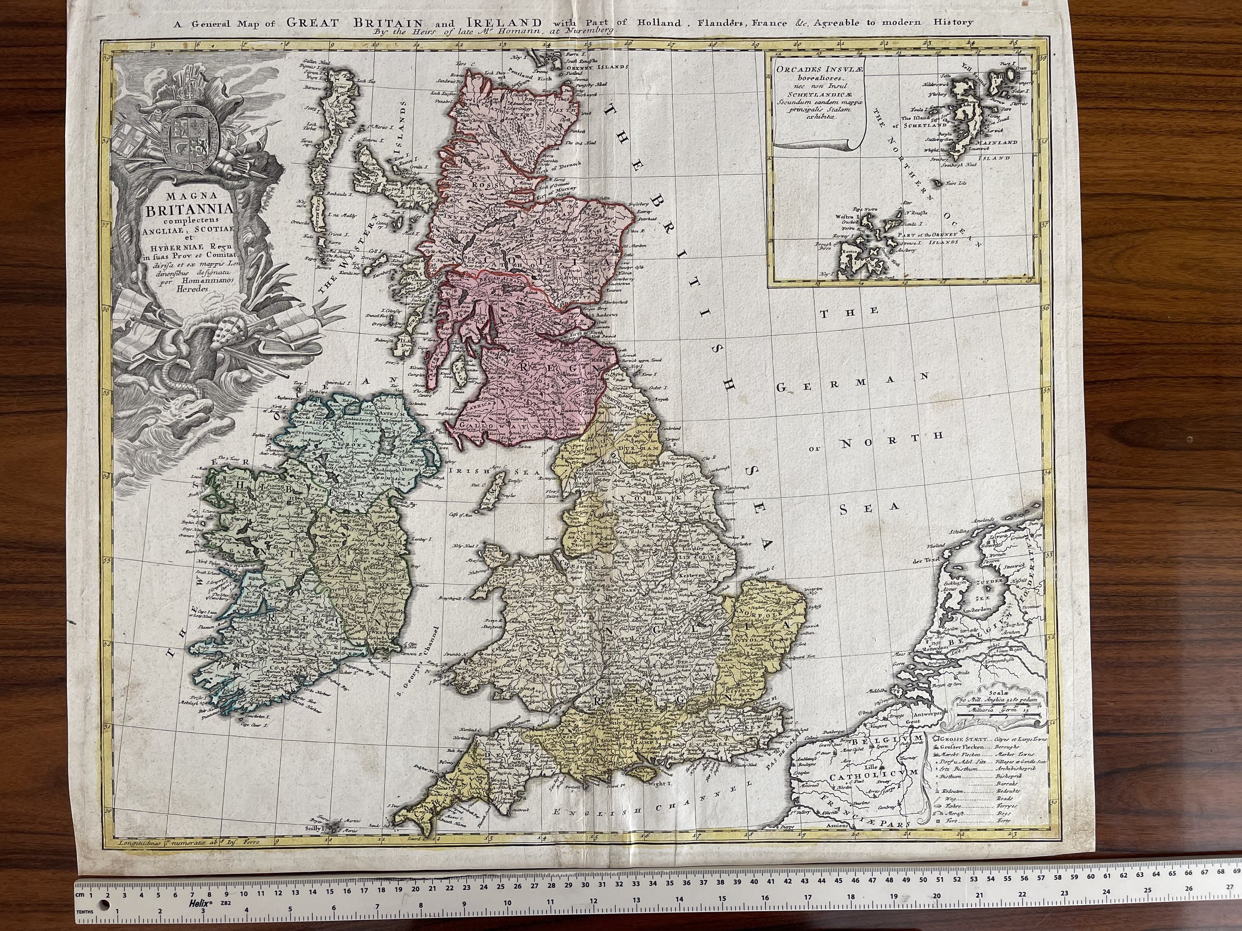
Great Britain & Ireland by HOMANN HRS 1740 18e CENTURY LARGE ANTIQUE ENGRAVED MAP Unusual English example of Homann's decorative map of the British Isles, with spectacular large format cartouche, coat of arms and other embellishments. Large inset of the Orkneys and Shetlands. Gorgeous colour. The first time we have ever seen this map with the English title at the top.
Johann Baptist Homann (1663-1724) was a mapmaker who founded the famous Homann Heirs publishing company. He lived his entire life in Bavaria, particularly in Nuremberg. Initially, Johann trained to become a priest before converting to Protestantism and working as a notary.
In 1702, Johann founded a publishing house that specialised in engravings. The firm flourished, becoming the leading map publisher in Germany and an important entity in the European map market. In 1715, Johann was named Imperial Geographer to the Holy Roman Empire by Charles VI and made a member of the Prussian Academy of Sciences. Most importantly for his business, his reputation and contacts gained him imperial printing privileges which protected his publications and recommended him to customers. Johann is best known for this Grosser Atlas ueber die ganze Welt, or the Grand Atlas of the World, published in 1716.
After Johann died in 1724, the business passed to his son, Christoph (1703-1730). Upon Christoph’s early death, the company passed to subsequent heirs, with the name of the company changing to Homann Erben, or Homann Heirs. The firm continued in business until 1848.
Code : A232
Cartographer : Cartographer / Engraver / Publisher: Johann Baptist Homann
Date : Publication Place / Date - 1740
Size : Sheet size: Image Size: 61 x 52.5 cm
Availability : Available
Type - Genuine - Antique
Grading A
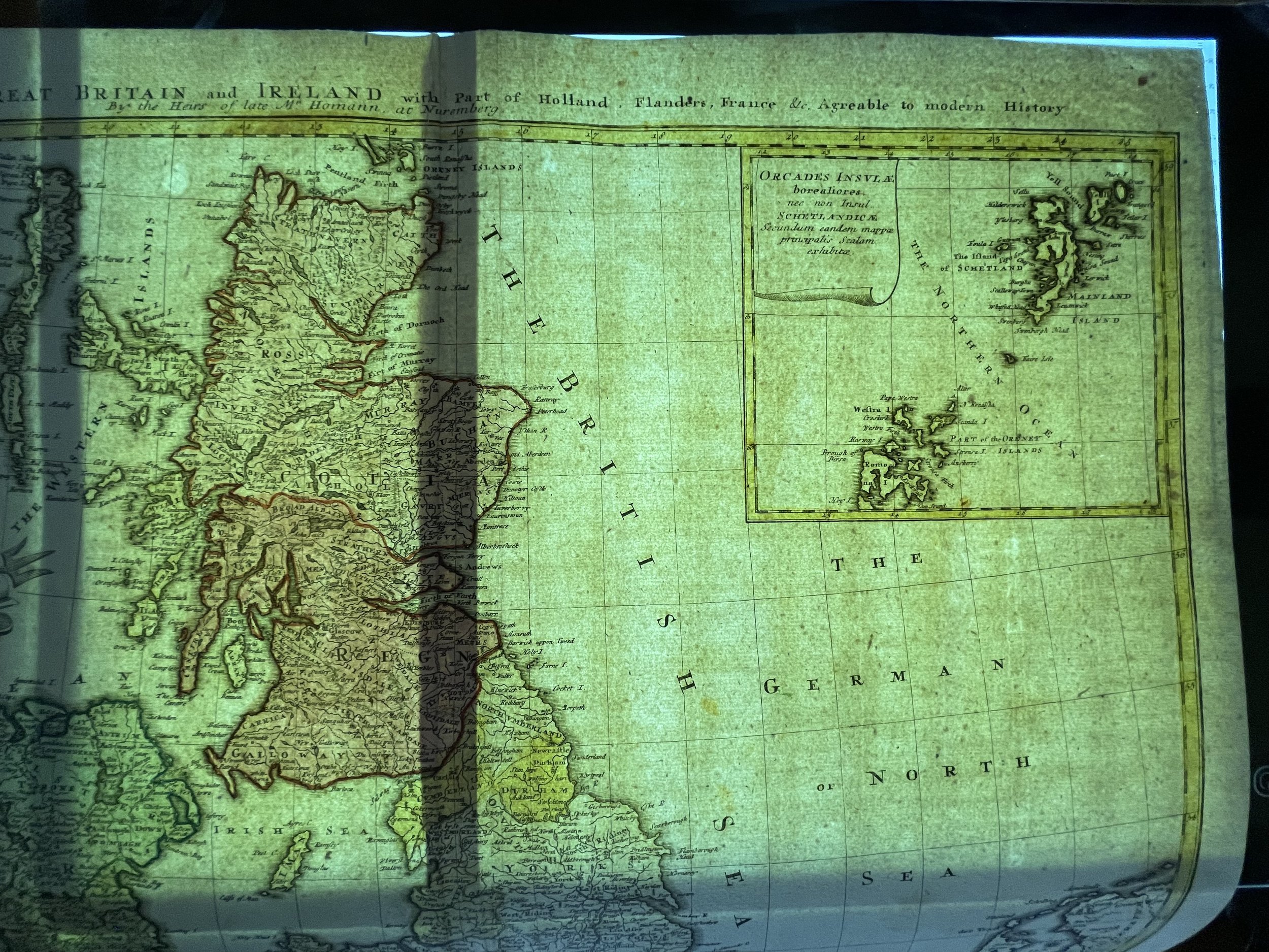
Where Applicable - Folds as issued. Light box photo shows the folio leaf centre margin hinge ‘glue’, this is not visible otherwise.
Tracked postage, in casement. Please contact me for postal quotation outside of the UK.