Hamburg Prussia (Holy Roman Empire) - Johann Baptist Homann - c 1710
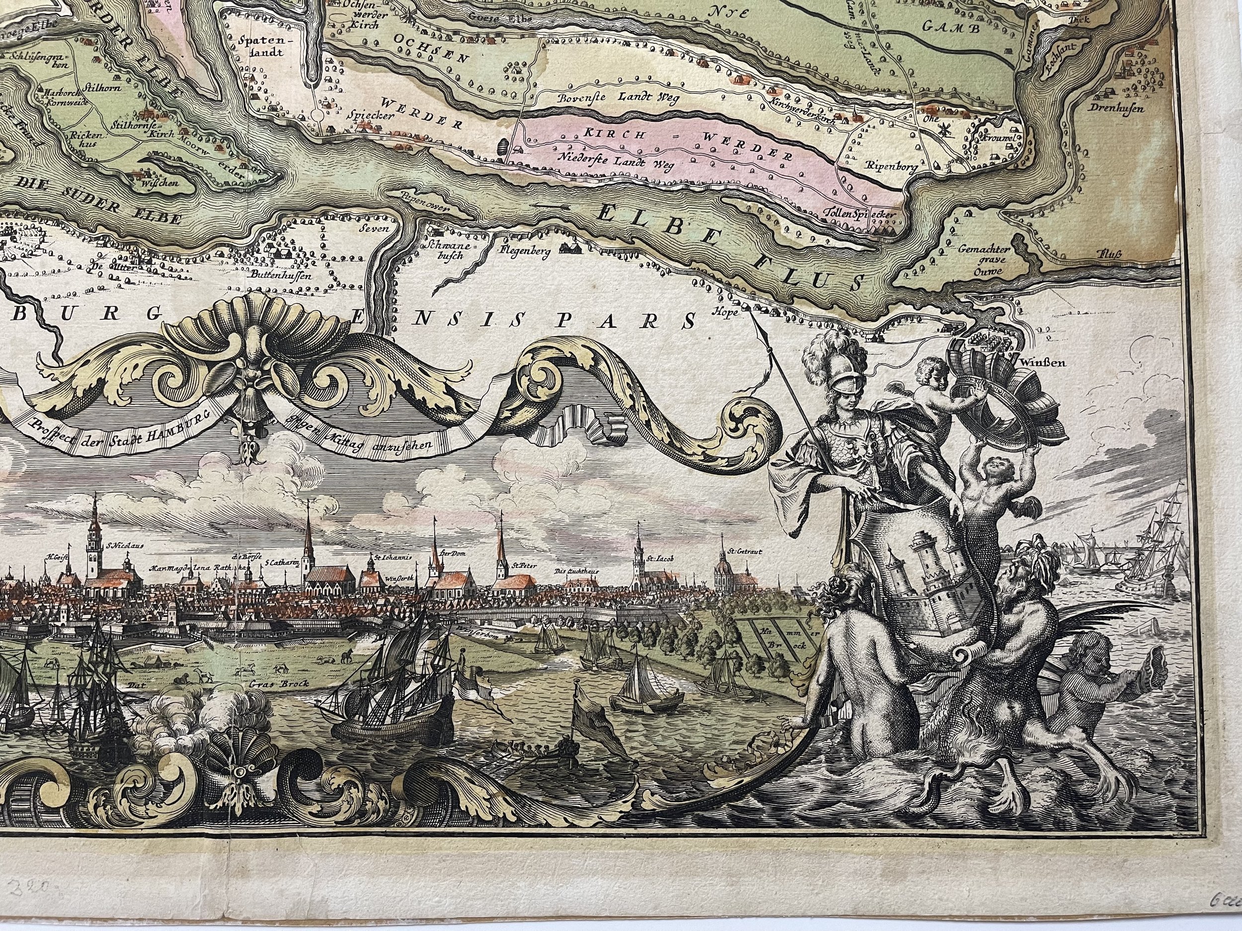
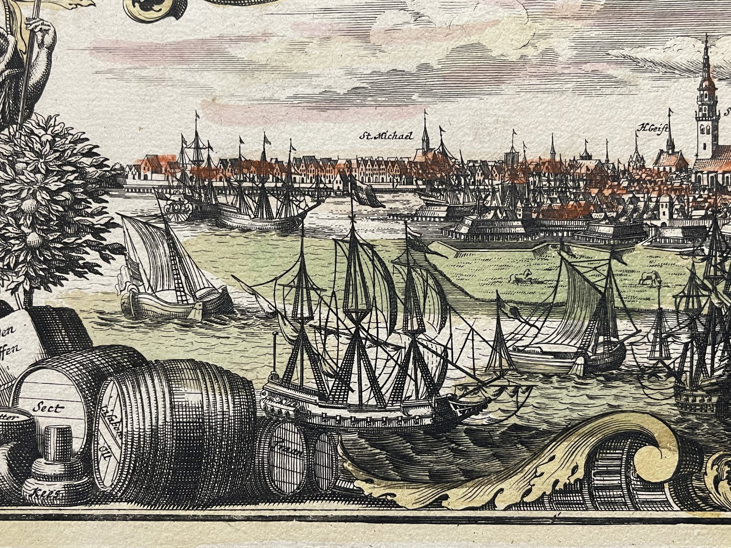
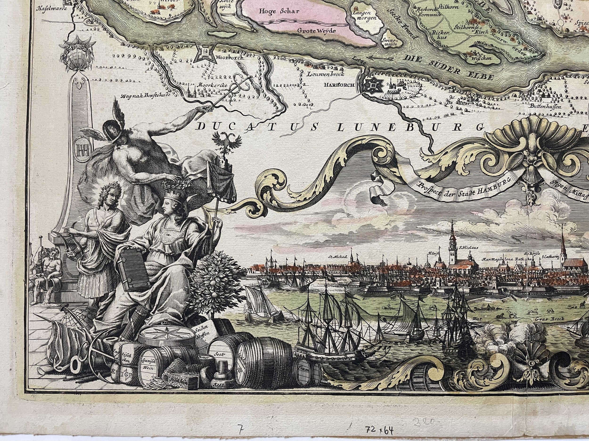
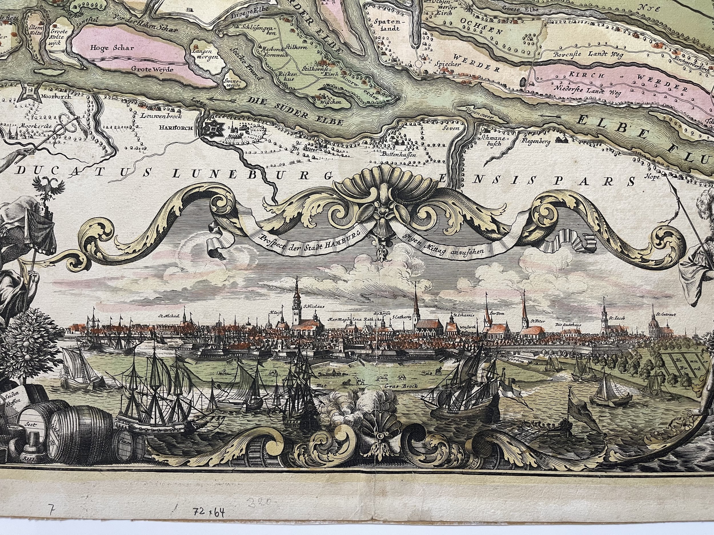
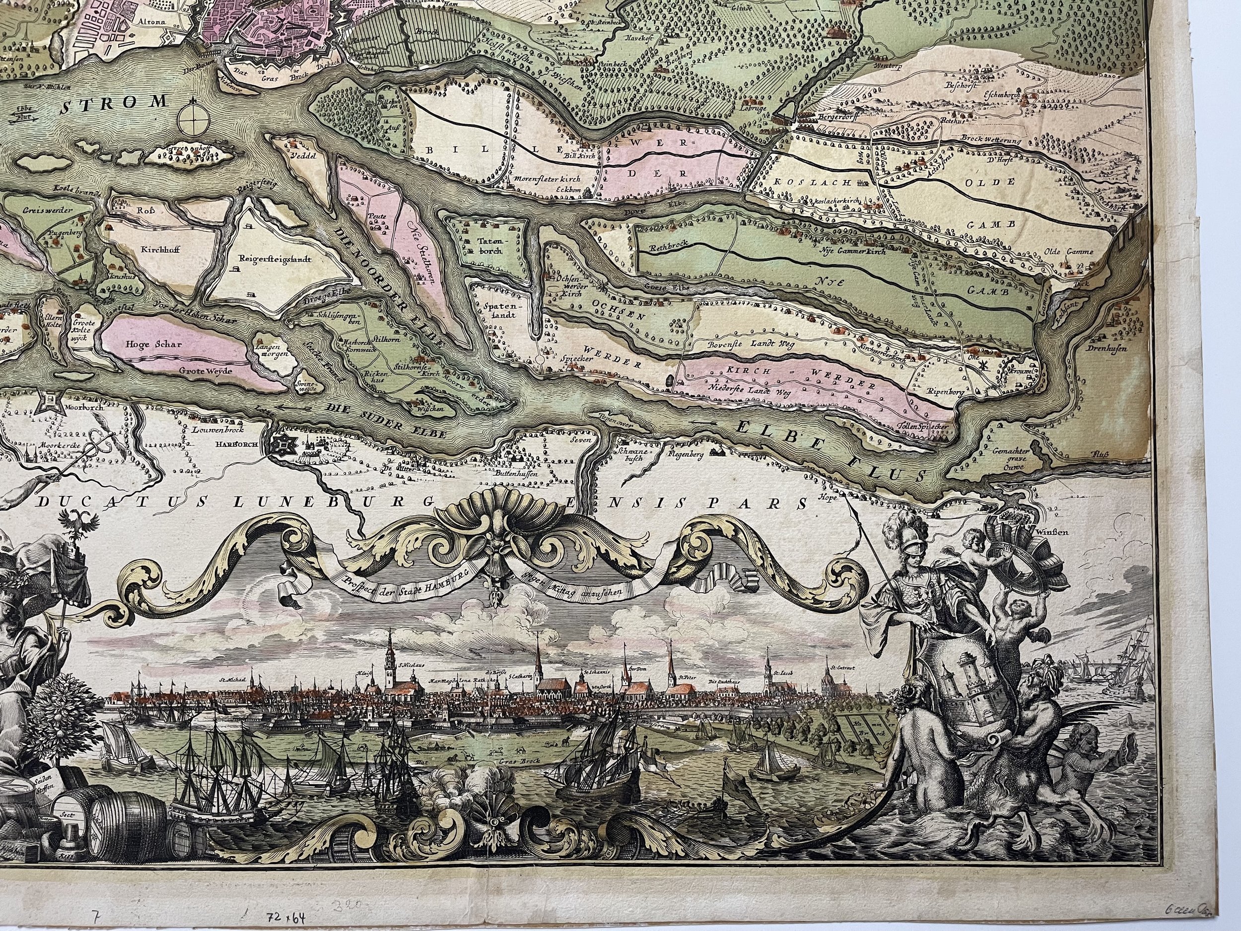
One of the most beautiful maps of Hamburg and its environs. Richly decorated with a wonderful view of the city, ships, and allegorical figures. Bundles and barrels of goods are labelled with Spanish wine; English cloth, butter, Lisabon oil, and so on.
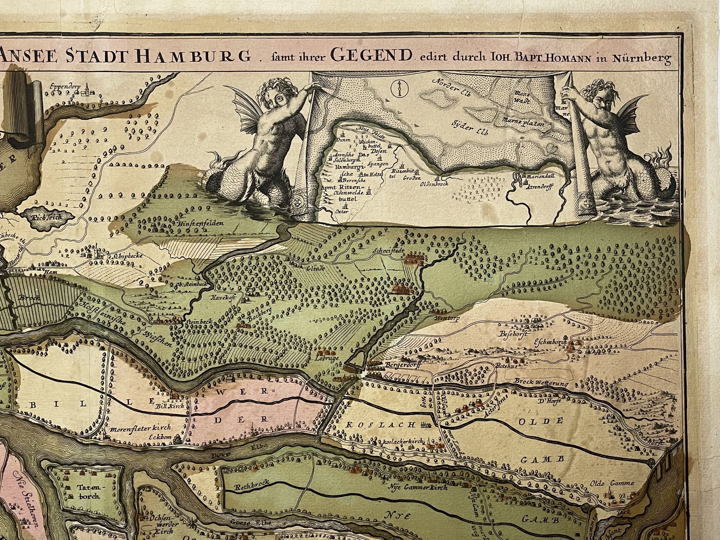
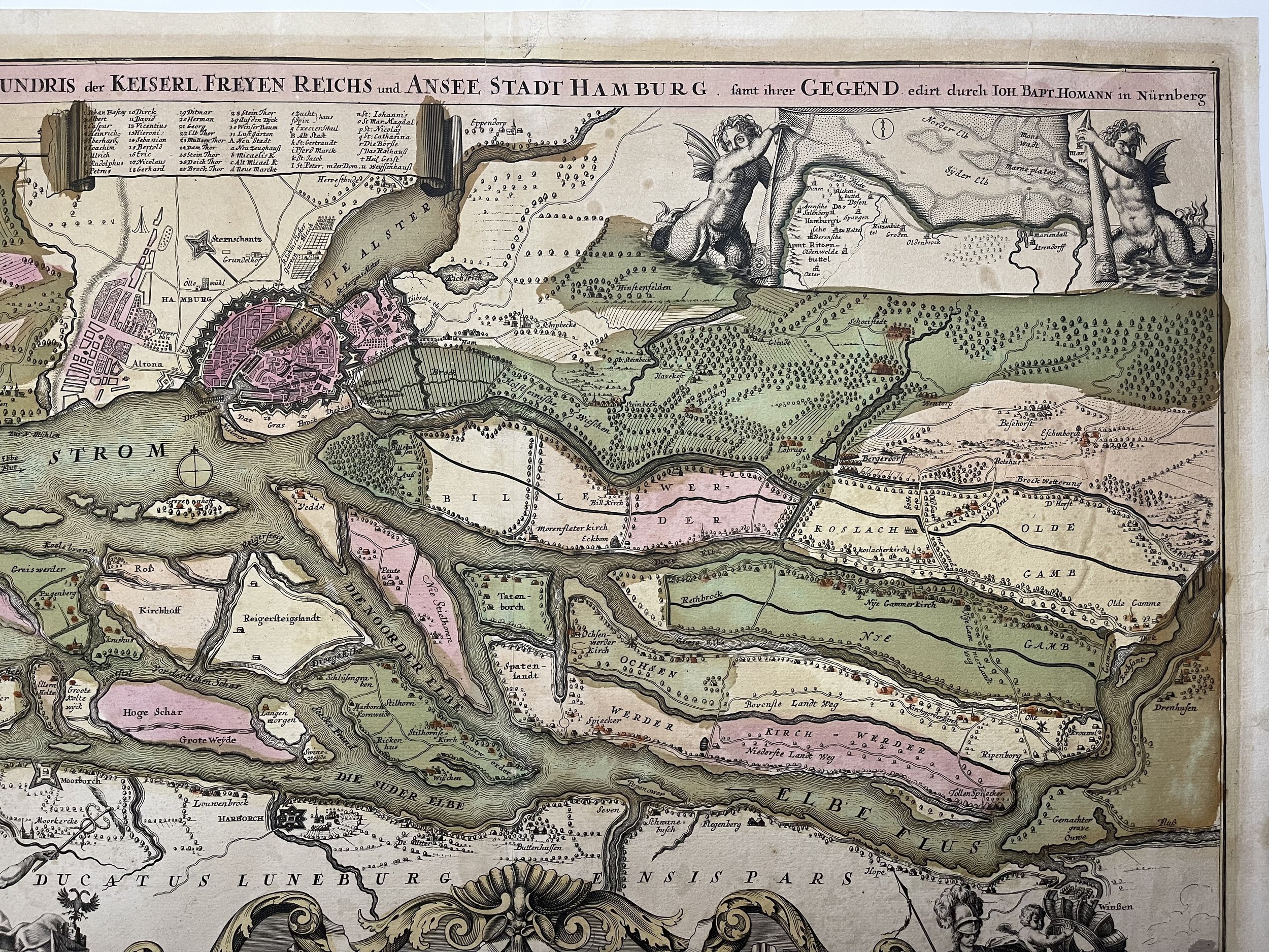
The Amt Ritzebüttel, Hamburgs outpost on the mouth of the Elbe River.
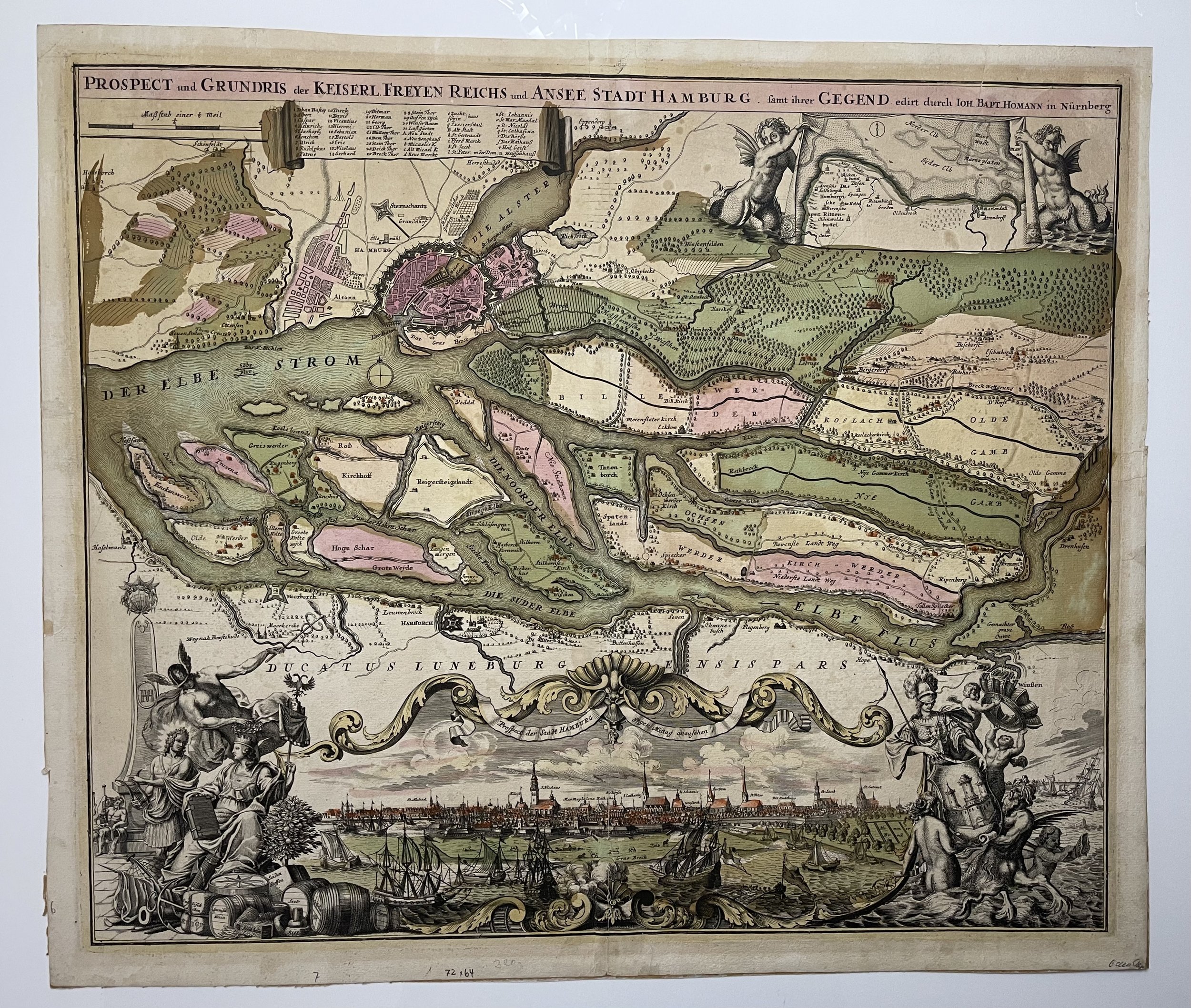
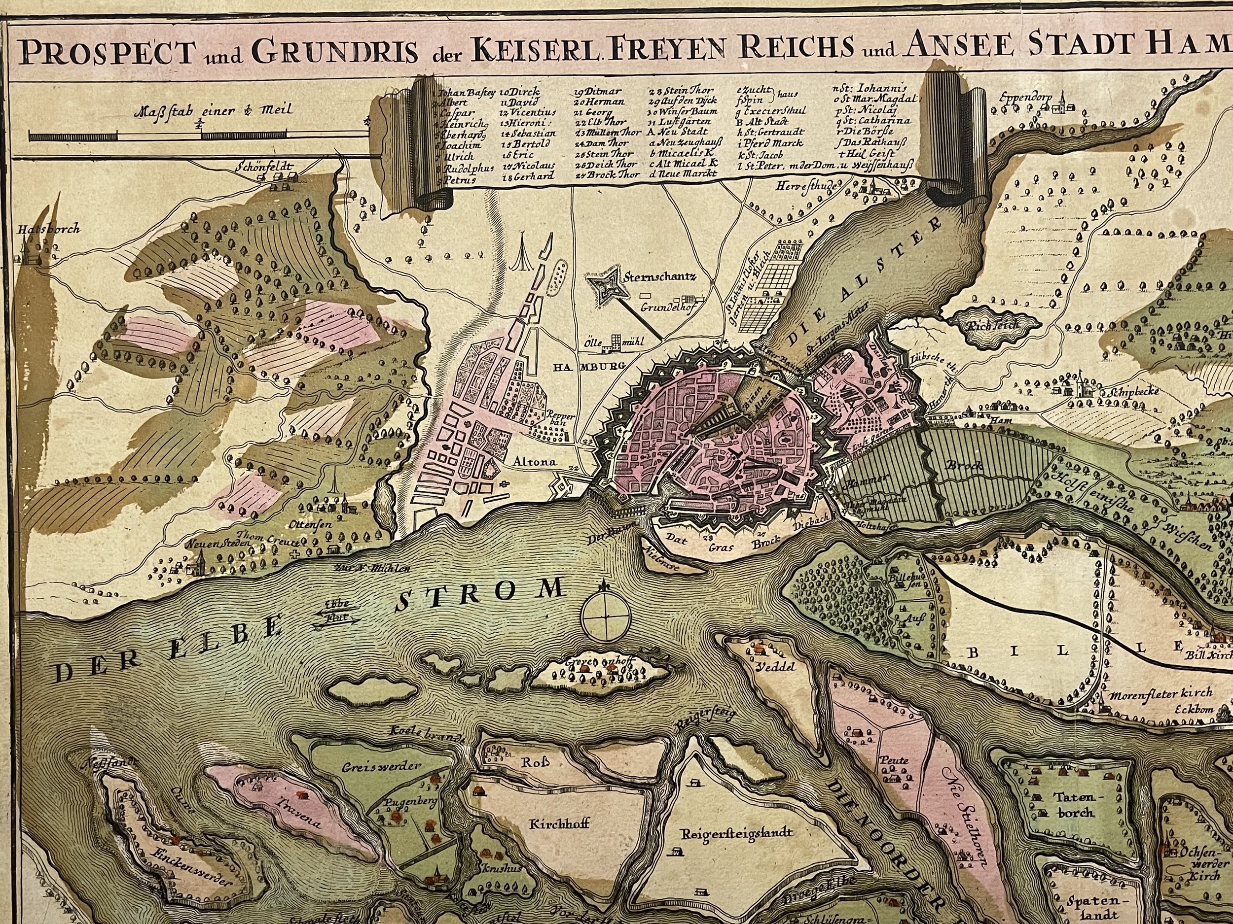
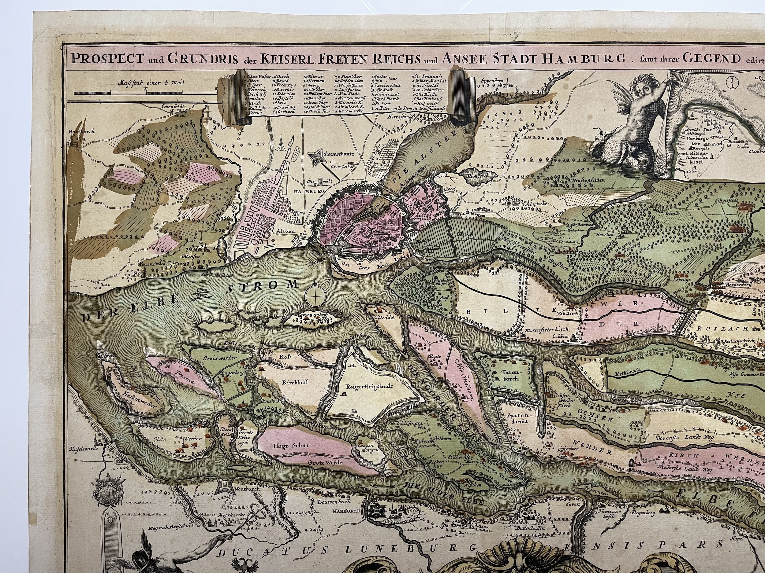
Prospect and ground plan of the Free Imperial and Ansee City of Hamburg and its surroundings.
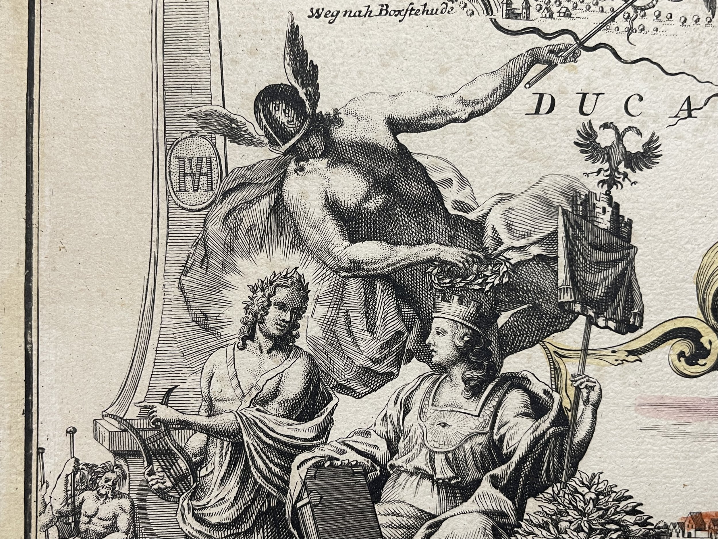
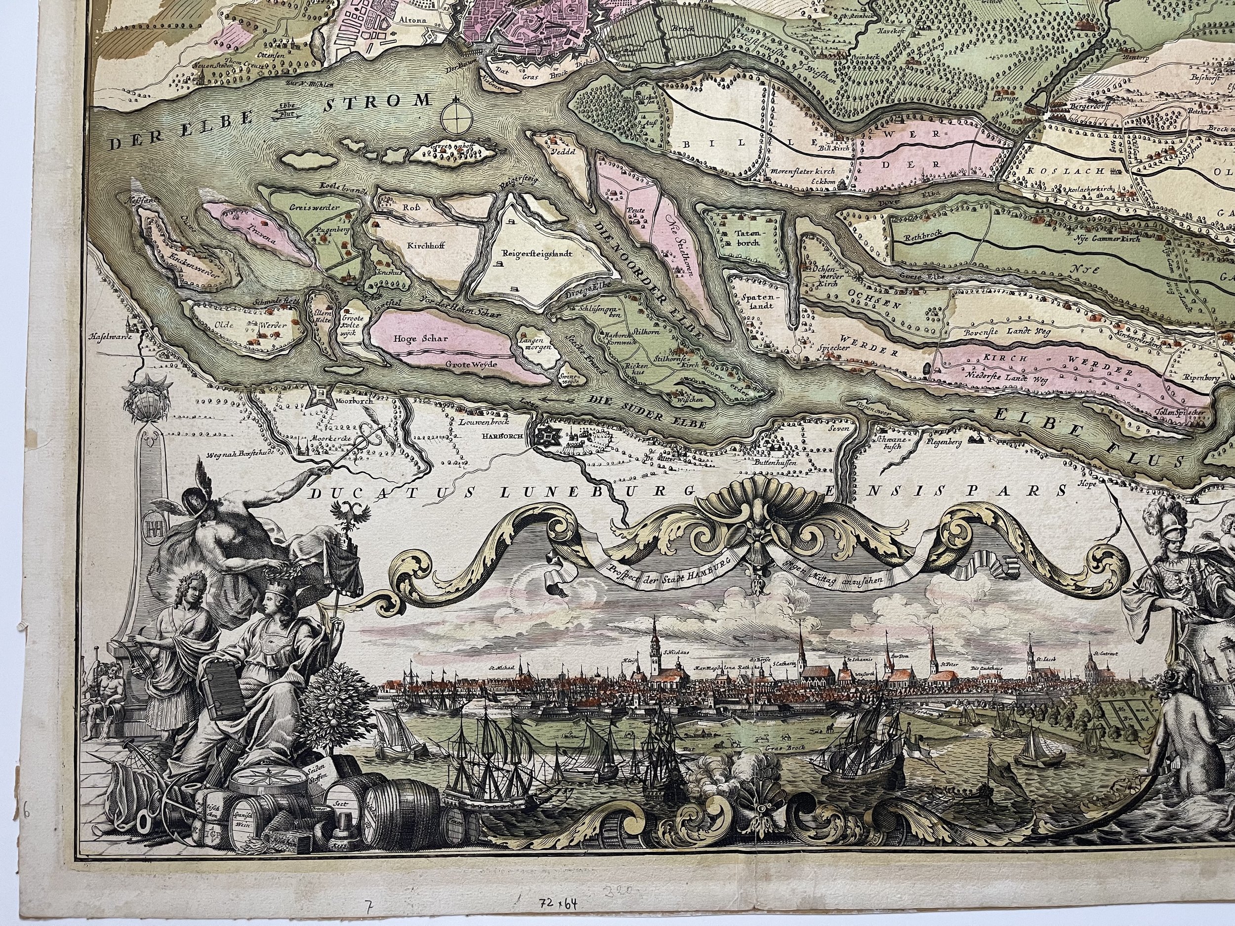
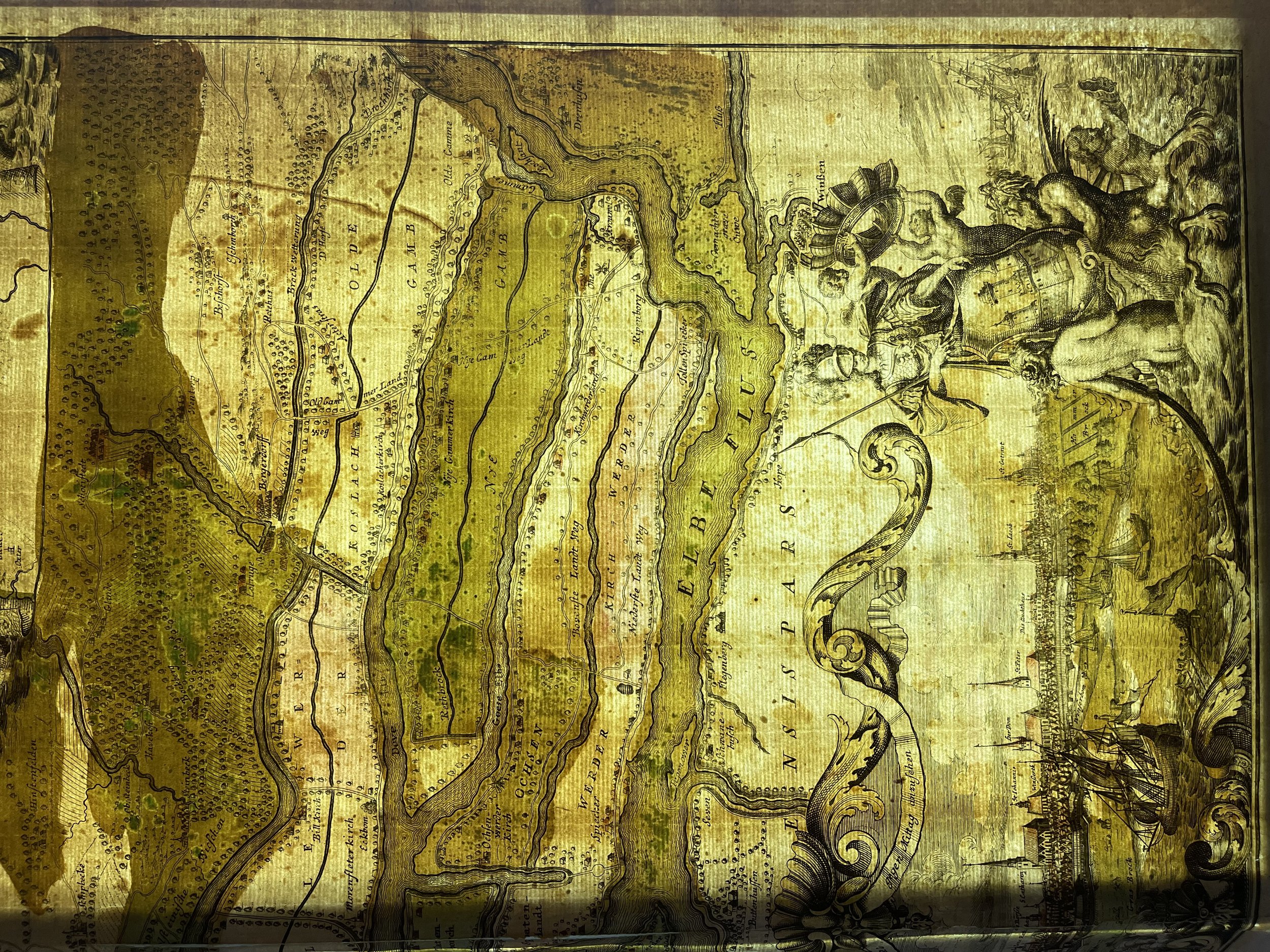
Hamburg's orientation towards the water is illustrated by this representative map from the beginning of the 18th century. On a scale of approximately 1:60,000. The view of the "City of Hamburg and its surroundings" essentially includes the Elbe areas and islands south of the city as the surrounding area. The city prospectus from the Elbe side is therefore consistent. Numerous ships of all types testify to the lively domestic and long-distance trade. The fortifications give an impression of one of the strongest fortresses in Europe of its time. The front view is lavishly framed by baroque ornamentation. On both sides there are allegorical representations that symbolize both the trading and seafaring fortunes of the city. A detailed legend is above the city plan. In addition to information on churches and squares, there is also a complete list of the city gates and the individual bastions. They were named after the saints of the incumbent officials. Top right: sea creatures, Tritons, unfold a view of the mouth of the Elbe. Since 1393, the city had an outpost here, the office of "Ritzenbüttel". An important outpost directly on the North Sea, which remained in the city's possession for over five hundred years.
Johann Baptist Homann (20 March 1664 – 1 July 1724) was a German geographer and cartographer, who also made maps of the Americas.
Homann was born in Oberkammlach near Kammlach in the Electorate of Bavaria. Although educated at a Jesuit school, and preparing for an ecclesiastical career, he eventually converted to Protestantism and from 1687 worked as a civil law notary in Nuremberg. He soon turned to engraving and cartography; in 1702 he founded his own publishing house.
Homann acquired renown as a leading German cartographer, and in 1715 was appointed Imperial Geographer by Holy Roman Emperor Charles VI. Giving such privileges to individuals was an added right that the Holy Roman Emperor enjoyed. In the same year he was also named a member of the Prussian Academy of Sciences in Berlin. Of particular significance to cartography were the imperial printing privileges (Latin: privilegia impressoria). These protected for a time the authors in all scientific fields such as printers, copper engravers, map makers and publishers. They were also very important as a recommendation for potential customers.
In 1716 Homann published his masterpiece Grosser Atlas ueber die ganze Welt (Grand Atlas of all the World). Numerous maps were drawn up in cooperation with the engraver Christoph Weigel the Elder, who also published Siebmachers Wappenbuch.
Homann died in Nuremberg in 1724. He was succeeded by his son Johann Christoph (1703–1730). The company carried on upon his death as Homann heirs company, managed by Johann Michael Franz and Johann Georg Ebersberger. After subsequent changes in management the company folded in 1852. The company was known as "Homann Erben", "Homanniani Heredes", or "Heritiers de Homann" abroad.
Very good dark and clear print. Several short and repaired marginal tears, two reaching into border area. Printers crease to top left. Central fold with old split, wear and creasing. Strengthened on verso. Some light soiling and staining. In original colours with later colour addition. Pricing and grading commensurate.
One of the most beautiful maps of Hamburg and its environs. Richly decorated with a wonderful view of the city, ships, and allegorical figures. Bundles and barrels of goods are labelled with Spanish wine; English cloth, butter, Lisabon oil, and so on.
The Amt Ritzebüttel, Hamburgs outpost on the mouth of the Elbe River.
Prospect and ground plan of the Free Imperial and Ansee City of Hamburg and its surroundings.
Hamburg's orientation towards the water is illustrated by this representative map from the beginning of the 18th century. On a scale of approximately 1:60,000. The view of the "City of Hamburg and its surroundings" essentially includes the Elbe areas and islands south of the city as the surrounding area. The city prospectus from the Elbe side is therefore consistent. Numerous ships of all types testify to the lively domestic and long-distance trade. The fortifications give an impression of one of the strongest fortresses in Europe of its time. The front view is lavishly framed by baroque ornamentation. On both sides there are allegorical representations that symbolize both the trading and seafaring fortunes of the city. A detailed legend is above the city plan. In addition to information on churches and squares, there is also a complete list of the city gates and the individual bastions. They were named after the saints of the incumbent officials. Top right: sea creatures, Tritons, unfold a view of the mouth of the Elbe. Since 1393, the city had an outpost here, the office of "Ritzenbüttel". An important outpost directly on the North Sea, which remained in the city's possession for over five hundred years.
Johann Baptist Homann (20 March 1664 – 1 July 1724) was a German geographer and cartographer, who also made maps of the Americas.
Homann was born in Oberkammlach near Kammlach in the Electorate of Bavaria. Although educated at a Jesuit school, and preparing for an ecclesiastical career, he eventually converted to Protestantism and from 1687 worked as a civil law notary in Nuremberg. He soon turned to engraving and cartography; in 1702 he founded his own publishing house.
Homann acquired renown as a leading German cartographer, and in 1715 was appointed Imperial Geographer by Holy Roman Emperor Charles VI. Giving such privileges to individuals was an added right that the Holy Roman Emperor enjoyed. In the same year he was also named a member of the Prussian Academy of Sciences in Berlin. Of particular significance to cartography were the imperial printing privileges (Latin: privilegia impressoria). These protected for a time the authors in all scientific fields such as printers, copper engravers, map makers and publishers. They were also very important as a recommendation for potential customers.
In 1716 Homann published his masterpiece Grosser Atlas ueber die ganze Welt (Grand Atlas of all the World). Numerous maps were drawn up in cooperation with the engraver Christoph Weigel the Elder, who also published Siebmachers Wappenbuch.
Homann died in Nuremberg in 1724. He was succeeded by his son Johann Christoph (1703–1730). The company carried on upon his death as Homann heirs company, managed by Johann Michael Franz and Johann Georg Ebersberger. After subsequent changes in management the company folded in 1852. The company was known as "Homann Erben", "Homanniani Heredes", or "Heritiers de Homann" abroad.
Very good dark and clear print. Several short and repaired marginal tears, two reaching into border area. Printers crease to top left. Central fold with old split, wear and creasing. Strengthened on verso. Some light soiling and staining. In original colours with later colour addition. Pricing and grading commensurate.
Code : A667
Cartographer : Cartographer / Engraver / Publisher: Johann Baptist Homann
Date : Publication Place / Date - Circa 1710
Size : Sheet size: Image Size: 62.5 x 53 cm
Availability : Available
Type - Genuine - Antique
Grading A-
Where Applicable - Folds as issued. Light box photo shows the folio leaf centre margin hinge ‘glue’, this is not visible otherwise.
Tracked postage, in casement. Please contact me for postal quotation outside of the UK.