Hemispheres Polar Projections, Northwest Passage - Nicolas Sanson / Jean Somer - 1657
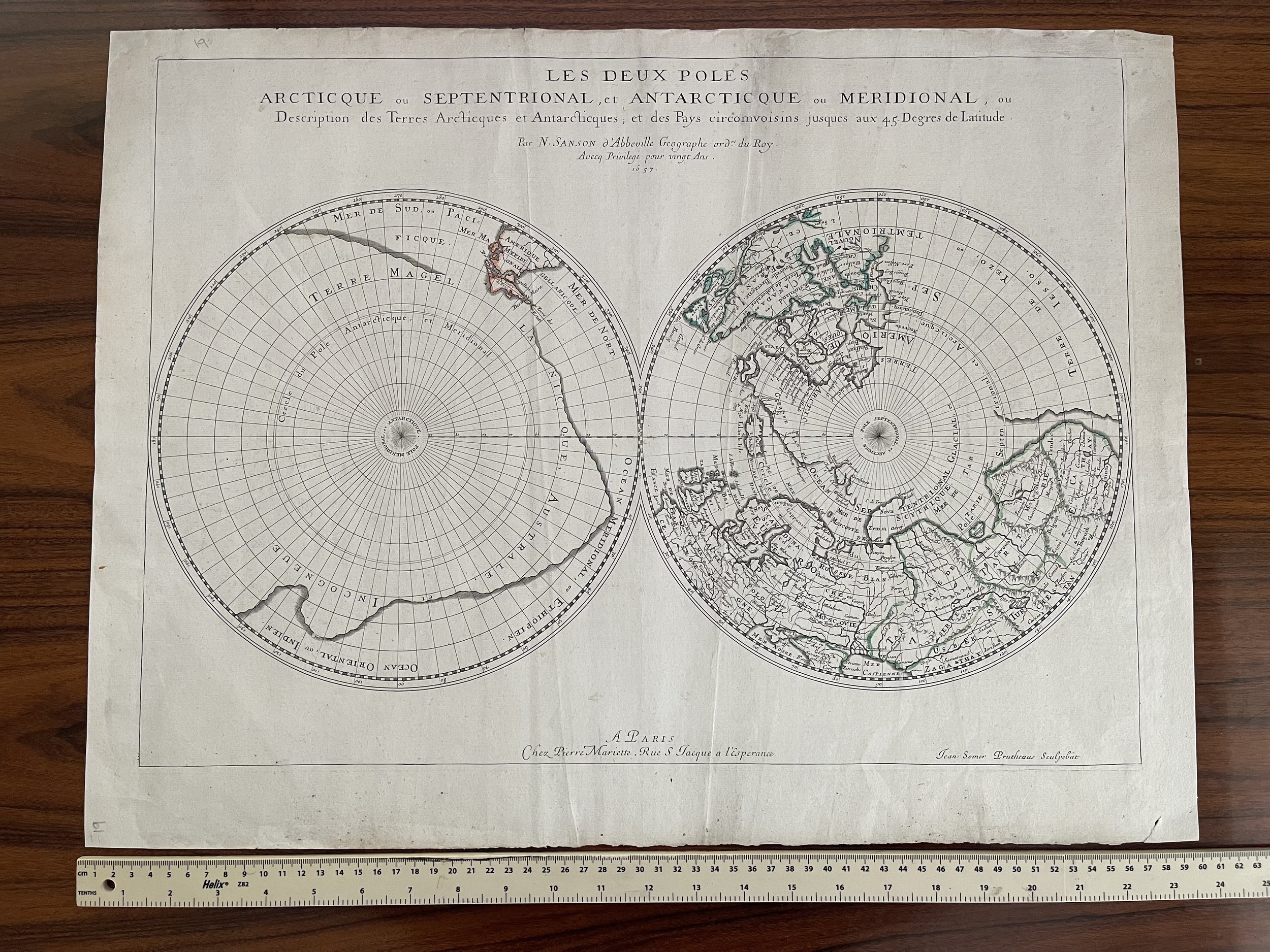
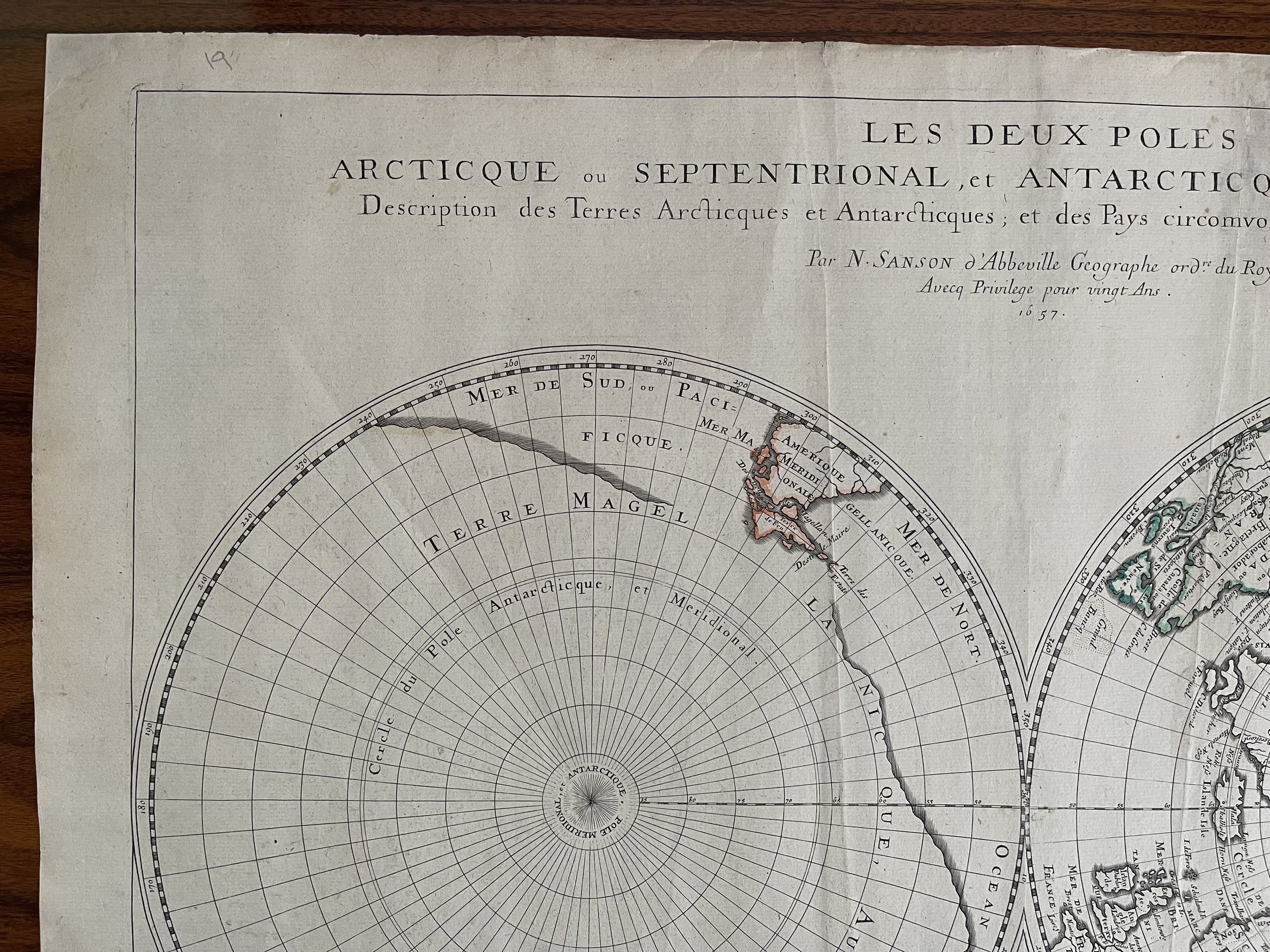
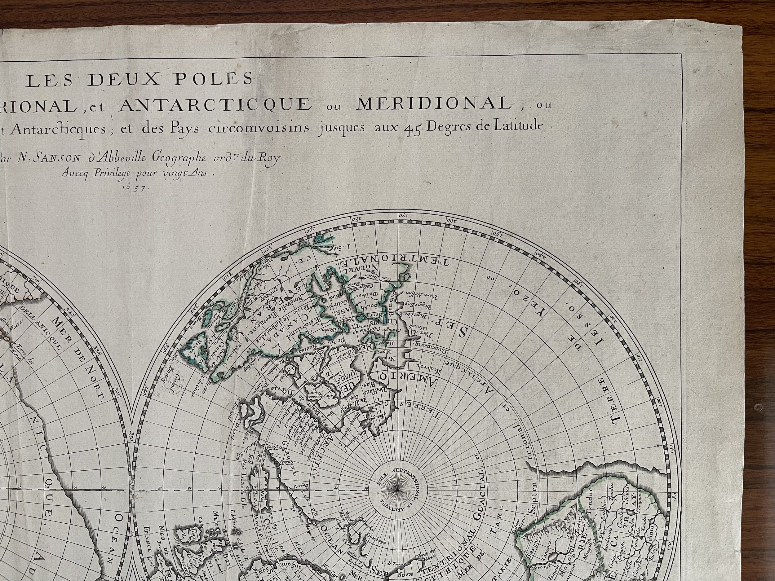
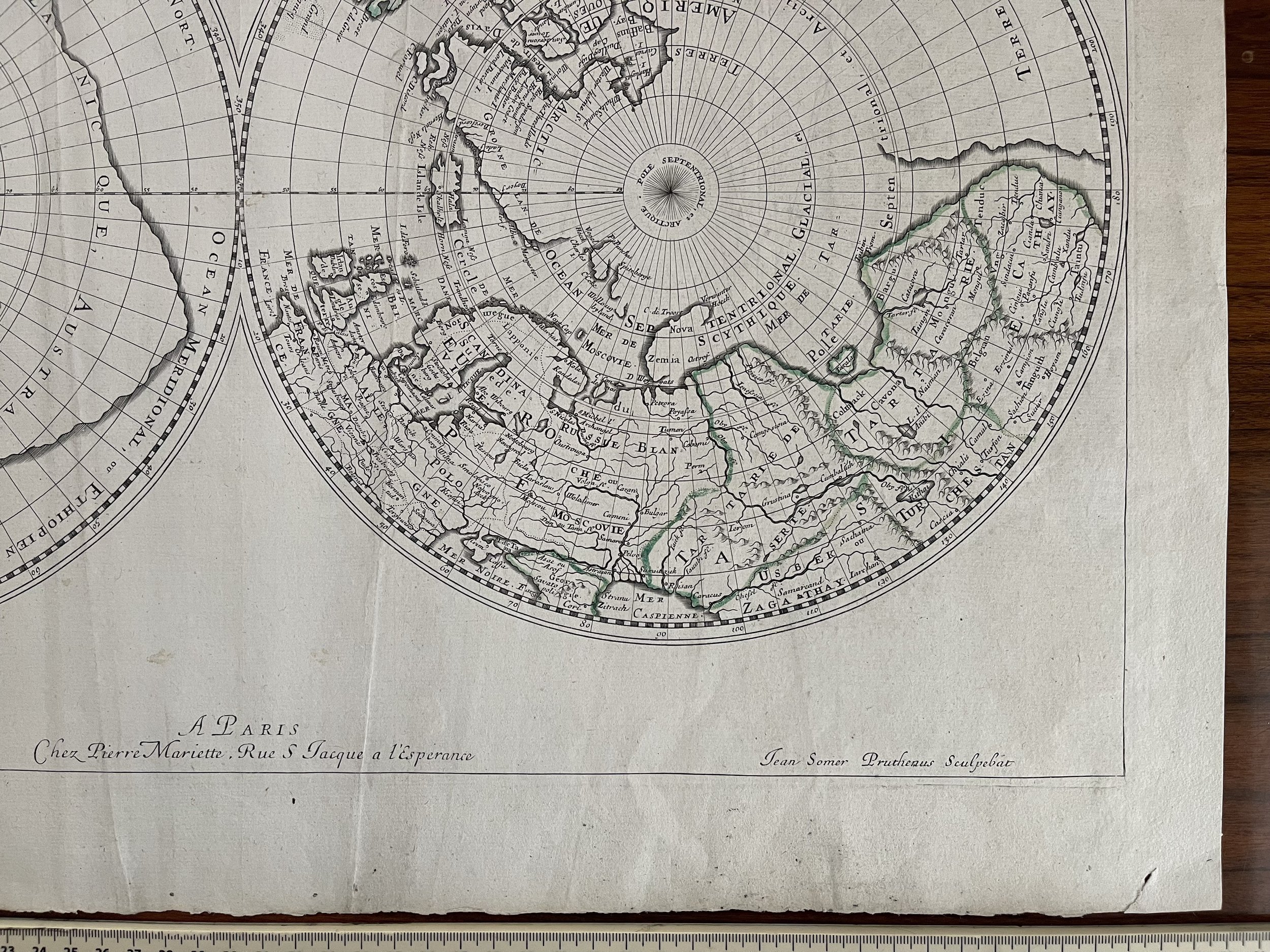
Les deux poles arctique ou septentrional, et Antarctique ou meridional, ou description des terres arctiques et antarctiques, et des pays circomvoisins jusques aux 45 degres de latitude
Exceptionally rare - Sanson's Map of the Poles, the First Dual Polar Projection
Fine old color example of this fascinating map of the Polar Regions, extending from the poles to 45 degrees latitude, first published by Sanson in 1657.
Sanson is widely considered as the father of French cartography and this innovative map is one of the first drawn on a dual polar projection. The map includes all the great geographical myths of the era pertaining to these then still largely unknown and undiscovered regions.
To the left is the southern pole, which is dominated by a huge southern continent. The southern continent, or Terra Australis Incognita, was a favorite geographical theory of the medieval and early modern periods; the continent was hypothesized to exist to counter balance the northern continents, hence its huge size. The idea would only be abandoned in the years after James Cook's first and second voyages at the end of the eighteenth century. Cook and his crew discovered the eastern coast of Australia and sailed extreme southern latitudes, reducing the possible size of the continent. Here, the continent is called Magellanicque after the first navigator to circumnavigate the globe, Ferdinand Magellan.
Peeking out of the rim of the hemisphere is the southern tip of South America. Tierra del Fuego is not attached to the southern continent, as it was in sixteenth century maps. This is due to the voyage of Jacob Le Maire and Willem Schouten between 1615 and 1617. They sought to elude the Dutch East India Company's monopoly of the Straits of Magellan. They searched to the east of Tierra del Fuego and found it possible to sail around it, via Cape Horn, proving the former was an island. Le Maire's name was used for the new strait, between Tierra del Fuego and Staten Landt, here Terre des Estats.
The north polar hemisphere, to the right, includes a definitive passage to China. The map suggests that if a ship could steer around Nova Zembla, it is possible to continue to the eastern Chinese coast. Along with the great southern continent, a northern passage, to the east or west, was the most sought after geographic chimera in history. In the sixteenth century, several voyages, particularly the three of Martin Frobisher, sought the passage. These voyages continued for the next several hundred years, culminating in the sensationalized lost Franklin expedition, and those sent to find him, in the mid-nineteenth century.
The third geographic fable that this map chronicles is the huge landmass that is seemingly attached to western North America, Terre de Yezo, ou Iesso. This island is on many eighteenth-century maps. Historically, Yezo (Eso, Yedso, Yesso) refers to the island of Hokkaido. It varies from a small island to a near-continent sized mass that stretches from Asia to Alaska. Sanson's depiction here is one of the most extensive of any on a seventeenth century map.
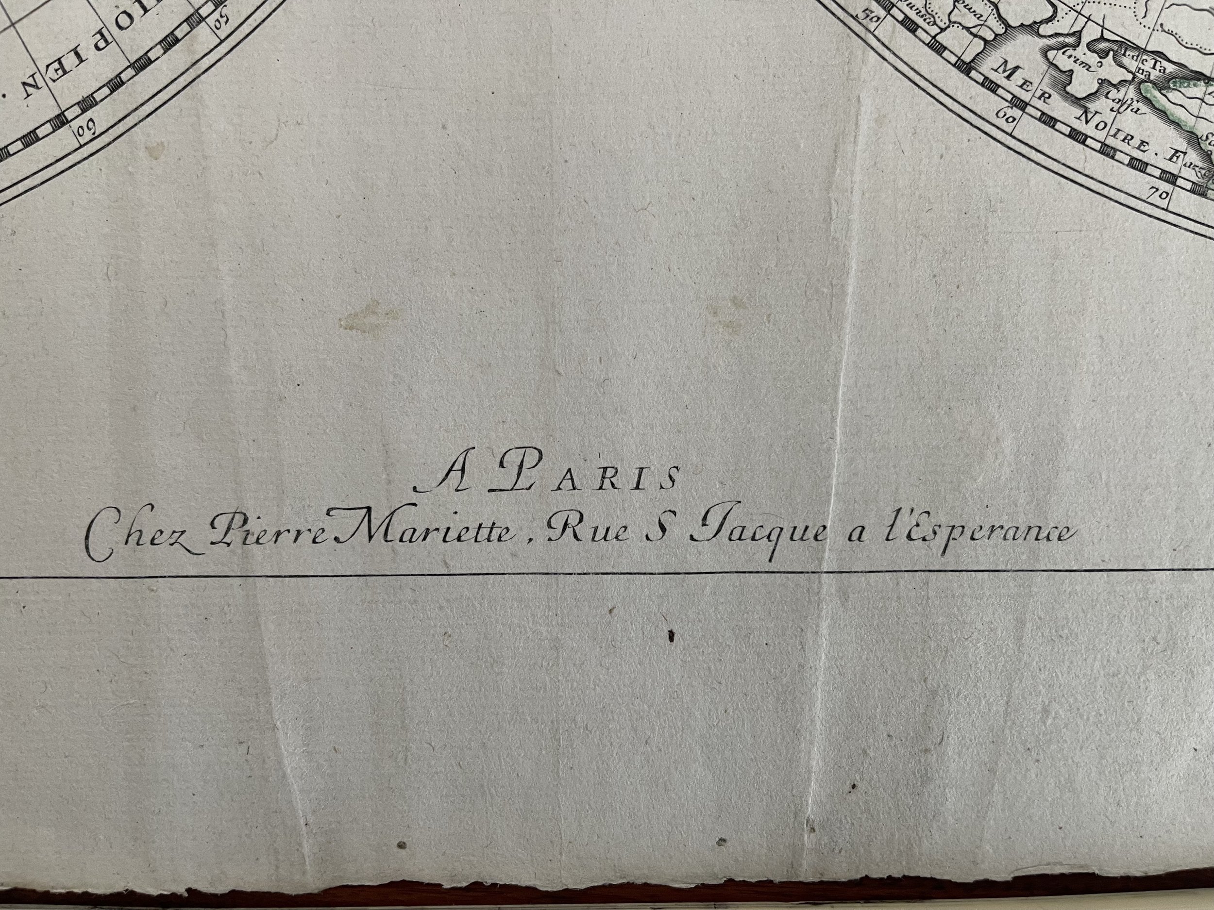
Sanson's map is important in the history of polar mapping. It was one of the first to use this dual hemisphere format. Previous depictions focused on only one of the poles, whereas Sanson sought to show the extremes at both ends of the earth. The map appeared in Sanson's atlas, Cartes générales de toutes les parties du monde (Paris : P. Mariette, 1658).
Nicholas Sanson (1600-1667) is considered the father of French cartography in its golden age from the mid-seventeenth century to the mid-eighteenth. Over the course of his career he produced over 300 maps; they are known for their clean style and extensive research. Sanson was largely responsible for beginning the shift of cartographic production and excellence from Amsterdam to Paris in the later-seventeenth century.
Sanson was born in Abbeville in Picardy. He made his first map at age twenty, a wall map of ancient Gaul. Upon moving to Paris, he gained the attention of Cardinal Richelieu, who made an introduction of Sanson to King Louis XIII. This led to Sanson's tutoring of the king and the granting of the title ingenieur-geographe du roi.
His success can be chalked up to his geographic and research skills, but also to his partnership with Pierre Mariette. Early in his career, Sanson worked primarily with the publisher Melchior Tavernier. Mariette purchased Tavernier’s business in 1644. Sanson worked with Mariette until 1657, when the latter died. Mariette’s son, also Pierre, helped to publish the Cartes générales de toutes les parties du monde (1658), Sanson' atlas and the first French world atlas.
Code : A244
Cartographer : Cartographer / engraver: Nicolas Sanson
Date : Paris 1657
Size : Sheet size: 21.5 x 15.5 inches
Availability : Available
Type - Genuine Antique
Grading - A
