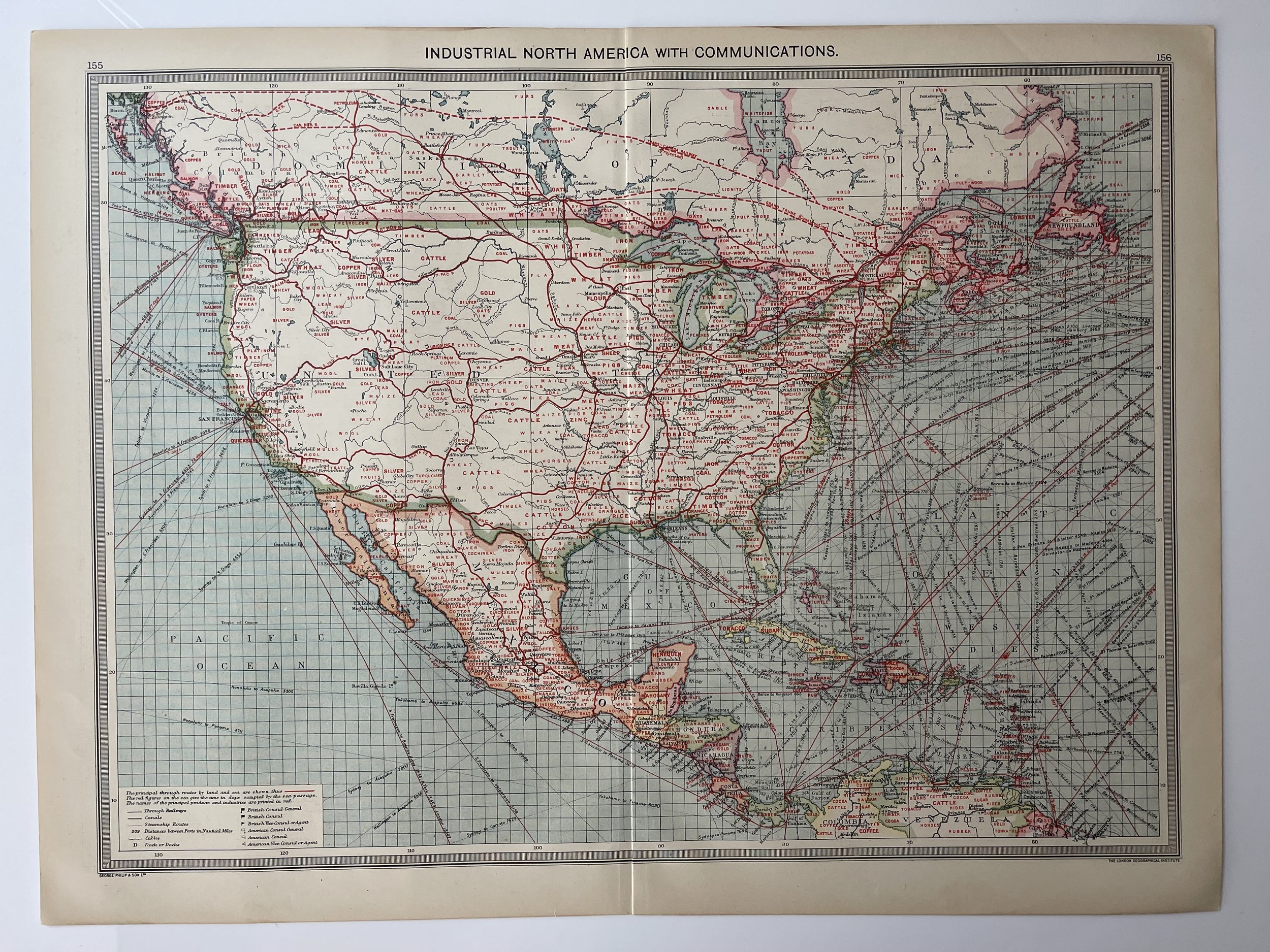
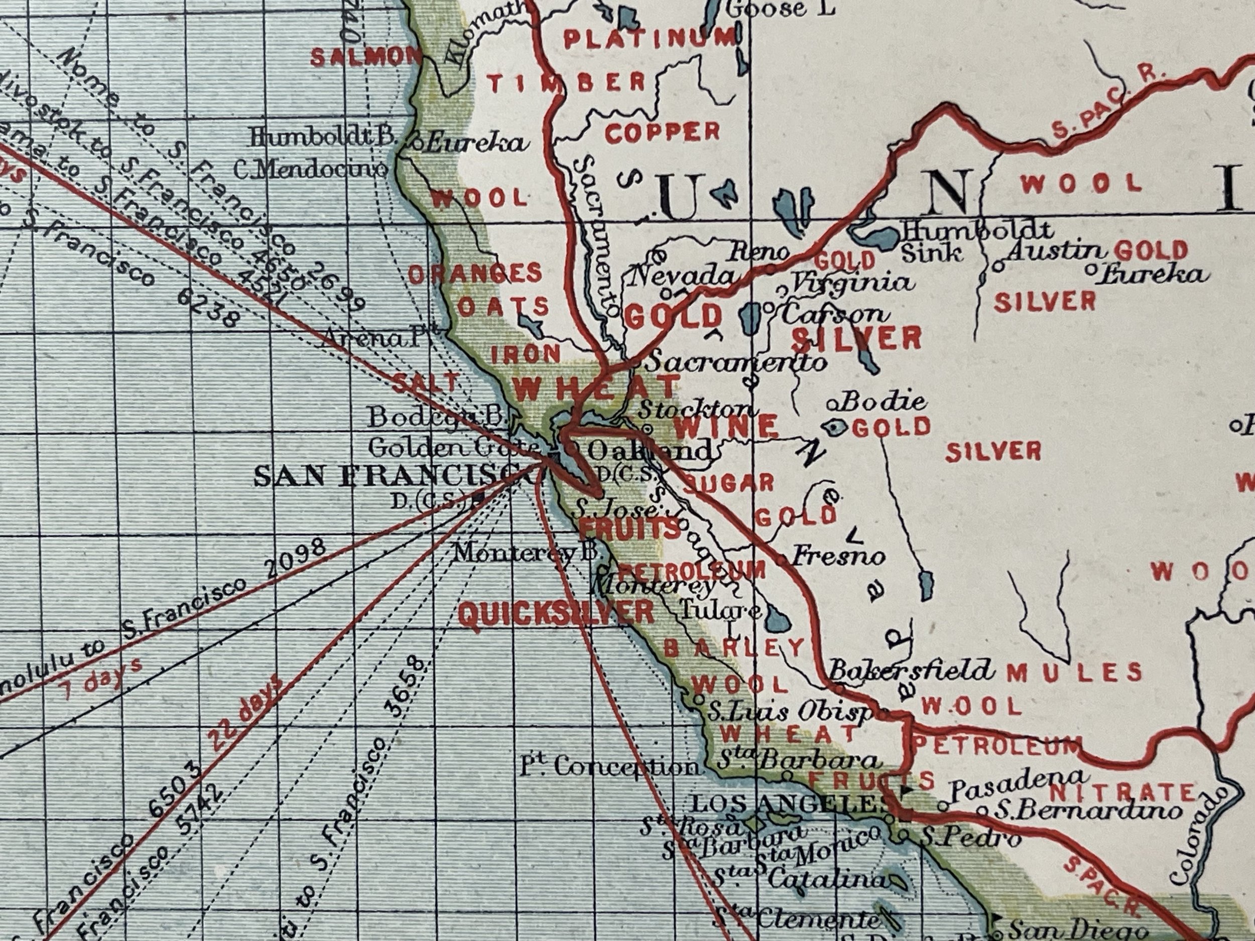
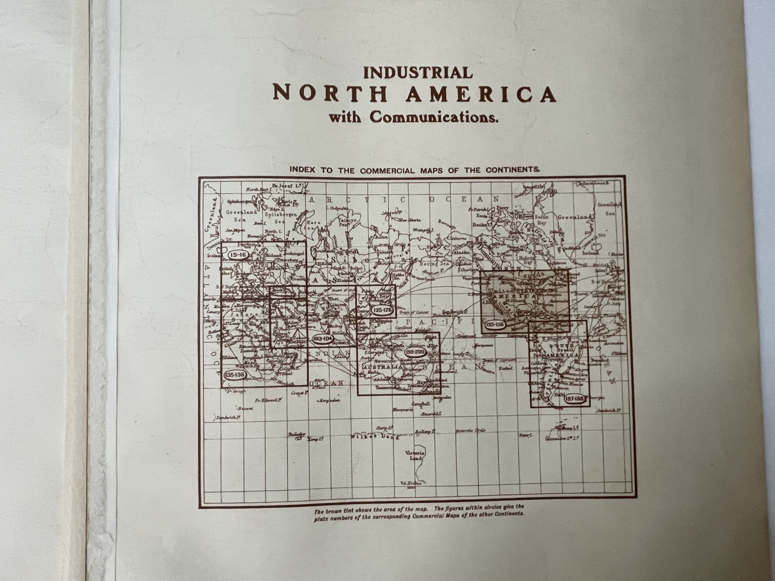
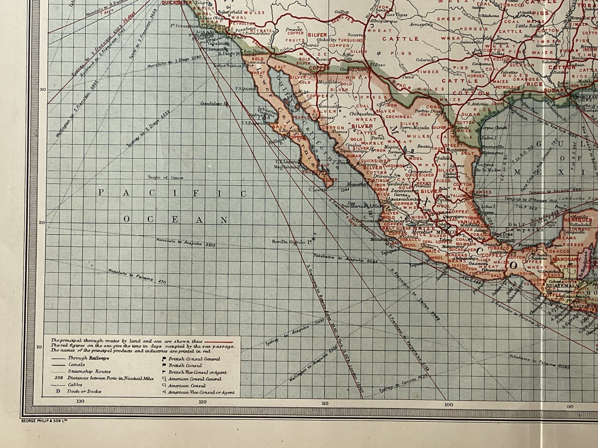
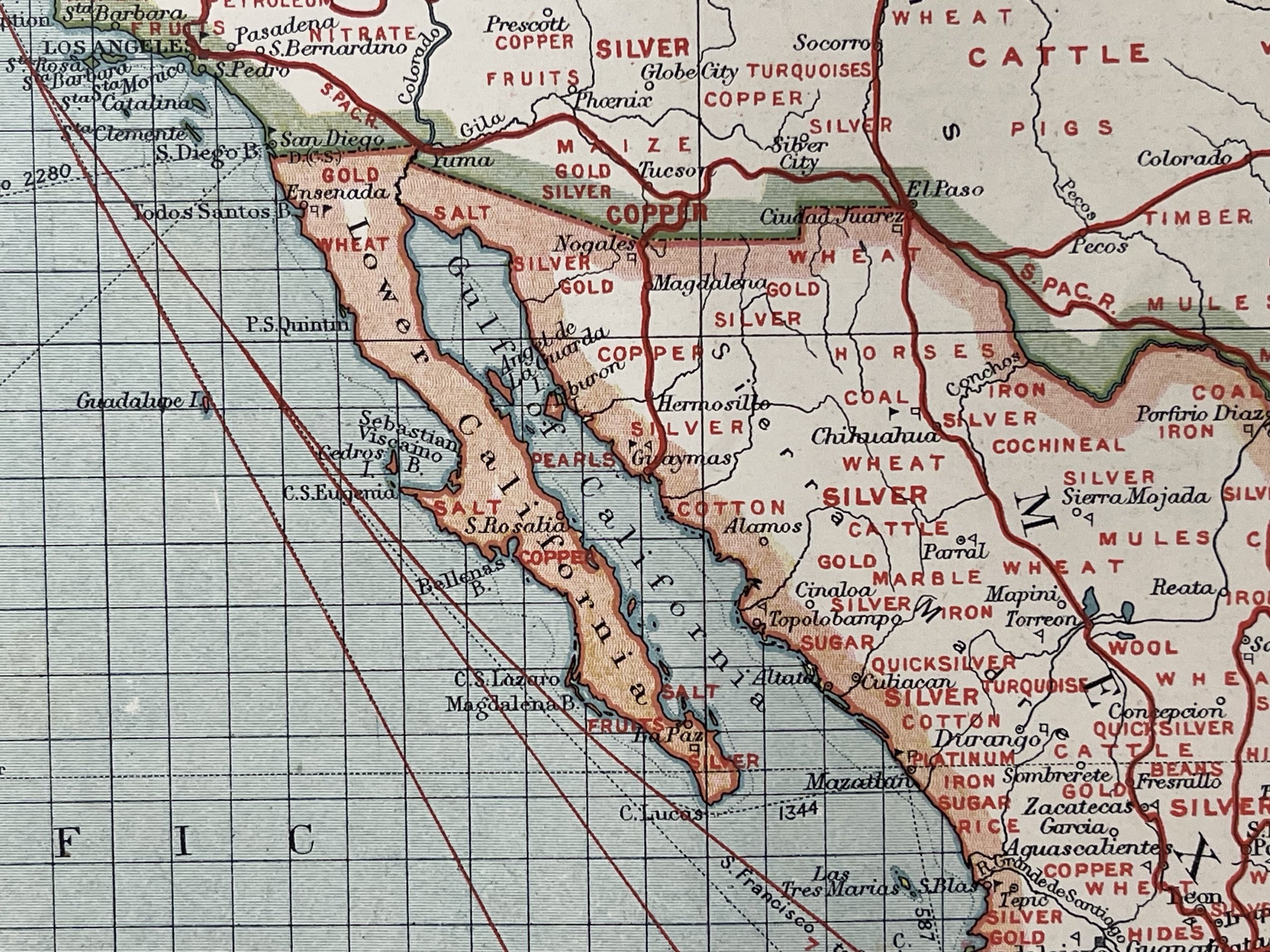
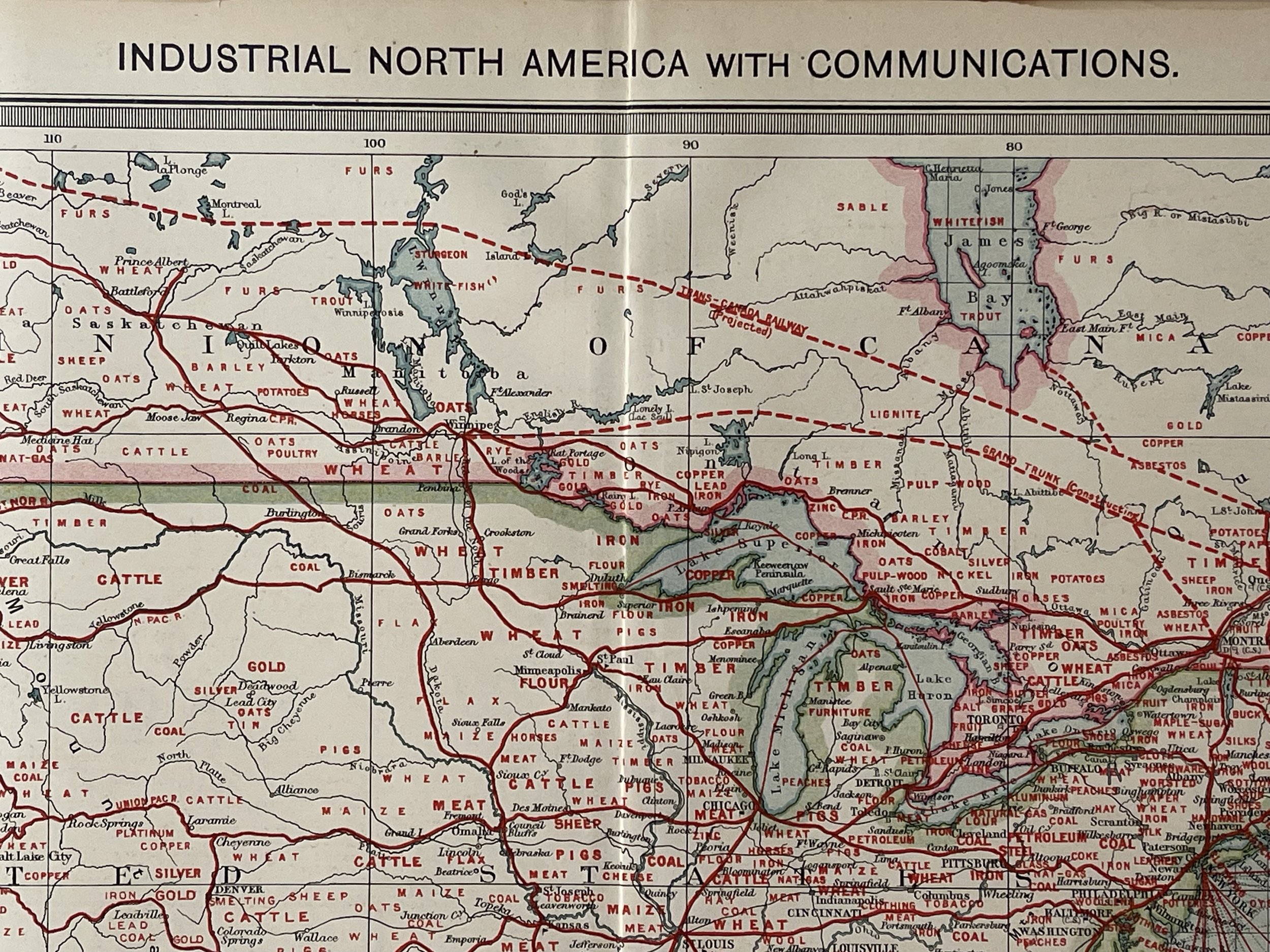
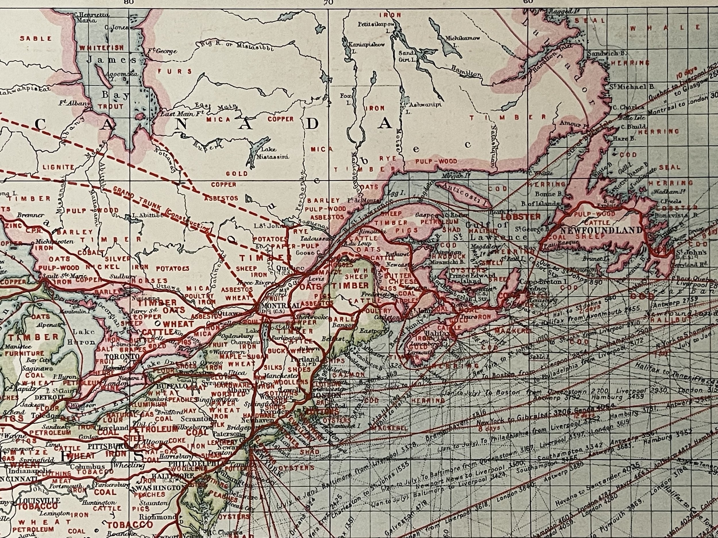
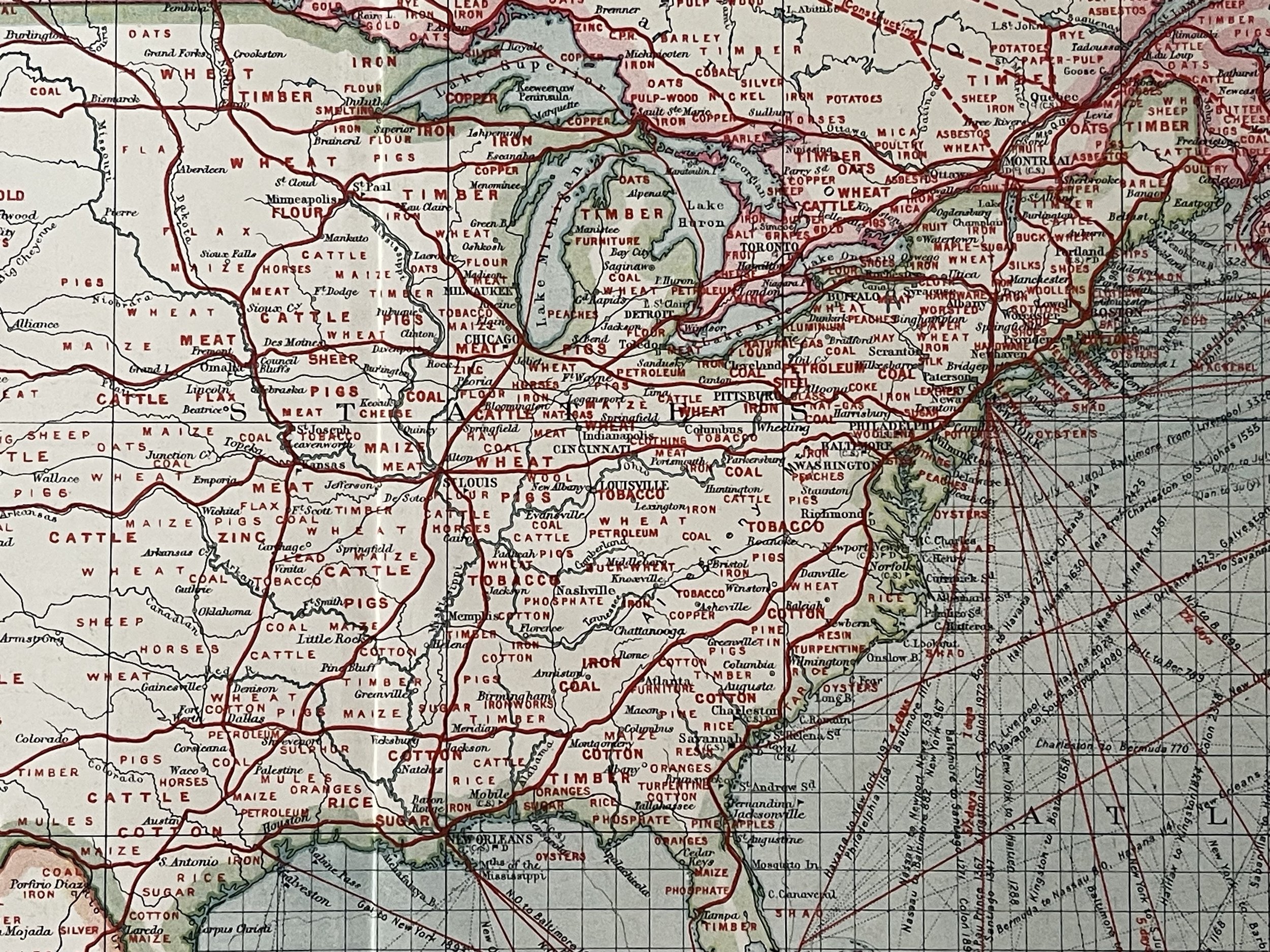
Industrial North America with communications - George Philip & Son Ltd - 1908
Industrial North America with communications - George Philip & Son Ltd - 1908
From the The Harmsworth Universal Atlas & Gazetteer. Sent from New Westminster Canada.
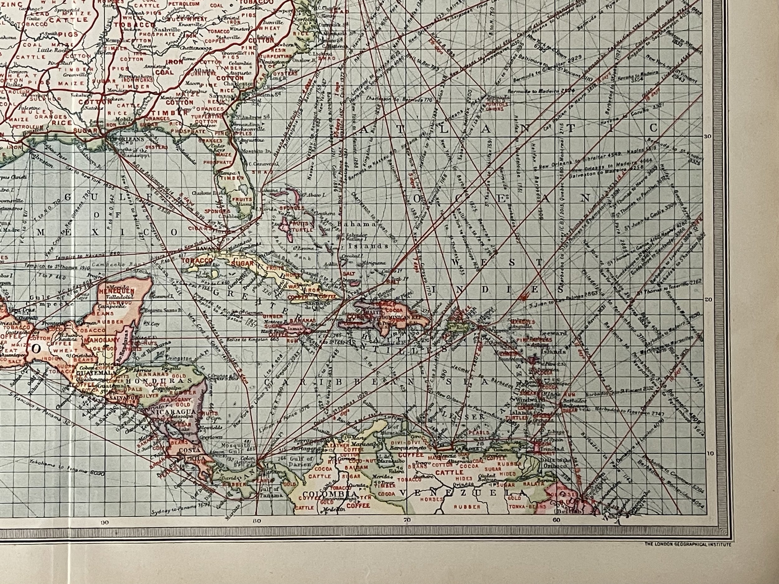
Economic map of the United States, the Caribbean, and Central America highlighting the commodities produced by each region and the trade routes. Map of North America : Industries & Communication
The Harmsworth Atlas was mapped by George Philip & Son, Published by The London Geographical Institute 1907.
George Philip and Son, British publishing house, one of the oldest in the United Kingdom, located in London. The company, specialising in maps and atlases, was founded in 1834. Some of its well-known publications are the Philip International Atlas and A Philip Management Planning Atlas.
Excellent condition. Pricing and grading commensurate.
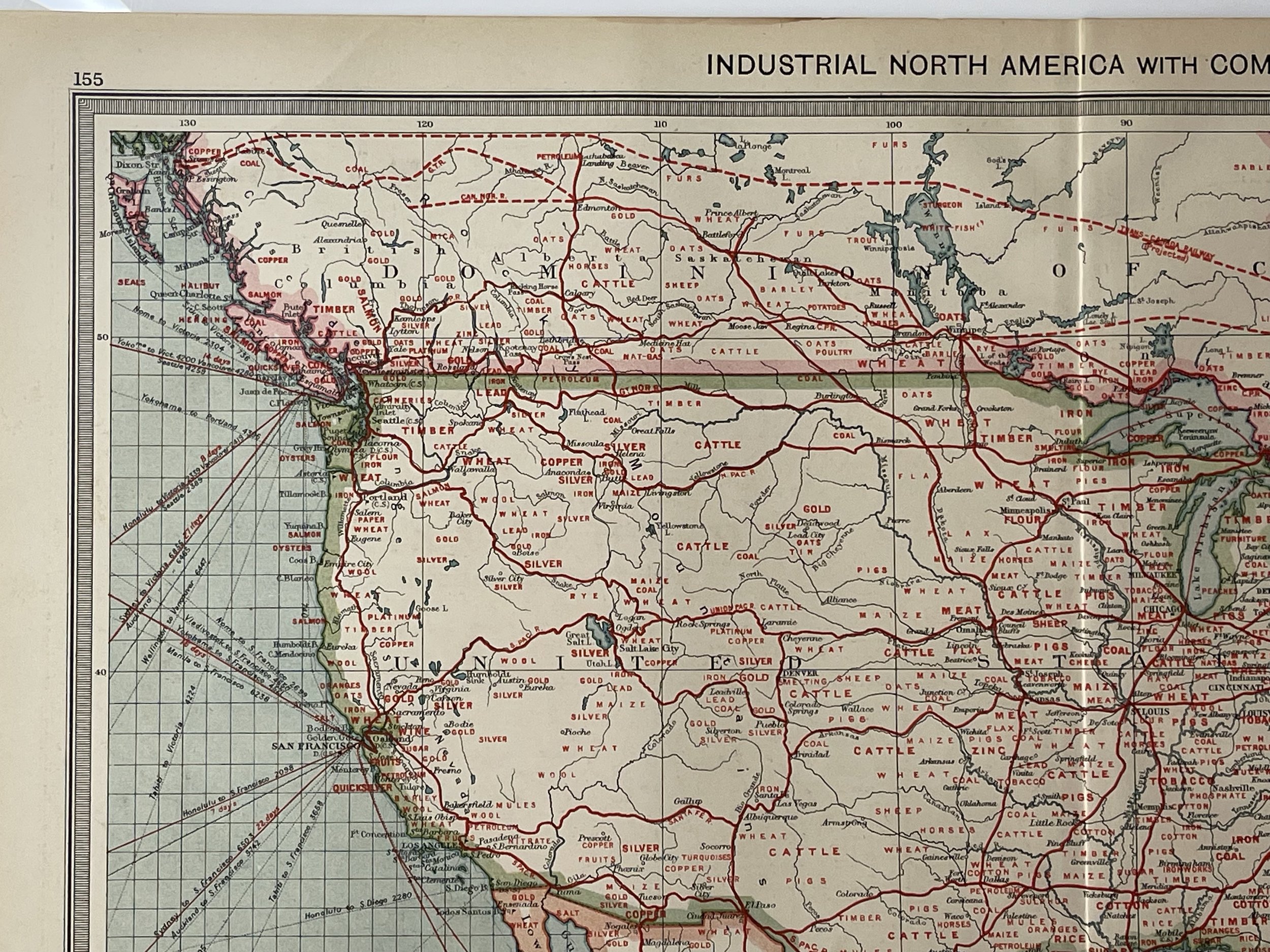
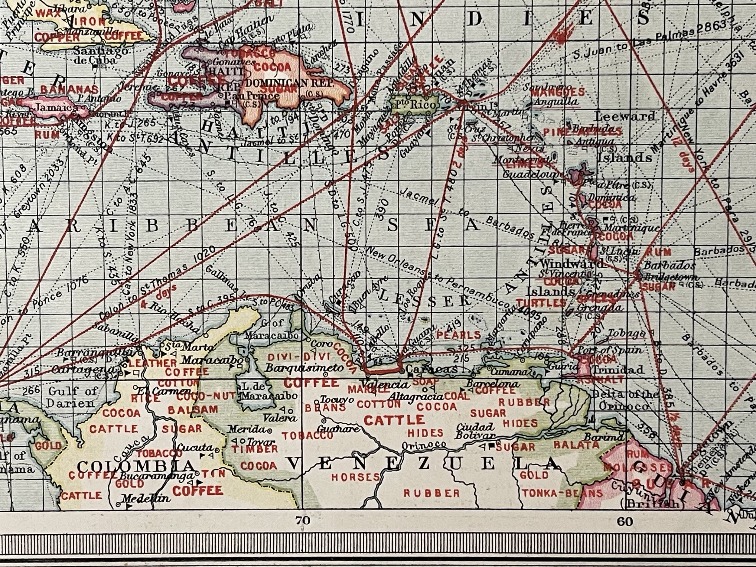
Industrial North America with communications - George Philip & Son Ltd - 1908
From the The Harmsworth Universal Atlas & Gazetteer. Sent from New Westminster Canada.
Economic map of the United States, the Caribbean, and Central America highlighting the commodities produced by each region and the trade routes. Map of North America : Industries & Communication
The Harmsworth Atlas was mapped by George Philip & Son, Published by The London Geographical Institute 1907.
George Philip and Son, British publishing house, one of the oldest in the United Kingdom, located in London. The company, specialising in maps and atlases, was founded in 1834. Some of its well-known publications are the Philip International Atlas and A Philip Management Planning Atlas.
Excellent condition. Pricing and grading commensurate.
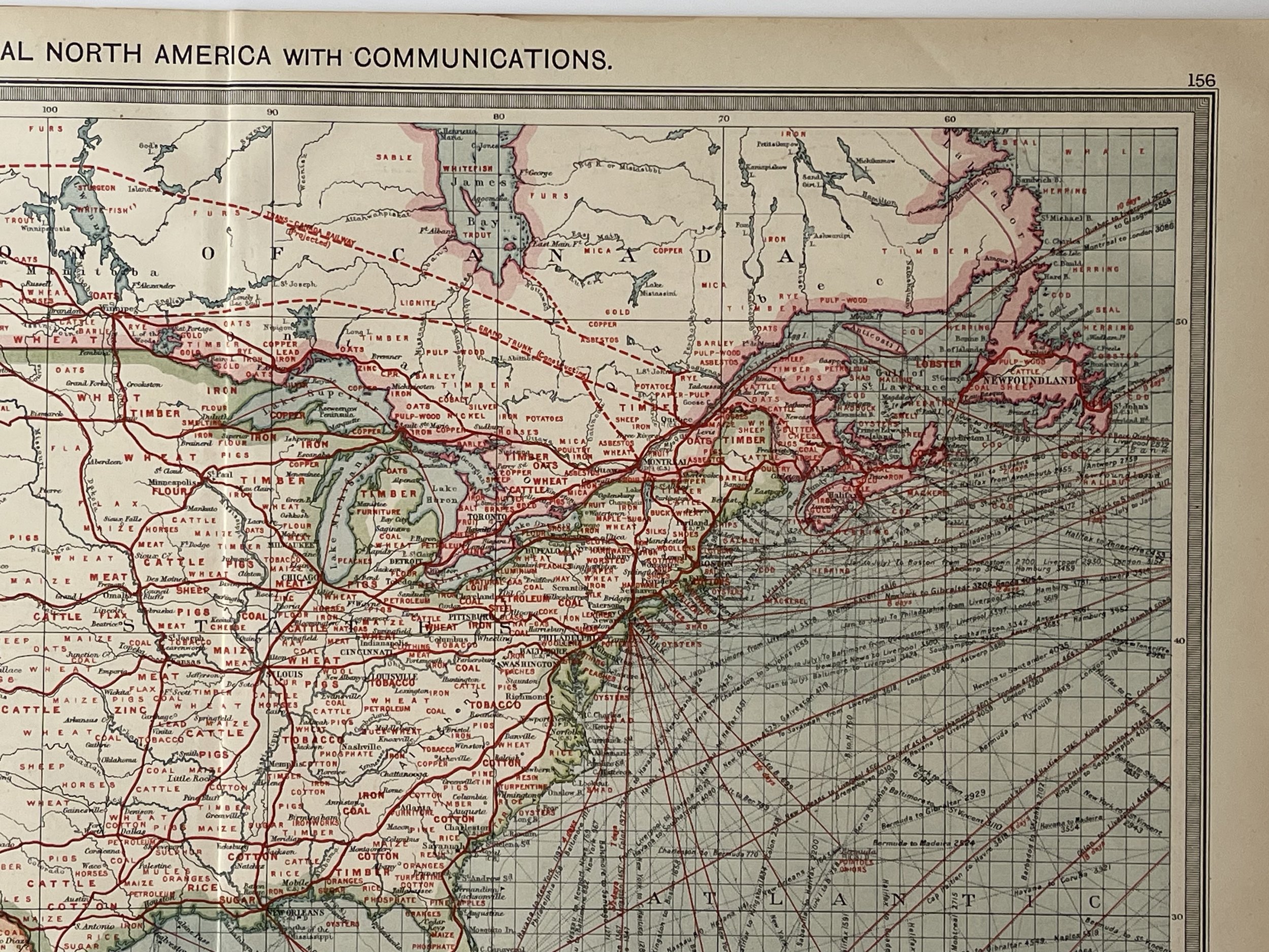
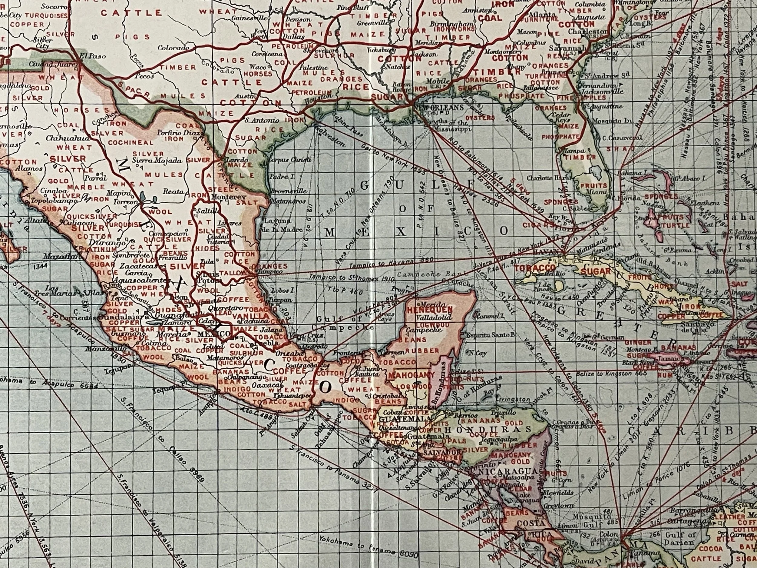
Industrial North America with communications - George Philip & Son Ltd - 1908
From the The Harmsworth Universal Atlas & Gazetteer. Sent from New Westminster Canada.
Economic map of the United States, the Caribbean, and Central America highlighting the commodities produced by each region and the trade routes. Map of North America : Industries & Communication
The Harmsworth Atlas was mapped by George Philip & Son, Published by The London Geographical Institute 1907.
George Philip and Son, British publishing house, one of the oldest in the United Kingdom, located in London. The company, specialising in maps and atlases, was founded in 1834. Some of its well-known publications are the Philip International Atlas and A Philip Management Planning Atlas.
Excellent condition. Pricing and grading commensurate.
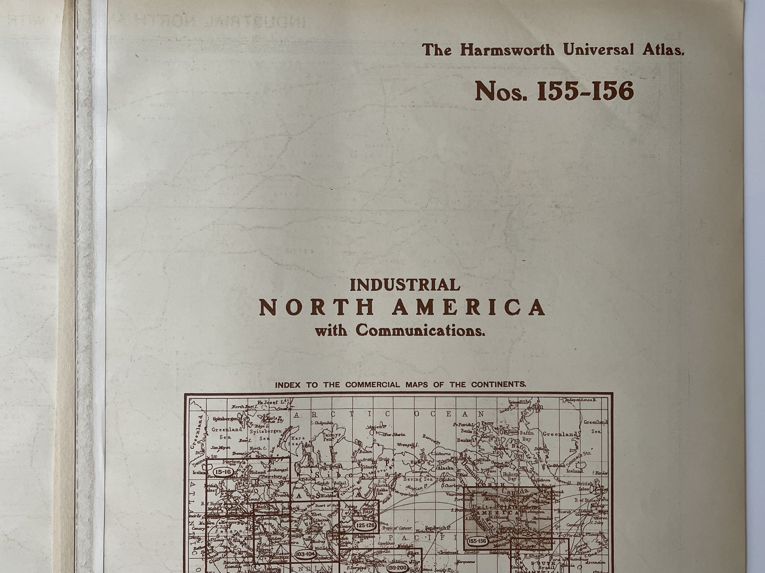
Code : A140
Cartographer : Cartographer / Engraver / Publisher: George Philip & Son
Date : Publication Place / Date - 1908
Size : Sheet size: 52.5 x 39.5 Inches
Availability : Available
Type - Genuine - Antique
Grading A+
Where Applicable - Folds as issued. Light box photo shows the folio leaf centre margin hinge ‘glue’, this is not visible otherwise.
Tracked postage, in casement. Please contact me for postal quotation outside of the UK.