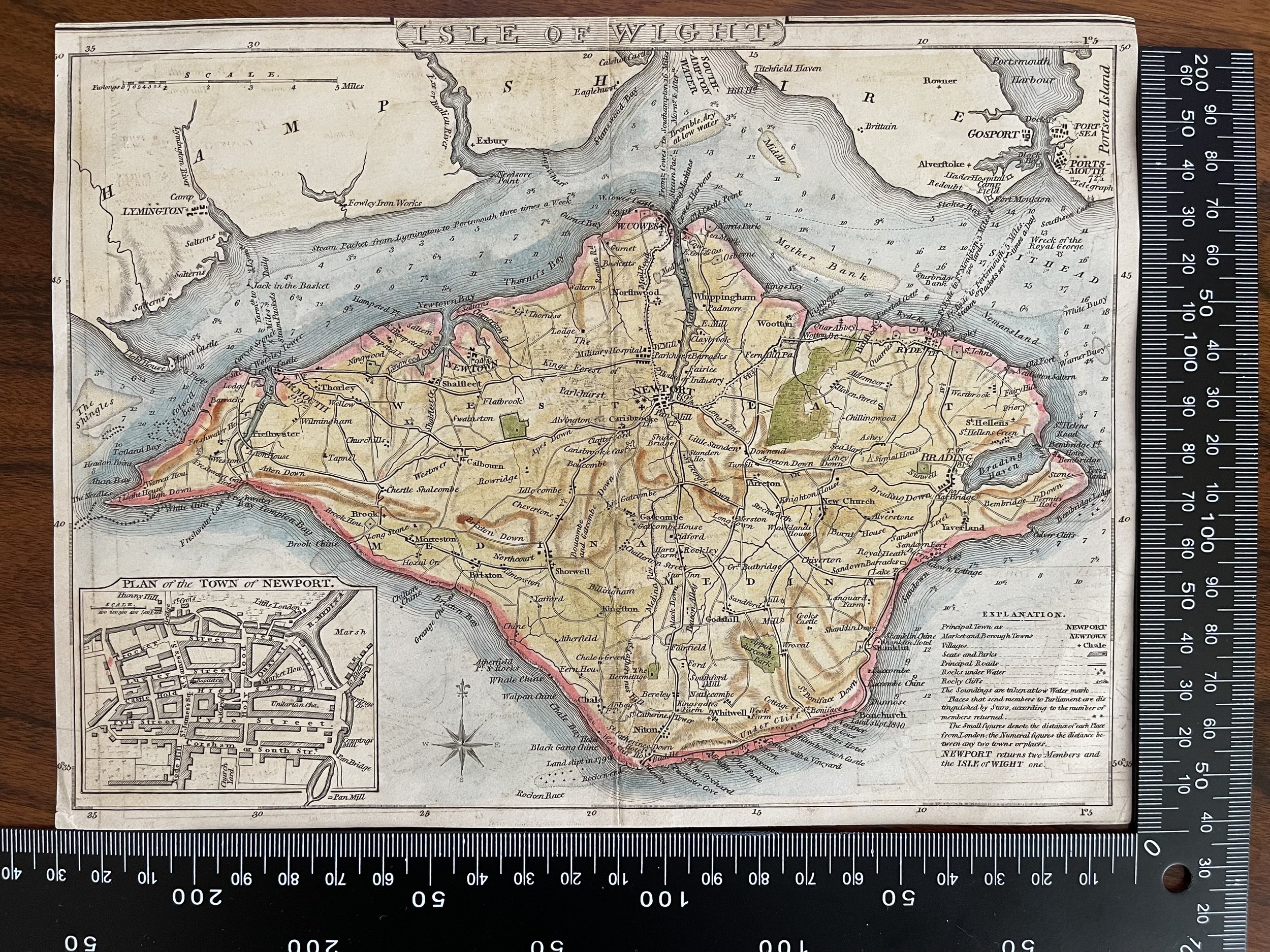
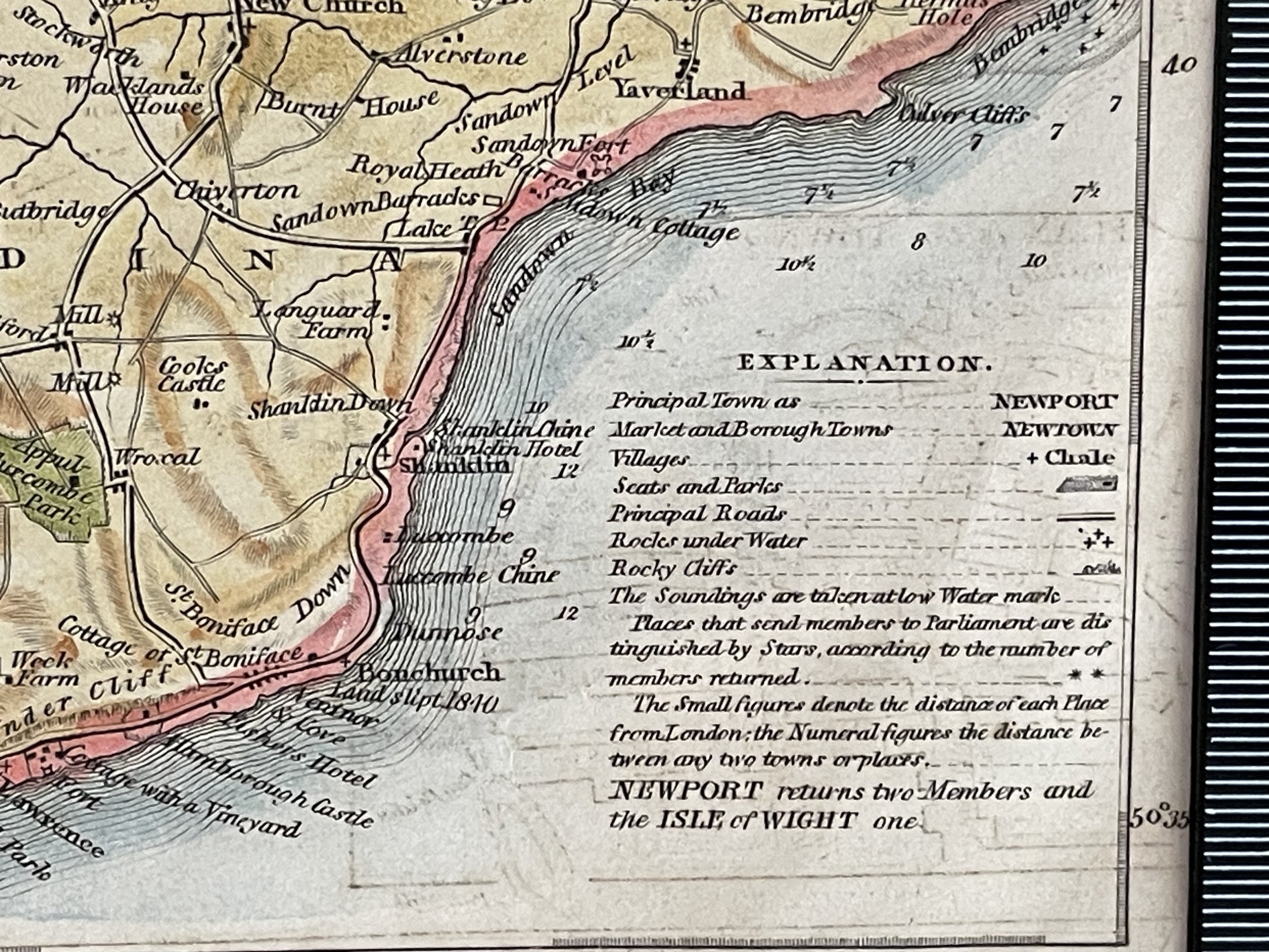
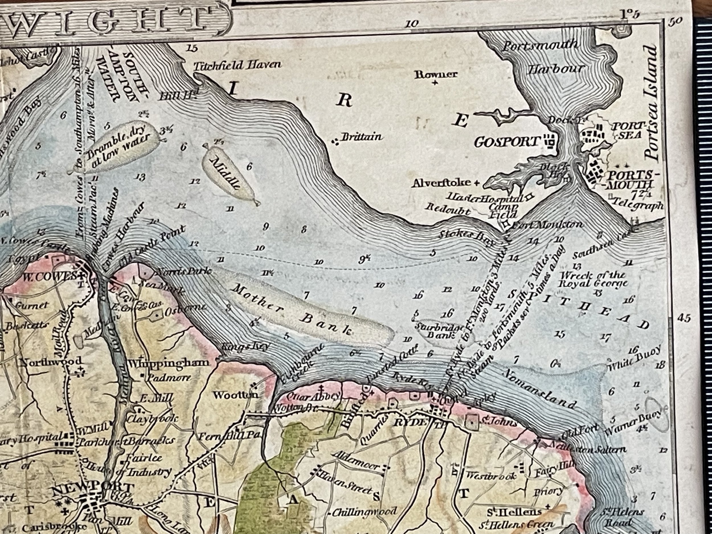
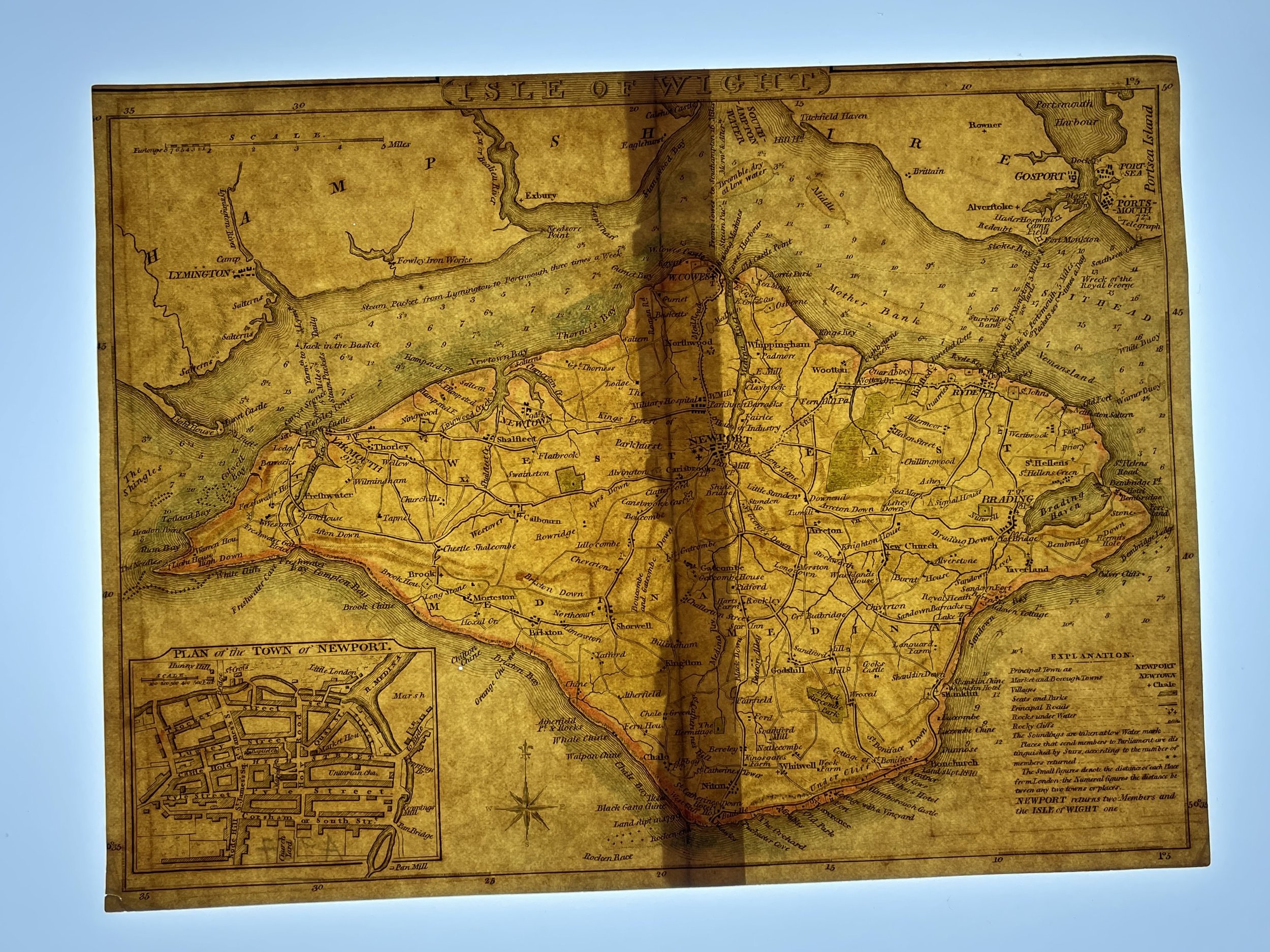

Isle of Wight, Southern England - George Cole & John Roper - 1810
A detailed and attractive early 19th Century map of the Isle of Wight, with an inset plan of the town of Newport, which was drawn and engraved by G. Cole & J. Roper, respectively, and published in The British Atlas (London: Vernor, Hood & Sharpe, 1805-1810).
George Cole was the cartographer and artist and John Roper the engraver. They collaborated to produce The British Atlas published in 1810. You maybe a little confused by the date a reputable map dealer will put on the maps as most of the maps bear a date earlier from 1804 to 1809 beneath together with the imprint of the publishers Vernor, Hood and Sharp. This is because the maps were prepared for Britton and Brayley's 'The Beauties of England and Wales' which was published in separate parts and published over a period of years. You are not going to be able to determine which work your map came from as the publishers imprint on each map is identical.
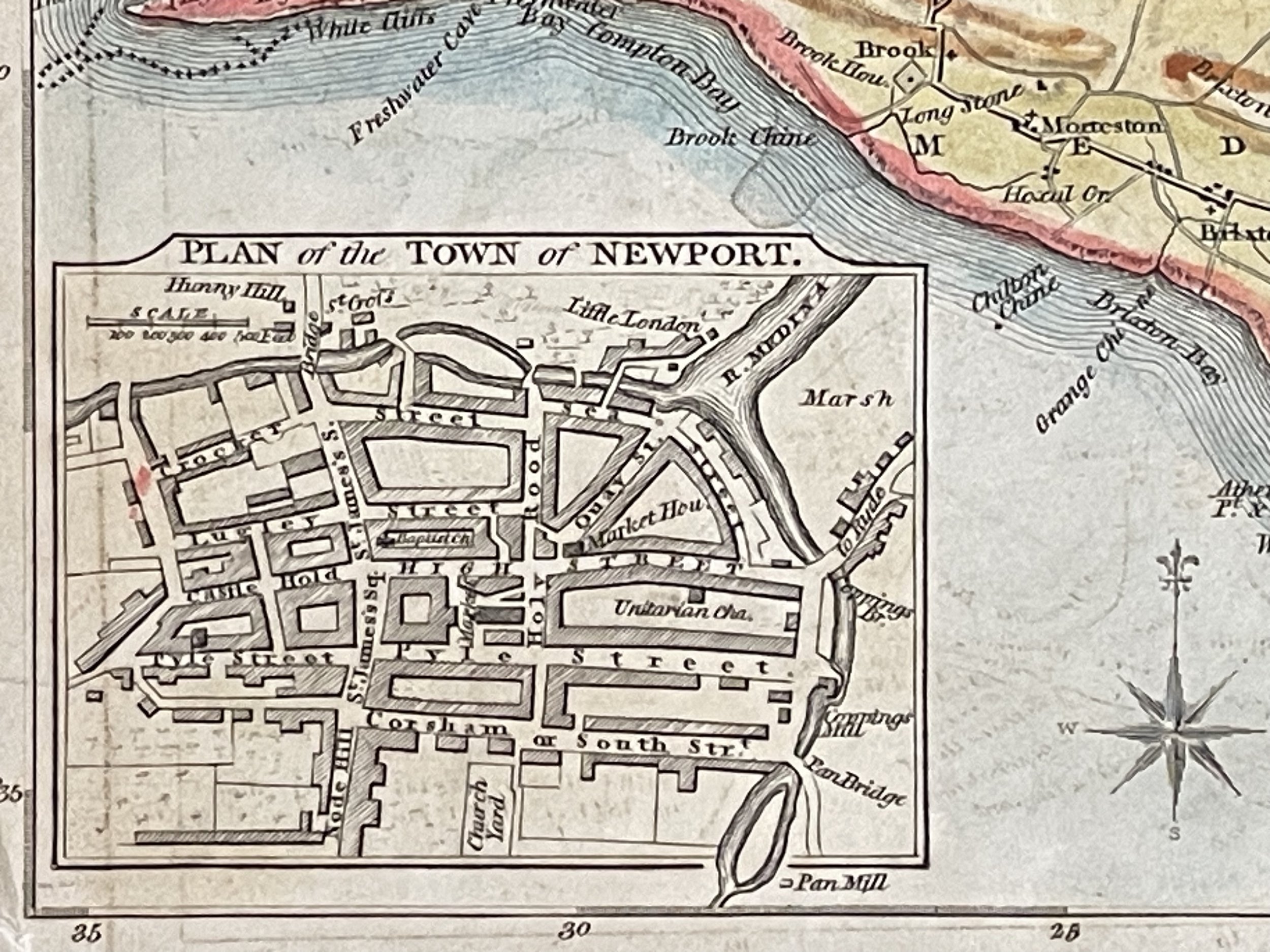
When The British Atlas was published in 1810 it also contained a fine series of 21 engraved town plans. The maps were also inluded in Dugdale's Curiosities of Great Britain published 1838.The maps were also inluded in Dugdale's Curiosities of Great Britain published 1838
A detailed and attractive early 19th Century map of the Isle of Wight, with an inset plan of the town of Newport, which was drawn and engraved by G. Cole & J. Roper, respectively, and published in The British Atlas (London: Vernor, Hood & Sharpe, 1805-1810).
George Cole was the cartographer and artist and John Roper the engraver. They collaborated to produce The British Atlas published in 1810. You maybe a little confused by the date a reputable map dealer will put on the maps as most of the maps bear a date earlier from 1804 to 1809 beneath together with the imprint of the publishers Vernor, Hood and Sharp. This is because the maps were prepared for Britton and Brayley's 'The Beauties of England and Wales' which was published in separate parts and published over a period of years. You are not going to be able to determine which work your map came from as the publishers imprint on each map is identical.
When The British Atlas was published in 1810 it also contained a fine series of 21 engraved town plans. The maps were also inluded in Dugdale's Curiosities of Great Britain published 1838.The maps were also inluded in Dugdale's Curiosities of Great Britain published 1838
Code : A957
Cartographer : Cartographer / Engraver / Publisher: George Cole & John Roper
Date : Publication Place / Date - 1810
Size : Sheet size: Image Size: 23 x 17.5 cm
Availability : Available
Type - Genuine - Antique
Grading A
Where Applicable - Folds as issued. Light box photo shows the folio leaf centre margin hinge ‘glue’, this is not visible otherwise.
Tracked postage, in casement. Please contact me for postal quotation outside of the UK.