John Bartholomew 1888
From an 1888 Atlas of the World. The colours indicate the time required to travel from London to destinations around the world, measured in days. For example, at that time it was possible to reach most of Western Europe within five days, New York in five to ten days, and the west coast of North America and Africa, within 10-20 days, but to reach central Africa, Australia and much of Asia required 40 or more travel days. It is now surprisingly accurate if the units are changed from days to hours. For example, travel from London to New York now requires five to ten hours, and to isolated areas in Africa or Australia often takes 20-40 hours including time required to reach airports, clear security and customs, make connections, and travel overland to destinations. This indicates that international travel speeds have increased about 24 times.
John Bartholomew (25 December 1831 – 30 March 1893) was a Scottish cartographer
Bartholomew was born in Edinburgh, Scotland. His father, John Bartholomew Sr., started a cartographical establishment in Edinburgh, and he was educated in the work.
He was subsequently assistant to the German geographer August Petermann, until in 1856 he took up the management of his father's firm. For this establishment, now known as the Edinburgh Geographical Institute, Bartholomew built up a reputation unsurpassed in Great Britain to produce the finest cartographical work.
Bartholomew was an in-house cartographer for George Philip. He is best known for the development of colour contouring (or hypsometric tints), the system of representing altitudes on a graduated colour scale, with areas of high altitude in shades of brown and areas of low altitude in shades of green. He first showcased his colour contouring system at the Paris Exhibition of 1878; although it initially met with scepticism, it went on to become standard cartographical practice.
Among his numerous publications, particularly worthy of note is the series of maps of Great Britain reduced from the Ordnance Survey to scales of ½ inch and ¾ inch to 1 mile, with relief shown by contour lines and hypsometric tints. The ½ inch series is among the finest of its kind ever produced.
Upon his retirement in 1888, John Bartholomew was succeeded in the firm by his son John George, who extended the ½-inch series, and applied its principles to many other works. For the last six years of his life Bartholomew was living at 32 Royal Terrace in Edinburgh.
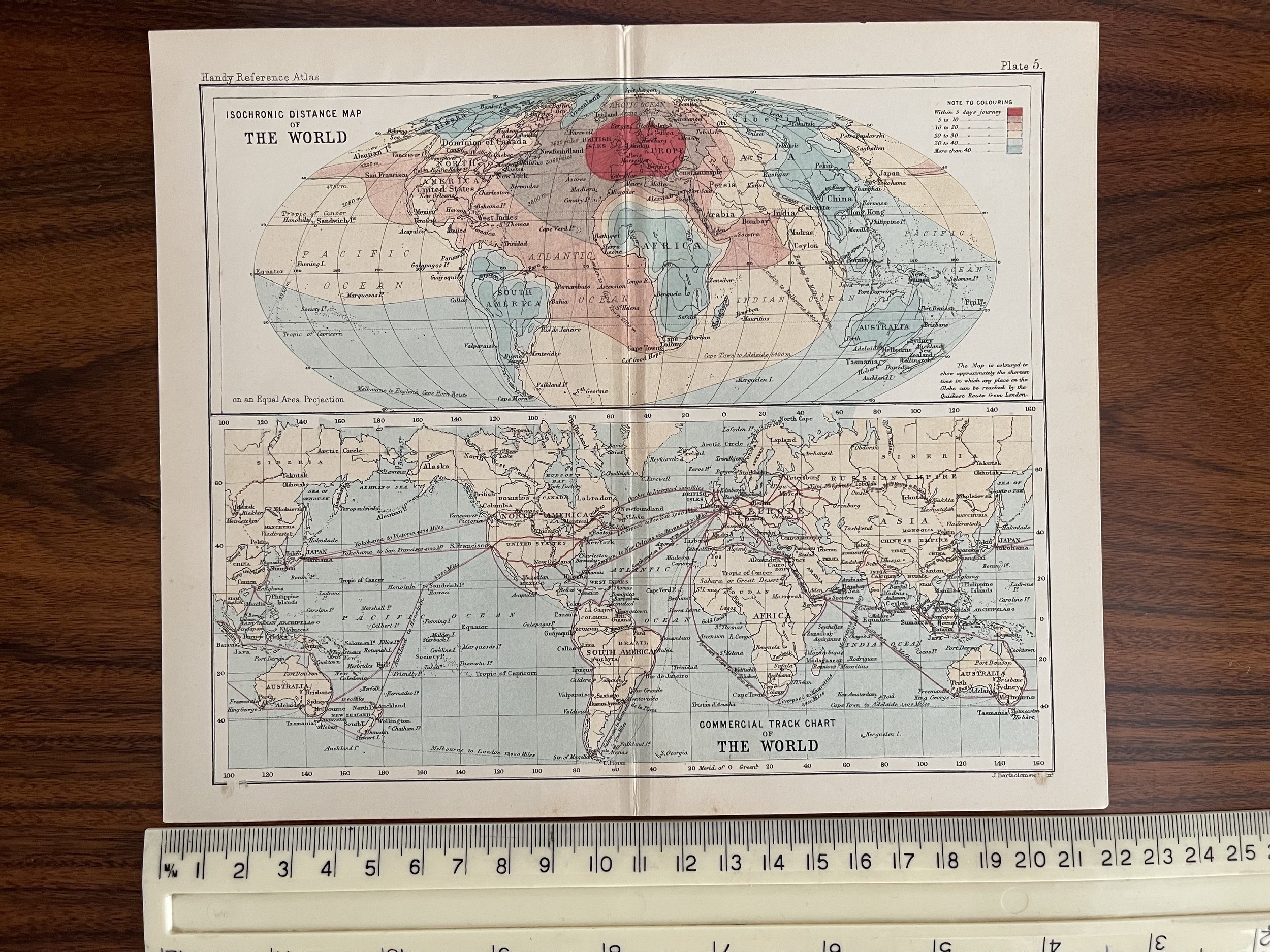 Image 1 of 7
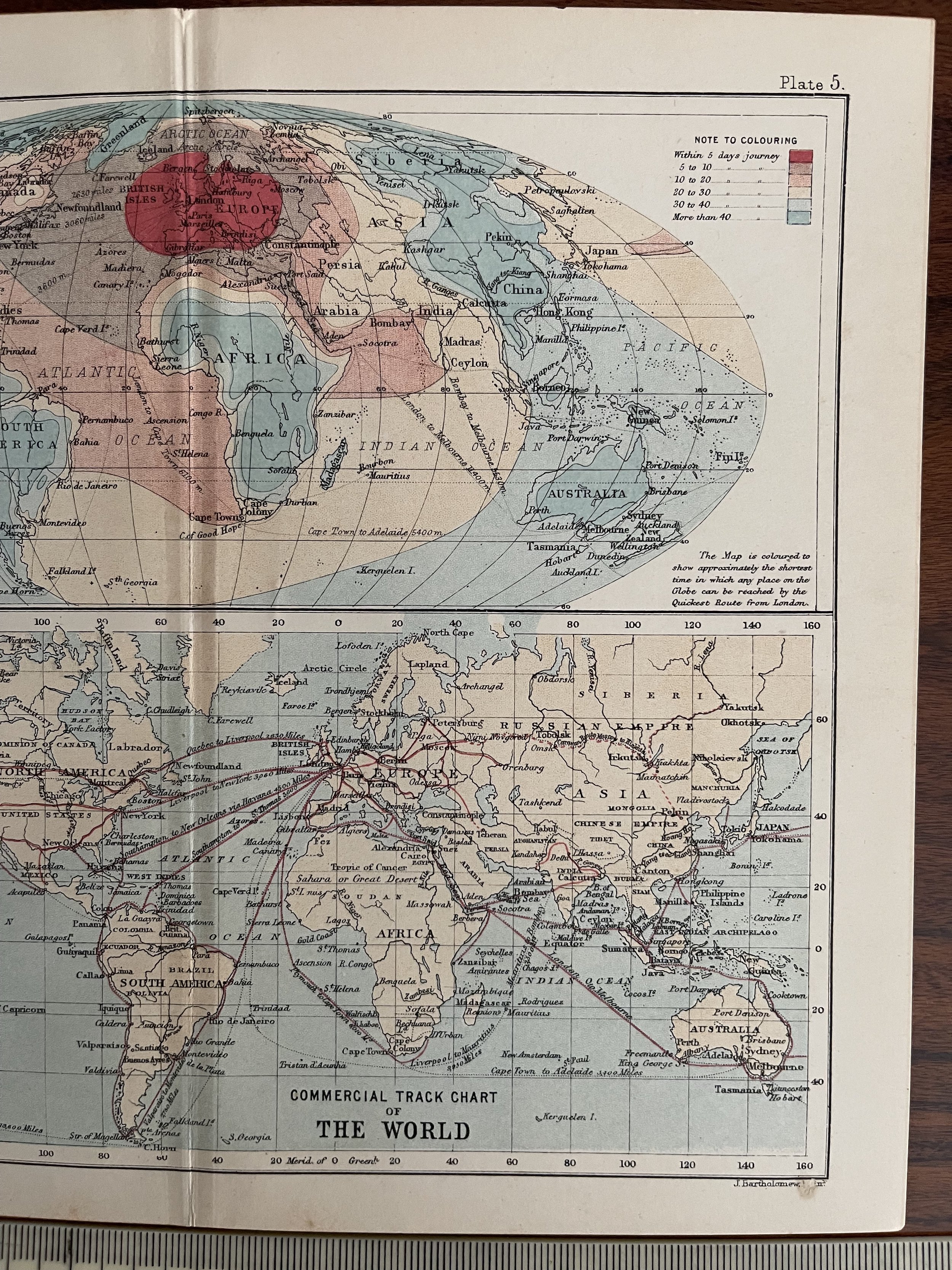 Image 2 of 7
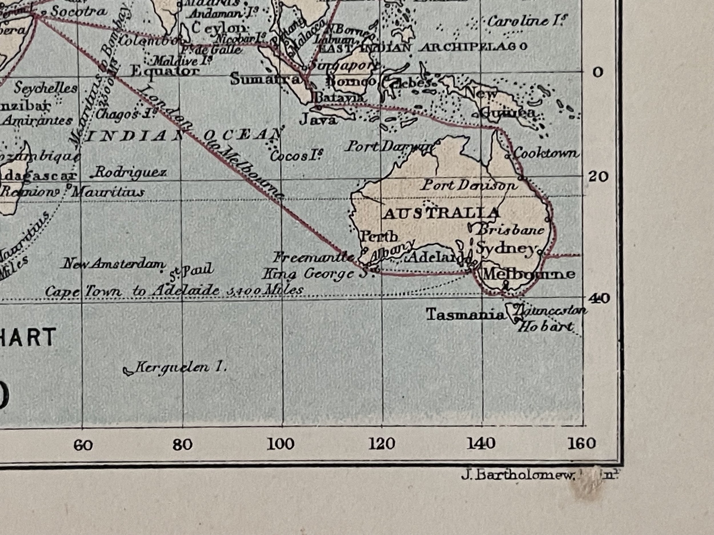 Image 3 of 7
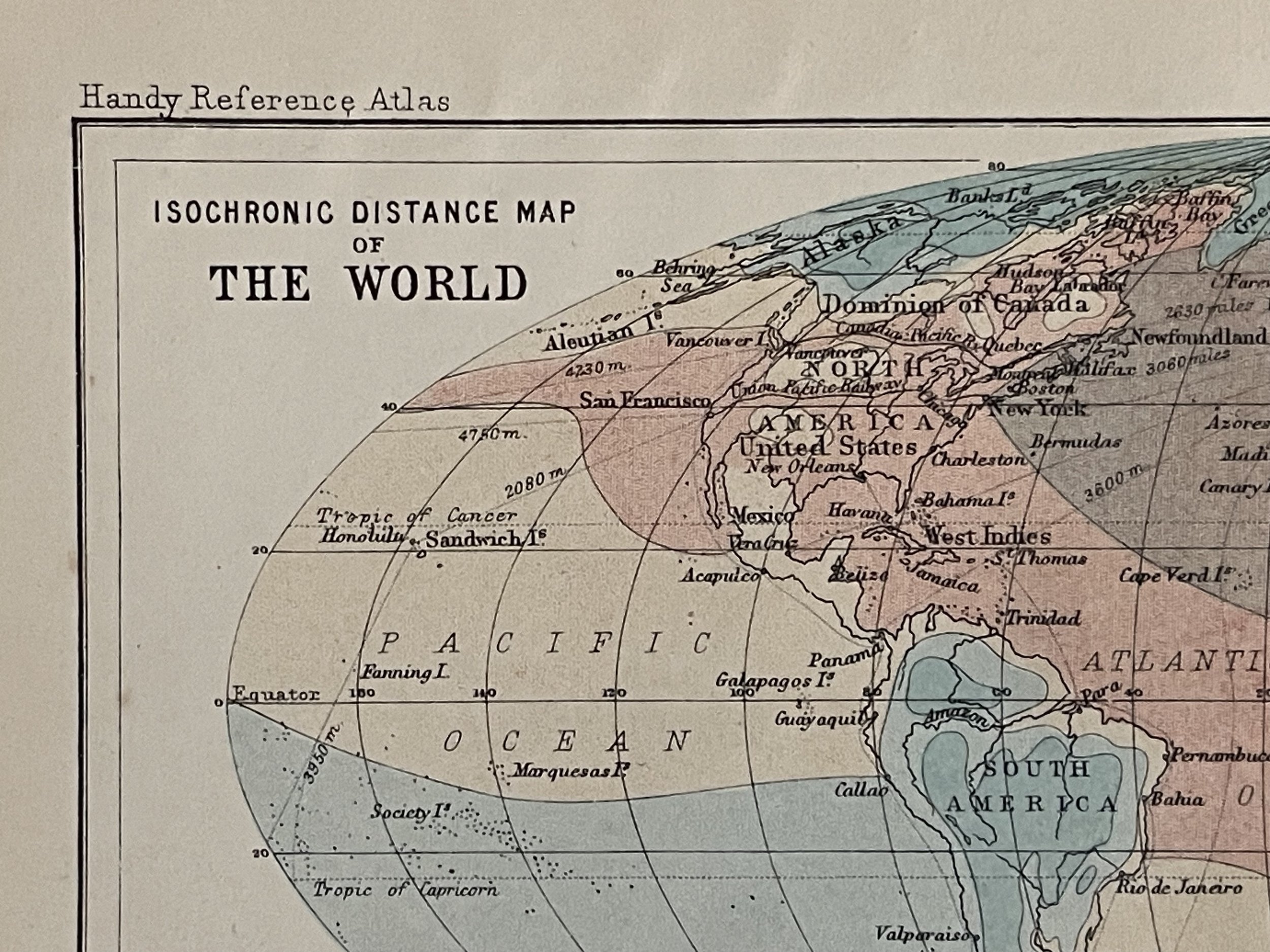 Image 4 of 7
 Image 5 of 7
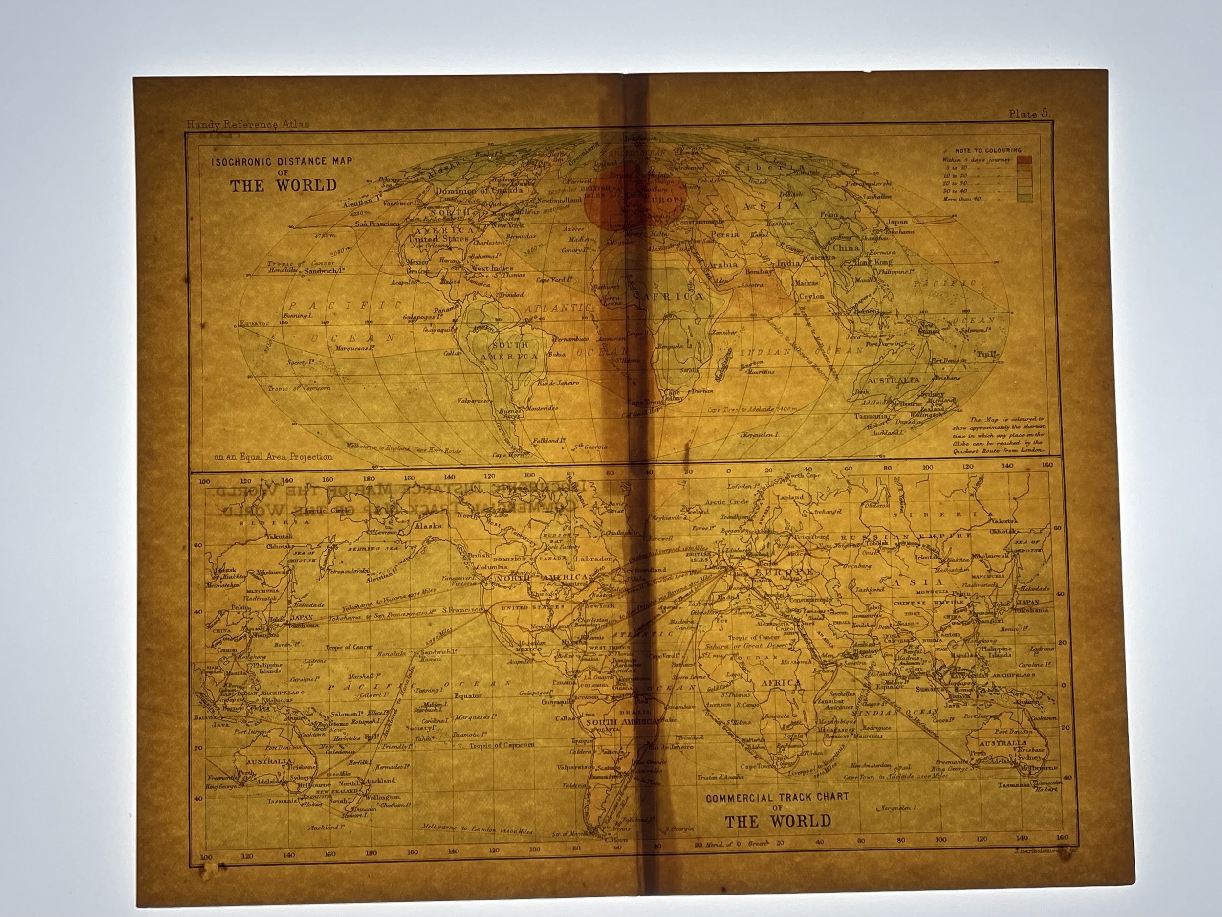 Image 6 of 7
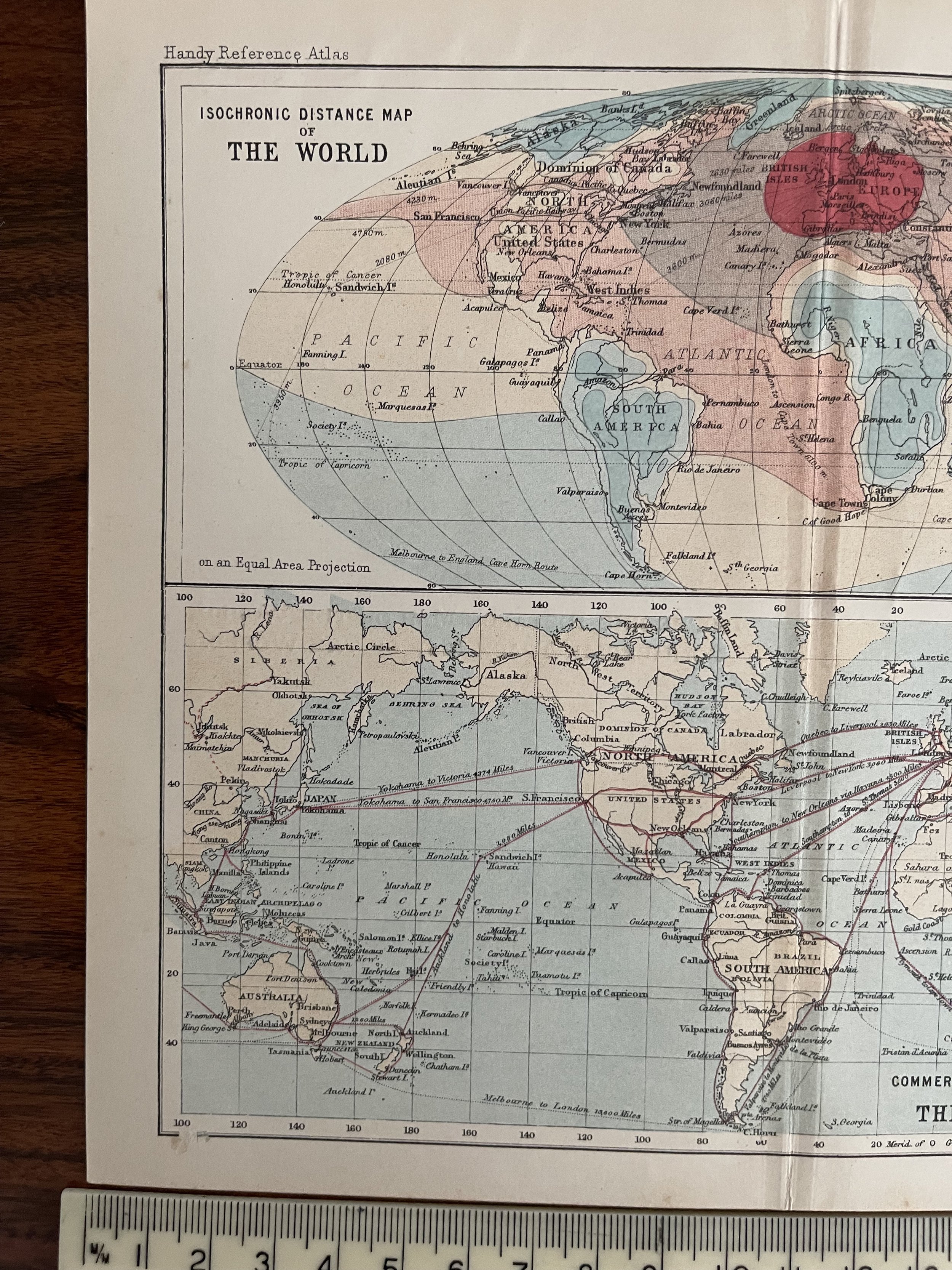 Image 7 of 7