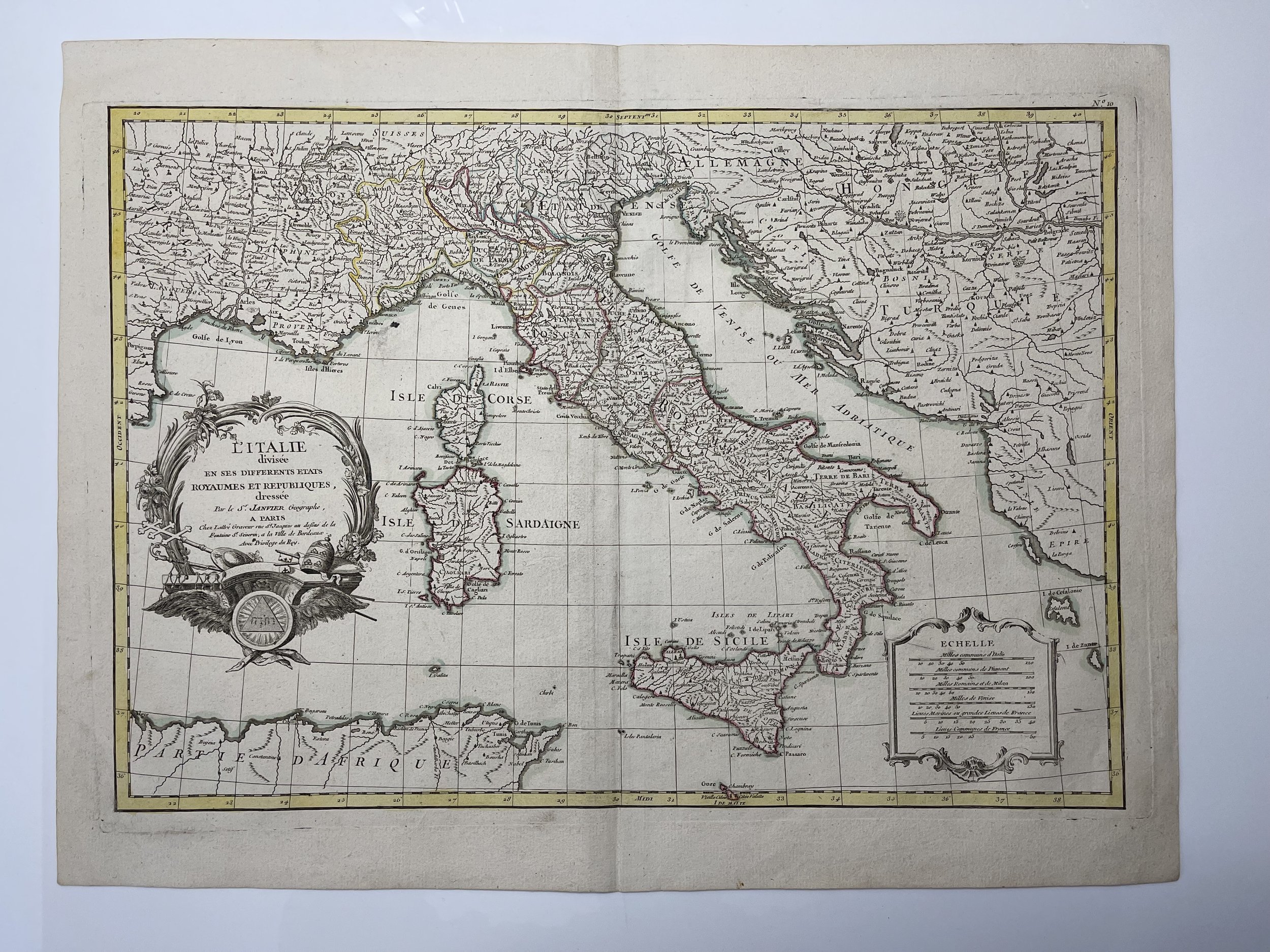
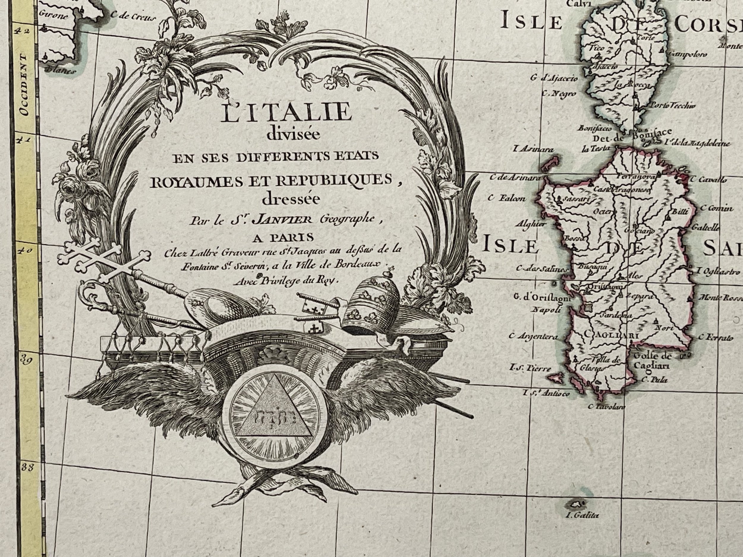
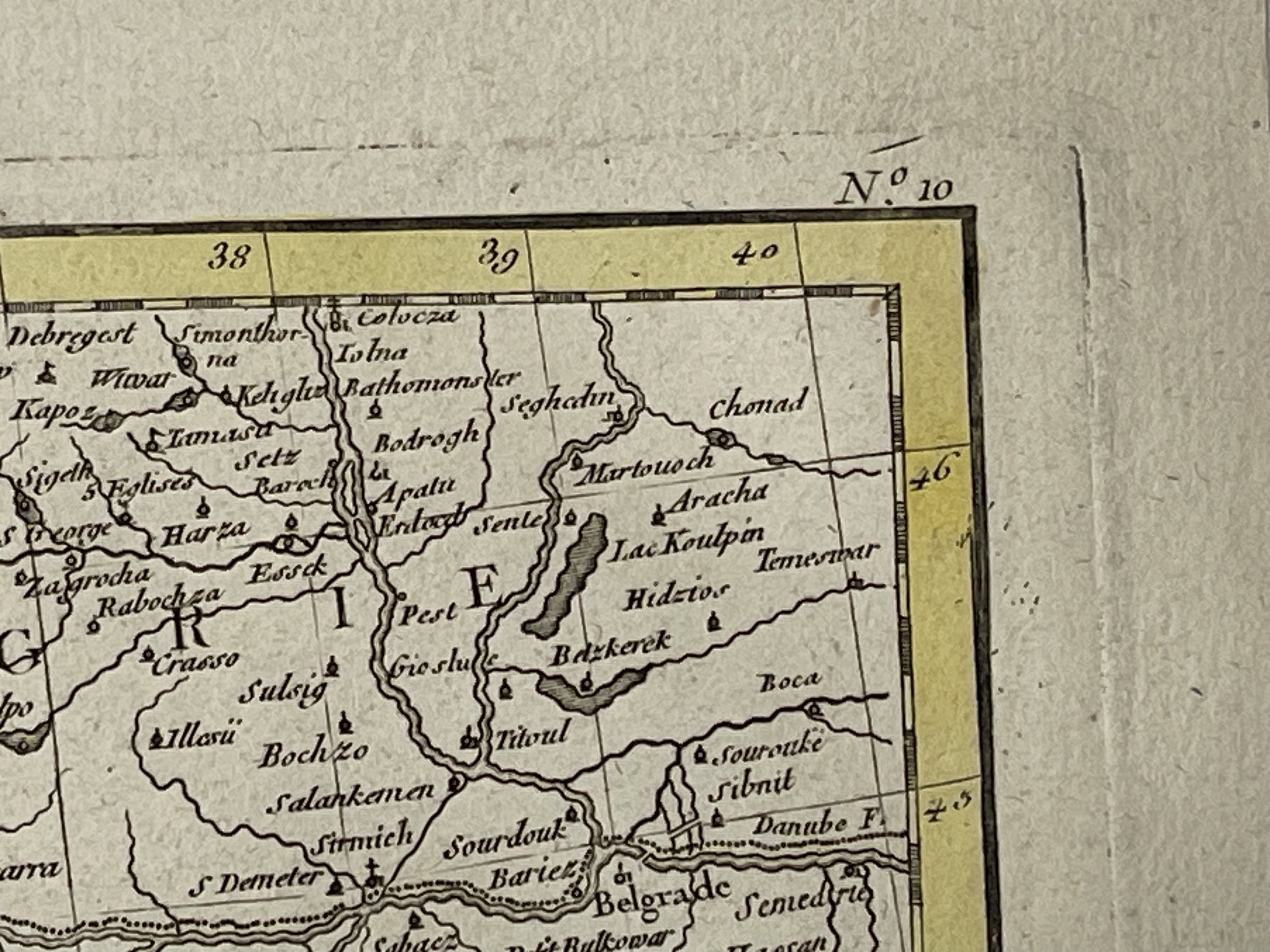
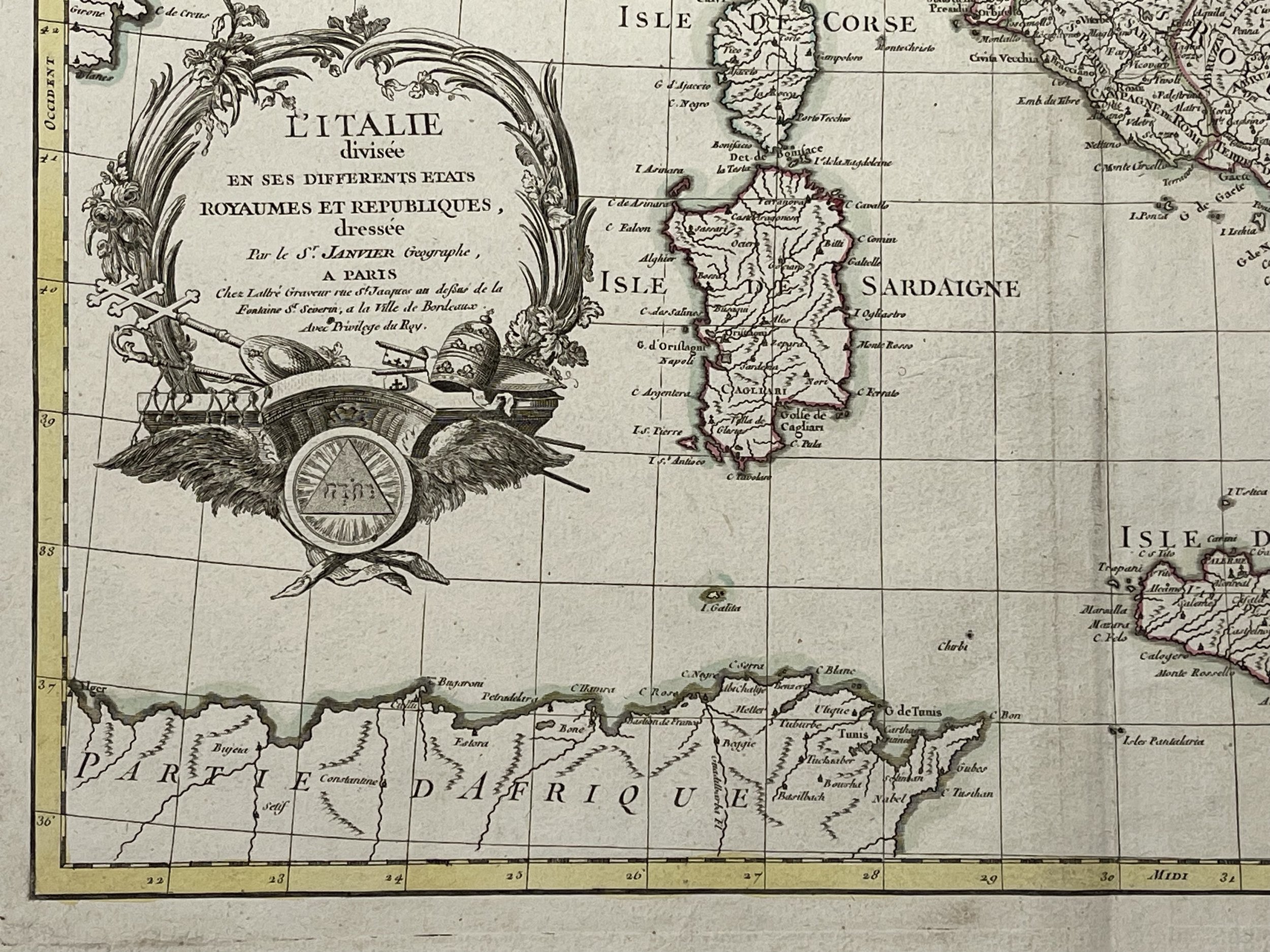
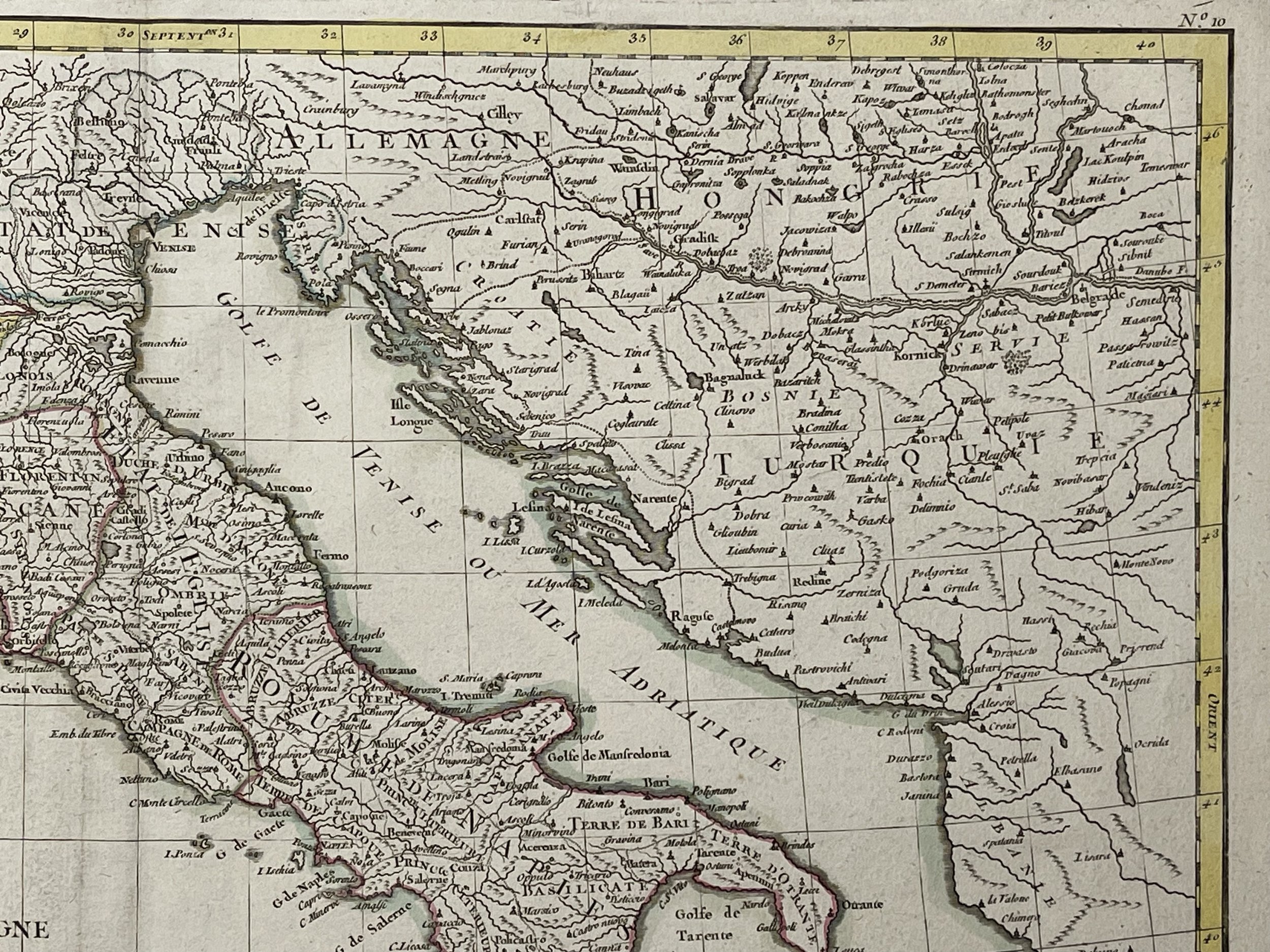
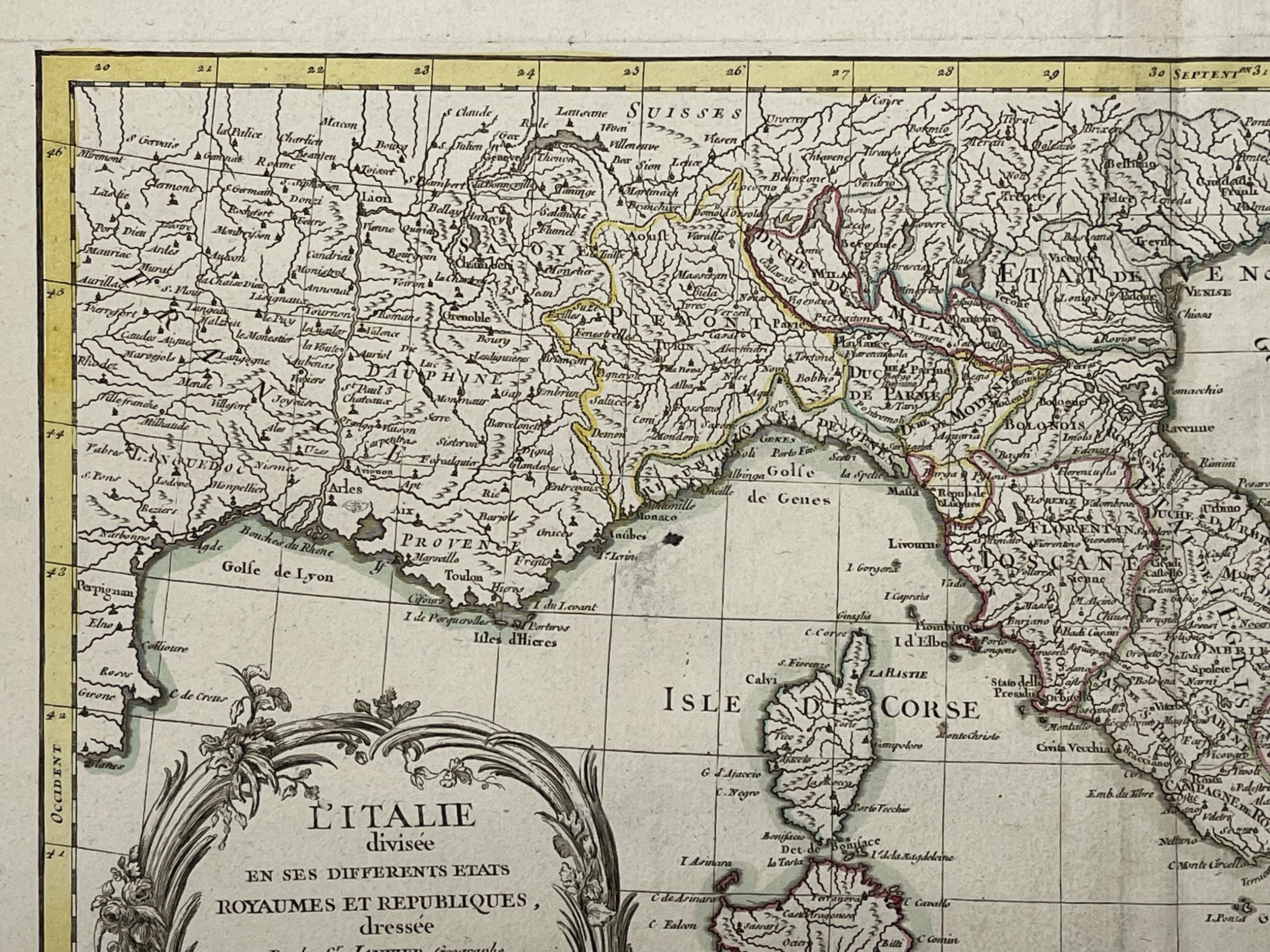
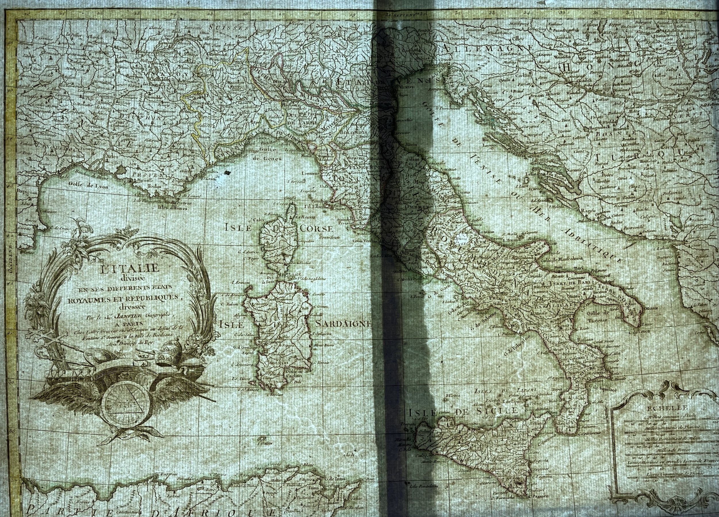
Italy - L' Italie divisee en ses differens etats royaumes et republiques - Janvier Lattrie - C 1762
Italy - Map of Italy and the surrounding islands (Corsica, Sardinia, Malta and Sicily). Originally hand coloured engraving on laid paper.
L'Italie divisee en ses differents etats Royaumes et Republiques.
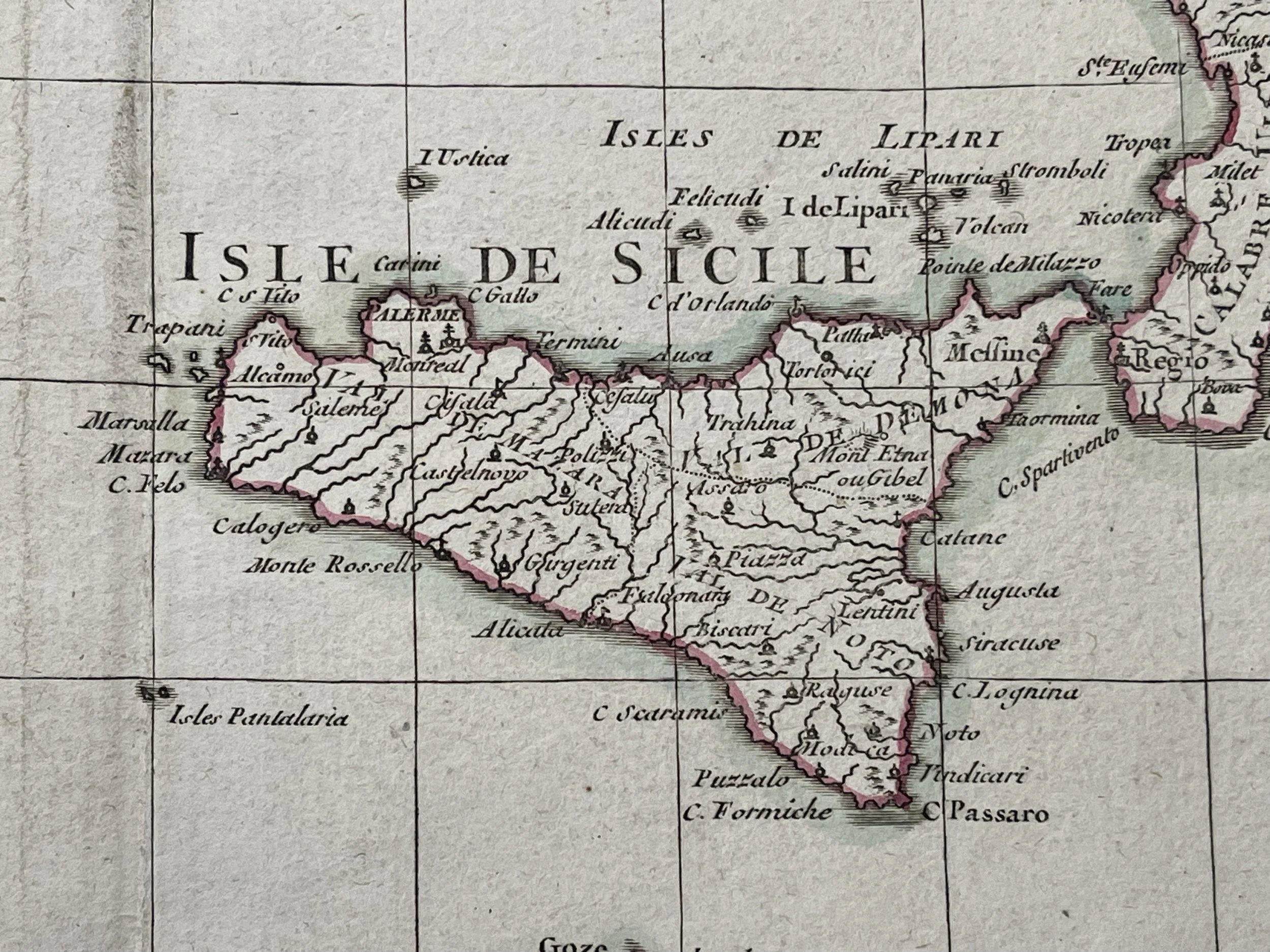
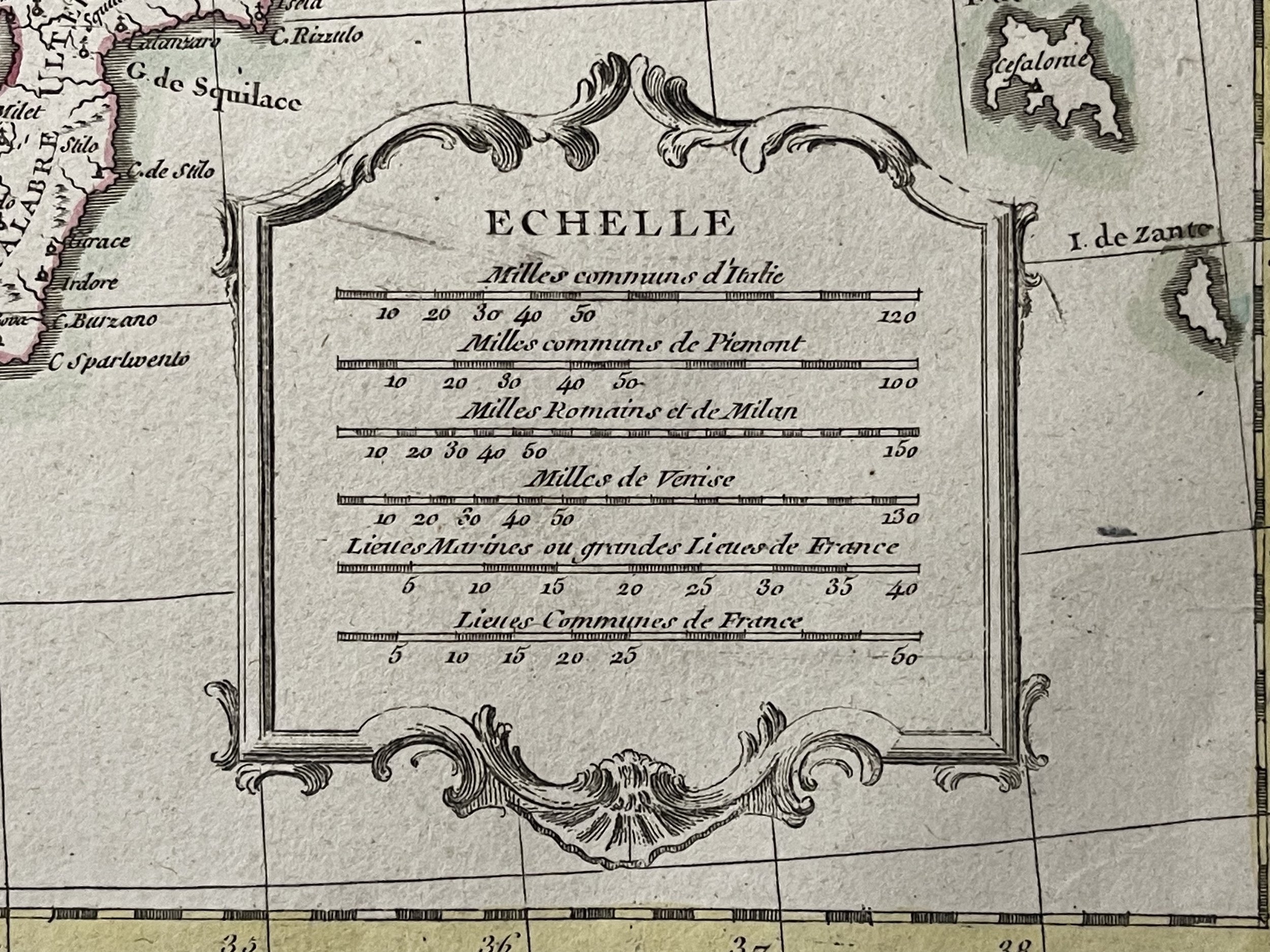
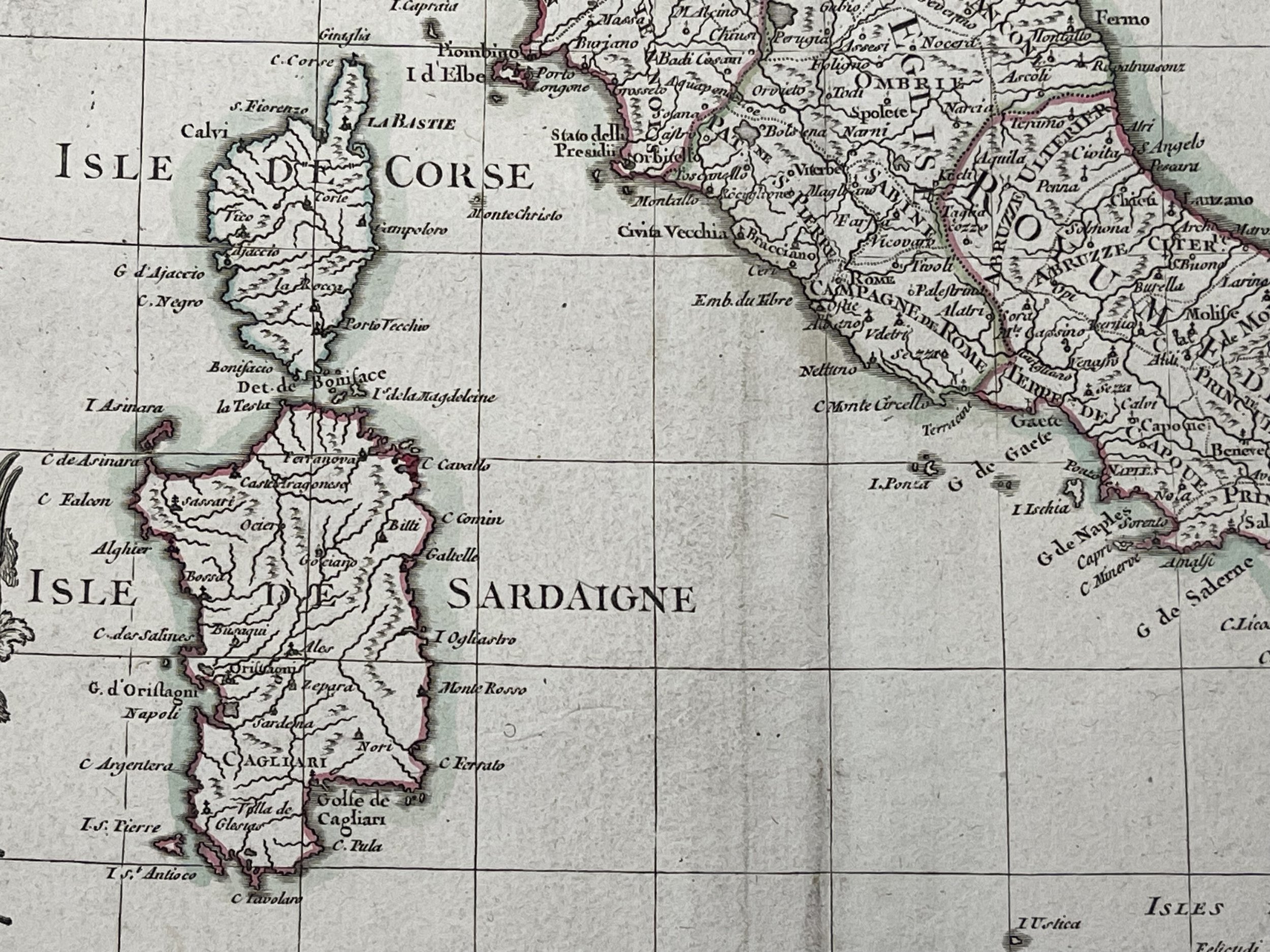
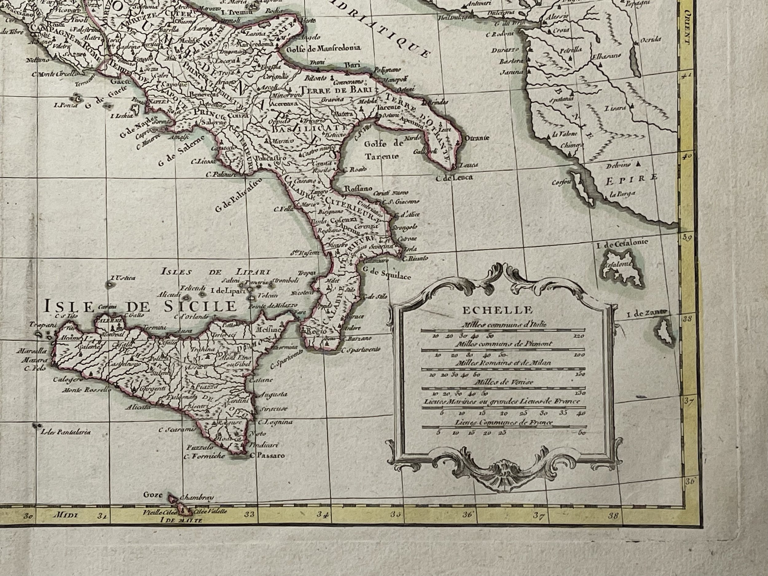
A beautiful example of Le Sieur Janvier's decorative map of Italy. Janvier's map covers from the Gulf of Eyon eastward to include all of Corsica, Sardinia, Italy, the Adriatic, and parts of Hungary and Turkey in Europe. It extends southwards to include adjacent parts of Africa and northwards as far as Lake Geneva. An elaborate title cartouche featuring Papal accoutrements appears in the lower left quadrant. A secondary cartouche bearing a six distance scales appears in the lower right.
This map shows the Italian peninsula prior to its struggle for national solidarity which would emerge as a movement about 50 or so years later in the early 19th century. The peninsula is divided into numerous independent states, duchies, republics, kingdoms and, of course, the Papal States (States of the Church).
Jean Lattre's "Atlas Moderne", C 1762.Artists and Engravers: Made by 'Jean Lattre' after 'Janvier'. - Plate 10.
Jean Denis Janvier (fl. 1746 - 1776), sometimes also known as 'Robert', was a Paris based cartographer active in the mid to late 18th century. Janvier signed his maps Signor Janvier. By the late 18th century, Janvier was awarded the title of 'Geographe Avec Privilege du Roi' and this designation appears on many of his later maps. Janvier worked with many of the most prominent French, English and Italian map publishers of his day, including Longchamps, Faden, Lattre, Bonne, Santini, Zannoni, Delamarche, and Desnos. More by this mapmaker...
Jean Lattré was a Paris based bookseller, engraver, globe maker, calligrapher, and map publisher active in the mid to late 18th century. Lattré published a large corpus of maps, globes, and atlases in conjunction with a number of other important French cartographic figures, including Janvier, Zannoni, Bonne and Delamarche. He is also known to have worked with other European cartographers such as William Faden of London and the Italian cartographer Santini. Map piracy and copyright violations were common in 18th century France. Paris court records indicate that Lattré brought charges against several other period map publishers, including fellow Frenchman Desnos and the Italian map engraver Zannoni, both of whom he accused of copying his work. Lattré likes trained his wife Madame Lattré (né Vérard), as an engraver, as a late 18th century trade card promotes the world of 'Lattré et son Epouse.' Lattré's offices and bookshop were located at 20 rue St. Jaques, Paris, France. Later in life he relocated to Bordeaux.
The map is in fine condition for its age. Pricing and grading commensurate.
Italy - Map of Italy and the surrounding islands (Corsica, Sardinia, Malta and Sicily). Originally hand coloured engraving on laid paper.
L'Italie divisee en ses differents etats Royaumes et Republiques.
A beautiful example of Le Sieur Janvier's decorative map of Italy. Janvier's map covers from the Gulf of Eyon eastward to include all of Corsica, Sardinia, Italy, the Adriatic, and parts of Hungary and Turkey in Europe. It extends southwards to include adjacent parts of Africa and northwards as far as Lake Geneva. An elaborate title cartouche featuring Papal accoutrements appears in the lower left quadrant. A secondary cartouche bearing a six distance scales appears in the lower right.
This map shows the Italian peninsula prior to its struggle for national solidarity which would emerge as a movement about 50 or so years later in the early 19th century. The peninsula is divided into numerous independent states, duchies, republics, kingdoms and, of course, the Papal States (States of the Church).
Jean Lattre's "Atlas Moderne", C 1762.Artists and Engravers: Made by 'Jean Lattre' after 'Janvier'. - Plate 10.
Jean Denis Janvier (fl. 1746 - 1776), sometimes also known as 'Robert', was a Paris based cartographer active in the mid to late 18th century. Janvier signed his maps Signor Janvier. By the late 18th century, Janvier was awarded the title of 'Geographe Avec Privilege du Roi' and this designation appears on many of his later maps. Janvier worked with many of the most prominent French, English and Italian map publishers of his day, including Longchamps, Faden, Lattre, Bonne, Santini, Zannoni, Delamarche, and Desnos. More by this mapmaker...
Jean Lattré was a Paris based bookseller, engraver, globe maker, calligrapher, and map publisher active in the mid to late 18th century. Lattré published a large corpus of maps, globes, and atlases in conjunction with a number of other important French cartographic figures, including Janvier, Zannoni, Bonne and Delamarche. He is also known to have worked with other European cartographers such as William Faden of London and the Italian cartographer Santini. Map piracy and copyright violations were common in 18th century France. Paris court records indicate that Lattré brought charges against several other period map publishers, including fellow Frenchman Desnos and the Italian map engraver Zannoni, both of whom he accused of copying his work. Lattré likes trained his wife Madame Lattré (né Vérard), as an engraver, as a late 18th century trade card promotes the world of 'Lattré et son Epouse.' Lattré's offices and bookshop were located at 20 rue St. Jaques, Paris, France. Later in life he relocated to Bordeaux.
The map is in fine condition for its age. Pricing and grading commensurate.
Code : A233
Cartographer : Cartographer / Engraver / Publisher: Janvier Lattrie
Date : Publication Place / Date - Circa 1762
Size : Sheet size: Image Size: 49 x 37 cm
Availability : Available
Type - Genuine - Antique
Grading A
Where Applicable - Folds as issued. Light box photo shows the folio leaf centre margin hinge ‘glue’, this is not visible otherwise.
Tracked postage, in casement. Please contact me for postal quotation outside of the UK.