Japan Empire antique map Carte L'Empire du Japon Bellin 1752 - (Royal Hydrographer, engineer of the French Navy and member of the Royal Society)Title: Carte de L'Empire du Japon. Attractive map of Japan with decorative cartouche from Abbe Prevost’s ‘Histoire Generale des Voyages…’, published by Didot, Paris, folds. (No 5 Tome X Page 484) - One of the best 18th century maps of Japan.
Carte de L’Empire du Japon Pour server a l’Histoire Generale des Voyages Empire of Japan, a fine detailed mid-18th century antique map with very attractive title cartouche. Bellin’s wonderfully detailed map of Japan from the atlas of Prevost d’Exiles’ influential collection of travel narratives, Histoire Generale des Voyages. Considered the best general outline of Japan of the 18th century, the map includes Provincial borders, many place names and topographical details, and a lovely Rococo-style title cartouche.
Jacques-Nicolas Bellin, a French geographer, was among the most important mapmakers of the eighteenth century. In 1721, at the age of 18, he was appointed hydrographer of the Ministry of the Navy following the French hydrographic office's creation and the Dépot of charts and plans of the Navy. Appointed hydrographic engineer in August 1741. Member of the Academy of the Navy and the Royal Society of London.
Over the course of a 50-year career, he drew the maps of several major works of his time such as Histoire et description générale de la Nouvelle-France de Charlevoix (1744); Histoire générale des voyages de l'Abbé Prévost (published between 1746 and 1759) ); Neptune François (1753), Hydrographie Françoise (1756-1765), and Petit Atlas Français (1763) - reissued as Petit Atlas Maritime (1765). He is the most copied cartographer of the 18th century.
His maps of Canada and the French territories of North America are of considerable value. This is all the more remarkable since, an archetype of the cabinet cartographer, Bellin never came to America. For his cartography of the St. Lawrence River, he entrusted handwritten maps to navigators to correct and enrich. With each return of these maps, he was updating his knowledge. Two basic needs drive its cartography of North America: to secure navigation on the St. Lawrence River and to claim for France the lands explored by the French in the Great Lakes region and along the Mississippi River.
Jacques-Nicolas Bellin died on March 21, 1772, in Versailles. In the burial certificate, he is described as "the first engineer of the navy and the deposit of plans, royal censor of the academy of navy and the royal society of London".
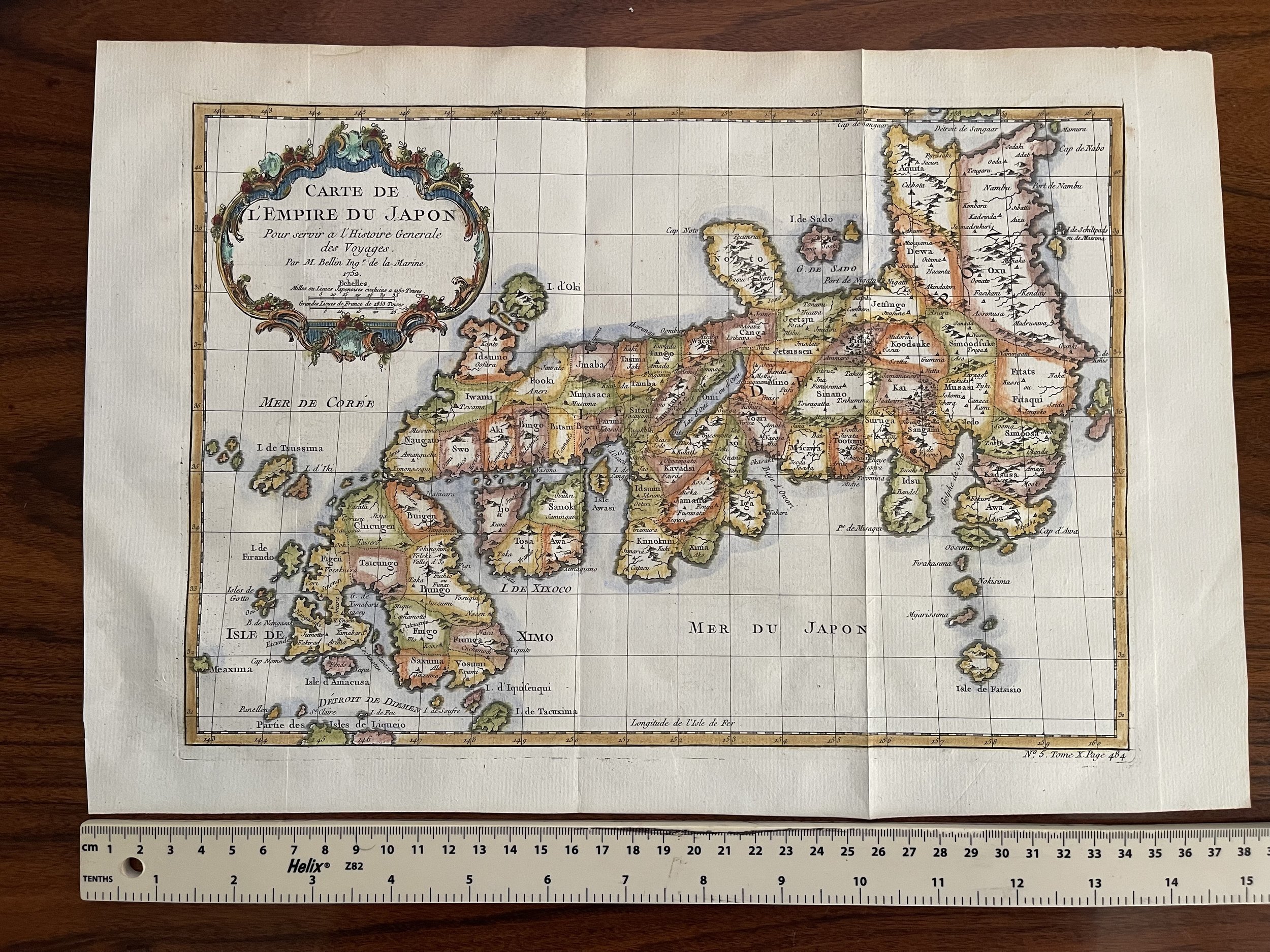 Image 1 of 8
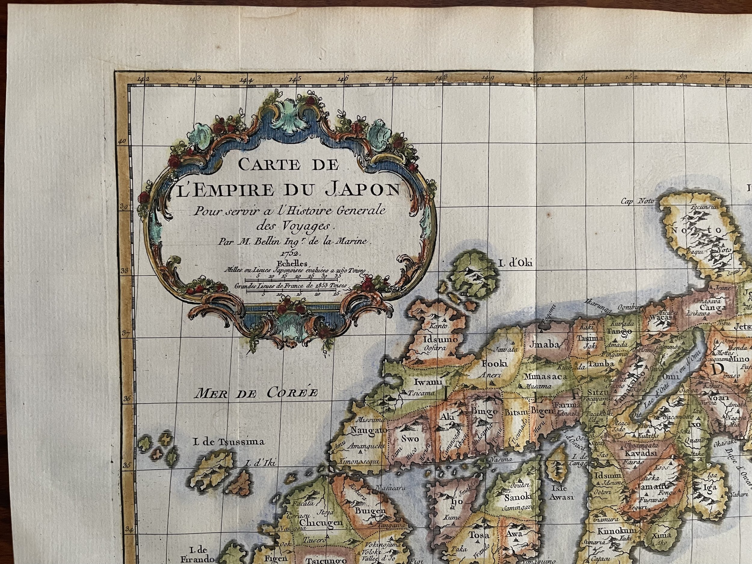 Image 2 of 8
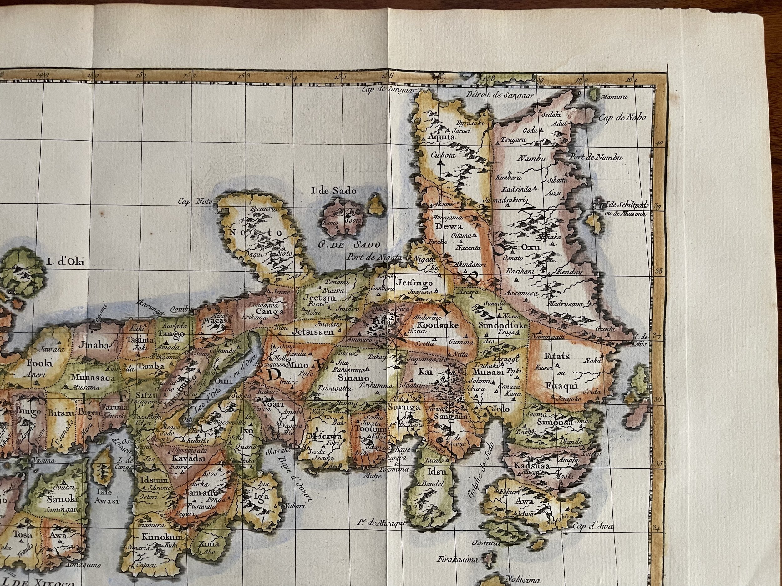 Image 3 of 8
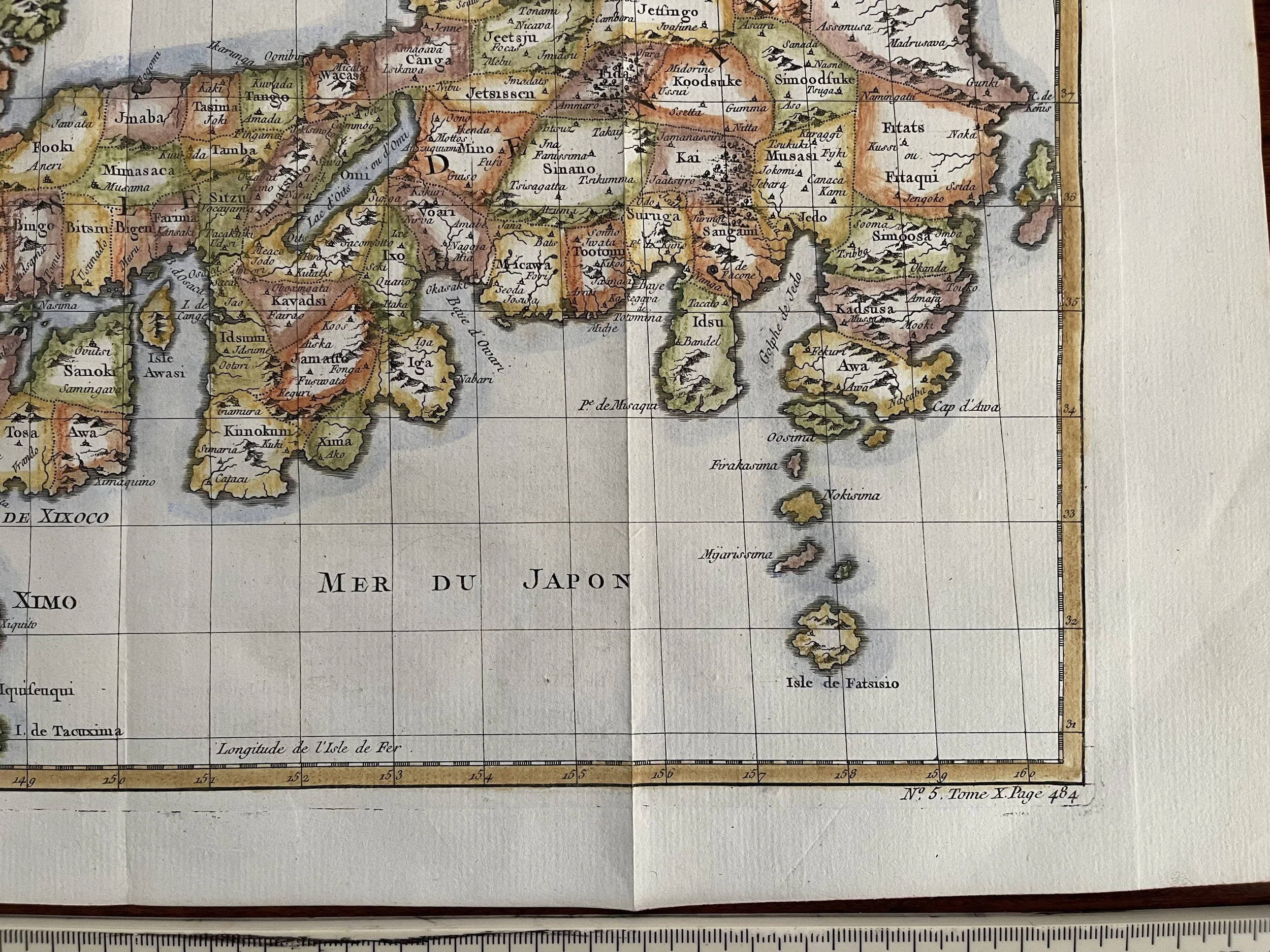 Image 4 of 8
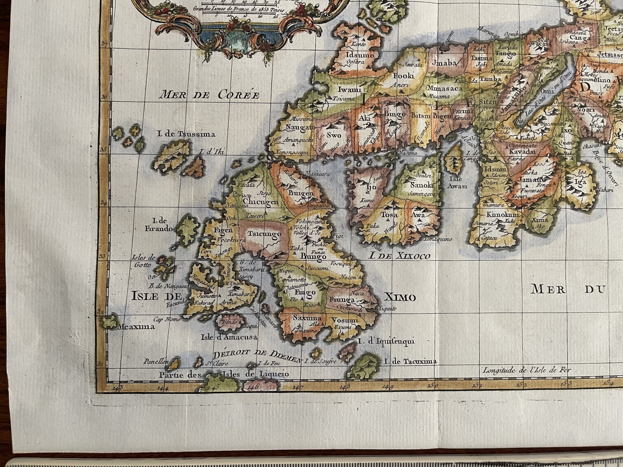 Image 5 of 8
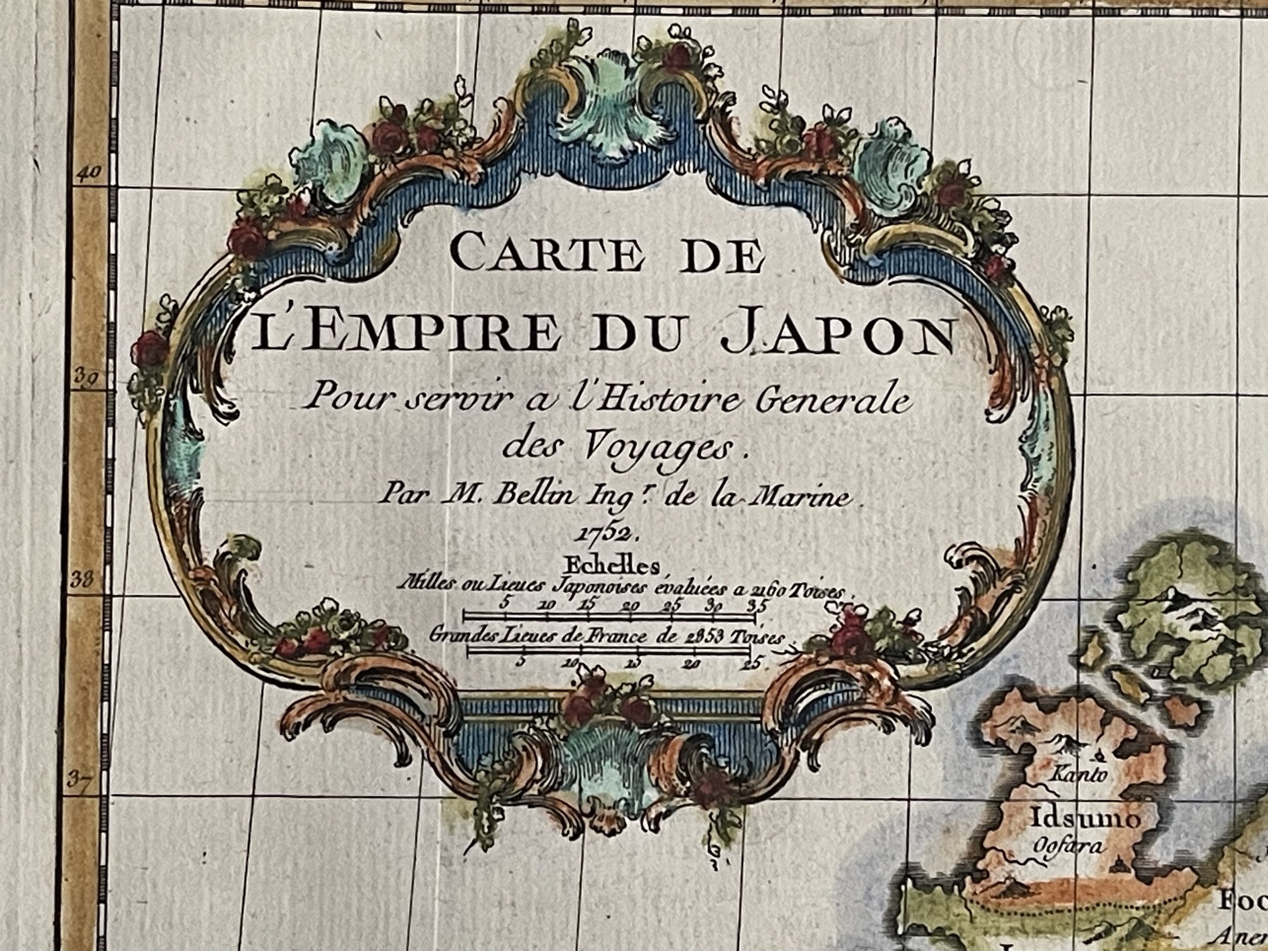 Image 6 of 8
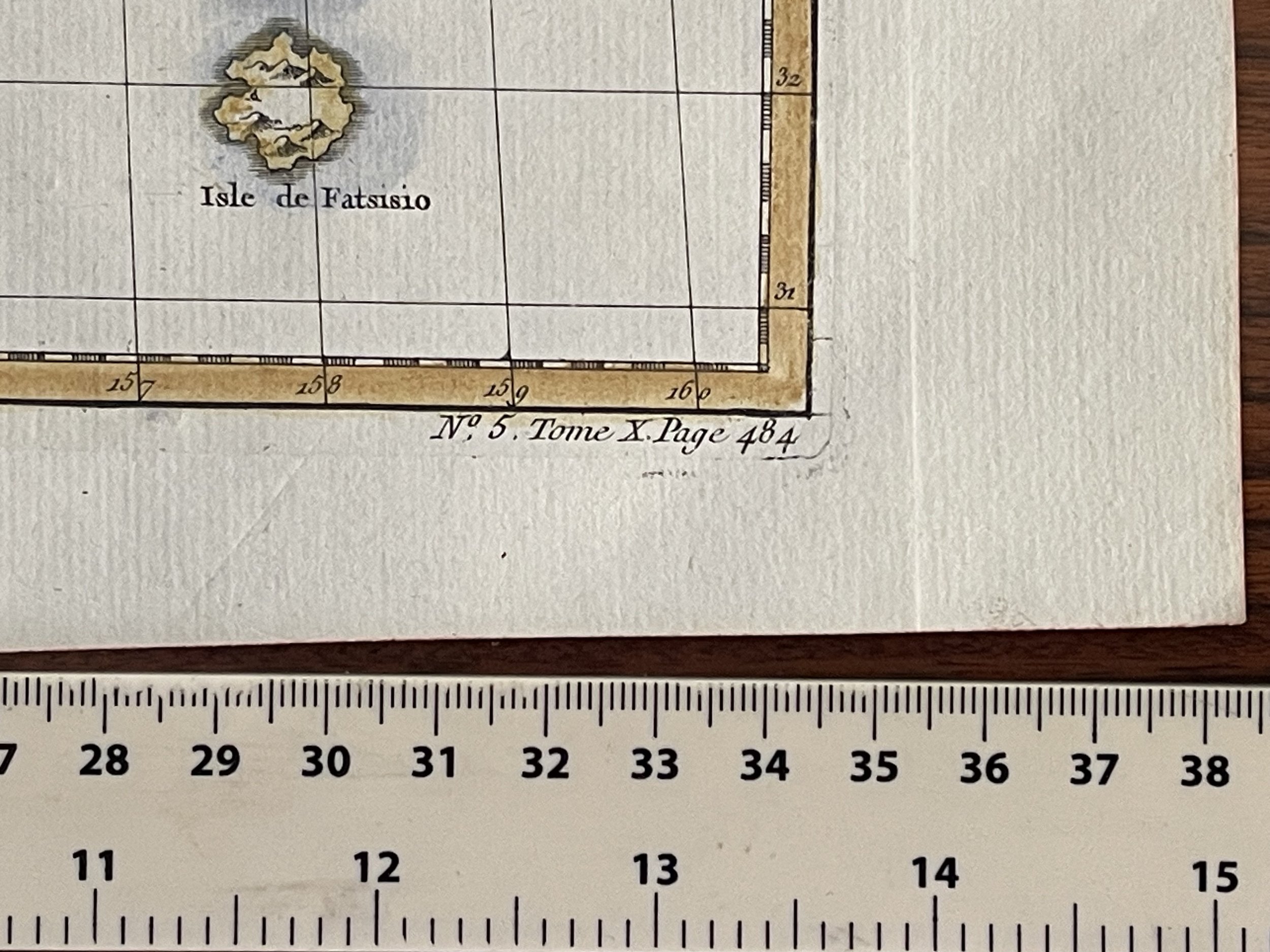 Image 7 of 8
 Image 8 of 8