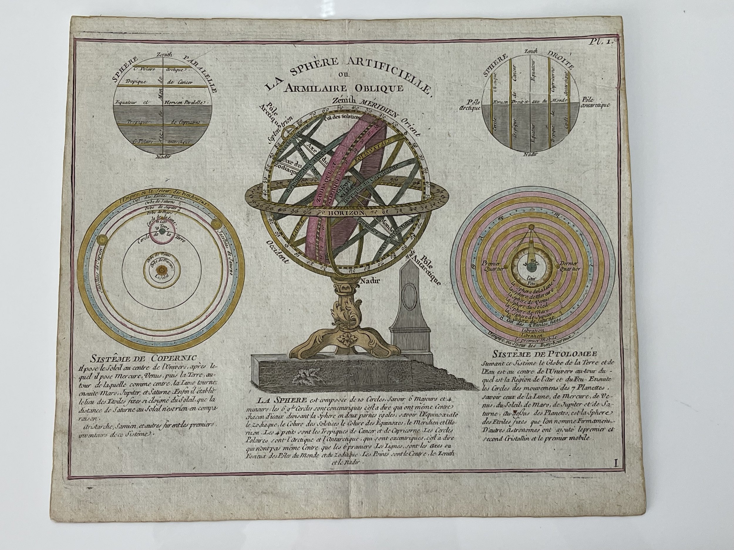
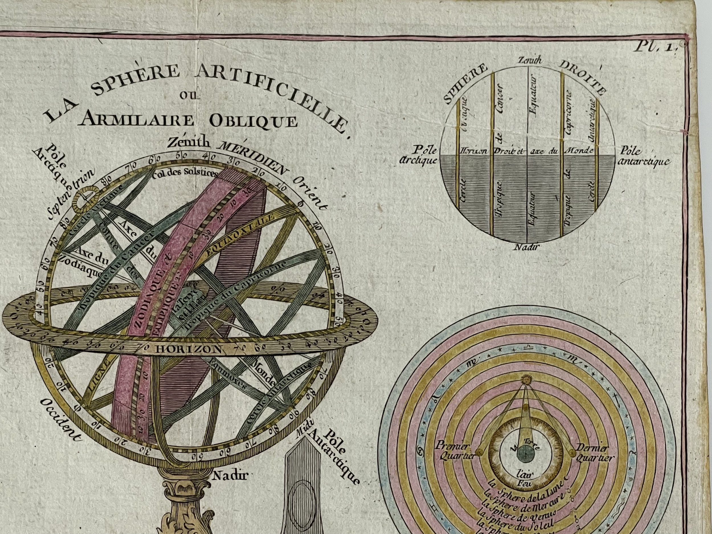
La Shere Artificielle ou Armilaire Oblique - Etienne Brion - Paris 1779
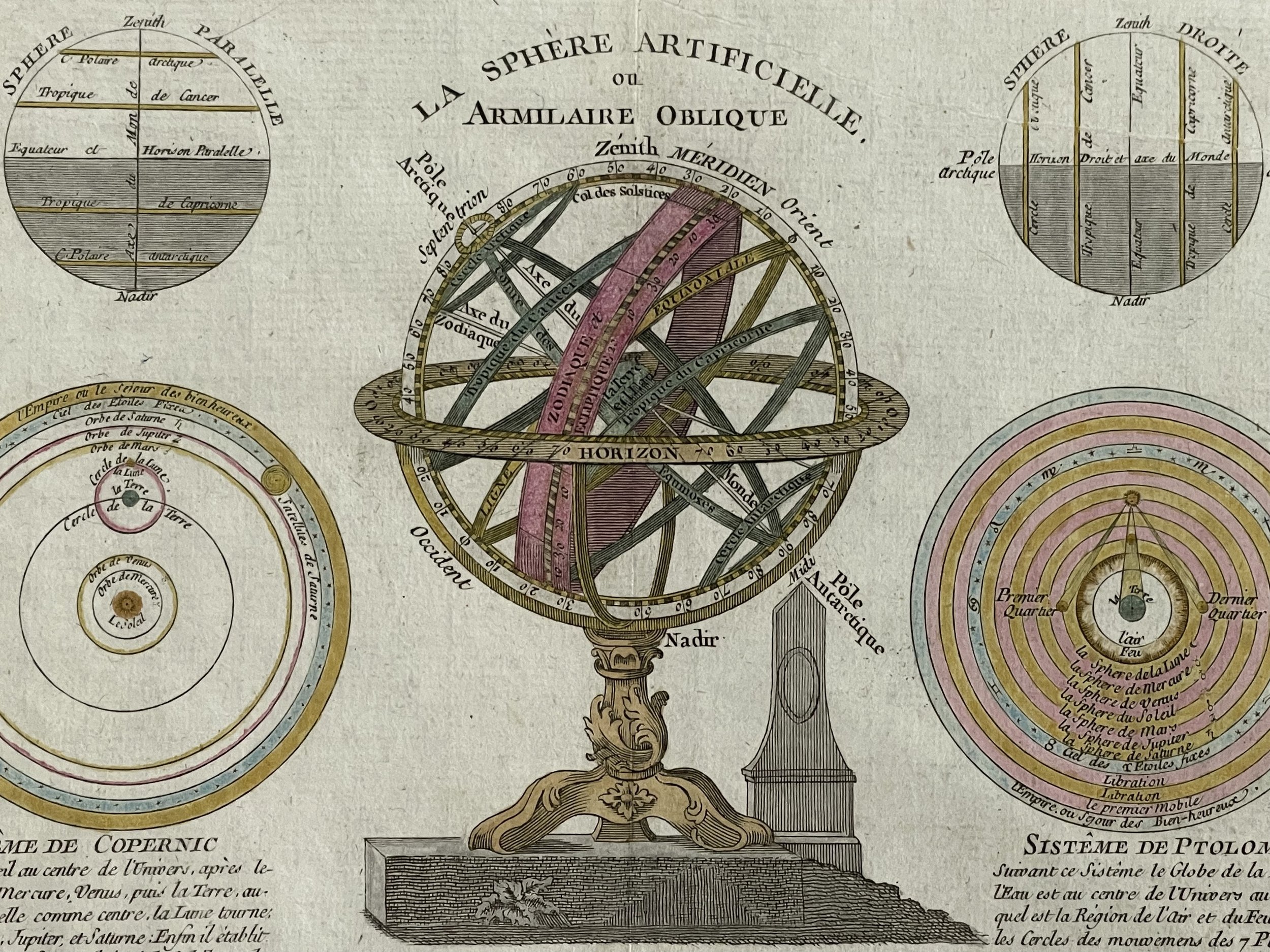
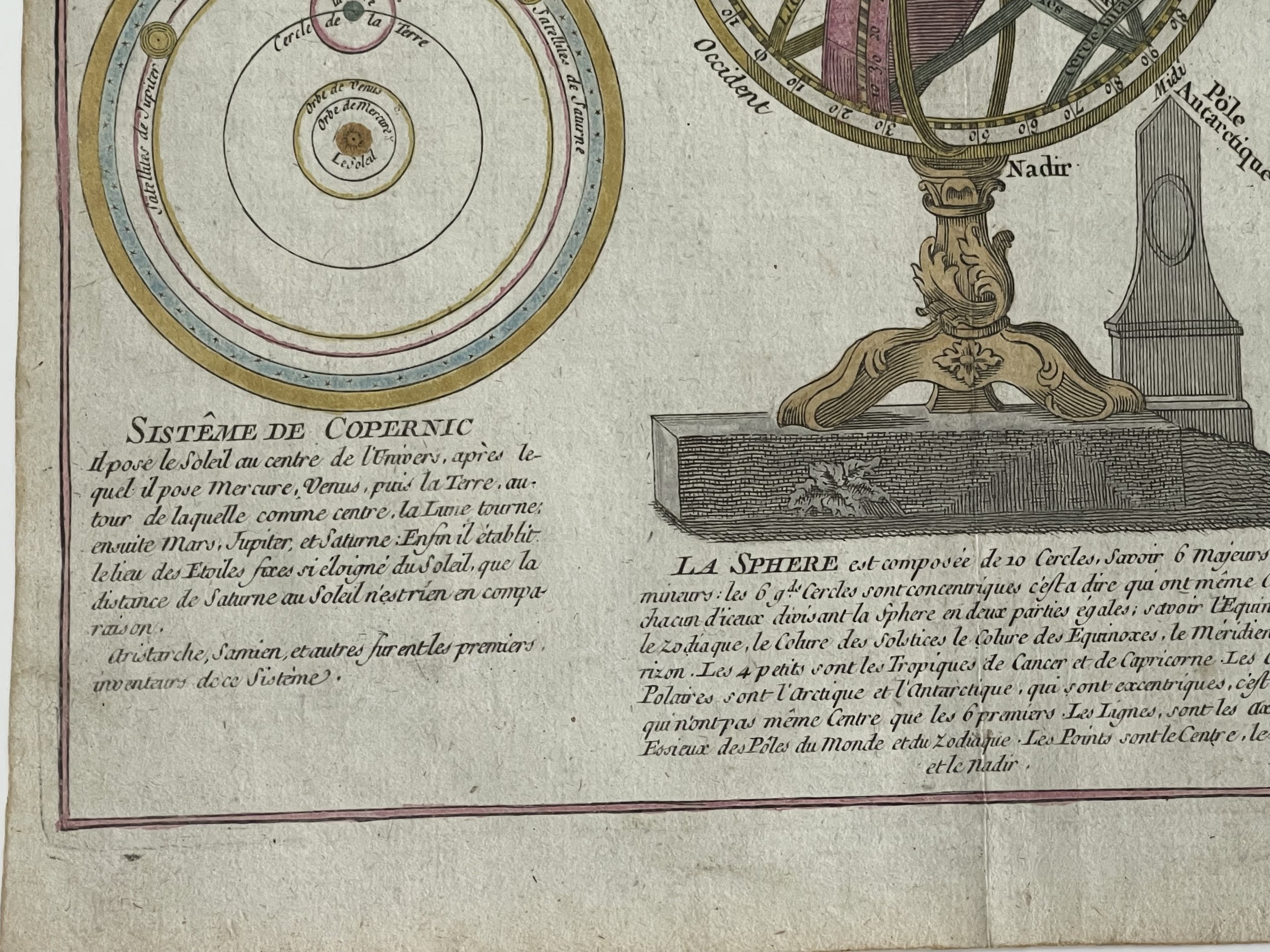
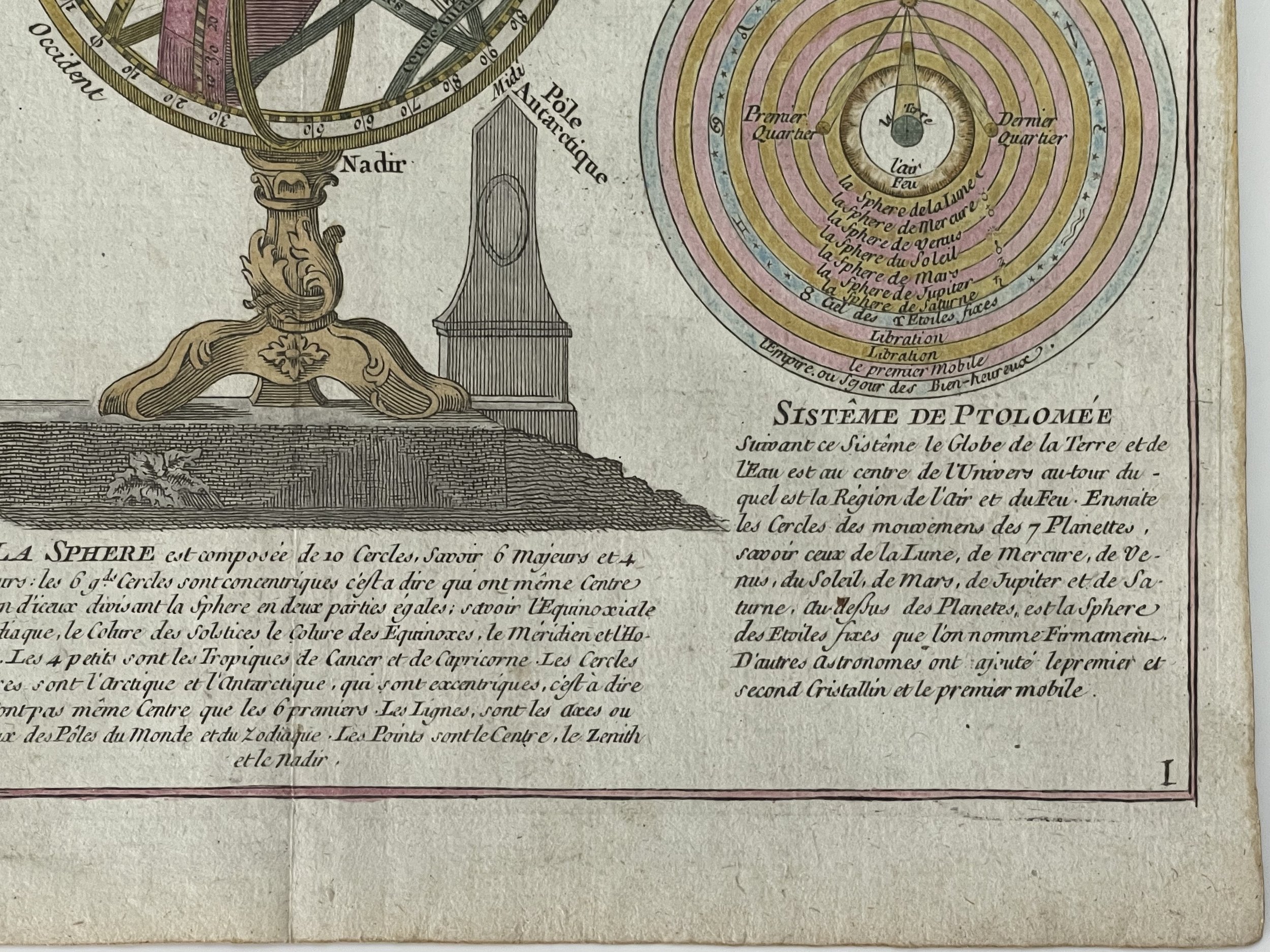
Wonderfully detailed and decorative copper plate showing ‘Armillary Sphere’, two spheres according to Copernicus and Ptolemy and two diagrams.
Possibly engraved by Etienne Brion, a French engraver who born in 1729, flourished around 1760 onwards or Louis Charles Desnos & Claude Buy de Mornas 1725-1805.
During the latter half of the eighteenth century, Paris emerged as the leading center of map making in the world, with two notable contributors leading the field - Louis Charles Desnos and Claude Buy de Mornas. Desnos, a noted globe maker and map publisher, was appointed as the globe maker to the King of Denmark, though most of his work was centered in Paris. The "Atlas Methodique et Elementaire" published by Desnos holds a prominent place, along with his other notable works such as "Routes des Postes" (1761), "Nouvel Atlas d'Angleterre" (1767) and "Atlas General" (1786).
Meanwhile, Claude Buy de Mornas, the author and publisher of "Atlas Methodique et Elementaire", also served as the Geographer to King Louis XVI and the Duc de Berry. Both Desnos and Buy de Mornas operated their Paris establishments from Rue St. Jacques. These elegantly designed, double-page maps covered a wide range of topics, including the Sun, stars, solar system, eclipses, seasons, climates, and both terrestrial and celestial coordinates. Each map featured a central image, with elaborate borders and flanking columns of text. The intricate hand-coloring was done at the time of publication.
These engraved maps not only provide valuable insights into each subject but also reflect the strong connection between geography and astronomy during the eighteenth century. "Division Astronomique de la Terre" focuses on the various lines, points, and circles of the Earth, including the Arctic and Antarctic poles and circles, the tropics of Cancer and Capricorn, the Equator, the Meridian, and the Sun's ecliptic line. The side columns contain explanatory text. Seventeen examples of Desnos and Buy de Mornas' maps are housed in the permanent collection of England's National Maritime Museum, which can be viewed on their website, www.nmm.ac.uk. Below is a detailed view of the central image of "Division Astronomique de la Terre" (Astronomical Division of the Earth).
Excellent condition for its near 250 years of age. Pricing and grading commensurate.
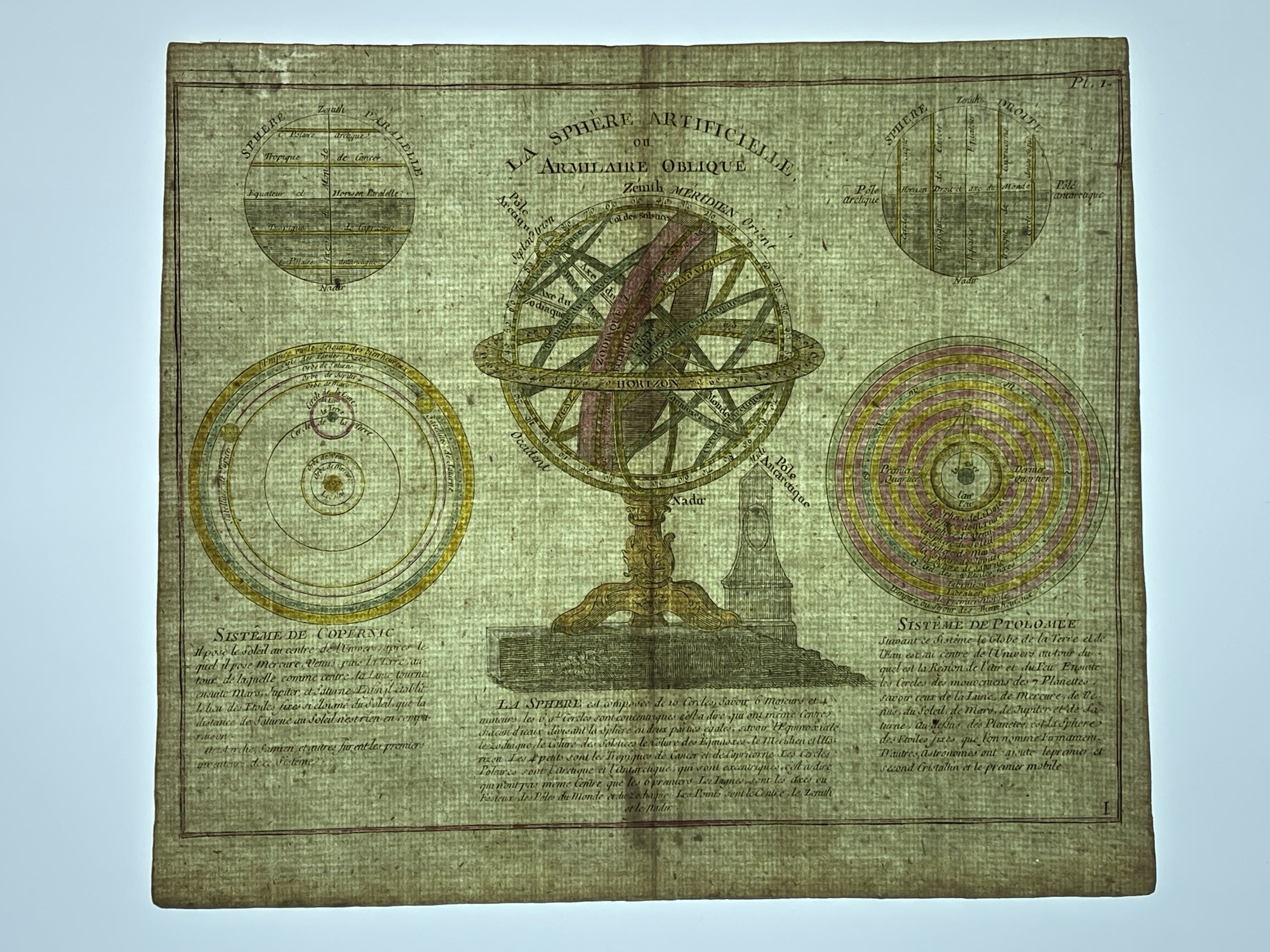
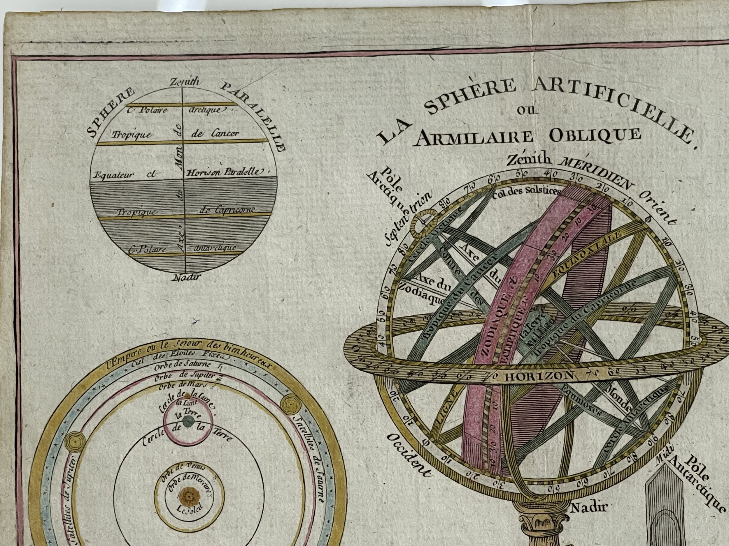
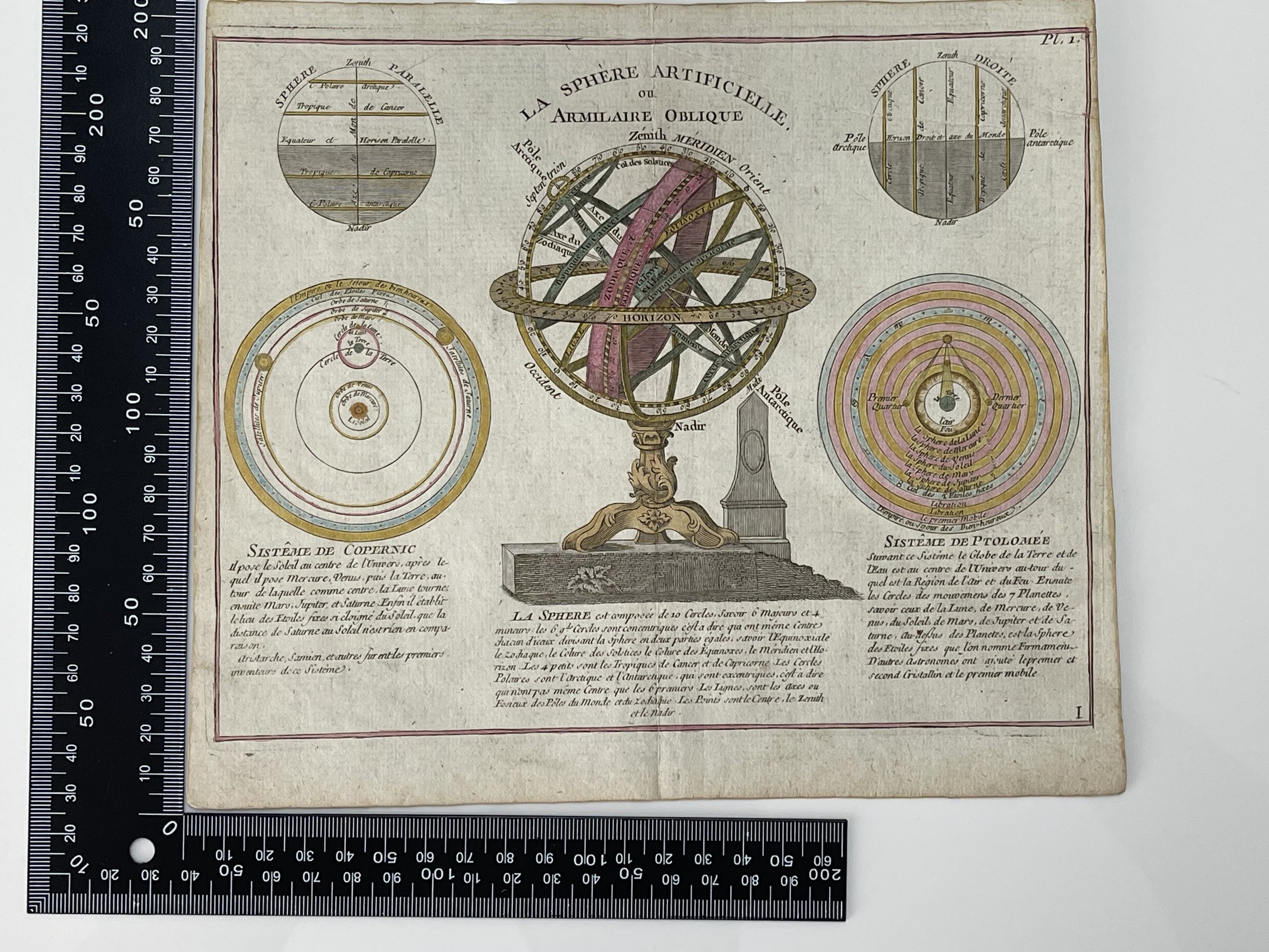
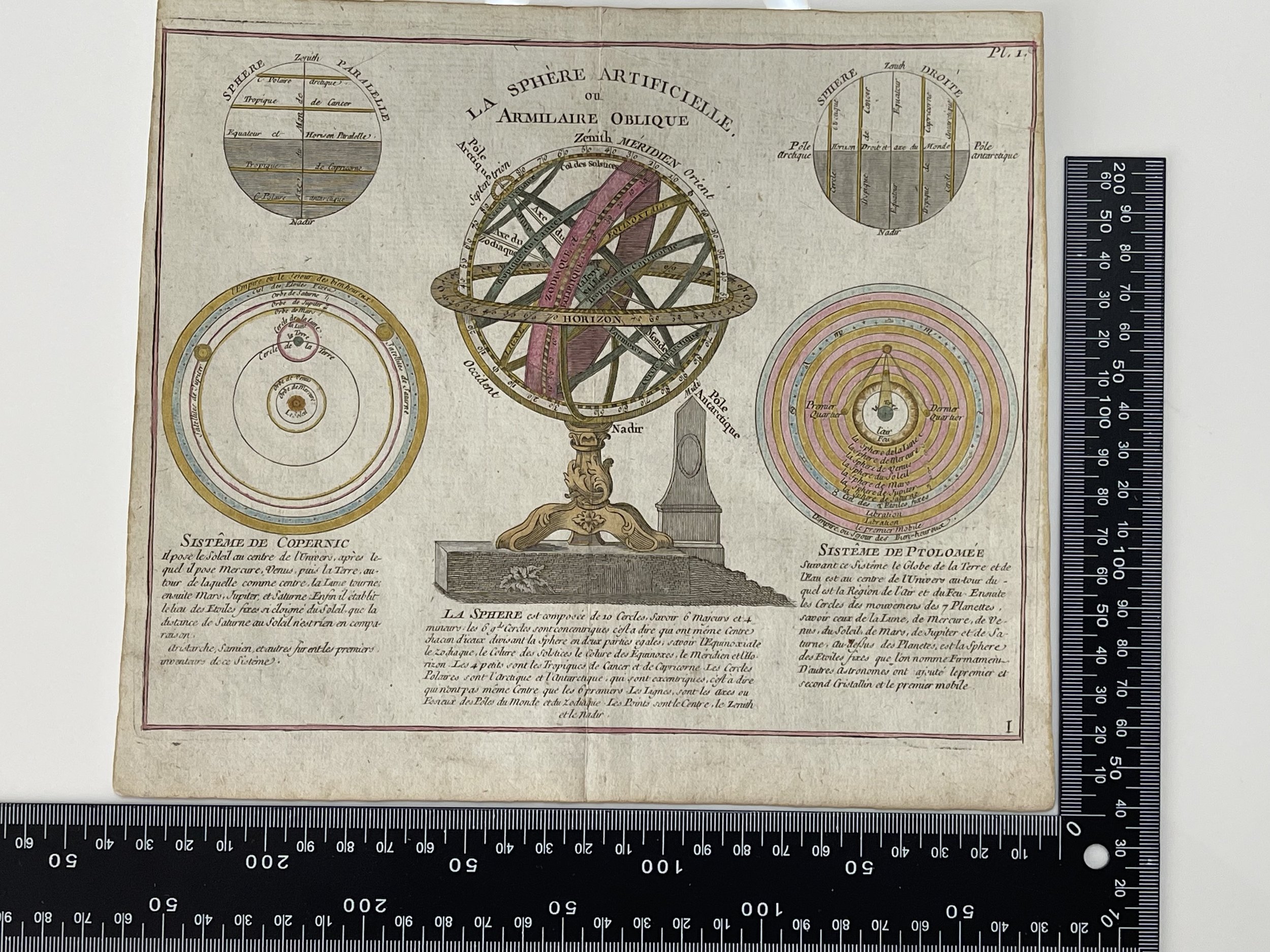
Code : A896
Cartographer : Cartographer / Engraver / Publisher: Etienne Brion - (Not established)
Date : Publication Place / Date - Circa 1779
Size : Sheet size: approx 17.5 x 21.9 Cm
Availability : Available
Type - Genuine - Antique
Grading A
Where Applicable - Folds as issued. Light box photo shows the folio leaf centre margin hinge ‘glue’, this is not visible otherwise.
Tracked postage, in casement. Please contact me for postal quotation outside of the UK.