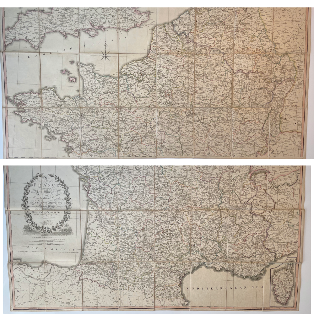


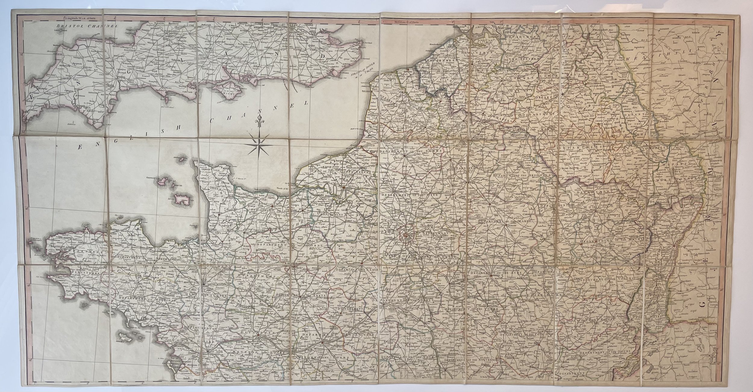
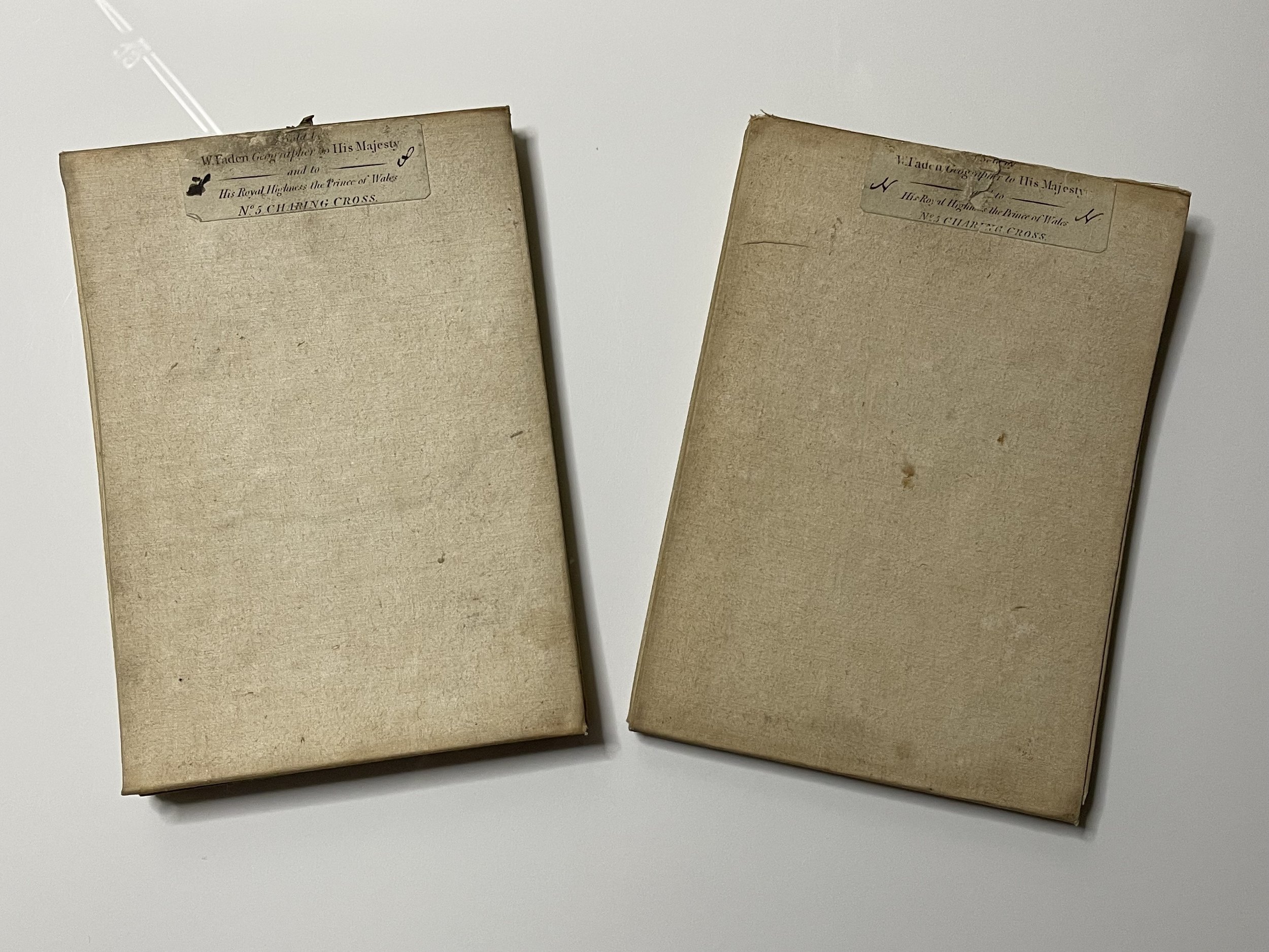
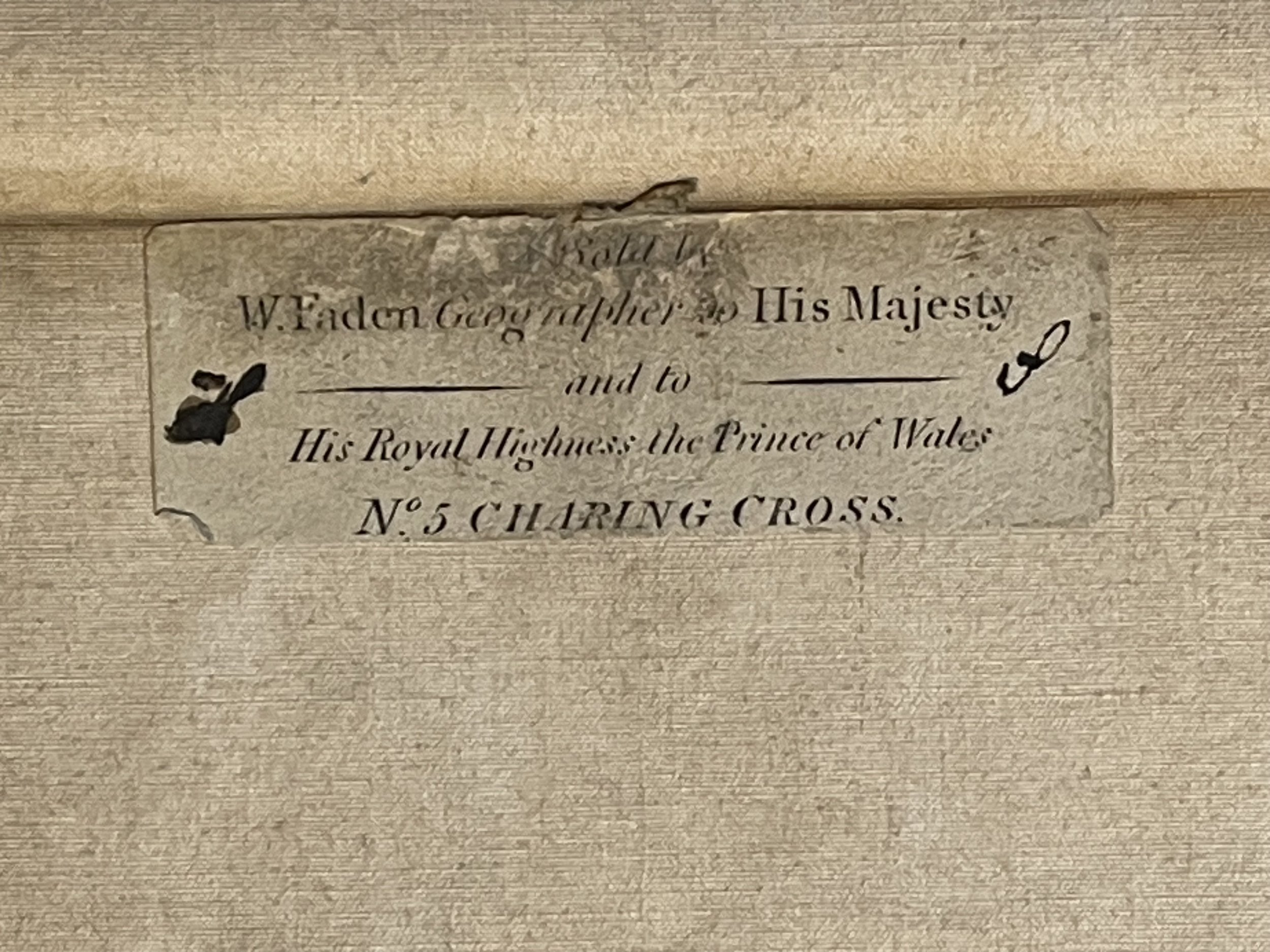
Large Map of France (Double folding portions ) - William Faden - 1806
Large Map of France (In two folding portions ) - William Faden - 1806
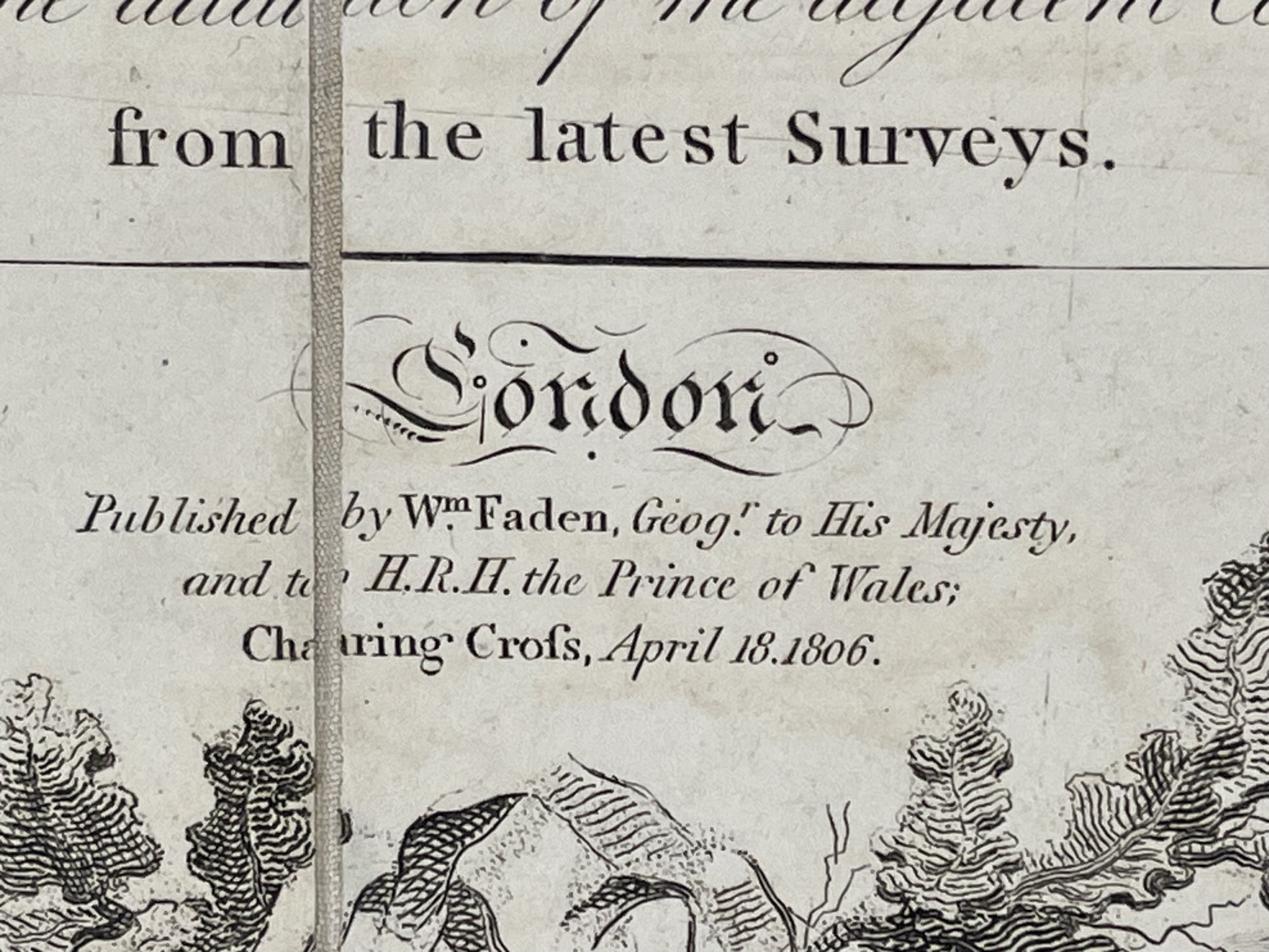
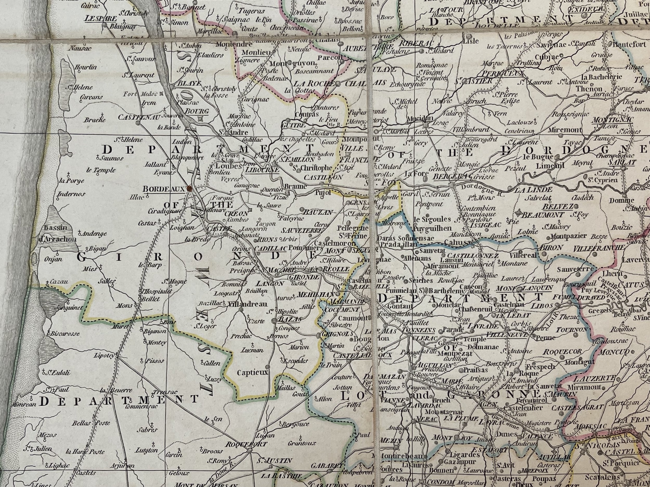
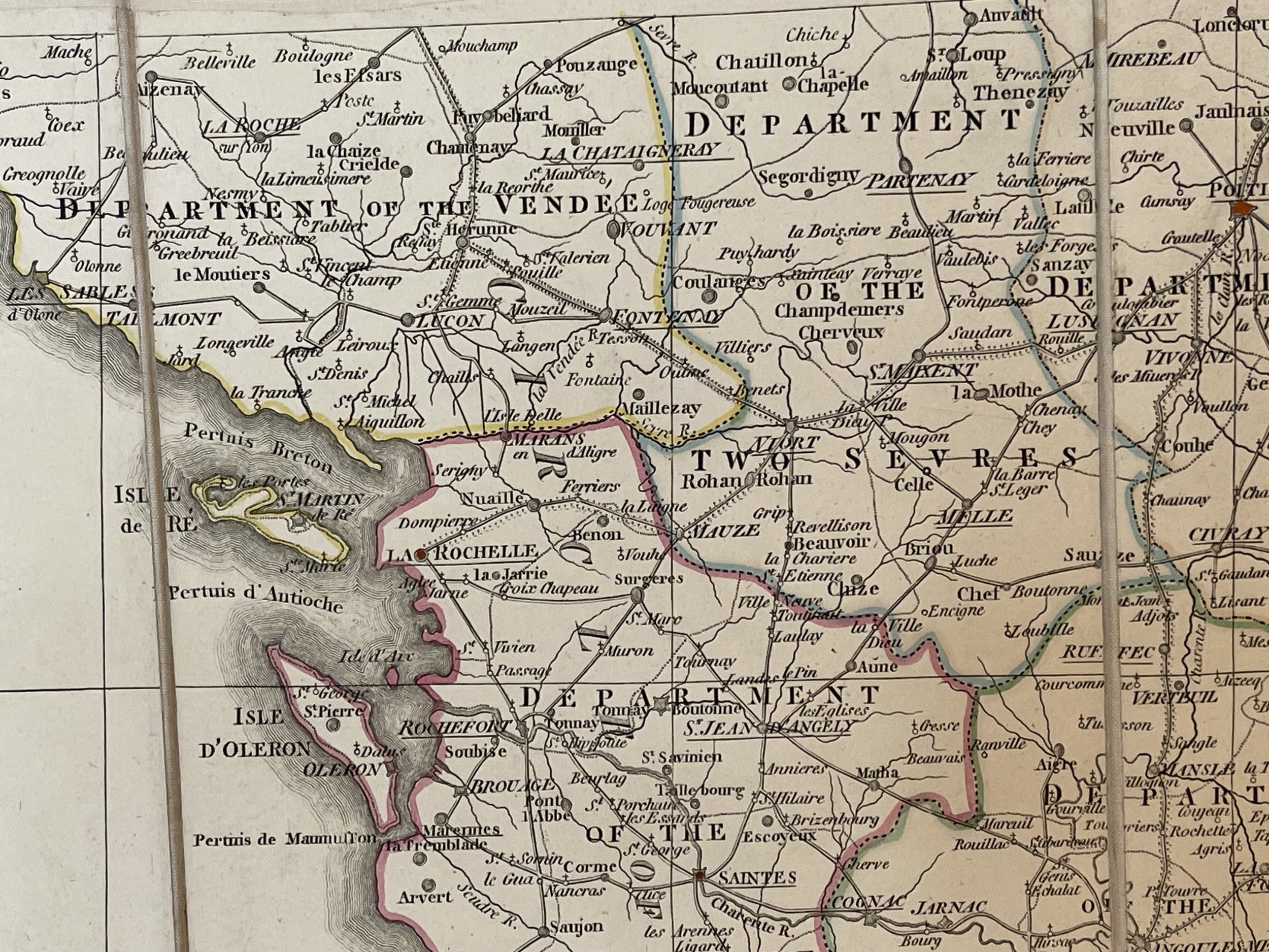
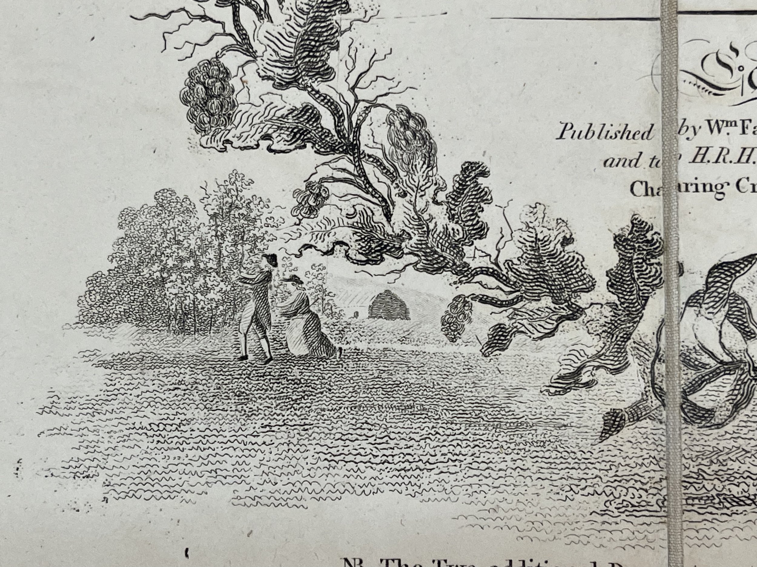
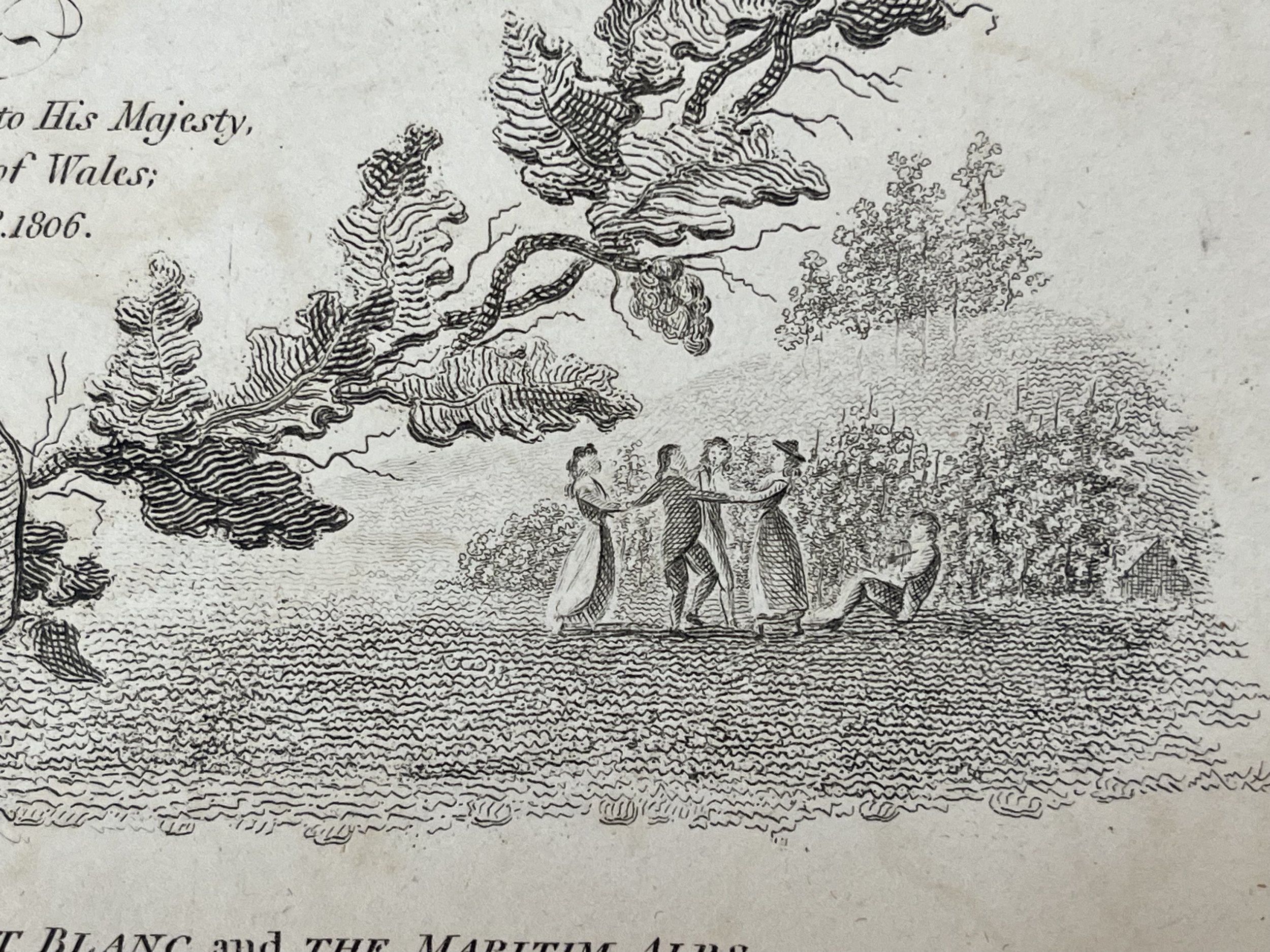
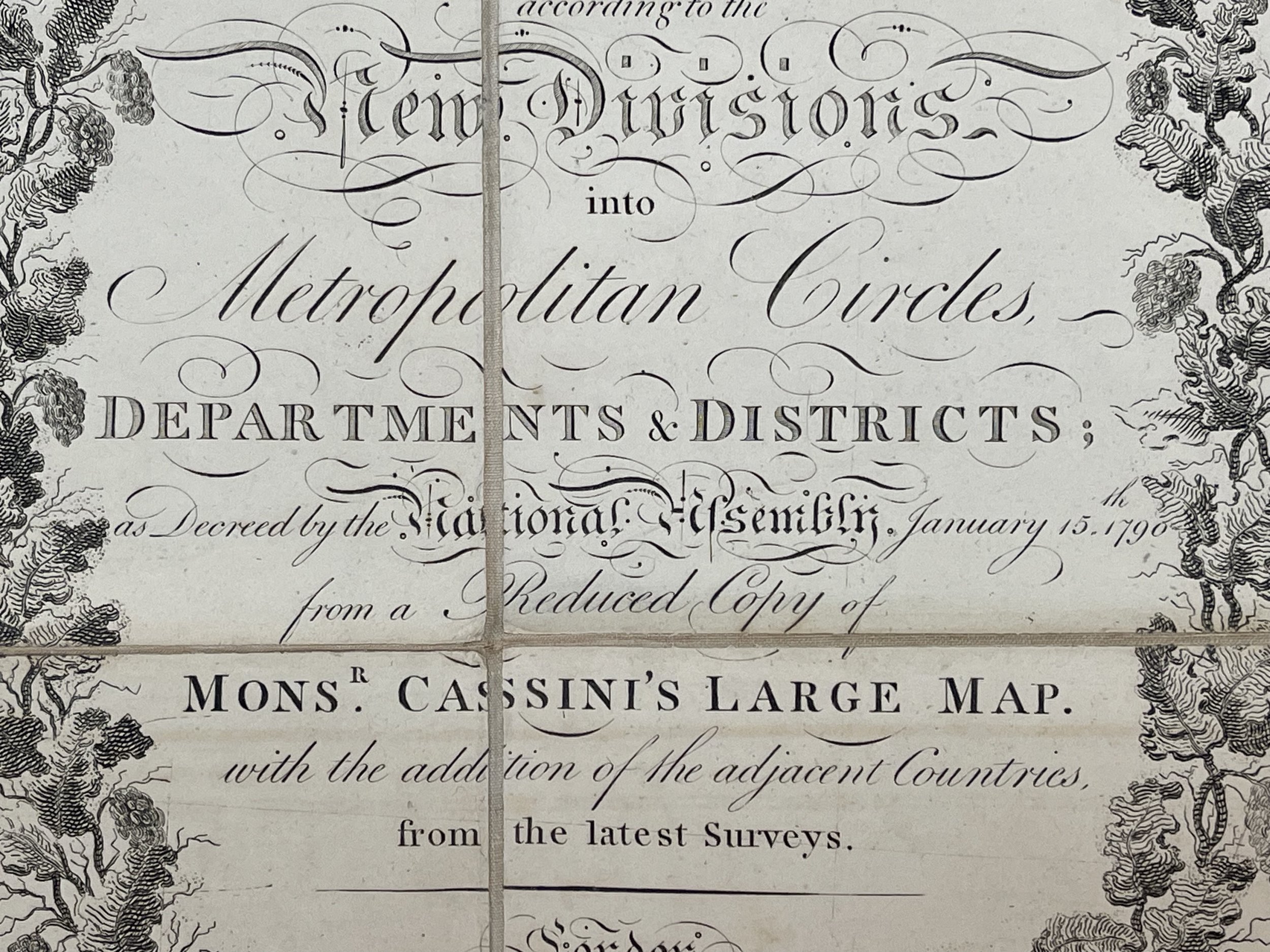
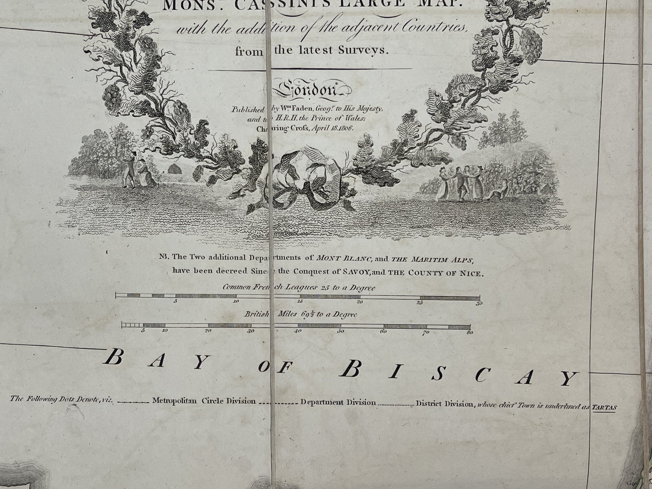
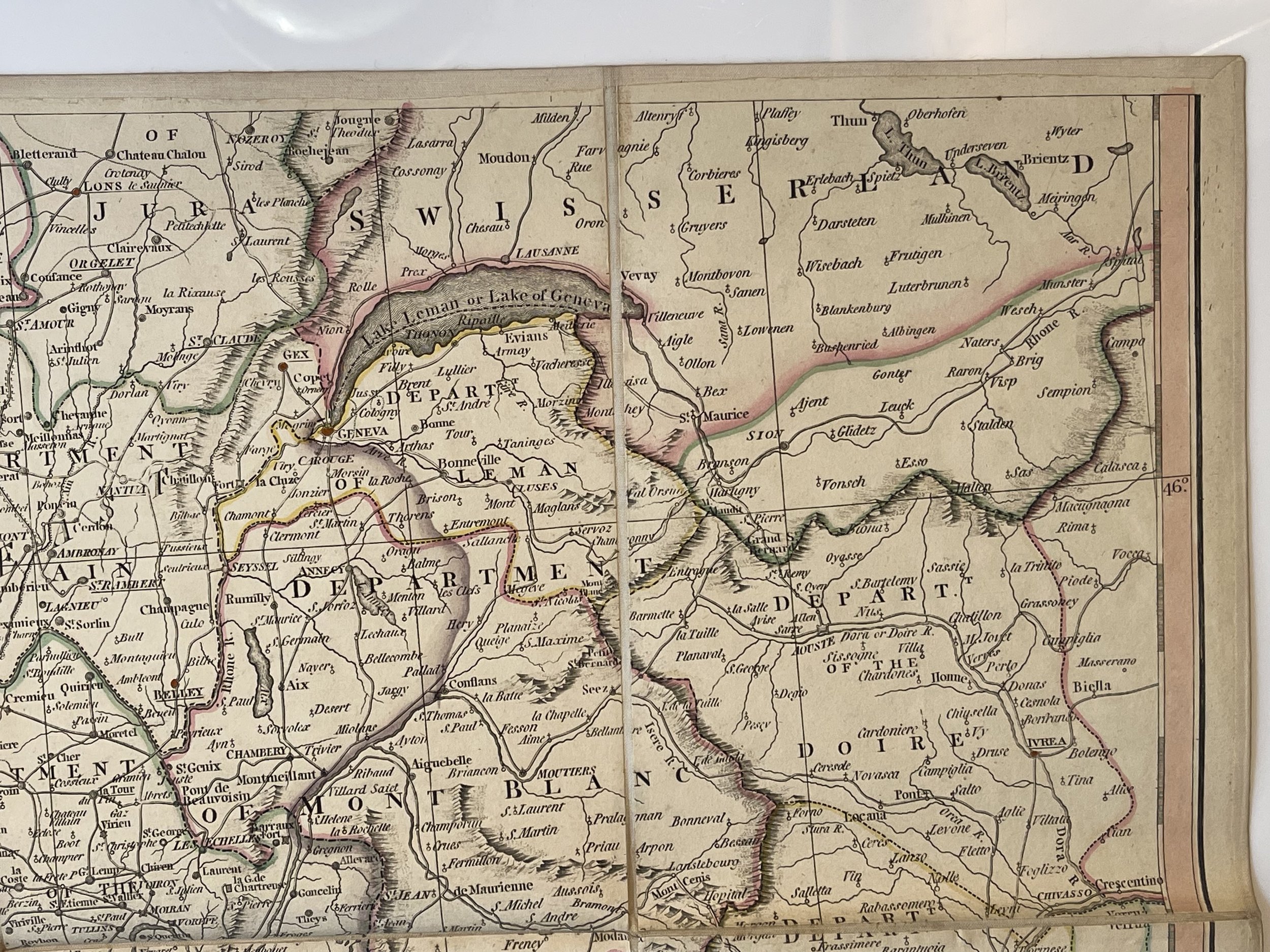
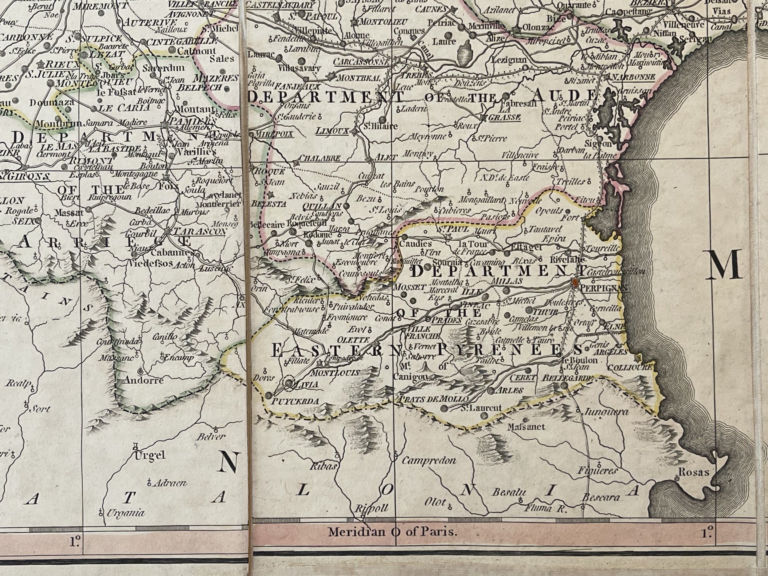
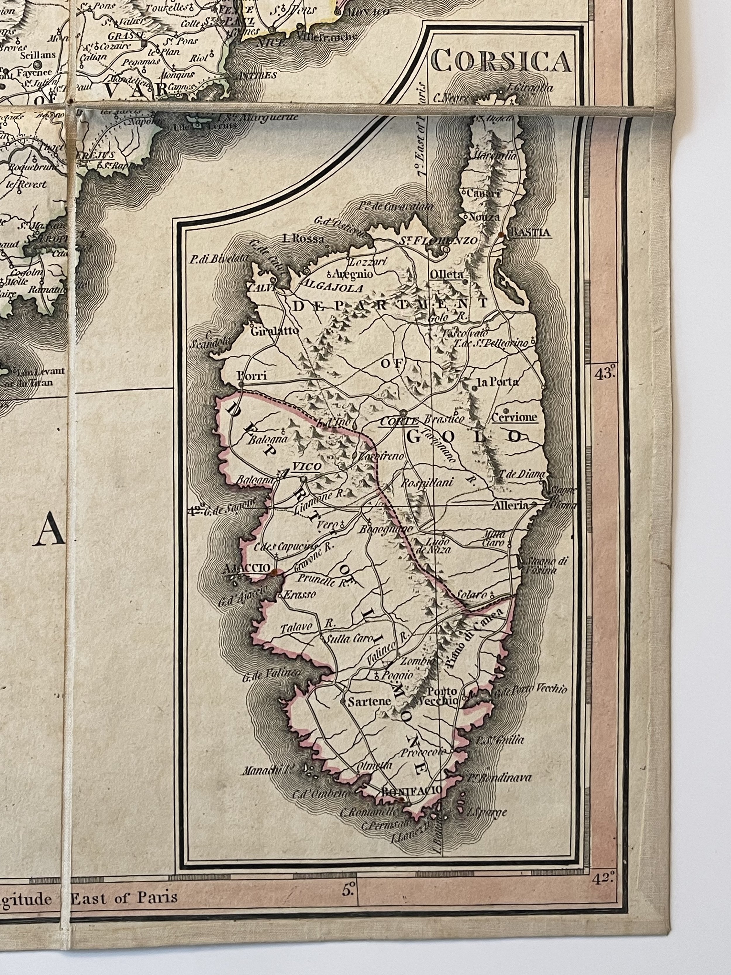
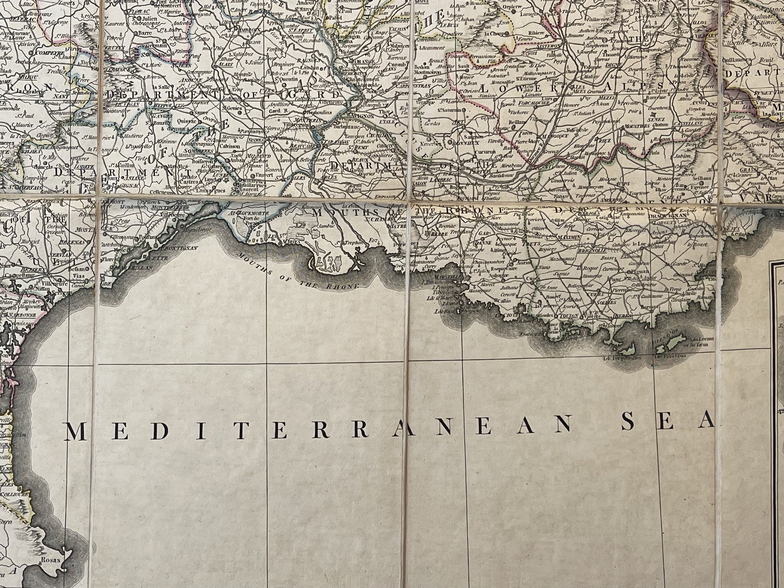
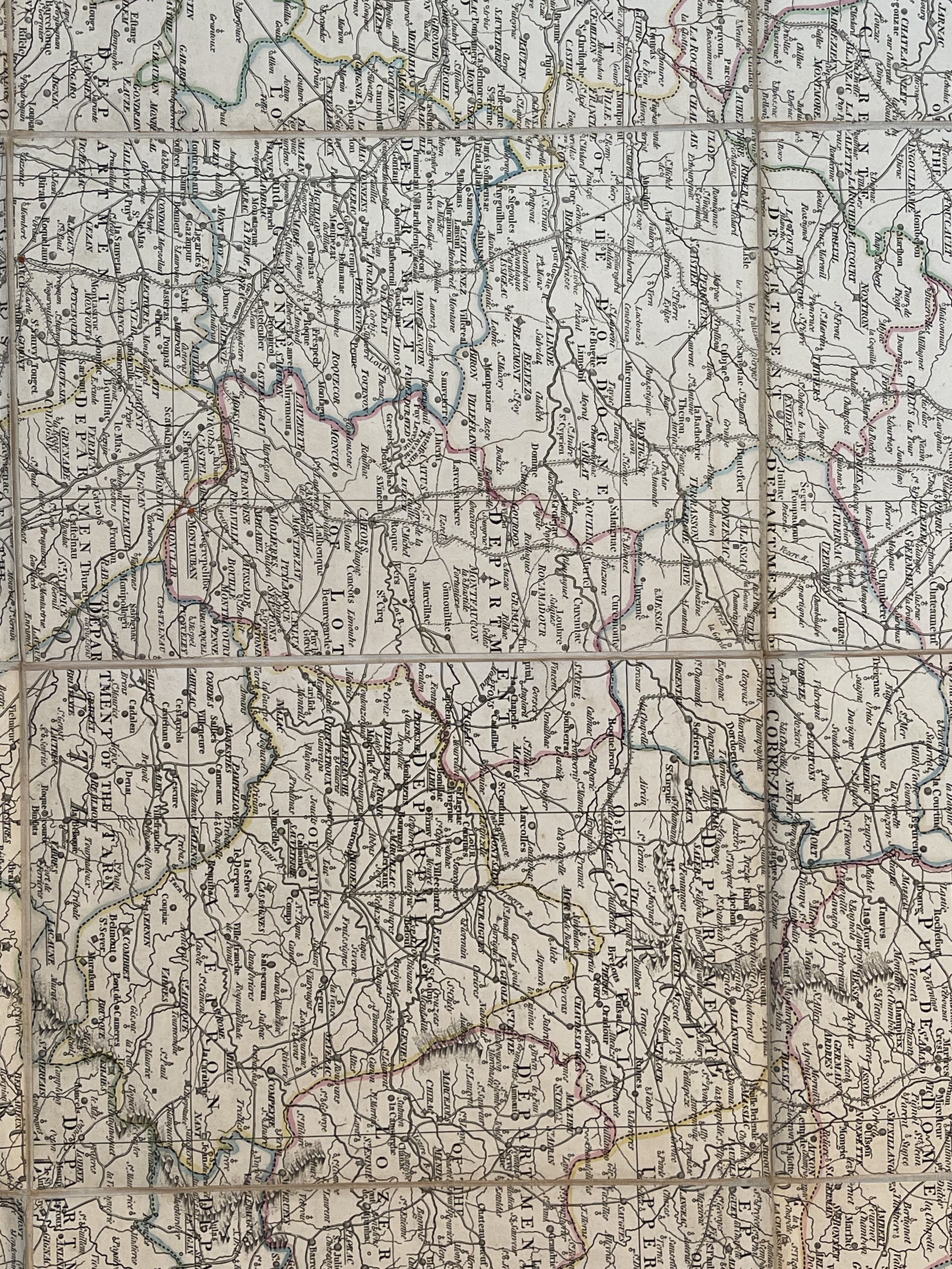
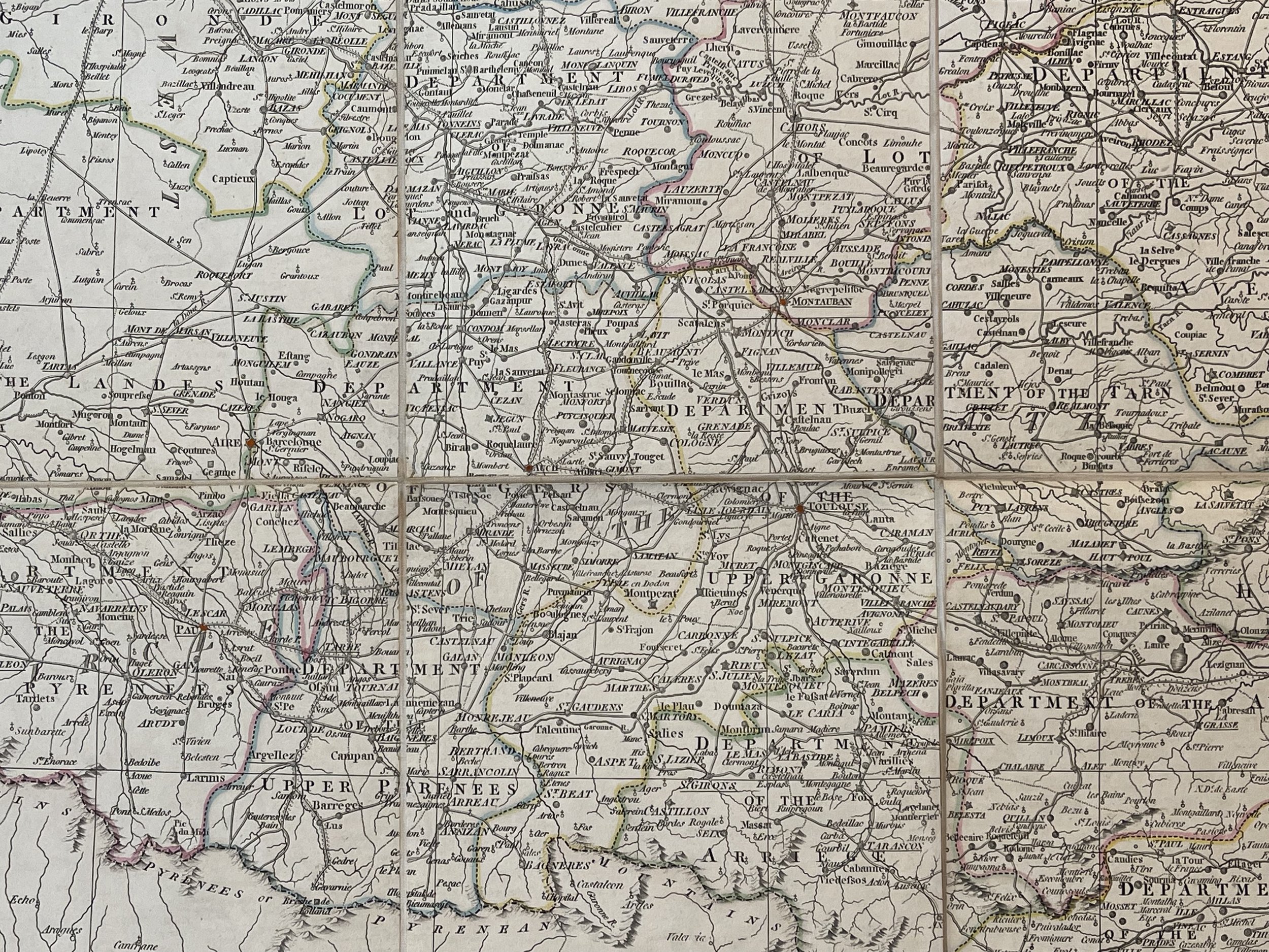
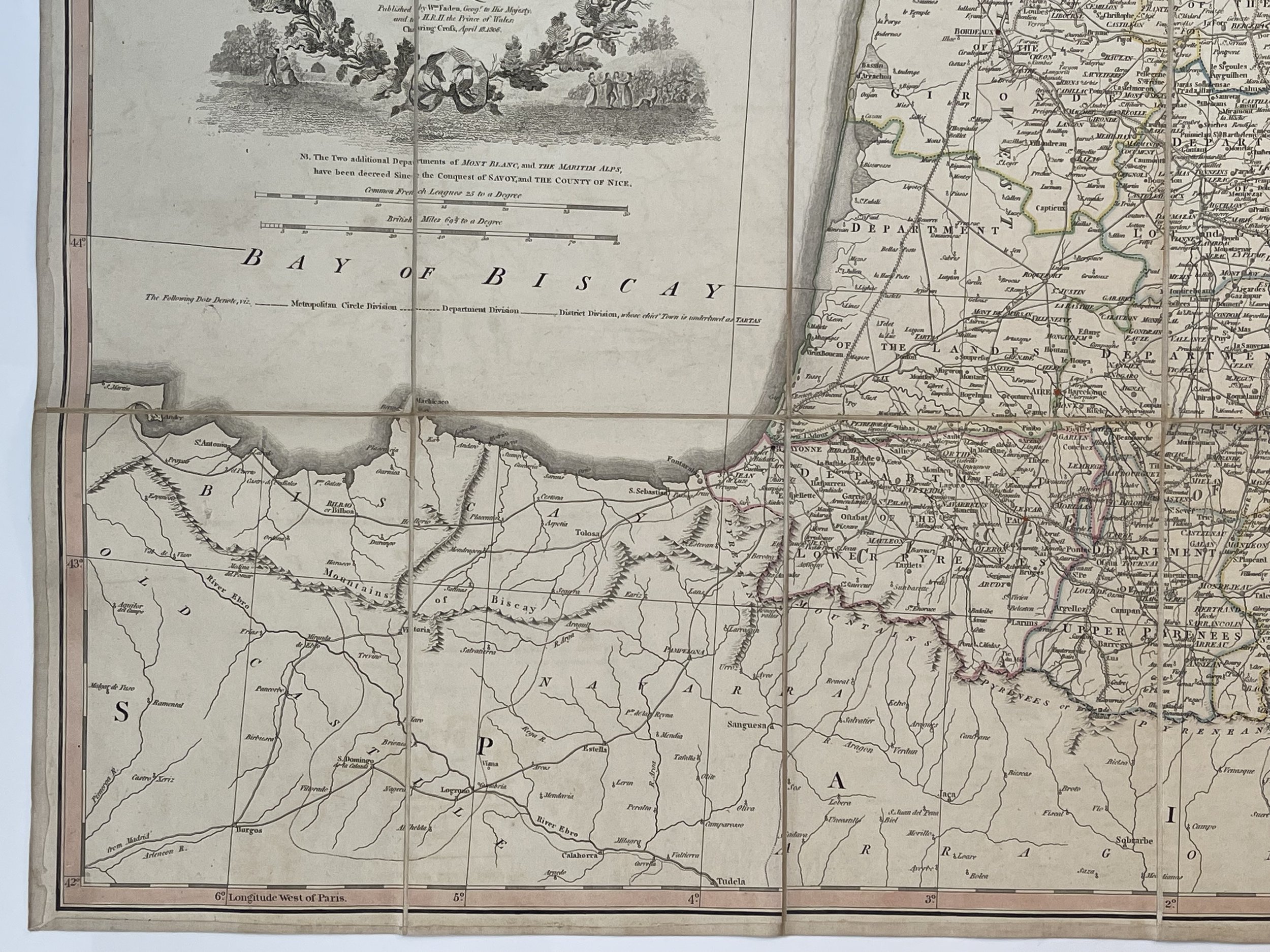
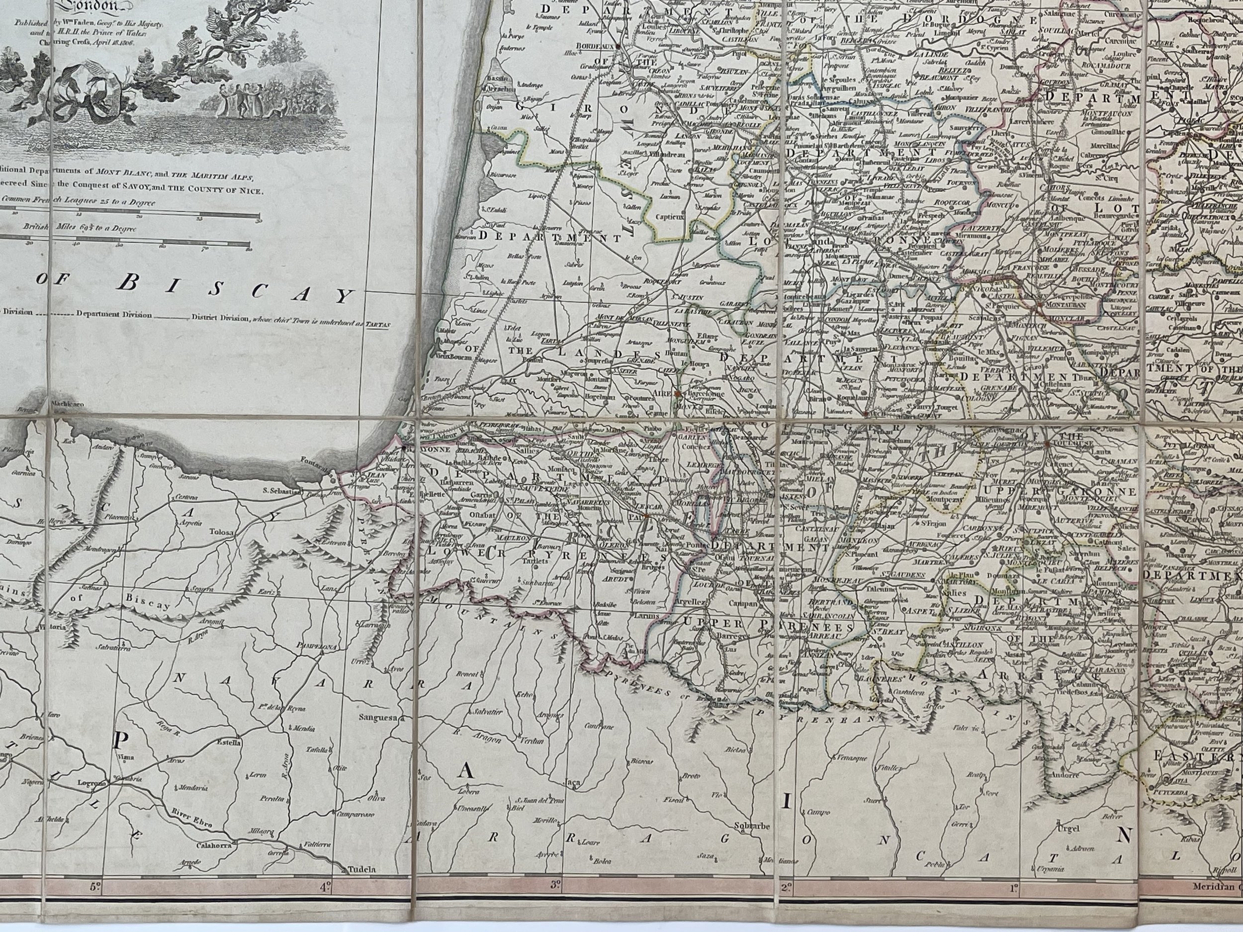
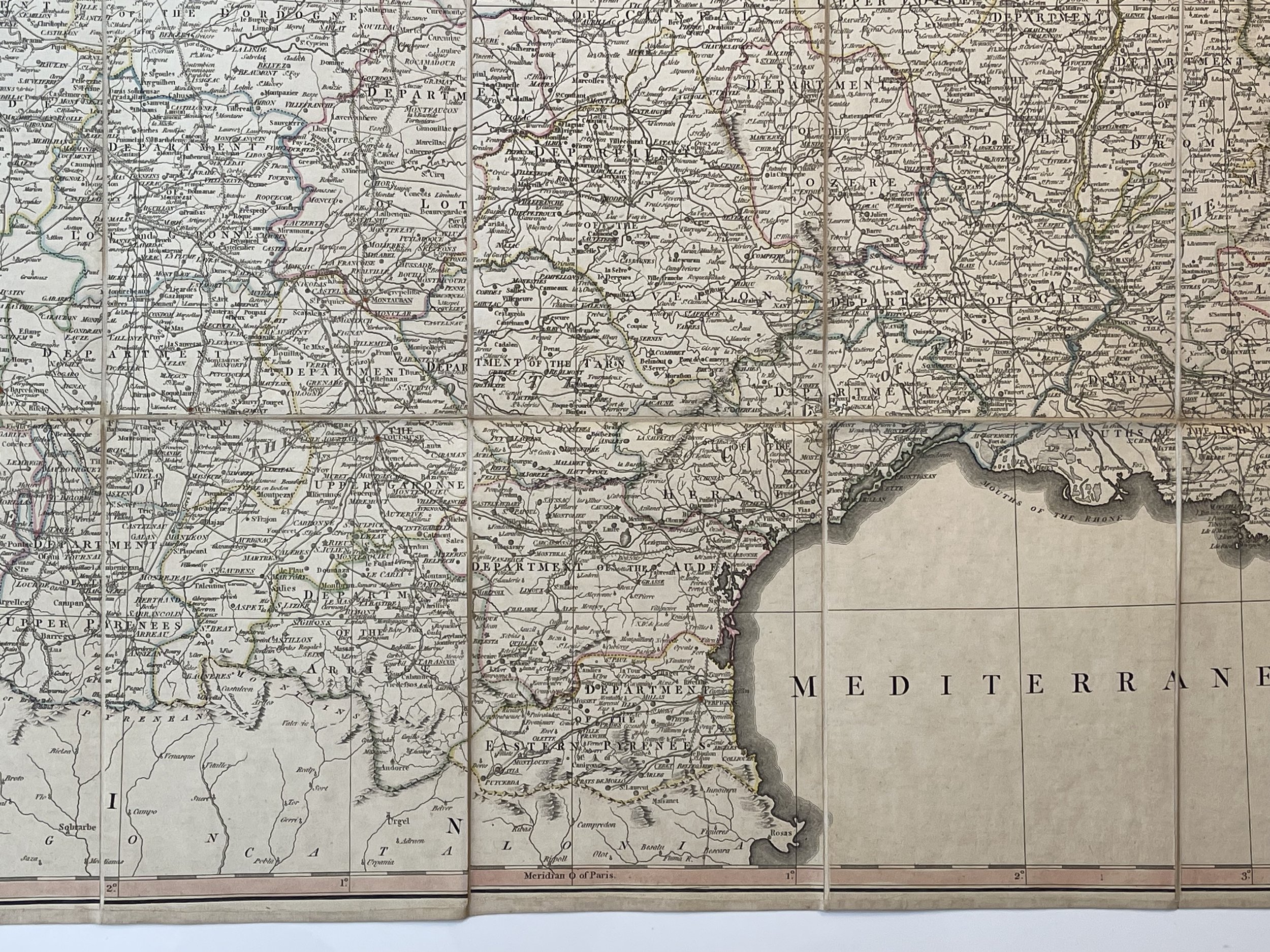
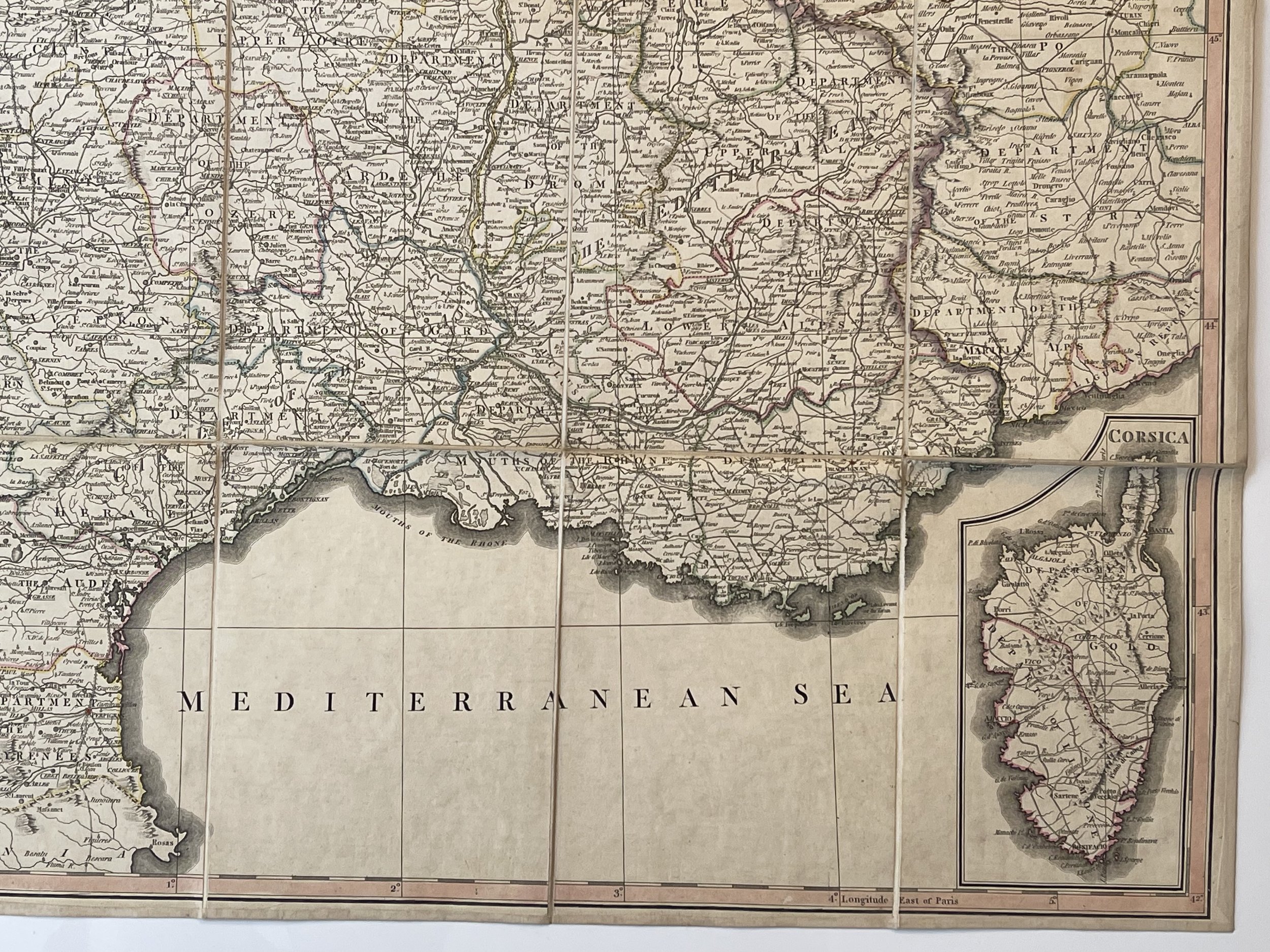
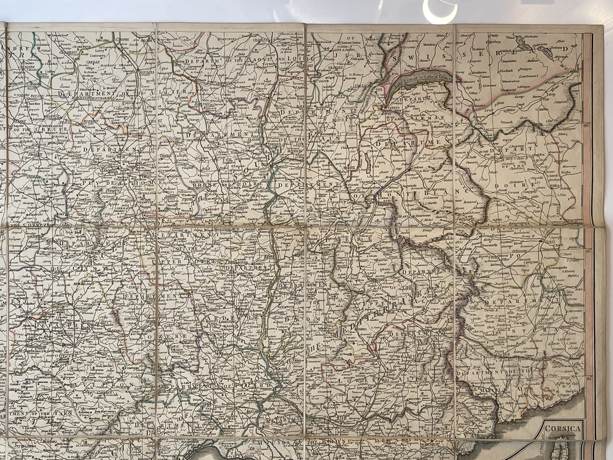
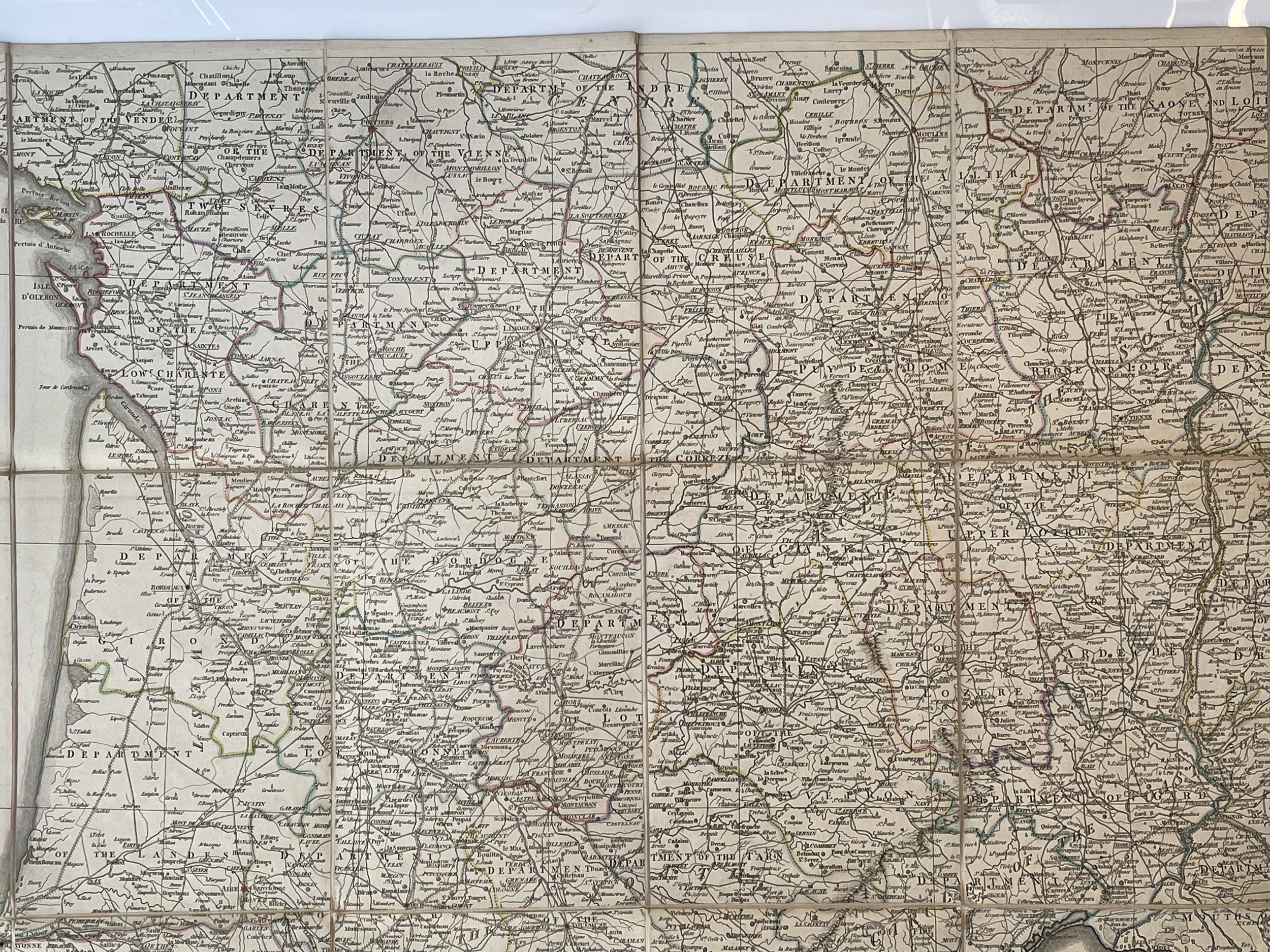
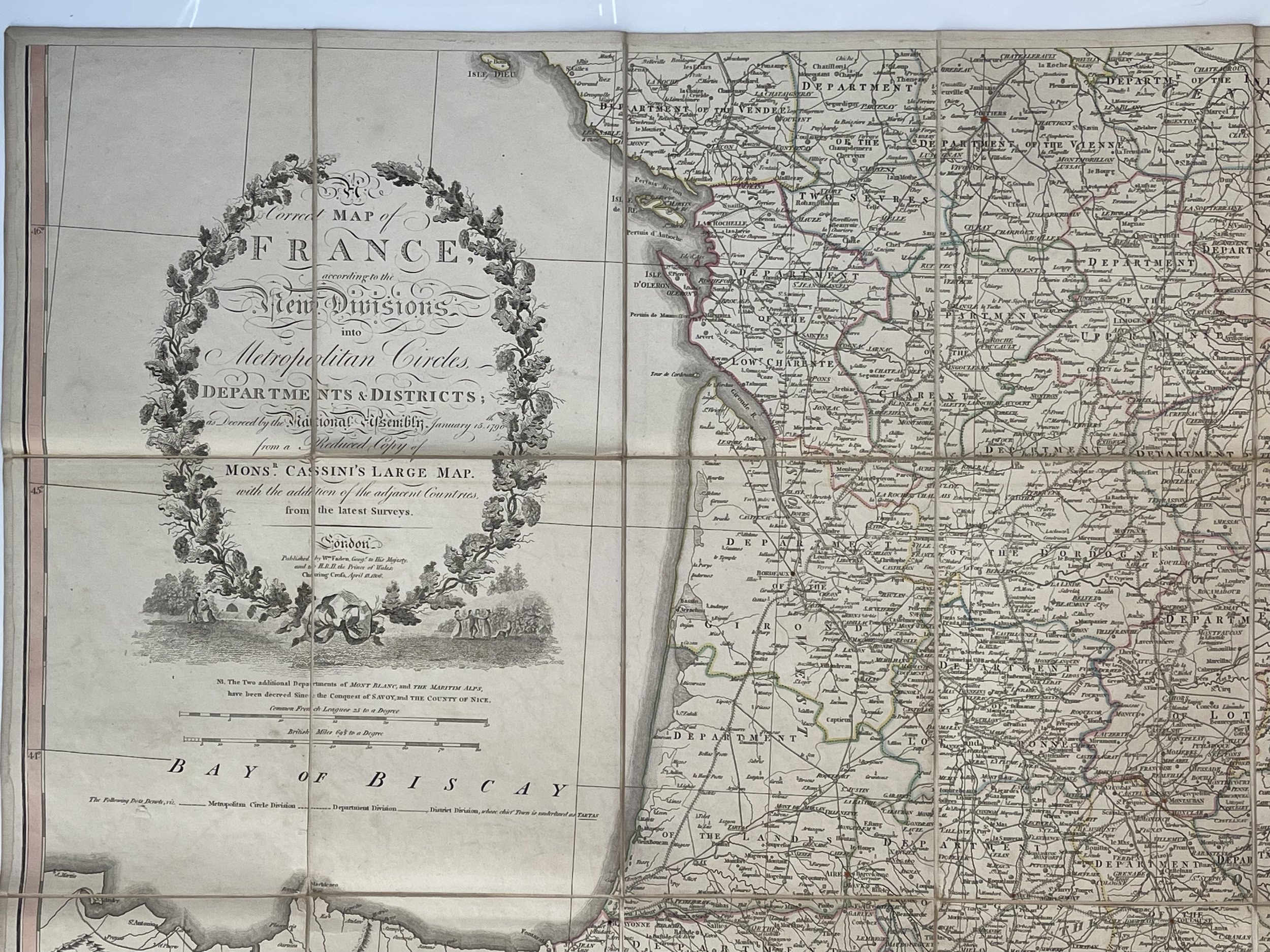
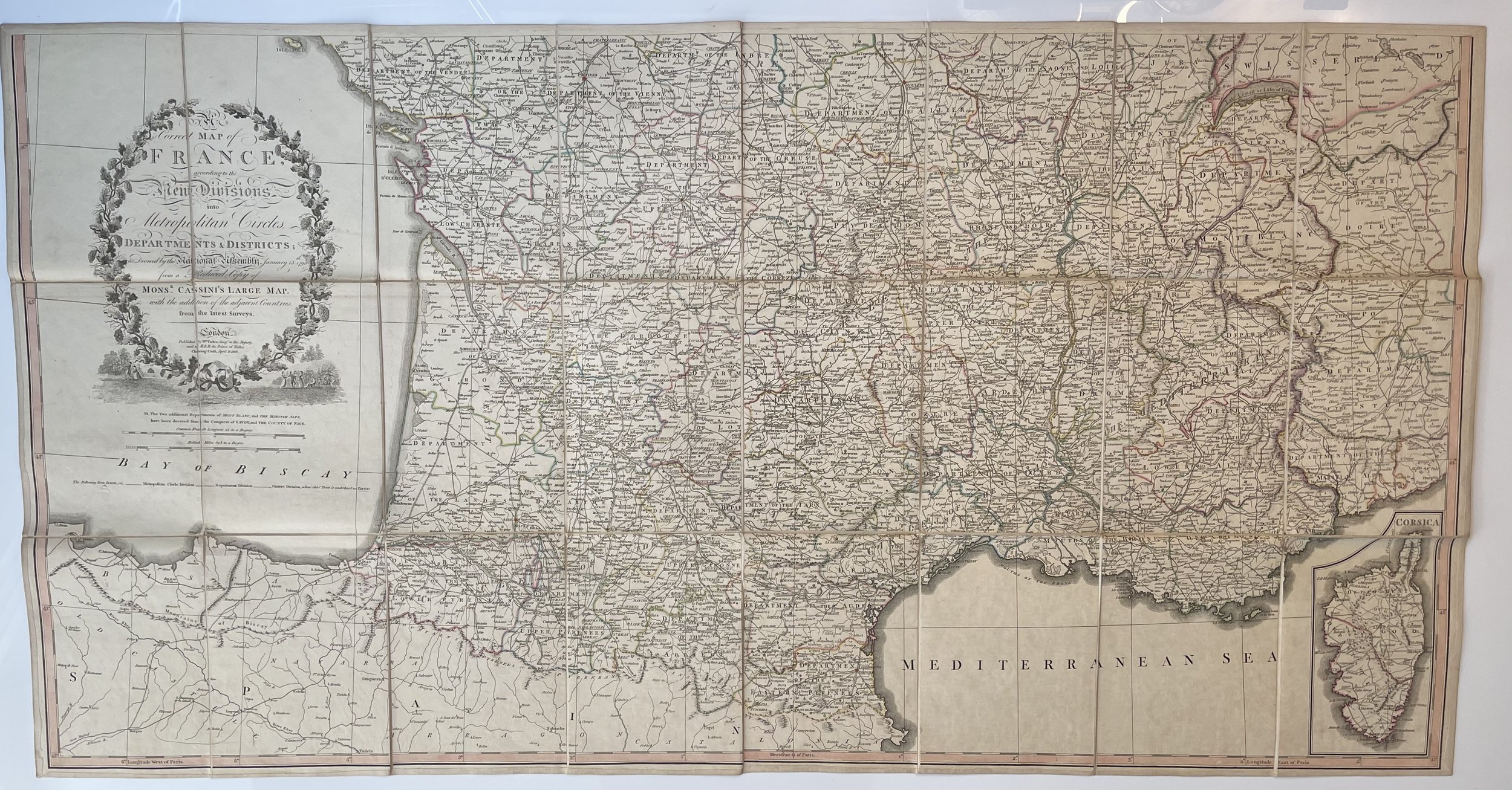
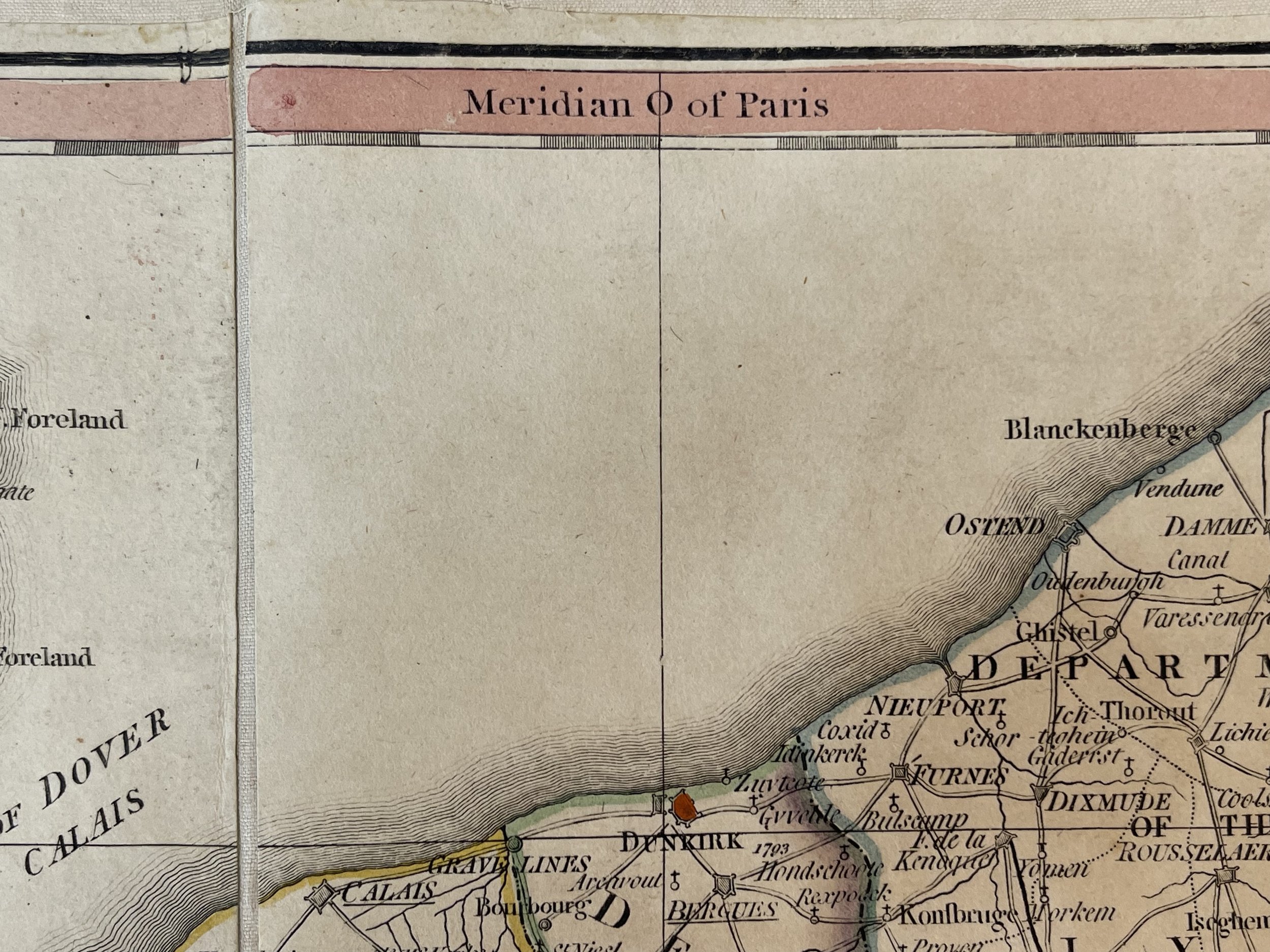
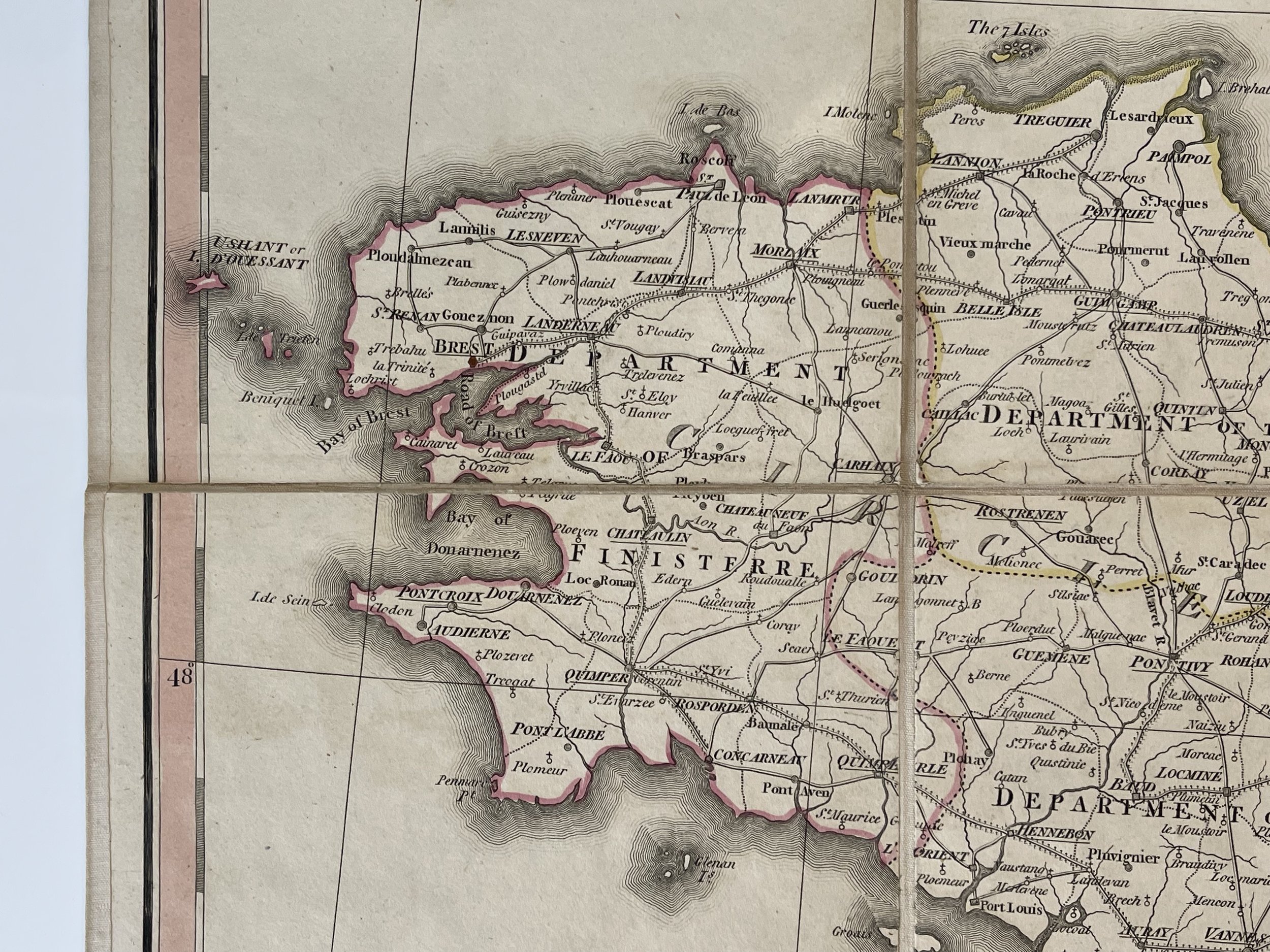
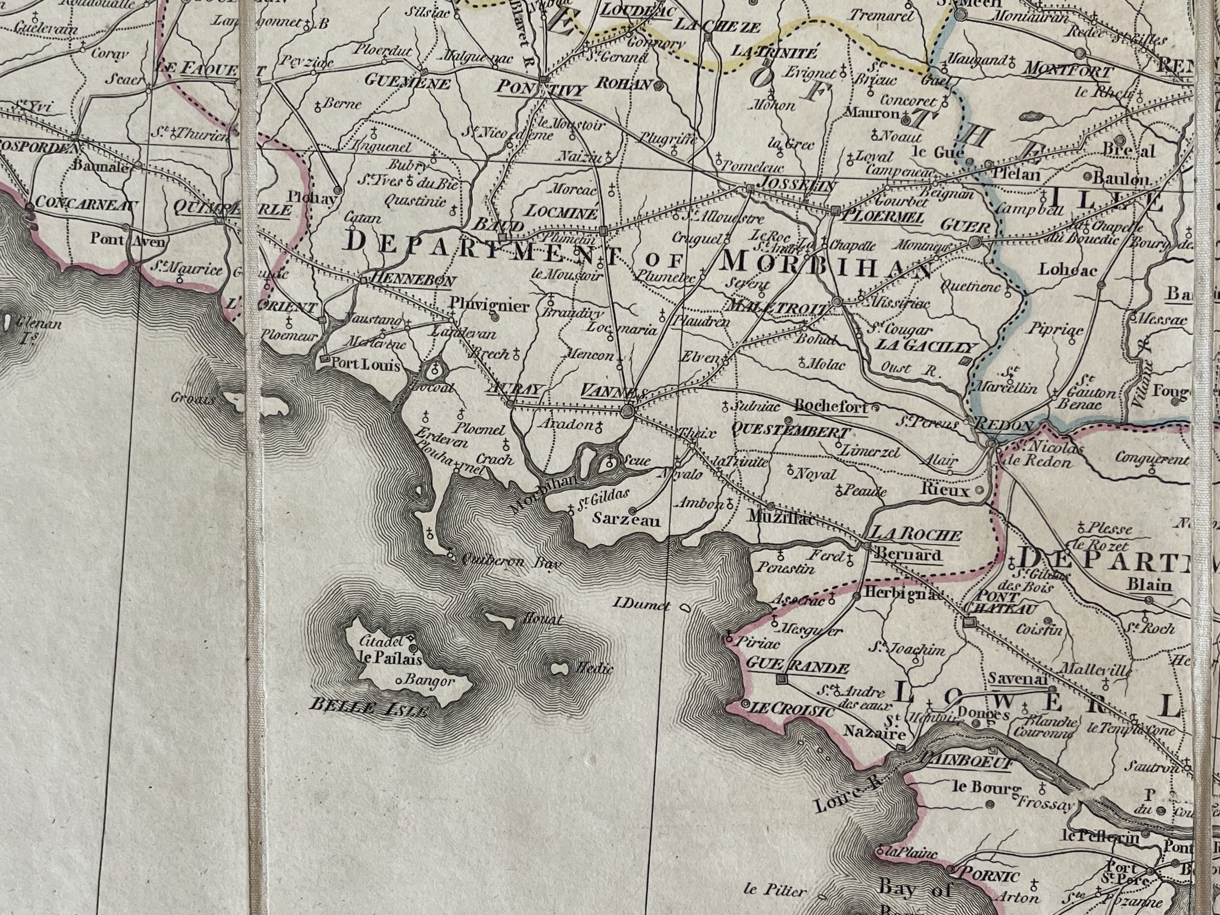
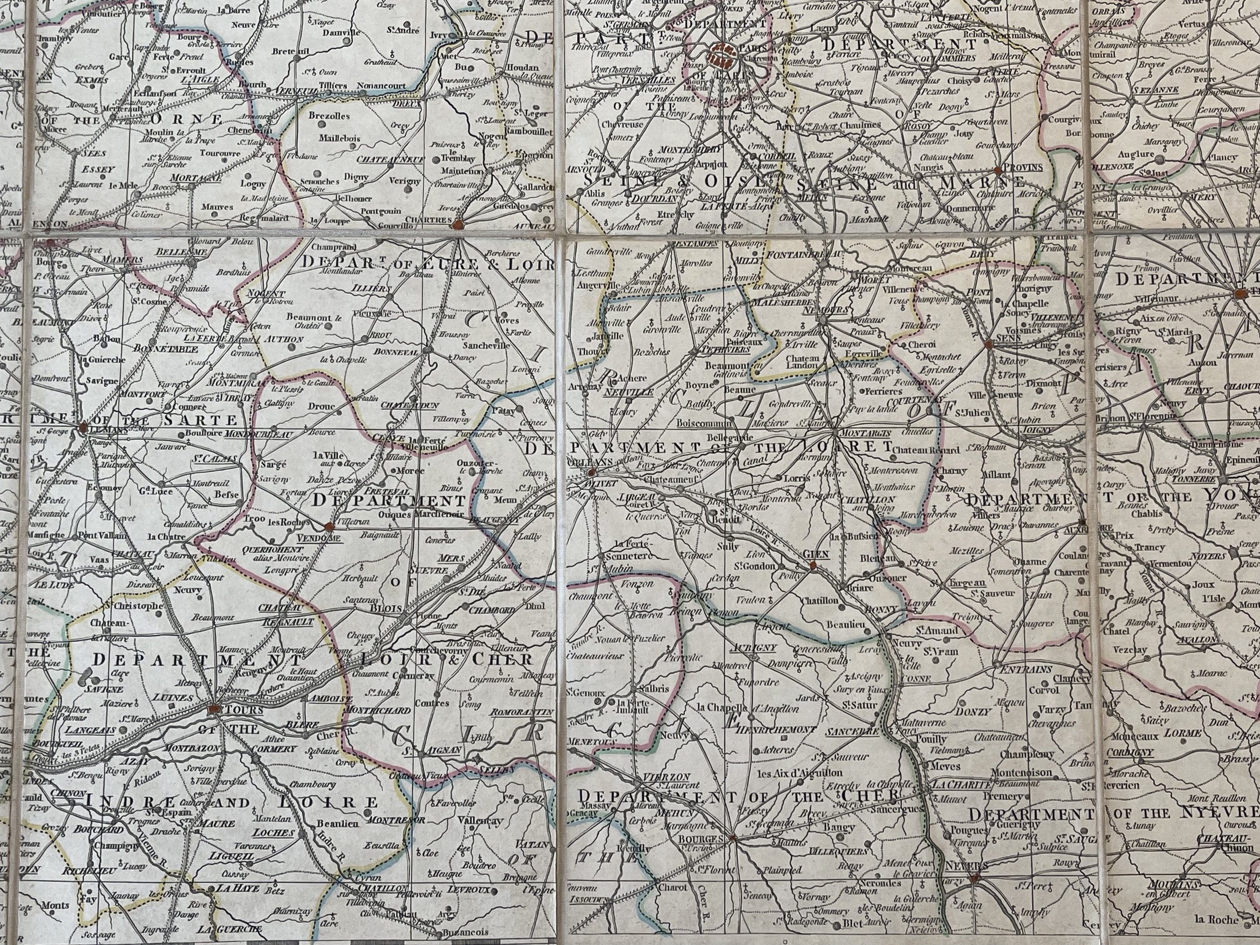
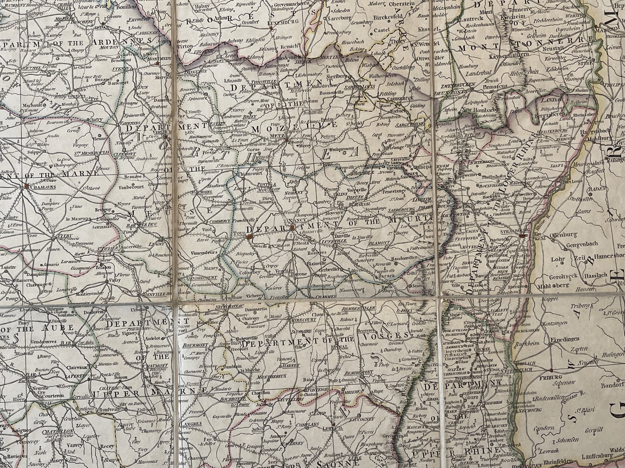
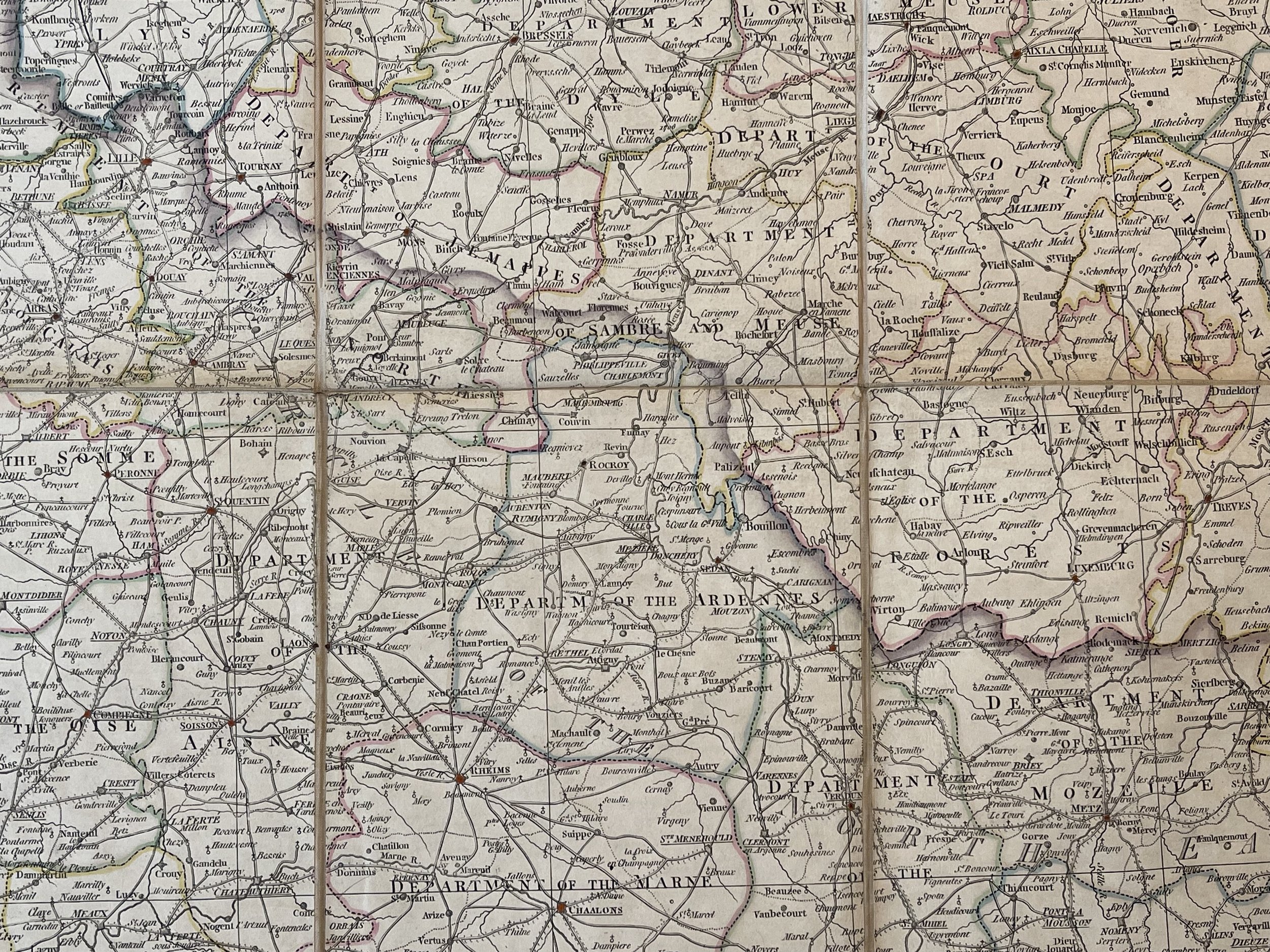
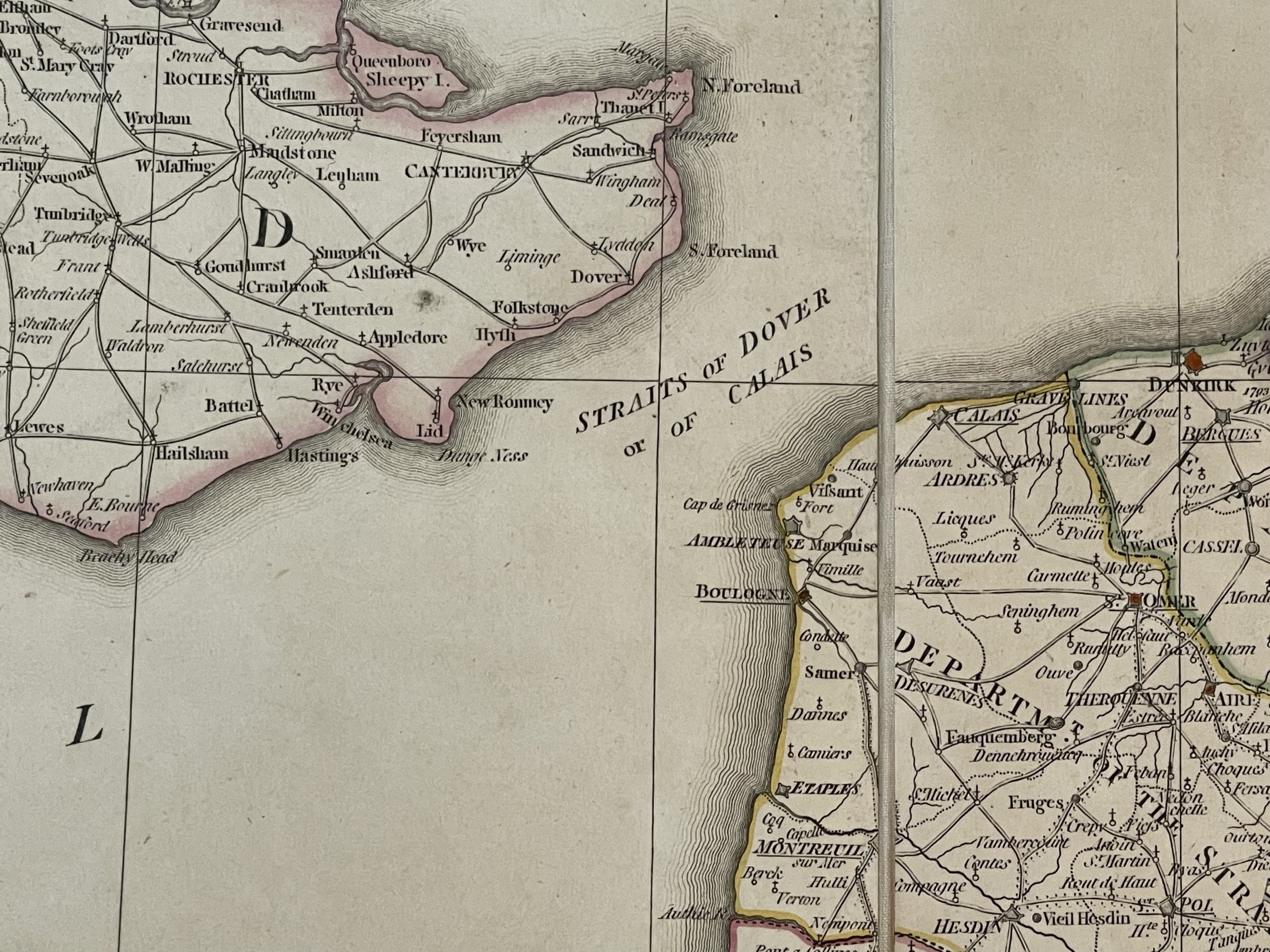
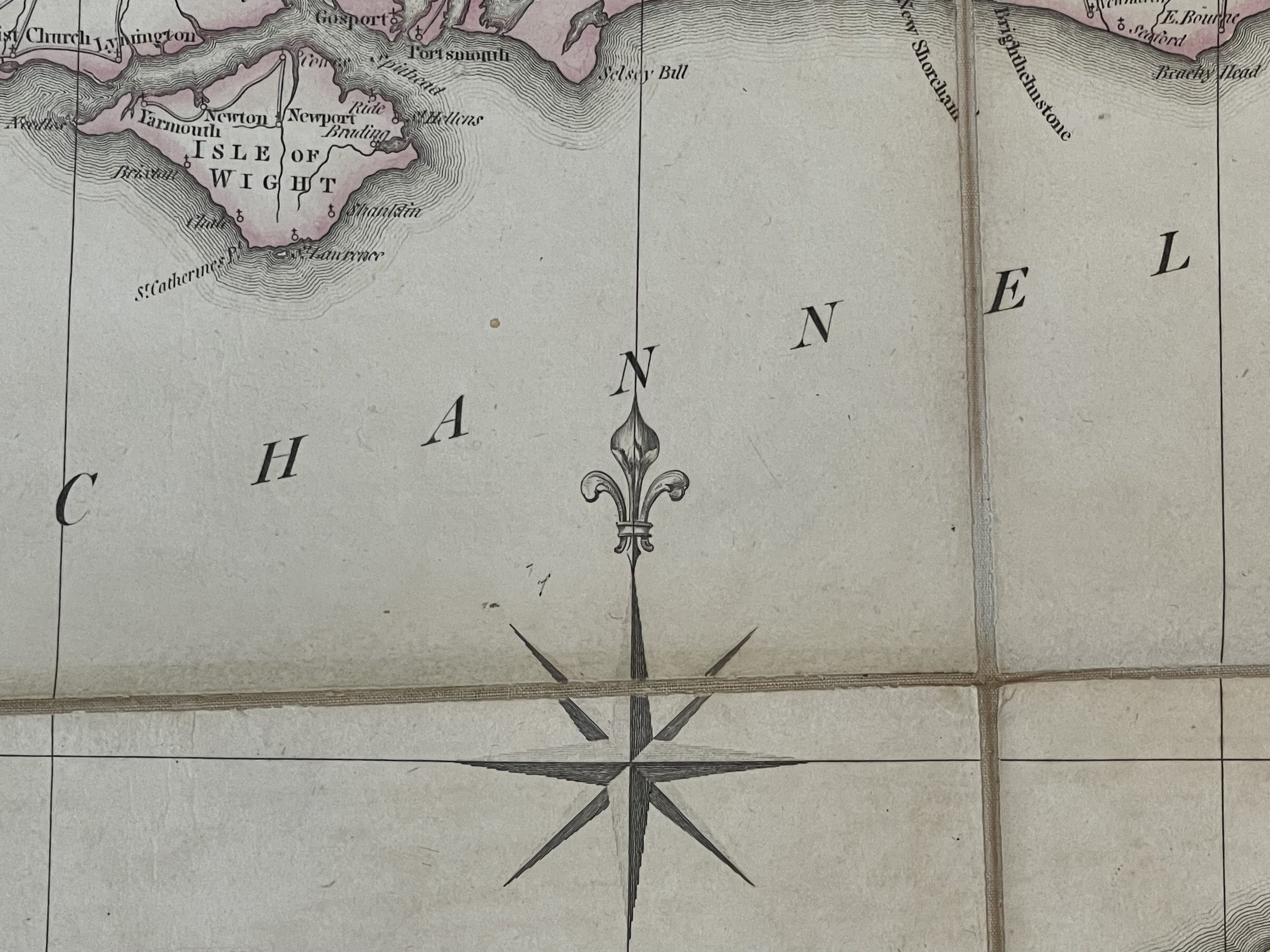
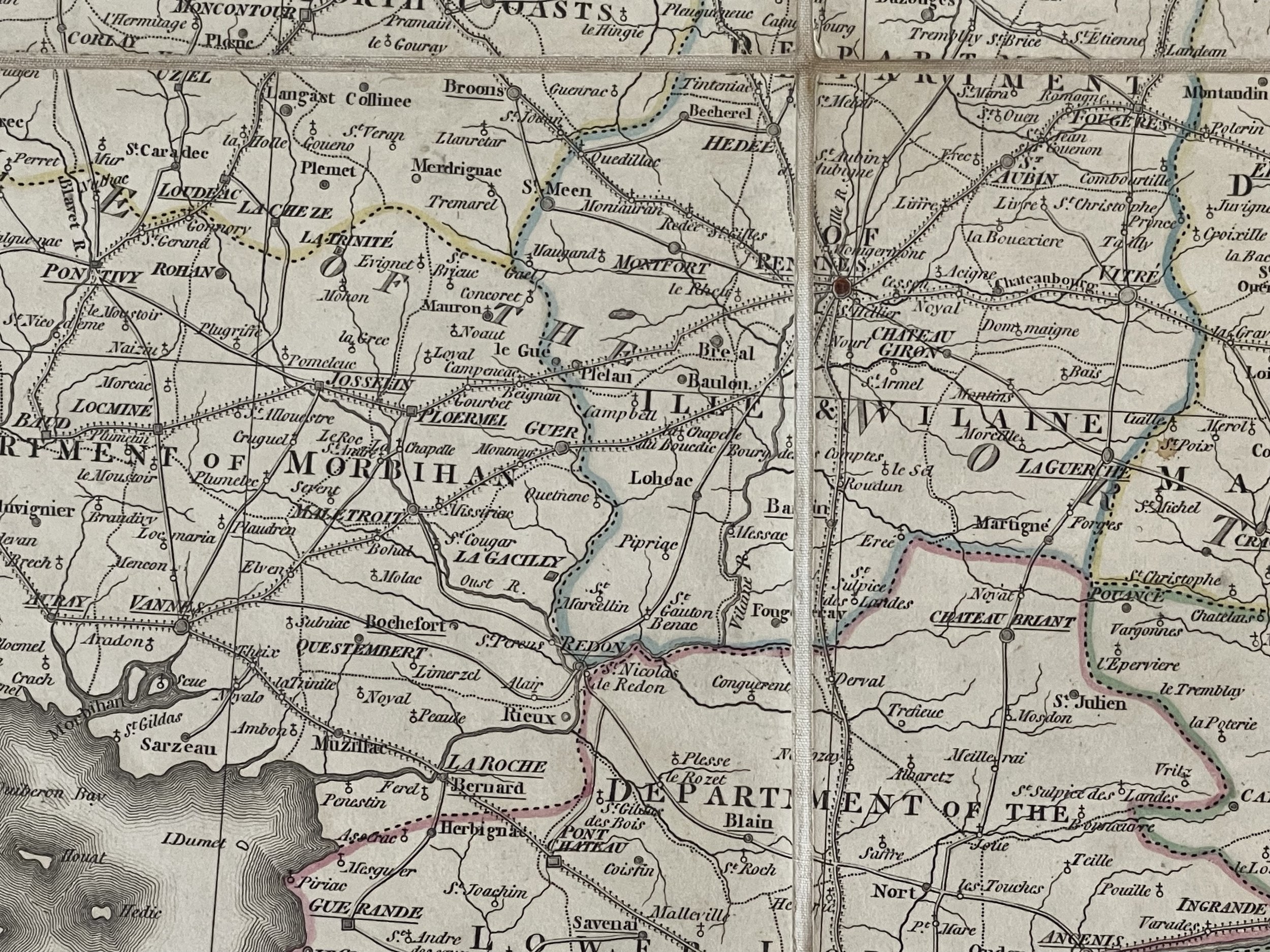
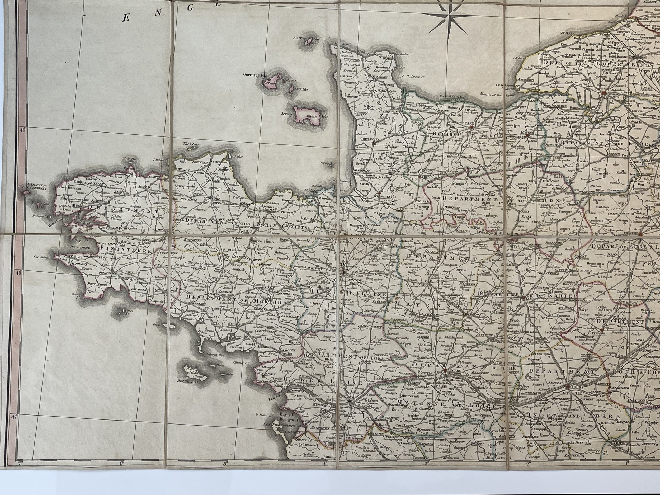
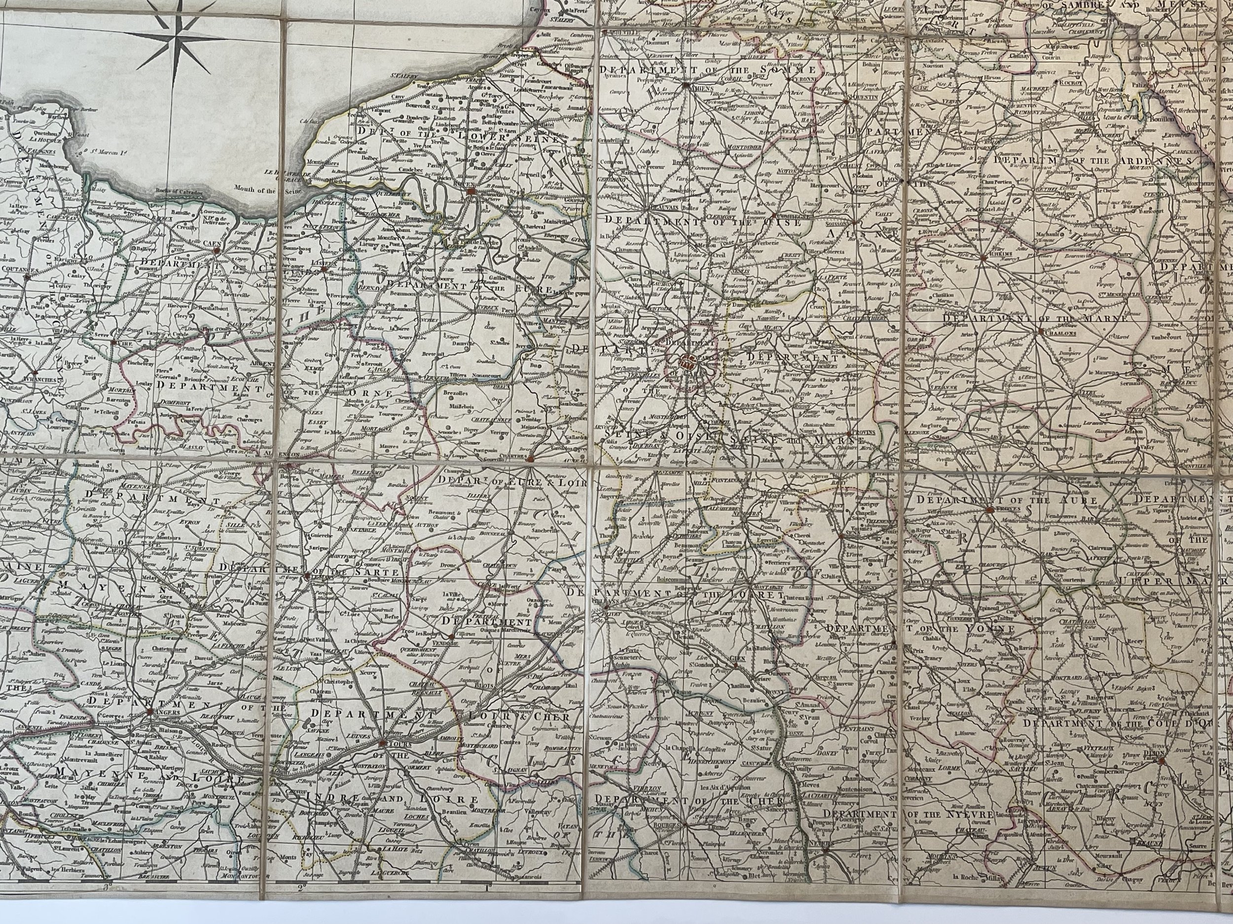
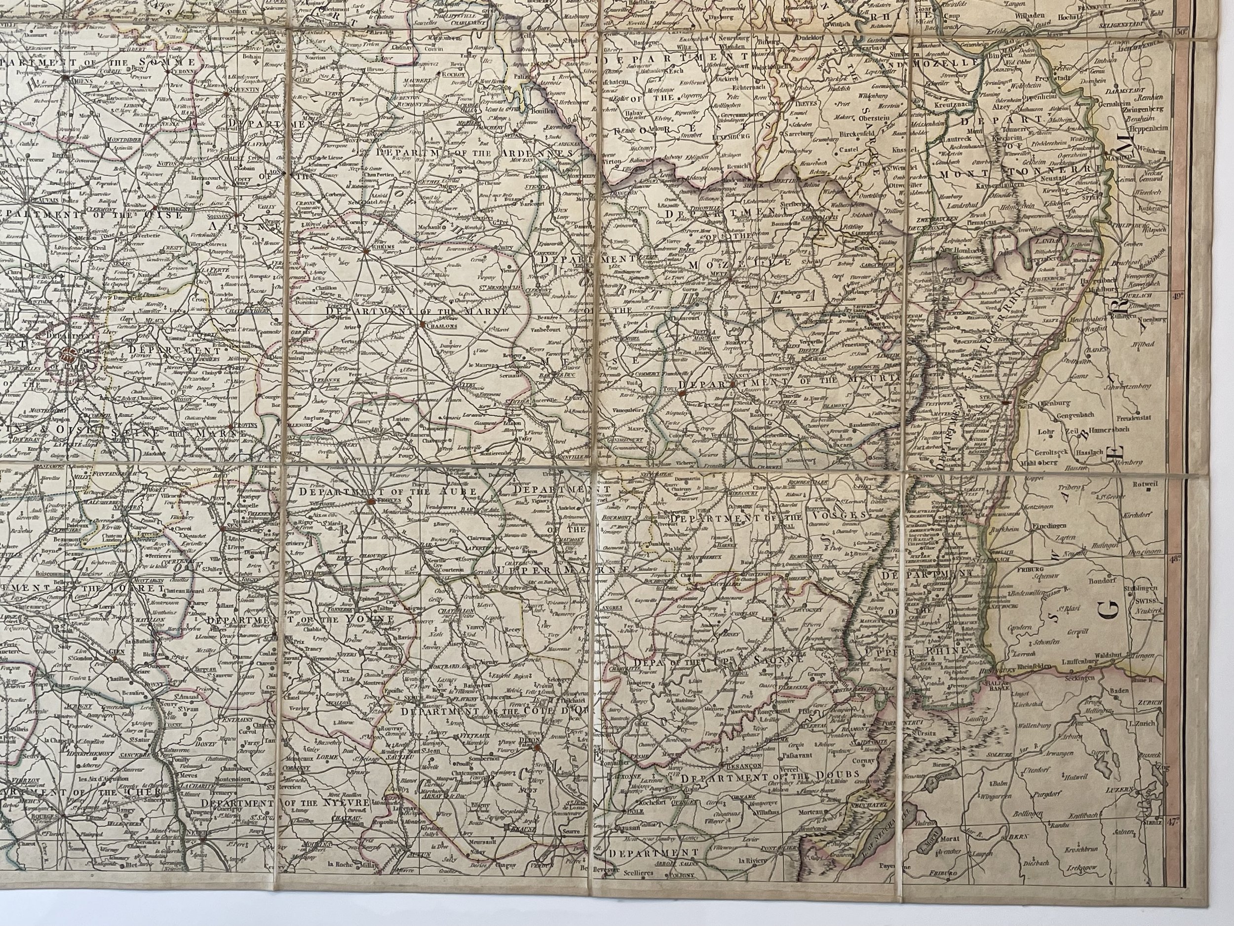
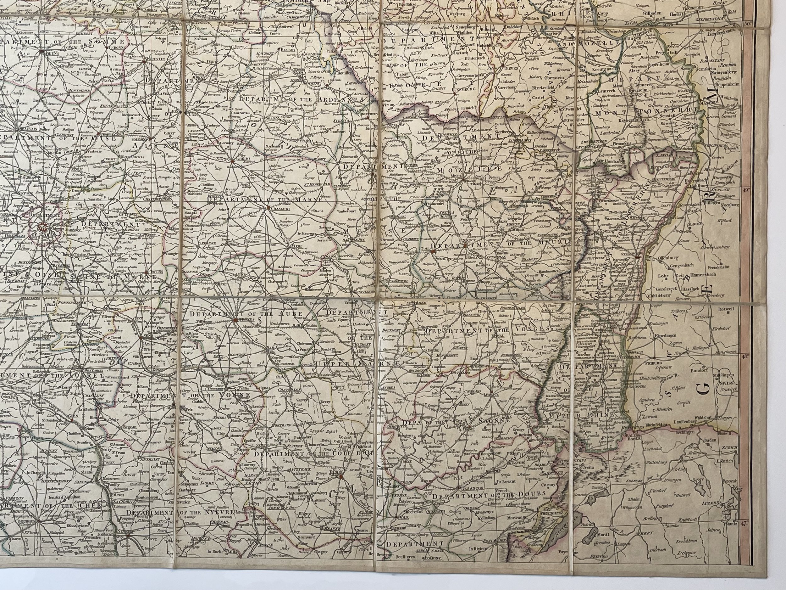
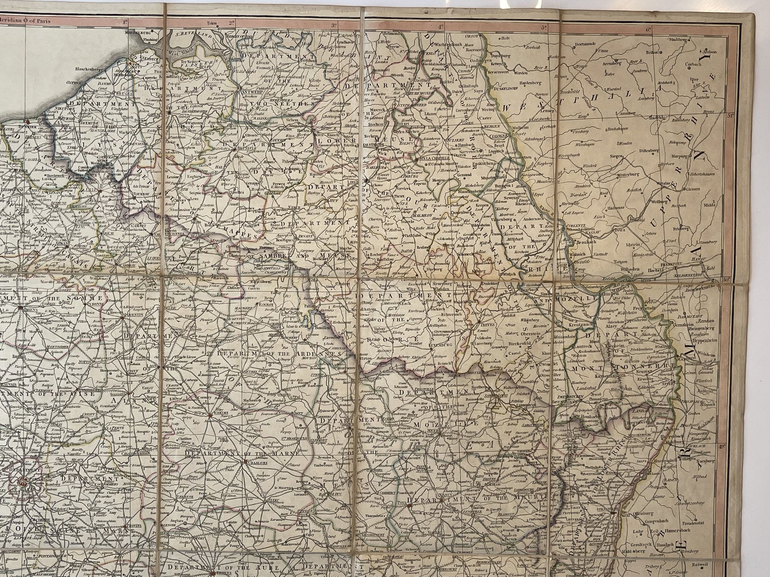
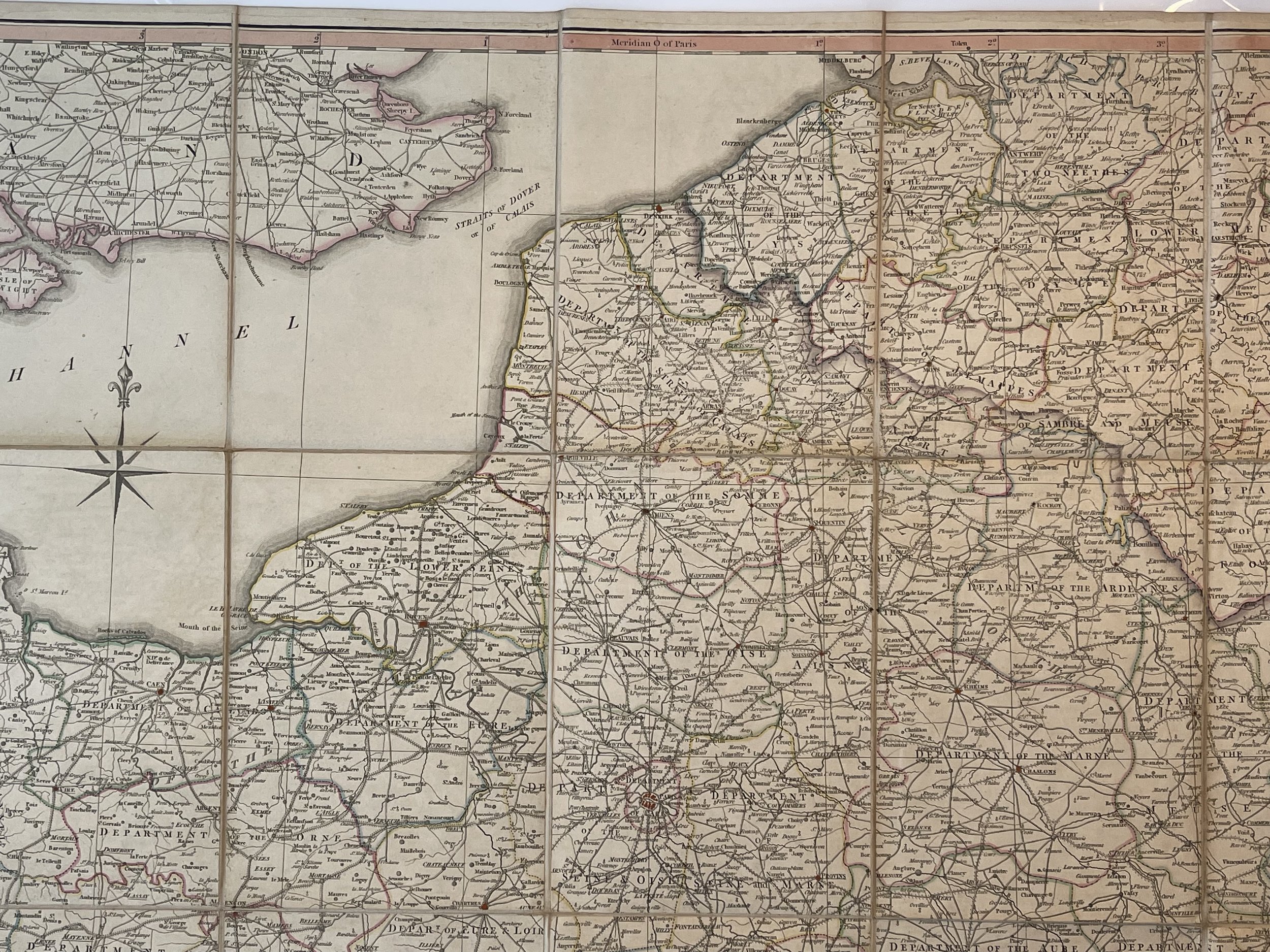
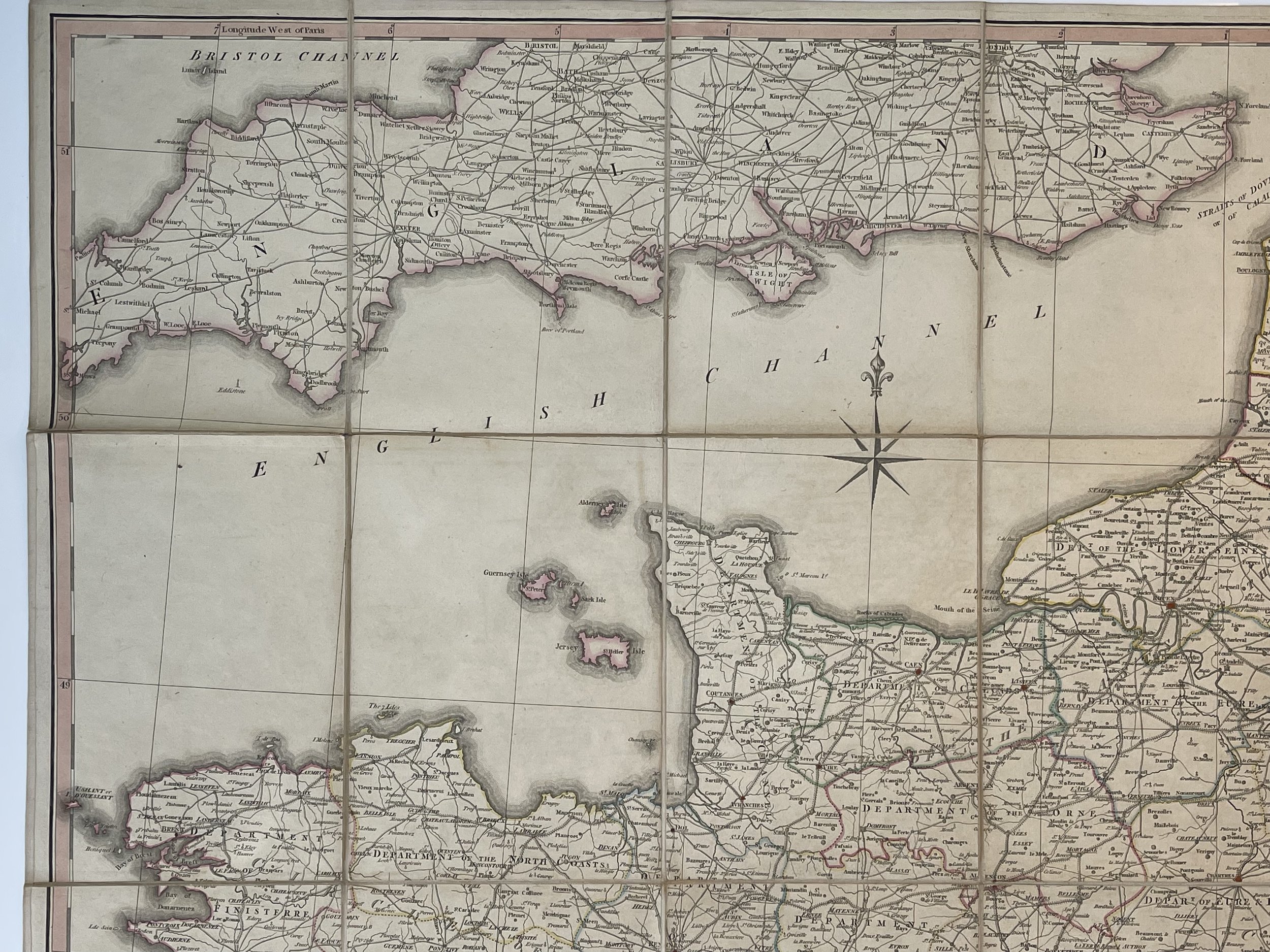
A correct map of France, according to the new divisions into Metropolitan Circles, Departments and Districts; as decreed by the National Assembly, January 15th, 1790. From a reduced copy of Monsr Cassini s L.
William Faden (1749–1836) was an English cartographer and a publisher of maps. He was the royal geographer to King George III. He replaced Thomas Jefferys in that role.
The title of "geographer to the king" was given to various people in the 18th century, including John Senex, Herman Moll, Emanuel Bowen and Thomas Jeffreys. All these men, including William Faden, were engravers and publishers, not scholars or academics. Their part was to publish and supply maps to the crown and parliament.
William Faden was born as the son of the printer William Faden Senior (1711-1783). He self-printed the North American Atlas in 1777, and it became the most important atlas chronicling the Revolution's battles. There were 29 maps in the atlas, and they included detailed battle maps drawn by eyewitnesses.
William Faden was also the publisher of the periodical "the Public Ledger" or "The Daily Register" in London.
A list of the English county maps printed by William Faden is also given in one of his biographies.
Maps in excellent condition for their age. Would look superb framed together. Pricing and grading commensurate.
Large Map of France (In two folding portions ) - William Faden - 1806
A correct map of France, according to the new divisions into Metropolitan Circles, Departments and Districts; as decreed by the National Assembly, January 15th, 1790. From a reduced copy of Monsr Cassini s L.
William Faden (1749–1836) was an English cartographer and a publisher of maps. He was the royal geographer to King George III. He replaced Thomas Jefferys in that role.
The title of "geographer to the king" was given to various people in the 18th century, including John Senex, Herman Moll, Emanuel Bowen and Thomas Jeffreys. All these men, including William Faden, were engravers and publishers, not scholars or academics. Their part was to publish and supply maps to the crown and parliament.
William Faden was born as the son of the printer William Faden Senior (1711-1783). He self-printed the North American Atlas in 1777, and it became the most important atlas chronicling the Revolution's battles. There were 29 maps in the atlas, and they included detailed battle maps drawn by eyewitnesses.
William Faden was also the publisher of the periodical "the Public Ledger" or "The Daily Register" in London.
A list of the English county maps printed by William Faden is also given in one of his biographies.
Maps in excellent condition for their age. Would look superb framed together. Pricing and grading commensurate.
Code : A1094
Cartographer : Cartographer / Engraver / Publisher: William Faden
Date : Publication Place / Date - Circa 1806
Size : Sheet size: approx 128 x 117.5 Cm
Availability : Available
Type - Genuine - Antique
Grading A
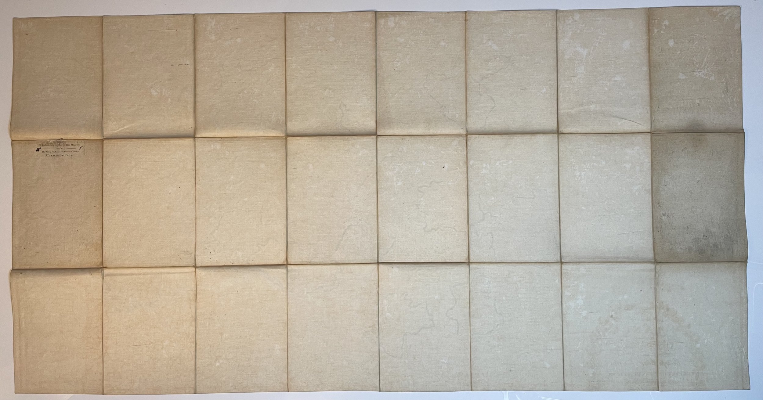
Where Applicable - Folds as issued. Light box photo shows the folio leaf centre margin hinge ‘glue’, this is not visible otherwise.
Tracked postage, in casement. Please contact me for postal quotation outside of the UK.