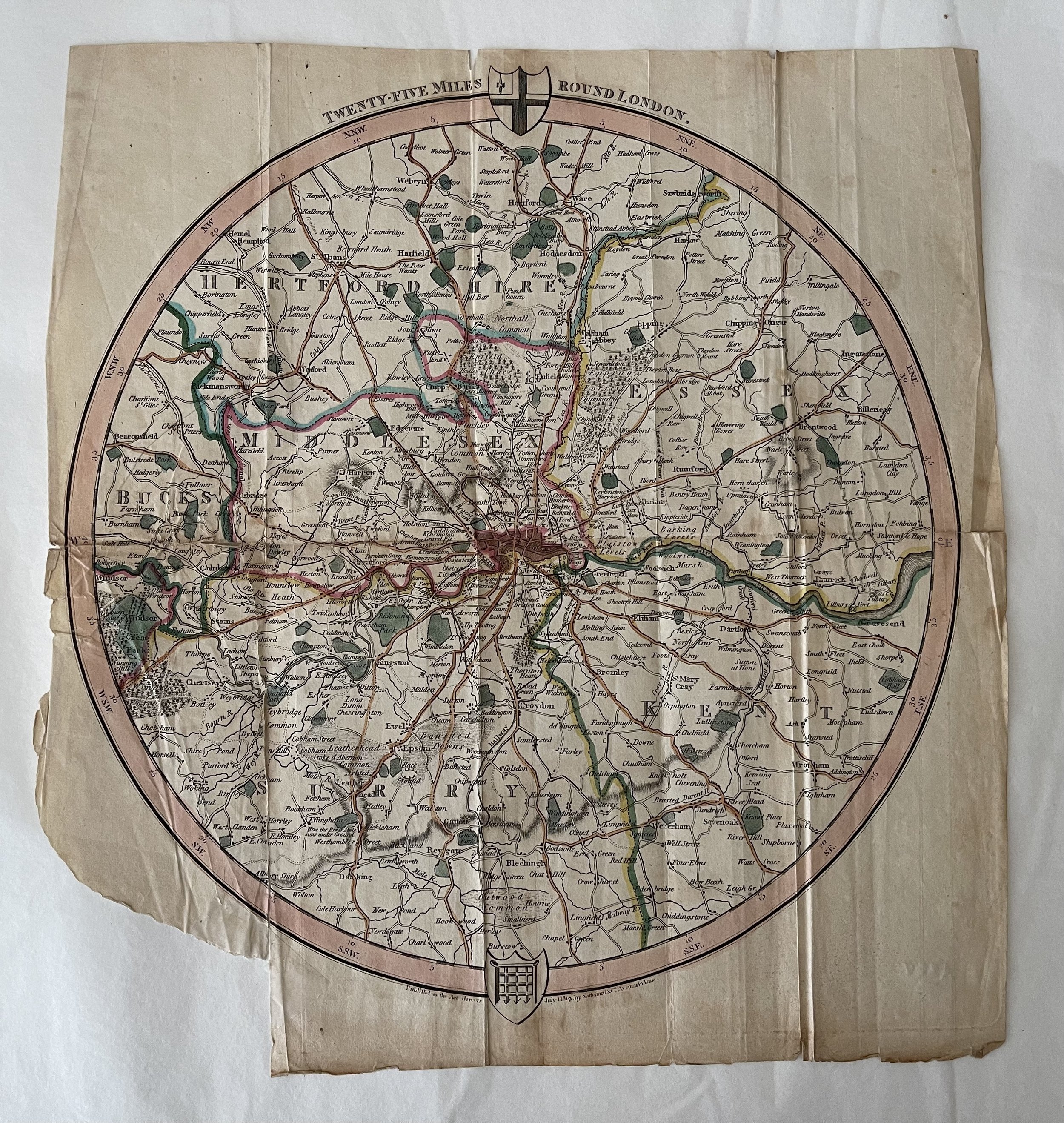
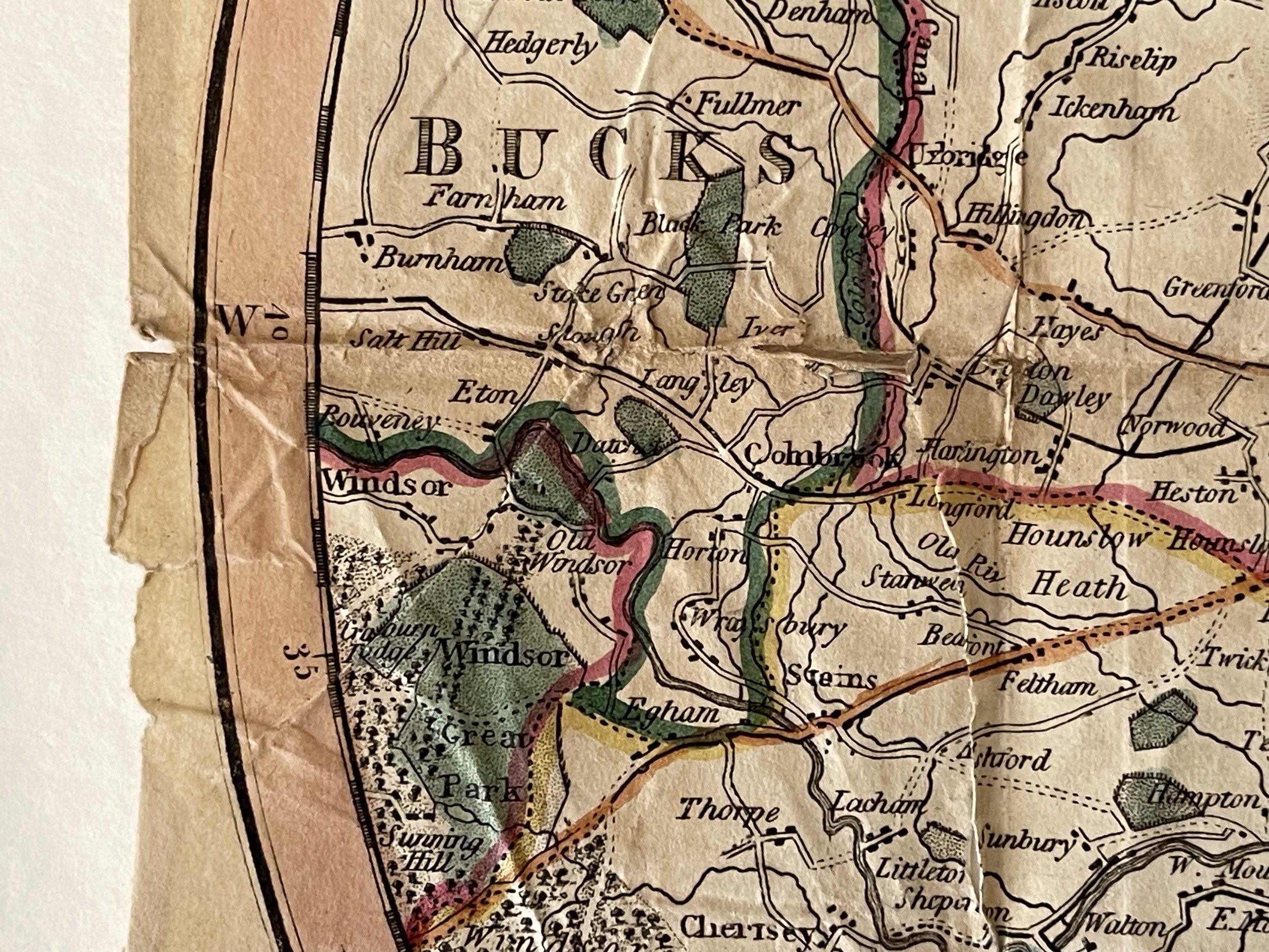
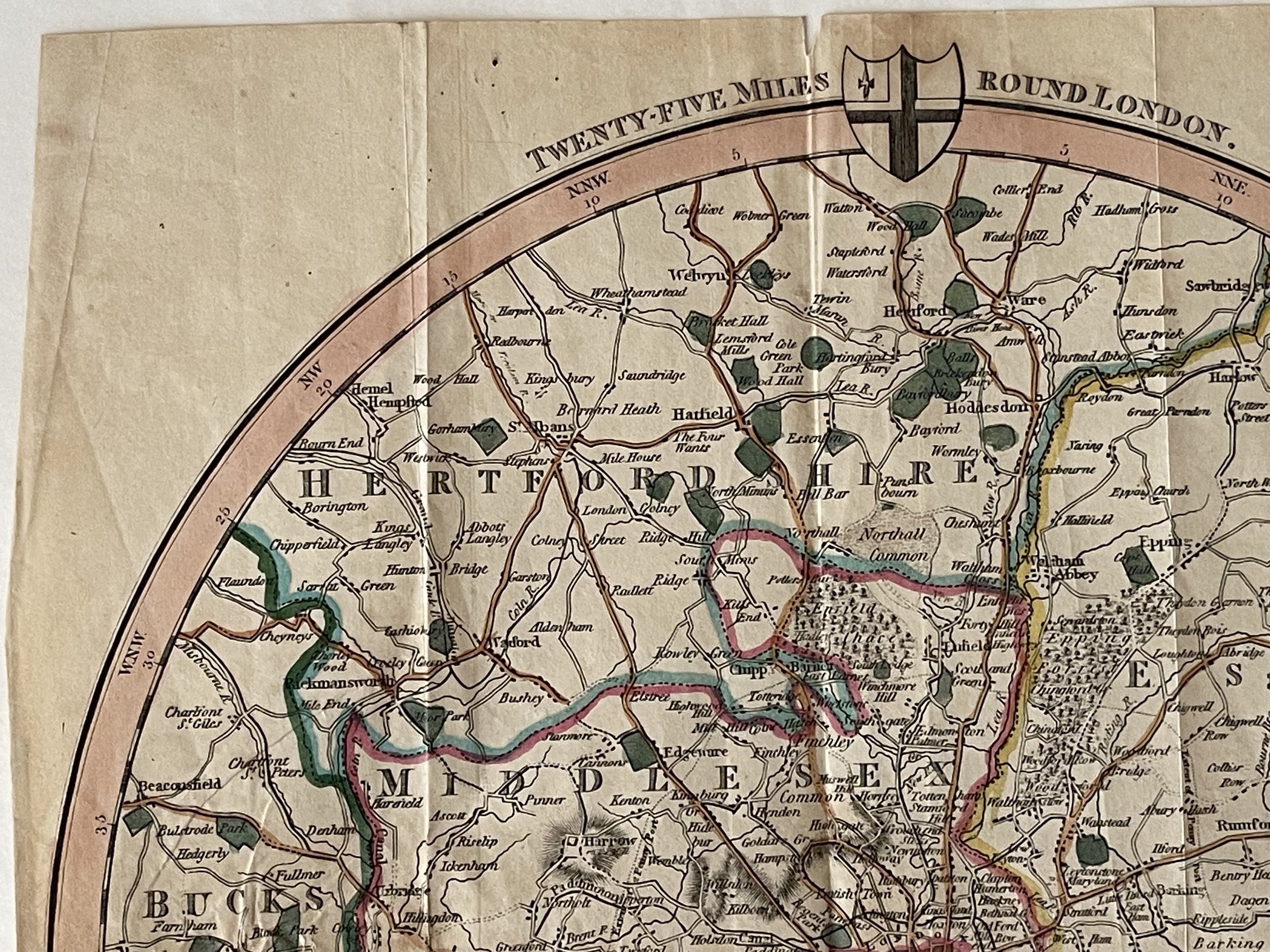
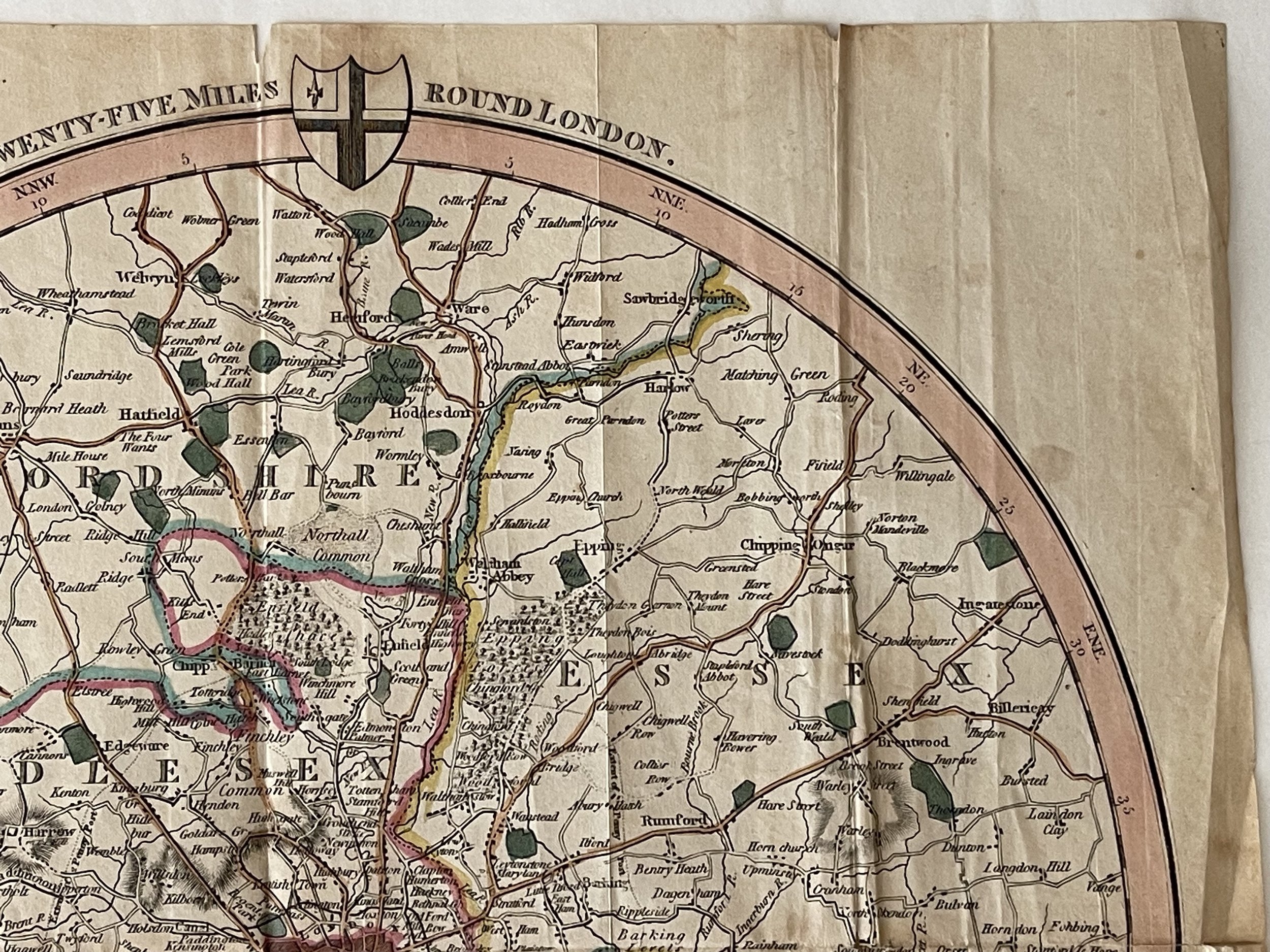
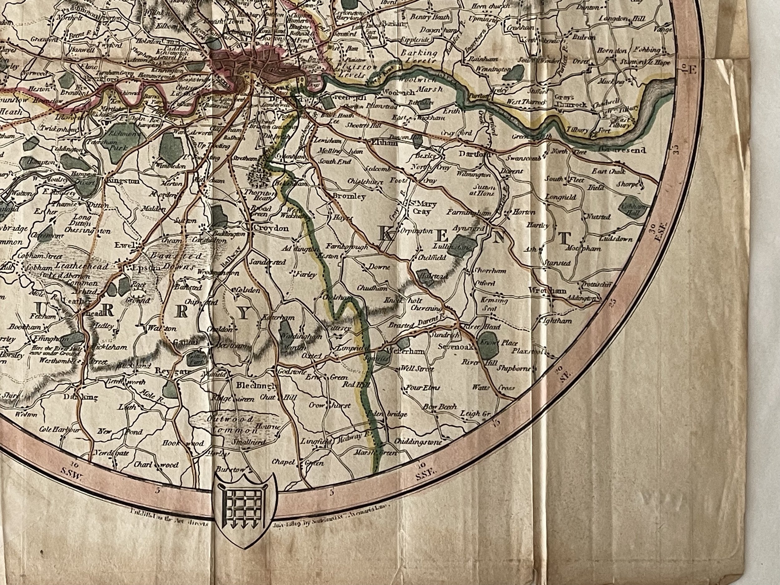
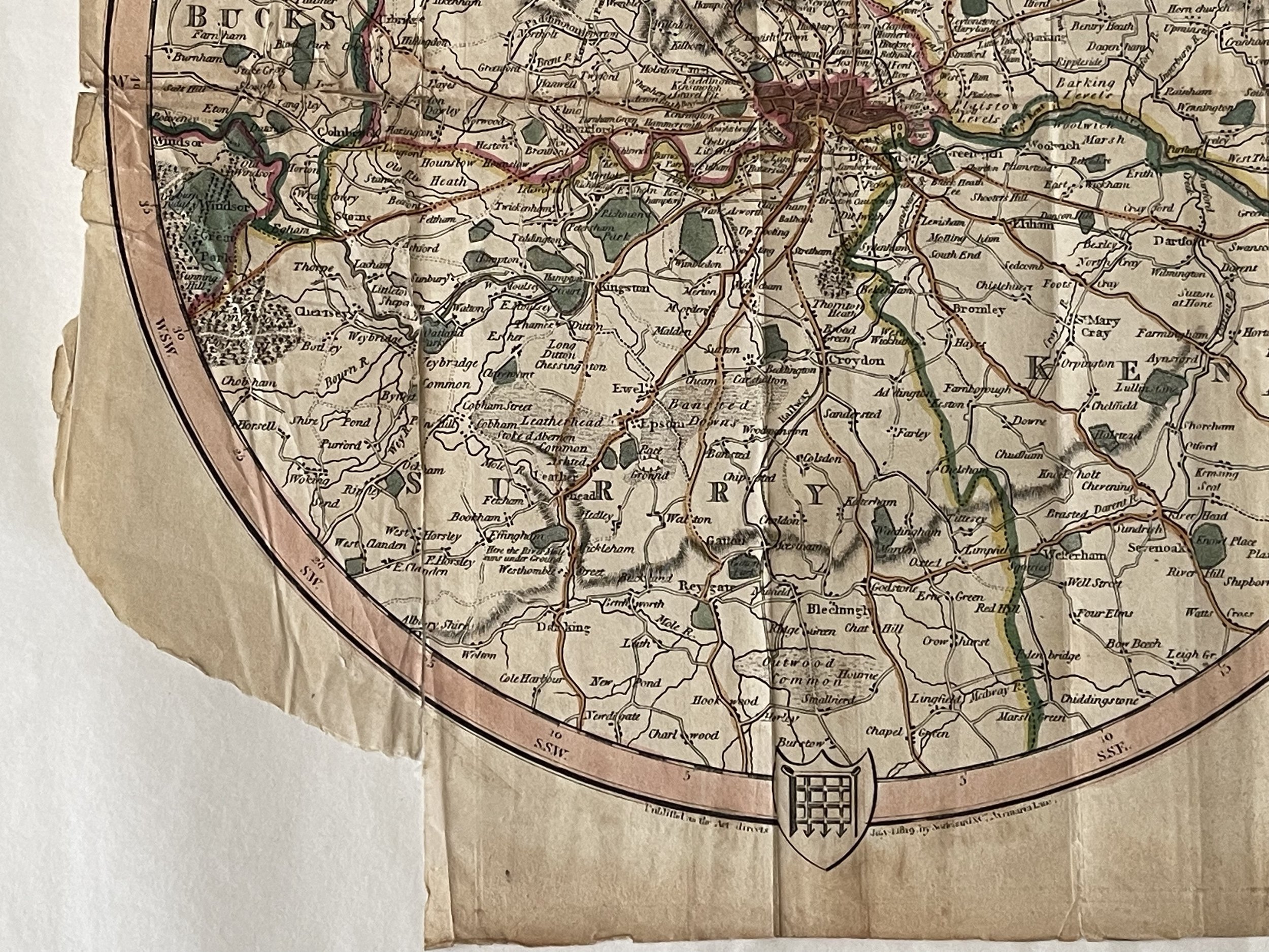
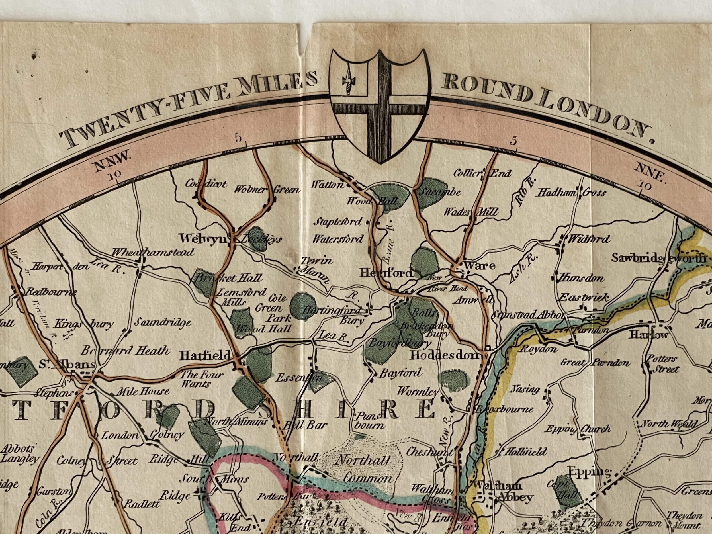
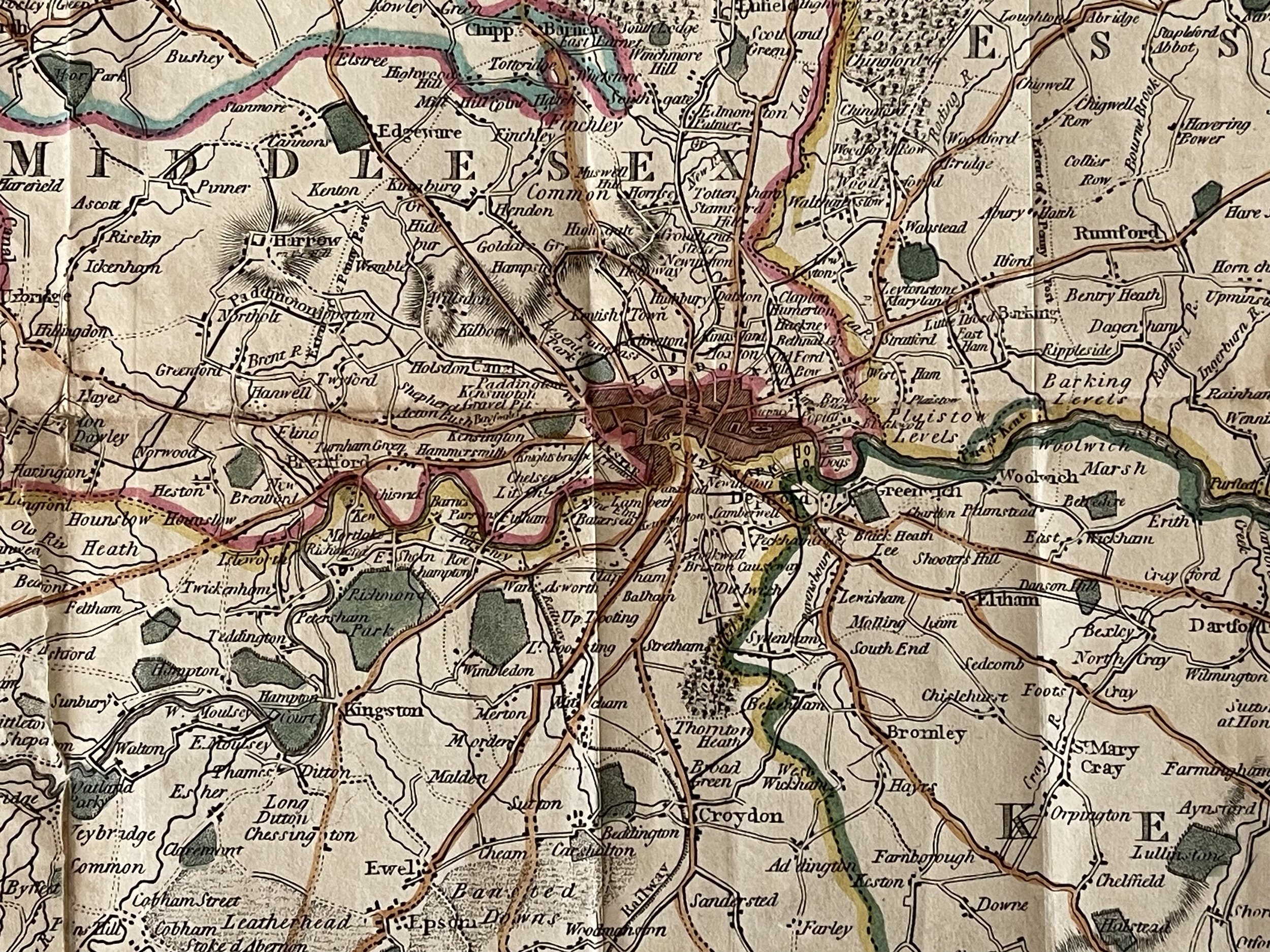
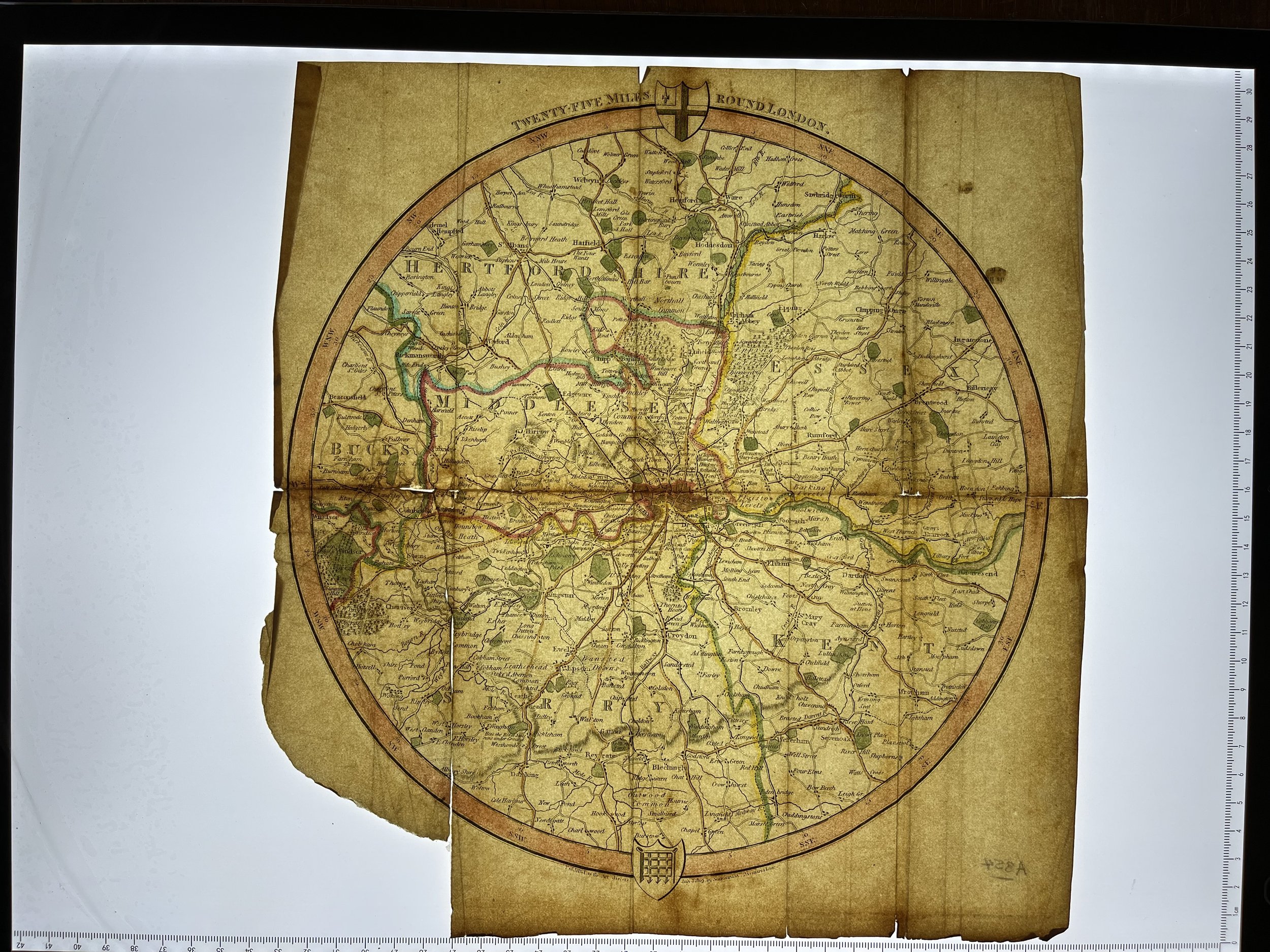
London & Its Environs, Ambulator Map - James Scatcherd and Letterman - Dated 1819
London and its Environs or, the General Ambulator - describes London and its region with a radius of 25 miles.
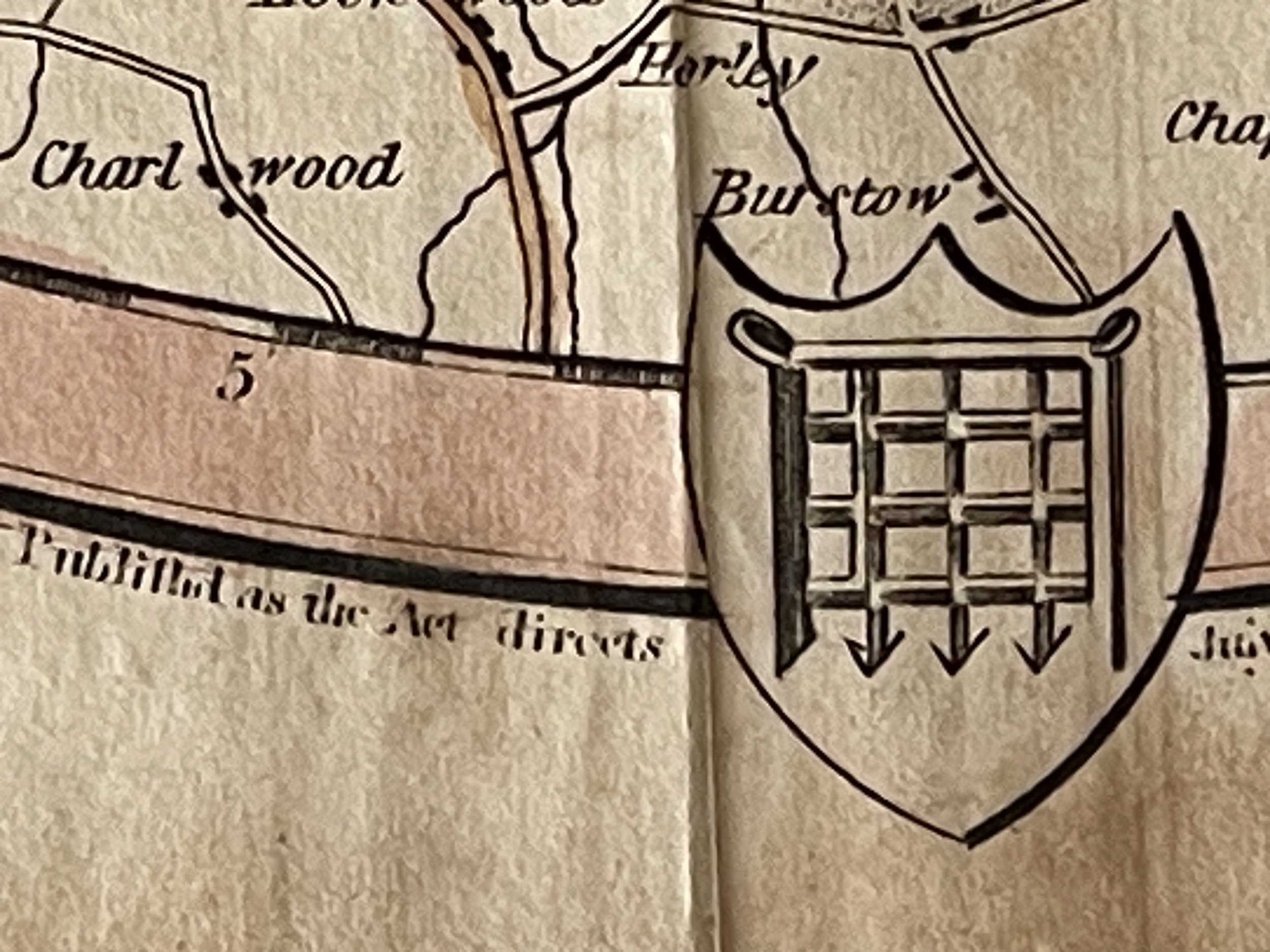
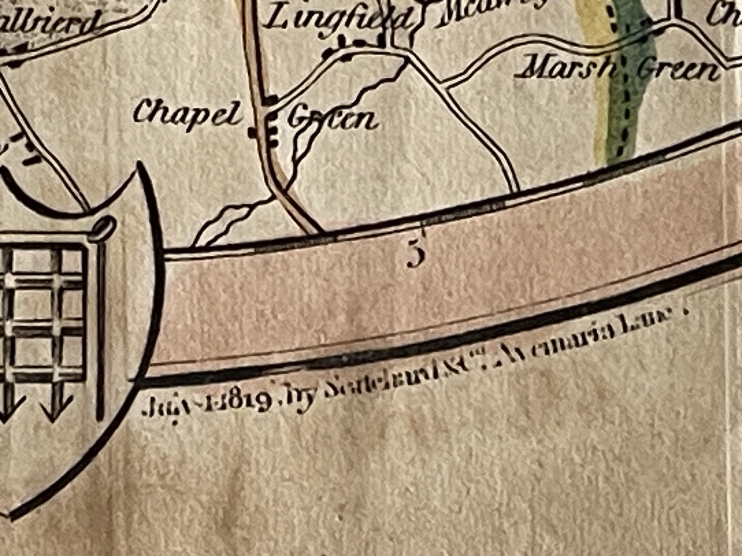
Foxing, minor tears and folds present. These folded maps in old books always suffered. The stub which adhered the map to the book is still in place. Pricing and grading commensurate.
Map size 255mm diameter.
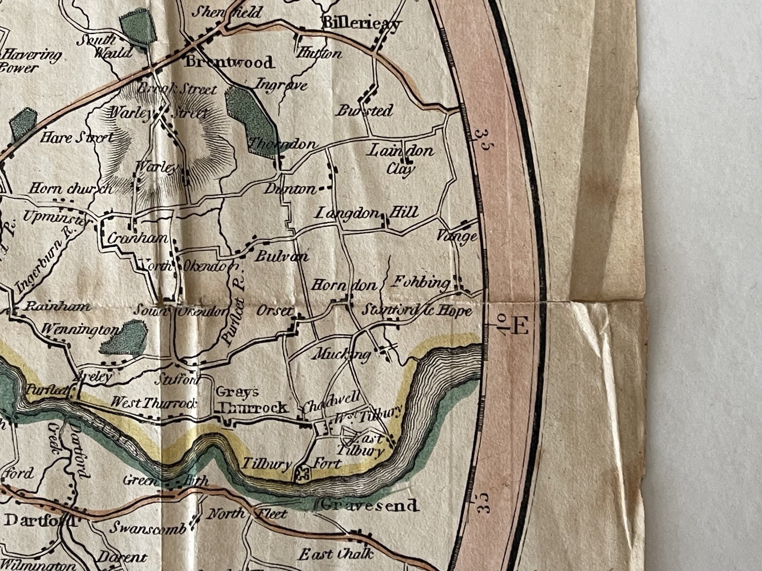
The map dates from 1819, and includes a portion of Essex which begins with Sheering in the north-west of the county, before the circular edge sweeps down past the Rodings and Willingale, down to Ingatestone, Billericay and Laindon, before finally passing Vange and Stanford-le-Hope and then reaching the Thames.
The map shows main roads and some secondary roads, parks and most villages. It also defines the extent of the ‘Penny Post’ by a faint dotted line. In Essex the Penny Post line is drawn through Chingford and Woodford, not quite reaching Romford. The map was made at a time when the county of Essex was much bigger than it is today, extending as far as the River Lea and including areas such as Stratford, West Ham, Walthamstow and Barking and Dagenham.
London and its Environs; or, The General Ambulator and Pocket Companion for the tour of the metropolis and its vicinity.
The Ambulator was illustrated with sixteen elegant engravings and a correct map, published by Scatcherd and Letterman and others, London 1820.
London and its Environs or, the General Ambulator - describes London and its region with a radius of 25 miles.
Foxing, minor tears and folds present. These folded maps in old books always suffered. The stub which adhered the map to the book is still in place. Pricing and grading commensurate.
Map size 255mm diameter.
The map dates from 1819, and includes a portion of Essex which begins with Sheering in the north-west of the county, before the circular edge sweeps down past the Rodings and Willingale, down to Ingatestone, Billericay and Laindon, before finally passing Vange and Stanford-le-Hope and then reaching the Thames.
The map shows main roads and some secondary roads, parks and most villages. It also defines the extent of the ‘Penny Post’ by a faint dotted line. In Essex the Penny Post line is drawn through Chingford and Woodford, not quite reaching Romford. The map was made at a time when the county of Essex was much bigger than it is today, extending as far as the River Lea and including areas such as Stratford, West Ham, Walthamstow and Barking and Dagenham.
London and its Environs; or, The General Ambulator and Pocket Companion for the tour of the metropolis and its vicinity.
The Ambulator was illustrated with sixteen elegant engravings and a correct map, published by Scatcherd and Letterman and others, London 1820.
Code : A854
Cartographer : Cartographer / Engraver / Publisher: Scatcherd and Letterman
Date : Publication Place / Date - Circa 1819
Size : Sheet size: Image Size: 16 x 10 cm
Availability : Available
Type - Genuine - Antique
Grading B+
Where Applicable - Folds as issued. Light box photo shows the folio leaf centre margin hinge ‘glue’, this is not visible otherwise.
Tracked postage, in casement. Please contact me for postal quotation outside of the UK.