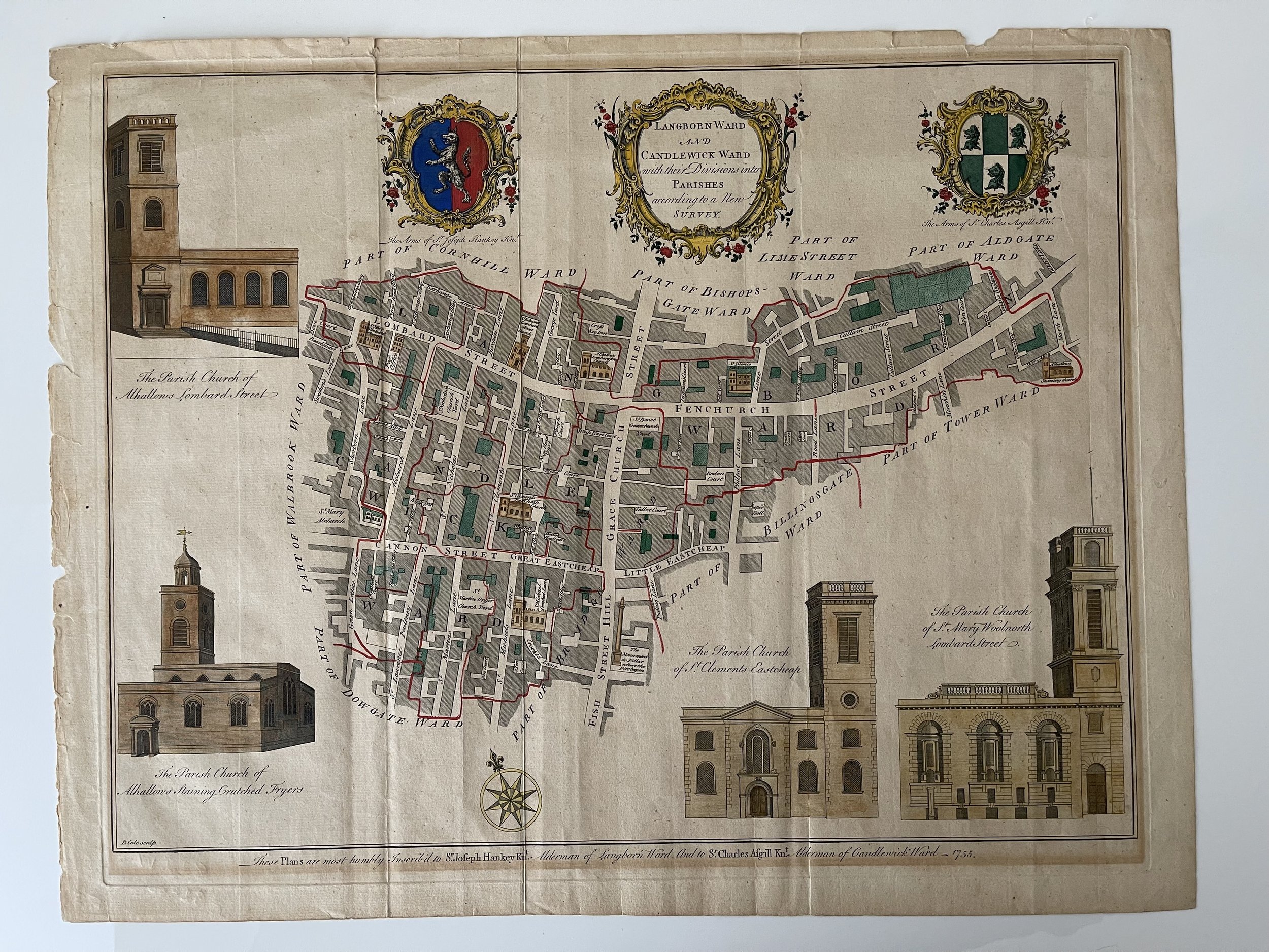
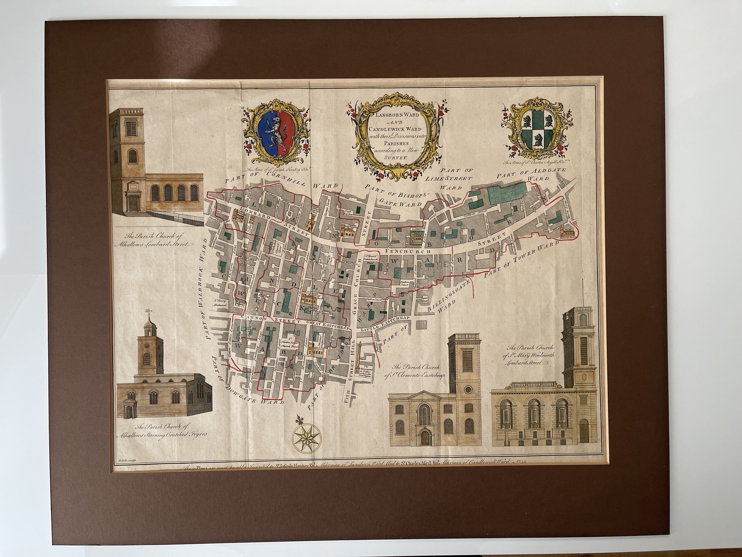
London Langborn Ward and Candlewick Ward and Parishes - Benjamin Cole - 1755
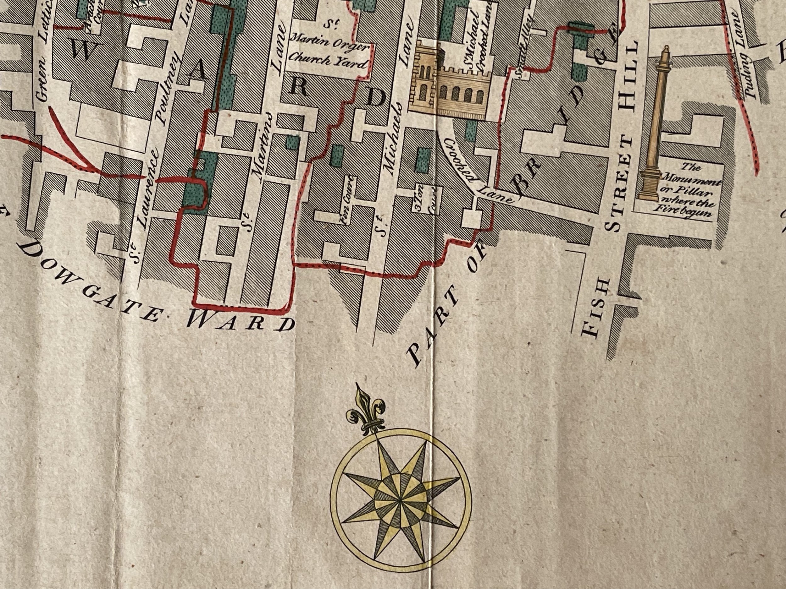
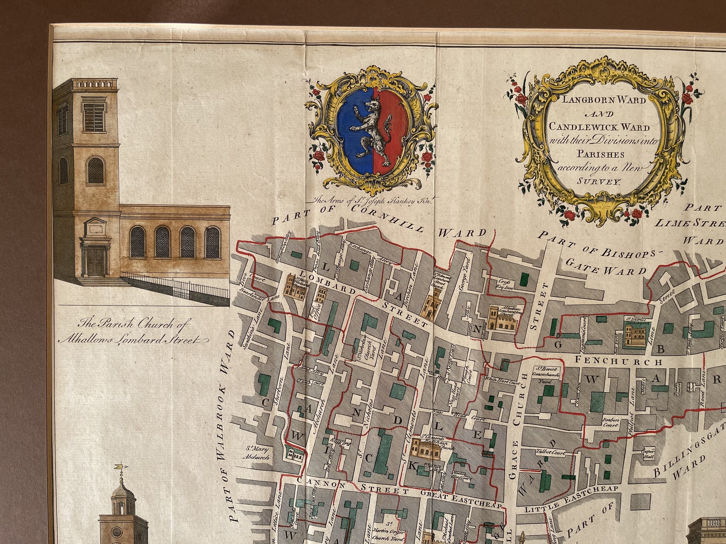
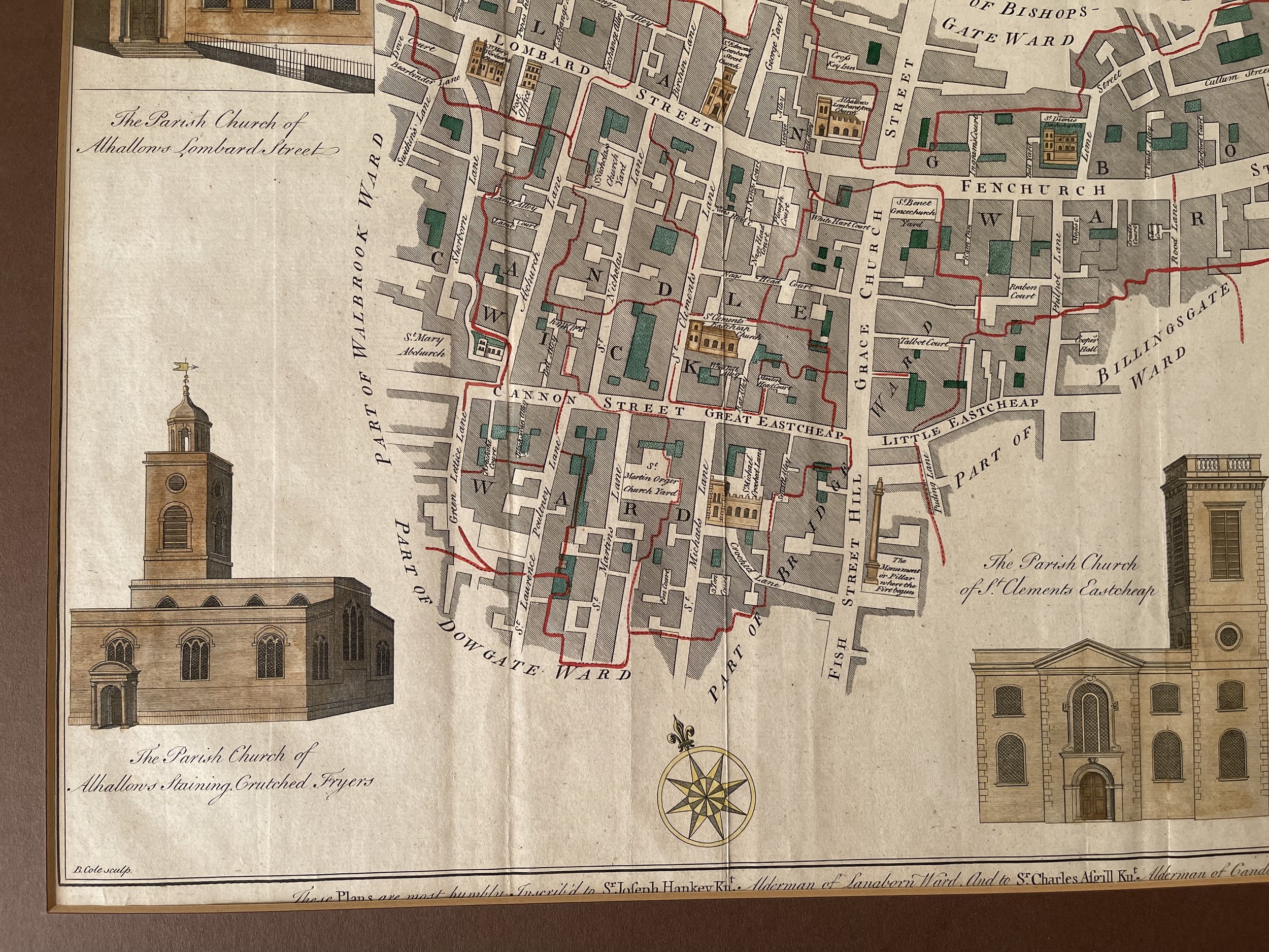
Attractive original antique map showing the heart of the City of London, showing the region around the Walkie Talkie. The map shows the area bounded by Fenchurch Street, Lombard Street, and Canon Street, and cantered on Gracechurch Street (now the A10).
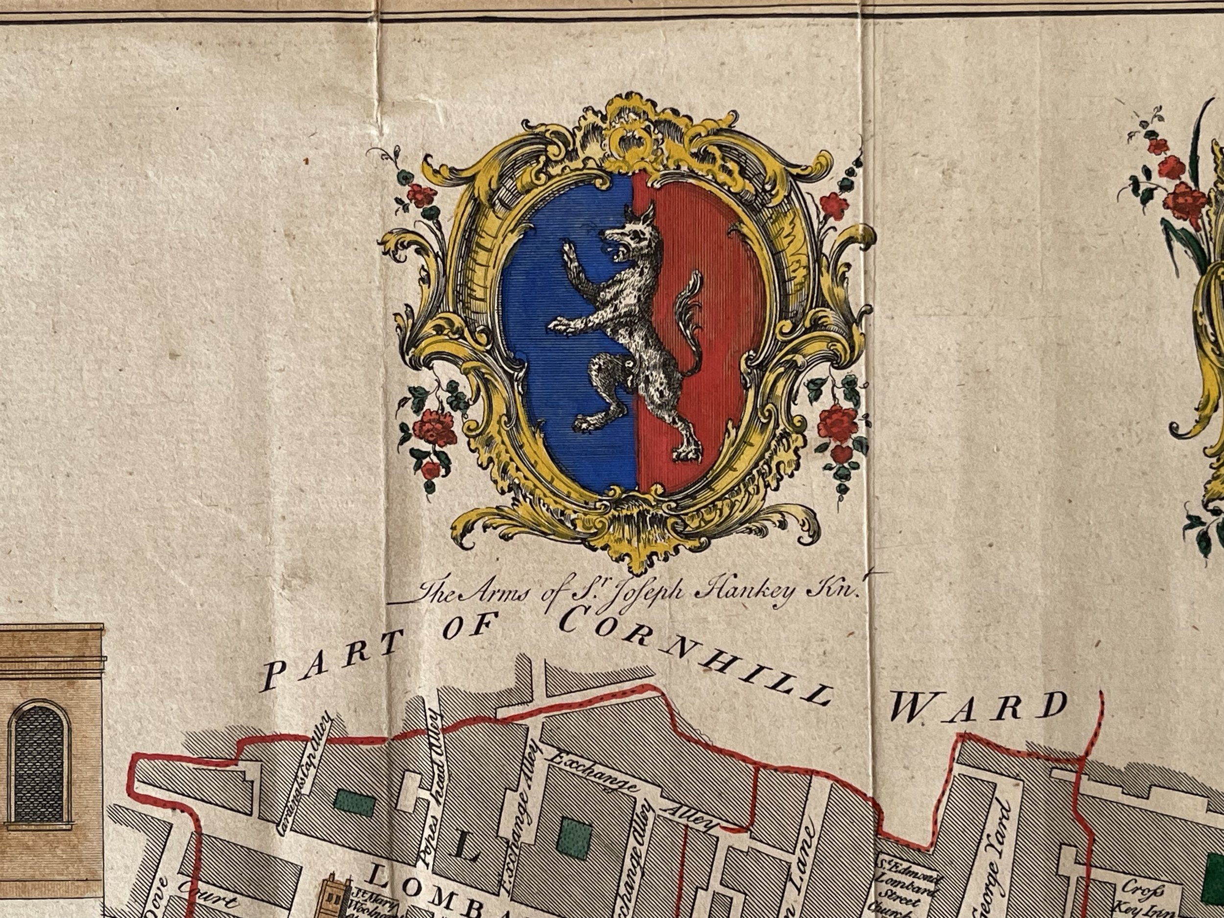
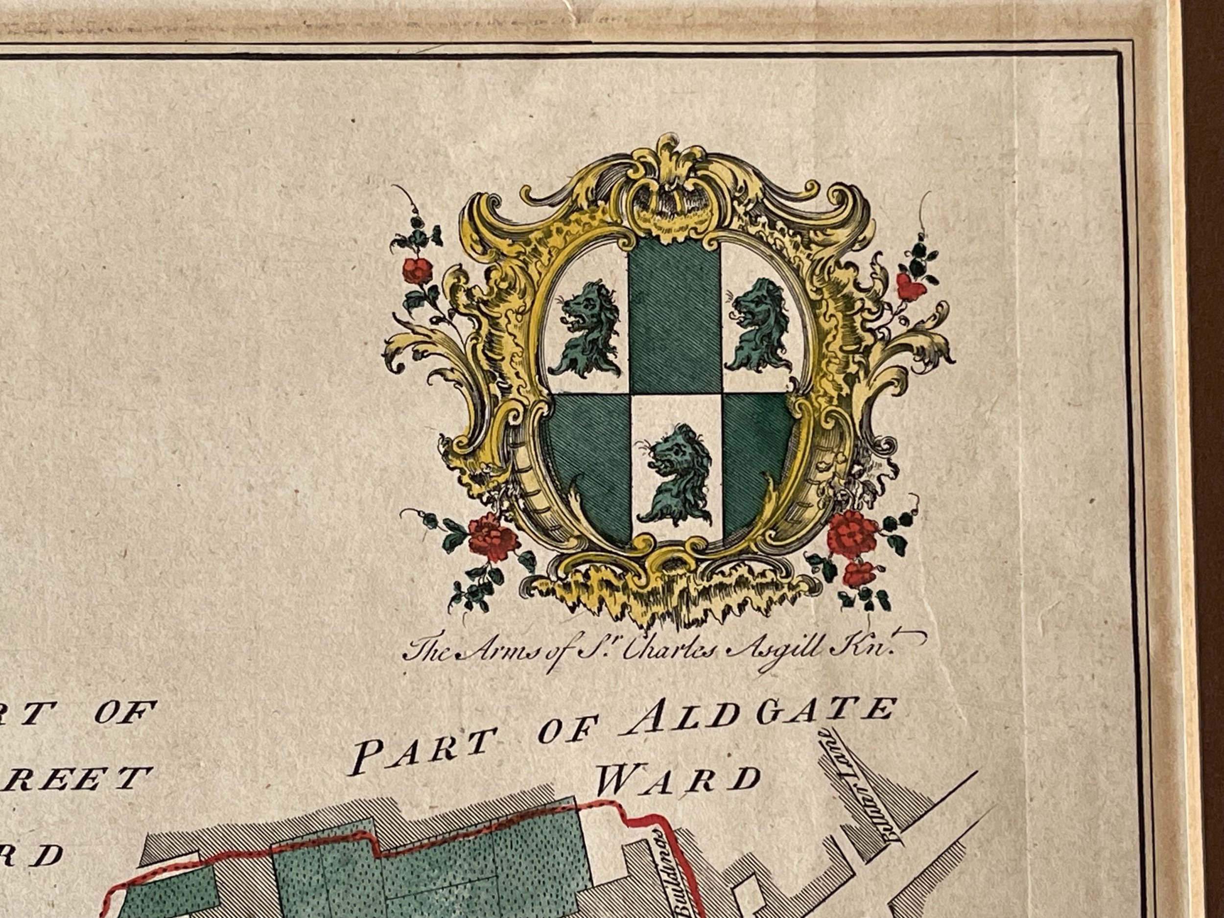
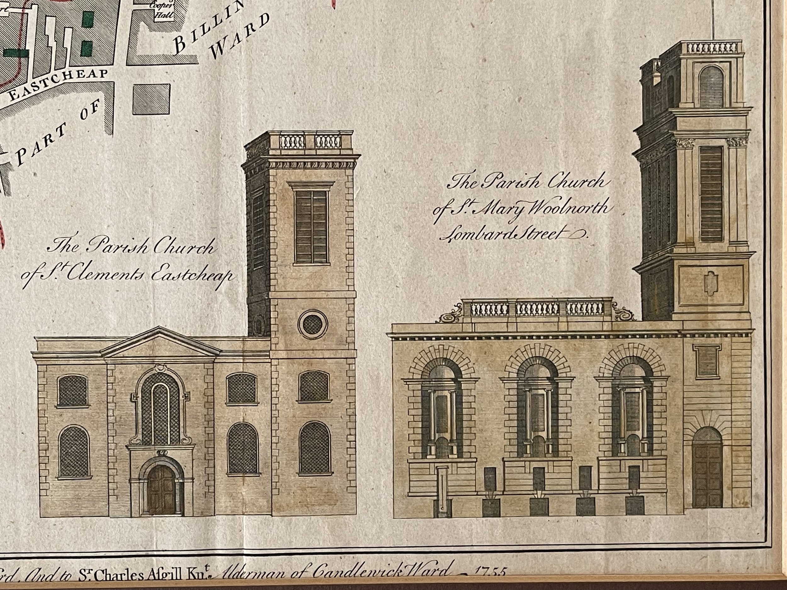
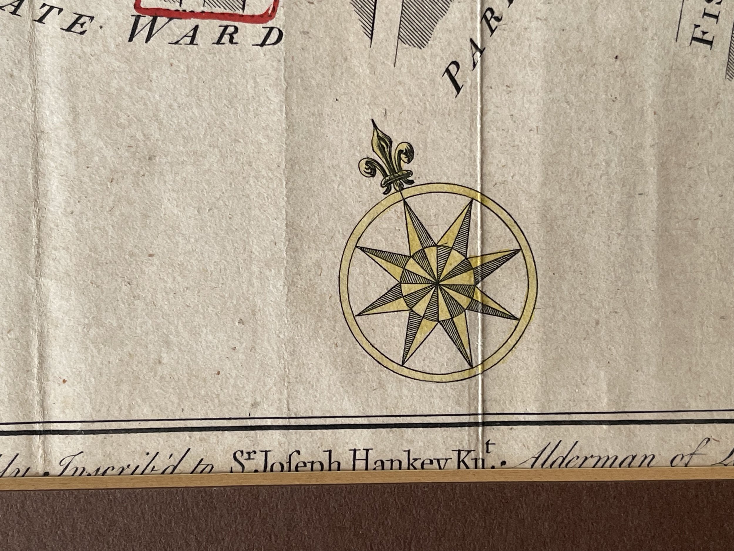
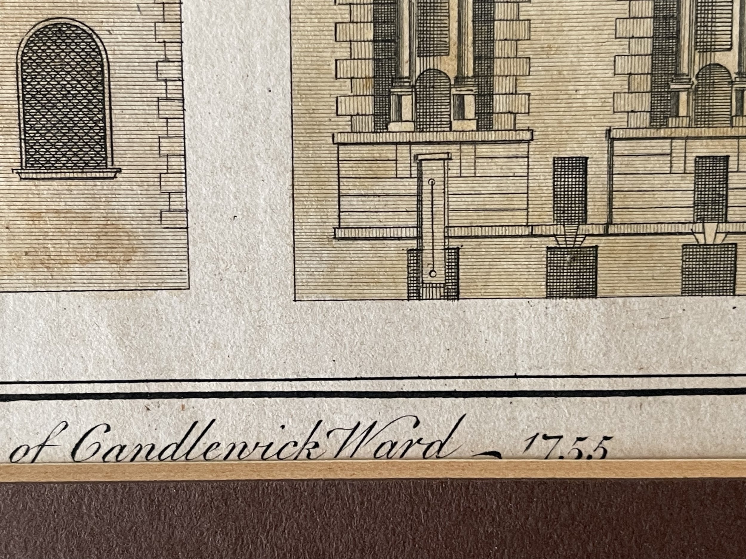
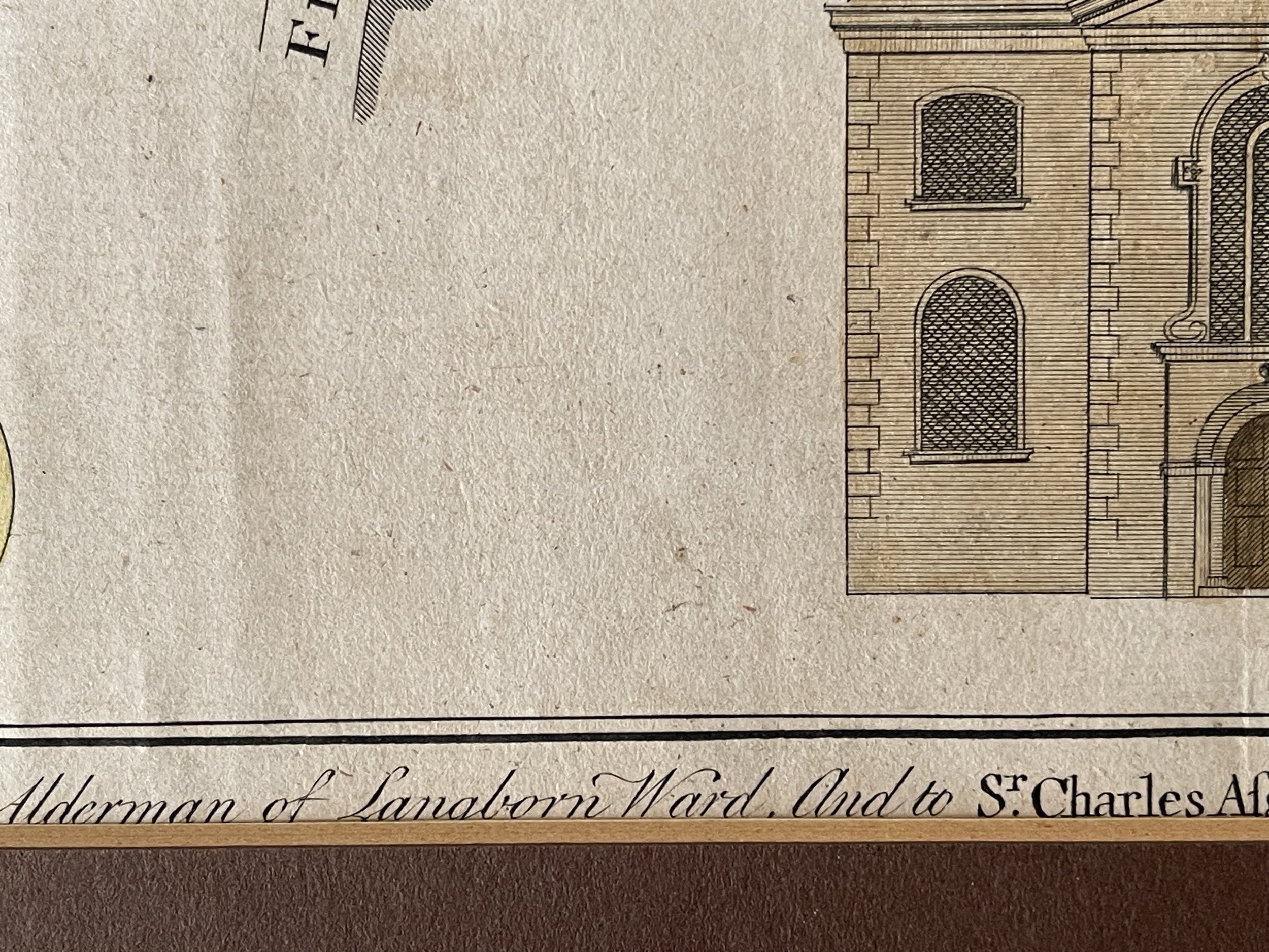
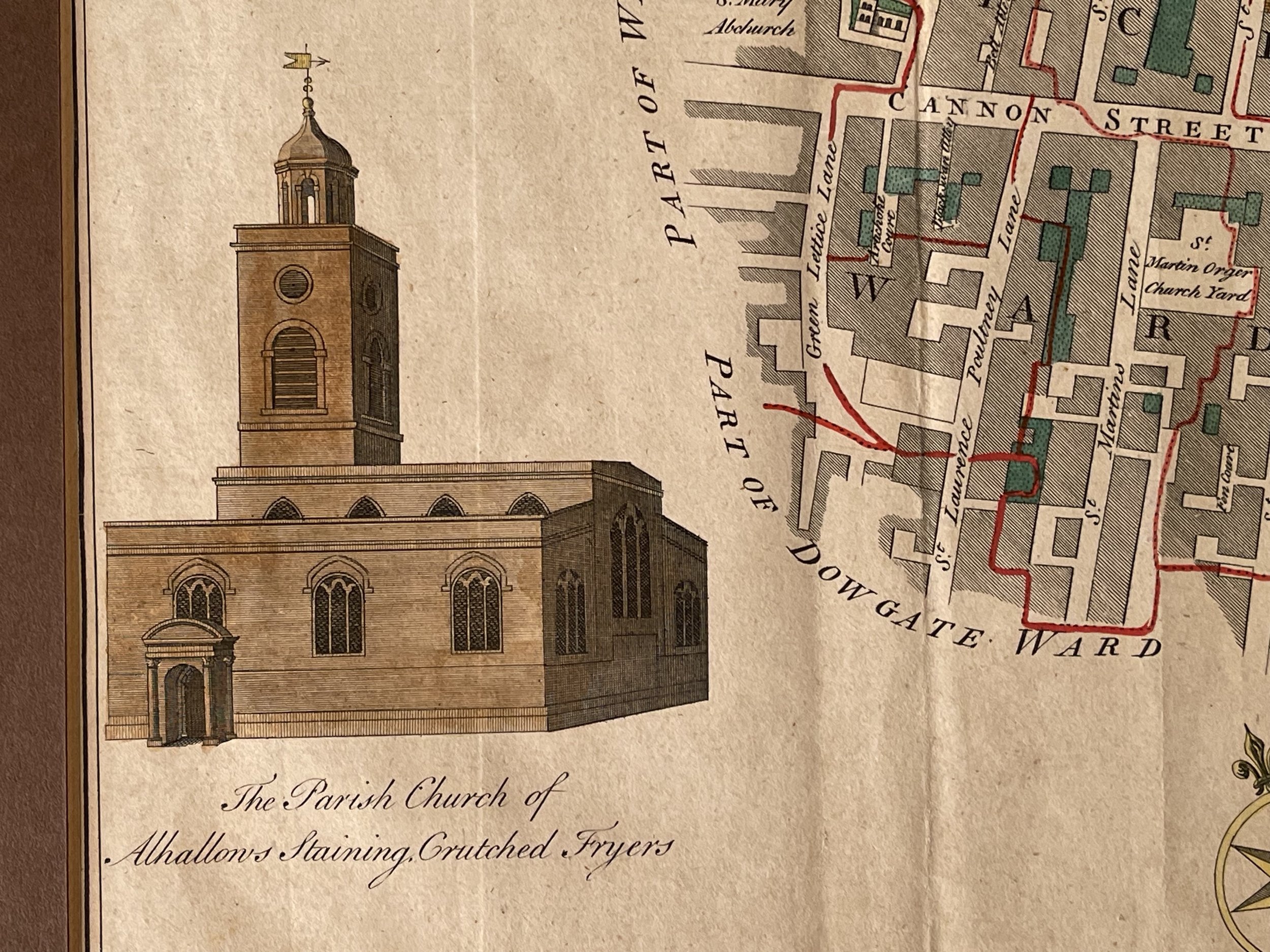
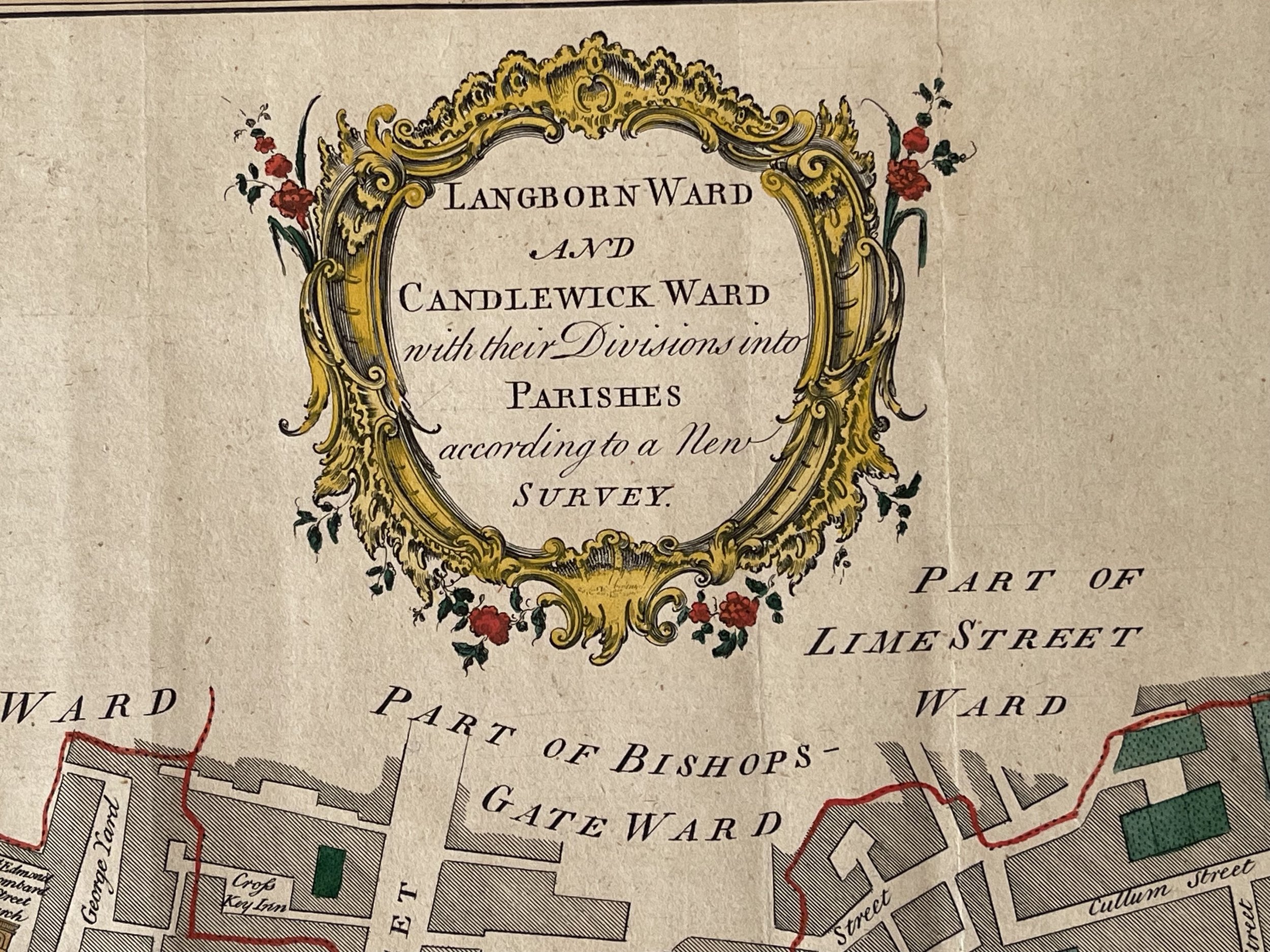
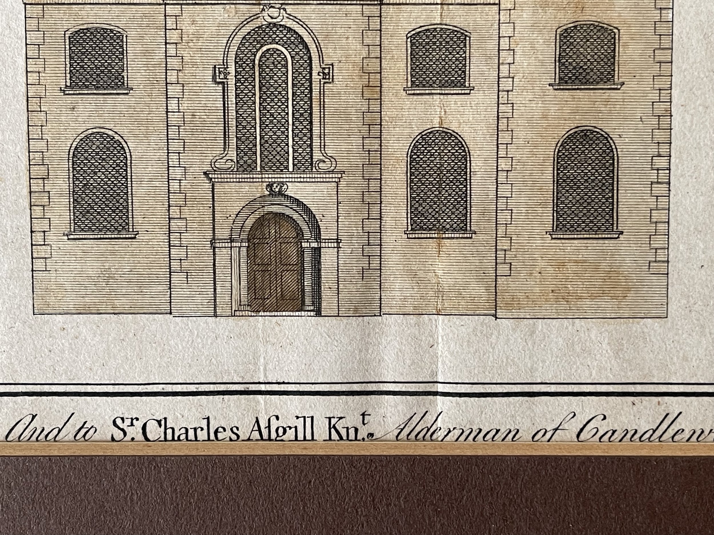
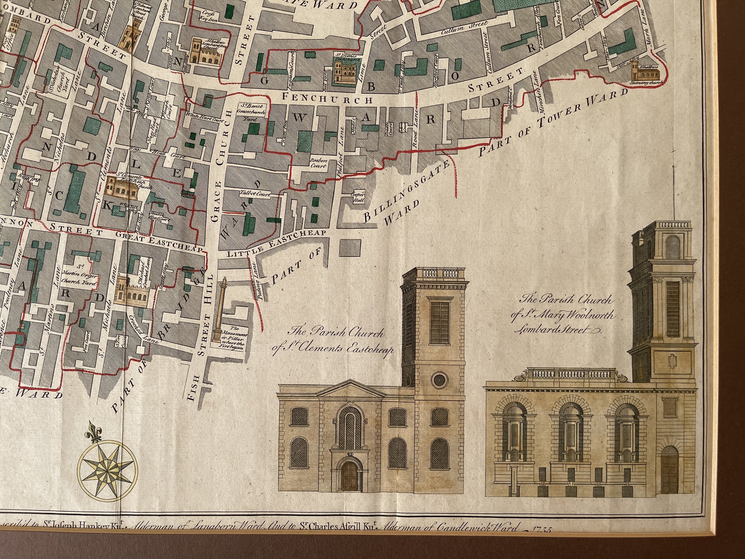
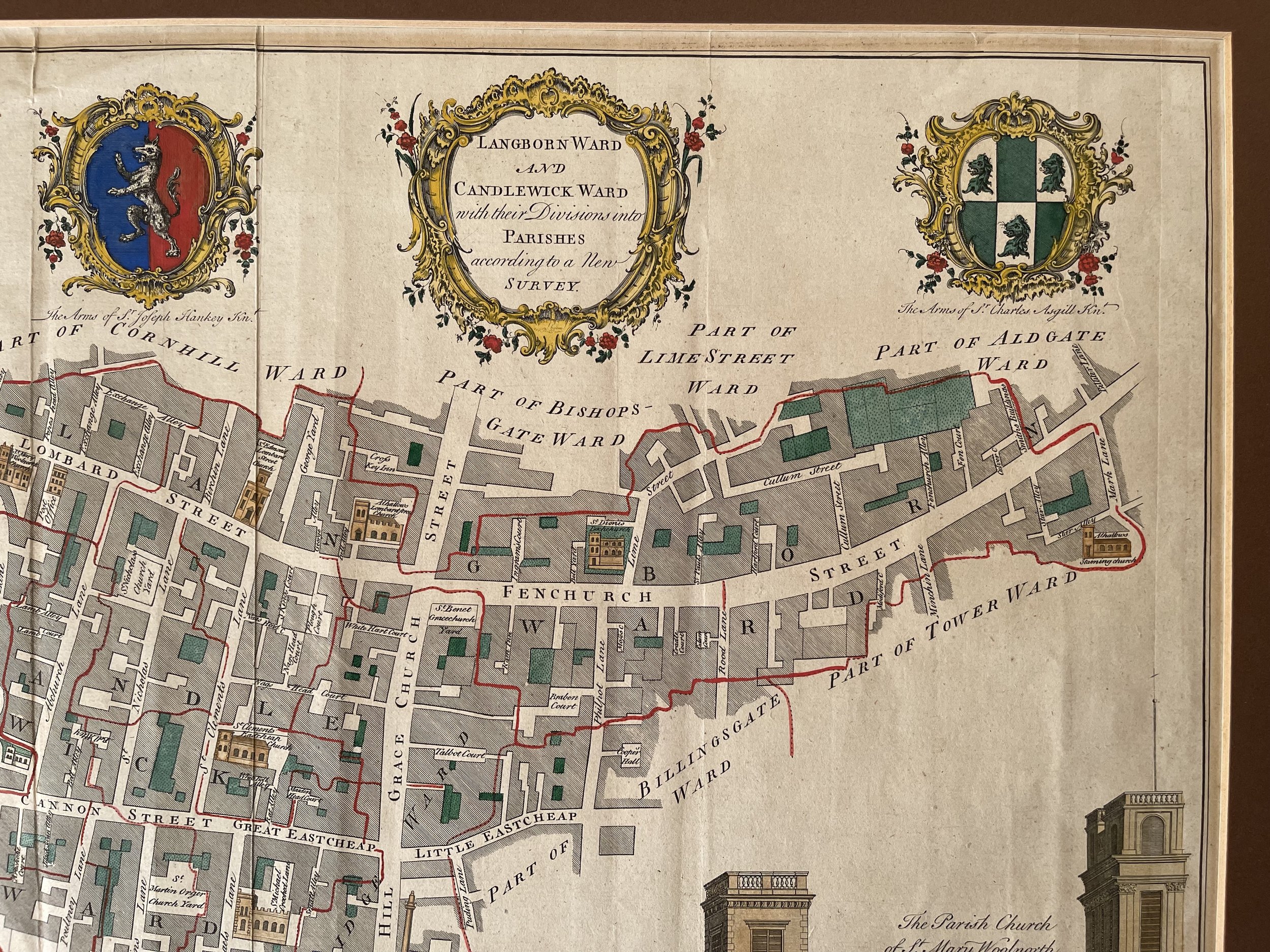
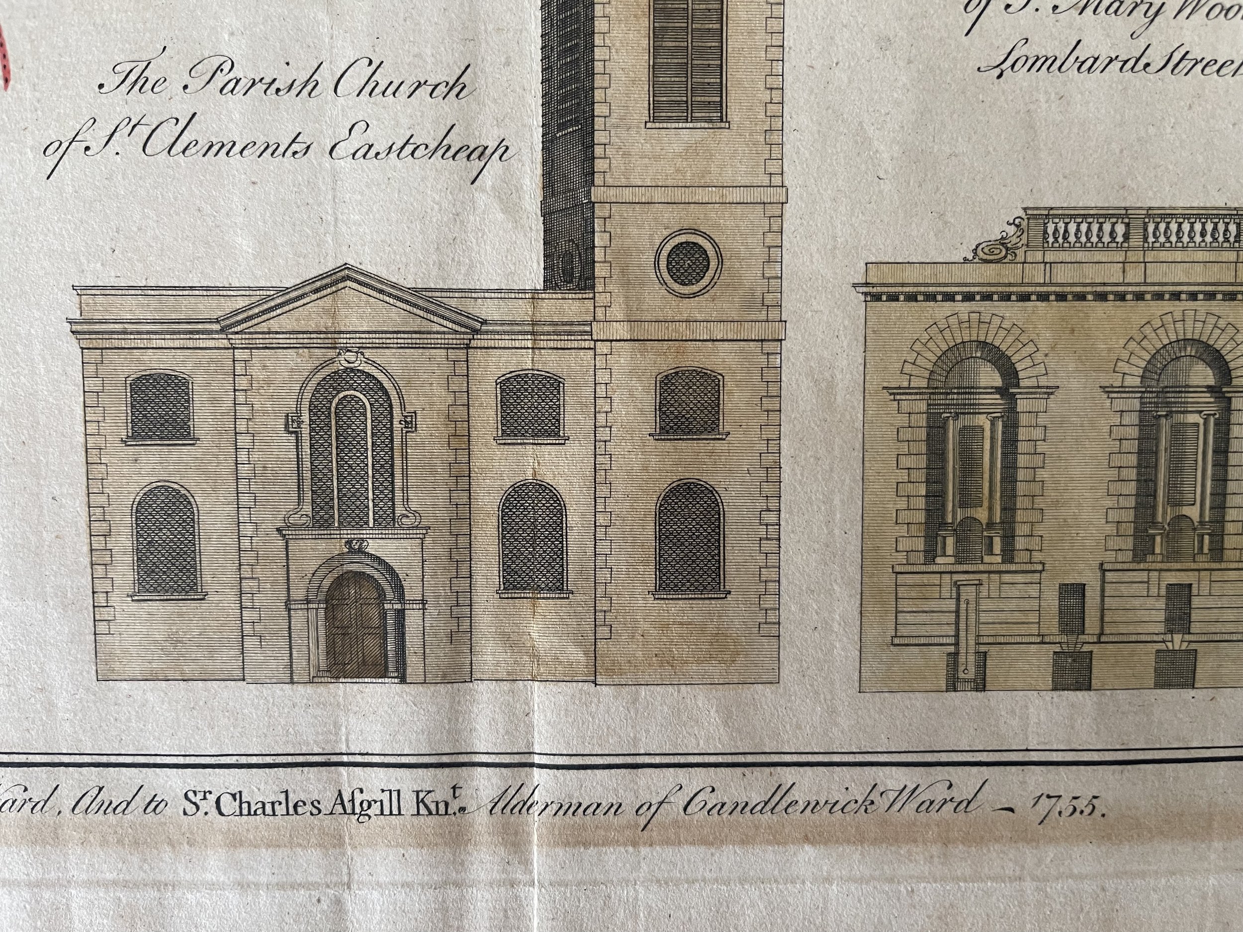
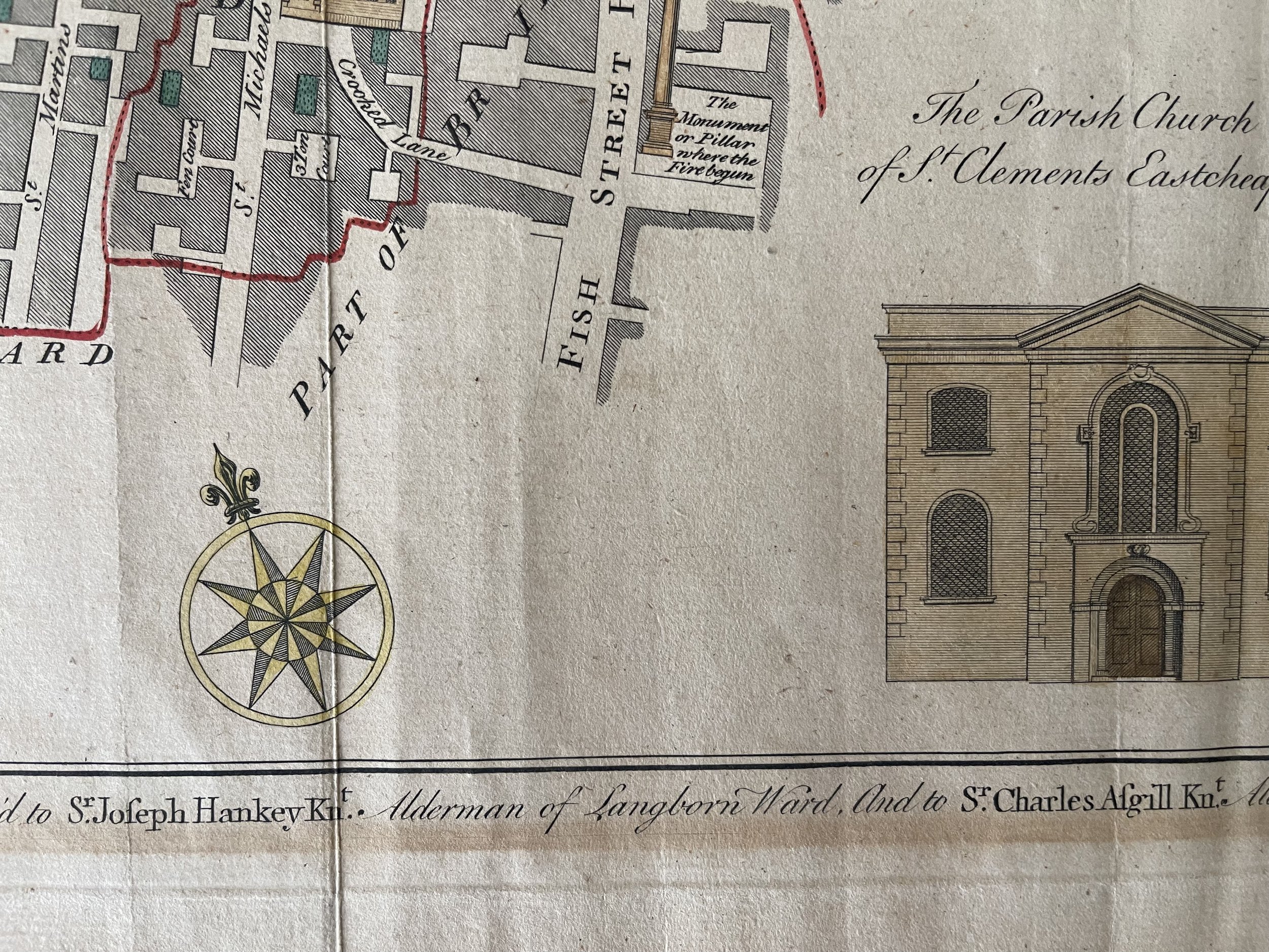
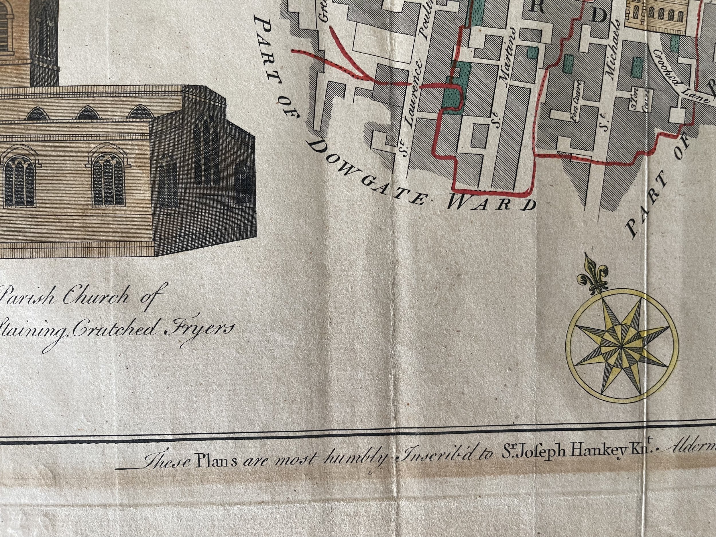
Detail is extensive, with the outlines of buildings drawn and many streets, lanes, and alleys all depicted. Churches are shown pictorially, and a view of four local parish churches, including St. Mary Woolnoth. The map is dedicated to the aldermen of the two wards depicted: Sir Joseph Hankey and Sir Charles Asgill. Their coats of arms are shown in the lower left of the map.
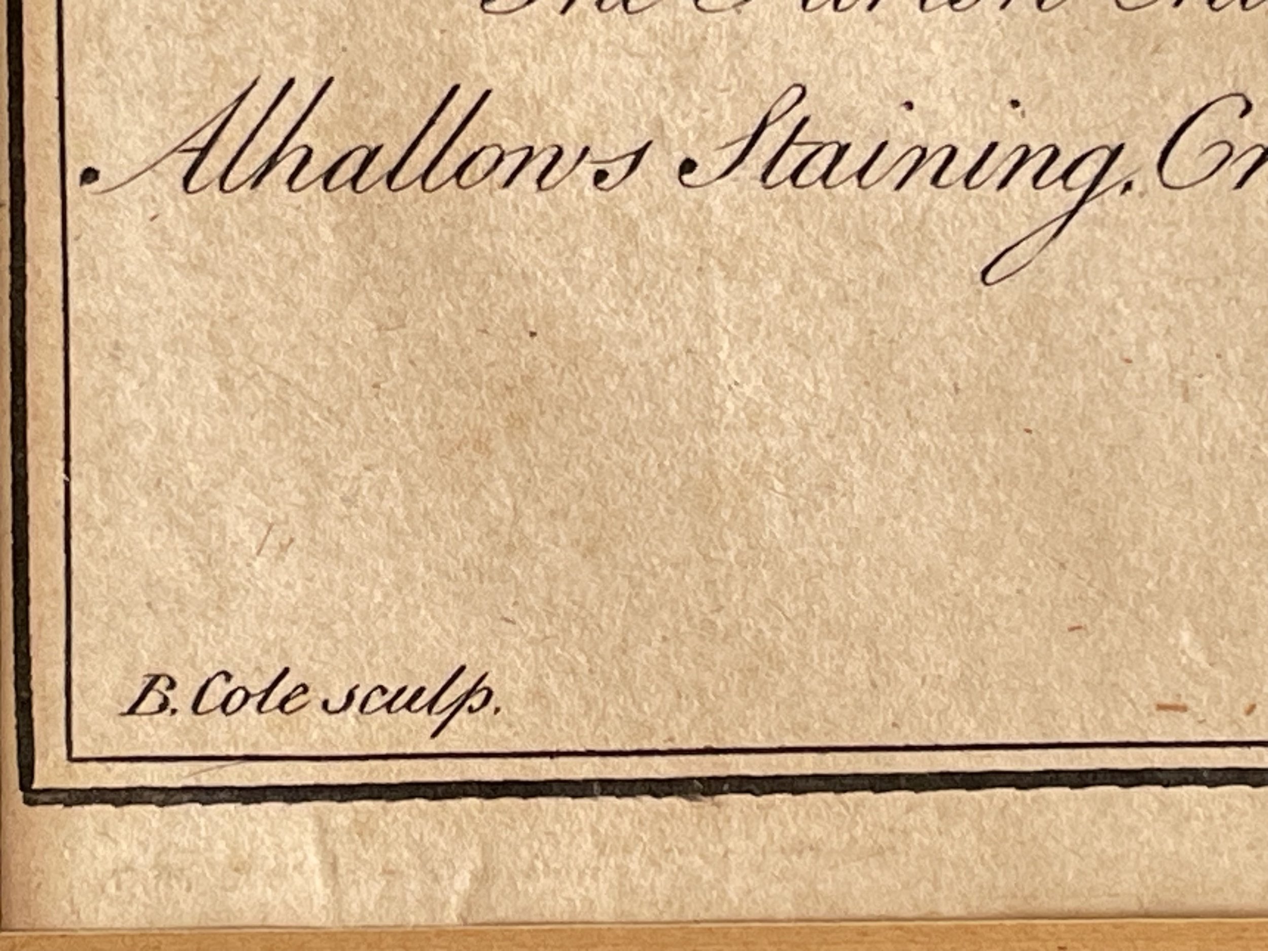
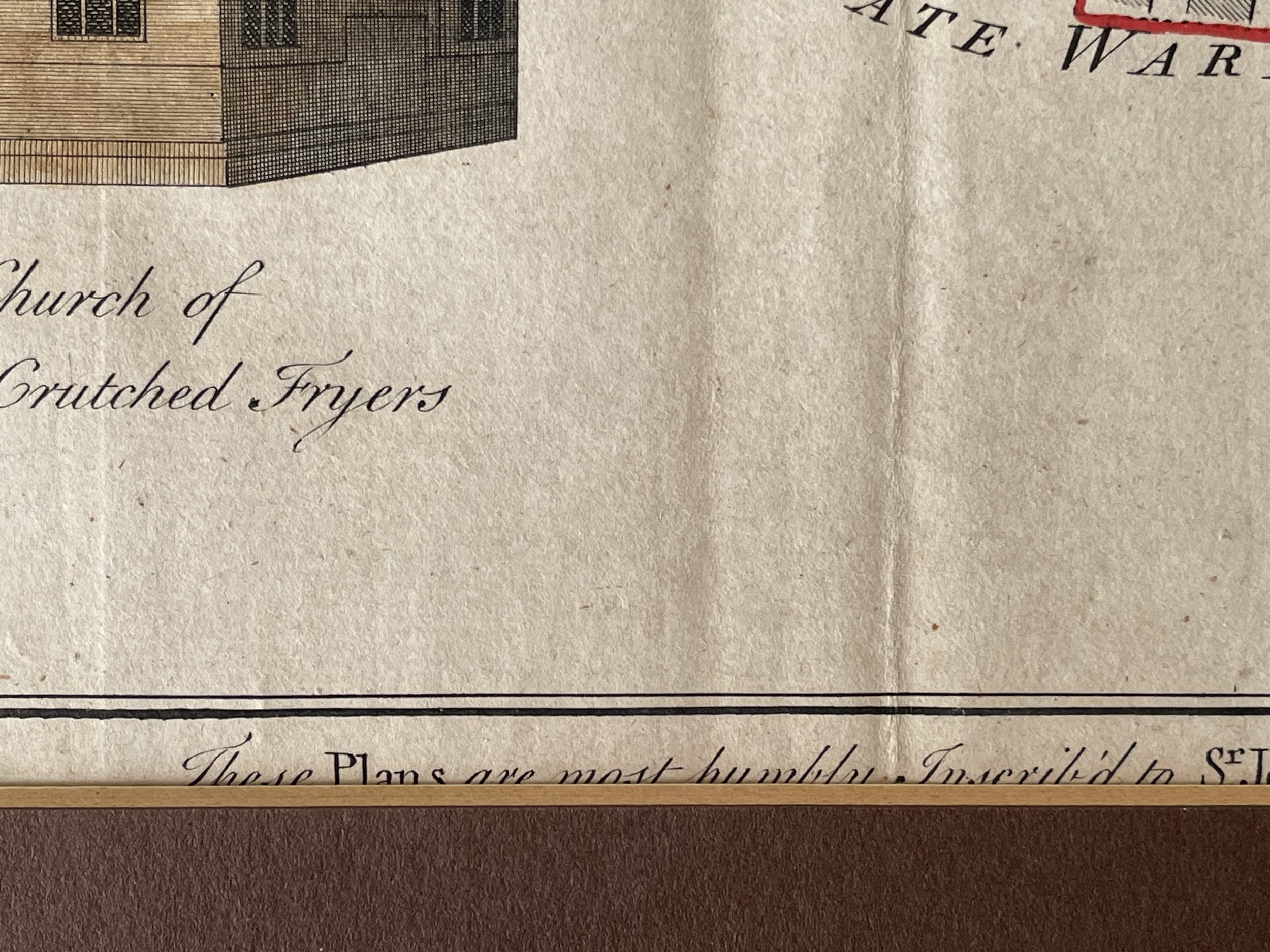
Langborn ward and Candlewick ward with their divisions into parishes according to a new survey Engraved by Benjamin Cole This plan was published in William Maitland's 'History of London from its Foundation to the Present Day'. The plan's title features at top centre, flanked by the heraldic arms of Joseph Hankey, Alderman for Langbourn ward, and Charles Asgill, Alderman for Candlewick ward. View of All Hallows Lombard Street church appear at top left, with a view of St Clement's church at bottom centre and St Mary's church at bottom right. The church building shown at bottom left is in fact St Olave Hart Street not All Hallows Staining.
The map was engraved for Maitland's Survey of London, which showed London in the middle of the 18th century and for which Cole engraved numerous maps.
Working through the eighteenth century, Benjamin Cole was a well-known English engraver, illustrator and map seller. He began as an apprentice in 1739, to his father (also Benjamin), a renowned instrument maker. He went on to draw and engrave the London ward maps for the first edition of William Maitland's History of London from Its Foundation to the Present Time (1769), having already provided them John Entick's New and Accurate History and Survey of London (1766).
These same plates were also used for Thornton's New & Complete History & Survey of London & Westminster, published between 1775-1780. He also engraved maps for some of French map-maker John Rocque’s published works. In 1728-9, given his connections to freemasonry, Cole published a spectacular engraved edition of the historic masonic charters and manuscripts, Old Charges, with various masonic songs and speeches.
He later published a separate collection of masonic songs, and engraved the frontispiece of the 1756 Book of Constitutions. In 1743, Cole took over the production of the engraved lists from John Pine, continuing their publication until 1767, when the responsibility passed to his brother, William. Benjamin Cole also illustrated children’s books and military manuals, completing a remarkable and varied engraving career. He died in 1813.
Map in good condition with the odd foxing spot / blemish. Small tear at the top near coat of arms, outside of the engraving. Border mount shown not included and has been removed for photo shots. Pricing and grading commensurate.
Attractive original antique map showing the heart of the City of London, showing the region around the Walkie Talkie. The map shows the area bounded by Fenchurch Street, Lombard Street, and Canon Street, and cantered on Gracechurch Street (now the A10).
Detail is extensive, with the outlines of buildings drawn and many streets, lanes, and alleys all depicted. Churches are shown pictorially, and a view of four local parish churches, including St. Mary Woolnoth. The map is dedicated to the aldermen of the two wards depicted: Sir Joseph Hankey and Sir Charles Asgill. Their coats of arms are shown in the lower left of the map.
Langborn ward and Candlewick ward with their divisions into parishes according to a new survey Engraved by Benjamin Cole This plan was published in William Maitland's 'History of London from its Foundation to the Present Day'. The plan's title features at top centre, flanked by the heraldic arms of Joseph Hankey, Alderman for Langbourn ward, and Charles Asgill, Alderman for Candlewick ward. View of All Hallows Lombard Street church appear at top left, with a view of St Clement's church at bottom centre and St Mary's church at bottom right. The church building shown at bottom left is in fact St Olave Hart Street not All Hallows Staining.
The map was engraved for Maitland's Survey of London, which showed London in the middle of the 18th century and for which Cole engraved numerous maps.
Working through the eighteenth century, Benjamin Cole was a well-known English engraver, illustrator and map seller. He began as an apprentice in 1739, to his father (also Benjamin), a renowned instrument maker. He went on to draw and engrave the London ward maps for the first edition of William Maitland's History of London from Its Foundation to the Present Time (1769), having already provided them John Entick's New and Accurate History and Survey of London (1766).
These same plates were also used for Thornton's New & Complete History & Survey of London & Westminster, published between 1775-1780. He also engraved maps for some of French map-maker John Rocque’s published works. In 1728-9, given his connections to freemasonry, Cole published a spectacular engraved edition of the historic masonic charters and manuscripts, Old Charges, with various masonic songs and speeches.
He later published a separate collection of masonic songs, and engraved the frontispiece of the 1756 Book of Constitutions. In 1743, Cole took over the production of the engraved lists from John Pine, continuing their publication until 1767, when the responsibility passed to his brother, William. Benjamin Cole also illustrated children’s books and military manuals, completing a remarkable and varied engraving career. He died in 1813.
Map in good condition with the odd foxing spot / blemish. Small tear at the top near coat of arms, outside of the engraving. Border mount shown not included and has been removed for photo shots. Pricing and grading commensurate.
Code : A335
Cartographer : Cartographer / Engraver / Publisher: Benjamin Cole
Date : Publication Place / Date - Circa 1755
Size : Sheet size: Image Size: 18.25 x 14.25 Inches
Availability : Available
Type - Genuine - Antique
Grading A-
Where Applicable - Folds as issued. Light box photo shows the folio leaf centre margin hinge ‘glue’, this is not visible otherwise.
Tracked postage, in casement. Please contact me for postal quotation outside of the UK.