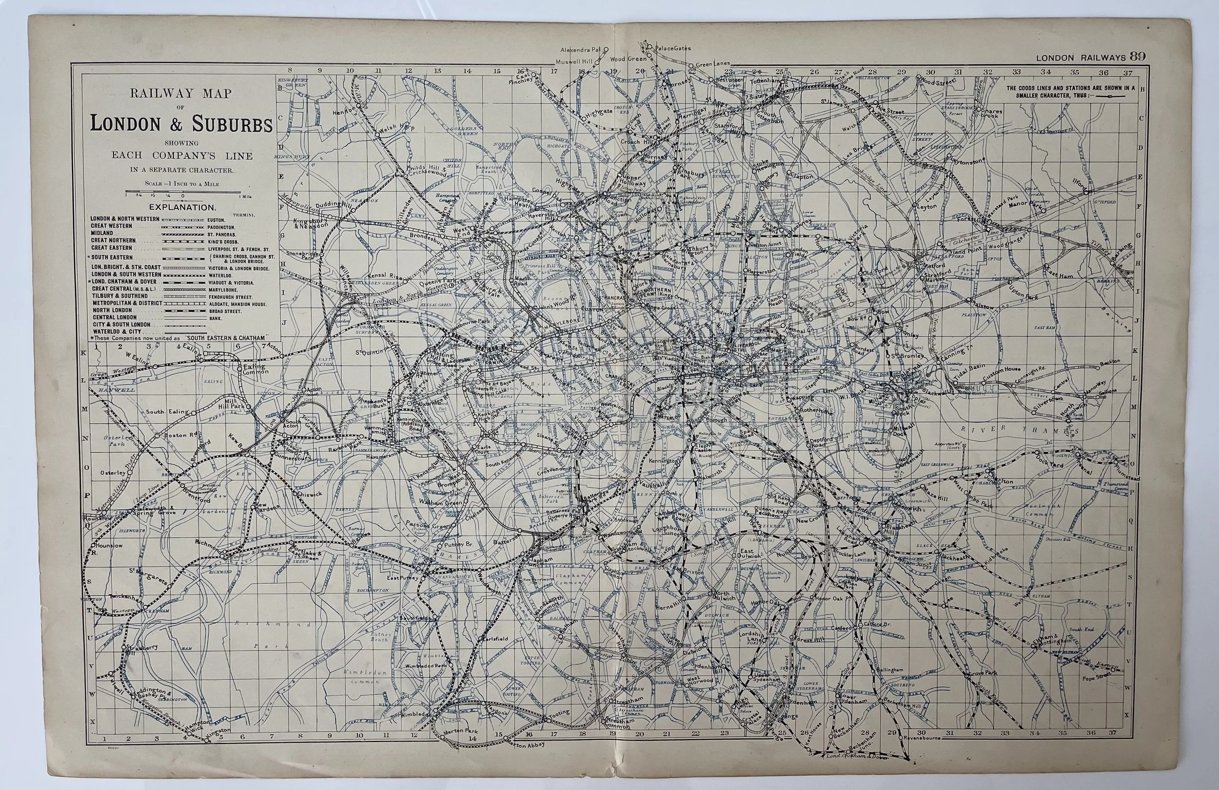
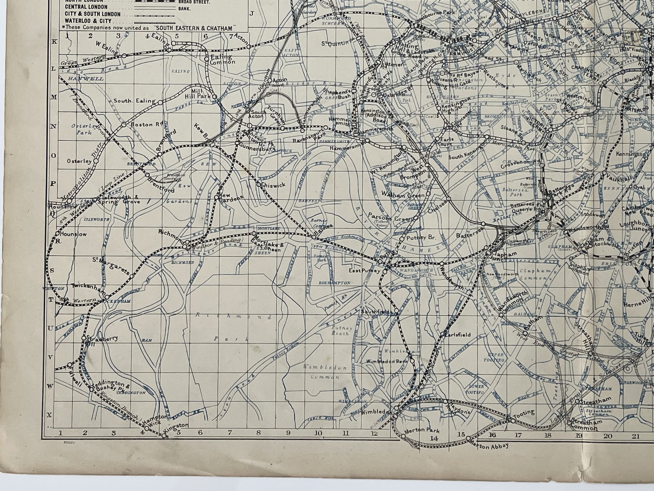
London Railways Showing Companies & Termini Tube Underground - George Washington Bacon - 1900
London Railways Showing Companies & Termini Tube Underground - George W Bacon – 1900
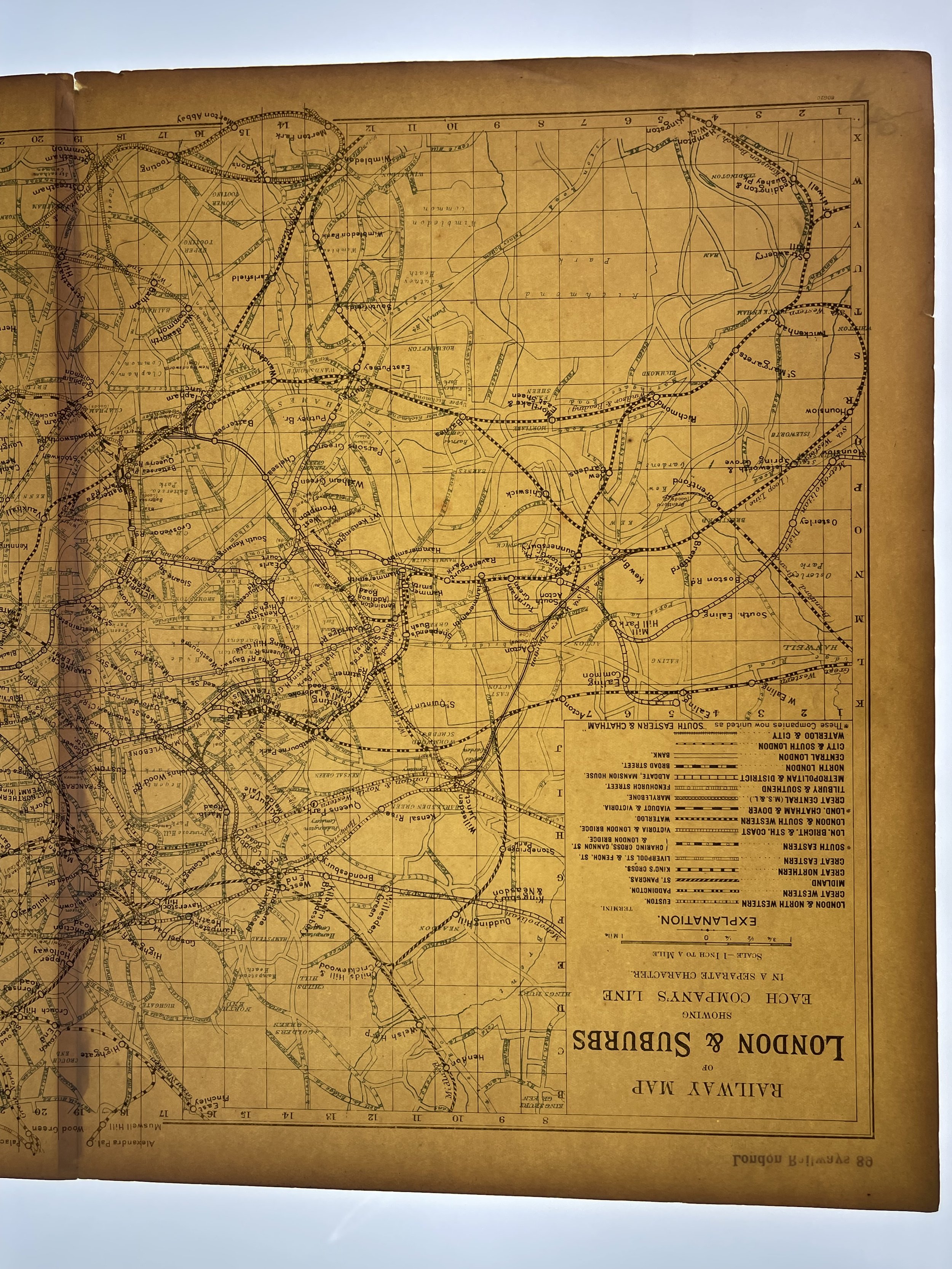
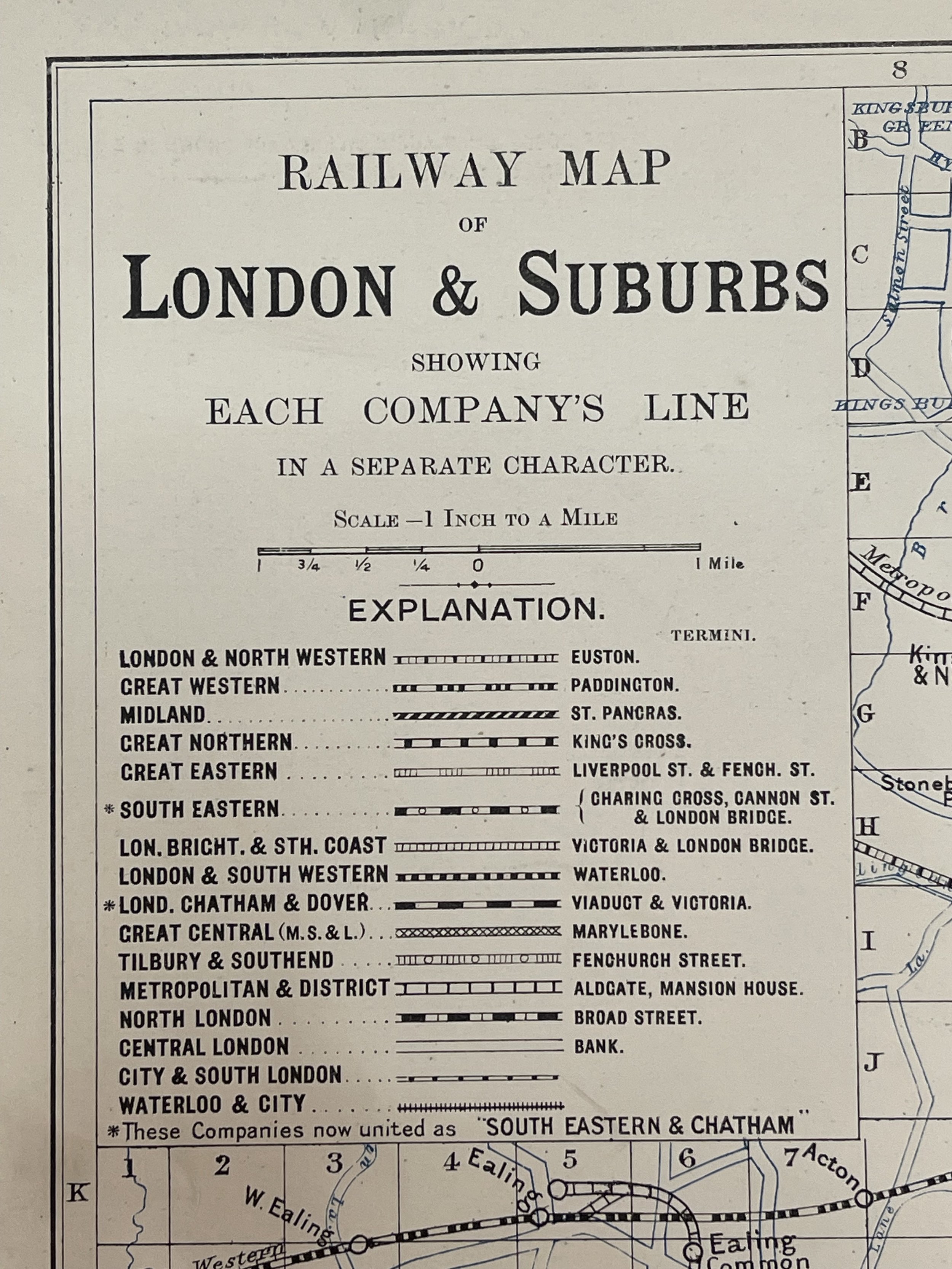
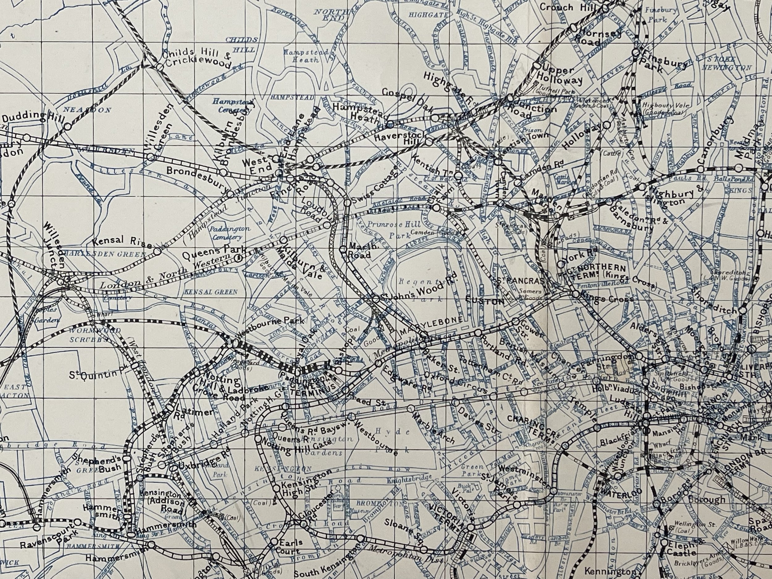
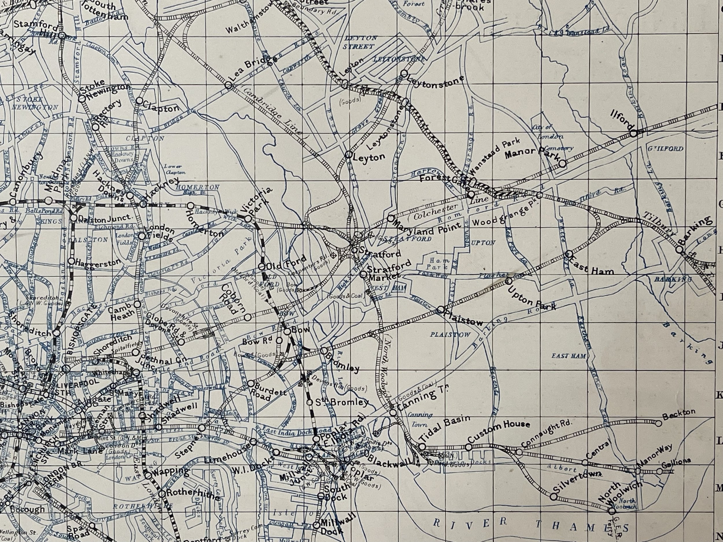
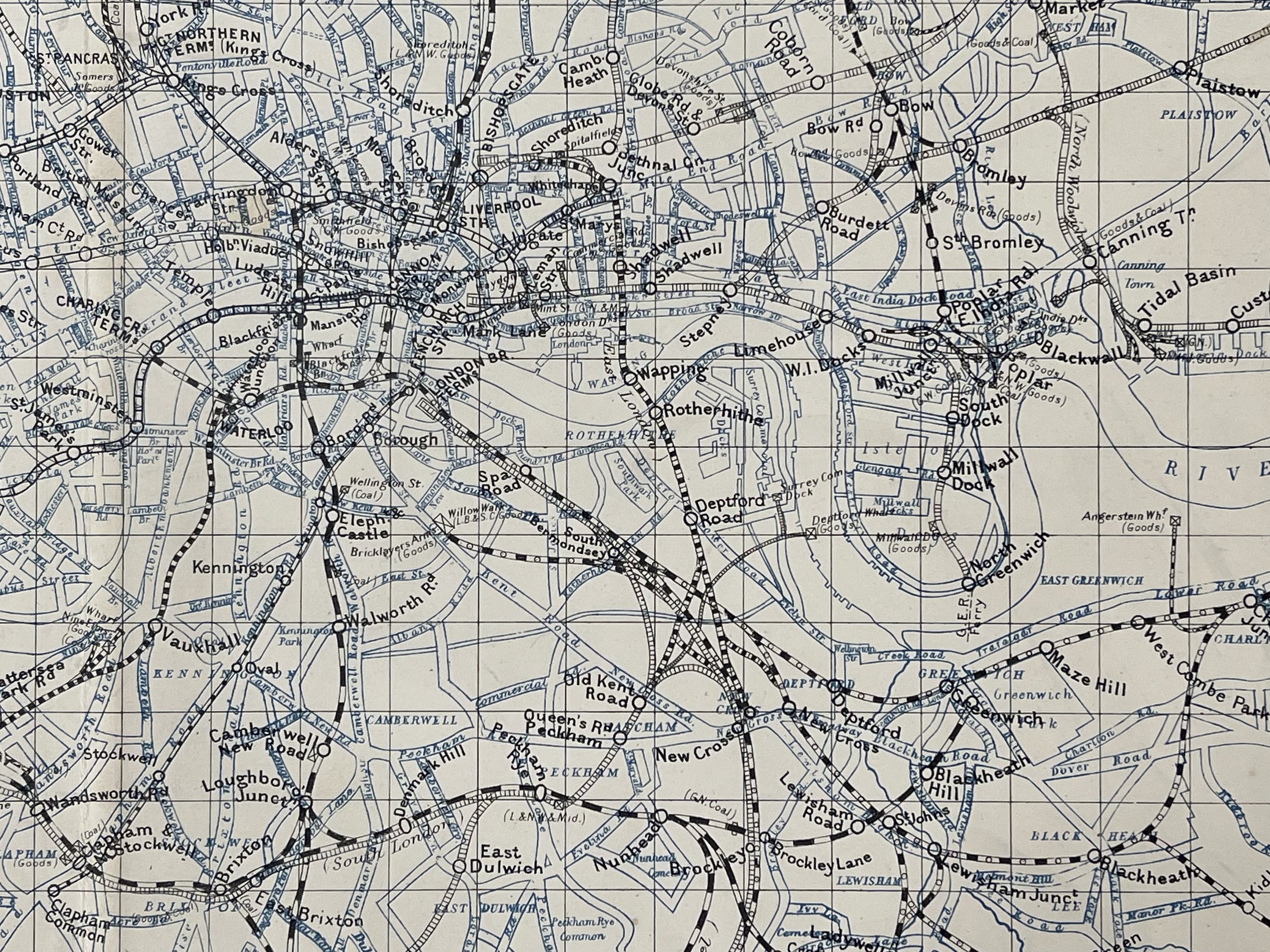
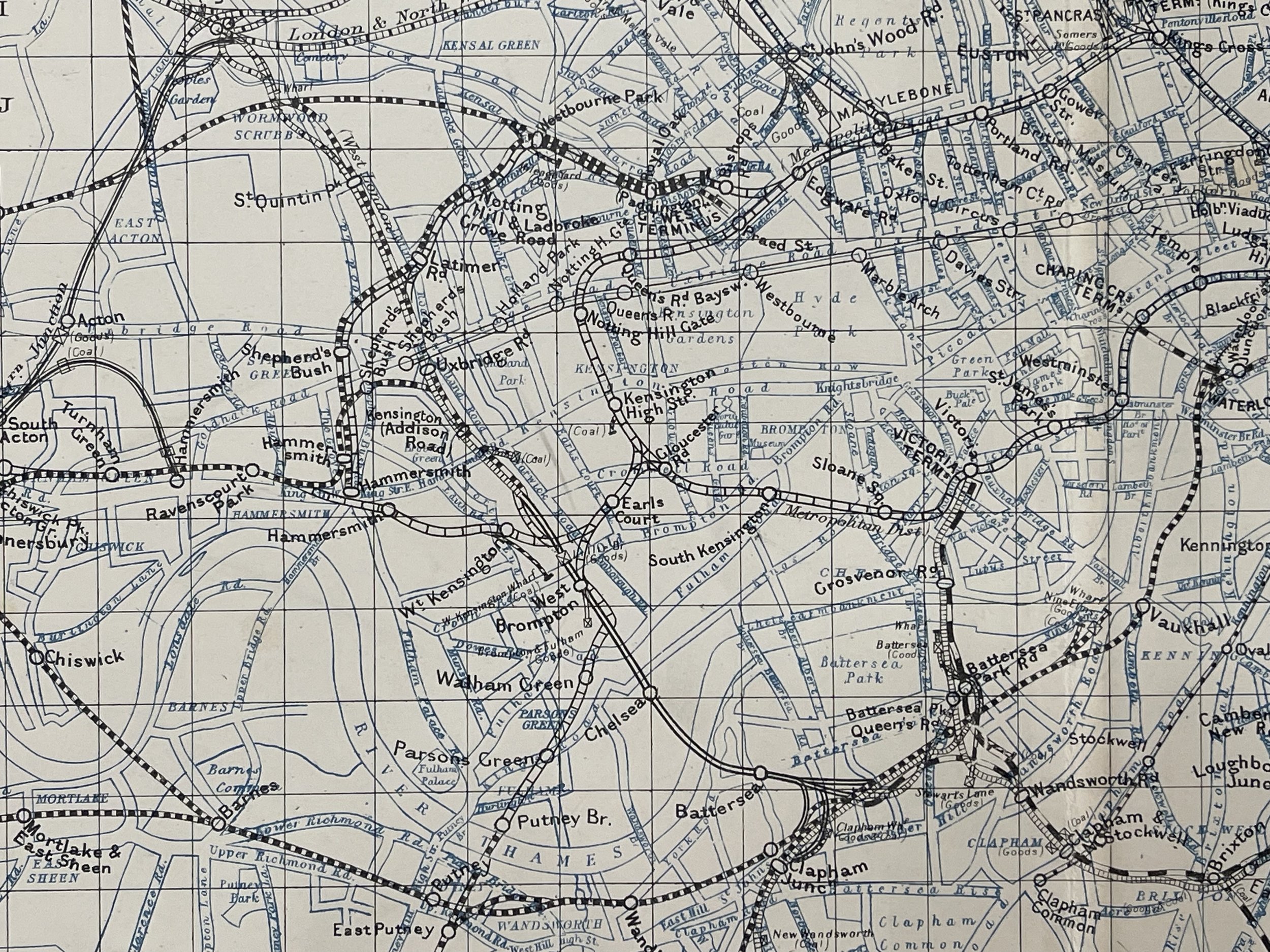
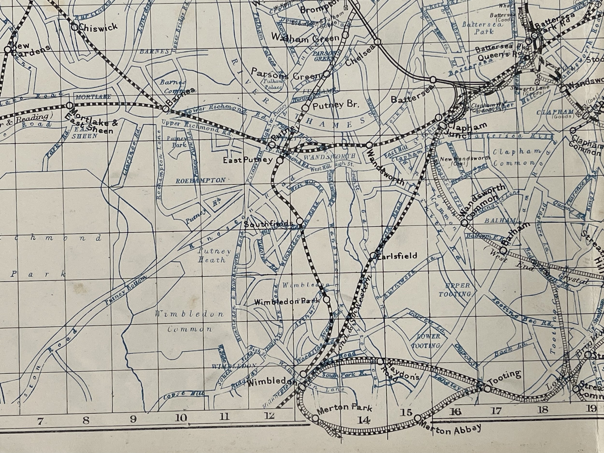
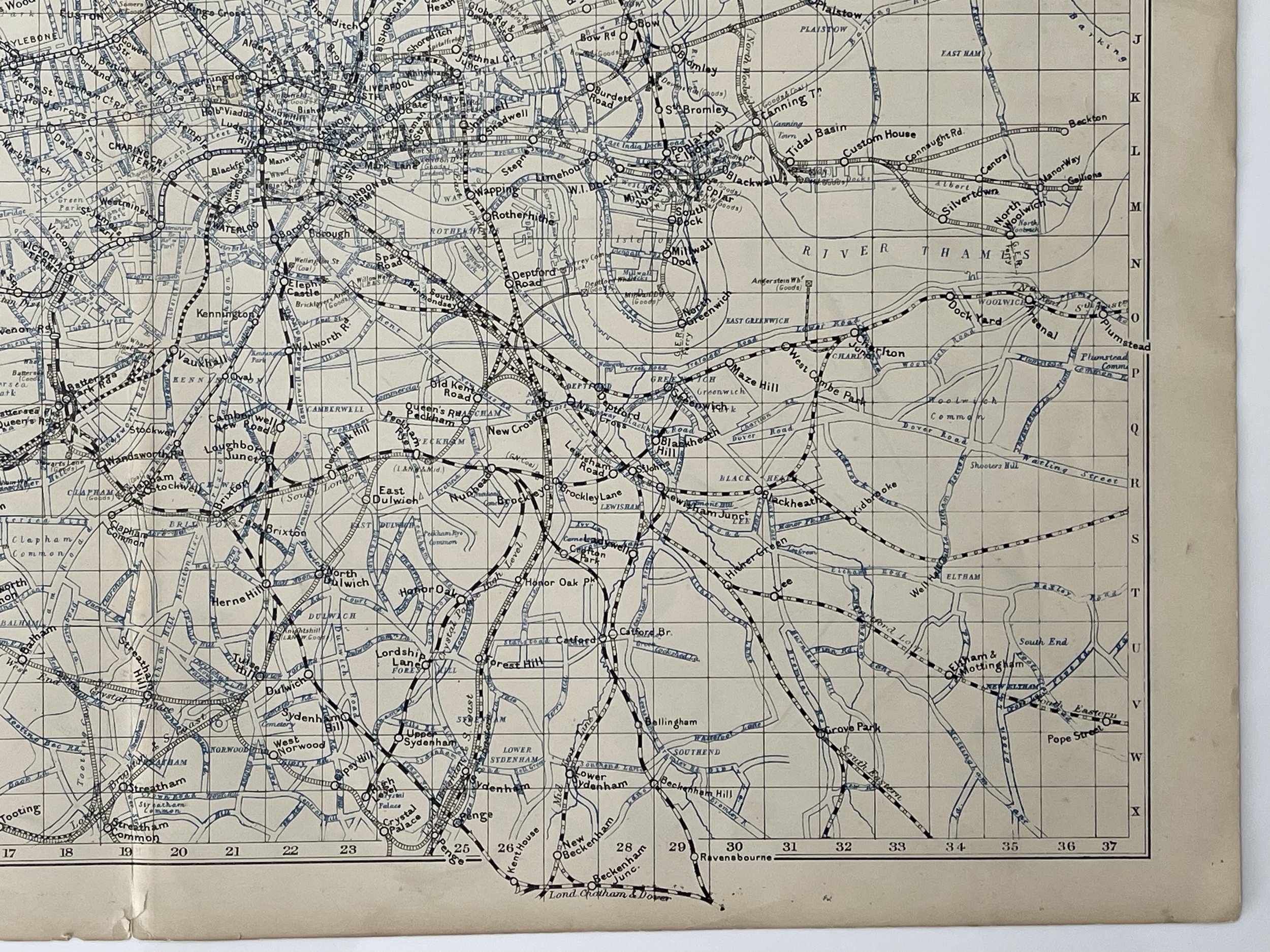
'Railway map of London & Suburbs showing each company's line in a separate character' by George W Bacon (1900).
"Bacon's New Large-Scale Atlas of London & Suburbs", G.W.Bacon & Co Limited, 127, Strand, London.
George Washington Bacon (1830–1922) was an American mapmaker and publisher who developed a successful business producing maps of London.
In 1861, Bacon founded a series of businesses. He became bankrupt in 1867, after failing to keep on top of managing these businesses.
In 1870, Bacon started his business, G.W. Bacon & Co., on 127 Strand, London. He based his atlases on the plates used by Edward Weller for his Weekly Dispatch Atlas. In 1893, he bought the map business of James Wyld.
During this time, G.W Bacon created illustrations of British colonial wars, with their most famous publication being Bacon's South Africa War Prints in 1901, covering the Second Boer War.
Around 1900, G.W. Bacon was purchased by the Scottish publishing house of W.& A.K. Johnston and incorporated into their own. Maps using the Bacon brand were being produced as late as 1956. About 1967 their name was changed to Johnston & Bacon.
Excellent condition, a must for rail ephemera and map collectors. Pricing and grading commensurate.
London Railways Showing Companies & Termini Tube Underground - George W Bacon – 1900
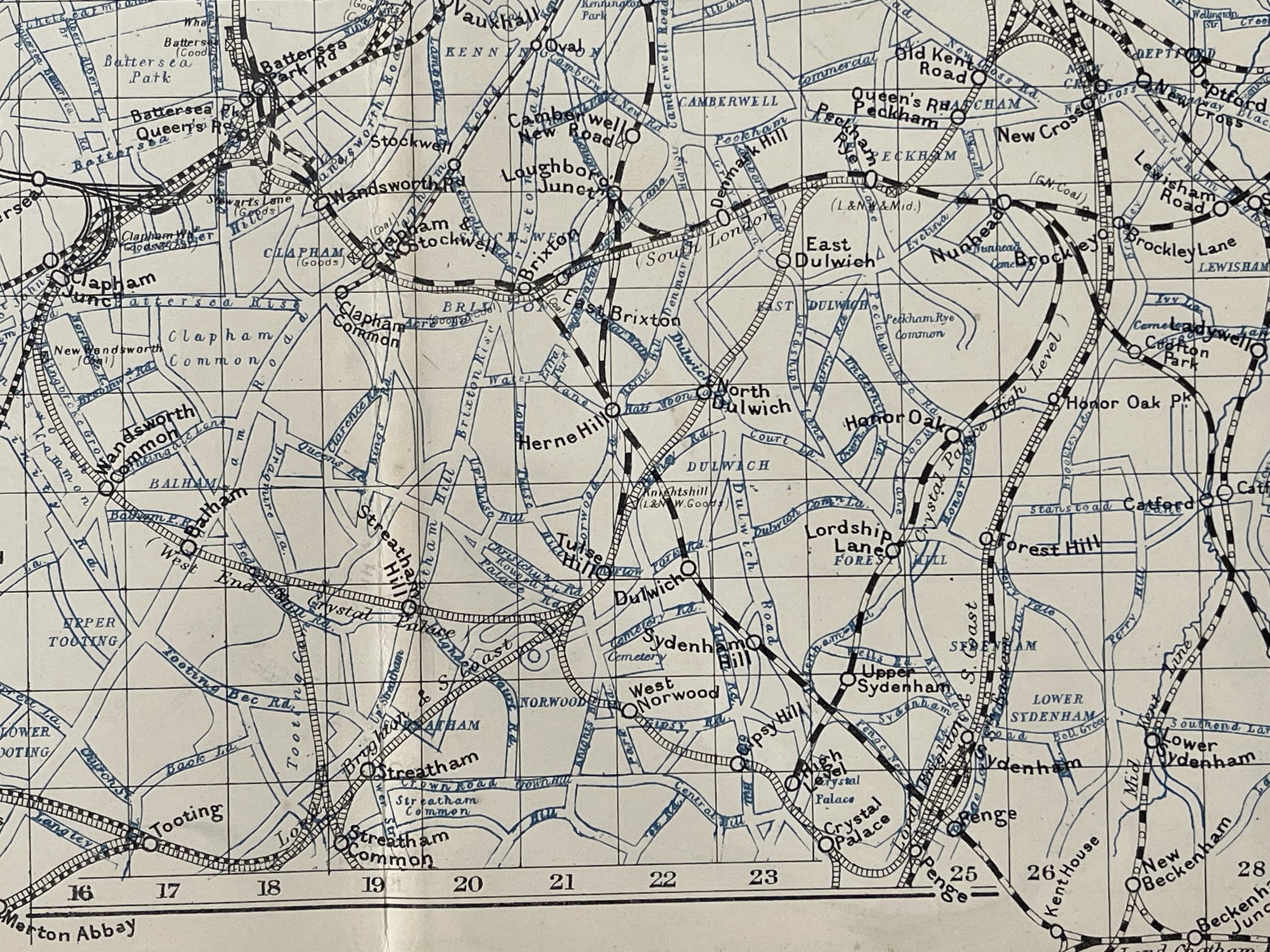
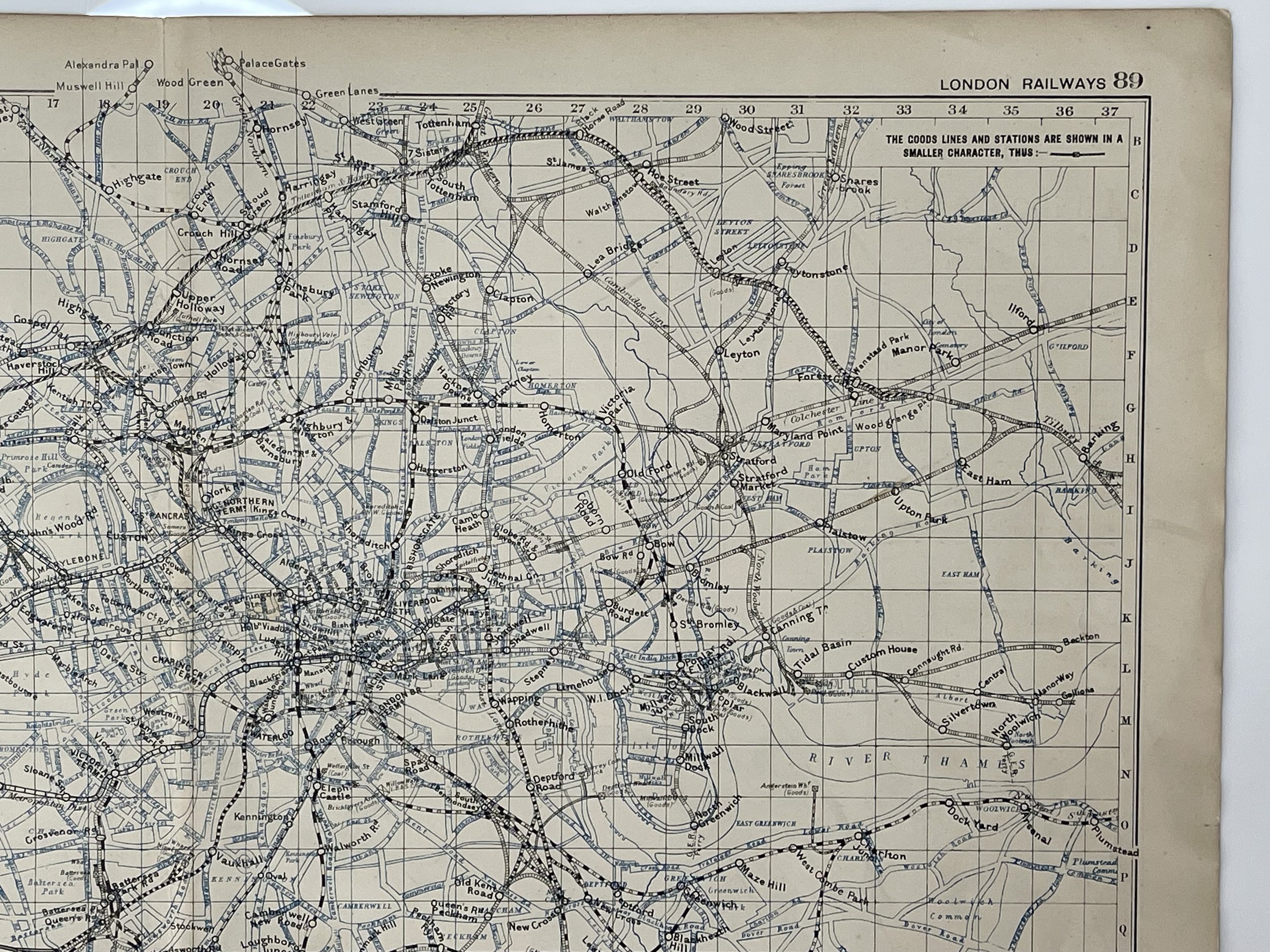
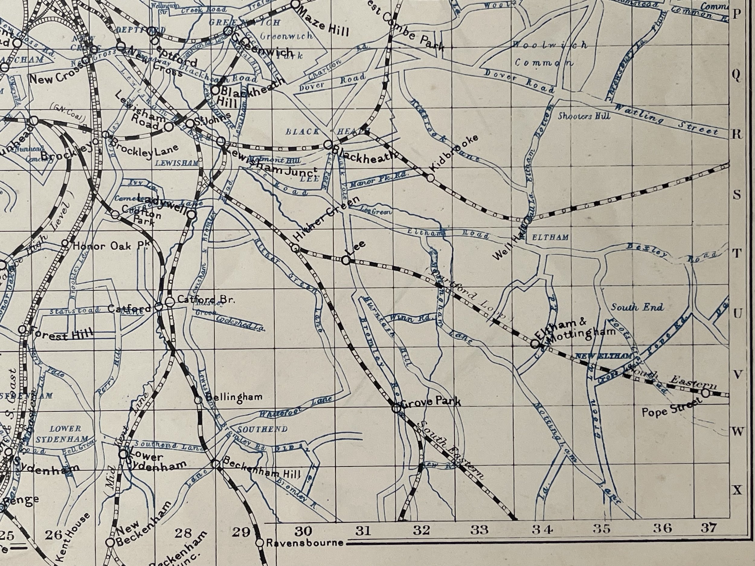
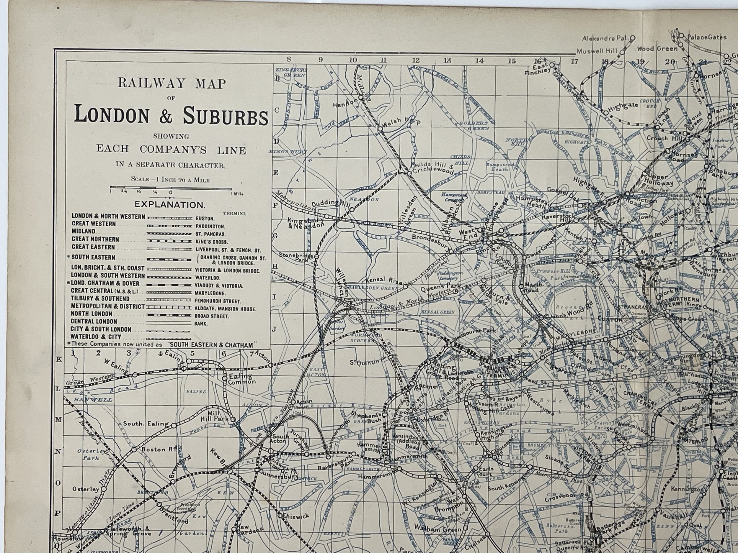
'Railway map of London & Suburbs showing each company's line in a separate character' by George W Bacon (1900).
"Bacon's New Large-Scale Atlas of London & Suburbs", G.W.Bacon & Co Limited, 127, Strand, London.
George Washington Bacon (1830–1922) was an American mapmaker and publisher who developed a successful business producing maps of London.
In 1861, Bacon founded a series of businesses. He became bankrupt in 1867, after failing to keep on top of managing these businesses.
In 1870, Bacon started his business, G.W. Bacon & Co., on 127 Strand, London. He based his atlases on the plates used by Edward Weller for his Weekly Dispatch Atlas. In 1893, he bought the map business of James Wyld.
During this time, G.W Bacon created illustrations of British colonial wars, with their most famous publication being Bacon's South Africa War Prints in 1901, covering the Second Boer War.
Around 1900, G.W. Bacon was purchased by the Scottish publishing house of W.& A.K. Johnston and incorporated into their own. Maps using the Bacon brand were being produced as late as 1956. About 1967 their name was changed to Johnston & Bacon.
Excellent condition, a must for rail ephemera and map collectors. Pricing and grading commensurate.
Code : A120
Cartographer : Cartographer / Engraver / Publisher: George Washington Bacon
Date : Publication Place / Date - 1900
Size : Sheet size: approx 26 x 39.5 Cm
Availability : Available
Type - Genuine - Antique
Grading A
Where Applicable - Folds as issued. Light box photo shows the folio leaf centre margin hinge ‘glue’, this is not visible otherwise.
Tracked postage, in casement. Please contact me for postal quotation outside of the UK.