Nouvelle représentation Des Côtes Nord et Est de l'Asie pour servir d'éclaircissement aux Articles du Supplement de L'Encyclopédie qui concernent le passage aux Indes par le Nord.
1772 (dated) - 11.5 x 14 in (29.21 x 35.56
Didier Robert de Vaugondy (ca. 1723-1786) was the son of prominent geographer Gilles Robert de Vaugondy and Didier carried on his father’s impressive work. Together, they published their best-known work, the Atlas Universel (1757). The atlas took fifteen years to create and was released in a folio and ¾ folio edition; both are rare and highly sought-after today. Together and individually, father and son were known for their exactitude and depth of research.
Like his father, Didier served as geographer to King Louis XV. He was especially recognized for his skills in globe making; for example, a pair of his globes made for the Marquise de Pompadour are today in the collection of the Municipal Museum of Chartres. Didier was also the geographer to the Duke of Lorraine. In 1773, he was appointed royal censor in charge of monitoring the information published in geography texts, navigational tracts, and travel accounts. When Charles Joseph Panckoucke took over publication of Diderot's Encyclopedie in 1768, he promised to correct the cursory treatment of geography for which the first seventeen volumes had been criticized, with emphasis on the discoveries of the last 25 years. He employed Samuel Engel, a Swiss geographer, to write a series of articles about the northern regions and Didier Robert de Vaugondy to prepare ten maps to illustrate them. Engel rejected the De la Fonte Northwest Passage discoveries and believed the most sensible route from the Atlantic to the Pacific was along the north coast of Siberia. These maps illustrate the discoveries and various cartographic theories concerning the Pacific Northwest, East Asia and the North Pacific Ocean and include some of the most interesting comparative cartography of the eighteenth century
This map is part of the 10 map series prepared by Robert de Vaugondy for the Supplement to Diderot's Encyclopedie, of which this is plate 3. We are aware of two states of this man: a second includes the nade number 162. A full re-endraved olate dated 1779 with the imprint of livorno endraver Snadaccini is also two states of this map: a second includes the page number 162. A fully re-engraved plate dated 1779 with the imprint of Livorno engraver Spadaccini Is also known. The present example, lacking page number, corresponds to the first state. The Supplément à l'Encyclopédie is well represented in institutional collections.
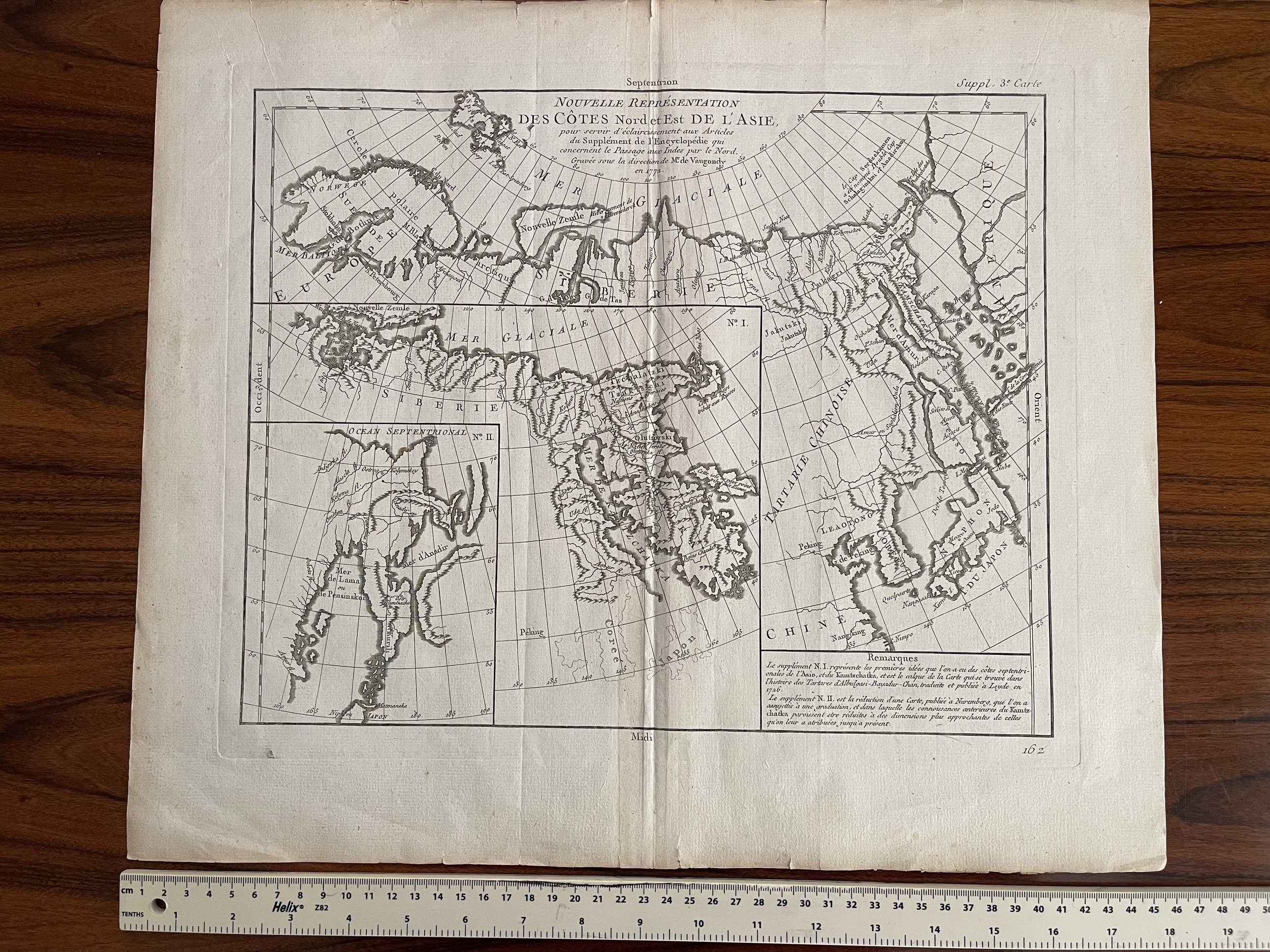 Image 1 of 8
 Image 2 of 8
 Image 3 of 8
 Image 4 of 8
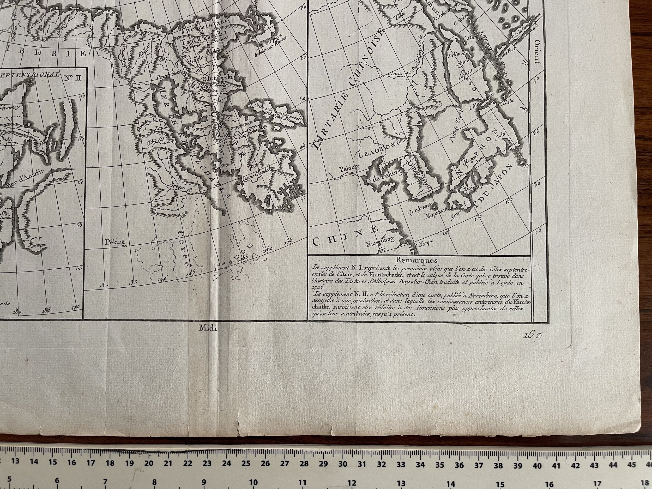 Image 5 of 8
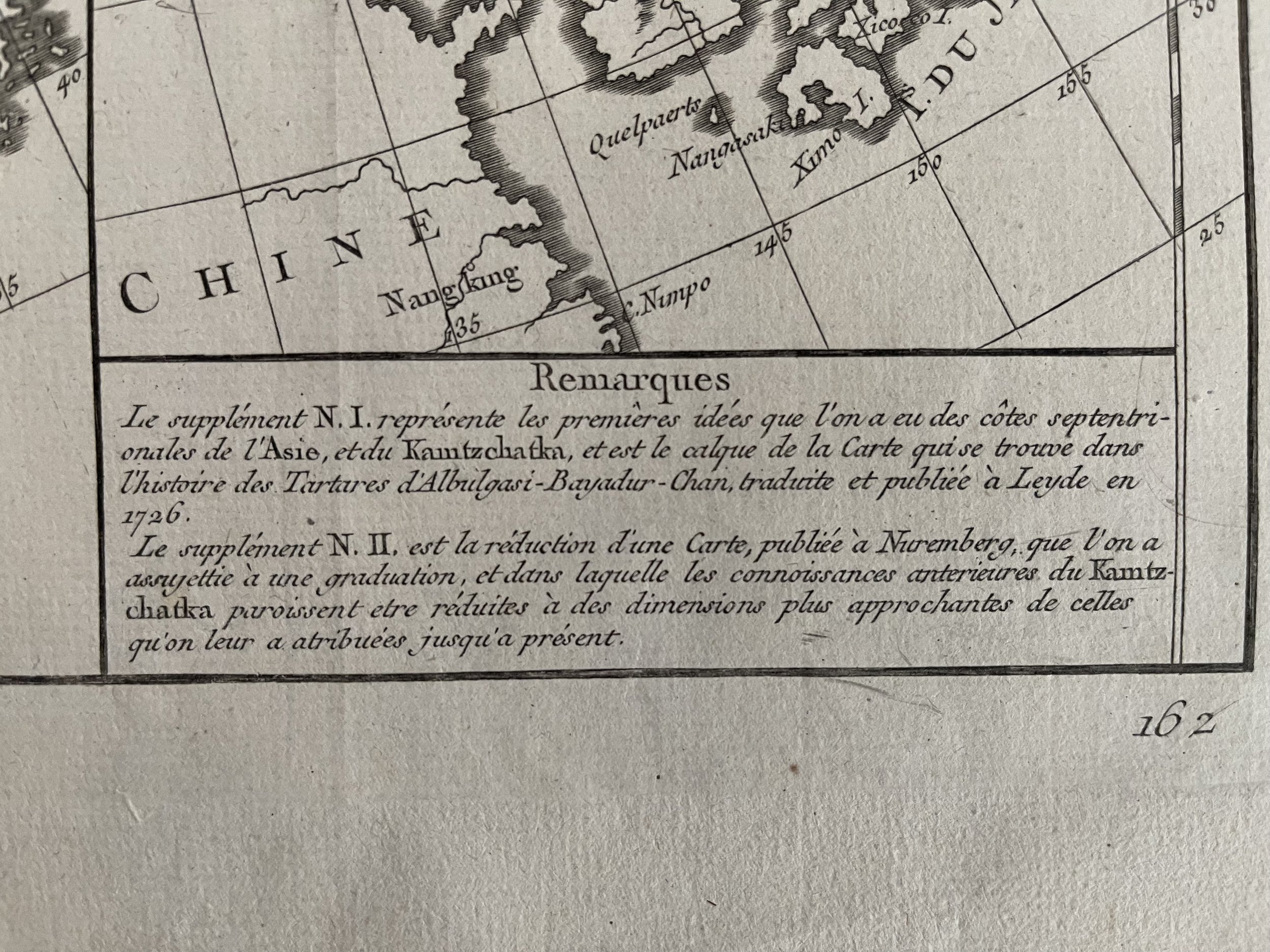 Image 6 of 8
 Image 7 of 8
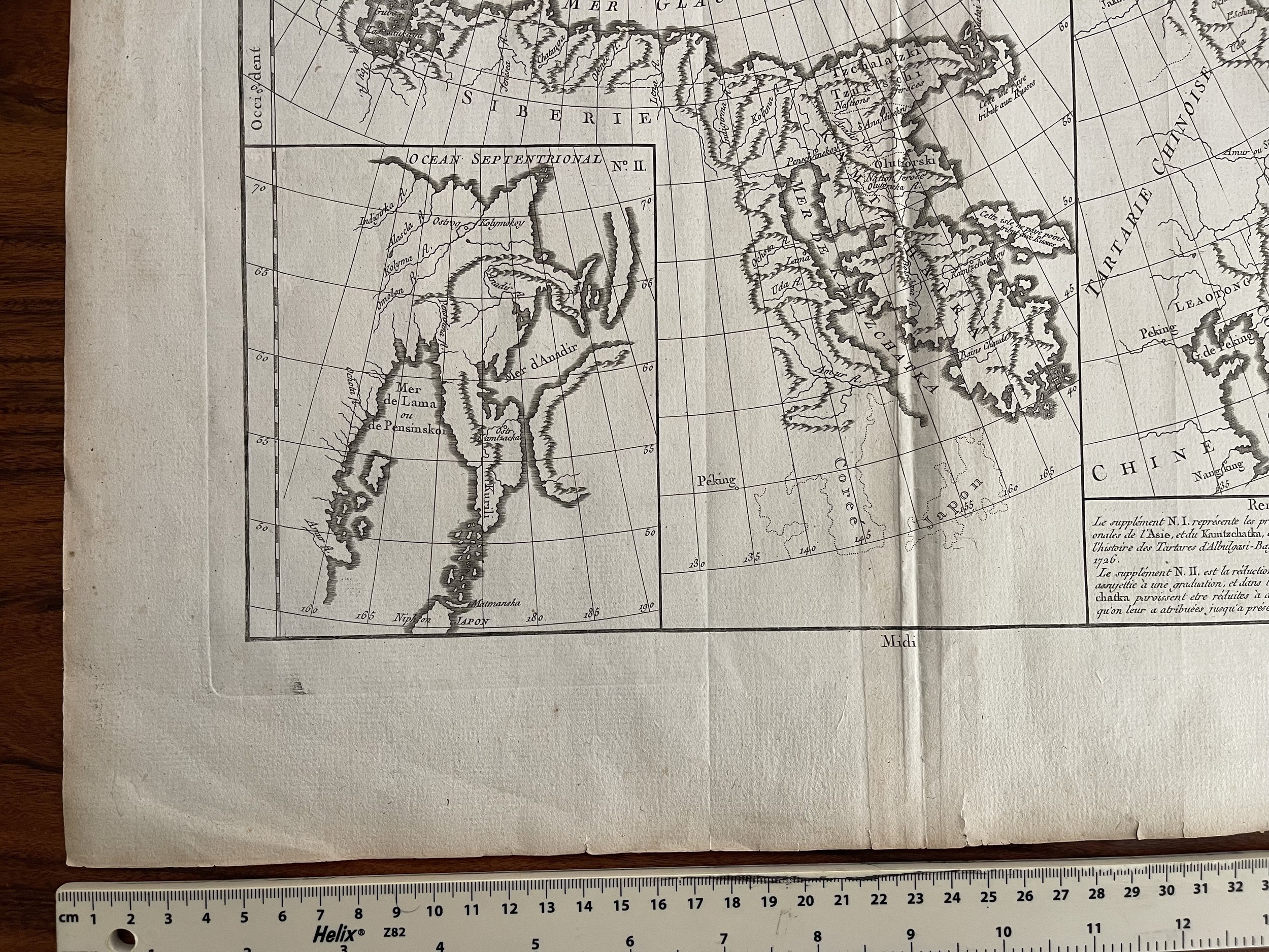 Image 8 of 8