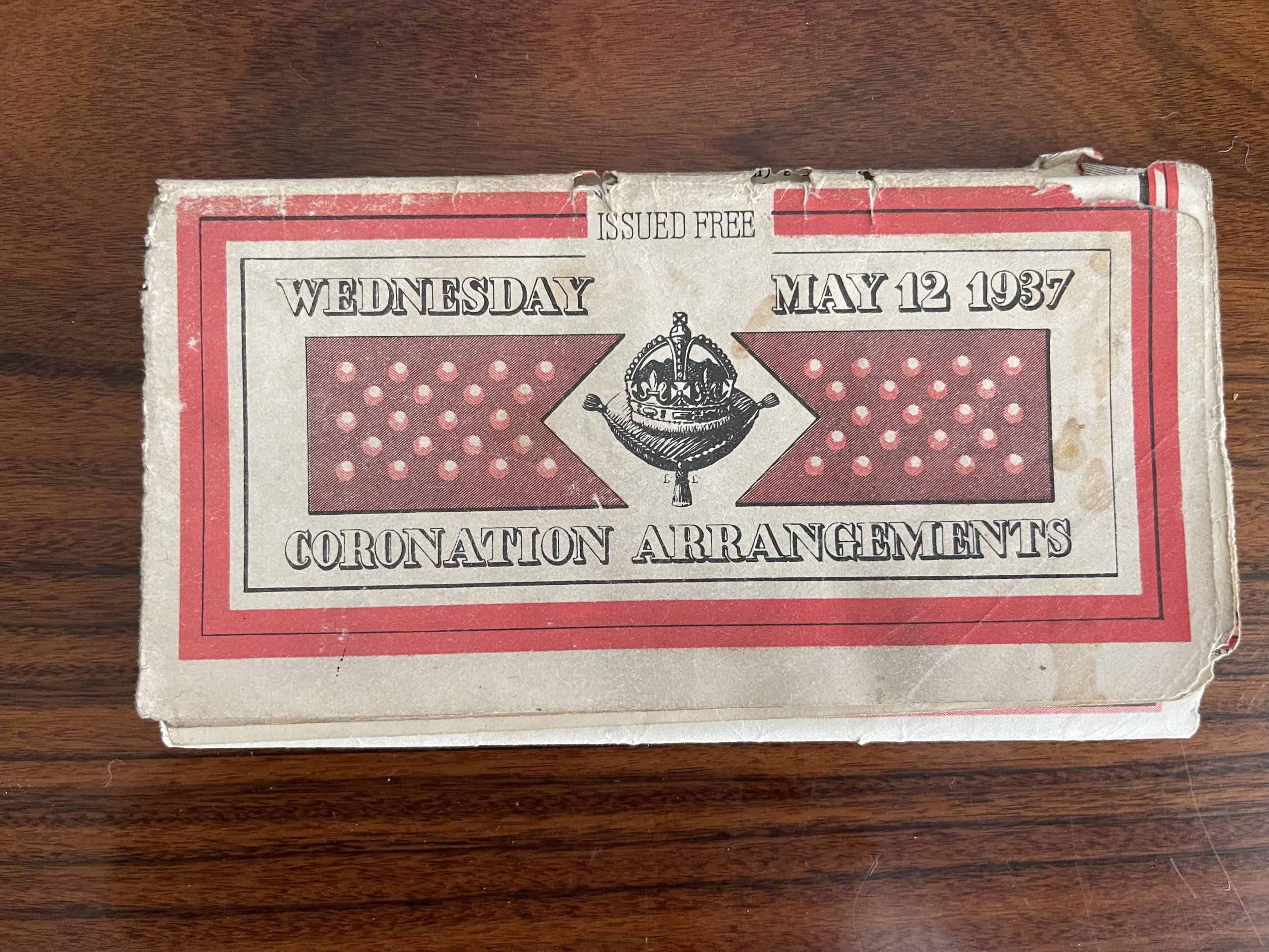
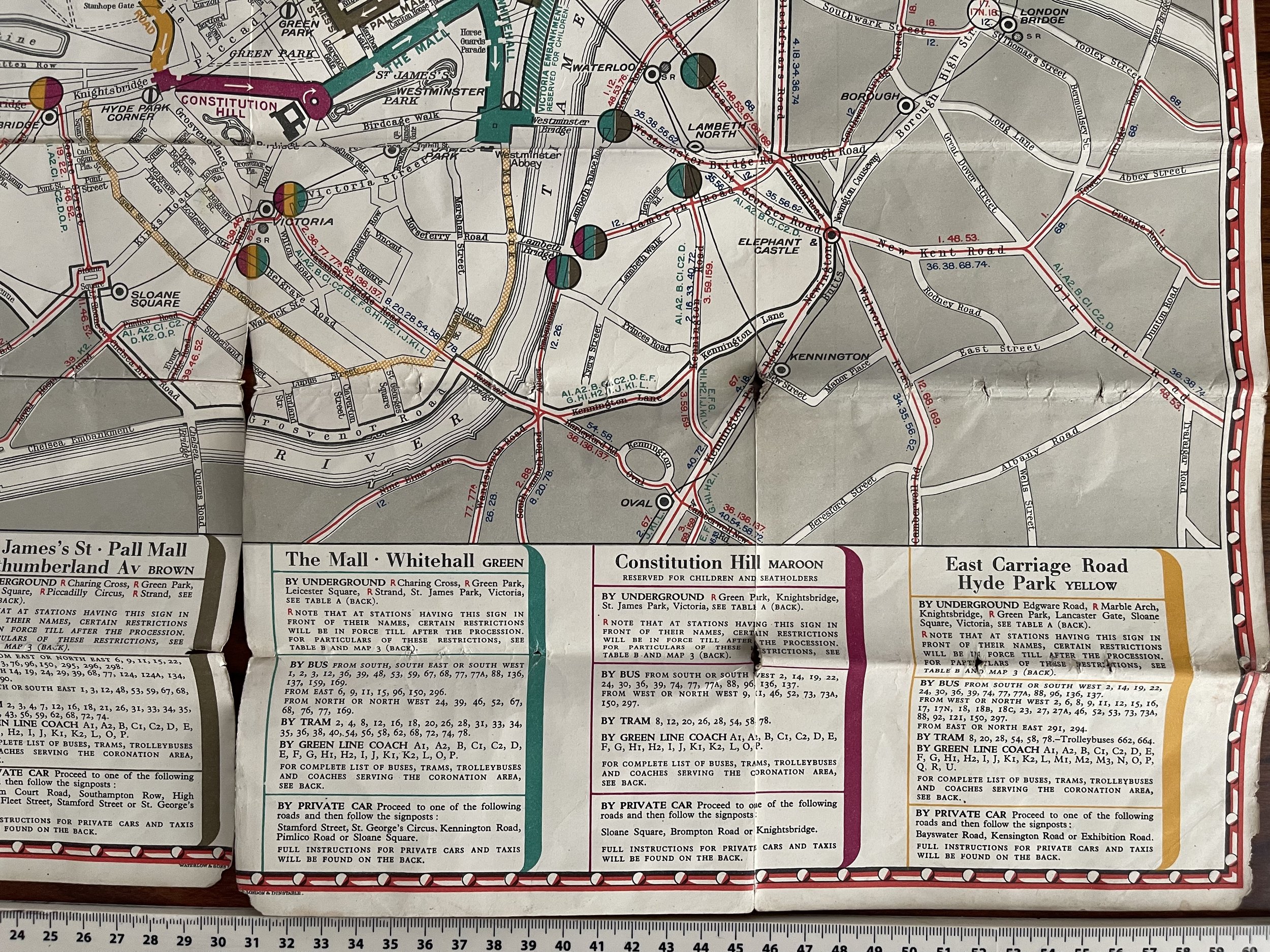
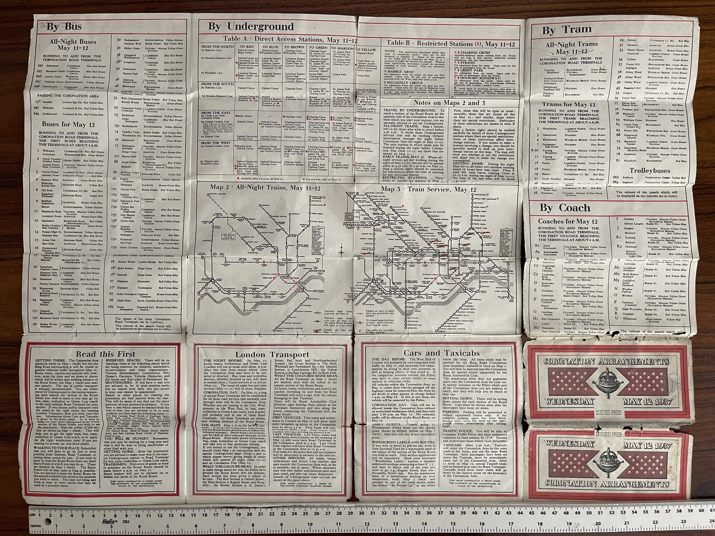
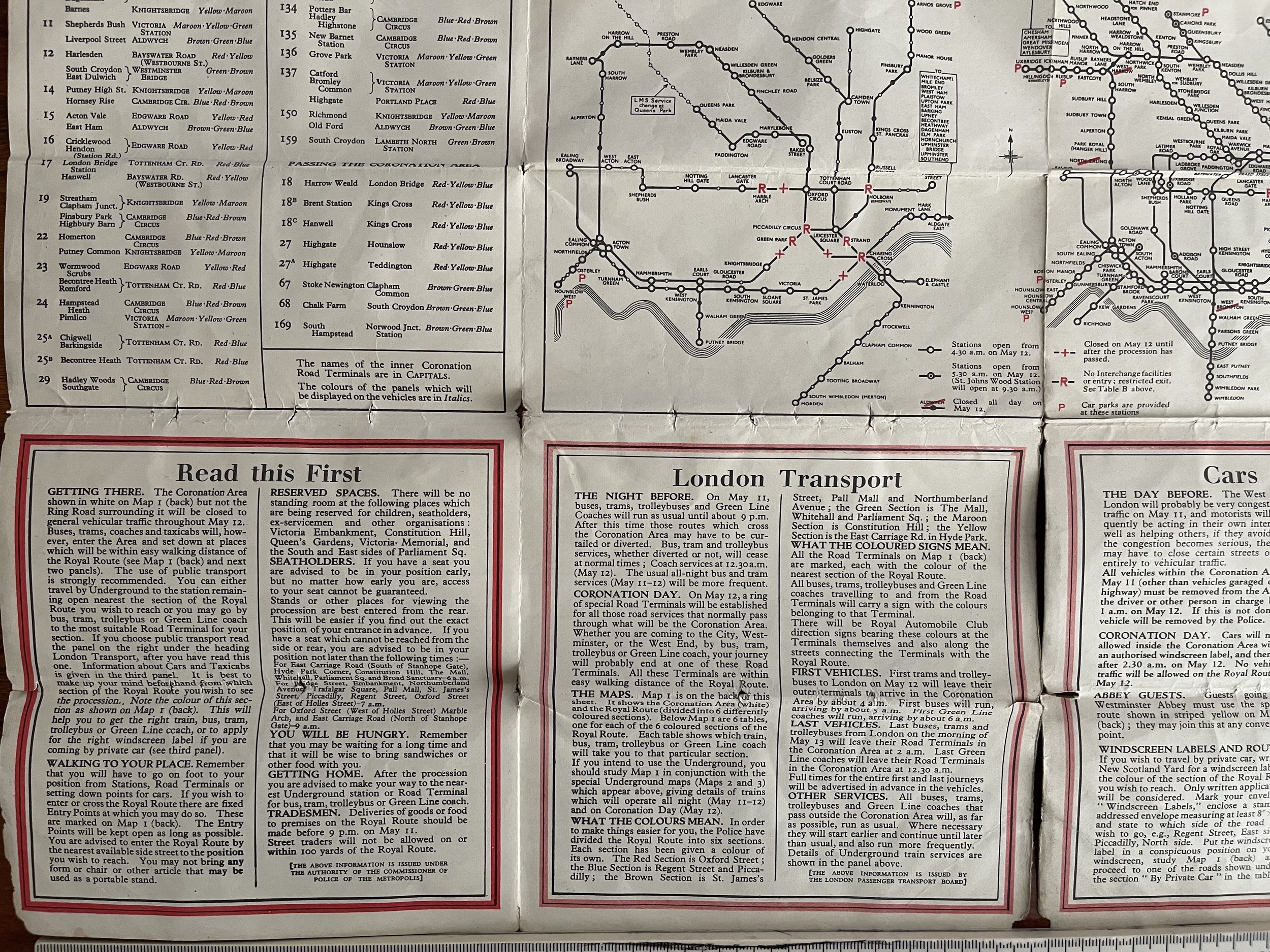
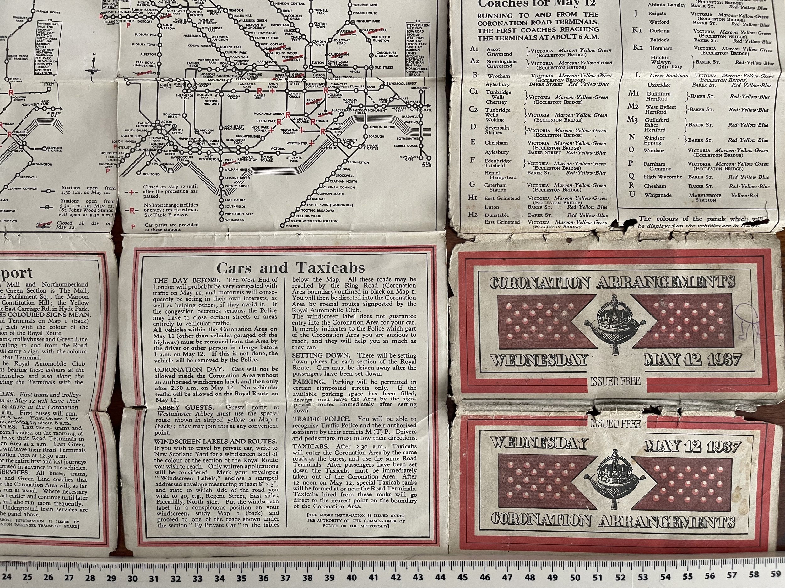
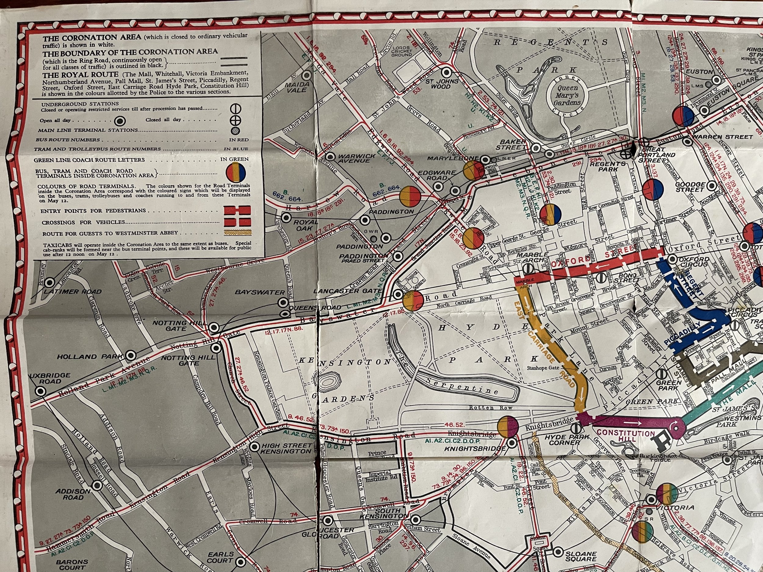
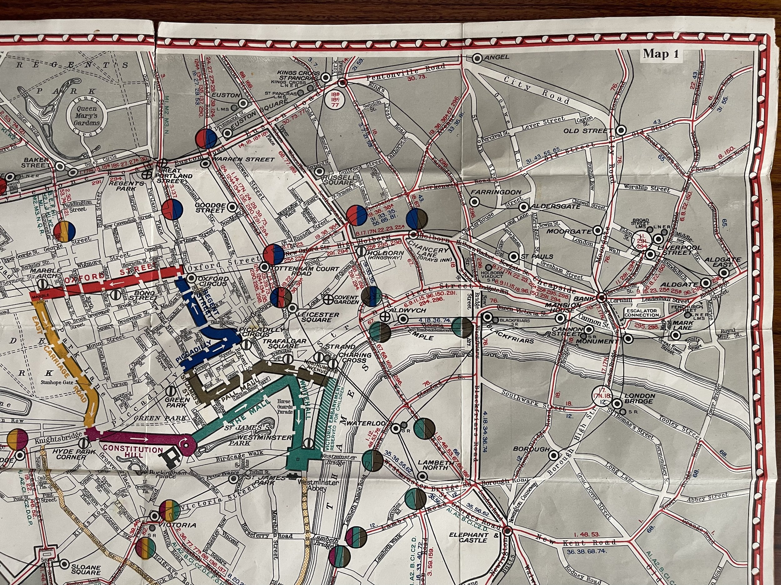
Map of the Coronation route of King George VI Central London - Geographia Ltd - 1937
This is an original 1937 city map or plan of London illustrating how well wishers and other attendees could best attend the Coronation of King George VI of Great Britain. Measurements: 23 x 17 in. (58½ x 43 cm).
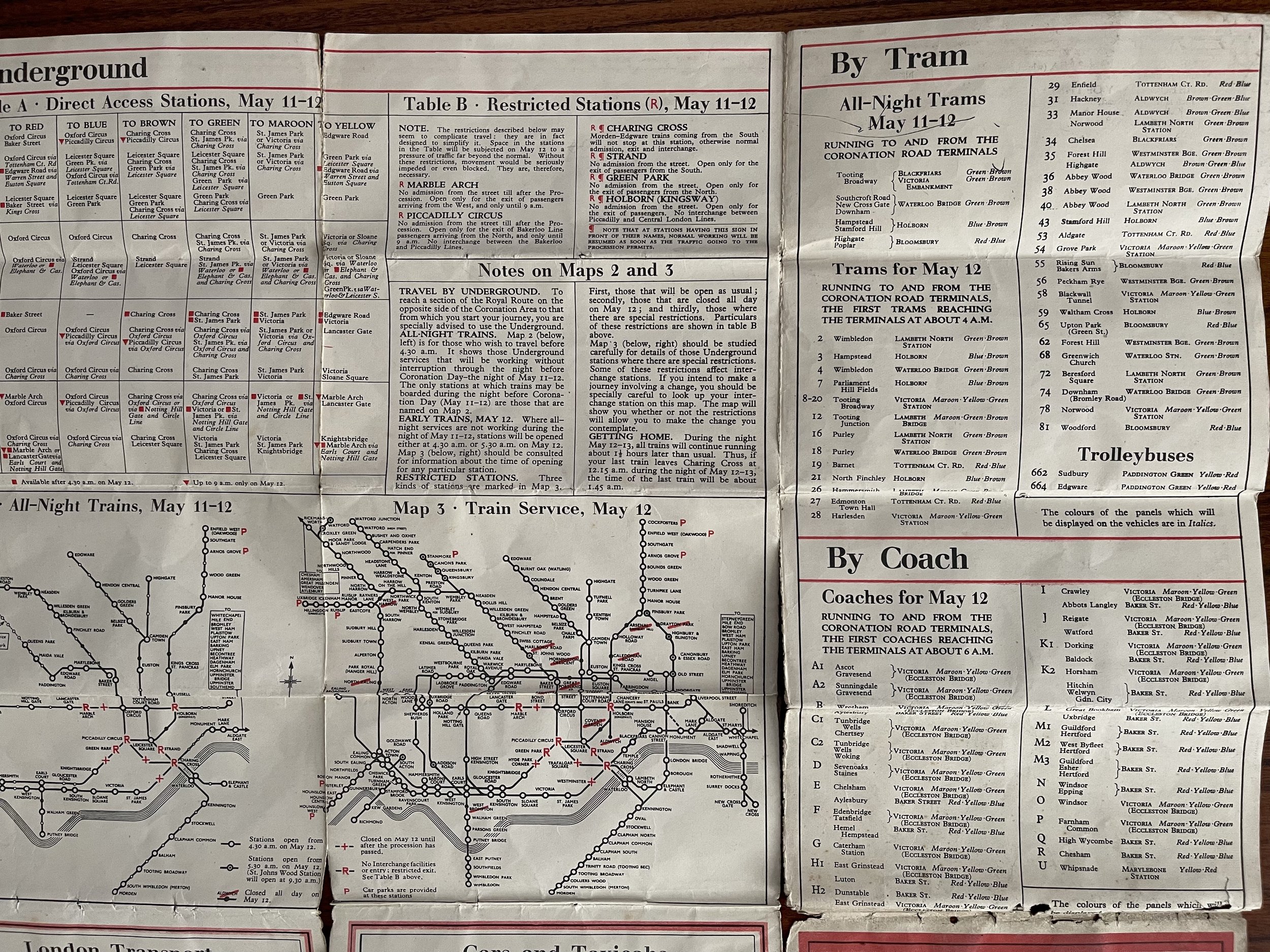
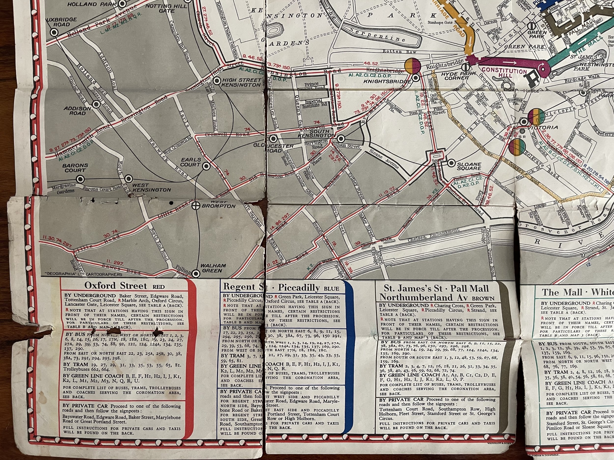
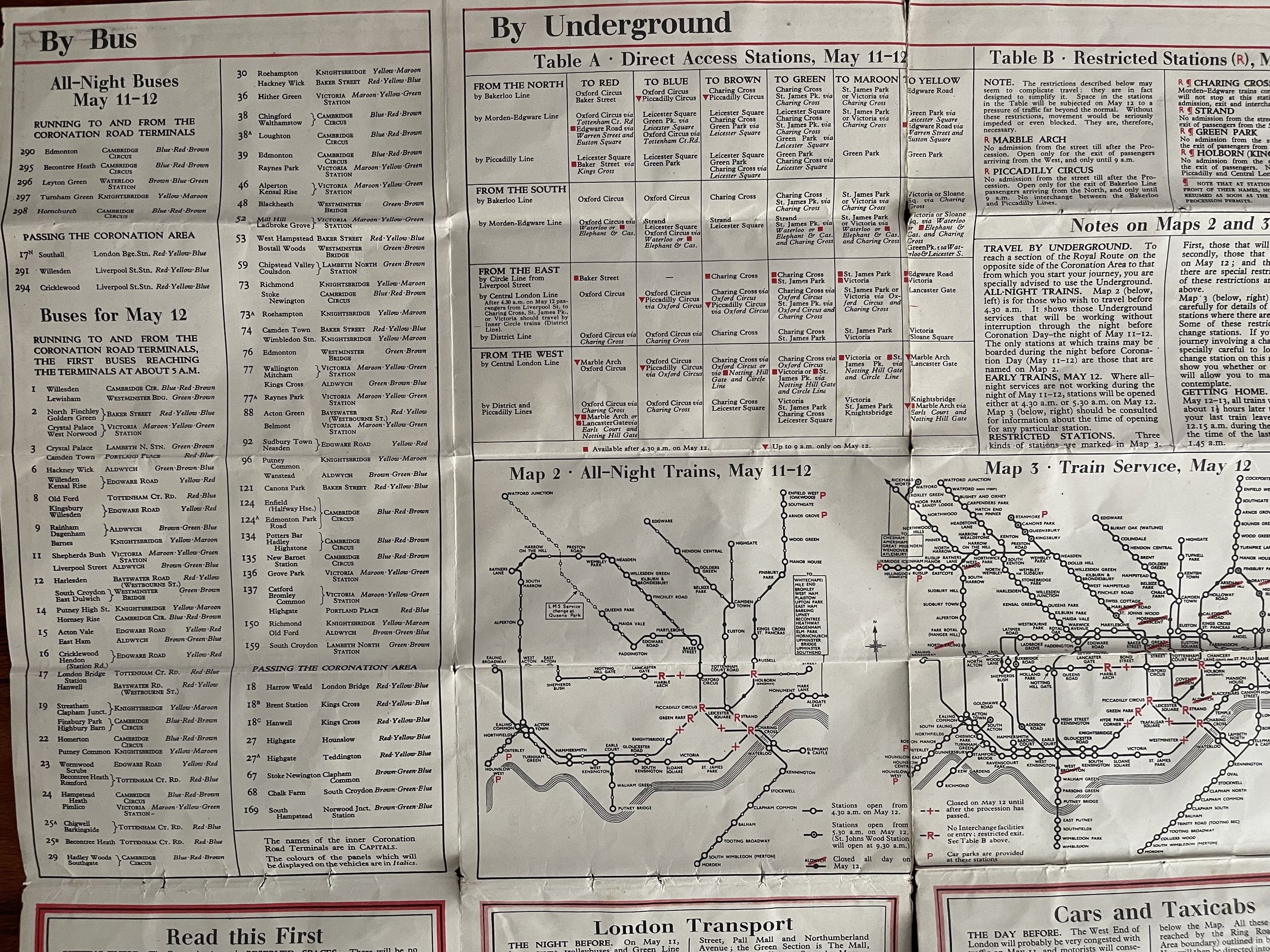
The map depicts London from the now closed Uxbridge Road Underground Station (it was on the Metropolitan Line) to Tower Bridge and from Regents Park to the Borough of Lambeth and the Oval Underground station, which is on the Northern Line. Through the presentation of clear, concise information, directions concerning how to reach the Royal Route are presented. Each colored section represents a part of the Royal Route and correspond to the colors that would be used by buses, trams, and Green Line coaches to easily display for passengers their destination. The part of London each color encompasses is explained in explicit detail on verso, allowing potential attendees to decide where they would like to watch the procession and how best to arrive at their proposed destination. Only pre-arranged private traffic would be allowed into the Coronation Area (the white area on the map) and no superfluous deliveries, etc., would be allowed in. Bus, tram, and Green Line coach routes are labeled in different colors and different symbols are used for Underground stations, so riders can are informed which stations will be open, restricted, or closed for the day. A more detailed Underground map is printed on verso, along with detailed directions of how to get to the Royal Route.
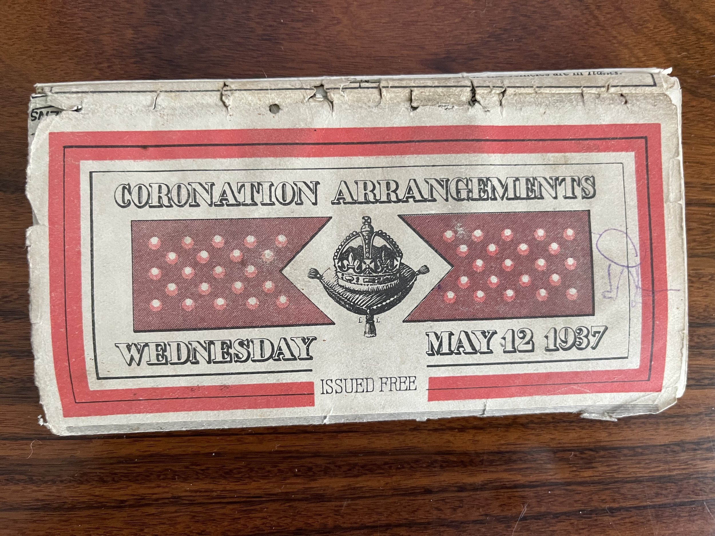
This map was published by Geographia and freely distributed in advance of the Coronation of King George VI on May 12, 1937.
Geographia, Ltd. (1911 - 1985) was a London based cartographic publishing firm. The company was founded by Alexander Gross (1879 - 1958), a Hungarian immigrant to the United Kingdom. Geographia Ltd. is best known for its folding pocket maps and globes. Many of his maps were drawn by a mysterious 'Mr.
Fountain' of which we have been able to discovery little. Gross ran into financial problems around 1940, likely associated with World War II, and relocated with offices in New York at 11 John Street. There he issued a large corpus of U.S. focused maps and city plans. By the 1940s, the branch in the United States had been renamed the Geographia Map Company and experienced rapid growth. By the 1950s Geographia had published maps of dozens of cities across the United States. In 1987, the British branch was bought out by Harper Collins and continues to produce maps under the Collins Bartholomew imprint. Rand McNally bought the New York based Geographia Map Company in the late 1980s, but its original owners repurchased the Geographia Map Company a few years later and still operate the company in Hackensack, New Jersey. Gross's daughter, Phyllis Isobella Gross / Pearsall (1906 - 1996) founded the Geographers' A-Z Map Company in London, the largest independent map publisher in the United Kingdom. In the UK, they offices were originally at 33 Strand, where they published as 'Geographia Designing and Publishing Company Ltd.'. Later, by 1933, they had relocated to 55 Fleet Street, where they remained until ate least 1937. By 1942, they related to 167 Fleet Street, followed by 114 Fleet Street by 1964. It is of note that many of the Geographia Ltd. maps feature a peculiar dating system wherein the letters in the world CUMBERLAND correspond to the numbers 1234567890, such that a date is rendered by substitution, so A.MU would break out like this A = 8, M = 3, U = 2, so 8.32 or, August 1932. Or, MM.YY e.g. E.MC = 5.31 = May 1931.
Code : A1043
Cartographer : Cartographer / Engraver / Publisher: Geographic Ltd
Date : Publication Place / Date - London - 1937
Size : Sheet size: Image Size: 23 x 17 Inches, (58½ x 43 cm)
Availability : Available
Type - Genuine - Antique
Grading A
Where Applicable - Folds as issued. Light box photo shows the folio leaf centre margin hinge ‘glue’, this is not visible otherwise.
Tracked postage, in casement. Please contact me for postal quotation outside of the UK.
