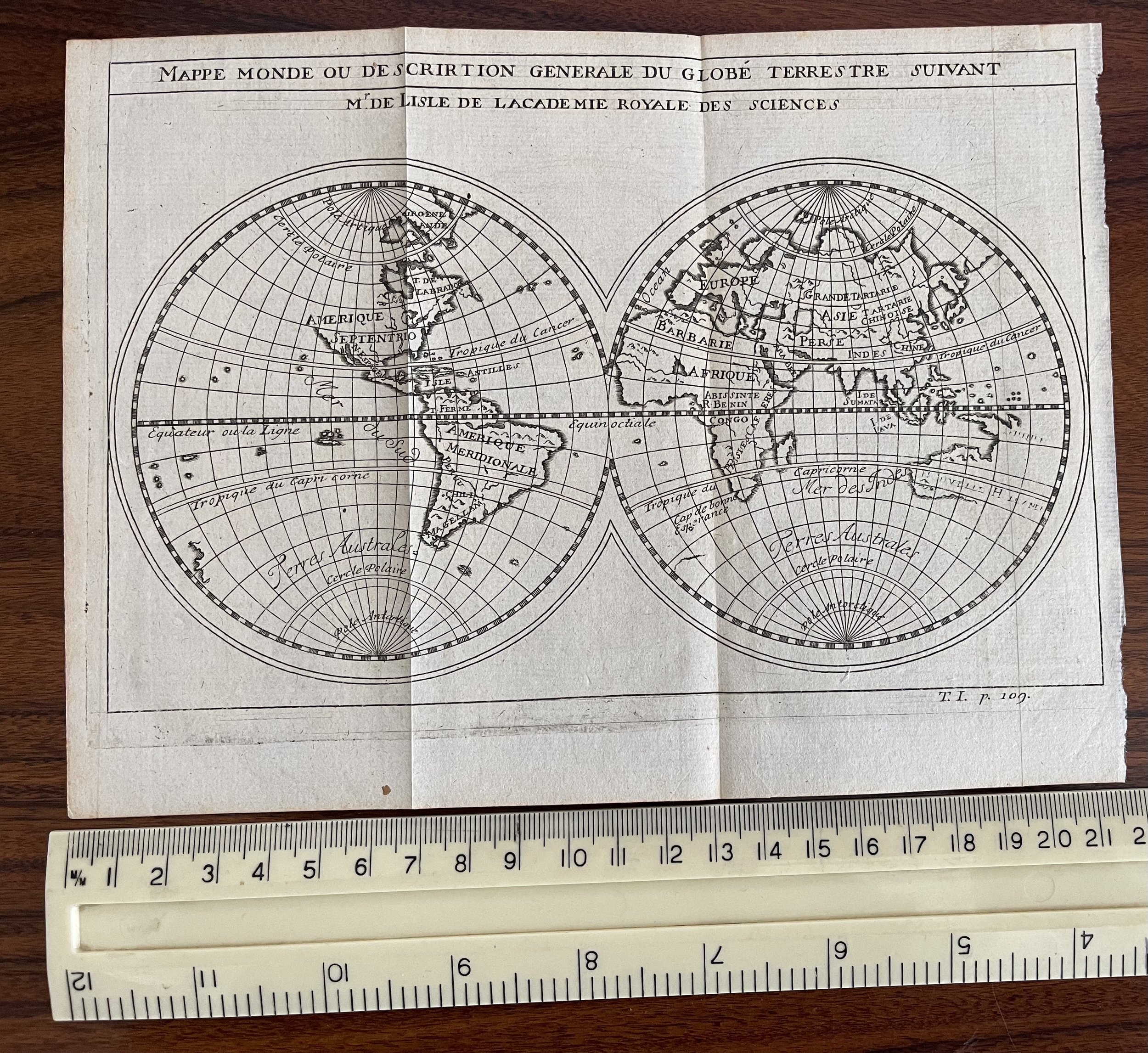
Mappe Monde ou Description Generale du Globe Terrestre, suivant M.de Lisle de L’Academie Royale des Sciences - Guillaume D'Lisle (France 1675–1726)
An original copper engraved map of the world in two hemispheres by Gullaume De L’Isle published in Amsterdam by Chatelain.
The full title to the map is … “Mappe Monde ou description Generale du Globe Terrestre suivant M. De L’Isle de l’Academie Royale des Sciences”.
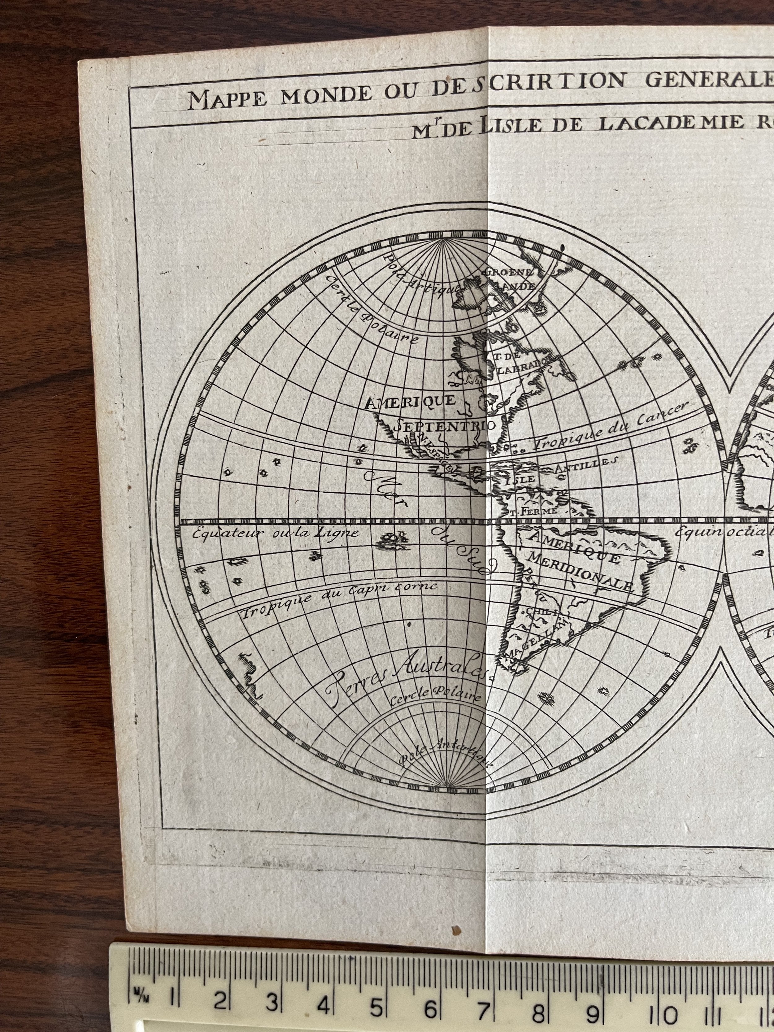
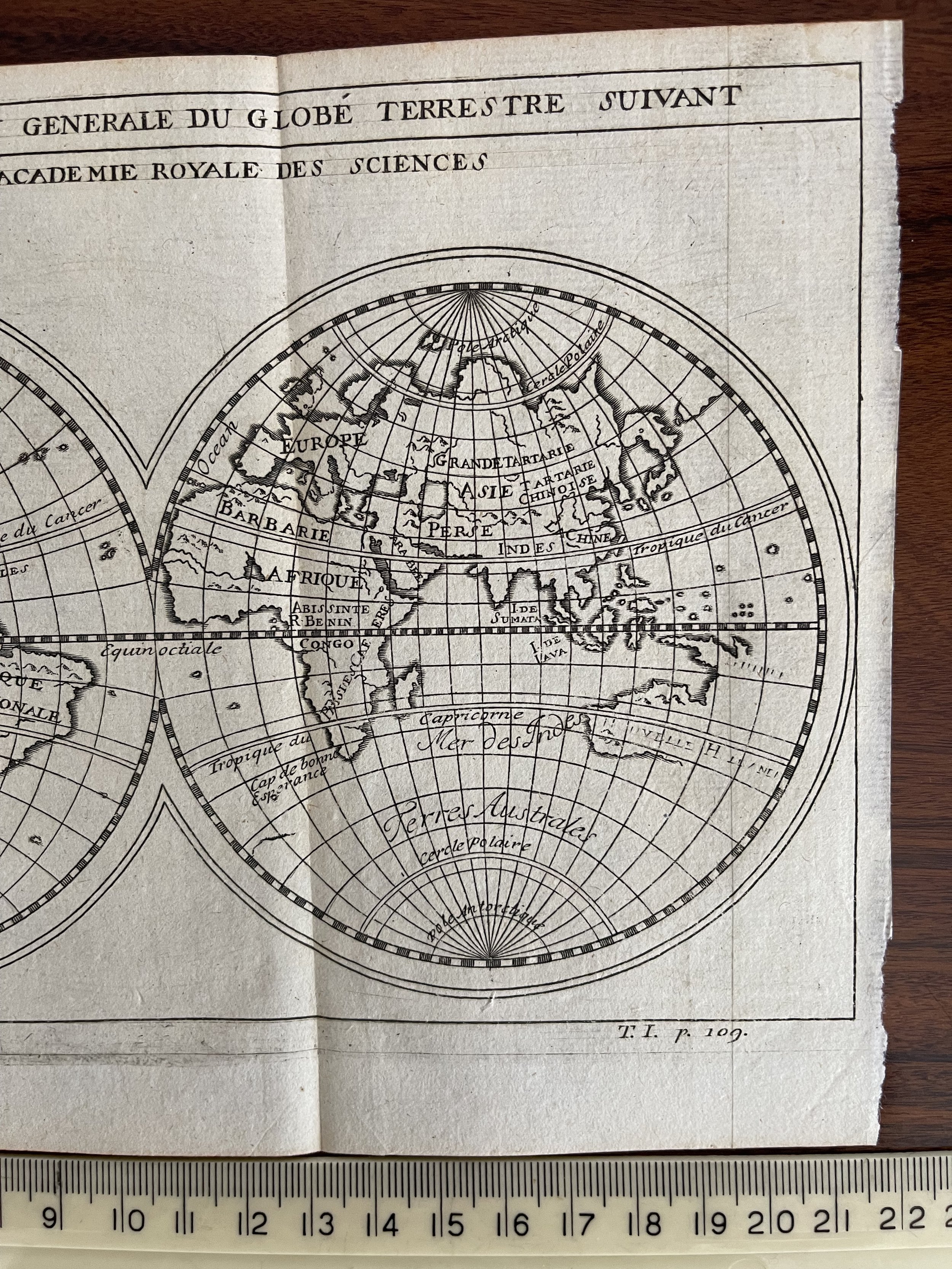
A curious map reflecting the unknown and the incorrect at the time. Nothing understood about the North West Coast of America although a land mass. to the east, is identified but not named … this is the fictitious “Campany’s Land”. The Dutch understanding of Australia (Nouvelle Holland)is shown with its limitations but without the south coast of Tasmania, noting also the mountain ranges shown in the North West. A most unusual map with some interesting features.
Gullaume De l’Isle (1675-1726) was a leading French cartographer of his period, following Sanson. His father was involved in geography and education although Gullaume was independent and bright at an early age. He was mentored by the great Astronomer Cassini. He became a member of the Acadamie Royale de Sciences and was appointed by Louis XIV to teach geography to the Dauphin. Like most cartographer his maps continued to be published well after his death. His intellectual property was eventually taken over by cartographer Bauche.
Henri Abraham Chatelain (1684-1743) was a Huguenot who lived variously in Paris, London the Hague and Amsterdam. He was the main mover in a family of engravers and publishers, and produced the Atlas Historic which included maps after De l’Isle of which this delightful World Map is an example.
An original copper engraved map of the world in two hemispheres by Gullaume De L’Isle published in Amsterdam by Chatelain.
The full title to the map is … “Mappe Monde ou description Generale du Globe Terrestre suivant M. De L’Isle de l’Academie Royale des Sciences”.
A curious map reflecting the unknown and the incorrect at the time. Nothing understood about the North West Coast of America although a land mass. to the east, is identified but not named … this is the fictitious “Campany’s Land”. The Dutch understanding of Australia (Nouvelle Holland)is shown with its limitations but without the south coast of Tasmania, noting also the mountain ranges shown in the North West. A most unusual map with some interesting features.
Gullaume De l’Isle (1675-1726) was a leading French cartographer of his period, following Sanson. His father was involved in geography and education although Gullaume was independent and bright at an early age. He was mentored by the great Astronomer Cassini. He became a member of the Acadamie Royale de Sciences and was appointed by Louis XIV to teach geography to the Dauphin. Like most cartographer his maps continued to be published well after his death. His intellectual property was eventually taken over by cartographer Bauche.
Henri Abraham Chatelain (1684-1743) was a Huguenot who lived variously in Paris, London the Hague and Amsterdam. He was the main mover in a family of engravers and publishers, and produced the Atlas Historic which included maps after De l’Isle of which this delightful World Map is an example.
Code : A154
Cartographer : Cartographer / Engraver / Publisher: Gullaume De l’Isle / Henri Abraham Chatelain
Date : Paris 1752
Size : Sheet size: 210mm x 145mm
Availability : Available
Type - Genuine Antique
Grading - A