MILFORD HAVEN - from the ADMIRALTY AND ORDNANCE SURVEYS. | Drawn and Eng.d by J.Bartholomew. Edin.r, A. Fullarton & C.o London & Edinburgh.
Published by Fullarton & Co. in The Imperial Gazetteer of England and Wales by Rev. John Marius Wilson. 1866.
Lithograph in original hand colour. Inset of Pembroke Dock Yard.
John Bartholomew (25 December 1831 – 30 March 1893) was a Scottish cartographer
Bartholomew was born in Edinburgh, Scotland. His father, John Bartholomew Sr., started a cartographical establishment in Edinburgh, and he was educated in the work.
He was subsequently assistant to the German geographer August Petermann, until in 1856 he took up the management of his father's firm. For this establishment, now known as the Edinburgh Geographical Institute, Bartholomew built up a reputation unsurpassed in Great Britain to produce the finest cartographical work.
Bartholomew was an in-house cartographer for George Philip. He is best known for the development of colour contouring (or hypsometric tints), the system of representing altitudes on a graduated colour scale, with areas of high altitude in shades of brown and areas of low altitude in shades of green. He first showcased his colour contouring system at the Paris Exhibition of 1878; although it initially met with scepticism, it went on to become standard cartographical practice.
Among his numerous publications, particularly worthy of note is the series of maps of Great Britain reduced from the Ordnance Survey to scales of ½ inch and ¾ inch to 1 mile, with relief shown by contour lines and hypsometric tints. The ½ inch series is among the finest of its kind ever produced.
Upon his retirement in 1888, John Bartholomew was succeeded in the firm by his son John George, who extended the ½-inch series, and applied its principles to many other works. For the last six years of his life Bartholomew was living at 32 Royal Terrace in Edinburgh.
Archibald Fullarton and Co.
Was a prominent publisher in Glasgow in the 1800s, and maintained a prodigious output of books, atlases and maps. The company produced the last maps to boast decorative vignettes, often done by George Heriot Swanston, the Scottish cartographer and engraver. Fullarton was in partnership with John Blackie in Glasgow until 1831, when the stock, plant and agencies were equally shared out. Fullarton's Parliamentary Gazetteer of England and Wales, was a set of finely engraved maps of the counties, recording the changes brought about by the Great Reform Bill, which was the basis of Britain's modern parliamentary constituencies, and went through a large number of editions. Some maps were engraved by Robert Scott, who made use of vignette views to decorate the map border. Another monumental work by the firm was the Royal Illustrated Atlas
Slight foxing / staining in the borders.
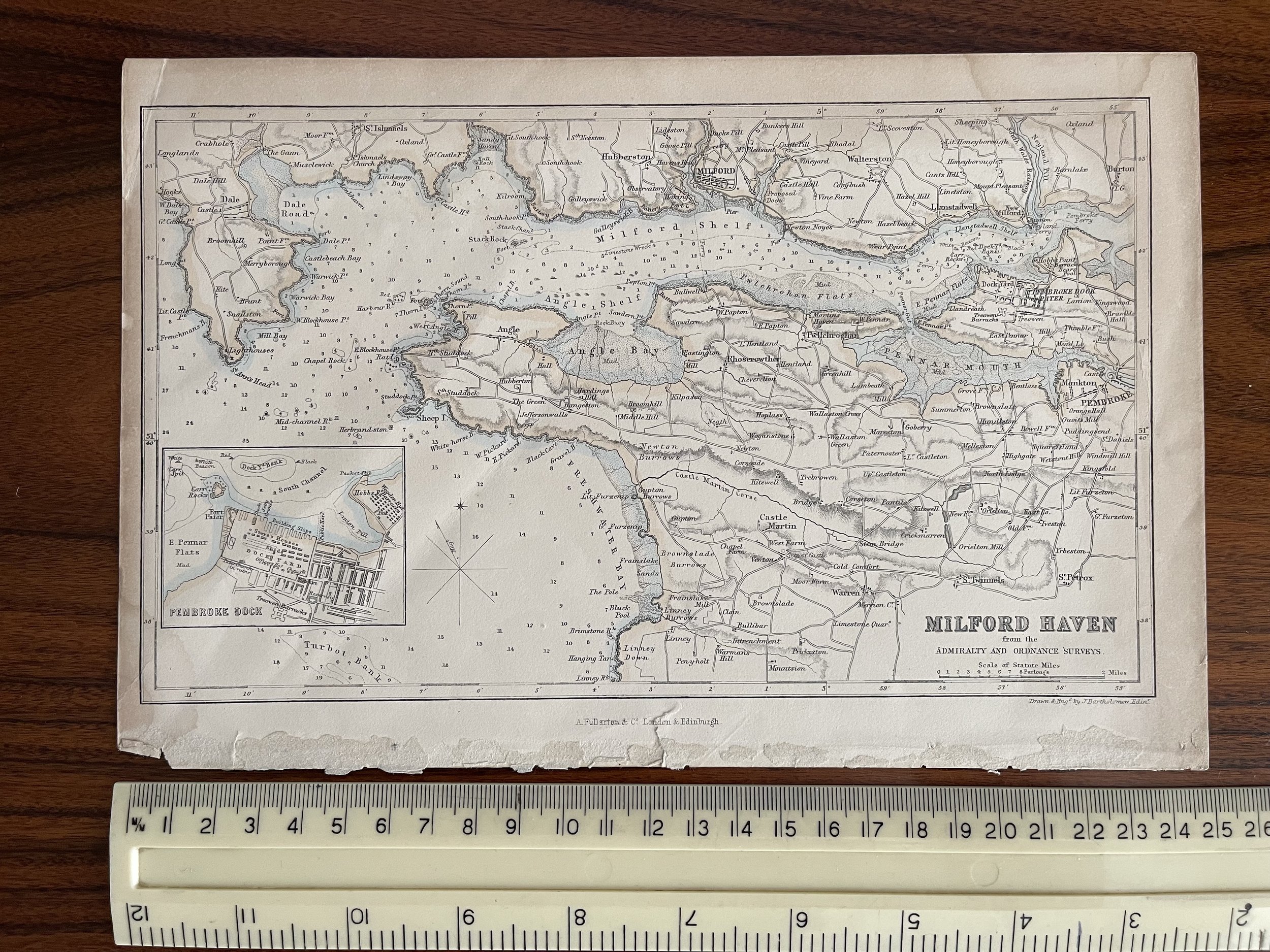 Image 1 of 6
 Image 2 of 6
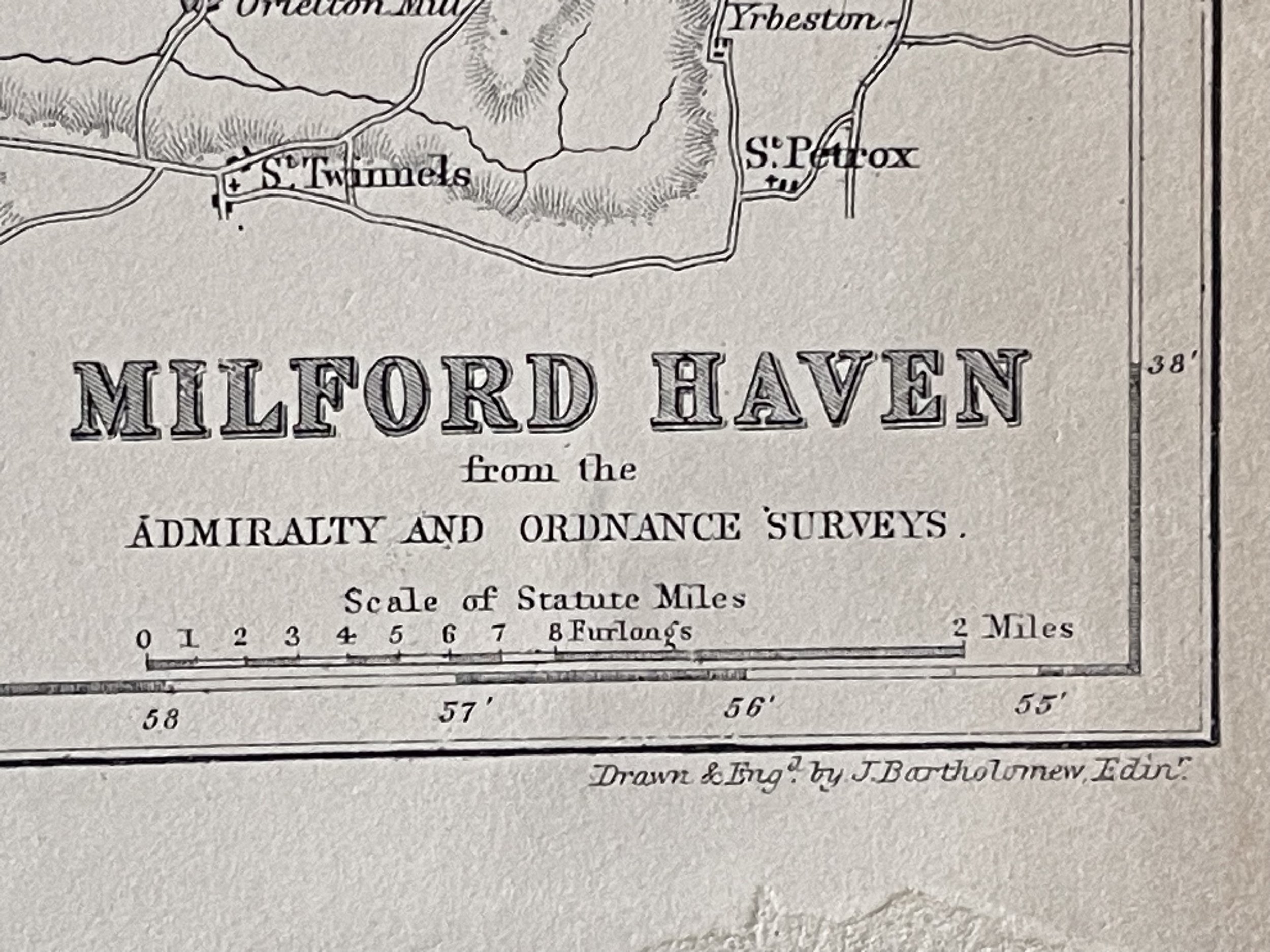 Image 3 of 6
 Image 4 of 6
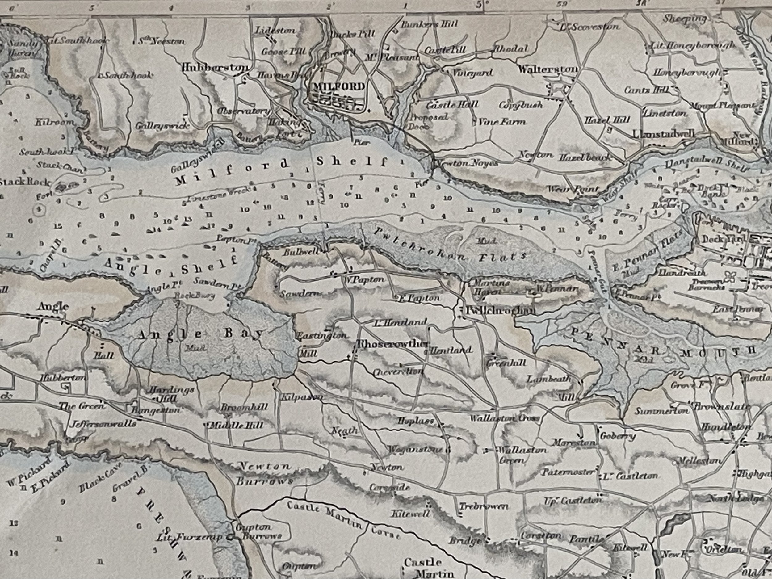 Image 5 of 6
 Image 6 of 6